
Umbria · Perugia
Pietralunga
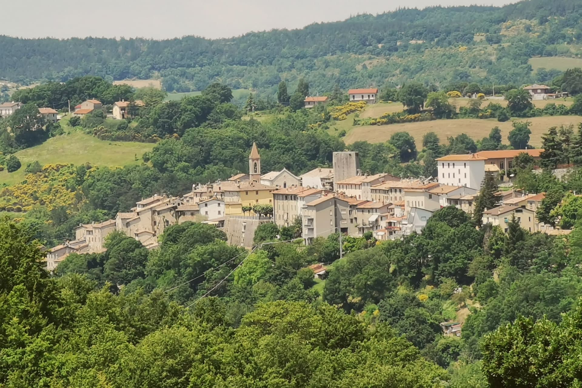
A pre-Apennine hill town at 566 meters on the northeast Tiber ridge, ringed by truffle woods and white-potato fields.
Picked by Peter Benei
Letter to come
Why Pietralunga is on our list
It holds Città del Tartufo and Comuni Virtuosi.
The nearest town with a letter is Gubbio, No. 91, 37 min by car.
Subscribe and you get Pietralunga's letter the day it comes out.
Visiting
- Best time
- Apr–Oct
- By car
- 1 h from Perugia
- Population
- 2,014
- J7°
- F10°
- M11°
- A14°
- M19°
- J25°
- J29°
- A28°
- S23°
- O18°
- N12°
- D9°
- Best
- Hot or crowded
- Quiet
- Mostly closed
Daytime air temperature, averages for 2020–2024. Weather data by Open-Meteo.com.
Why come
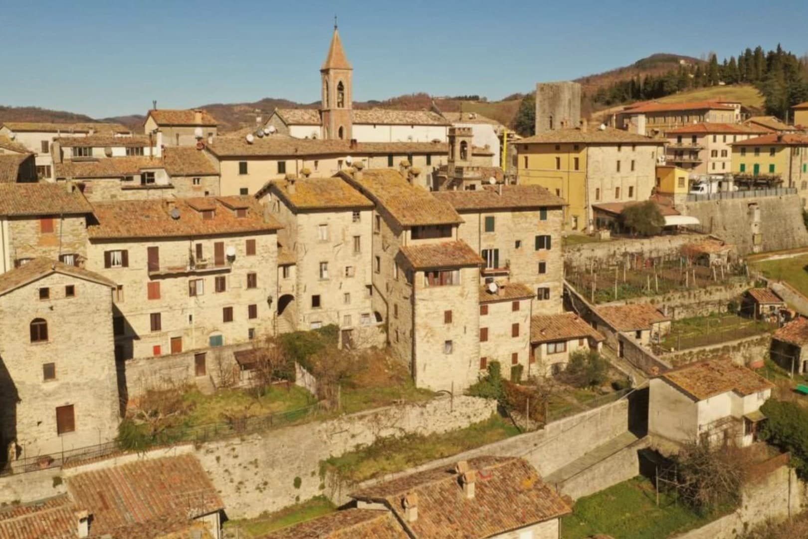
Pietralunga sits at 566 meters on a hilly ridge near the Umbria-Marche Apennines, on the northeast side of the upper Tiber. The Umbrian people founded the original settlement in the period of the Eugubine Tablets, between the second and first centuries BC. The Lombards rebuilt it as a fortified hilltop village between the sixth and eighth centuries, and the Rocca Longobarda from that era still dominates the ridge.
The Pieve di Santa Maria on the main square dates from the seventh or eighth century in foundation, with an irregular single-nave plan and a Romanesque portal added later. The territory is one of the densest truffle districts in Umbria, with documented tartufaie in the surrounding woods and a tartufo bianco fair every October. The Pietralunga white potato, grown on the upper slopes, has its own consortium and is one of the products that have kept the smallholders in the area working.
How to get there
From Ancona (AOI), about 1 h 55 min by car.
Rimini (RMI) is about 2 h 11 min away.
By car from the center of Perugia 1 h or Florence 2 h 7 min.
Coming by train into Perugia? Pietralunga is about 1 h 3 min away by road.
Every town within reach of Ancona airport.
First time driving in Italy? Read our complete manual.
What to see
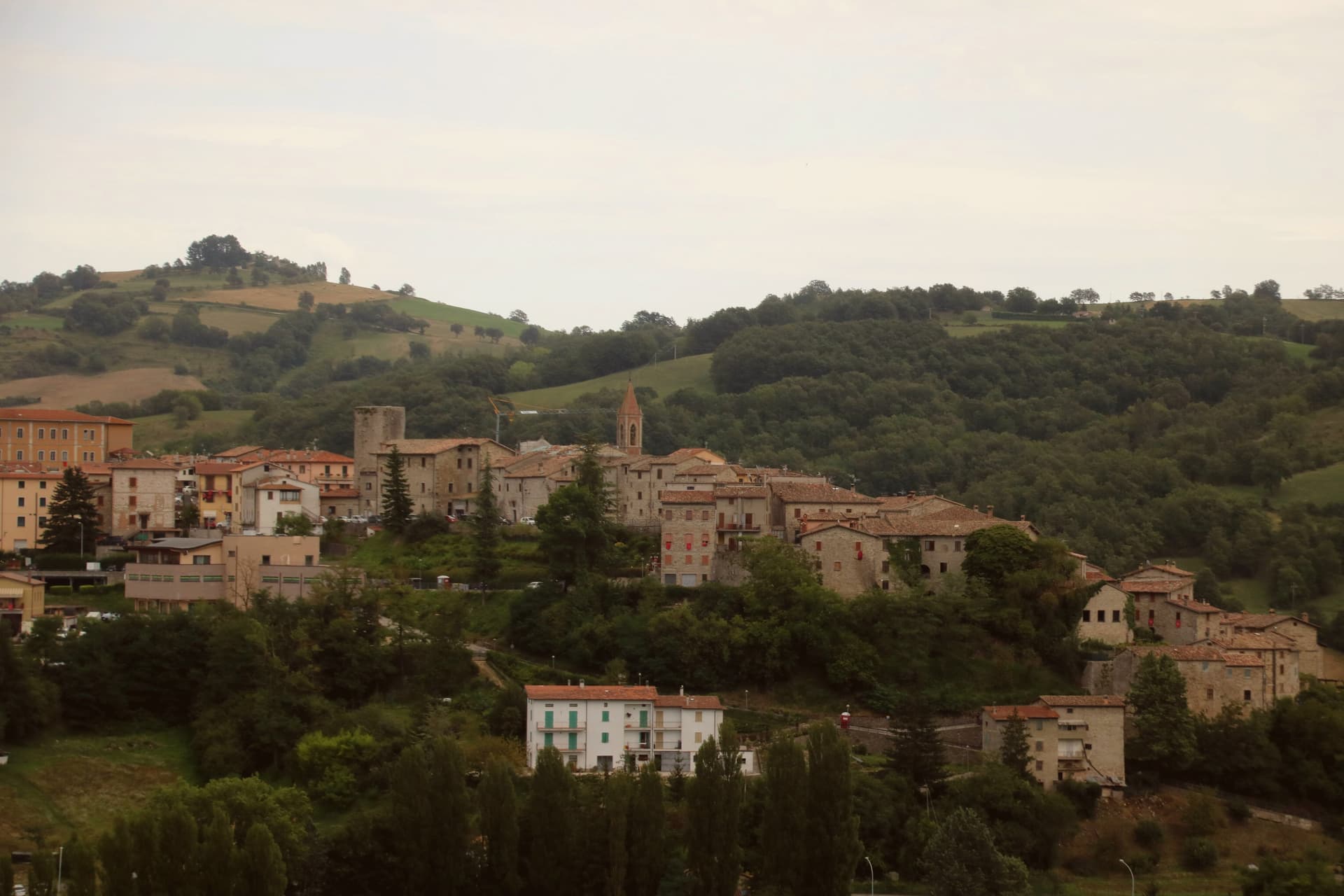
Rocca Longobarda
Eighth-century Lombard fortress dominating the borgo; the original triangular plan and central keep survive on the highest point of the ridge.
Pieve di Santa Maria
Parish church on the main square with 7th-8th century foundation and a 13th-century Romanesque portal, single nave with ogive vaults inside.
Centro storico medievale
Walled Lombard core organized around the Rocca, narrow streets and stone houses radiating from Piazza Fiorucci.
Tartufaie del territorio
Truffle grounds in the woods between Pietralunga and Gubbio, producing tartufo bianco and recognized by the Città del Tartufo network.
Living here
Could you live here?
Pietralunga is at the end of the road.
- A village of 2,014. The nearest town of 5,000 people, Città di Castello, is 32 min away: past our 15-minute rule, which makes this the end of the road.
- Perugia, a city of 162,050, is 1 h by car. Inside our 30 to 60 minutes: close for the services, far enough to keep its own life.
The rules come from our series Where to Move in Italy, written from the places we have lived: Part 1, The End of the Road · Part 2, The Small Town · Part 3, The City · Part 4, The Postcard · Part 5, The Other Half. The towns we would pick are in Part 6, The Best Towns.
- Population 2,014, down 3.9% since 2015
- Nearest city Perugia, 1 h drive
- Nearest national health service hospital Gubbio, 15 km as the crow flies · how healthcare works in Italy
- Homes in the center: €490 to €720 per m² to buy, €1.90 to €2.60 per m² a month to rent
All the numbers Common questions, designations, lists and sources.
More about living here
- Remote
- Pharmacy in town
- Nearest high school over ~30 minutes away
- Full fibre reaches 79% of homes
- Primary school in the comune
- Earthquake zone 2, medium hazard
- Perugia airport (PEG), 57 min drive, the nearest with scheduled flights
- Regional capital Perugia, 1 h drive
If you are moving here
Who lives here
9% of residents are foreign citizens, most often from Romania, Morocco and the Netherlands, against 9% across Italy. 59 of them come from English-speaking countries or western and northern Europe, mostly the Netherlands, the United Kingdom and Germany. There are 349 people over 65 for every 100 children under 15, against 216 across Italy. 41% of homes have no resident, holiday homes and empty ones counted together, against 27% across Italy. Perugia province ranks 37th of 107 in Il Sole 24 Ore's quality of life ranking for 2025.
Health and schools
The nearest emergency room is in Gubbio, 15 km as the crow flies. The nearest major one is in Perugia, 34 km away. The nearest IB school is International School of Rimini, 69 km as the crow flies. The nearest school listed as international is Assisi International School, 46 km away.
Information, not medical advice. Confirm with a professional.
Taxes
A home that is not your main one pays 1.04% a year in property tax, charged on the cadastral value rather than the price. A main home pays none unless it is in a luxury category. The town adds 0.8% to your income tax, with nothing due on income under €12,000. 7% pensioner tax: this town is not in a qualifying area.
Information, not tax advice. Confirm with a professional.
What it costs
The average household in Umbria spends about €2,310 a month, €550 of it on food, against about €2,170 across Italy. A family of three pays about €677 a year for water, on the Umbria average. In Perugia, the provincial capital, in September 2026, an espresso cost €1.23, a meal in a pizzeria €12.04 and a man's haircut €20.47.
Climate and risk
It is in climate zone E, on a scale from A, the warmest, to F, the coldest, and heating may run from October 15 to April 15, up to 14 hours a day, unless the mayor changes it. The national maps show no residents in a high or medium flood zone. 18% live in a zone rated high or very high for landslides.
These shares cover the whole comune, not any one street. Check an address on IdroGEO.
Moving from abroad? Which visa you need. Sources: ISTAT, the Ministry of Health, ISPRA, the Finance Ministry, the Ministry of Enterprise, Poste Italiane, the comuni, the IB, International Schools Database, Il Sole 24 Ore, Cittadinanzattiva.
Known for
TARTUFO BIANCO
Pietralunga sits in one of the densest white-truffle districts in Umbria; the October fair is the year's biggest event.
PATATA BIANCA
Pietralunga white potato grown on the upper slopes has its own consortium and is one of the products keeping local smallholders working.
ROCCA LONGOBARDA
Eighth-century Lombard fortress on the highest point of the ridge, the dominating feature of the borgo since its earliest reconstruction.
Common questions
- What is Pietralunga known for?
- Pietralunga is a pre-Apennine hill town at 566 meters on the northeast Tiber ridge, ringed by truffle woods and white-potato fields.
- Where is Pietralunga?
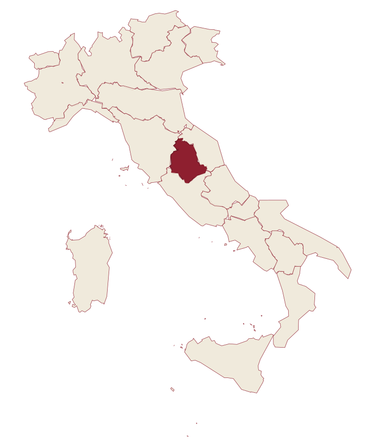
- Pietralunga is a comune in the province of Perugia, in Umbria.
- What is the nearest airport to Pietralunga?
- The nearest airport with scheduled flights is Perugia (PEG), about 57 min by car.
- How long is the drive from Perugia to Pietralunga?
- About 1 h by car.
- When is the best time to visit Pietralunga?
- Best in Apr–Oct. July is the warmest month, averaging 29 degrees, and May the wettest, with about 15 rain days.
- Which other towns are like Pietralunga?
- Cantiano, Esanatoglia and Castelnuovo di Val di Cecina.
- How many people live in Pietralunga?
- 2,014 residents, by ISTAT's count on 1 January 2025.
- Is Pietralunga a good place to live?
- By the rules in our Where to Move in Italy series, Pietralunga is at the end of the road: the nearest town of 5,000 people, Città di Castello, is 32 min away. The nearest city, Perugia, is 1 h away by car. The nearest national health service hospital is in Gubbio, 15 km as the crow flies. Full fibre reaches 79% of homes.
Tags & data designations · numbers · sources
Landscape
The numbers
- Elevation: 566 m
- Population: 2,014
- Surface area: 140.42 km²
These figures were compiled from public directories: ISTAT, OpenStreetMap and Wikidata, and from the official listings of the guides named on this page. Town details change; verify with official sources before you travel.
The ranked lists
Lists Pietralunga appears in
- The 6 best hidden truffle towns in the province of PerugiaPerugia provincetrufflehidden6 towns · smallest 334 residents
- The best hidden towns on a walking route in the province of PerugiaPerugia provinceon a walking routehidden8 towns · smallest 426 residents
- The best small towns on a walking route in UmbriaUmbriaon a walking routesmall8 towns · smallest 426 residents
- The best hill towns on a walking route within 90 minutes of PerugiaNear Perugiahill townon a walking routewithin 90 min9 towns · smallest 2,014 residents · closest 33 min away
- The best truffle towns in the province of PerugiaPerugia provincetruffle9 towns · smallest 334 residents
Near here, with a letter
Similar
Towns like Pietralunga
What all six share with Pietralunga: inland, away from the coast · under 3,000 people
Cantiano
Province: Pesaro e Urbino
both hill towns
Esanatoglia
Province: Macerata
both hill towns
Castelnuovo di Val di Cecina
Province: Pisa
both hill towns
Chiusdino
Province: Siena
both hill towns
- Written about. No. 41.
Castiglione d'Orcia
Province: Siena
both hill towns
Monte Santa Maria Tiberina
Province: Perugia
1 h 5 min apart by road
Our guide
Our nearest guide, 38 km away
Umbria: the towns, when to go, how to get there
The Umbria guide came out of the letter. Letters from the towns we visit. Free.
Read the guide: Two banks, no sea. 21 towns, the drive and train times, the months, where to eat and sleep.
Paid plans, the moving year and the books are on the membership page.