
The 6 best hidden truffle towns in the province of Perugia
Umbrian truffle country smells of wet oak leaves and woodsmoke, and it works hardest between late autumn and early spring, when the prized black truffle comes out of the ground under holm oak and hazel. The cooking is blunt and good: strangozzi turned in oil and grated truffle, egg fried in butter with shavings on top, pecorino, lentils from the high plains, river trout from the Nera. The villages are built of pale local limestone, stacked on ridges above valley floors that hold mist until mid-morning. Sagre fill the piazzas in November, with trestle tables, a brass band and men selling dogs' worth of the morning's digging out of cool boxes.
Most people meet Umbria's truffles in Perugia and Assisi, where the shop windows on the main streets are lined with jars, pastes and truffle honey, and the tasting counters run all afternoon. Assisi in particular absorbs coach traffic all year, so the truffle becomes a souvenir bought between the basilica and the car park rather than something eaten in the season it belongs to. The quality can be perfectly good. It is simply the least interesting way to encounter it, priced for people who will not come back.
The oak woods do not stop at the edge of the tourist towns. They run east into the Valnerina, up the Nera gorge and north towards the Apennine border with Tuscany and the Marche, and the villages along that route are where the hunters live, sell and cook. All the towns on this list belong to Italy's national association of truffle municipalities, which means the trade is a local economy rather than a shop display. Fewer people go, the tables are booked by families from the next valley, and the season is the reason to arrive.
Of the 37 communes we have mapped in the province of Perugia, 9 qualify as truffle towns: each belongs to the national association of truffle towns. This list is the hidden ones, 6 in all, ordered smallest first. The smallest, Vallo di Nera, has 345 residents.
If you are still choosing, we have also written The best hidden towns on a walking route in the province of Perugia and The best hidden hill towns you can reach by train in the province of Perugia.
Vallo di Nera
Why visit Vallo di Nera
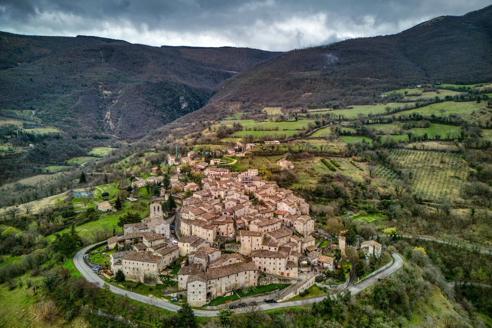
Vallo di Nera sits at 467 meters on a spur of the upper Valnerina, above the Nera river. The town of Spoleto granted the men of Vallo permission to build a castle here in 1217, on the hill where an earlier fortress had stood; the stone houses, the walls and the two symmetrical gates, Portella and Portaranne, have barely changed in eight centuries.
Inside, the village climbs in concentric rings to the Chiesa di Santa Maria Assunta at the top, built in 1176 and given to the Franciscans in the 13th century, who turned a defensive tower into a bell tower and frescoed the apse with a cycle of the Giotto school dated 1383. The Procession of the Whites, traceable to 1401, still leaves the church each year.
The population today is 345, smaller than at any point in the medieval records. Black truffle from the woods above and olive oil from the slopes down to the river are the surviving trades.
What to see in Vallo di Nera
- Chiesa di Santa Maria Assunta. Built 1176, Franciscan from the 13th century, with frescoes of the Giotto school dated 1383 in the apse, by Cola di Pietro da Camerino among others.
- Medieval walls. Twelfth-century walls and towers still encircle the village, with two original symmetrical gates, Portella and Portaranne.
- Centro storico. Light stone houses leaning against each other on three concentric rings, with embrasures, narrow alleys and stone portals preserved since 1217.
How to get to Vallo di Nera
There is a railway station in the town, so you can arrive without a car and never need one while you are here. Terni is roughly 53 minutes away by road.
Our tip
April through June and September into October are the months for Vallo di Nera. The Valnerina is green, the Nera river runs cold, and the trails up to Sellano or down to Scheggino are walkable. July and August push the valley into the mid-thirties; the stone houses hold their cool but most of the 345 residents close shutters between two and six.
Scheggino
Why visit Scheggino
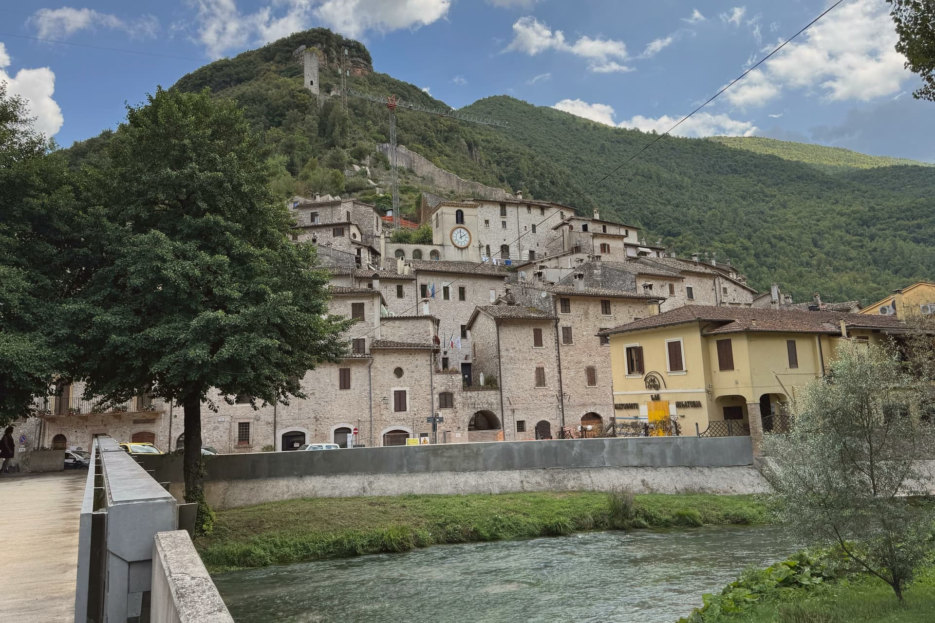
Scheggino sits at 280 meters in the heart of the Valnerina, the village wedged into a triangle of walls between the slope above and the Nera river below. The Duchy of Spoleto built it around the 12th century to defend one of the three bridges over the Nera; the triangular plan and the watchtower of white and pink stone, about 20 meters high, still mark the top of the castle.
The Nera runs alongside the lower edge of the village, divided into channels that once turned mills and now hold trout and the springs that feed the truffle washing rooms. Scheggino is the home of Urbani Tartufi, the first commercial company for the storage and processing of truffle, founded in 1928, which still has its plant on the river.
The Diamante Nero festival each summer prepares a giant frittata with more than 2,000 eggs and 80 kilos of black truffle. The Cammino di San Francesco passes through the village on the way south.
What to see in Scheggino
- Castello di Scheggino. Twelfth-century triangular castle of the Duchy of Spoleto, with a watchtower in white and pink stone about 20 meters high at the summit.
- Chiesa di San Nicola. Romanesque parish church at the heart of the centro storico, frescoes of the Umbrian school of the 15th century in the apse.
- Nera river canals. Channels of the Nera divided through the lower village, once for mills and now for trout farming and the truffle washing rooms of Urbani.
How to get to Scheggino
Terni is roughly 49 minutes away by road.
Our tip
April through June and September into October are the months for Scheggino. The Nera runs cold and full, the trout farms work at capacity, and the trails up to Vallo di Nera or down to Ferentillo are walkable in shade. July and August push the valley into the mid-thirties; the river canals through the village cool the lower streets and the trattorie pour Nera trout with local truffle.
Pietralunga
Why visit Pietralunga
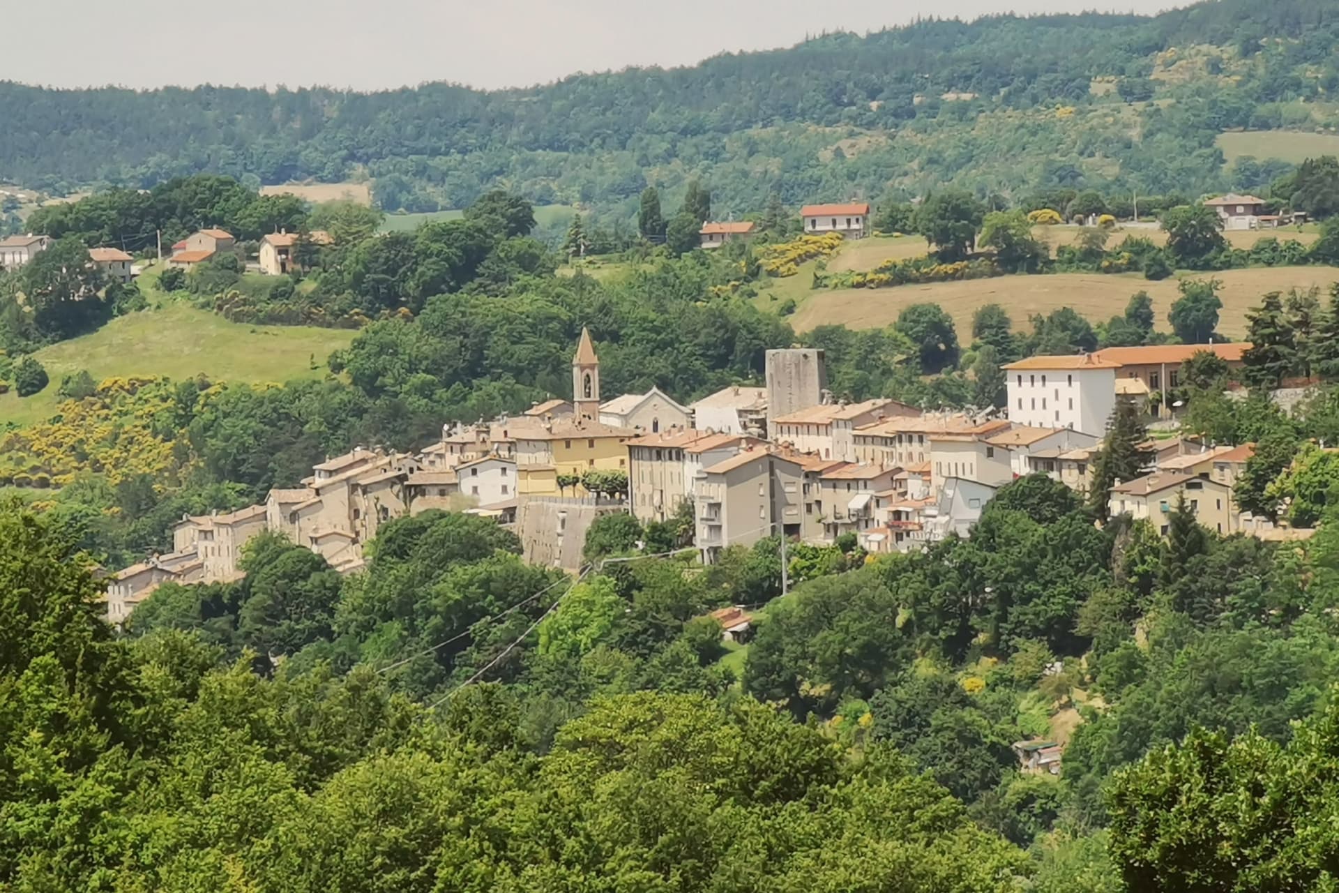
Pietralunga sits at 566 meters on a hilly ridge near the Umbria-Marche Apennines, on the northeast side of the upper Tiber. The Umbrian people founded the original settlement in the period of the Eugubine Tablets, between the second and first centuries BC.
The Lombards rebuilt it as a fortified hilltop village between the sixth and eighth centuries, and the Rocca Longobarda from that era still dominates the ridge. The Pieve di Santa Maria on Piazza Fiorucci dates from the seventh or eighth century in foundation, with an irregular single-nave plan and a Romanesque portal added later.
The territory is one of the densest truffle districts in Umbria, with documented tartufaie in the surrounding woods and a tartufo bianco fair every October. The Pietralunga white potato, grown on the upper slopes, has its own consortium and is one of the products that have kept the smallholders in the area working.
What to see in Pietralunga
- Rocca Longobarda. Eighth-century Lombard fortress dominating the borgo; the original triangular plan and central keep survive on the highest point of the ridge.
- Pieve di Santa Maria. Parish church on Piazza Fiorucci with 7th-8th century foundation and a 13th-century Romanesque portal, single nave with ogive vaults inside.
- Centro storico medievale. Walled Lombard core organized around the Rocca, narrow streets and stone houses radiating from Piazza Fiorucci.
How to get to Pietralunga
Perugia is roughly 65 minutes away by road.
Our tip
May through June and September into October are the working months for the territory. The truffle-hunting season opens in September and runs through January, with the white-truffle fair in October the year's largest event. July and August are warm in the upper Tiber, low thirties typically; the woods cool early in the morning and the trails through the tartufaie become the local refuge. Mostra Mercato del Tartufo Bianco e della Patata falls in October.
Campello sul Clitunno
Why visit Campello sul Clitunno
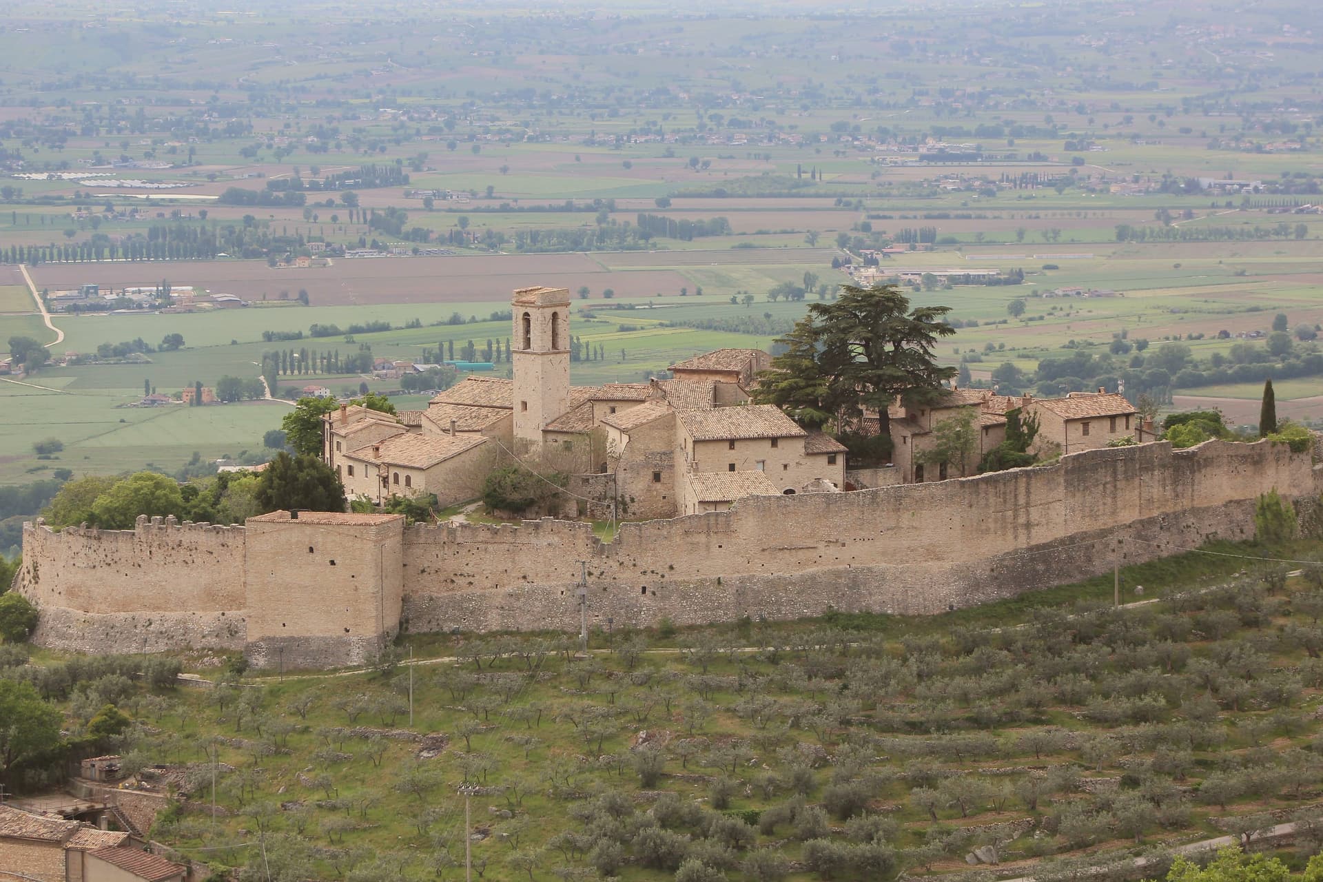
Campello sul Clitunno sits at 290 meters along the Clitunno river, a few kilometers north of Spoleto. The name comes from the Counts Campello, originally Champeaux of Reims, who founded the hilltop nucleus of Campello Alto in the mid-10th century under the Burgundian noble Rovero.
The Fonti del Clitunno, the springs that form the river, produce 1,300 to 1,500 liters of water per second; Pliny the Younger wrote about them, and Lord Byron and Giosuè Carducci returned to the place in poems centuries later, the latter with the ode Le fonti del Clitumno. A kilometer downstream from the springs, in the frazione of Pissignano, the Tempietto del Clitunno is a 4th- or 5th-century pagan sacellum reworked by the Lombards in the 7th and 8th centuries; the interior frescoes have parallels with Santa Maria Antiqua in Rome.
The Tempietto entered the UNESCO World Heritage List in June 2011 as part of the serial site The Lombards in Italy: Places of Power. The Castello di Pissignano above the temple covers the medieval layer.
What to see in Campello sul Clitunno
- Tempietto del Clitunno. Small temple-shaped chapel of the 4th-5th century reworked by the Lombards in the 7th-8th, with frescoes of the Saviour, Peter and Paul; UNESCO World Heritage.
- Fonti del Clitunno. Springs producing 1,300-1,500 liters per second, forming the source of the Clitunno; visited by Pliny, Byron and Carducci.
- Castello di Pissignano. Eleventh-twelfth century hilltop castle just above the Tempietto, founded by Benedictine monks who enclosed the settlement with walls.
How to get to Campello sul Clitunno
There is a railway station in the town, so you can arrive without a car and never need one while you are here. Terni is roughly 86 minutes away by road.
Our tip
April through June and September into October are the months for Campello sul Clitunno. The springs run cold and full, the willows along the lake at the source hold the morning light, and the trails between the Tempietto and Campello Alto are walkable in shade. July and August touch the mid-thirties in the Spoleto valley; the Fonti basin runs a few degrees cooler at the water's edge.
Cascia
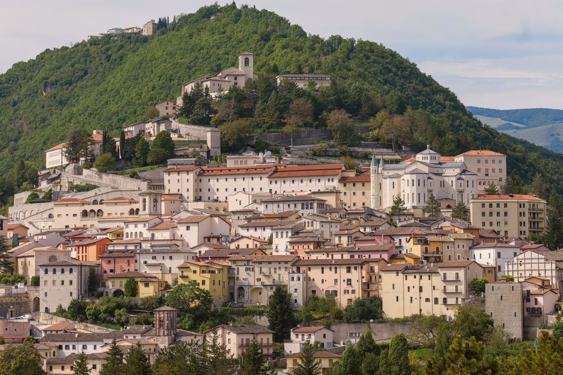
Why visit Cascia
Cascia sits at 653 meters in the mountainous southeastern corner of Umbria, a remote pocket of the upper Valnerina near the Marche and Lazio borders. The commune carries the highest seismic activity in the region together with Norcia twelve kilometers away, and a long history of destructive earthquakes that culminated in the August 2016 sequence.
The town is built around Rita Lotti, who died in the Augustinian monastery here in 1457 and was canonized as Santa Rita in 1900. The Basilica di Santa Rita, built 1937-1947 in white Tivoli travertine on the site of the older church, draws pilgrims year-round and turns Cascia into a town that runs on faith and on truffle.
The Cammino di San Benedetto passes through, linking Norcia to Subiaco and Montecassino. Visitors not pilgrims tend to come for the black truffle, the lentils of nearby Castelluccio, and the silence of the high pastures above town.
What to see in Cascia
- Basilica di Santa Rita. Built 1937-1947 in white Tivoli travertine, Greek-cross plan, frescoes by Montanarini, Filocamo, Consadori, Ceracchini and Vicenzi.
- Monastero di Santa Rita. Augustinian monastery where Rita Lotti lived and died in 1457, attached to the basilica and still active as a religious community.
- Chiesa di San Francesco. Medieval Franciscan church in the lower centro storico, fourteenth and fifteenth-century frescoes inside.
How to get to Cascia
Terni is roughly 74 minutes away by road.
Our tip
May through October is the open season at 653 meters. The basilica is busiest around the May 22 feast of Santa Rita, when pilgrims fill the upper town and accommodation books out months ahead. June through September brings mild days and cool nights, the high pastures green, the truffle hunters working the woods above town.
Norcia
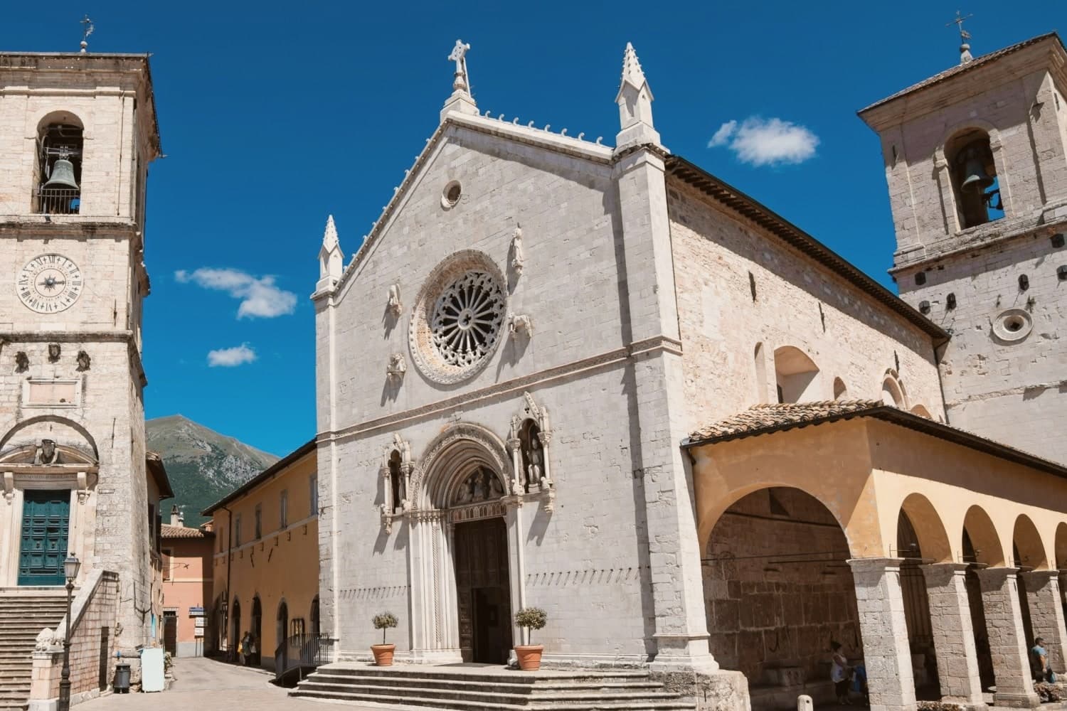
Why visit Norcia
Norcia sits at 604 meters on a high plateau on the Umbrian side of the Monti Sibillini, ancient Nursia of the Sabines, fortified in the 3rd century BC by Rome. Saints Benedict and his twin sister Scholastica were born here in 480; the Benedictine Order and the Ora et Labora motto that shaped Western monasticism began on this piazza.
The Basilica di San Benedetto rises on the traditional birthplace, built between 1290 and 1338 over a pre-existing crypt. On 30 October 2016 a magnitude 6.5 earthquake destroyed the nave; only the façade was left standing.
Reconstruction completed on 30 October 2025, nine years to the day, with the original stones and earthquake-resistant technology. The town gave its name to norcineria, the Italian word for quality pork delicatessen, after centuries of Norcia butchers specializing in wild boar and pork.
Black truffle from the Valnerina, lentils from Castelluccio, and ricotta from the high pastures complete the table.
Vespasia, Granaro del Monte, Casale nel Parco have been named by a guide.
What to see in Norcia
- Basilica di San Benedetto. Built 1290-1338 over the traditional birthplace of Saints Benedict and Scholastica, rebuilt with original stones after 2016, reopened 30 October 2025.
- Castellina. Fortified papal stronghold designed by Jacopo Barozzi da Vignola in 1554, on Piazza San Benedetto, now the Museo Civico e Diocesano.
- Piazza San Benedetto. Civic and religious heart of the centro storico, with the Palazzo Comunale, the basilica, the Castellina and the statue of Benedict at the center.
How to get to Norcia
Terni is roughly 93 minutes away by road.
Our tip
April through June and September into October are the months for Norcia. The plateau holds its color, the lentil fields of Castelluccio bloom from mid-June into July, and the high pastures are open for hiking. July and August stay cooler than the Umbrian valleys at 604 meters, but the town fills with festival crowds for the Mostra Mercato del Tartufo Nero on the last weekend of February and again for sagras through the summer.
More from Anywhere Italy
- The best hidden towns on a walking route in the province of Perugia
- The best hidden hill towns you can reach by train in the province of Perugia
 The best cheese towns within two hours of Perugia
- The 10 best hidden hill towns you can reach by train within 90 minutes of Terni
- The best olive oil towns you can reach by train in the province of Perugia
- The best small olive oil towns in the province of Perugia