
The best small towns on a walking route in Umbria
90 towns visited, 910 to go. Follow along, free: Subscribe on Substack
Umbria walks well because the distances between towns are the distances a person covers between breakfast and late afternoon. The paths climb through holm oak and broom, cross the Nera and the Corno on old stone bridges, then rise to a gate in a wall the color of wet ash. Kitchens along the way run on what the ground gives: black truffle shaved over strangozzi, mountain lentils cooked plain with oil, river trout, cured pork from the high pastures, sheep's cheese aged in ash. Spring and early autumn are the seasons for it, when the valleys hold mist in the morning and the stone gives back the day's heat at dusk.
Almost everyone who walks in Umbria walks toward Assisi. The pilgrim routes converge there, the basilica fills from opening time, and the approach along the Tescio has become one of the busiest walking corridors in central Italy. Coach parties arrive on the same morning as the walkers, and the last stretch into town can feel less like a stage and more like a queue. It is worth seeing, and it is not the only reason the paths exist.
The routes carry on past it, north into the Apennine foothills and south into the Valnerina, through towns that see walkers pass rather than stop. Each of the places below is a stage on one of those long historic ways, small enough to cross in an hour, with a bar that opens early and a kitchen that expects hungry people. Fewer travelers get this far off the main pilgrim axis, which is the point of the list.
Of the 47 communes we have mapped in Umbria, 16 qualify as towns on a walking route: each is a stage on one of the long historic walking routes. This list is the small ones, 8 in all. The smallest, Scheggino, has 446 residents.
If you are still choosing, we have also written The prettiest villages on a walking route in Umbria and The best hidden towns on a walking route in the province of Perugia.
Why visit Monteleone di Spoleto
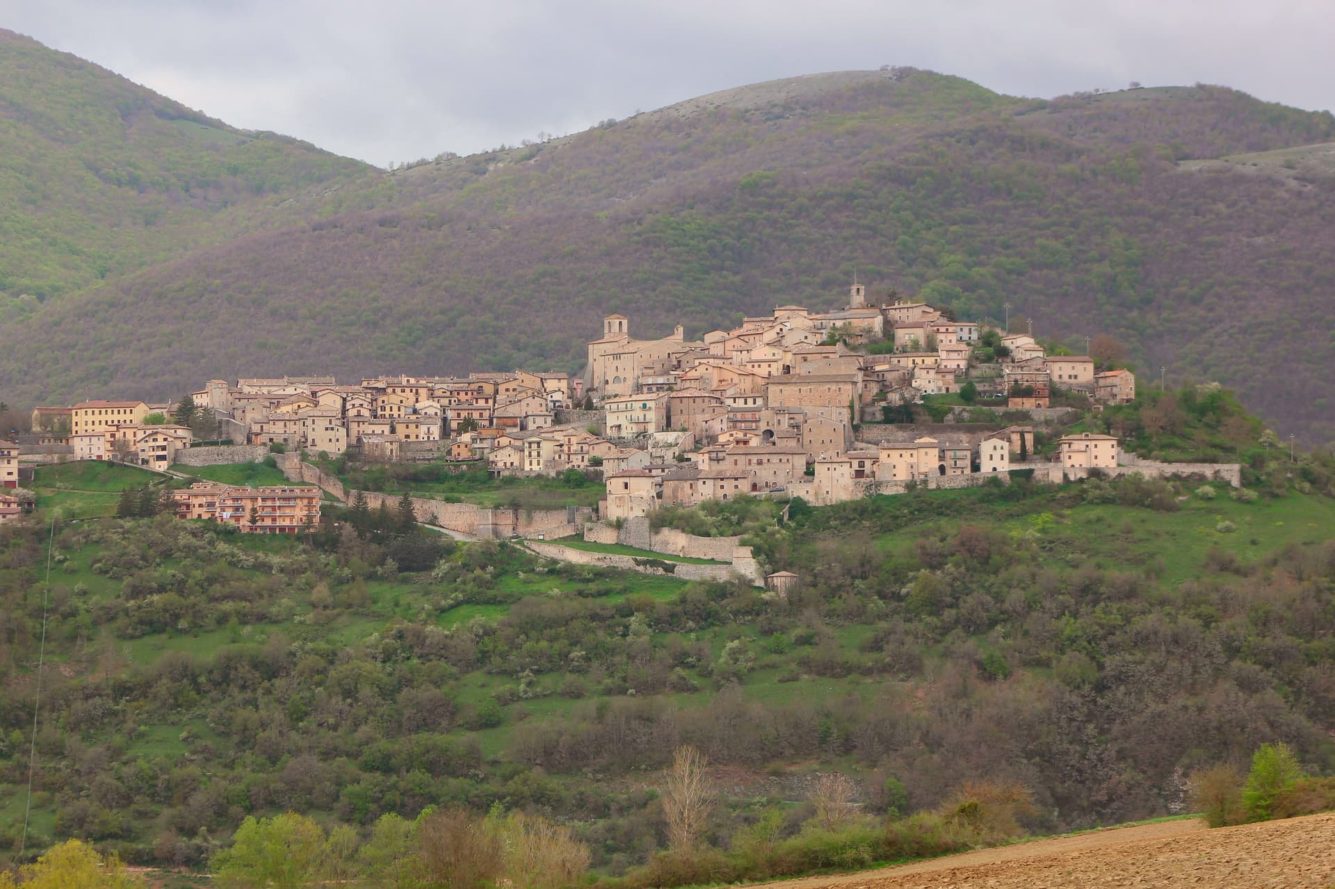
Monteleone sits at 978m on a hilltop in the upper Nera valley, the upper extension of the Valnerina, at the point where Umbria, Lazio and Marche converge. A castle anchors the summit and gives the borgo its defining silhouette, much-rebuilt over the centuries and again after the 2016 earthquake.
Below it sit the Chiesa and Convento di San Francesco, and the whole village is compact enough that the fortress organizes the view from almost anywhere within it. The find that put the town on archaeological maps happened by accident: a local farmer ploughing a field at the Colle del Capitano turned up an Etruscan bronze parade chariot in 1902, a complete biga from the 6th century BC.
His family sold it to French dealers for the equivalent of 950 lire, and it reached the Metropolitan Museum of Art in New York in 1903, where it is now displayed in Gallery 170 as the most complete pre-Roman parade chariot known to survive, its bronze panels depicting Achilles' birth, his combat with Memnon, and his apotheosis. Monteleone has pursued repatriation since 1990 through multiple legal proceedings, none successful, and the Met's title is now considered settled.
The village opened a museum in 2002 holding a full-scale replica alongside the original context of the find, and the town is also a marked stop on a 350-km pilgrim walk running from Norcia, Benedict's birthplace, through Monteleone to Subiaco and Montecassino, with pilgrim accommodation available locally. The 2016 Norcia and Cascia earthquake damaged several buildings in town; the castle and the Franciscan church have been restored, though reconstruction continues elsewhere.
Beyond the village, the Sibillini Mountains National Park lies to the east, the Cascia-Norcia route linking Benedict's and Rita's home towns runs to the north, and Lago di Piediluco is 30 km south. The food follows the Valnerina pattern: strangozzi with truffle, lentils from Castelluccio di Norcia, prosciutto and other Norcineria meats, pecorino, and Sagrantino di Montefalco from 60 km west.
Depopulation has been steep, from 1,800 residents in 1951 to 555 today, which leaves a village built for a much larger population now organized around a fortress, a church and a museum that all outsize the number of people currently living among them.
What to see in Monteleone di Spoleto
- Museo della Civiltà del Carro (replica chariot). Full-scale replica of the Monteleone Chariot, with the context of the 1902 find laid out around it. The panels on the original show Achilles' birth, his combat with Memnon, and his apotheosis. The museum also documents the village's repatriation campaign, active since 1990 and unsuccessful in every legal proceeding brought so far.
- Rocca dei Brancaleoni. The castle anchors the high point of the borgo, its rebuilt walls now standing again after 2016 earthquake repairs. From the top, the view runs across the whole upper Nera valley.
- Chiesa di San Francesco (Renaissance ceiling). 13th-century Franciscan church with later restorations and a carved wooden ceiling added in the 16th century. Also repaired after 2016 earthquake damage.
How to get to Monteleone di Spoleto
Terni is about 59 min away by road.
Our tip
Monteleone di Spoleto is mountain-seasonal: May through September is the high season. June-July brings the Cammino di San Benedetto pilgrim flow. Castelluccio di Norcia lentil bloom (late June-early July, 20 km east, the famous fiorita) is a major regional draw.
Why visit Pietralunga
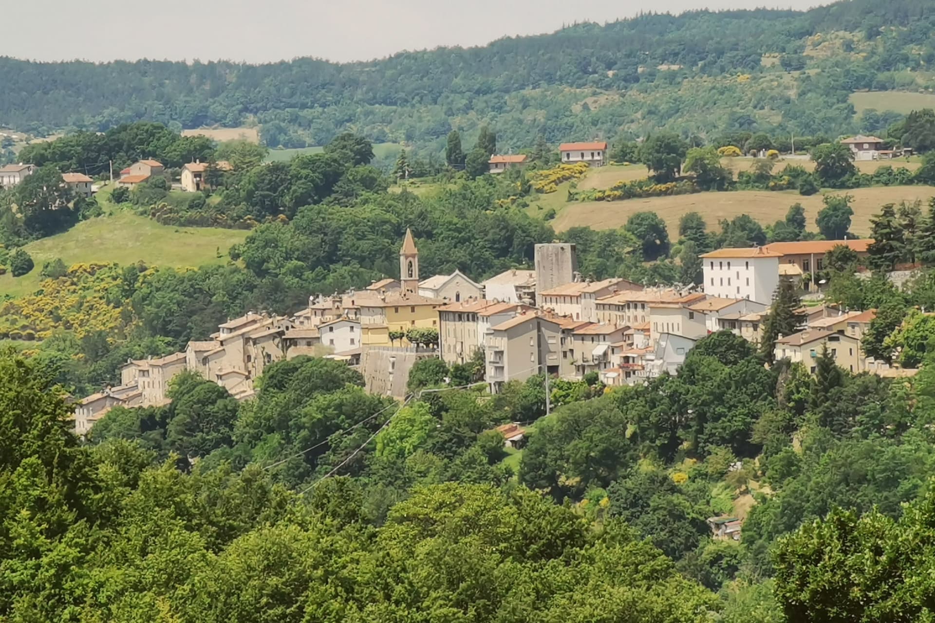
Pietralunga sits at 566 meters on a hilly ridge near the Umbria-Marche Apennines, on the northeast side of the upper Tiber. The Umbrian people founded the original settlement in the period of the Eugubine Tablets, between the second and first centuries BC.
The Lombards rebuilt it as a fortified hilltop village between the sixth and eighth centuries, and the Rocca Longobarda from that era still dominates the ridge. The Pieve di Santa Maria on Piazza Fiorucci dates from the seventh or eighth century in foundation, with an irregular single-nave plan and a Romanesque portal added later.
The territory is one of the densest truffle districts in Umbria, with documented tartufaie in the surrounding woods and a tartufo bianco fair every October. The Pietralunga white potato, grown on the upper slopes, has its own consortium and is one of the products that have kept the smallholders in the area working.
What to see in Pietralunga
- Rocca Longobarda. Eighth-century Lombard fortress dominating the borgo; the original triangular plan and central keep survive on the highest point of the ridge.
- Pieve di Santa Maria. Parish church on Piazza Fiorucci with 7th-8th century foundation and a 13th-century Romanesque portal, single nave with ogive vaults inside.
- Centro storico medievale. Walled Lombard core organized around the Rocca, narrow streets and stone houses radiating from Piazza Fiorucci.
How to get to Pietralunga
Perugia is about 1 h 5 min away by road.
Our tip
May through June and September into October are the working months for the territory. The truffle-hunting season opens in September and runs through January, with the white-truffle fair in October the year's largest event. July and August are warm in the upper Tiber, low thirties typically; the woods cool early in the morning and the trails through the tartufaie become the local refuge.
Why visit Arrone
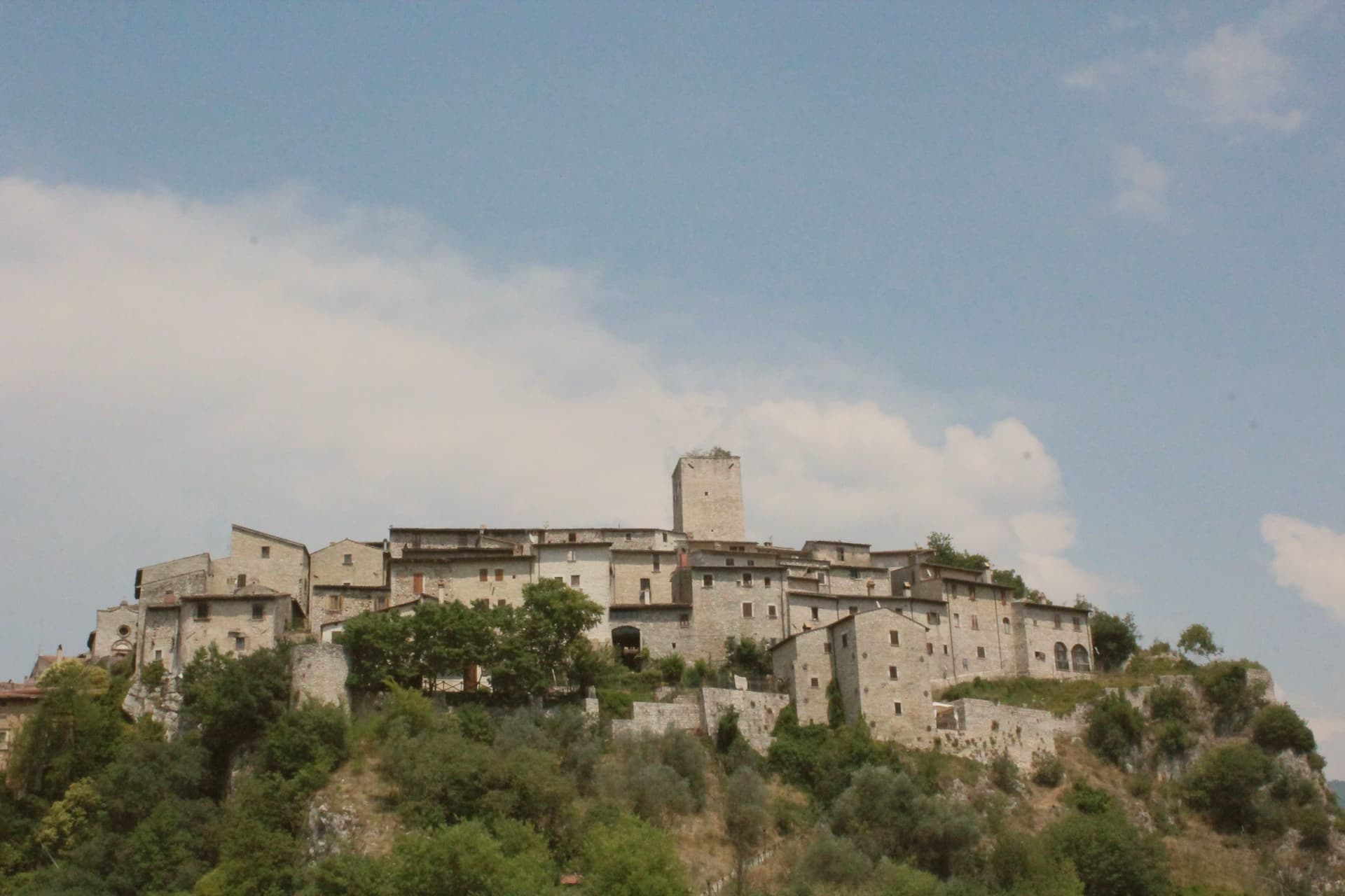
Arrone sits at 243 meters on the left bank of the Nera in the lower Valnerina, the upper part of the village a 9th- or 10th-century noble castle with its walls and alleys still in their medieval layout. The town grew up around the fortified hill and spread along the river as the danger faded.
The Cascata delle Marmore, the largest man-made waterfall in the world at 165 meters across three tiers, is five kilometers downstream; the Romans cut the original channel in 271 BC to drain the marshes around Rieti, and successive interventions through the 16th century gave the falls their present form. The Cammino di San Francesco passes through, and the village is the base for kayaking and rafting on the lower Nera.
The Chiesa di San Giovanni Battista in the upper castle holds 15th-century frescoes of the Umbrian school, and the collegiate Chiesa di Santa Maria in the lower village was rebuilt in the 16th century on Romanesque foundations.
What to see in Arrone
- Castello di Arrone. Upper part of the village, the 9th-10th century castle, walls and steep medieval alleys preserved to the original layout.
- Chiesa di San Giovanni Battista. Fourteenth-century church inside the upper castle, with 15th-century frescoes of the Umbrian school, including a Madonna and saints.
- Chiesa Collegiata di Santa Maria. Sixteenth-century collegiate church in the lower village, rebuilt on Romanesque foundations, with frescoes by Vincenzo Tamagni.
How to get to Arrone
Terni is about 34 min away by road.
Our tip
April through June and September into October are the months for Arrone. The Nera runs full from snowmelt and spring rain, the rafting season opens, and the Cascata delle Marmore releases on a fixed schedule that suits the morning light. July and August touch the mid-thirties in the lower Valnerina; the falls cool the air around the basin, and the Cammino di San Francesco walkers pass through early.
Why visit Scheggino
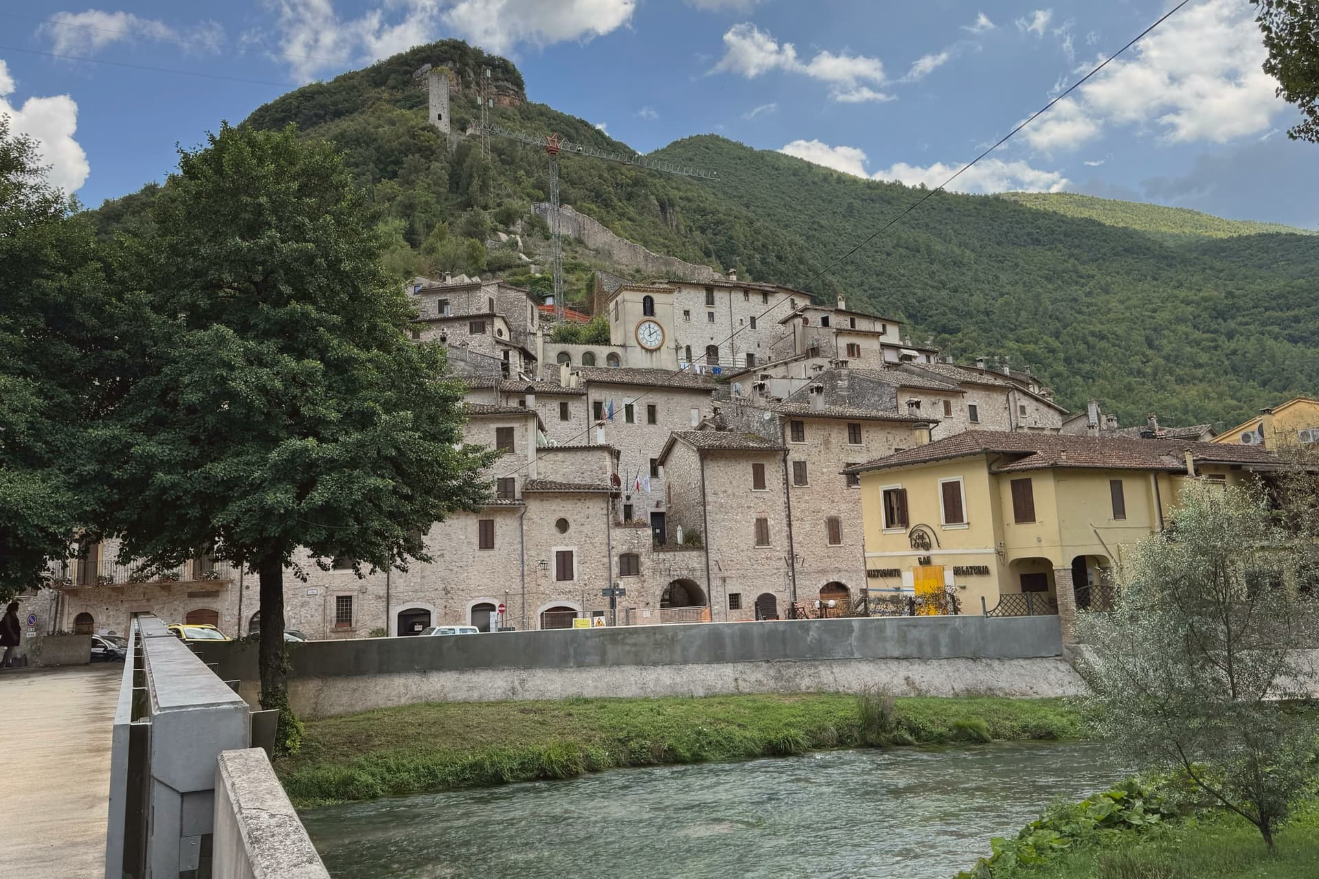
Scheggino sits at 280 meters in the heart of the Valnerina, the village wedged into a triangle of walls between the slope above and the Nera river below. The Duchy of Spoleto built it around the 12th century to defend one of the three bridges over the Nera; the triangular plan and the watchtower of white and pink stone, about 20 meters high, still mark the top of the castle.
The Nera runs alongside the lower edge of the village, divided into channels that once turned mills and now hold trout and the springs that feed the truffle washing rooms. Scheggino is the home of Urbani Tartufi, the first commercial company for the storage and processing of truffle, founded in 1852, which still has its plant on the river.
The Diamante Nero festival each summer prepares a giant frittata with more than 2,000 eggs and 80 kilos of black truffle. The Cammino di San Francesco passes through the village on the way south.
What to see in Scheggino
- Castello di Scheggino. Twelfth-century triangular castle of the Duchy of Spoleto, with a watchtower in white and pink stone about 20 meters high at the summit.
- Chiesa di San Nicola. Romanesque parish church at the heart of the centro storico, frescoes of the Umbrian school of the 15th century in the apse.
- Nera river canals. Channels of the Nera divided through the lower village, once for mills and now for trout farming and the truffle washing rooms of Urbani.
How to get to Scheggino
Terni is about 49 min away by road.
✷ We have written about Scheggino
“Scheggino is the black truffle town on the banks of the Nera river, which lies in the valley and is famous for its giant truffle frittata. Scheggino is one of the stops on our Umbrian Circle road trip.”
Read our piece on Scheggino →The Umbrian Circle | Town Tasting in a Day
Our tip
April through June and September into October are the months for Scheggino. The Nera runs cold and full, the trout farms work at capacity, and the trails up to Vallo di Nera or down to Ferentillo are walkable in shade. July and August push the valley into the mid-thirties; the river canals through the village cool the lower streets and the trattorie pour Nera trout with local truffle.
Why visit Cascia
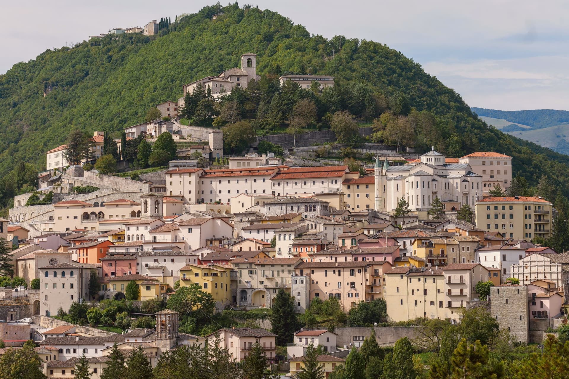
Cascia sits at 653 meters in the mountainous southeastern corner of Umbria, a remote pocket of the upper Valnerina near the Marche and Lazio borders. The commune carries the highest seismic activity in the region together with Norcia twelve kilometers away, and a long history of destructive earthquakes that culminated in the August 2016 sequence.
The town is built around Rita Lotti, who died in the Augustinian monastery here in 1457 and was canonized as Santa Rita in 1900. The Basilica di Santa Rita, built 1937-1947 in white Tivoli travertine on the site of the older church, draws pilgrims year-round and turns Cascia into a town that runs on faith and on truffle.
The Cammino di San Benedetto passes through, linking Norcia to Subiaco and Montecassino. Visitors not pilgrims tend to come for the black truffle, the lentils of nearby Castelluccio, and the silence of the high pastures above town.
What to see in Cascia
- Basilica di Santa Rita. Built 1937-1947 in white Tivoli travertine, Greek-cross plan, frescoes by Montanarini, Filocamo, Consadori, Ceracchini and Vicenzi.
- Monastero di Santa Rita. Augustinian monastery where Rita Lotti lived and died in 1457, attached to the basilica and still active as a religious community.
- Chiesa di San Francesco. Medieval Franciscan church in the lower centro storico, fourteenth and fifteenth-century frescoes inside.
How to get to Cascia
Terni is about 1 h 14 min away by road.
Our tip
May through October is the open season at 653 meters. The basilica is busiest around the May 22 feast of Santa Rita, when pilgrims fill the upper town and accommodation books out months ahead. June through September brings mild days and cool nights, the high pastures green, the truffle hunters working the woods above town.
Why visit Citerna
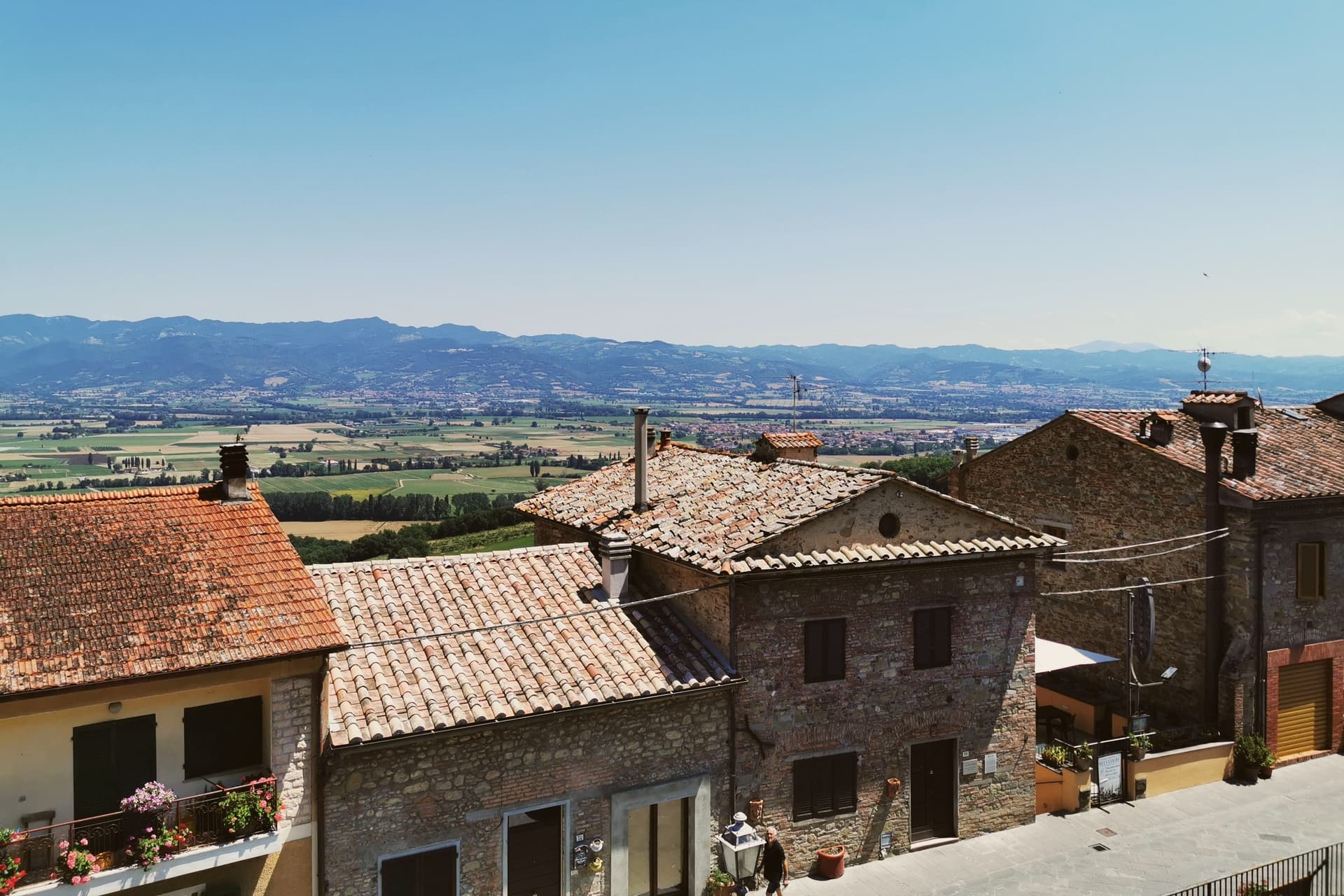
Citerna sits at 480 meters on a ridge at the confluence of the Cerfone and Sovara streams, fifty kilometers north of Perugia in the upper Tiber valley. The name comes from the rainwater cisterns hollowed under the town, still walkable through the underground camminamenti that run beneath the medieval streets.
Umbrian and Etruscan settlement preceded the Roman finds at San Fista and Pistrino. In 1221 Citerna swore loyalty to Città di Castello in exchange for protection, then passed to the Vitelli of Città di Castello as a vicariate in the early sixteenth century, and joined the Kingdom of Italy in 1860 as the first Umbrian town to do so.
The Chiesa di San Francesco on Corso Garibaldi holds a polychrome terracotta Madonna by Donatello, dated around 1415, the only work by the sculptor in Umbria, alongside paintings by Pomarancio, Luca Signorelli and Raffaellino del Colle. The view from the ramparts reaches the mountains of La Verna and Gubbio on a clear day.
What to see in Citerna
- Madonna di Donatello. Polychrome terracotta Madonna and Child of around 1415 in the Chiesa di San Francesco, the only sculpture by Donatello in Umbria.
- Chiesa di San Francesco. Convent church on Corso Garibaldi with works by Pomarancio, Luca Signorelli, Raffaellino del Colle and a Della Robbia school Madonna.
- Camminamenti medievali. Underground walkways and rainwater cisterns hollowed below the streets, the source of the town's name and now open to visit.
How to get to Citerna
Perugia is about 1 h 8 min away by road.
Our tip
April through June and September into October are the months that suit the ridge. Spring and early autumn give clear views from the ramparts as far as La Verna; the air at 480 meters stays mild even in midsummer afternoons. July and August warm the upper Tiber valley but Citerna is small and the underground camminamenti stay cool.
Why visit Norcia
Norcia sits at 604 meters on a high plateau on the Umbrian side of the Monti Sibillini, ancient Nursia of the Sabines, fortified in the 3rd century BC by Rome. Saints Benedict and his twin sister Scholastica were born here in 480; the Benedictine Order and the Ora et Labora motto that shaped Western monasticism began on this piazza.
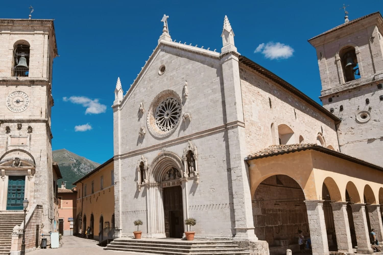
The Basilica di San Benedetto rises on the traditional birthplace, built between 1290 and 1338 over a pre-existing crypt. On 30 October 2016 a magnitude 6.5 earthquake destroyed the nave; only the façade was left standing.
Reconstruction completed on 30 October 2025, nine years to the day, with the original stones and earthquake-resistant technology. The town gave its name to norcineria, the Italian word for quality pork delicatessen, after centuries of Norcia butchers specializing in wild boar and pork.
Black truffle from the Valnerina, lentils from Castelluccio, and ricotta from the high pastures complete the table.
What to see in Norcia
- Basilica di San Benedetto. Built 1290-1338 over the traditional birthplace of Saints Benedict and Scholastica, rebuilt with original stones after 2016, reopened 30 October 2025.
- Castellina. Fortified papal stronghold designed by Jacopo Barozzi da Vignola in 1554, on Piazza San Benedetto, now the Museo Civico e Diocesano.
- Piazza San Benedetto. Civic and religious heart of the centro storico, with the Palazzo Comunale, the basilica, the Castellina and the statue of Benedict at the center.
How to get to Norcia
Terni is about 1 h 33 min away by road.
Our tip
April through June and September into October are the months for Norcia. The plateau holds its color, the lentil fields of Castelluccio bloom from mid-June into July, and the high pastures are open for hiking. July and August stay cooler than the Umbrian valleys at 604 meters, but the town fills with festival crowds for the Mostra Mercato del Tartufo Nero on the last weekend of February and again for sagras through the summer.
Why visit Stroncone
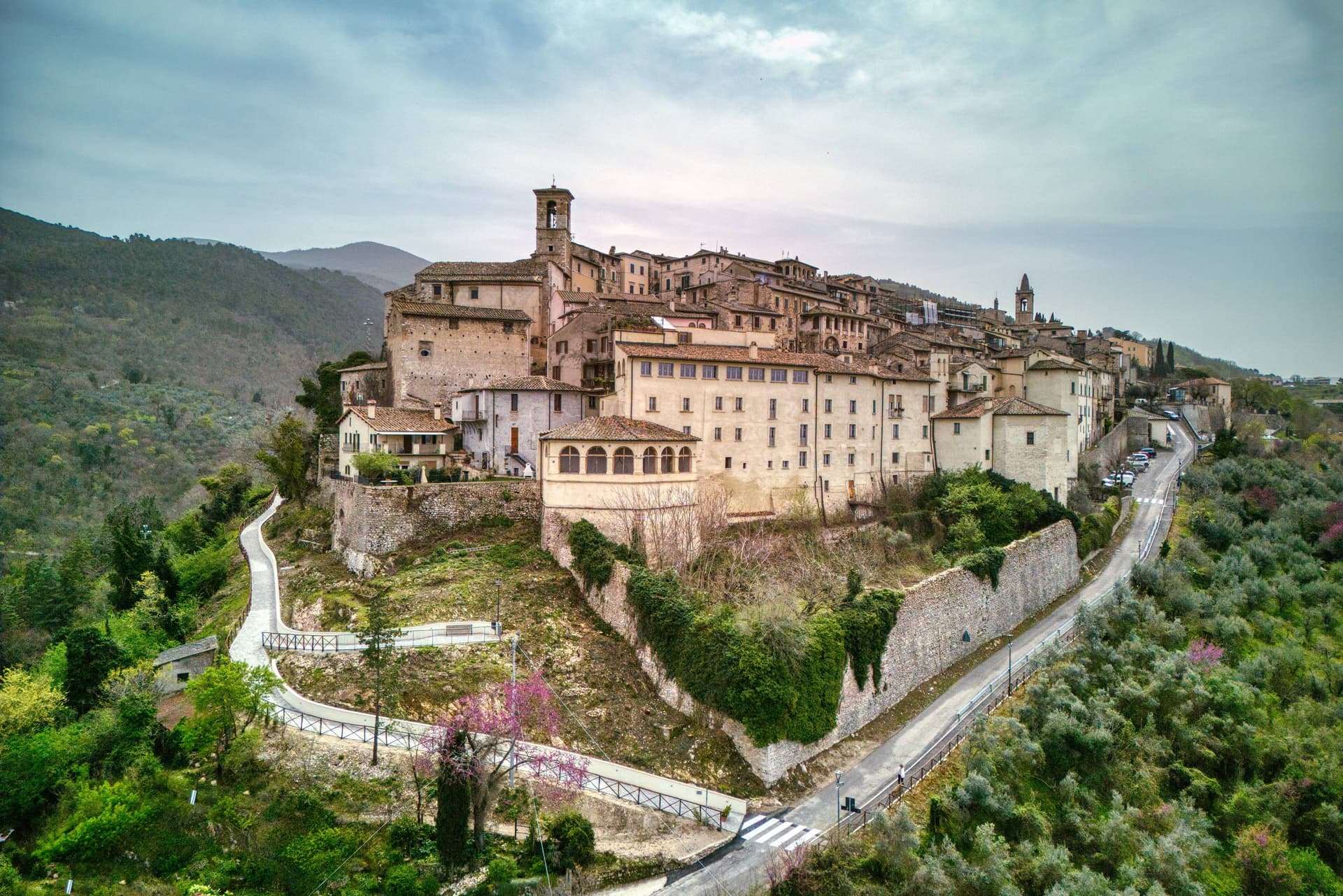
Stroncone sits at 451 meters on an olive-covered hill eight kilometers south of Terni, in the Conca Ternana on the western slope of the Apennine. The name traces to Duke Ugone of Spoleto, whose castrum Hugonis evolved through Castrugone and Strungone to the present form.
A group settled here around the tenth century and built a castle; Stroncone first appears in documents in 1012, when Giovanni di Pietro made a donation to the monastery of San Simeone. Pope Innocent III granted municipal self-rule in 1215.
The Convento di San Francesco, south of the walls, is one of the older Franciscan foundations in Umbria, founded by tradition by Francis himself in 1213, two years before papal recognition of the order. The medieval circuit walls remain almost complete, with the original gates framing a network of stepped lanes that climb to the small main square.
The Cammino di San Francesco passes through, picking up walkers between Rieti and Assisi.
What to see in Stroncone
- Convento di San Francesco. Franciscan convent south of the walls, founded by tradition by Saint Francis in 1213, two years before papal recognition of the order.
- Centro storico. Walled medieval core with original gates intact, climbing through stepped lanes to the small main square at the top of the hill.
- Chiesa di San Giovanni Decollato. Main parish church at the heart of the borgo, with frescoed interior and a Renaissance baptismal font.
How to get to Stroncone
Terni is about 18 min away by road. The full route from Rome.
Our tip
April through June and September into October are the months for Stroncone. Olive harvest carries the autumn rhythm into late November, and the frantoi work into the evening through October and November. July and August are warm in the Conca Ternana but the hill is high enough that nights cool quickly.
More from Anywhere Italy
- The prettiest villages on a walking route in UmbriaUmbriaon a walking routeprettiest villages8 towns · smallest 446 residents
- The best hidden towns on a walking route in the province of PerugiaPerugia provinceon a walking routehidden8 towns · smallest 446 residents
- The 8 best hill towns on a walking route within 90 minutes of TerniNear Ternihill townon a walking routewithin 90 min8 towns · smallest 446 residents · closest 18 min away
- The best small towns that eat well in UmbriaUmbriaeats wellsmall9 towns · smallest 681 residents
- The 6 best hidden truffle towns in the province of PerugiaPerugia provincetrufflehidden6 towns · smallest 345 residents
- The best truffle towns in the province of PerugiaPerugia provincetruffle9 towns · smallest 345 residents