
Tuscany · Siena
Castiglione d'Orcia
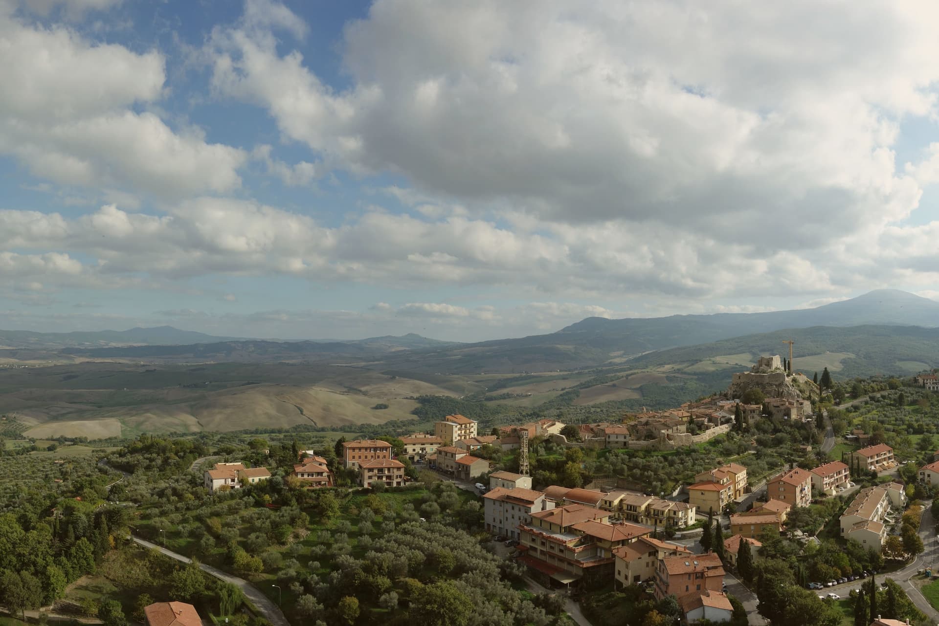
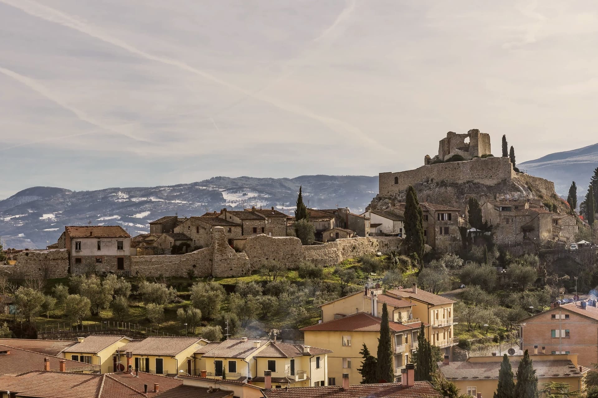
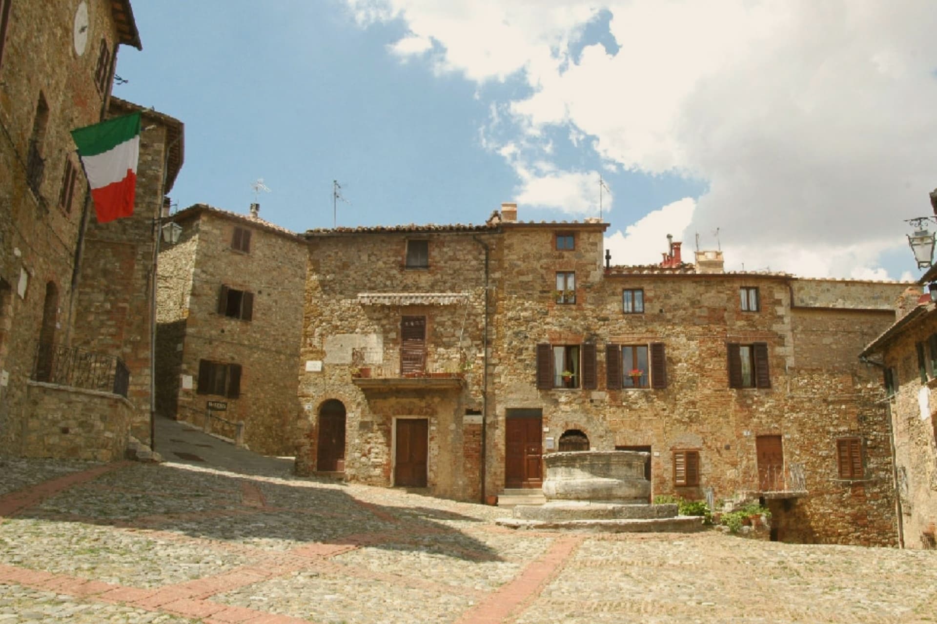
A stone borgo at 540 meters in the UNESCO Val d'Orcia, with two fortresses guarding the road from Amiata to the Via Francigena.
- Best time
- Apr–Oct
- By car
- 2 h 12 min from Siena
- Population
- 2,144
Known for
VAL D'ORCIA UNESCO
One of three communes that share the 2004 UNESCO listing of the Val d'Orcia cultural landscape between Siena and Monte Amiata.
ROCCA A TENTENNANO
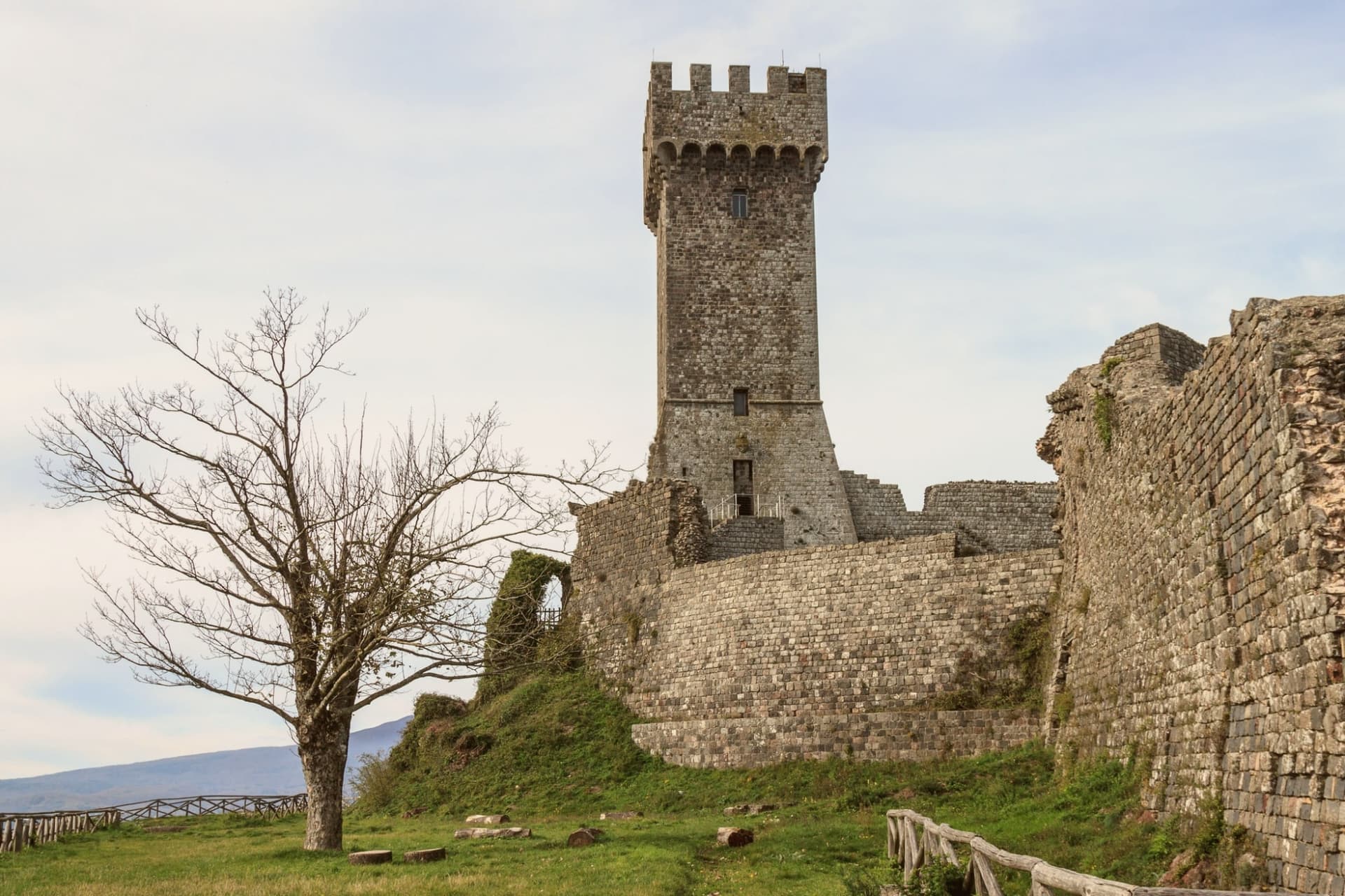
Twelfth-century Salimbeni stronghold in the frazione of Rocca d'Orcia, where Catherine of Siena retired and learned to write in 1377.
IL VECCHIETTA
Painter, sculptor and architect Lorenzo di Pietro, born here around 1410, central figure of fifteenth-century Sienese art.
When to visit
Best · Apr–Oct
- J9°
- F11°
- M13°
- A16°
- M21°
- J27°
- J31°
- A30°
- S24°
- O19°
- N14°
- D10°
- Best
- Hot or crowded
- Quiet
- Mostly closed
Daytime averages, 2020–2024. Weather data by Open-Meteo.com.
Why come
The village stands on a ridge where the land drops toward the Val d'Orcia, the agricultural landscape shaped by Sienese painters and Renaissance estate managers that stretches between Siena and the mountain to the south. First documented in 714, the settlement was then held by the Aldobrandeschi, who built the fortress above the village to hold the medieval road running between the mountain and the Via Francigena, the pilgrim route below. Siena took the town in 1251 and passed control to the Salimbeni and later the Piccolomini, a shift that put a Sienese family in charge of the second fortress on the neighboring outcrop in the frazione of Rocca d'Orcia.
The village center and its outlying frazione form two working parts of one settlement: the walled hill town with its civic square and parish church, and the fortified outcrop a short distance off that once policed the valley approach on its own. The territory is one of three communes sharing the UNESCO inscription, a status that recognizes the whole valley rather than any single settlement within it. What the record shows, across all of it, is a place whose function was always defensive and administrative before it was scenic: two fortresses set to watch one road, a town divided between them, and a landscape that outgrew its original purpose to become the reason people look at it now.
Read on
Castiglione d'Orcia in our articles
 The best small towns on a walking route in the province of Siena6 towns, Castiglione d'Orcia among them.
 The best towns with a World Heritage site in the province of Siena6 towns, Castiglione d'Orcia among them.
 The 9 best hidden hill towns on a walking route in Toscana9 towns, Castiglione d'Orcia among them.
 The 10 best small hill towns in the province of Siena10 towns, Castiglione d'Orcia among them.
How to get there
From Florence / Pisa (PSA), about 3h 45m by car.
Bologna (BLQ) is about 3h 49m away.
By car from the centre of Siena 2h 12m, Perugia 2h 29m or Florence 2h 50m.
What to see
Rocca Aldobrandesca
Aldobrandeschi fortress above the village, documented from the eighth century, walls and keep open as an archaeological site.
Rocca a Tentennano
Stronghold on a basalt outcrop in the frazione of Rocca d'Orcia, reached by a climb that still shows the defensive logic of the site, controlling the approach along the valley.
Piazza Vecchietta
Small triangular civic square in the centro storico, the space that carries the painter's adopted name through the village center he left behind.
Pieve dei Santi Stefano e Degna
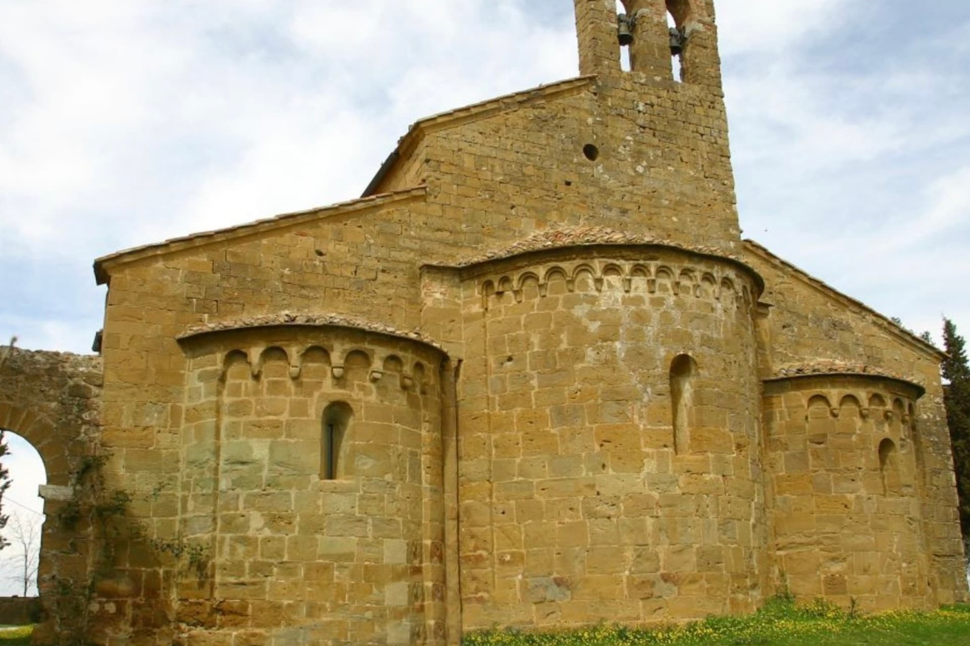
Romanesque parish church on the main square, holding a fourteenth-century panel of the Madonna by Pietro Lorenzetti.
Val d'Orcia panorama
Continuous view from the ridge over the UNESCO-listed agricultural landscape, with Pienza, Montalcino and Monte Amiata visible on a clear day.
The slow-trip planner
Building a trip? Find where Castiglione d'Orcia fits in a slow Italy circuit.
Answer five questions. We will shape a geographically coherent slow trip from the 1,000 Italian towns most travelers skip. Yours to save and share.
The Sunday letter
Castiglione d'Orcia got its letter. One town every Sunday, free. The photo, the food, the festa.
Living here
- Population 2,144
- Remotei
- Pharmacy in town
- Nearest high school over ~30 minutes away
- Nearest airport Florence / Pisa, 3 h 45 min drive
- Regional capital Firenze, 2 h 50 min drive
Thermal baths in town: La Balena Bianca, Il Bollore, Terme San Filippo.
Common questions
- What is Castiglione d'Orcia known for?
- Castiglione d'Orcia is a stone borgo at 540 meters in the UNESCO Val d'Orcia, with two fortresses guarding the road from Amiata to the Via Francigena.
- Where is Castiglione d'Orcia?
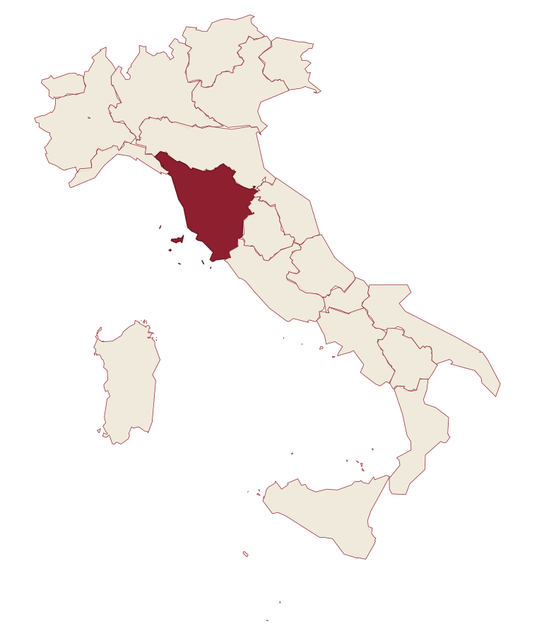
- Castiglione d'Orcia is a comune in the province of Siena, in Tuscany.
- What is the nearest airport to Castiglione d'Orcia?
- Florence / Pisa (PSA), about 3h 45m by car.
- How long is the drive from Siena to Castiglione d'Orcia?
- About 2h 12m by car.
- When is the best time to visit Castiglione d'Orcia?
- Best in Apr–Oct. July is the warmest month, averaging 31 degrees, and May the wettest, with about 13 rain days.
- Which other towns are like Castiglione d'Orcia?
- Castelnuovo di Val di Cecina, Chiusdino and Casale Marittimo.
- How many people live in Castiglione d'Orcia?
- 2,144 at the 2023 count.
Tags & datadesignations · numbers · sources
The numbers
- Elevation: 540 m
- Population: 2,144
- Surface area: 141.66 km²
These figures were compiled from public directories: ISTAT, OpenStreetMap and Wikidata, and from the official listings of the guides named on this page. Town details change; verify with official sources before you travel.
Similar
Towns like Castiglione d'Orcia
Castelnuovo di Val di Cecina
Province: Pisa
both inland, away from the coast · both under 3,000 people
Chiusdino
Province: Siena
both inland, away from the coast · both under 3,000 people
Casale Marittimo
Province: Pisa
both inland, away from the coast · both under 3,000 people
Pienza
Province: Siena
both inland, away from the coast · both under 3,000 people
Pietralunga
Province: Perugia
both inland, away from the coast · both under 3,000 people
Tenno
Province: Trento
both inland, away from the coast · both under 3,000 people
🏛️ UNESCO
More UNESCO towns in Tuscany
Barberino di Mugello
Province: Firenze
The Mugello gateway at 272 meters where the Medici family kept its first country villas, with Michelozzo's Cafaggiolo and the artificial Lago di Bilancino below.
Carmignano
Province: Prato
A Medici village at 189 meters on the Montalbano slopes, where Etruscan tumuli sit below the Renaissance villas.
Cerreto Guidi
Province: Firenze
The Medici hunting villa above the Padule di Fucecchio, where Cosimo I sent his court for the marshland game and Buontalenti built four ramps of stairs.
Montalcino
Province: Siena
A walled hill town at 564 meters above the Val d'Orcia, the last fortress to hold out for the Sienese Republic and the birthplace of Brunello.
Montecatini-Terme
Province: Pistoia
Eleven thermal springs in a Liberty-style park at the foot of the Apennines.