
Tuscany · Pisa
Castelnuovo di Val di Cecina
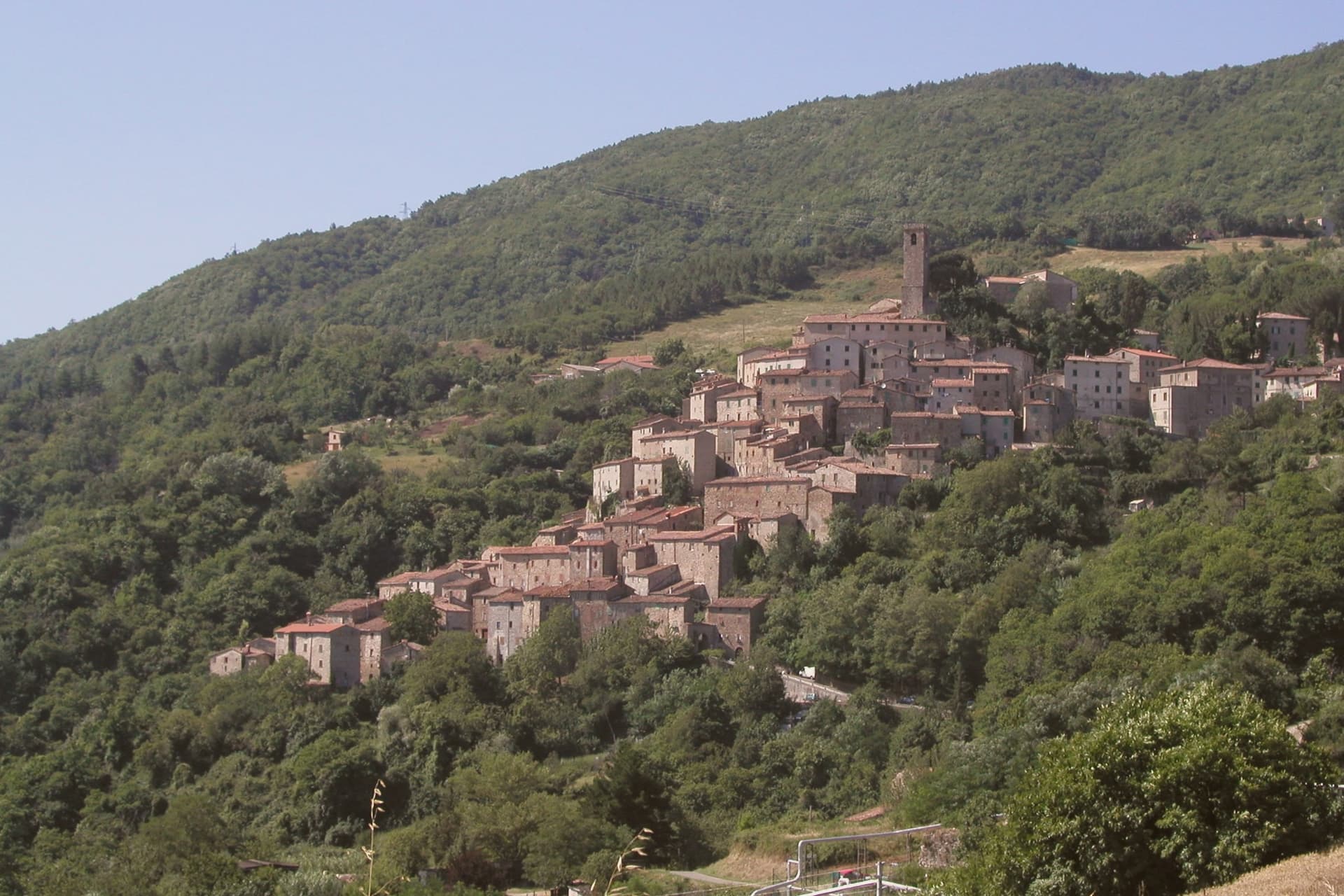
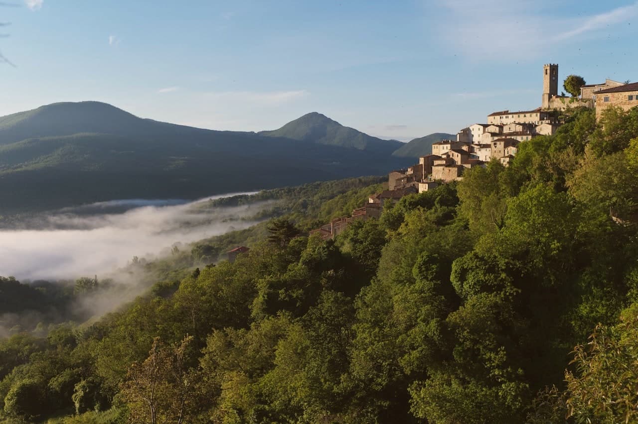
A copper and geothermal borgo at 576 meters in the Cecina valley, where natural steam vents and medieval towers sit on the same hill.
Picked by Peter Benei
Letter to come
Why Castelnuovo di Val di Cecina is on our list
Castelnuovo di Val di Cecina is on our list for its Bandiera Arancione listing.
The nearest town with a letter is Castagneto Carducci, No. 37, 24 km away.
Subscribe and you get Castelnuovo di Val di Cecina's letter the day it comes out.
Visiting
- Best time
- Apr–Oct
- By car
- 1 h 16 min from Siena
- Population
- 2,051
- J9°
- F11°
- M12°
- A15°
- M20°
- J25°
- J29°
- A29°
- S24°
- O19°
- N13°
- D10°
- Best
- Hot or crowded
- Quiet
- Mostly closed
Daytime air temperature, averages for 2020–2024. Weather data by Open-Meteo.com.
Why come
Castelnuovo di Val di Cecina sits on a high spur above the Cecina river, in the geothermal heart of Tuscany. The hills around it are scored with soffioni, the same steam that Francesco Larderel learned to harness in 1818 a few kilometers down the road: the natural resource that made this stretch of Tuscany industrial rather than merely agricultural. The frazione with the steam vents in its streets sits apart from the main village, which grew instead around copper.
The two economies, mineral steam and mined ore, shaped separate parts of the comune rather than the same hill, and the fortress on the neighboring ridge stood to survey the valley that connected them. The chestnut, gathered on the slopes above both, was the food that got people through the winter regardless of what came out of the ground. What this comune amounts to, then, is a single valley organized around three different things the earth gave it: heat, copper, and chestnuts, each claimed by a different part of the terrain.
How to get there
From Pisa (PSA), about 1 h 47 min by car.
Bologna (BLQ) is about 2 h 37 min away.
By car from the center of Siena 1 h 16 min, Pisa 1 h 41 min or Florence 1 h 44 min.
Every town within reach of Pisa airport.
First time driving in Italy? Read our complete manual.
What to see
Centro storico
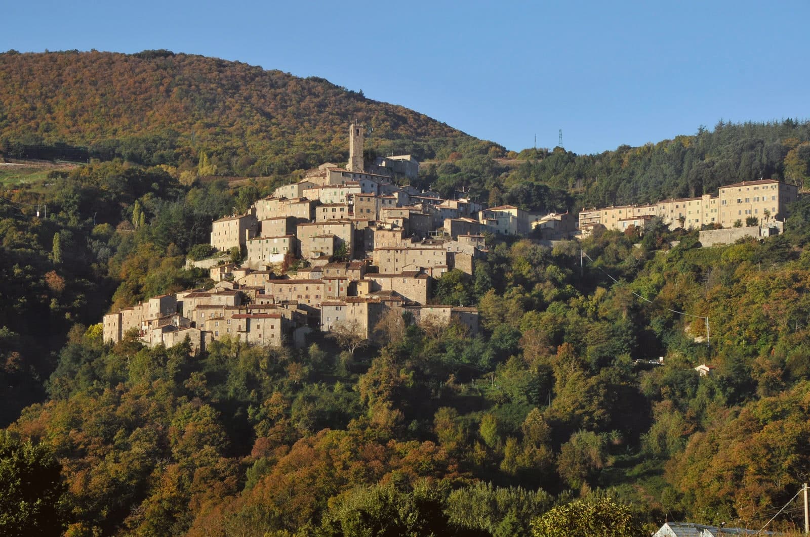
Surviving towers and stone houses mark the boundary of the old ore concession, laid out around the medieval copper-mining works at 576 meters.
Parco delle Fumarole di Sasso Pisano
Boiling pools and vents on the slopes around Sasso Pisano, ground that hisses underfoot and a landscape that shaped Tuscan industry before it became a place to walk through.
Rocca Sillana
Pentagonal keep on the next ridge, with views that take in the full sweep of the upper Cecina valley from its walls.
Pieve di San Bartolomeo
Romanesque stone façade at the center of the old village, the parish church that anchored the mining settlement below the towers.
Biolago di Sasso Pisano
A thermal pool fed directly by the fumarole field, open to bathers, its temperature shifting with the season rather than held constant.
Living here
Could you live here?
Castelnuovo di Val di Cecina is at the end of the road.
- A village of 2,051. The nearest town of 5,000 people, Pomarance, is 17 min away: past our 15-minute rule, which makes this the end of the road.
- Siena, a city of 52,990, is 1 h 16 min by car. Further than our 30 to 60 minutes, a long way for the hospital visit or the monthly shopping.
The rules come from our series Where to Move in Italy, written from the places we have lived: Part 1, The End of the Road · Part 2, The Small Town · Part 3, The City · Part 4, The Postcard · Part 5, The Other Half. The towns we would pick are in Part 6, The Best Towns.
- Population 2,051, down 9.6% since 2015
- Nearest city Siena, 1 h 16 min drive
- Nearest national health service hospital Massa Marittima, 19 km as the crow flies · how healthcare works in Italy
- Homes in the center: €850 to €1,100 per m² to buy, €3.20 to €3.80 per m² a month to rent
All the numbers Common questions, designations, lists and sources.
More about living here
- Remote
- Pharmacy in town
- High school within a 30-minute drive
- Full fibre reaches 87% of homes
- Primary school in the comune
- Earthquake zone 3, low hazard
- Pisa airport (PSA), 1 h 47 min drive, the nearest with scheduled flights
- Regional capital Florence, 1 h 44 min drive
If you are moving here
Who lives here
17% of residents are foreign citizens, most often from Albania, Morocco and Kosovo, against 9% across Italy. 37 of them come from English-speaking countries or western and northern Europe, mostly Germany, the Netherlands and Switzerland. There are 283 people over 65 for every 100 children under 15, against 216 across Italy. 48% of homes have no resident, holiday homes and empty ones counted together, against 27% across Italy. Pisa province ranks 29th of 107 in Il Sole 24 Ore's quality of life ranking for 2025.
Health and schools
The nearest emergency room is in Massa Marittima, 19 km as the crow flies. The nearest major one is in Siena, 37 km away. The nearest IB school is International School of Siena, 35 km as the crow flies.
Information, not medical advice. Confirm with a professional.
Taxes
A home that is not your main one pays 0.86% a year in property tax, charged on the cadastral value rather than the price. A main home pays none unless it is in a luxury category. 7% pensioner tax: this town is not in a qualifying area.
Information, not tax advice. Confirm with a professional.
What it costs
The average household in Tuscany spends about €2,410 a month, €540 of it on food, against about €2,170 across Italy. A family of three pays about €770 a year for water, on the Tuscany average.
Climate and risk
It is in climate zone E, on a scale from A, the warmest, to F, the coldest, and heating may run from October 15 to April 15, up to 14 hours a day, unless the mayor changes it. 1% of residents live in a zone the national maps rate high for floods, 1% in a high or medium one. 12% live in a zone rated high or very high for landslides.
These shares cover the whole comune, not any one street. Check an address on IdroGEO.
Moving from abroad? Which visa you need. Sources: ISTAT, the Ministry of Health, ISPRA, the Finance Ministry, the Ministry of Enterprise, Poste Italiane, the comuni, the IB, International Schools Database, Il Sole 24 Ore, Cittadinanzattiva.
This is a thermal town: terme operate here.
Known for
FUMAROLE
Natural steam vents around Sasso Pisano, hissing through the stone streets and staining them yellow with sulfur.
COPPER MINES
Medieval and modern copper extraction under the Republic of Pisa, active in the surrounding hills into the twentieth century.
CHESTNUTS
Apennine subsistence crop still harvested on the slopes above town, with autumn sagre across the comune.
Common questions
- What is Castelnuovo di Val di Cecina known for?
- Castelnuovo di Val di Cecina is a copper and geothermal borgo at 576 meters in the Cecina valley, where natural steam vents and medieval towers sit on the same hill.
- Where is Castelnuovo di Val di Cecina?
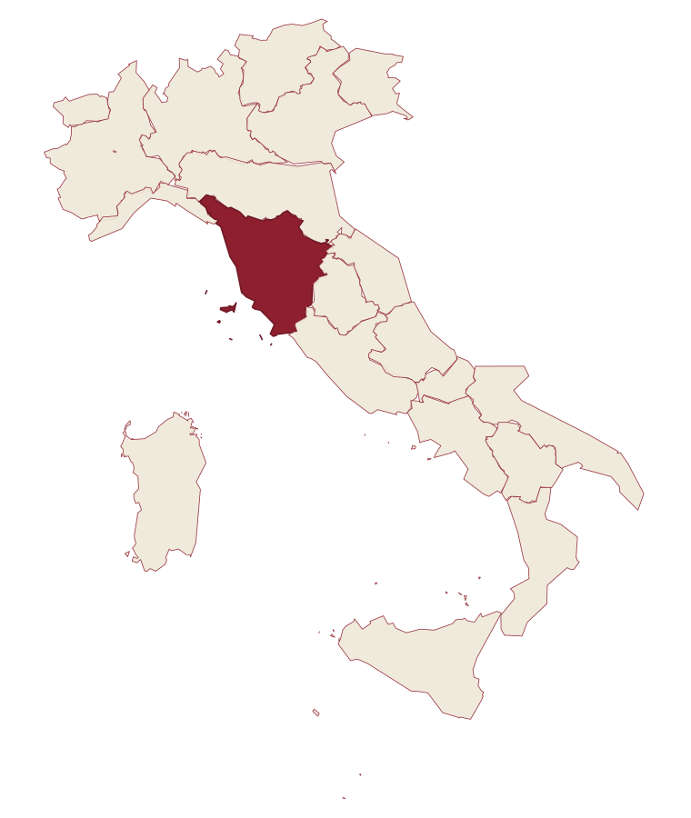
- Castelnuovo di Val di Cecina is a comune in the province of Pisa, in Tuscany.
- What is the nearest airport to Castelnuovo di Val di Cecina?
- The nearest airport with scheduled flights is Pisa (PSA), about 1 h 47 min by car.
- How long is the drive from Siena to Castelnuovo di Val di Cecina?
- About 1 h 16 min by car.
- When is the best time to visit Castelnuovo di Val di Cecina?
- Best in Apr–Oct. July is the warmest month, averaging 29 degrees, and November the wettest, with about 13 rain days.
- Which other towns are like Castelnuovo di Val di Cecina?
- Chiusdino, Casale Marittimo and Castiglione d'Orcia.
- How many people live in Castelnuovo di Val di Cecina?
- 2,051 residents, by ISTAT's count on 1 January 2025.
- Is Castelnuovo di Val di Cecina a good place to live?
- By the rules in our Where to Move in Italy series, Castelnuovo di Val di Cecina is at the end of the road: the nearest town of 5,000 people, Pomarance, is 17 min away. The nearest city, Siena, is 1 h 16 min away by car. The nearest national health service hospital is in Massa Marittima, 19 km as the crow flies. Full fibre reaches 87% of homes.
Tags & data designations · numbers · sources
Recognized as
Landscape
The numbers
- Elevation: 576 m
- Population: 2,051
- Surface area: 89.02 km²
These figures were compiled from public directories: ISTAT, OpenStreetMap and Wikidata, and from the official listings of the guides named on this page. Town details change; verify with official sources before you travel.
The ranked lists
Lists Castelnuovo di Val di Cecina appears in
Near here, with a letter
- Written about. No. 37.
Castagneto Carducci
Province: Livorno
A hilltop borgo at 194 meters above the Costa degli Etruschi, renamed for the poet Carducci in 1907 and the home of Bolgheri and Sassicaia.
24 km away
- Written about. No. 38.
Campiglia Marittima
Province: Livorno
A walled hilltop borgo above the Val di Cornia, where the Rocca tower watches a mining landscape worked from the Etruscans to 1976.
42 min by car
- Written about. No. 34.
Volterra
Province: Pisa
The Etruscan acropolis of Velathri at 531 meters, the alabaster town that has been carving the same stone for three thousand years.
44 min by car
Our guide
Our nearest guide, 37 km away
Tuscan Mainland: the towns, when to go, how to get there
The Tuscan Mainland guide came out of the letter. Letters from the towns we visit. Free.
Read the guide: The postcard country, and what is under it. 15 towns, the drive and train times, the months, where to eat and sleep.
Paid plans, the moving year and the books are on the membership page.