
The best hidden towns with a medieval festival in the province of Siena
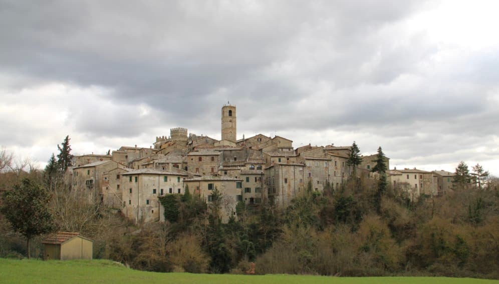
The province of Siena spends its summers in costume. Drummers rehearse in the shade of brick and travertine walls, contrade sew silk banners, and archers and crossbowmen practise in fields below hilltowns built from the pale local stone. The re-enactments cluster around saints' days and harvest weekends, which is also when the wine is poured freely, the pici come with garlic and breadcrumbs, and the pecorino is at its firmest. Evening light on tufa and cypress does most of the work; the processions do the rest.
Almost everyone who comes for medieval spectacle in this part of Tuscany comes for one thing, the Palio in Siena itself, run twice each summer in the Piazza del Campo. It is the most famous historical contest in Italy and deserves its reputation, but the piazza fills hours before the horses appear, hotel rates double, and accommodation in the city is booked months ahead. The costumed parade that precedes the race is superb and largely invisible from the standing area. It is a great day out and a difficult one.
The same tradition of contrade, drums and crossbows continues through the smaller comuni of the province, in Val d'Orcia, Valdichiana and on the flanks of Monte Amiata. These towns hold their own annual re-enactments, some medieval, some Renaissance, in front of audiences drawn largely from the surrounding valleys. Fewer people go, tickets are cheap or free, and you can usually eat afterwards without booking. The towns below are where to look.
Of the 20 communes we have mapped in the province of Siena, 12 qualify as towns with a medieval festival: each stages a recurring historical re-enactment in costume. This list is the hidden ones, 10 in all, ordered smallest first. The smallest, Radicofani, has 1,060 residents.
Two more lists worth reading alongside this one: The best towns with a food festival in the province of Siena and The best towns on a walking route in the province of Siena.
San Casciano dei Bagni
Why visit San Casciano dei Bagni
San Casciano dei Bagni sits at 582 meters at the southern edge of the province of Siena, above 42 hot springs that average 42 degrees Celsius. The baths were used continuously from Etruscan through Roman times and again from the Renaissance, when visitors came from across Europe.
In 2022, an excavation that began in 2019 at the ancient sanctuary turned up 24 bronze votive statues protected by mud, with around 6,000 coins in gold, silver and bronze. The find was the largest of its kind in fifty years; most surviving Etruscan votive material is terracotta.
The 1,500 residents live on a basalt outcrop above the Roman thermal complex, in a centro storico of stone houses and three small churches. The borgo joined the Borghi più belli network in 2014 and remains one of the smallest communes in Toscana to carry both that label and Bandiera Arancione.
The re-enactment here is Palio di San Cassiano di San Casciano dei Bagni, usually held in August.
What to see in San Casciano dei Bagni
- Santuario Ritrovato. Etruscan-Roman thermal sanctuary excavated since 2019, where 24 bronze votives and around 6,000 coins were recovered in 2022.
- Bagno Grande. The principal natural pool of the 42 hot springs, used from the second century BC through the Renaissance and reopened to the public.
- Collegiata di San Leonardo. Romanesque parish church in the centro storico, restored in the seventeenth century, with a baptismal font carved from local travertine.
How to get to San Casciano dei Bagni
Perugia is roughly 68 minutes away by road.
Our tip
The thermal pools make the calendar different here. Winter is the season many visitors prefer, when the 42-degree water steams against cold air and snow occasionally dusts the basalt outcrop. April through June and September into October are the most balanced months: warm hill light, the dry-stone walls of the borgo at their best, the sanctuary excavations open to guided tours. Sagra del Ciaffagnone di San Casciano dei Bagni falls in June.
Cetona
Why visit Cetona
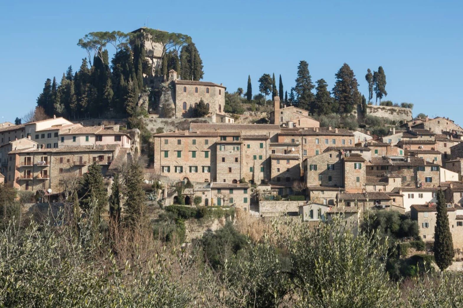
The town sits on the western flank of a ridge at the meeting point of Toscana, Umbria and Lazio, where the mountain divides the Val d'Orcia from the Val di Chiana. The medieval comune passed between Siena, Orvieto and Perugia before falling to Siena in the late fourteenth century, and it was Cosimo I who later sold it whole to a marchese.
The fortress at the top of the grid and the square laid out below it are two halves of the same Renaissance move: a private residence replacing a garrison at the summit, a flat civic stage opened up at the base. Above the town, in the woods, the hermitage and the caves belong to a much older layer, human use of the mountain reaching back to the Mesolithic, long before any comune or marchese laid claim to it.
What the town adds up to is a settlement built in tiers: a prehistoric mountain, a contested medieval center, and a Renaissance overlay that reorganized the base of the hill without touching what stood above it.
The re-enactment here is Corsa delle brocche a Cetona, usually held in July.
What to see in Cetona
- Piazza Garibaldi. Elliptical square at the foot of the medieval grid, flat and open where the streets above it climb steeply. The civic stage of the borgo, still the first thing that orients a visitor.
- Rocca di Cetona. Fortress at the top of the centro storico, its walls and keep still standing though the interior became a private residence rather than a garrison.
- Convento di San Francesco. Franciscan convent below the borgo, founded in 1212, with a single-nave church and a small cloister still in religious use.
How to get to Cetona
Perugia is roughly 78 minutes away by road.
Our tip
April through June and September into October are the months Cetona keeps its calmest pace, the wooded slopes of Monte Cetona green or rust depending on the half. July and August are hot in the centro storico but the mountain trails above 800 meters stay cool. The Mostra del Tartufo, dedicated to the local white truffles, runs the second weekend of November in Piazza Garibaldi. Sagra del Bico di Cetona falls in June.
Piancastagnaio
Why visit Piancastagnaio
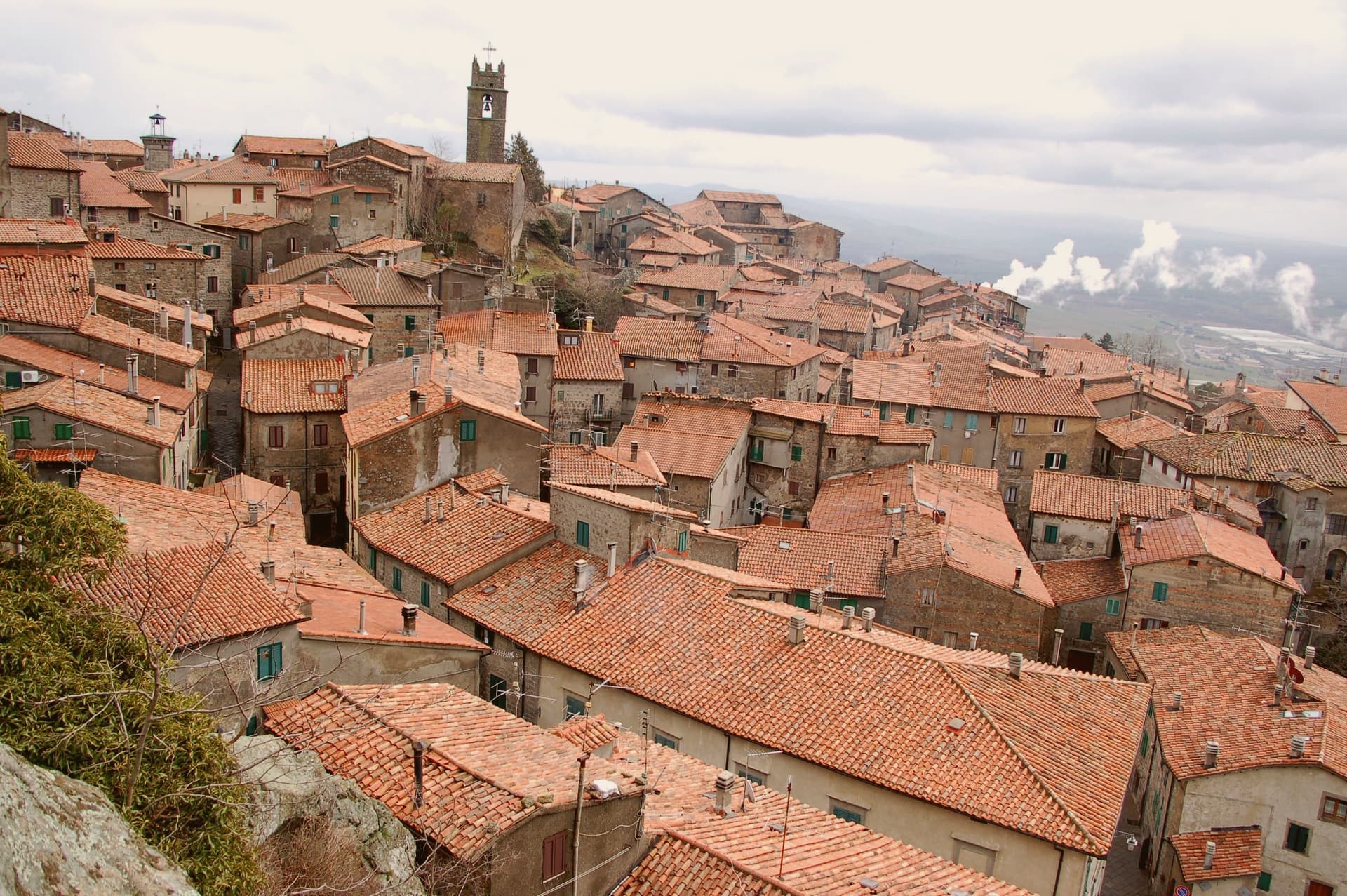
The name means plain of the chestnut, and the forest that still climbs the slope above the town is what fed it for most of its history: sweet chestnut, sessile oak, beech. The town itself sits at 772 meters, built around a twelfth-century keep that passed to Siena in 1418 and to the Medici in 1559, and the palazzo built into its old defenses in the sixteenth century reads as the Medici layer set directly against the Aldobrandeschi one.
Contrade named Borgo, Castello, Coro and Voltaia divide the centro storico for the August race, while the mining museum keeps the record of an industry, cinnabar and mercury, that ran on the mountain from Etruscan times until it closed in 1982 and that has otherwise left the town to the chestnut trade. What Piancastagnaio adds up to is a place where a volcano's slope has supplied, in turn, timber and food, ore, and a festival calendar, and where the built town still carries each of those histories as a separate, legible layer rather than a single blended one.
The re-enactment here is Palio delle Contrade di Piancastagnaio, usually held in August.
What to see in Piancastagnaio
- Rocca Aldobrandesca. Twelfth-century Aldobrandeschi keep at the heart of the centro storico, with a square tower and surviving curtain wall.
- Palazzo Bourbon del Monte. Sixteenth-century Medici-era palazzo built into the medieval defenses, with a courtyard loggia and ceremonial hall.
- Museo Minerario di Sant'Anna. Mining museum on the cinnabar and mercury extraction of Monte Amiata, active from the Etruscans until the mine closed in 1982.
How to get to Piancastagnaio
Perugia is roughly 135 minutes away by road.
Our tip
May through September is the season on the southern Amiata slope. The chestnut woods are open, the air at 772 meters stays cool against the Maremma heat below, and the trails to the volcano summit run from town. The Palio delle Contrade is the second weekend in August, the only date most outsiders know. Crastatone di Piancastagnaio falls in the season.
Radicofani
Why visit Radicofani
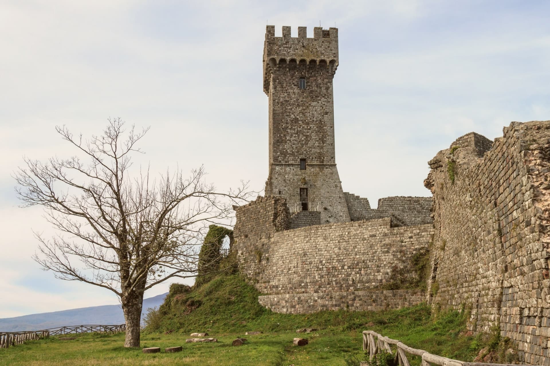
Radicofani sits where the rolling clay hills of the Val d'Orcia give way, abruptly, to a volcanic cone: the town rises straight off the plain rather than sitting among gentler slopes, which is why the rock is visible from Pienza, Montalcino, the Cassia road and points as far off as Lago Trasimeno, 60 km away, and why it reads as a landmark rather than a village from any distance. The medieval centro climbs in the same volcanic-basalt stone as the rock beneath it, narrowing as it rises, so that the streets themselves seem to funnel a visitor upward toward the fortress that caps the summit.
That fortress began under the Aldobrandeschi in the 12th century, was expanded by the outlaw and Ghibelline noble who made the rock his raiding base from 1297 to 1303, robbing pilgrims and churchmen on the road below and returning the richest captives to Pope Boniface VIII with gallows-humour notes attached, a story Dante folds into Purgatorio VI and Boccaccio into the Decameron's tenth day. The Sienese extended it again in the 14th century, the Medici in the 16th after Cosimo I bought the territory in 1556, and a powder-magazine explosion in 1735 took off the upper levels, leaving the restored lower fortress and its terrace standing today.
Below the village, at its foot rather than within its walls, sits the old stagecoach inn, a separate register of the town's history: not the fortress and its outlaw but the machinery of travel and hospitality that grew up beneath it to serve the pilgrim road running from Canterbury to Rome, hosting Montaigne, Dickens and Grand Tour travellers moving between Florence and Rome from 1500 to 1850. The town's church, the Romanesque Pieve di San Pietro, and its companion the Chiesa di Sant'Agata, with its Della Robbia altarpiece, belong to the centro itself rather than to the rock above it.
Surroundings widen the picture: Pienza, also UNESCO-listed, lies 30 km north, Montalcino 35 km northwest, and the extinct volcano immediately west offers a cooler, wooded counterpoint of chestnut and beech forest to the bare rock the town is built on, with thermal baths built around a pool 20 km north. The food follows the same Val d'Orcia line as its neighbors: pici with hare ragù, pecorino di Pienza, lardo di Colonnata and finocchiona, with Brunello di Montalcino and Vino Nobile di Montepulciano within easy reach.
The Festa Medievale in mid-July recreates the outlaw court that once ruled the summit, and the Festa del Fagiolo in early August celebrates the local cannellini bean. Like other Val d'Orcia hilltop villages, the population has fallen hard, from 2,800 in 1951 to 1,060 today.
The three marks the town carries together, UNESCO, Bandiera Arancione and the pilgrim route, are not separate honors so much as three ways of naming the same fact: a place built for defense and passage that has outlasted both purposes and now stands mostly for itself.
The re-enactment here is Festa degli antichi mestieri a Radicofani, usually held in June.
What to see in Radicofani
- Rocca di Radicofani. 12th-c Aldobrandeschi origin, expanded by the Sienese in the 14th century and by the Medici in the 16th, after Cosimo I bought the territory in 1556. A 1735 powder-magazine explosion destroyed the upper levels. The restored lower fortress and its panoramic terrace give the most expansive single view in southern Tuscany.
- Via Francigena + Posta Medicea. The inn stands at the foot of the village, on the pilgrim road from Canterbury to Rome, where it once put up travellers moving between Florence and Rome for three and a half centuries, among them Montaigne and Dickens.
- UNESCO Val d'Orcia centro. An intact medieval centro climbing in volcanic-basalt stone toward the fortress above it. The Pieve di San Pietro is Romanesque; the Chiesa di Sant'Agata holds a Della Robbia altarpiece.
How to get to Radicofani
Perugia is roughly 91 minutes away by road.
✷ We have written about Radicofani
“When the film industry needed a picture of heaven, of the fields a dead hero walks home to, they came and shot it here, and that is the truest thing anyone has ever said about the Val d'Orcia. It is not a place. It is the afterlife as imagined by people who lived in cities. It is how the country looks to men who never spent an hour in it, dreamed up by Florentine bankers five hundred years ago and maintained, beautifully, ever since.”
Read our piece on Radicofani →Val d'Orcia | The Postcard Is Constructed
Our tip
Radicofani is best May–September. The Festa Medievale mid-July (Ghino di Tacco pageant) + Festa del Fagiolo early August are the year's headline events. Summer is hot in the Val d'Orcia but the 814m altitude keeps Radicofani 5-7°C cooler than the lower valleys. Festa degli antichi mestieri a Radicofani falls in June.
Pienza
Why visit Pienza
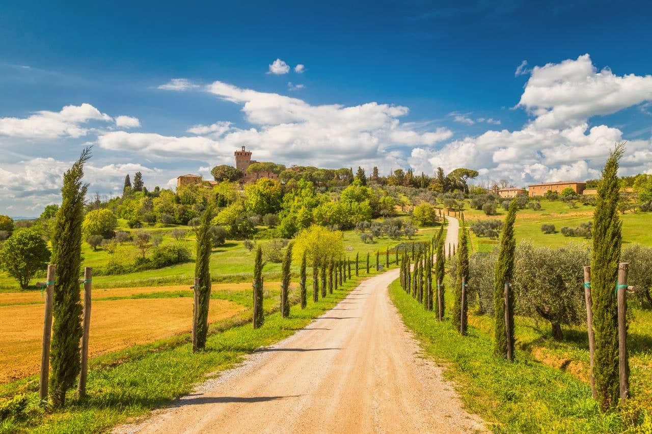
Pienza sits at 491 meters on a long ridge in the Val d'Orcia, an hour and a half south of Siena. The village was called Corsignano until 1462.
Enea Silvio Piccolomini was born here in 1405 and became Pope Pius II in 1458; the following year he ordered the Florentine architect Bernardo Rossellino to rebuild his birthplace as a Renaissance ideal city. The work took three years.
The square at the center, the cathedral on the cliff side, the palace built for the pope's family, the cardinal's palace facing it, and the town hall opposite the cathedral were all designed and built as a single composition rather than assembled piece by piece over time. Pius consecrated the cathedral on 29 August 1462, two years before his death, and the whole arrangement has survived almost unchanged since.
What stands in Pienza today is less a collection of monuments than the physical record of one commission carried out in one stretch of years.
The re-enactment here is Festa rinascimentale e corsa di Pio a Pienza, usually held in September.
What to see in Pienza
- Piazza Pio II. Trapezoidal Renaissance square laid out by Bernardo Rossellino, with the Duomo, Palazzo Piccolomini, Palazzo Borgia and Palazzo Comunale facing each other.
- Duomo di Pienza. Latin-cross cathedral with three apsidal chapels, built on the cliff edge, its Renaissance façade also by Rossellino.
- Palazzo Piccolomini. Renaissance palace for the pope's family, begun 1459, with an internal courtyard and a hanging garden overlooking the Val d'Orcia.
How to get to Pienza
Perugia is roughly 98 minutes away by road.
Our tip
April through June and September into October are the months when the Val d'Orcia sits at its best, green or gold depending on the wheat cycle, and the Piazza Pio II is open for photographs without the day-tripper buses. July and August push past thirty-three degrees and the Corso Rossellino fills with tour groups between ten and four. The Fiera del Cacio, the cheese festival, takes the first Sunday in September, when the streets fill with stalls of pecorino producers from the Pienza ridge. Festa del Cacio di Pienza falls in September.
San Quirico d'Orcia
Why visit San Quirico d'Orcia
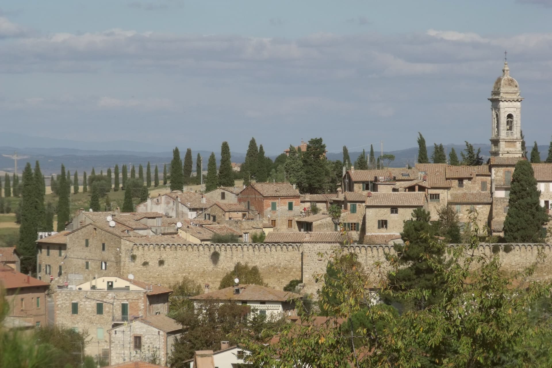
San Quirico d'Orcia sits at 409 meters on a low rise in the Val d'Orcia, the rolling clay-and-tufa landscape inscribed by UNESCO in 2004 as a cultural landscape shaped by fourteenth and fifteenth-century Sienese governance. The town was a stage on Sigeric the Serious's tenth-century Via Francigena from Canterbury to Rome and has remained a working stop on the route ever since.
The Collegiata dei Santi Quirico e Giulitta was built at the end of the twelfth century over an eighth-century baptistery; the lateral portal added in 1288 is attributed to Giovanni Pisano, then working on the Siena cathedral. The Horti Leonini, the geometric boxwood garden laid out by Diomede Leoni around 1580 inside the town walls, hosts the Forme nel Verde sculpture exhibition every summer since 1971.
Bagno Vignoni, the frazione five kilometers down the road, has a thermal pool at the center of its piazza, used since Etruscan times. Few comuni this small carry UNESCO, thermal and Francigena signals at once.
The re-enactment here is Festa del Barbarossa a San Quirico d'Orcia, usually held in June.
What to see in San Quirico d'Orcia
- Collegiata dei Santi Quirico e Giulitta. Romanesque parish church built late twelfth century over an eighth-century baptistery, with the 1288 lateral portal attributed to Giovanni Pisano.
- Horti Leonini. Italianate boxwood garden laid out by Diomede Leoni around 1580 inside the town walls, hosting the Forme nel Verde sculpture exhibition since 1971.
- Bagno Vignoni. Frazione five kilometers south, with a sixteenth-century thermal pool at the center of its piazza, fed by springs used since Etruscan times.
How to get to San Quirico d'Orcia
Perugia is roughly 96 minutes away by road.
Our tip
April through June and September into October are the gold months in the Val d'Orcia: green wheat in spring, ochre stubble by autumn, low light that defines the cypress ridges. The Festa del Barbarossa runs the third Sunday of June with archery, jousts and crossbow contests between the town quarters. July and August are hot and busy; the centro storico fills with day-trippers from Pienza and Montalcino. Festa del Barbarossa a San Quirico d'Orcia falls in June.
Montalcino
Why visit Montalcino
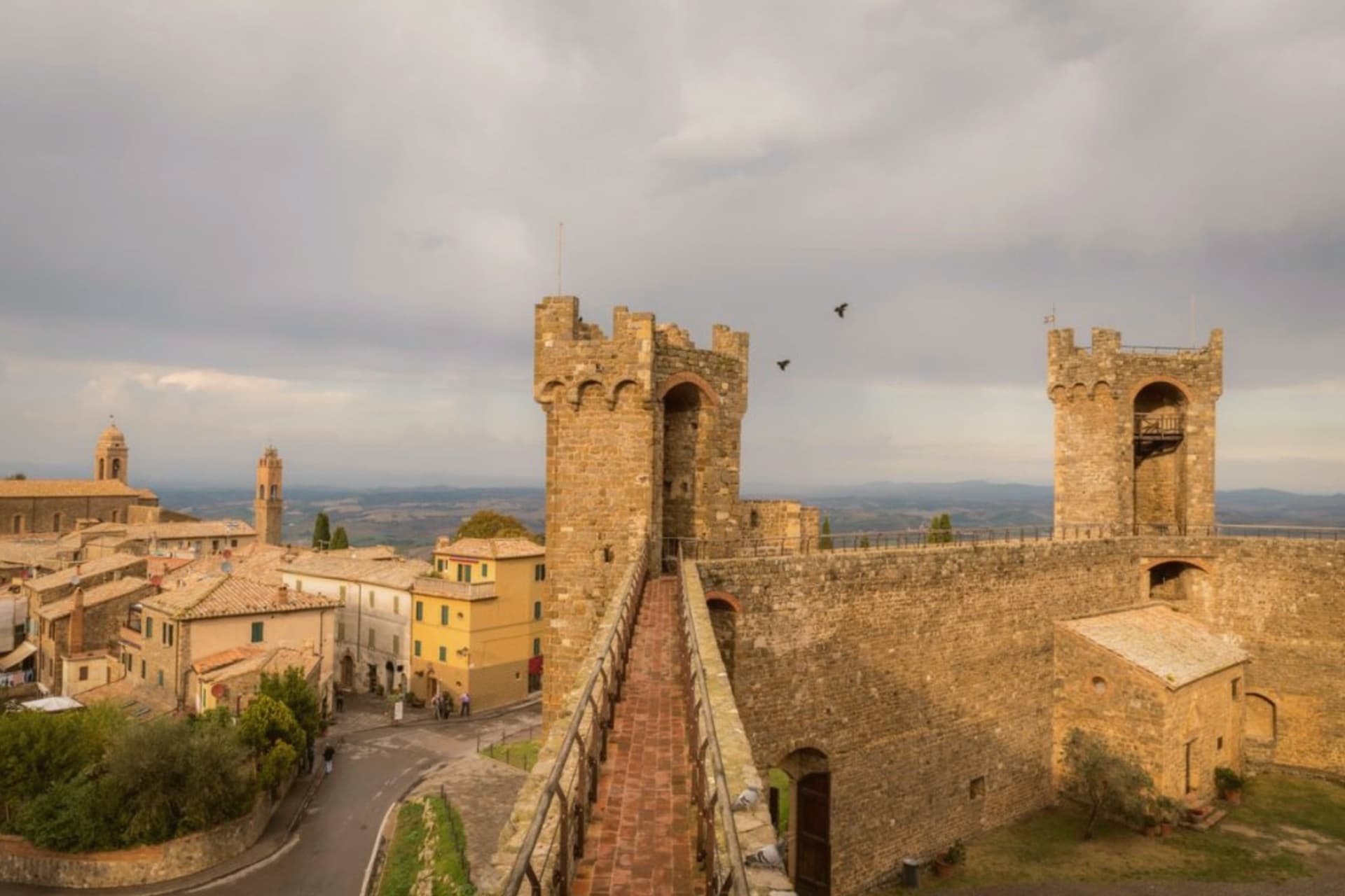
Montalcino sits at 564 meters on a hill south of Siena, the centro storico ringed by walls and crowned by a pentagonal fortress built in 1361. When Florence took Siena in 1555, the Sienese exiles regrouped here and held out for almost four years; the Rocca itself never fell.
That date matters less to most visitors than 1980, when Brunello di Montalcino was named one of the first four Italian wines to receive DOCG status. The vineyards run from the town at 600 meters down to plots at 200, on stony galestro soils that ripen Sangiovese Grosso into a wine that ages for decades.
The Abbey of Sant'Antimo, ten kilometers south, is a Romanesque church first documented in 814 and tied by local legend to a vow by Charlemagne. The town also produces miele, olio, and the white truffles of the surrounding woods.
It carries seven institutional signals at once, more than any other commune in this batch.
The re-enactment here is Torneo di Apertura delle Cacce a Montalcino, usually held in August.
What to see in Montalcino
- Rocca di Montalcino. Pentagonal fortress built in 1361 by Sienese architects Mino Foresi and Domenico di Feo, refuge of the Sienese Republic after 1555.
- Abbazia di Sant'Antimo. Romanesque abbey ten kilometers south, first documented in 814, set among olive groves below the town with Gregorian chant still sung.
- Palazzo dei Priori. Thirteenth-century town hall on Piazza del Popolo, slender tower attached, civic seat of the medieval commune.
How to get to Montalcino
There is a railway station in the town, so you can arrive without a car and never need one while you are here. Perugia is roughly 105 minutes away by road.
Our tip
April through June and September into October are the months locals prefer. The hills are green or gold depending on the half, and the vineyards run their full work cycle. The Sagra del Tordo, a medieval archery contest between the four quarters of the town, takes place the last Sunday of October. Sagra del Cinghiale di Montalcino falls in the season.
San Gimignano
Why visit San Gimignano
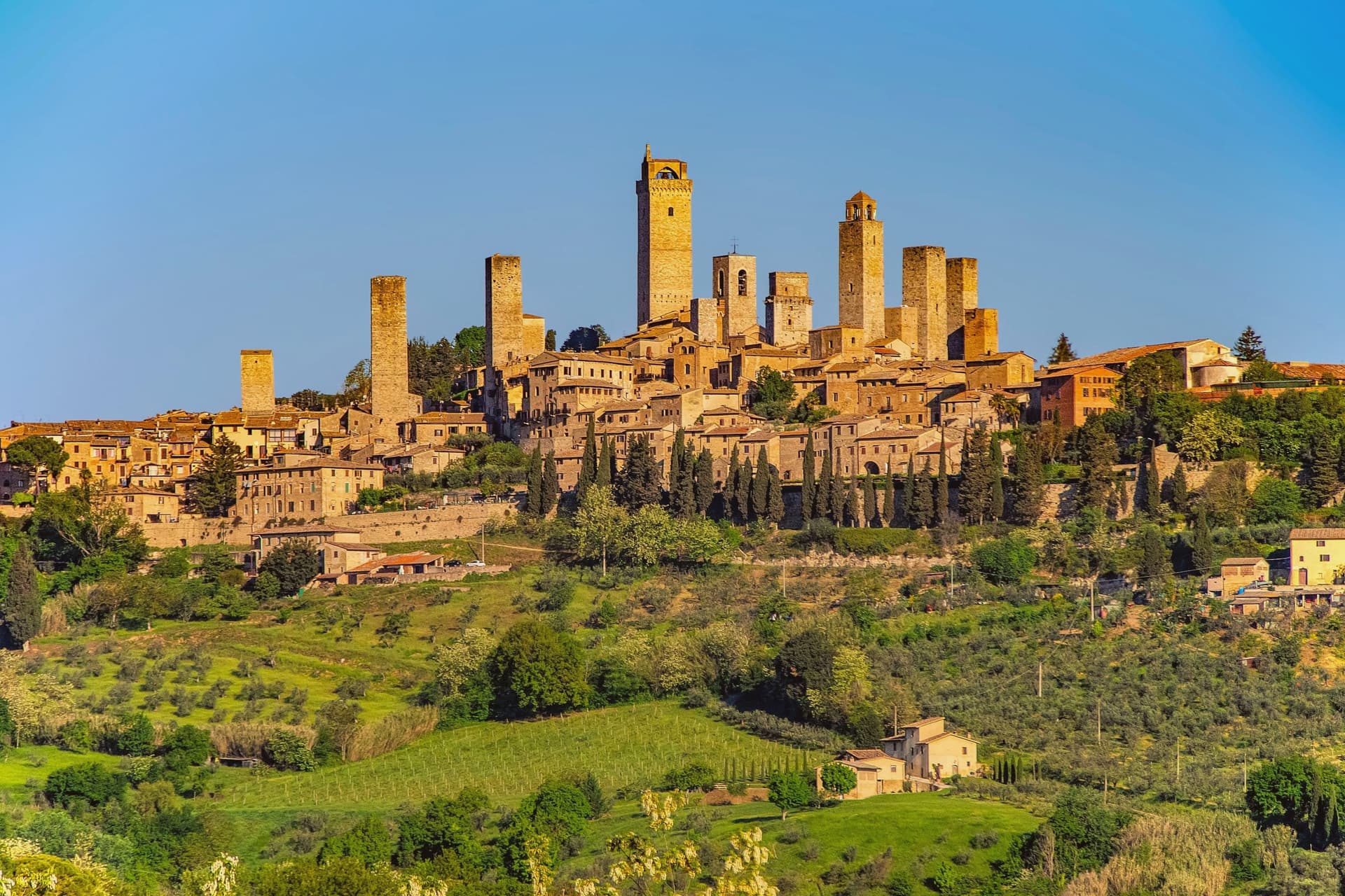
San Gimignano sits at 334 meters in the Val d'Elsa, halfway between Firenze and Siena on the medieval pilgrim road to Rome. Patrician families built 72 tower-houses in the twelfth and thirteenth centuries as proofs of wealth and platforms for vendettas; 14 still stand, the tallest being the Torre Grossa at 54 meters.
The town declared independence from the bishops of Volterra in 1199 and grew rich on saffron and Vernaccia, the white wine grown on the surrounding hills and praised since Dante. The Black Death of 1348 broke the boom; San Gimignano lost more than half its population and submitted to Florence.
That collapse is the reason the medieval skyline survived. UNESCO listed the historic centre in 1990 as a complete record of feudal architecture.
Roughly three million visitors come each year, more than 400 times the resident population, and the centro storico empties into the surrounding olive groves once the day-trippers leave.
The re-enactment here is Fiere delle Messi di San Gimignano, usually held in June.
What to see in San Gimignano
- Torre Grossa. Fifty-four meter civic tower attached to the Palazzo Comunale, the tallest of the surviving 14, open for the climb to the panoramic terrace.
- Piazza della Cisterna. Triangular medieval square paved in brick around an octagonal well of 1287, lined by tower houses and Romanesque palaces.
- Collegiata di Santa Maria Assunta. Romanesque parish church on Piazza Duomo, walls covered by Bartolo di Fredi and Lippo Memmi frescoes of Old and New Testament scenes.
How to get to San Gimignano
Firenze is roughly 61 minutes away by road.
✷ We have written about San Gimignano
“We arrived in the afternoon, into the second half of the day’s crowd. Off-season meant it was groups and guides rather than a flood, but the shops were open and doing their worst, the same garbage souvenirs, the same pasta no one local would eat, and we walked through it the way you walk through a thing you have decided not to let ruin your evening. The towers stood over all of it, indifferent, which is their whole talent.”
Read our piece on San Gimignano →San Gimignano | The Town After Seven
Our tip
April through June and September into October are the months the town is worth a full day rather than three hours. The buses still come, but late afternoon empties the piazzas and lets the towers take their light. July and August push temperatures past thirty and the centro storico becomes uncomfortable between two and six, when the stone radiates heat. Fiere delle Messi di San Gimignano falls in June.
Monteriggioni
Why visit Monteriggioni
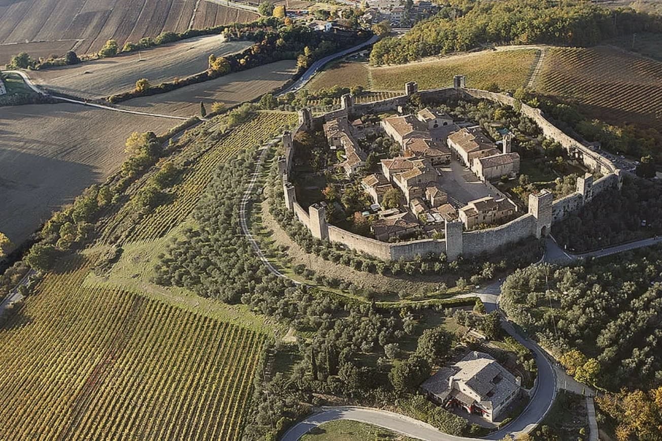
Monteriggioni sits at 274 meters on a natural hillock between Firenze and Siena, eleven kilometers from the Sienese gates. The walls were built between 1213 and 1219, when Siena ran them up as a frontline garrison facing Florentine expansion north.
They are still there. Fourteen square towers, 570 meters of curtain wall, ten meters tall, two gates: Porta Fiorentina to the north, Porta Romana to the south.
Dante used the towers in Inferno XXXI as the image for the giants ringing the central pit of Hell. The fortress was never breached by storm.
Inside, the village is a single irregular Piazza Roma, a Romanesque parish church of Santa Maria Assunta, a few streets that take fifteen minutes to walk end to end. The Via Francigena runs past the southern wall.
The town hosts a medieval festival in early July, when the population inside the walls multiplies for a weekend. The rest of the year, the silence inside the gates is the point.
The re-enactment here is Monteriggioni di torri si colora, usually held in July.
What to see in Monteriggioni
- Mura di Monteriggioni. Circular 570-meter wall built 1213-1219 by the Sienese, fourteen square towers on equidistant bases, ten meters high, intact.
- Piazza Roma. Single main square inside the walls, ringed by stone houses, with the Romanesque parish church on the north side.
- Chiesa di Santa Maria Assunta. Romanesque parish church on Piazza Roma, plain stone façade, single nave, the only significant religious building inside the walls.
How to get to Monteriggioni
There is a railway station in the town, so you can arrive without a car and never need one while you are here. Firenze is roughly 96 minutes away by road.
✷ We have written about Monteriggioni
“The wine is the whole economy of these hills, every village with its own, the region’s name stamped on the most famous red in Italy. Tuscan food runs to cured and roasted meat, so the wine ran red to meet it, lighter than you expect, almost fruity, easy, made to sit beside a steak and not to be lectured about. Here is the only wine knowledge you need on this road: it is all good.”
Read our piece on Monteriggioni →Road to Siena | The Long Way Is the Better Way
Our tip
April through June and September into October are the months when the walls and the Chianti ridge behind them sit at their best, before the heat closes in. The Festa Medievale takes the second weekend in July, three days of costumed reenactment and feasting inside Piazza Roma, when the village population multiplies. July and August are hot and the day-tripper buses from Firenze and Siena fill the gates between ten and four. Monteriggioni di torri si colora falls in July.
Montepulciano
Why visit Montepulciano
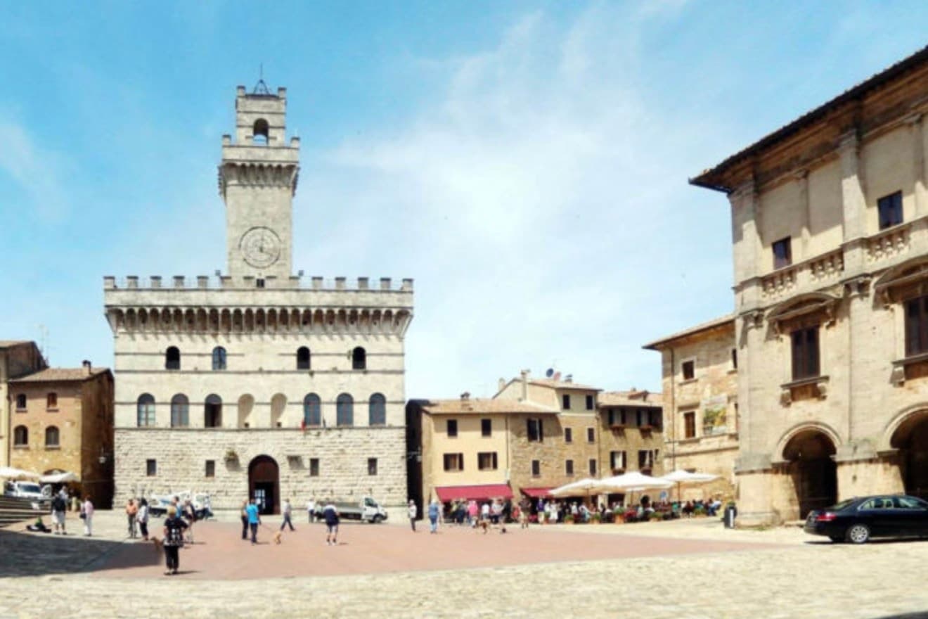
The ridge runs between the Val di Chiana and the Val d'Orcia, 70 kilometers southeast of Siena, and the town follows its spine uphill: streets climb from the gates toward the high point, where the main square sits ringed by the buildings that define the skyline from below. The origin predates the Renaissance fabric by centuries.
Etruscan tombs survive in the surrounding hills, though almost nothing of that period shows in the centro storico itself, which was rebuilt wholesale in the fifteenth and sixteenth centuries over whatever came before. The wine and the festival both use the climb as their setting rather than their subject: the cellars are cut into the rock beneath the palazzi, keeping a constant temperature for aging, and the barrel race each August sends two men from each of the eight contrade hauling an eighty-kilogram cask up the same gradient that every visitor covers on foot, only slower.
The steepness that shaped the defensive site nine centuries ago is still what a person feels first, in the legs, before the buildings register at all.
The re-enactment here is Bravio delle Botti, usually held in August.
What to see in Montepulciano
- Tempio di San Biagio. A 13-meter dome and travertine façade standing alone outside the walls, the ground falling away below it so the building reads as a single volume against the hillside.
- Piazza Grande. The high piazza at the top of the ridge, ringed by the Duomo, the Palazzo Comunale and the Palazzo Tarugi, all rebuilt in the fifteenth and sixteenth centuries.
- Palazzo Comunale. Town hall designed by Michelozzo in the fifteenth century, its tower offering a view over the Val di Chiana and Val d'Orcia.
How to get to Montepulciano
There is a railway station in the town, so you can arrive without a car and never need one while you are here. Perugia is roughly 57 minutes away by road.
Our tip
April through June and September into October are the working months on the ridge: vine work in the surrounding hills, mild days, evening light that lingers over the Val d'Orcia. July and August push into the low thirties and the climb to Piazza Grande slows even the residents. The Bravìo delle Botti runs the last Sunday of August and fills the town. Calici di Stelle falls in July.
More from Anywhere Italy
- The best towns with a food festival in the province of Siena
- The best towns on a walking route in the province of Siena
- The best small towns with a medieval festival in Toscana
- The best hidden towns with a medieval festival that are worth a night in Toscana
- The best hidden wine towns with a medieval festival in Toscana
 The best towns with a World Heritage site within two hours of Perugia