
The best towns with a World Heritage site within two hours of Perugia
Central Italy stacks its World Heritage listings close together, and Perugia sits near the middle of the pile. Drive west and the land opens into the clay ridges and cypress lines of the Val d'Orcia, where the towns are built of warm travertine and brick and the cellars hold Brunello and Vino Nobile. Drive south along the old Via Flaminia and you get olive groves on terraces, Lombard-era stonework, aqueducts and springs running cold under plane trees. Autumn is the season that rewards the driving: new oil in November, truffle markets, wood smoke, and light that flattens the hills into something close to a fresco background.
Most visitors treat this stretch of Italy as a triangle between Florence and Siena, with a day trip somewhere in the middle. Siena in particular absorbs the coaches, its Campo listed, walled and reached by every tour operator working the region, and in high summer the Piazza del Campo and the streets around the Duomo move at the pace of the crowd rather than the town. It is worth seeing, and it is worth understanding that the queues at the cathedral door are the price. The listed monuments there are magnificent and thoroughly shared.
The listings do not stop at the city walls. The same valley floors, the same Romanesque and Renaissance builders, the same road network carried on into smaller places, and several of them hold their own UNESCO inscriptions: a papal ideal city planned in miniature, a Lombard temple beside a spring, a ducal court on a Marche hillside. Fewer people go, and the towns are small enough that a morning covers the centre and a long lunch covers the rest. These are the ones within reach of Perugia.
Of the 128 communes we have mapped in a 120-minute drive of Perugia, 8 qualify as towns with a World Heritage site: each holds a site UNESCO has listed. The smallest, Radicofani, has 1,060 residents.
Elsewhere in the catalogue: The best towns with a medieval festival that hold a World Heritage site in Toscana and The best towns with a World Heritage site in the province of Siena.
Campello sul Clitunno
Why visit Campello sul Clitunno
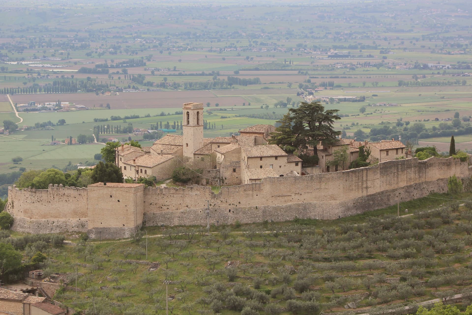
Campello sul Clitunno sits at 290 meters along the Clitunno river, a few kilometers north of Spoleto. The name comes from the Counts Campello, originally Champeaux of Reims, who founded the hilltop nucleus of Campello Alto in the mid-10th century under the Burgundian noble Rovero.
The Fonti del Clitunno, the springs that form the river, produce 1,300 to 1,500 liters of water per second; Pliny the Younger wrote about them, and Lord Byron and Giosuè Carducci returned to the place in poems centuries later, the latter with the ode Le fonti del Clitumno. A kilometer downstream from the springs, in the frazione of Pissignano, the Tempietto del Clitunno is a 4th- or 5th-century pagan sacellum reworked by the Lombards in the 7th and 8th centuries; the interior frescoes have parallels with Santa Maria Antiqua in Rome.
The Tempietto entered the UNESCO World Heritage List in June 2011 as part of the serial site The Lombards in Italy: Places of Power. The Castello di Pissignano above the temple covers the medieval layer.
What to see in Campello sul Clitunno
- Tempietto del Clitunno. Small temple-shaped chapel of the 4th-5th century reworked by the Lombards in the 7th-8th, with frescoes of the Saviour, Peter and Paul; UNESCO World Heritage.
- Fonti del Clitunno. Springs producing 1,300-1,500 liters per second, forming the source of the Clitunno; visited by Pliny, Byron and Carducci.
- Castello di Pissignano. Eleventh-twelfth century hilltop castle just above the Tempietto, founded by Benedictine monks who enclosed the settlement with walls.
How to get to Campello sul Clitunno
There is a railway station in the town, so you can arrive without a car and never need one while you are here. Terni is roughly 86 minutes away by road.
Our tip
April through June and September into October are the months for Campello sul Clitunno. The springs run cold and full, the willows along the lake at the source hold the morning light, and the trails between the Tempietto and Campello Alto are walkable in shade. July and August touch the mid-thirties in the Spoleto valley; the Fonti basin runs a few degrees cooler at the water's edge.
Urbino
Why visit Urbino
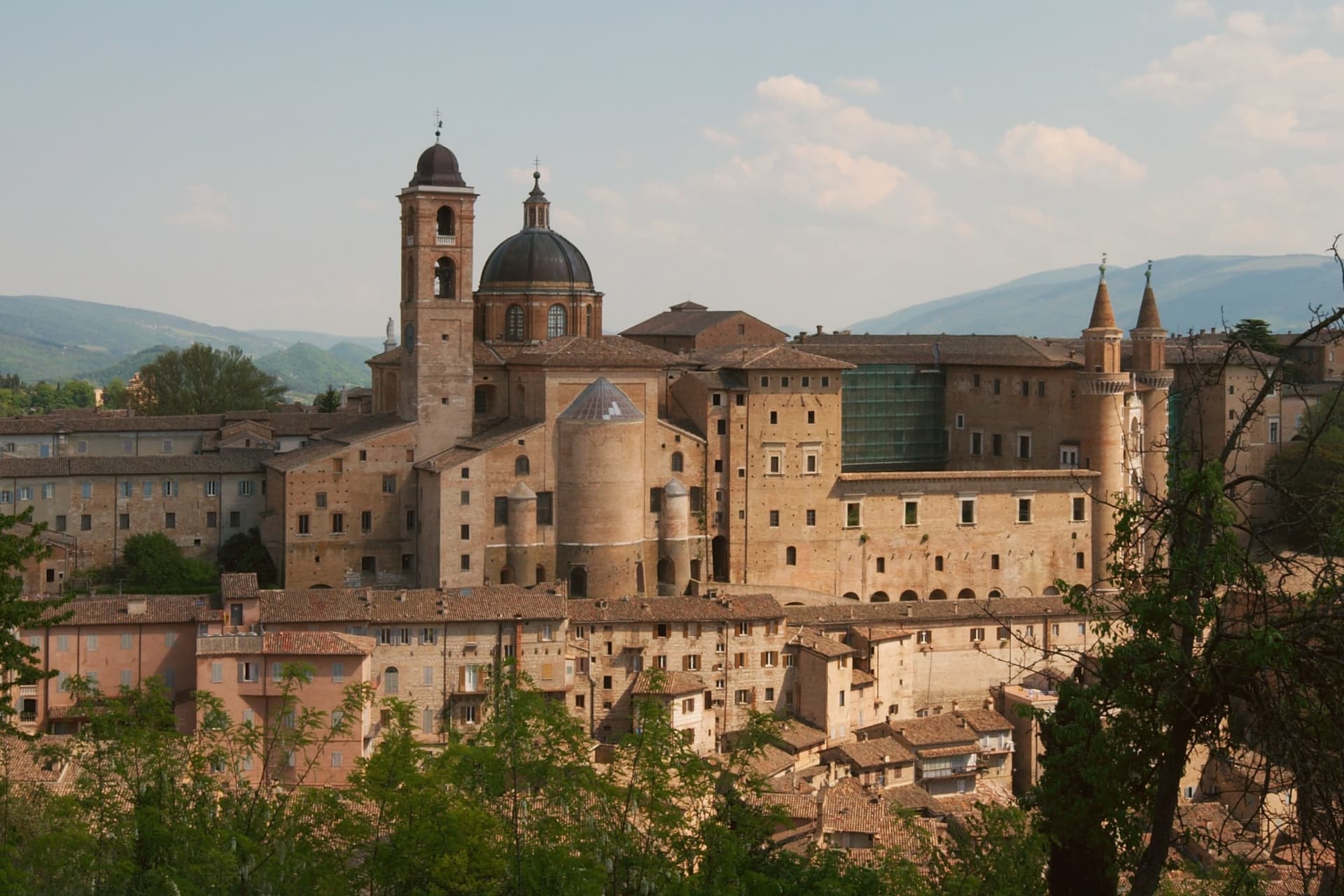
Urbino sits at 451 meters in the Apennine foothills, seventy kilometers north of Perugia, its historic core spread across twin hills with the fortress on the higher of the two and the palace complex below on the other. Federico II da Montefeltro ruled from 1444 to 1482, and under him the town became one of the central courts of the Italian Renaissance: he was condottiere, diplomat, patron and humanist at once, and the building campaign he set running through the 1450s to the 1470s, first under Maso di Bartolomeo, gave the city the asymmetric silhouette that still defines it from a distance.
The university, founded in 1506, keeps that Renaissance investment active in the present rather than fossilized: the centro storico holds roughly 14,000 residents and around 14,000 enrolled students, so the old town runs on a population it did not have in the fifteenth century. The two hills, the ducal seat and the fortress above it, read as the same civic project seen from two elevations: one built to project a court outward, the other to hold the higher ground behind it.
What the 1998 inscription recognizes is that this pairing, court and citadel, survives largely as Federico left it.
What to see in Urbino
- Palazzo Ducale. Federico da Montefeltro's Renaissance palace begun 1444, completed by Luciano Laurana with the twin torricini facade, now housing the Galleria Nazionale delle Marche.
- Galleria Nazionale delle Marche. One of the most important Renaissance painting collections in Italy, with Raffaello, Piero della Francesca's Flagellazione and Madonna di Senigallia, Paolo Uccello and Tiziano.
- Casa Natale di Raffaello. Fifteenth-century house on Via Raffaello where the painter was born in 1483 in the workshop of his father Giovanni Santi, now a museum of the early years.
How to get to Urbino
There is a railway station in the town, so you can arrive without a car and never need one while you are here. Rimini is roughly 65 minutes away by road.
Our tip
April through June and September into October are the best months for Urbino. The hills hold their green, the city's brick warms in afternoon light, and the long climb to the Fortezza Albornoz is bearable in mild weather. July and August touch the low thirties at 451 meters; the Palazzo Ducale stays cool inside, but the steep streets in afternoon sun are slow going.
Spoleto
Why visit Spoleto
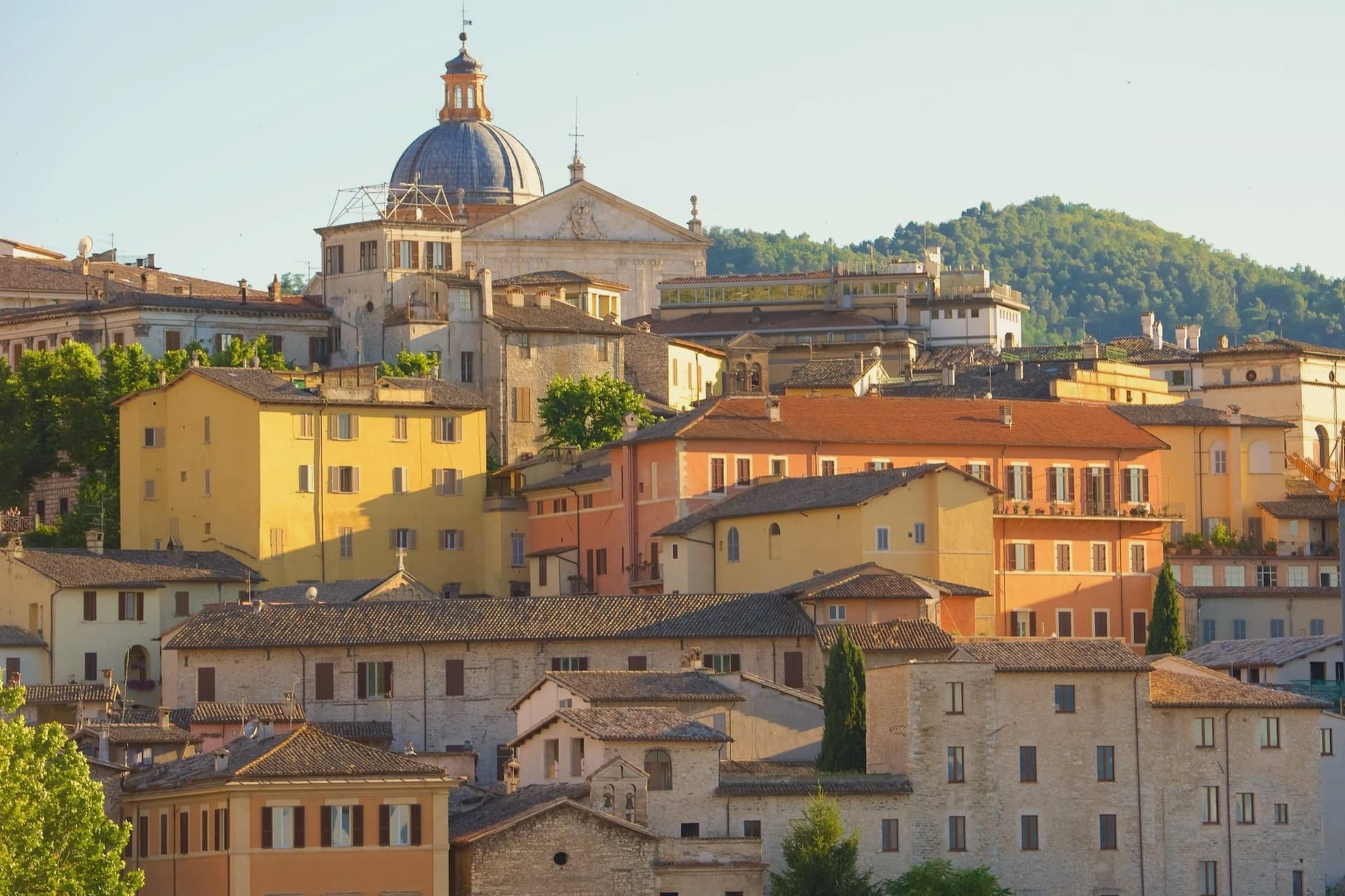
Spoleto sits at 396 meters at the southern edge of the Valle Umbra, the Apennines rising behind it toward Monteluco. The town was Roman Spoletium from 241 BC, then capital of one of the two great Lombard duchies of Italy from 576, controlling Umbria, Sabina, Picenum and the Pescara valley for more than five centuries.
The Rocca Albornoziana on the Colle Sant'Elia was built between 1363 and 1367 by Matteo Gattapone for Cardinal Albornoz, both a papal fortress and a residence, now the Museo Nazionale del Ducato. From the Rocca the Ponte delle Torri, 230 meters long and 80 meters high, crosses the Tessino gorge to Monteluco, an aqueduct of the 13th century built over Roman foundations.
The Duomo holds a Byzantine mosaic of 1207 across its façade and Filippo Lippi's last fresco cycle in the apse. Gian Carlo Menotti founded the Festival dei Due Mondi in 1958; the Roman theater, the Rocca courtyard and Piazza del Duomo still carry the program each year from late June into mid-July.
What to see in Spoleto
- Rocca Albornoziana. Papal fortress built 1363-1367 by Matteo Gattapone for Cardinal Albornoz, now the Museo Nazionale del Ducato di Spoleto.
- Ponte delle Torri. Aqueduct bridge 230 meters long and 80 meters high, crossing the Tessino gorge to Monteluco, 13th-14th century on Roman foundations.
- Duomo di Santa Maria Assunta. Twelfth-century Romanesque cathedral with Byzantine mosaic of 1207 on the façade, Renaissance portico, and Filippo Lippi frescoes in the apse.
How to get to Spoleto
There is a railway station in the town, so you can arrive without a car and never need one while you are here. Terni is roughly 41 minutes away by road.
Our tip
April through June and September into October are the months for Spoleto. The town opens its gardens, the Rocca courtyard fills with sun, and the long walks along the Giro dei Condotti above the Ponte delle Torri become bearable again. The Festival dei Due Mondi runs from late June into mid-July, when Spoleto doubles in population and the Roman theater carries opera into the small hours. Sagra dell'Anguilla e del Gambero di Fiume falls in August.
Radicofani
Why visit Radicofani
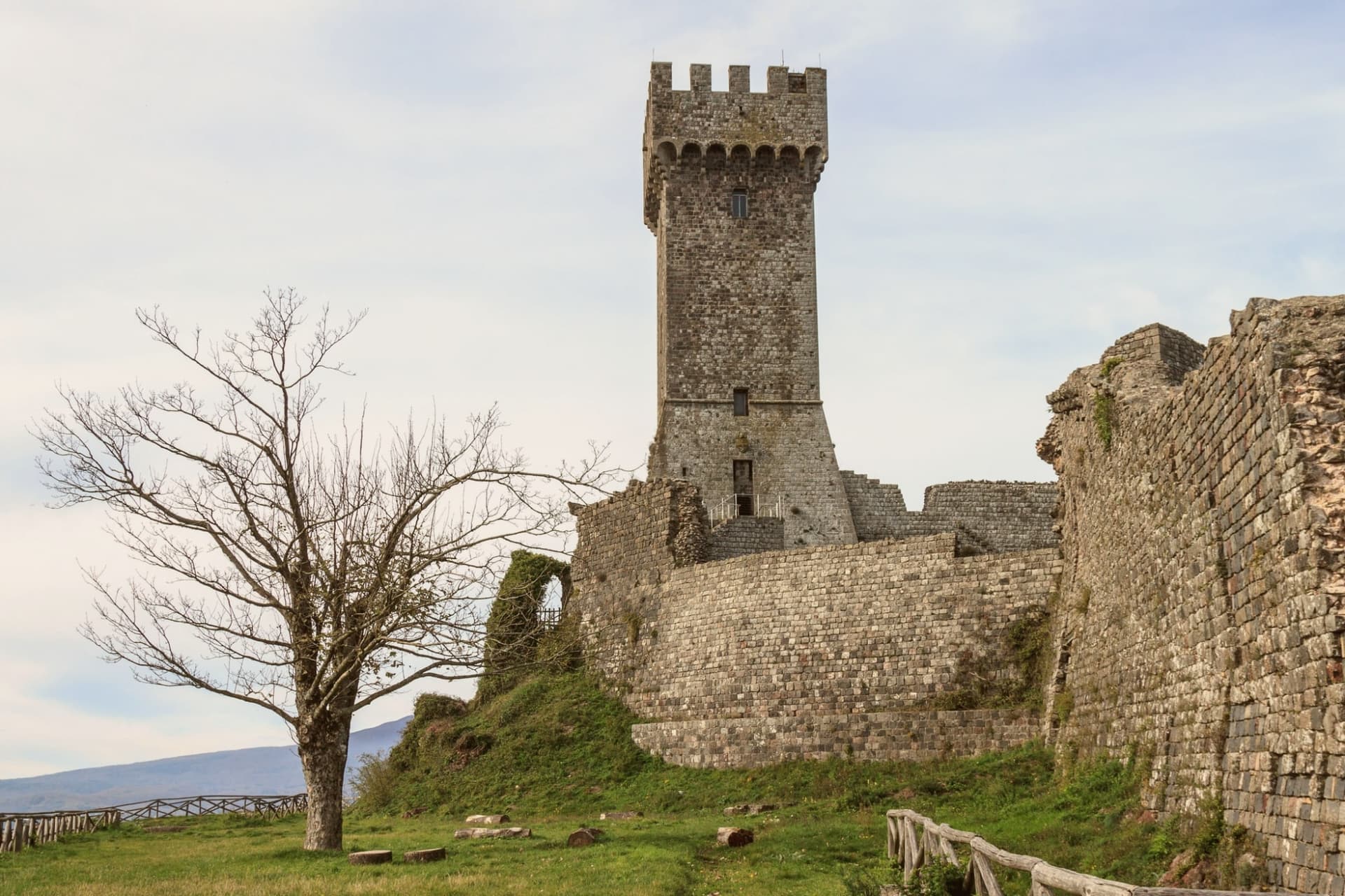
Radicofani sits where the rolling clay hills of the Val d'Orcia give way, abruptly, to a volcanic cone: the town rises straight off the plain rather than sitting among gentler slopes, which is why the rock is visible from Pienza, Montalcino, the Cassia road and points as far off as Lago Trasimeno, 60 km away, and why it reads as a landmark rather than a village from any distance. The medieval centro climbs in the same volcanic-basalt stone as the rock beneath it, narrowing as it rises, so that the streets themselves seem to funnel a visitor upward toward the fortress that caps the summit.
That fortress began under the Aldobrandeschi in the 12th century, was expanded by the outlaw and Ghibelline noble who made the rock his raiding base from 1297 to 1303, robbing pilgrims and churchmen on the road below and returning the richest captives to Pope Boniface VIII with gallows-humour notes attached, a story Dante folds into Purgatorio VI and Boccaccio into the Decameron's tenth day. The Sienese extended it again in the 14th century, the Medici in the 16th after Cosimo I bought the territory in 1556, and a powder-magazine explosion in 1735 took off the upper levels, leaving the restored lower fortress and its terrace standing today.
Below the village, at its foot rather than within its walls, sits the old stagecoach inn, a separate register of the town's history: not the fortress and its outlaw but the machinery of travel and hospitality that grew up beneath it to serve the pilgrim road running from Canterbury to Rome, hosting Montaigne, Dickens and Grand Tour travellers moving between Florence and Rome from 1500 to 1850. The town's church, the Romanesque Pieve di San Pietro, and its companion the Chiesa di Sant'Agata, with its Della Robbia altarpiece, belong to the centro itself rather than to the rock above it.
Surroundings widen the picture: Pienza, also UNESCO-listed, lies 30 km north, Montalcino 35 km northwest, and the extinct volcano immediately west offers a cooler, wooded counterpoint of chestnut and beech forest to the bare rock the town is built on, with thermal baths built around a pool 20 km north. The food follows the same Val d'Orcia line as its neighbors: pici with hare ragù, pecorino di Pienza, lardo di Colonnata and finocchiona, with Brunello di Montalcino and Vino Nobile di Montepulciano within easy reach.
The Festa Medievale in mid-July recreates the outlaw court that once ruled the summit, and the Festa del Fagiolo in early August celebrates the local cannellini bean. Like other Val d'Orcia hilltop villages, the population has fallen hard, from 2,800 in 1951 to 1,060 today.
The three marks the town carries together, UNESCO, Bandiera Arancione and the pilgrim route, are not separate honors so much as three ways of naming the same fact: a place built for defense and passage that has outlasted both purposes and now stands mostly for itself.
What to see in Radicofani
- Rocca di Radicofani. 12th-c Aldobrandeschi origin, expanded by the Sienese in the 14th century and by the Medici in the 16th, after Cosimo I bought the territory in 1556. A 1735 powder-magazine explosion destroyed the upper levels. The restored lower fortress and its panoramic terrace give the most expansive single view in southern Tuscany.
- Via Francigena + Posta Medicea. The inn stands at the foot of the village, on the pilgrim road from Canterbury to Rome, where it once put up travellers moving between Florence and Rome for three and a half centuries, among them Montaigne and Dickens.
- UNESCO Val d'Orcia centro. An intact medieval centro climbing in volcanic-basalt stone toward the fortress above it. The Pieve di San Pietro is Romanesque; the Chiesa di Sant'Agata holds a Della Robbia altarpiece.
How to get to Radicofani
Perugia is roughly 91 minutes away by road.
✷ We have written about Radicofani
“When the film industry needed a picture of heaven, of the fields a dead hero walks home to, they came and shot it here, and that is the truest thing anyone has ever said about the Val d'Orcia. It is not a place. It is the afterlife as imagined by people who lived in cities. It is how the country looks to men who never spent an hour in it, dreamed up by Florentine bankers five hundred years ago and maintained, beautifully, ever since.”
Read our piece on Radicofani →Val d'Orcia | The Postcard Is Constructed
Our tip
Radicofani is best May–September. The Festa Medievale mid-July (Ghino di Tacco pageant) + Festa del Fagiolo early August are the year's headline events. Summer is hot in the Val d'Orcia but the 814m altitude keeps Radicofani 5-7°C cooler than the lower valleys. Festa degli antichi mestieri a Radicofani falls in June.
Pienza
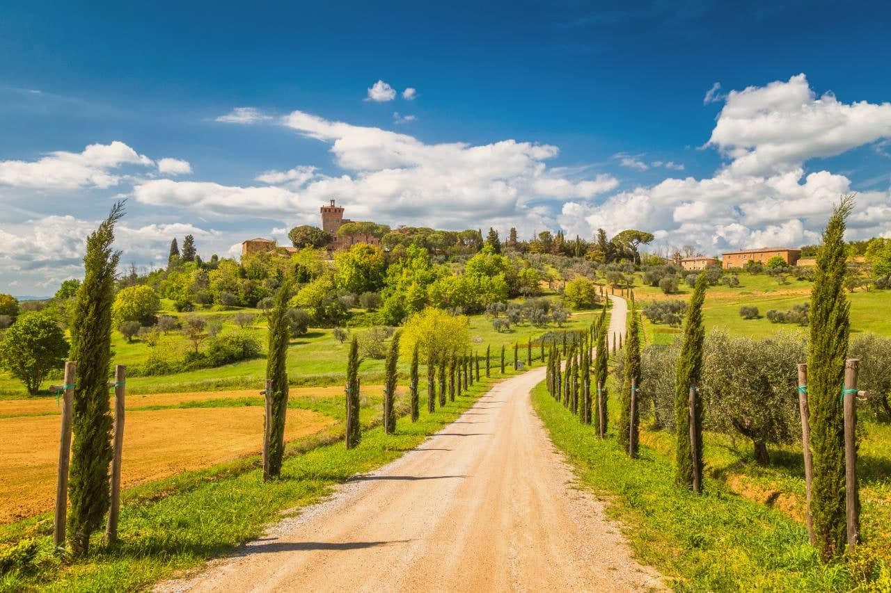
Why visit Pienza
Pienza sits at 491 meters on a long ridge in the Val d'Orcia, an hour and a half south of Siena. The village was called Corsignano until 1462.
Enea Silvio Piccolomini was born here in 1405 and became Pope Pius II in 1458; the following year he ordered the Florentine architect Bernardo Rossellino to rebuild his birthplace as a Renaissance ideal city. The work took three years.
The square at the center, the cathedral on the cliff side, the palace built for the pope's family, the cardinal's palace facing it, and the town hall opposite the cathedral were all designed and built as a single composition rather than assembled piece by piece over time. Pius consecrated the cathedral on 29 August 1462, two years before his death, and the whole arrangement has survived almost unchanged since.
What stands in Pienza today is less a collection of monuments than the physical record of one commission carried out in one stretch of years.
What to see in Pienza
- Piazza Pio II. Trapezoidal Renaissance square laid out by Bernardo Rossellino, with the Duomo, Palazzo Piccolomini, Palazzo Borgia and Palazzo Comunale facing each other.
- Duomo di Pienza. Latin-cross cathedral with three apsidal chapels, built on the cliff edge, its Renaissance façade also by Rossellino.
- Palazzo Piccolomini. Renaissance palace for the pope's family, begun 1459, with an internal courtyard and a hanging garden overlooking the Val d'Orcia.
How to get to Pienza
Perugia is roughly 98 minutes away by road.
Our tip
April through June and September into October are the months when the Val d'Orcia sits at its best, green or gold depending on the wheat cycle, and the Piazza Pio II is open for photographs without the day-tripper buses. July and August push past thirty-three degrees and the Corso Rossellino fills with tour groups between ten and four. The Fiera del Cacio, the cheese festival, takes the first Sunday in September, when the streets fill with stalls of pecorino producers from the Pienza ridge. Festa del Cacio di Pienza falls in September.
San Quirico d'Orcia
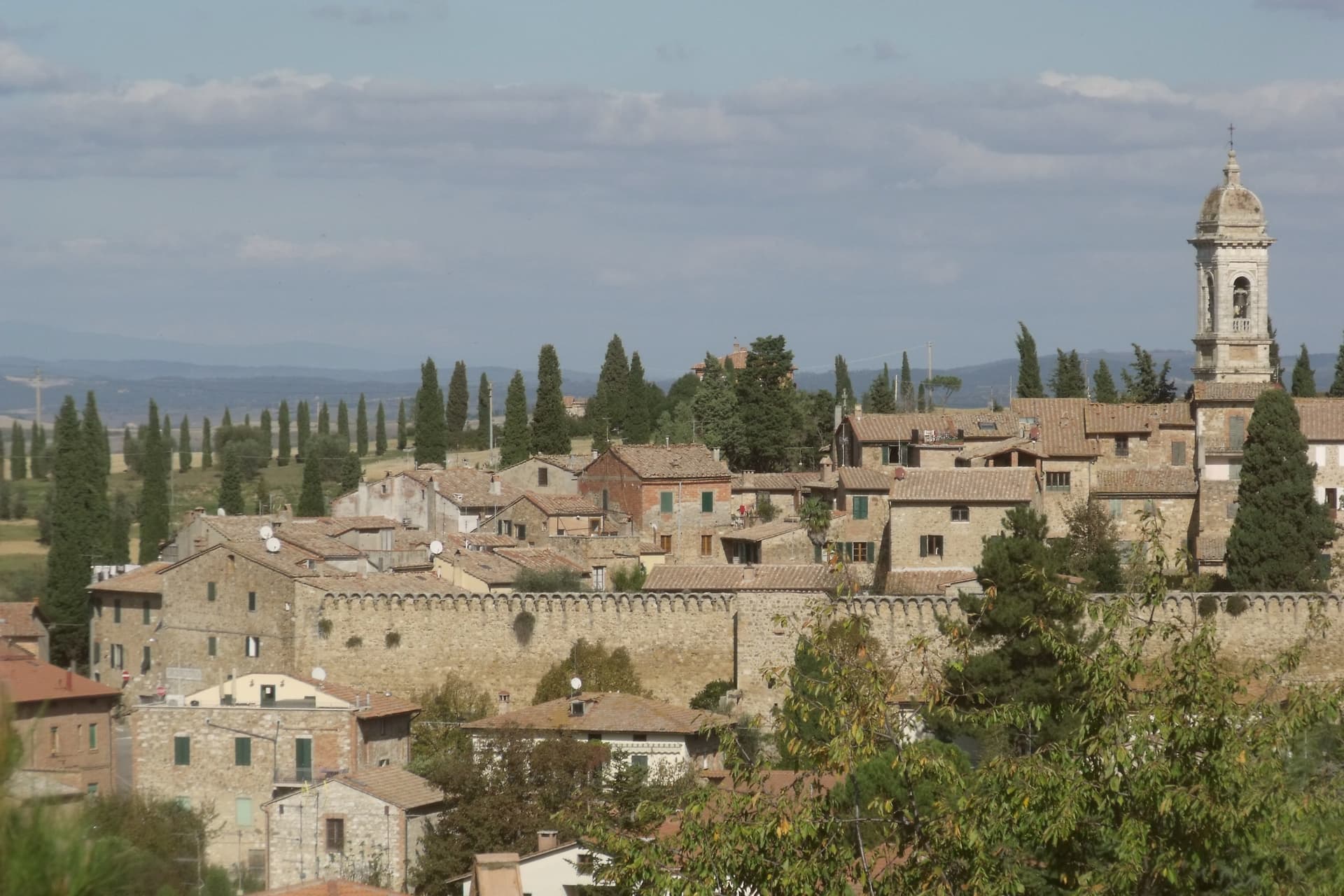
Why visit San Quirico d'Orcia
San Quirico d'Orcia sits at 409 meters on a low rise in the Val d'Orcia, the rolling clay-and-tufa landscape inscribed by UNESCO in 2004 as a cultural landscape shaped by fourteenth and fifteenth-century Sienese governance. The town was a stage on Sigeric the Serious's tenth-century Via Francigena from Canterbury to Rome and has remained a working stop on the route ever since.
The Collegiata dei Santi Quirico e Giulitta was built at the end of the twelfth century over an eighth-century baptistery; the lateral portal added in 1288 is attributed to Giovanni Pisano, then working on the Siena cathedral. The Horti Leonini, the geometric boxwood garden laid out by Diomede Leoni around 1580 inside the town walls, hosts the Forme nel Verde sculpture exhibition every summer since 1971.
Bagno Vignoni, the frazione five kilometers down the road, has a thermal pool at the center of its piazza, used since Etruscan times. Few comuni this small carry UNESCO, thermal and Francigena signals at once.
What to see in San Quirico d'Orcia
- Collegiata dei Santi Quirico e Giulitta. Romanesque parish church built late twelfth century over an eighth-century baptistery, with the 1288 lateral portal attributed to Giovanni Pisano.
- Horti Leonini. Italianate boxwood garden laid out by Diomede Leoni around 1580 inside the town walls, hosting the Forme nel Verde sculpture exhibition since 1971.
- Bagno Vignoni. Frazione five kilometers south, with a sixteenth-century thermal pool at the center of its piazza, fed by springs used since Etruscan times.
How to get to San Quirico d'Orcia
Perugia is roughly 96 minutes away by road.
Our tip
April through June and September into October are the gold months in the Val d'Orcia: green wheat in spring, ochre stubble by autumn, low light that defines the cypress ridges. The Festa del Barbarossa runs the third Sunday of June with archery, jousts and crossbow contests between the town quarters. July and August are hot and busy; the centro storico fills with day-trippers from Pienza and Montalcino. Festa del Barbarossa a San Quirico d'Orcia falls in June.
Montalcino
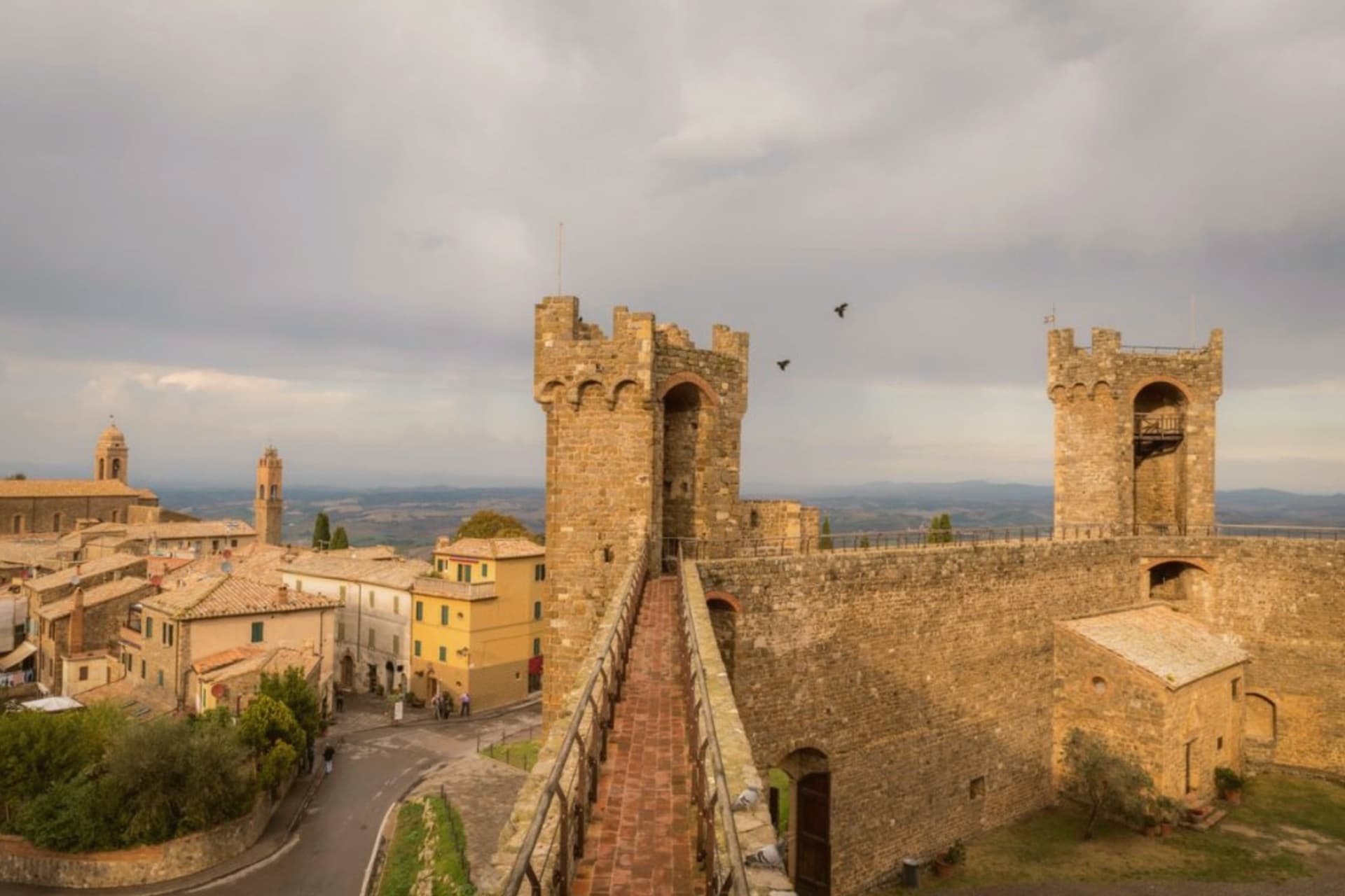
Why visit Montalcino
Montalcino sits at 564 meters on a hill south of Siena, the centro storico ringed by walls and crowned by a pentagonal fortress built in 1361. When Florence took Siena in 1555, the Sienese exiles regrouped here and held out for almost four years; the Rocca itself never fell.
That date matters less to most visitors than 1980, when Brunello di Montalcino was named one of the first four Italian wines to receive DOCG status. The vineyards run from the town at 600 meters down to plots at 200, on stony galestro soils that ripen Sangiovese Grosso into a wine that ages for decades.
The Abbey of Sant'Antimo, ten kilometers south, is a Romanesque church first documented in 814 and tied by local legend to a vow by Charlemagne. The town also produces miele, olio, and the white truffles of the surrounding woods.
It carries seven institutional signals at once, more than any other commune in this batch.
What to see in Montalcino
- Rocca di Montalcino. Pentagonal fortress built in 1361 by Sienese architects Mino Foresi and Domenico di Feo, refuge of the Sienese Republic after 1555.
- Abbazia di Sant'Antimo. Romanesque abbey ten kilometers south, first documented in 814, set among olive groves below the town with Gregorian chant still sung.
- Palazzo dei Priori. Thirteenth-century town hall on Piazza del Popolo, slender tower attached, civic seat of the medieval commune.
How to get to Montalcino
There is a railway station in the town, so you can arrive without a car and never need one while you are here. Perugia is roughly 105 minutes away by road.
Our tip
April through June and September into October are the months locals prefer. The hills are green or gold depending on the half, and the vineyards run their full work cycle. The Sagra del Tordo, a medieval archery contest between the four quarters of the town, takes place the last Sunday of October. Sagra del Cinghiale di Montalcino falls in the season.
Assisi
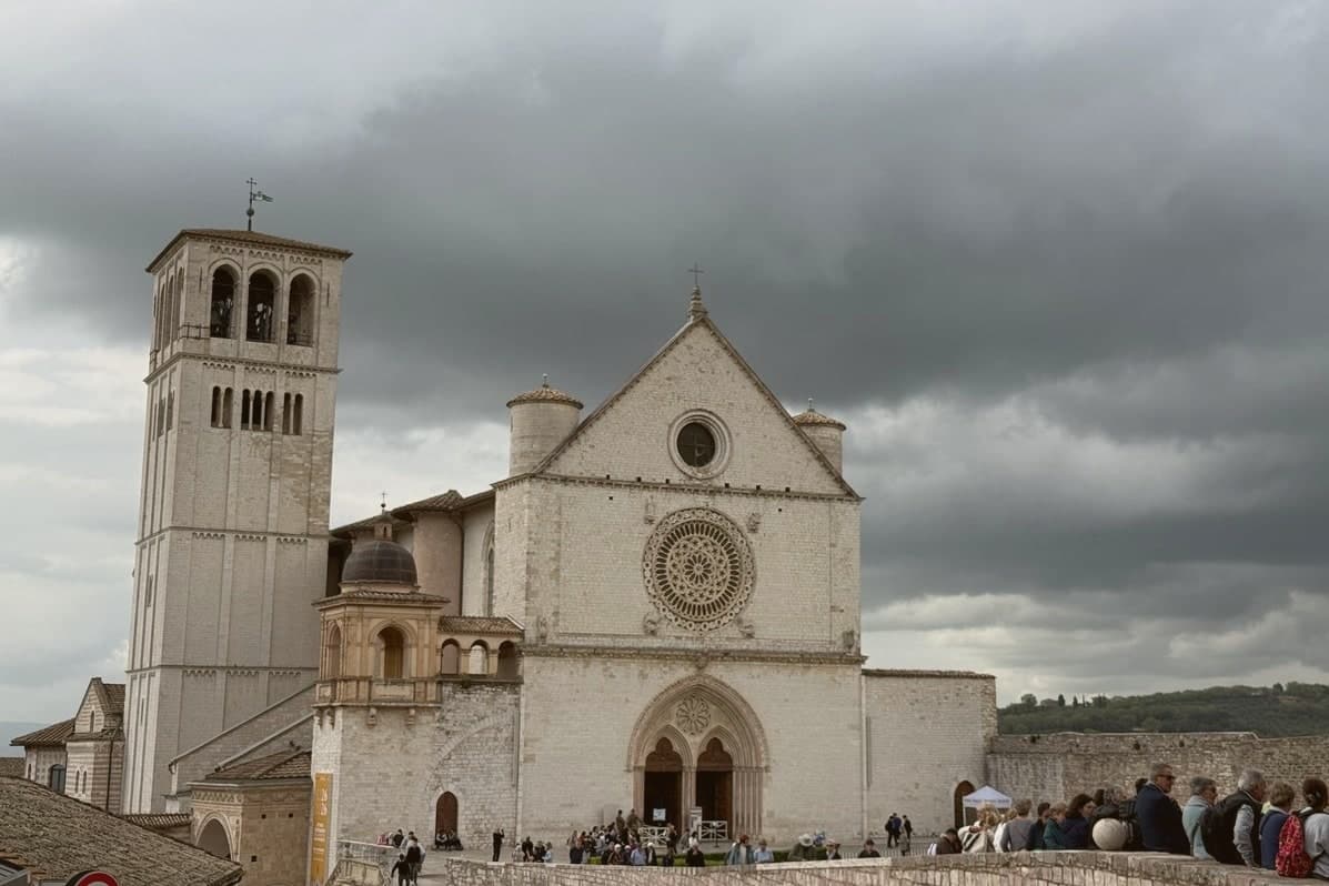
Why visit Assisi
Assisi sits on a terraced spur twenty kilometers east of Perugia, the town built into the western flank of Monte Subasio where it drops toward the plain below. The Umbri settled the site before the Romans came, and the municipium of Asisium grew up around what is now Piazza del Comune, the square that still forms the civic center of the medieval town.
The centro storico runs between two poles: the basilica holding Francis's tomb at one end and the church holding Clare's relics at the other, with the Roman square and its temple facade sitting between them as the oldest layer beneath the medieval one. Below the town, on the plain, stands the basilica built around the chapel where Francis founded his order and died.
Further up the mountain, past the town walls, the hermitage occupies a beech wood where Francis and his companions withdrew from all of it. The layout traces the life it commemorates: birth and burial at the center, founding and death on the plain below, retreat in the wood above.
The town has arranged itself, over centuries, around the geography of one man's biography.
What to see in Assisi
- Basilica di San Francesco. Two superimposed churches over the saint's tomb, frescoed by Cimabue, Giotto, Simone Martini and Pietro Lorenzetti.
- Basilica di Santa Chiara. Church at the eastern end of the centro storico, holding the relics of Saint Clare and the San Damiano Crucifix.
- Tempio di Minerva. Roman temple on Piazza del Comune, six Corinthian columns intact, one of the best-preserved temple façades in the country, converted to a church in 1539.
How to get to Assisi
There is a railway station in the town, so you can arrive without a car and never need one while you are here. Perugia is roughly 35 minutes away by road.
✷ We have written about Assisi
“The basilica is grand, and it is grand from a distance, which is the harder trick. You see it from the valley road as a long horizontal weight along the end of the ridge, held up on arches, wider than the town it belongs to. In front of it there is a huge sloping field, stone, which functions as a piazza sort-of.”
Read our piece on Assisi →Assisi | The Church He Would Have Chosen
Our tip
April through June and September into October are the months Assisi was built for. The hills around Monte Subasio turn green in spring and gold in autumn, and the pilgrim traffic spreads thinly enough that the centro storico keeps its silence in the early morning. October 3 and 4 are the Festa di San Francesco, when delegations from every Italian region process to the basilica. Festa di Sant'Anna falls in July.
More from Anywhere Italy
 The best towns with a medieval festival that hold a World Heritage site in Toscana
- The best towns with a World Heritage site in the province of Siena
 The best hidden towns with a medieval festival in the province of Siena
 The 10 best small hill towns in the province of Siena
 The 9 best hidden hill towns on a walking route in Toscana
- The best small towns with a medieval festival in Toscana