
Without a car
Umbria by train
23 towns
Towns in this region where we confirmed an active station. Check the timetable before you go: a station on the map is not the same as a useful service.
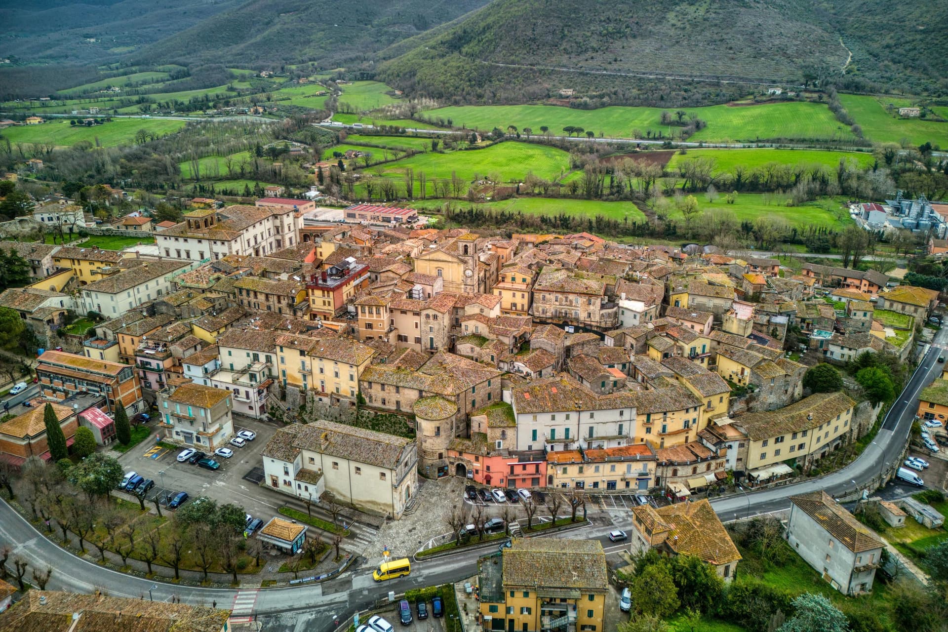
Acquasparta
Province: Terni · 350 m
A hill town at 350 meters above the Naia valley, where a Renaissance duchy briefly became the seat of Europe's first scientific academy.
- ✷ We've been
Assisi
Province: Perugia · 424 m
A pink limestone town at 424 meters on the western flank of a mountain above the plain, the birthplace of Francis and a UNESCO site since 2000.
Campello sul Clitunno
Province: Perugia · 290 m
Springs of the Clitunno and the Lombard Tempietto on the valley floor at 290 meters, the temple inscribed by UNESCO in 2011.
- ✷ We've been
Castiglione del Lago
Province: Perugia · 304 m
Trasimeno's western promontory, once the lake's fourth island, fortified in 1247 and later frescoed for a marquis of Corgna.
Città della Pieve
Province: Perugia · 508 m
A red-brick hill town at 508 meters above the Valdichiana, the birthplace of Perugino and the home of Italy's narrowest alley.
Città di Castello
Province: Perugia · 288 m
A walled town of 38,000 in the upper Tiber valley where Raphael painted his first independent commissions and the white truffle season is the year's headline food event.
Deruta
Province: Perugia · 218 m
A hill town at 218 meters on the left bank of the Tiber, the maiolica capital of central Italy since the late thirteenth century.
Foligno
Province: Perugia · 235 m
A valley town at 235 meters on the Topino, where Dante's Divine Comedy was first printed in 1472.
Fossato di Vico
Province: Perugia · 581 m
A medieval village on Mount Mutali at 581 meters, where the Via Flaminia's Roman waystation Hellvillum became a tenth-century castle still threaded by covered alleyways.
- ✷ We've been
Magione
Province: Perugia · 299 m
A hill town east of Trasimeno built around a medieval Order's fortified base.
Massa Martana
Province: Perugia · 351 m
Umbria's Via Flaminia BPB, a 3,613-resident borgo on the original Roman consular road between Rome and Rimini, with the intact 9th-c Abbazia dei Santi Fidenzio e Terenzio above town, a network of Roman-era catacombe Cristiane (Catacombe di Villa San Faustino, the only ones in Umbria), and the Borghi più belli inscription restored after the 1997 Marche-Umbria earthquake.
Narni
Province: Terni · 240 m
Narni is a hilltop town on a travertine outcrop above the Nera valley whose Latin name, Narnia, gave C.S. Lewis a word for a fictional kingdom he never set foot in.
Nocera Umbra
Province: Perugia · 520 m
A hill town at 520 meters on the Apennine slope, leveled by the 1997 earthquake and rebuilt, with mineral springs flowing since the sixteenth century.
Orvieto
Province: Terni · 325 m
Etruscan Velzna on a 325-meter tufa butte, later a medieval refuge of popes.
- ✷ We've been
Passignano sul Trasimeno
Province: Perugia · 289 m
A near-peninsula on the northern shore of Lake Trasimeno, on the road Hannibal closed when he ambushed the Romans in 217 BC.
San Gemini
Province: Terni · 337 m
A medieval borgo at 337 meters above ancient Roman paving, four kilometers below the ruins of Carsulae.
Spello
Province: Perugia · 280 m
Augustan Hispellum sits at 280 meters on Monte Subasio, its Roman gates still standing over streets that Pinturicchio once painted a chapel for.
Spoleto
Province: Perugia · 396 m
Lombard ducal capital at 396 meters under the Rocca Albornoziana, where a 230-meter aqueduct bridge crosses to Monteluco and Menotti founded the Festival in 1958.
Stroncone
Province: Terni · 451 m
A walled medieval borgo at 451 meters eight kilometers south of Terni, with a Franciscan convent traditionally founded by Francis himself in 1213.
Terni
Province: Terni · 130 m
Umbria's second city, rebuilt around its steelworks, home of Saint Valentine and seven kilometers from the Cascata delle Marmore.
Todi
Province: Perugia · 398 m
A walled hill town at 398 meters on the Tiber, with Etruscan, Roman, and medieval rings stacked one above the other.
Trevi
Province: Perugia · 412 m
A walled town at 412 meters above the Spoleto valley, ringed by 200,000 olive trees that make it the Umbrian capital of olive oil.
Vallo di Nera
Province: Perugia · 467 m
Castle village of 345 people at 467 meters in the upper Valnerina, granted by Spoleto in 1217 and barely changed since.
The slow-trip planner
Plan a slow trip across the towns travelers skip.
Answer five questions. We will shape a geographically coherent slow trip from the 1,000 Italian towns most travelers skip. Yours to save and share.
From elsewhere in Italy
Five more towns to discover
Visso
Province: Macerata
The northern Sibillini gate at 607 meters where the Nera meets the Ussita, holding one of two surviving manuscripts of Leopardi's L'Infinito.
Goriano Sicoli
Province: L'Aquila
At 720 meters in the Subequana valley, a medieval village drawn by M.C. Escher in 1929 keeps a May ritual folklorists trace to Demeter.
Ugento
Province: Lecce
A Messapian-Roman town five kilometers from the Ionian, where a Baroque castle sits on the walls of the ancient city of Ozan.
Fontanellato
Province: Parma
A Parma-plain town built around the Rocca Sanvitale, the moated fortress at its center.
Pescina
Province: L'Aquila
A Marsica town at 735 meters, on the rim of the drained Fucino basin, that lost five thousand of six thousand people in a single morning in 1915.