
Umbria · Perugia
Passignano sul Trasimeno
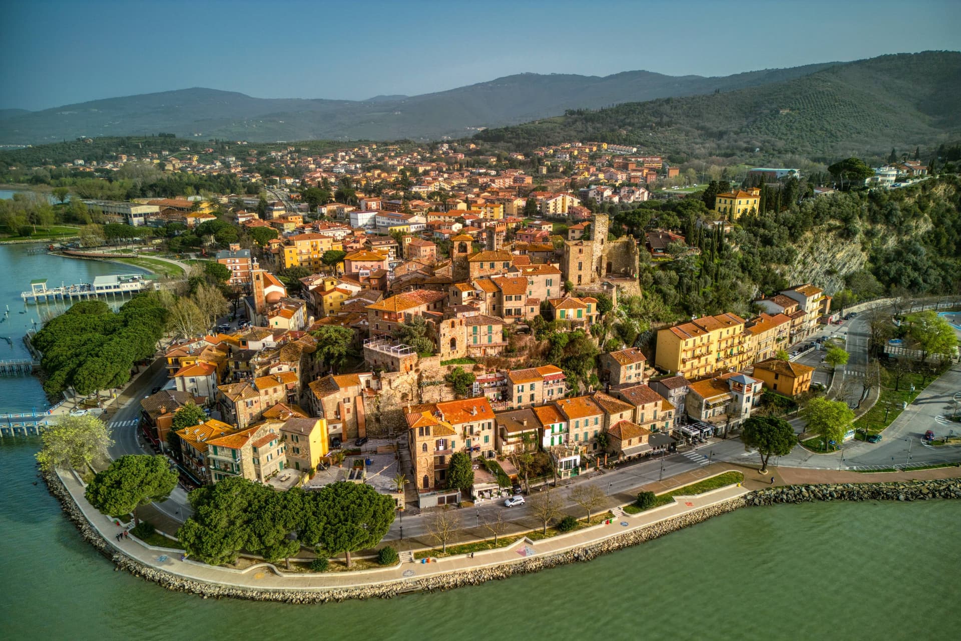
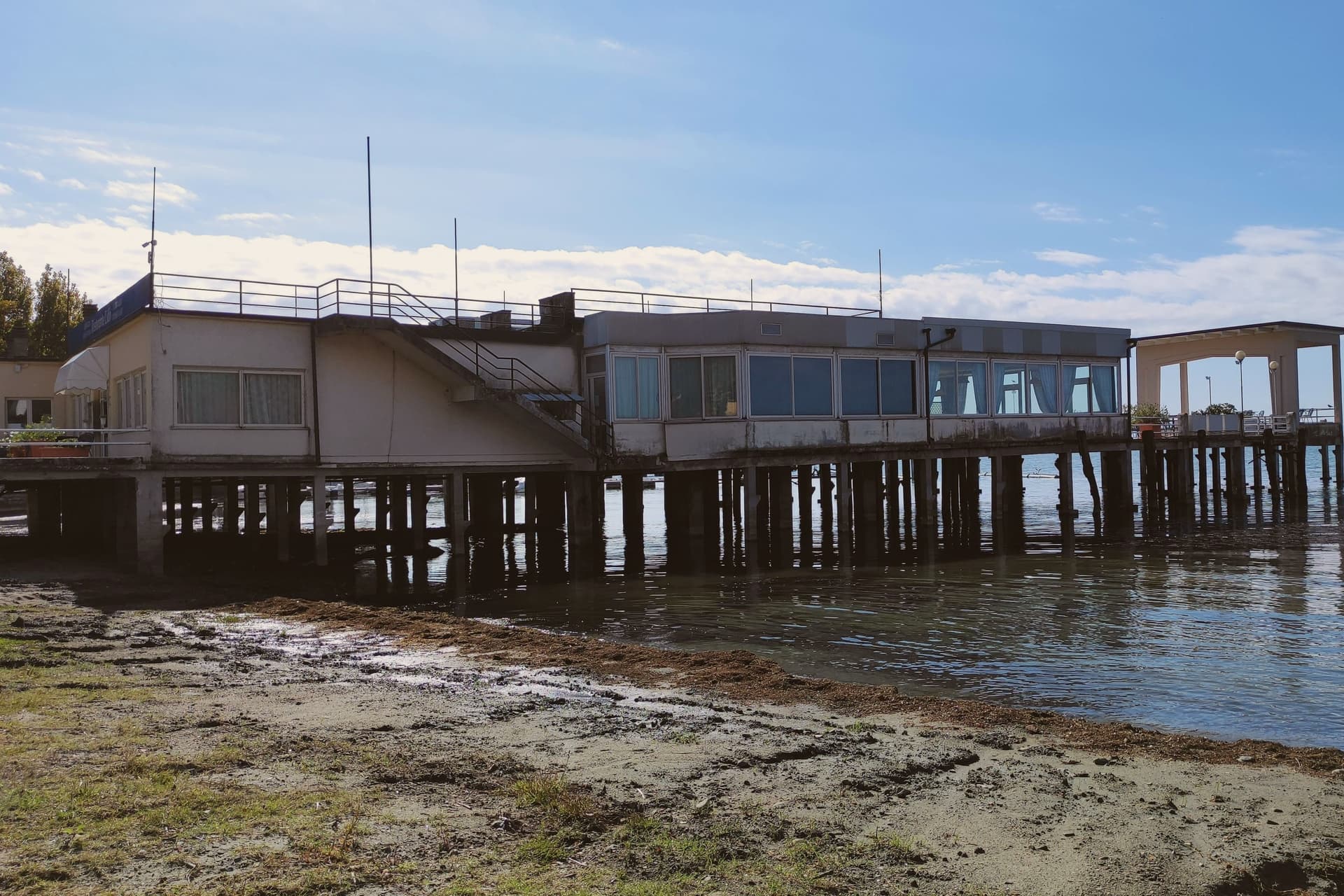
A near-peninsula on the northern shore of Lake Trasimeno, on the road Hannibal closed when he ambushed the Romans in 217 BC.
By Peter Benei
Written about. No. 61.
The letter
Passignano sul Trasimeno got its letter. One town at a time, free. The photo, the food, the festa.
Visiting
- Best time
- Apr–Oct
- By car
- 25 min from Perugia
- By train
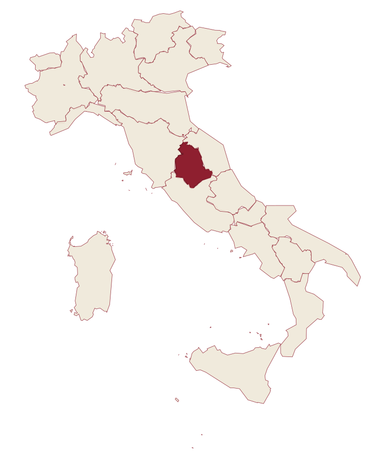
- Station in the comune
- Population
- 5,705
- J9°
- F12°
- M13°
- A17°
- M22°
- J28°
- J32°
- A31°
- S25°
- O20°
- N14°
- D10°
- Best
- Hot or crowded
- Quiet
- Mostly closed
Daytime air temperature, averages for 2020–2024. Weather data by Open-Meteo.com.
Why come
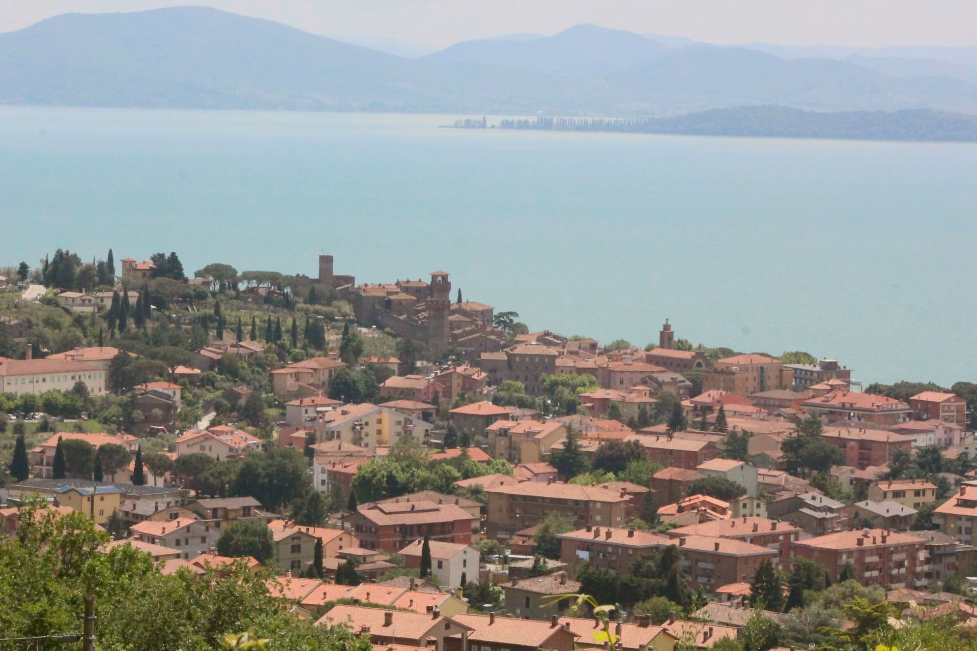
Passignano sul Trasimeno sits on a low promontory on the northern shore of Lake Trasimeno, twenty kilometers northwest of Perugia, separated from the lake only by the road that links Perugia to Tuscany. The Umbri held the ground first, then the Etruscans pushed them east of the Tiber; the Romans turned the spur into a watchtower controlling the pass between northern and central Italy. In 217 BC Hannibal trapped Gaius Flaminius's army of 25,000 in the narrow road between Tuoro and Passignano, killing about 15,000 Romans in the morning fog of June 21, one of the worst defeats in Roman history.
The Rocca, built around 850 by the marquises of Tuscany and conquered by Perugia in 1187, holds a quadrangular plan around a 32-meter keep that survived a 1778 partial demolition. The Festa della Padella, held in late August, fries lake fish for the village in a four-and-a-half-meter pan on the shore. The Borgo dei Borghi finalist designation arrived in the 2010s.
How to get there
From Ancona (AOI), about 2 h by car.
Bologna (BLQ) is about 2 h 33 min away.
By car from the center of Perugia 25 min, Siena 1 h 13 min or Florence 1 h 34 min.
There is a railway station in the comune, so you can arrive without a car.
Coming by train into Perugia? Passignano sul Trasimeno is about 22 min away by road.
Every town within reach of Ancona airport.
First time driving in Italy? Read our complete manual.
What to see
Rocca di Passignano
Quadrangular fortress built around 850 by the marquises of Tuscany with a 32-meter central keep, partly demolished in 1778.
Chiesa di San Bernardino
Sixteenth-century church near the Rocca with a Renaissance interior and views down to the lake from its portico.
Centro di Documentazione Annibale e Battaglia del Trasimeno
Small documentation center on the Battle of Lake Trasimene of 217 BC and Hannibal's ambush of Gaius Flaminius.
Lungolago
Lakefront promenade running east from the harbor, with ferry connections to Isola Maggiore and the southern shore villages.
Centro storico
Walled medieval upper town climbing from the harbor to the Rocca, with narrow stepped streets and views over the lake.
From the guides
Where to eat
Not our picks, but places the guides put their name to: a Michelin star, a Gambero Rosso fork, a Slow Food snail, a Michelin Key for the hotels. Worth a table, a counter, or a night when you pass through.
Da LucianoRistorante
Da Luciano has a Gambero Rosso listing and a spot in the Michelin Guide.
Il MoloRistorante
Il Molo carries two Gambero Rosso forks (81/100), plus a spot in the Michelin Guide.
Before you sit down: how to order at a restaurant, how to spot a tourist trap, what aperitivo is and how the Italian bar works.
Living here
Could you live here?
Passignano sul Trasimeno meets both of our rules for a small town.
- 5,705 people, inside our sweet spot of 5,000 to 20,000: a real town, still one community.
- Perugia, a city of 162,050, is 25 min by car. Closer than our 30 to 60 minutes: handy for everything, so check the town still keeps a life of its own.
- A station of its own. Trains are the overlooked way to get around Italy: no parking, straight into the center.
The rules come from our series Where to Move in Italy, written from the places we have lived: Part 1, The End of the Road · Part 2, The Small Town · Part 3, The City · Part 4, The Postcard · Part 5, The Other Half. The towns we would pick are in Part 6, The Best Towns.
- Population 5,705, up -0% since 2015
- Nearest city Perugia, 25 min drive
- Train station in the comune
- Nearest national health service hospital Castiglione del Lago, 13 km as the crow flies · how healthcare works in Italy
- Homes in the center: €670 to €1,150 per m² to buy, €2.30 to €3.80 per m² a month to rent
Weighing a move here? See the moving year.
All the numbers Common questions, designations, lists and sources.
More about living here
- Commuter belt
- Pharmacy in town
- High school within a 30-minute drive
- Full fibre reaches 92% of homes
- Primary school in the comune
- Earthquake zone 2, medium hazard
- Perugia airport (PEG), 34 min drive, the nearest with scheduled flights
- Regional capital Perugia, 25 min drive
If you are moving here
Who lives here
9% of residents are foreign citizens, most often from Romania, Albania and Morocco, against 9% across Italy. 86 of them come from English-speaking countries or western and northern Europe, mostly the United Kingdom, Germany and the Netherlands. There are 258 people over 65 for every 100 children under 15, against 216 across Italy. 34% of homes have no resident, holiday homes and empty ones counted together, against 27% across Italy. Perugia province ranks 37th of 107 in Il Sole 24 Ore's quality of life ranking for 2025.
Health and schools
The nearest emergency room is in Castiglione del Lago, 13 km as the crow flies. The nearest major one is in Perugia, 22 km away. The nearest IB school is International School of Siena, 70 km as the crow flies. The nearest school listed as international is Assisi International School, 40 km away.
Information, not medical advice. Confirm with a professional.
Working from here
Poste Italiane has finished a coworking room in the comune, on its register of 30 September 2026. Check that it is open on Poste's booking site before you count on it.
Taxes
A home that is not your main one pays 1.06% a year in property tax, charged on the cadastral value rather than the price. A main home pays none unless it is in a luxury category. The town adds 0.8% to your income tax, with nothing due on income under €12,000. 7% pensioner tax: this town is not in a qualifying area.
Information, not tax advice. Confirm with a professional.
What it costs
The average household in Umbria spends about €2,310 a month, €550 of it on food, against about €2,170 across Italy. A family of three pays about €677 a year for water, on the Umbria average. In Perugia, the provincial capital, in September 2026, an espresso cost €1.23, a meal in a pizzeria €12.04 and a man's haircut €20.47.
Climate and risk
It is in climate zone D, on a scale from A, the warmest, to F, the coldest, and heating may run from November 1 to April 15, up to 12 hours a day, unless the mayor changes it. The national maps show no residents in a high or medium flood zone. Under 1% live in a zone rated high or very high for landslides.
These shares cover the whole comune, not any one street. Check an address on IdroGEO.
Moving from abroad? Which visa you need. Sources: ISTAT, the Ministry of Health, ISPRA, the Finance Ministry, the Ministry of Enterprise, Poste Italiane, the comuni, the IB, International Schools Database, Il Sole 24 Ore, Cittadinanzattiva.
Known for
BATTLE OF TRASIMENO
Hannibal's June 21, 217 BC ambush of 25,000 Romans on the road between Tuoro and Passignano, one of the worst defeats in Roman history.
THE ROCCA
Ninth-century fortress with a 32-meter quadrangular keep, conquered by Perugia in 1187 and partly demolished in 1778.
FESTA DELLA PADELLA
Late August fish-fry festival on the lakeshore using a four-and-a-half-meter pan, fourteen meters around, serving the entire village.
Common questions
- What is Passignano sul Trasimeno known for?
- Passignano sul Trasimeno is a near-peninsula on the northern shore of Lake Trasimeno, on the road Hannibal closed when he ambushed the Romans in 217 BC.
- Where is Passignano sul Trasimeno?
- Passignano sul Trasimeno is a comune in the province of Perugia, in Umbria, at 289 meters above sea level.
- What is the nearest airport to Passignano sul Trasimeno?
- The nearest airport with scheduled flights is Perugia (PEG), about 34 min by car.
- Can you get to Passignano sul Trasimeno without a car?
- Yes. There is a railway station in the comune, so you can arrive by train.
- How long is the drive from Perugia to Passignano sul Trasimeno?
- About 25 min by car.
- When is the best time to visit Passignano sul Trasimeno?
- Best in Apr–Oct. July is the warmest month, averaging 32 degrees, and May the wettest, with about 12 rain days.
- Which other towns are like Passignano sul Trasimeno?
- Baveno, Stresa and Laveno-Mombello.
- How many people live in Passignano sul Trasimeno?
- 5,705 residents, by ISTAT's count on 1 January 2025.
- Is Passignano sul Trasimeno a good place to live?
- By the rules in our Where to Move in Italy series, Passignano sul Trasimeno is a small town that meets both of our rules. The nearest city, Perugia, is 25 min away by car. The nearest national health service hospital is in Castiglione del Lago, 13 km as the crow flies. Full fibre reaches 92% of homes.
Tags & data designations · numbers · sources
Landscape
The numbers
- Elevation: 289 m
- Population: 5,705
- Surface area: 81.33 km²
These figures were compiled from public directories: ISTAT, OpenStreetMap and Wikidata, and from the official listings of the guides named on this page. Town details change; verify with official sources before you travel.
The ranked lists
Lists Passignano sul Trasimeno appears in
- The 6 prettiest villages you can reach by train within 90 minutes of PerugiaNear Perugiaby trainwithin 90 minprettiest villages6 towns · smallest 3,442 residents · closest 28 min away
- The best hidden towns inside a nature park that eat well in UmbriaUmbriainside a parkeats wellhidden6 towns · smallest 2,493 residents
- The 7 best towns with a serious restaurant that sit inside a nature park in the province of PerugiaPerugia provinceinside a parkserious restaurant7 towns · smallest 5,312 residents
- The best hidden towns with a serious restaurant in the province of PerugiaPerugia provinceserious restauranthidden7 towns · smallest 1,537 residents
- The best hidden towns you can reach by train that eat well within 90 minutes of PerugiaNear Perugiaby trainwithin 90 mineats wellhidden7 towns · smallest 5,115 residents · closest 23 min away
- The best towns you can reach by train that have a serious restaurant within 90 minutes of PerugiaNear Perugiaby trainwithin 90 minserious restaurant7 towns · smallest 5,115 residents · closest 28 min away
Near here, with a letter
- Written about. No. 60.
Magione
Province: Perugia
A hill town east of Trasimeno built around a medieval Order's fortified base.
15 min by car
- Written about. No. 85.
Panicale
Province: Perugia
A walled hill town at 431 meters on Monte Petrarvella, where a 1505 Perugino fresco covers the back wall of San Sebastiano.
18 km away
- Written about. No. 84.
Paciano
Province: Perugia
Walled hill town of 937 people at 391 meters above the lake, three parallel streets, eight towers and three medieval gates intact.
19 km away
The letter
Passignano sul Trasimeno got its letter. One town at a time, free. The photo, the food, the festa.
Paid plans, the moving year and the books are on the membership page.