
Sardinia · Sassari
Castelsardo
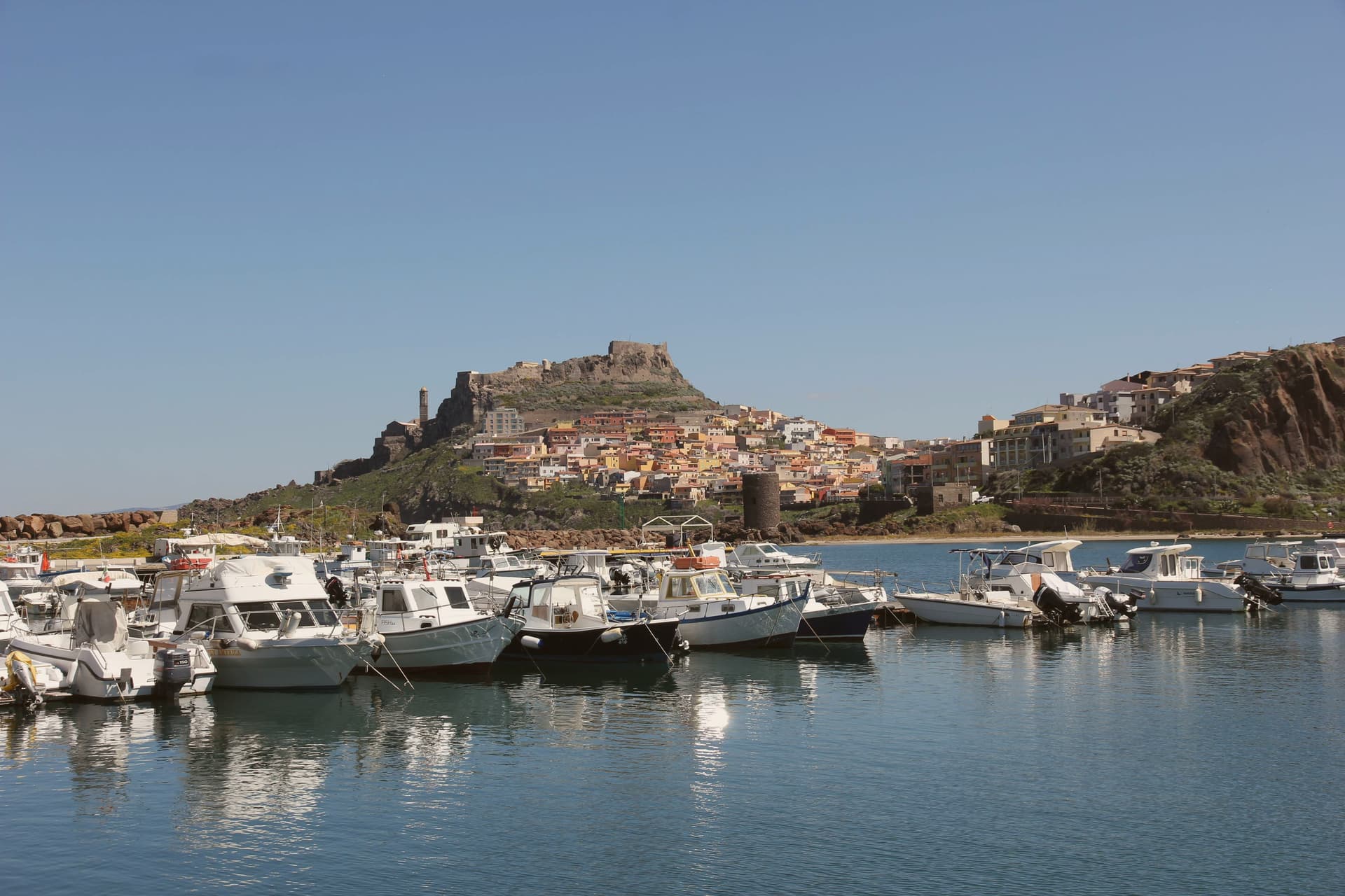
A Doria sea fortress above the Gulf of Asinara, Genoese from 1100, Aragonese from 1448, Savoyard from the 1700s.
- Best time
- May–Oct
- By car
- 3 h 28 min from Cagliari
- Population
- 5,656
Known for
DORIA CASTLE
Twelfth-century Genoese fortress that defined the town for nine hundred years, residence of Eleonora d'Arborea, later Aragonese, then Savoyard.
BASKET WEAVING
Asphodel and dwarf-palm weaving is the signature Castellanese craft; the Museo dell'Intreccio Mediterraneo inside the castle is dedicated to it.
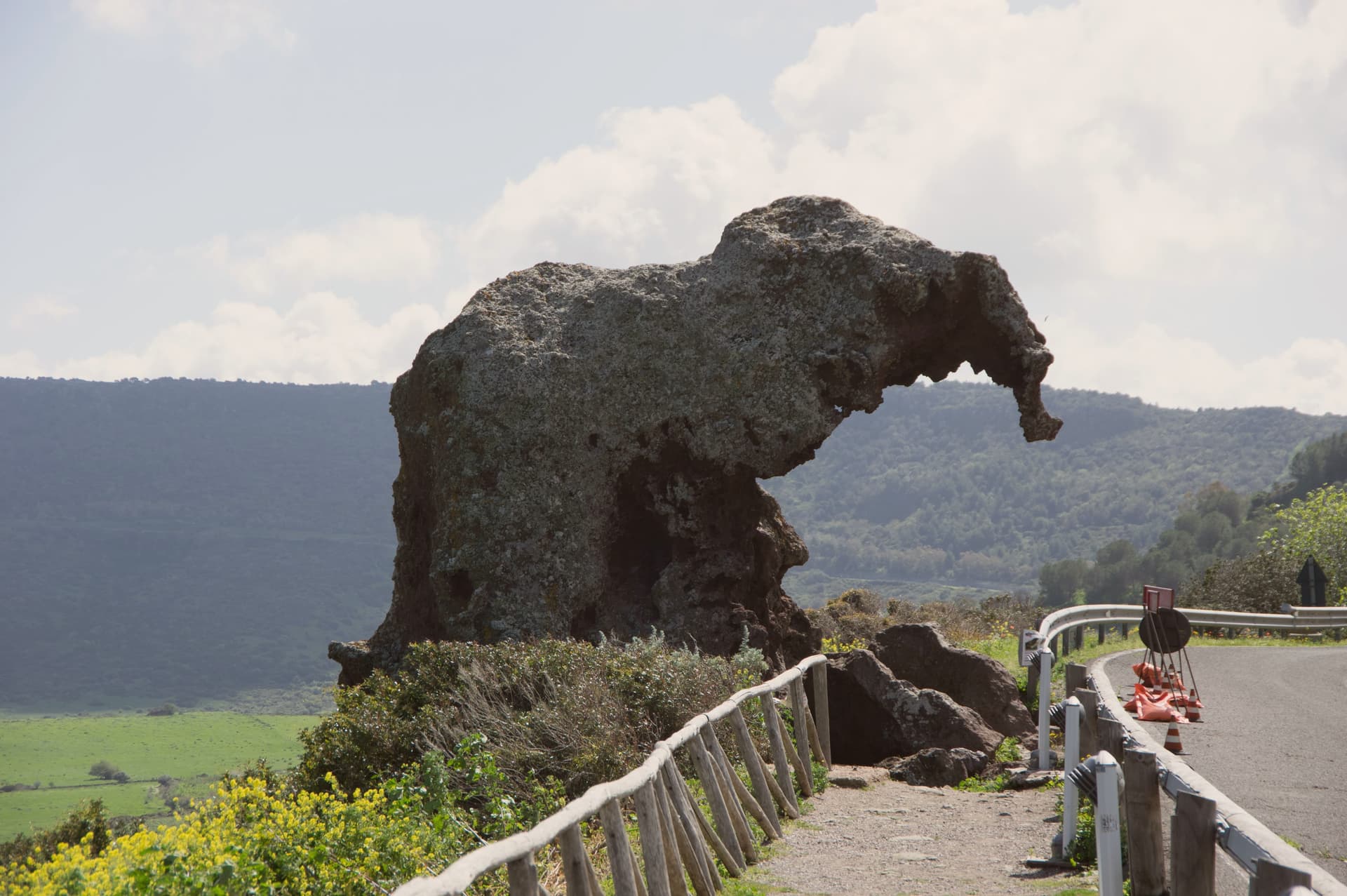
ROCCIA DELL'ELEFANTE
Eroded red porphyry six kilometers east shaped like a seated elephant, with two pre-Nuragic tombs of around 6000 and 3000 BC cut inside.
When to visit
Best · May–Oct
- J13°
- F14°
- M15°
- A18°
- M21°
- J26°
- J29°
- A29°
- S26°
- O22°
- N18°
- D14°
- Best
- Hot or crowded
- Quiet
- Mostly closed
Daytime averages, 2020–2024. Weather data by Open-Meteo.com.
Why come
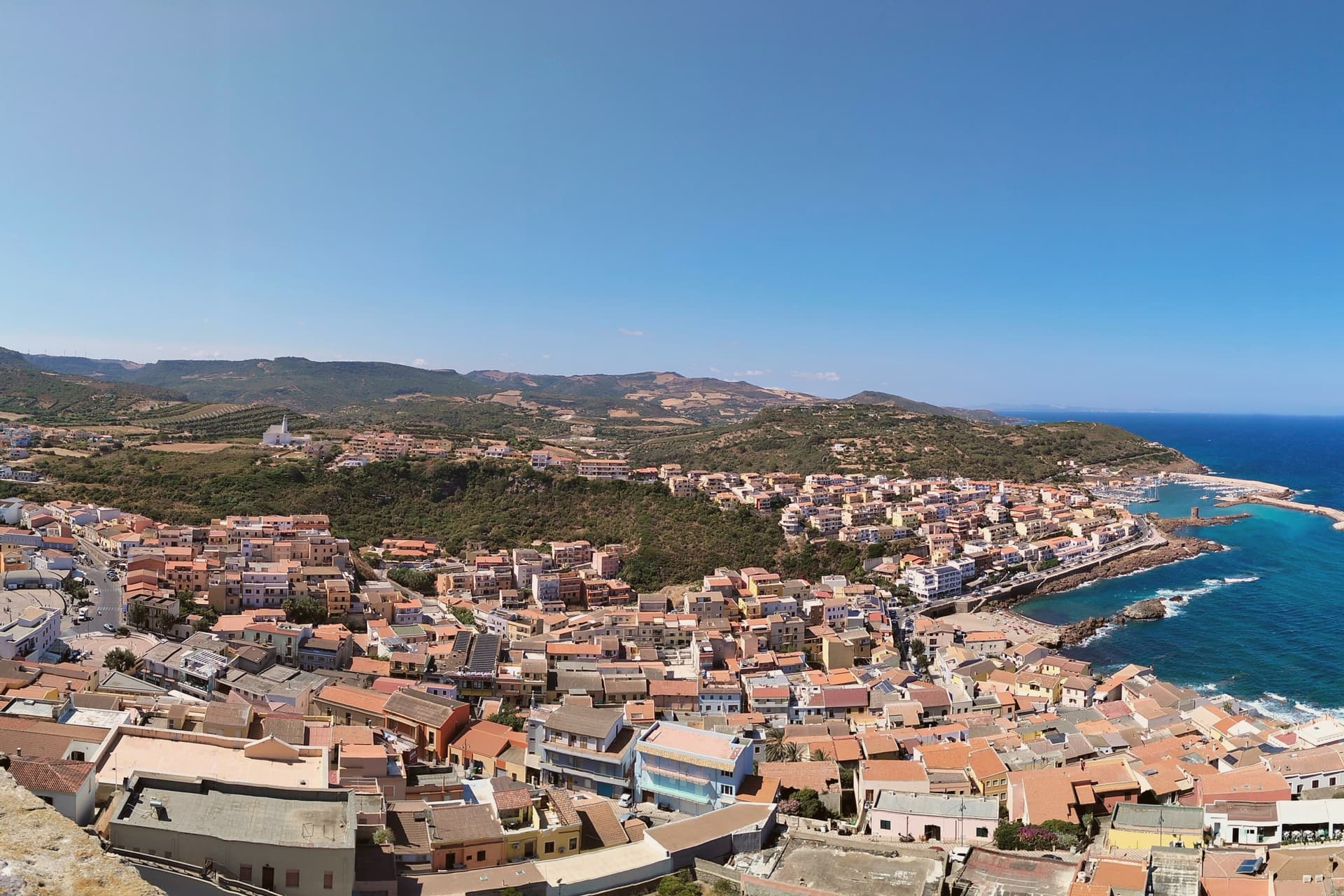
Castelsardo sits on a rock above the Gulf of Asinara, twenty-five kilometers north of Sassari. The Doria family of Genoa built the castle in the early twelfth century to control the gulf, and it served as the residence of Brancaleone Doria and Eleonora d'Arborea until 1448, when the Aragonese took it and renamed it Castel Aragonese. The Spanish turned it into a defensive fort with towers and bastions, and it kept that name until the Savoys took over in the eighteenth century and gave it the present name.
The old town climbs the rock in a single line from the harbour to the castle at its summit, the walled village wrapped around the slope between the two. Below the castle, the cathedral stands on its own terrace above the sea, its tiled bell tower placed so it can be picked out from boats well offshore. Six kilometers east, on the road out of town, the Roccia dell'Elefante sits apart from this vertical arrangement, a single eroded outcrop rather than part of the settlement. Three rulers in succession, Genoese, Aragonese, Savoyard, each left their mark on the same rock without erasing what came before: the castle they fought over, the church they built beneath it, and the harbour they all needed at its foot.
The Sunday letter
Castelsardo is on our list. Its letter is still to come.
We are writing about all 1,000 of these towns, one at a time, in a free letter every Sunday: the photo, the food, the festa. That is our mission. Sign up and you will be there when Castelsardo comes up. By Peter & Sophia, from Pietrasanta.
Read on
Castelsardo in our articles
How to get there
From Cagliari (CAG), about 3h 46m by car.
Coming by train into Sassari? Castelsardo is about 35 minutes away by road.
What to see
Castello dei Doria
Tops the walled village at its highest point, the rock dropping to the harbour below. Its rooms now hold the museum devoted to the town's weaving craft.
Cattedrale di Sant'Antonio Abate
Gothic core with seventeenth-century Renaissance and Baroque additions, tiled bell tower visible from sea, Maestro di Castelsardo altarpiece inside.
Museo dell'Intreccio Mediterraneo
Recreated workshops and historical pieces set inside the castle's rooms, tracing how asphodel and dwarf palm are cut, stripped and worked into baskets and sieves.
Roccia dell'Elefante
Set beside the SS134, the rock's eroded form makes the resemblance to a seated elephant immediate on approach, the tomb openings visible in its flank.
Centro storico
Walled medieval village rising up the rock from the harbour to the castle, one of the Borghi più belli d'Italia.
The slow-trip planner
Building a trip? Find where Castelsardo fits in a slow Italy circuit.
Answer five questions. We will shape a geographically coherent slow trip from the 1,000 Italian towns most travelers skip. Yours to save and share.
We recommend
Where to eat and stay
Not our picks, but places the guides put their name to: a Michelin star, a Gambero Rosso fork, a Slow Food snail, a Michelin Key for the hotels. Worth a table, a counter, or a night when you pass through.
Il CormoranoRistorante
Il Cormorano has one Gambero Rosso fork (76/100) to its name.
Bajaloglia ResortHotel
Bajaloglia Resort has a place in the Michelin hotel guide to its name.
Living here
- Population 5,656
- Remotei
- Pharmacy in town
- High school within a 30-minute drive
- Nearest airport Cagliari, 3 h 46 min drive
- Regional capital Cagliari, 3 h 34 min drive
Common questions
- What is Castelsardo known for?
- Castelsardo is a Doria sea fortress at 114 meters above the Gulf of Asinara, Genoese from 1100, Aragonese from 1448, Savoyard from the 1700s.
- Where is Castelsardo?
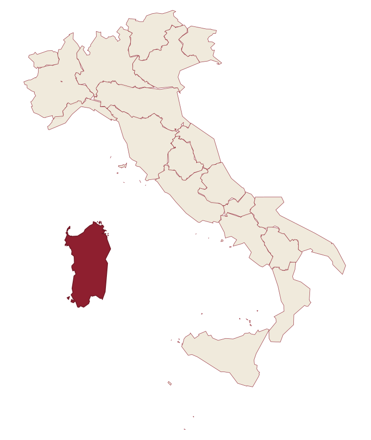
- Castelsardo is a comune in the province of Sassari, in Sardinia.
- What is the nearest airport to Castelsardo?
- Cagliari (CAG), about 3h 46m by car.
- When is the best time to visit Castelsardo?
- Best in May–Oct. July is the warmest month, averaging 29 degrees, and December the wettest, with about 12 rain days.
- Which other towns are like Castelsardo?
- Santa Teresa Gallura, Orosei and Palau.
- How many people live in Castelsardo?
- 5,656 at the 2023 count.
Tags & datadesignations · numbers · sources
Recognised as
The numbers
- Elevation: 114 m
- Population: 5,656
- Surface area: 43.34 km²
These figures were compiled from public directories: ISTAT, OpenStreetMap and Wikidata, and from the official listings of the guides named on this page. Town details change; verify with official sources before you travel.
Similar
Towns like Castelsardo
Santa Teresa Gallura
Province: Sassari
both on the Sardinian coast · both between 3,000 and 10,000 people
Orosei
Province: Nuoro
both on the Sardinian coast · both between 3,000 and 10,000 people
Palau
Province: Sassari
both on the Sardinian coast · both between 3,000 and 10,000 people
Carloforte
Province: Sud Sardegna
both on the Sardinian coast · both between 3,000 and 10,000 people
Mattinata
Province: Foggia
both between 3,000 and 10,000 people · both near sea level
Specchia
Province: Lecce
both between 3,000 and 10,000 people · both near sea level
🎨 Borghi più belli d'Italia
More Borghi più belli d'Italia towns in Sardinia
Atzara
Province: Nuoro
A Mandrolisai wine village on the western Gennargentu, painted in the early twentieth century by Spanish costumbristas and the Sardinian Scuola di Atzara.
Bosa
Province: Oristano
A colour-washed riverside town on Sardinia's only navigable river, with a Malaspina castle on the hill and the tanneries of Sas Conzas along the Temo.
Carloforte
Province: Sud Sardegna
A Ligurian-speaking fishing town on the Isola di San Pietro, founded in 1738 by coral fishers returning from Tunisian Tabarka.
La Maddalena
Province: Sassari
The only inhabited town of a sixty-island granite archipelago between Sardinia and Corsica, and the place Giuseppe Garibaldi chose to die.
Posada
Province: Nuoro
The capital of the Baronia, a 3,000-person village on a 71-meter rock with a 13th-century tower over the valley.