
Known for
VILLA SAN MICHELE
Axel Munthe's villa and garden on the Phoenician ledge, built from 1895 on Tiberian ruins, made famous by his 1929 memoir.
MONTE SOLARO
Island summit at 589 meters reached by chairlift from Piazza Vittoria in about 13 minutes for the widest view on Capri.
SCALA FENICIA
Greek-era stairway of about 800 steps linking the two communes, the only connection between them until the 1874 carriage road.
LIMONE DI SORRENTO
The commune lies inside the Limone di Sorrento IGP production zone.
When to visit
Best · May–Sep
- J12°
- F12°
- M13°
- A14°
- M18°
- J22°
- J25°
- A26°
- S24°
- O20°
- N17°
- D14°
- Best
- Hot or crowded
- Quiet
- Mostly closed
Daytime averages, 2020–2024. The sea is warmest in August at 28° and coldest in February at 15°. Weather data by Open-Meteo.com.
The festa: Antonio di Padova, 13 June
Why come
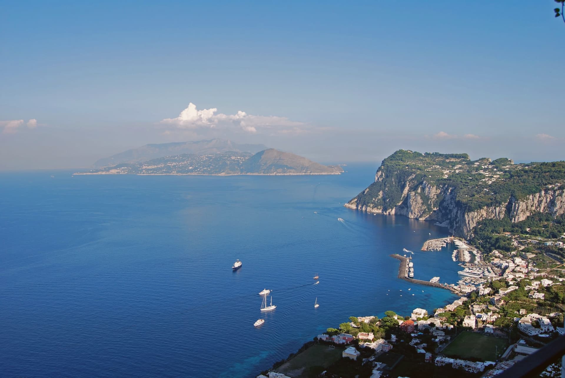
Anacapri occupies the western, higher plateau of Capri, about 150 meters above the harbour town at the municipal centre and rising to 589 at Monte Solaro. The Ancient Greek prefix ana means up: the name simply says the upper one. Until 1874 the only link between the two communes was a stairway of some 800 steps, cut by Greek settlers in the seventh or sixth century BC, not by Phoenicians despite what its common name suggests.
In 1895 the Swedish physician Axel Munthe began building his villa on the ledge above those steps, on the ruins of one of Tiberius's residences and a tenth-century chapel. His 1929 memoir turned the place into a literary destination. The two communes of Capri, one at sea level and one on the plateau above, were for centuries connected only by that stair cut into the rock, and a settlement reachable only on foot from its lower twin is a different kind of place than one arrived at by road.
The Sunday letter
Anacapri is on our list. Its letter is still to come.
We are writing about all 1,000 of these towns, one at a time, in a free letter every Sunday: the photo, the food, the festa. That is our mission. Sign up and you will be there when Anacapri comes up. By Peter & Sophia, from Pietrasanta.
Read on
Anacapri in our articles
 The 6 best beach towns with a serious restaurant in Campania6 towns, Anacapri among them.
 The best towns worth staying overnight in the province of Napoli6 towns, Anacapri among them.
 The best hidden towns worth staying overnight in Campania8 towns, Anacapri among them.
 The 9 best olive oil towns in Campania9 towns, Anacapri among them.
How to get there
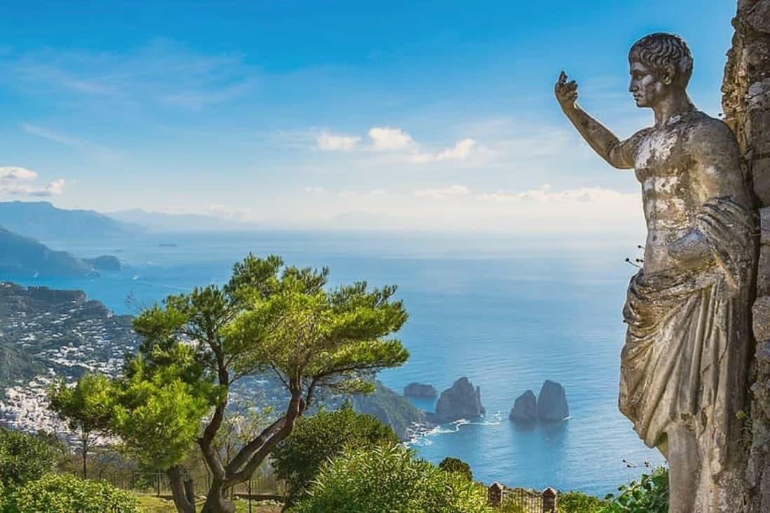
Anacapri is on an island and is reached by ferry.
What to see
Villa San Michele
Neoclassical villa and garden with an antiquities collection and a granite Sphinx set over the harbour, facing east toward Vesuvius.
Monte Solaro
Reached by a single-seat chairlift from Piazza Vittoria, the summit opens onto views across the whole of Capri.
Faro di Punta Carena
Second-tallest lighthouse in Italy, built in 1862 and operational since 1867, at the southwestern tip of the island.
Scala Fenicia
The stairway climbs between the harbour town and the plateau above, cut into the rock rather than built up from it, its name a misnomer since it predates any Phoenician presence.
Castello di Barbarossa
Ruined castle at 412 meters above sea level on a spur of Monte Solaro, now an ornithological station for migratory birds.
Casa Rossa
Nineteenth-century red house in the centre of Anacapri, built by American John Clay MacKowen, now a small museum of paintings and Roman finds.
The slow-trip planner
Building a trip? Find where Anacapri fits in a slow Italy circuit.
Answer five questions. We will shape a geographically coherent slow trip from the 1,000 Italian towns most travelers skip. Yours to save and share.
We recommend
Where to eat and stay
Not our picks, but places the guides put their name to: a Michelin star, a Gambero Rosso fork, a Slow Food snail, a Michelin Key for the hotels. Worth a table, a counter, or a night when you pass through.
Da GelsominaRistorante
A spot in the Michelin Guide, at Da Gelsomina.
Il RiccioRistorante
A spot in the Michelin Guide, at Il Riccio.
L' O l i v oRistorante
L' O l i v o carries a La Liste score of 92.5.
L'OlivoRistorante
Two Michelin stars, at L'Olivo.
La Zagara di Casa MariantoniaRistorante
La Zagara di Casa Mariantonia has a Gambero Rosso listing to its name.
Hotel Caesar AugustusHotel
Hotel Caesar Augustus carries a La Liste score of 91.
Living here
- Population 6,835
- Remotei
- Pharmacy in town
- High school within a 30-minute drive
- Regional capital Napoli, 1 h 26 min drive
Common questions
- What is Anacapri known for?
- Anacapri is the upper half of Capri, 150 meters above its famous twin.
- Where is Anacapri?
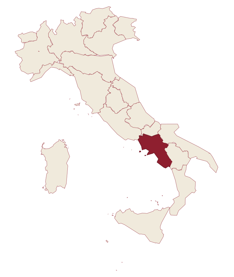
- Anacapri is a comune in the province of Napoli, in Campania, at 275 meters above sea level.
- How do you get to Anacapri?
- Anacapri is on an island and is reached by ferry.
- When is the best time to visit Anacapri?
- Best in May–Sep. August is the warmest month, averaging 26 degrees, and November the wettest, with about 16 rain days.
- Is there a sagra or a festival in Anacapri?
- The town keeps its patron saint's day: Antonio di Padova, 13 June.
- Which other towns are like Anacapri?
- Capri, Castellabate and Capalbio.
- How many people live in Anacapri?
- 6,835 at the 2023 count.
Tags & datadesignations · numbers · sources
Recognised as
The numbers
- Elevation: 275 m
- Population: 6,835
- Surface area: 6.47 km²
On the map
These figures were compiled from public directories: ISTAT, OpenStreetMap and Wikidata, and from the official listings of the guides named on this page. Town details change; verify with official sources before you travel.
Similar
Towns like Anacapri
Capri
Province: Napoli
both on the Tyrrhenian coast · both between 3,000 and 10,000 people
Castellabate
Province: Salerno
both on the Tyrrhenian coast · both between 3,000 and 10,000 people
Capalbio
Province: Grosseto
both on the Tyrrhenian coast · both between 3,000 and 10,000 people
Isola del Giglio
Province: Grosseto
both on the Tyrrhenian coast · both hill towns
Ascea
Province: Salerno
both on the Tyrrhenian coast · both between 3,000 and 10,000 people
Camerota
Province: Salerno
both on the Tyrrhenian coast · both between 3,000 and 10,000 people
🟦 Bandiera Blu
More Bandiera Blu towns in Campania
Agropoli
Province: Salerno
The gateway commune of the Cilento, a Byzantine acropolis on a promontory taken by the Saracens in 882 as a base for raids on Salerno.
Ascea
Province: Salerno
Two villages, a hilltown at 230 meters and a Cilento marina, with Parmenides and Zeno's Eleatic school in the ruins of Greek Velia below.
Camerota
Province: Salerno
A Cilento hill town of 422 meters above the Costa degli Infreschi, its caves holding one of the longest prehistoric stratigraphies on the southern Tyrrhenian.
Castellabate
Province: Salerno
A hilltown on a 280-meter Cilento ridge, with a Bandiera Blu beach below and the Benvenuti al Sud film.
Centola
Province: Salerno
A Cilento hill village at 336 meters whose seaside frazione carries the name of Aeneas' helmsman.