
The 6 best beach towns with a serious restaurant in Campania
Campania's coast runs from tufa cliffs and lemon terraces down to the low dunes and olive country of the Cilento, and the cooking changes with the rock. Up near the Sorrentine peninsula it is provolone del monaco, pasta with courgettes, mozzarella still warm, cakes built on ricotta and candied fruit. Further south the boats bring in alici di menaica, salted in wooden barrels and eaten with bread and oil and nothing else. Summer is long here, the sea stays swimmable well into October, and the best tables tend to sit in towns small enough to walk end to end. Houses are whitewashed lime over volcanic stone, with vaulted roofs built to hold the heat off.
Most people arrive by hydrofoil or on the coast road and head straight for Amalfi and Ravello, which absorb the coaches, the day trips and the wedding parties from spring through September. The reputation is earned, the views are what everyone says they are, and the road is a single lane of traffic for most of the day. Restaurants in that stretch cook for a crowd that will not come back next week. You can eat very well there, but you will book weeks ahead and pay for the terrace.
The same limestone, the same lemons and the same fishing fleets carry on either side of that famous stretch. The towns in this list all hold the national award for clean bathing water, and each one also holds a restaurant the most demanding of the Italian guides takes seriously. Fewer people make the effort to reach them, which is chiefly a matter of timing and a car, or a slow boat. Worth a detour for lunch and a swim in the same afternoon.
Of the 66 communes we have mapped in Campania, 6 qualify as beach towns with a serious restaurant: each holds the national award for clean bathing water, and each holds a restaurant listed by the most demanding of the guides. The smallest, Pisciotta, has 2,428 residents.
Elsewhere in the catalogue: The 9 best towns with a serious restaurant in the province of Napoli and The best hidden beach towns in Campania.
Pisciotta
Why visit Pisciotta
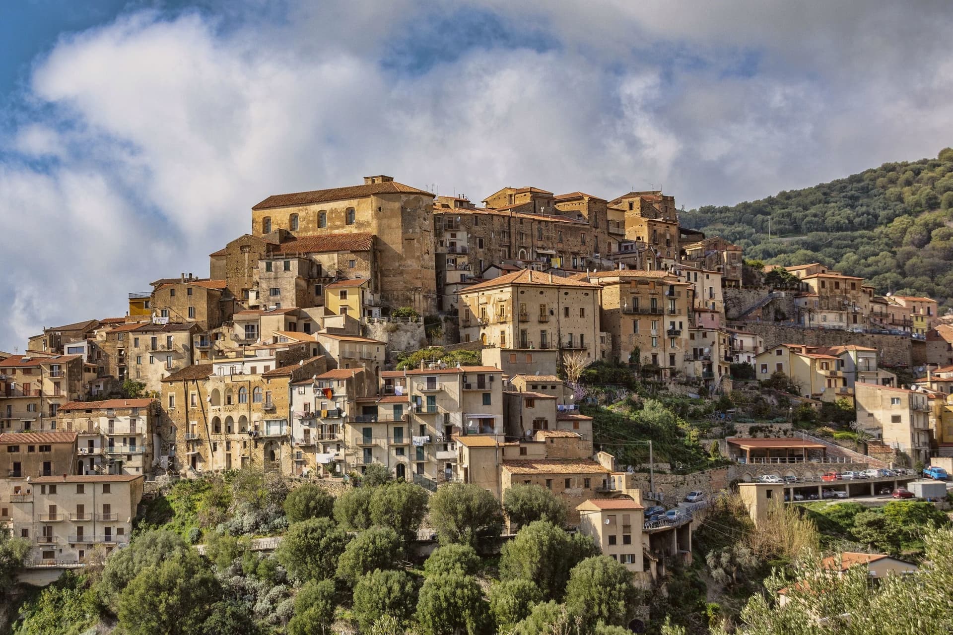
The hill the town occupies rises between Ascea and Palinuro, part of the strictest zone of the Cilento and Vallo di Diano National Park, and the ridge gives the stone houses of the centro storico a clear line of sight to Capo Palinuro twelve kilometers south. The town's parts sit at different elevations doing different work: the historic core holds the ridge at 171 meters, the olive terraces cover the slopes below it, and Marina di Pisciotta occupies the shore at the foot of the hill, where the fishing boats go out.
The menaica net worked by the Marina's fishermen is a technique once widespread around the Mediterranean and now reduced to a few coves, of which this is one. Carlo Pisacane's failed 1857 revolutionary expedition landed at Sapri and was crushed nearby; the Cilento coast keeps the memory in plaques and processions rather than in any structure at Pisciotta itself.
What holds the town together is elevation: everything of note here, the anchovies, the olives, the beach, the ridge, is defined by how far it sits above or below that 171-meter line.
Angiolina, Perbacco have been named by a guide.
What to see in Pisciotta
- Centro storico di Pisciotta. Hilltop medieval core of stone houses on a ridge 171 meters above the sea, with a clear sightline to Capo Palinuro.
- Marina di Pisciotta. Fishing port at the foot of the hill, departure point for the last menaica anchovy boats on the coast, its beach holding the Blue Flag.
- Uliveti di Pisciottana. Terraces holding trees of considerable age, the source groves of the Cilento DOP extra-virgin oil.
How to get to Pisciotta
There is a railway station in the town, so you can arrive without a car and never need one while you are here. Salerno is roughly 138 minutes away by road.
Our tip
May through September is the open season on the Cilento coast: clear water, warm evenings and the menaica boats out at night. July and August push past thirty-five degrees and the Marina rentals book; the centro storico on the hill above stays a few degrees cooler in the breeze. April and October are dry and mild, the right time for the olive harvest road and Parco Nazionale walks without heat.
Positano
Why visit Positano
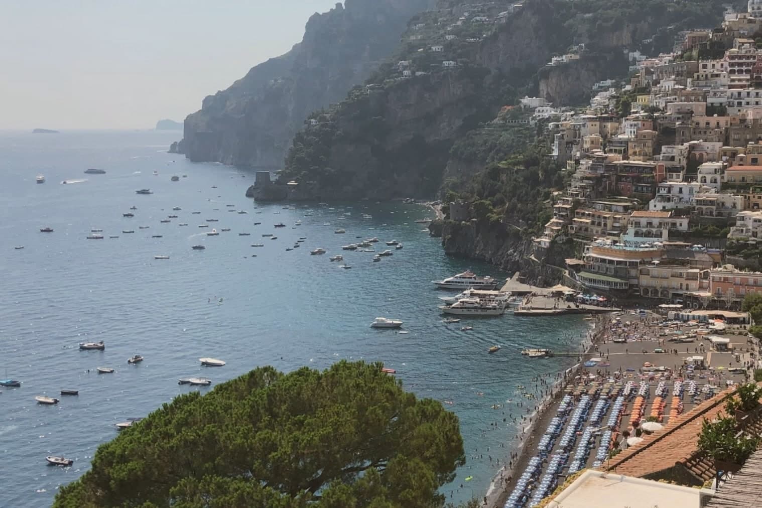
Positano is built on the rugged limestone of the Lattari Mountains, which is why locals call it the città verticale: the ground itself will not allow a level street in the centro storico, and every path either climbs or descends. The settlement grew from the ninth century around the Benedictine monastery that kept the icon, and the frazione of Nocelle above the town shows how far the climb goes, linked to the coast below by the ridge trail rather than by road.
After being sacked by Pisa in the thirteenth century, the town fortified itself with watchtowers and prospered as a small fish-trading port, a working settlement long before it was a resort. The twentieth century made it a writer's refuge: John Steinbeck described it in Harper's Bazaar in 1953 as a dream place that isn't quite real.
Today Positano runs almost entirely on summer tourism, with a UNESCO Amalfi Coast inscription and a Bandiera Blu beach. The vertical geography that once forced fishermen and monks onto narrow terraces is the same feature now sold as a view: the town's difficulty of ground became its main asset.
Li Galli, Zass, Next2 and 7 more have been named by a guide.
What to see in Positano
- Chiesa di Santa Maria Assunta. Majolica tiled dome over the church around which the village grew, the icon inside marking the spot where the sailors are said to have set the Madonna down.
- Spiaggia Grande. Main pebble beach below the centro storico, the postcard image of the Amalfi Coast, with the pastel facades of the village rising directly above the sand.
- Sentiero degli Dei. Path of the Gods, the high ridge trail of the Monti Lattari from Agerola to Nocelle, a frazione of Positano, with the Faraglioni of Capri offshore.
How to get to Positano
Salerno is roughly 54 minutes away by road.
Our tip
May, June and September are the open months on the Amalfi Coast, water warm enough for swimming and the road still navigable. July and August fill the village past capacity, with day boats running from Capri and Sorrento and the SS163 backed up for hours; locals avoid the centro storico between eleven and four. April and October stay quiet, with the Path of the Gods at its best and the town easier to walk.
Anacapri
Why visit Anacapri
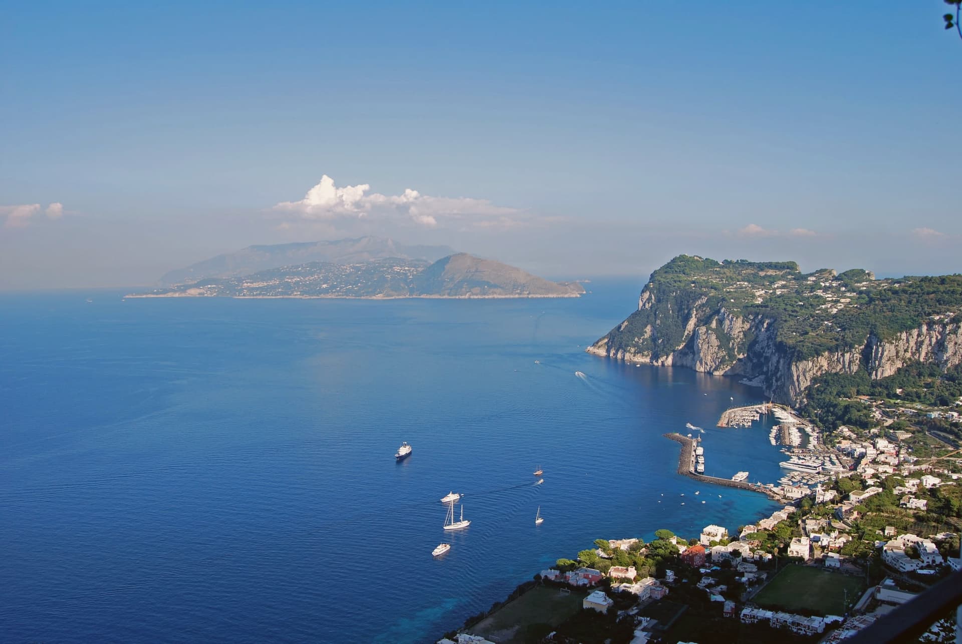
Anacapri occupies the western, higher plateau of Capri, about 150 meters above the harbour town, at 275 meters at the municipal centre and rising to 589 at Monte Solaro. The Ancient Greek prefix ana means up: the name simply says the upper one.
Until 1874 the only link between the two communes was a stairway of some 800 steps, cut by Greek settlers in the seventh or sixth century BC, not by Phoenicians despite what its common name suggests. In 1895 the Swedish physician Axel Munthe began building his villa on the ledge above those steps, on the ruins of one of Tiberius's residences and a tenth-century chapel.
His 1929 memoir turned the place into a literary destination. The two communes of Capri, one at sea level and one on the plateau above, were for centuries connected only by that stair cut into the rock, and a settlement reachable only on foot from its lower twin is a different kind of place than one arrived at by road.
L'Olivo, Da Gelsomina, Il Riccio and 2 more have been named by a guide.
What to see in Anacapri
- Villa San Michele. Neoclassical villa and garden with an antiquities collection and a granite Sphinx set over the harbour, facing east toward Vesuvius.
- Monte Solaro. Reached by a single-seat chairlift from Piazza Vittoria, the summit opens onto views across the whole of Capri.
- Faro di Punta Carena. Second-tallest lighthouse in Italy, built in 1862 and operational since 1867, at the southwestern tip of the island.
How to get to Anacapri
Our tip
May, June, September and the first half of October are the months Anacapri stays usable: blue water at Punta Carena, the Solaro chairlift running, and a degree or two cooler than Capri Marina below. July and August bring the day-trippers off the Naples and Sorrento ferries; the centro of Capri saturates by ten and Anacapri carries the spillover by lunchtime. Villa San Michele books out in advance.
Massa Lubrense
Why visit Massa Lubrense
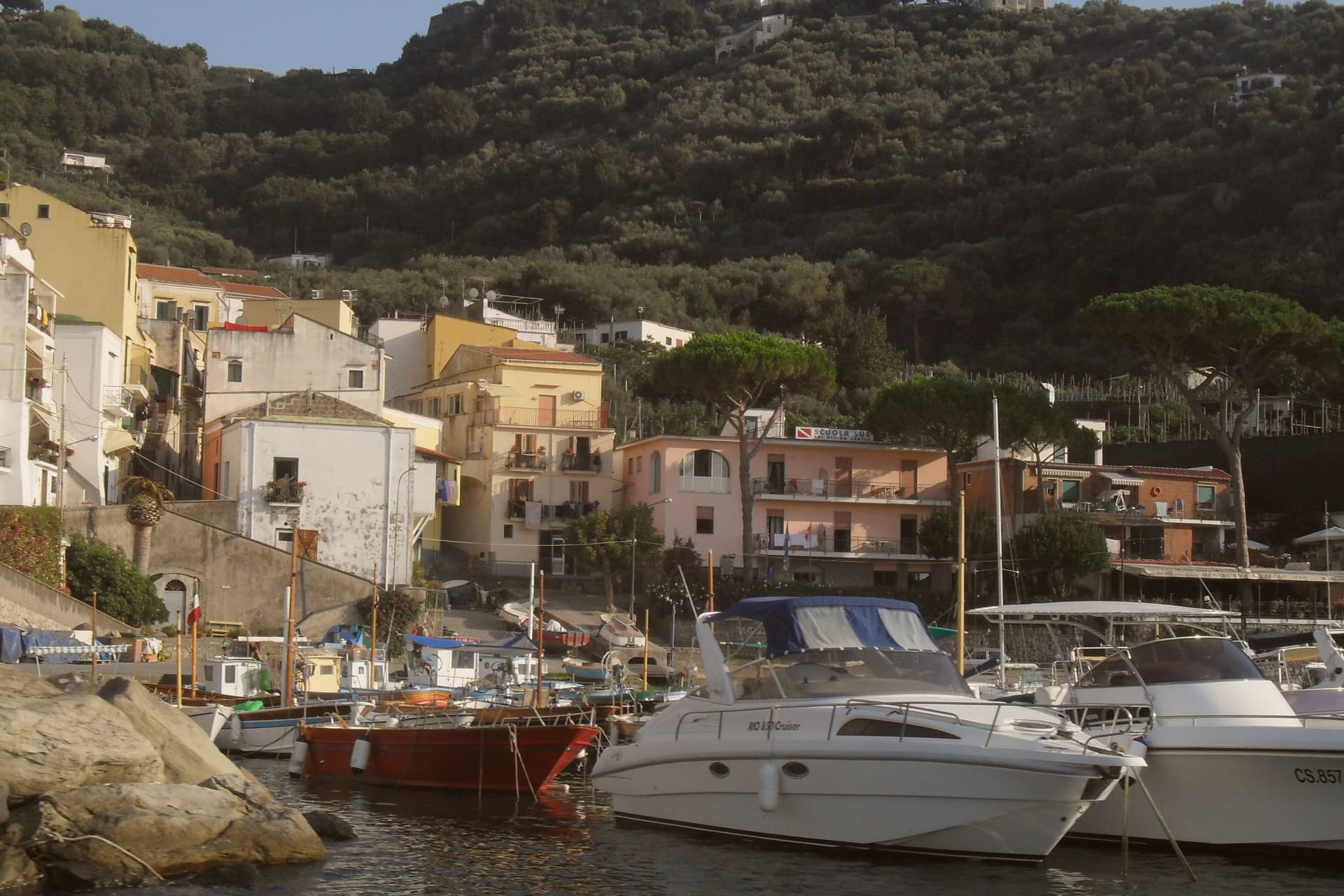
Massa Lubrense holds the western tip of the Sorrentine Peninsula, the largest municipal area on the peninsula and the closest land to Capri, three nautical miles across the Bocche di Capri. The hilltop centro sits at 121 meters; the commune's eighteen frazioni spread between the Tyrrhenian and the Gulf of Salerno, including Termini, Nerano, Sant'Agata sui Due Golfi and the Marina della Lobra.
Punta Campanella, the cape at the end, has the remains of a Roman sanctuary of Athena and a sixteenth-century watchtower against Saracen raids; the surrounding sea is a protected marine area established in 1997. The commune holds a Bandiera Blu, a Spiga Verde, and Città dell'Olio status: the Penisola Sorrentina DOP olive groves climb the hills above the bays.
Spaghetti alla Nerano, courgette and provolone del Monaco, is the dish that came out of these kitchens in the 1950s.
Ristorante Antico Francischiello da Peppino, Quattro Passi, Relais Blu and 6 more have been named by a guide.
What to see in Massa Lubrense
- Punta Campanella. Cape at the western tip of the peninsula, with the ruins of a Roman sanctuary of Athena, a watchtower, and the marine reserve established in 1997.
- Marina del Cantone. Pebble bay at Nerano, Italy's largest pebble beach by some measures and the kitchen where spaghetti alla Nerano was created.
- Chiesa di Santa Maria della Lobra. Sixteenth-century mother church above the small Marina della Lobra, with a wooden coffered ceiling and a former Franciscan convent attached.
How to get to Massa Lubrense
Napoli is roughly 69 minutes away by road.
Our tip
May, June, September and early October are the months Massa Lubrense was built for. The water around Punta Campanella sits above twenty degrees, the marine reserve runs daily boat tours, and the Sentiero degli Dei from Bomerano descends through olive groves in stable weather. July and August are full: the parking at Marina del Cantone closes by mid-morning and the SS145 from Sorrento backs up.
Sorrento
Why visit Sorrento
Sorrento sits on a block of tuff cliff fifty meters above the Bay of Napoli, thirty kilometers from the city by Circumvesuviana railway or ferry. The town began as a Greek foundation and became the Roman Surrentum, a resort favored by senators.
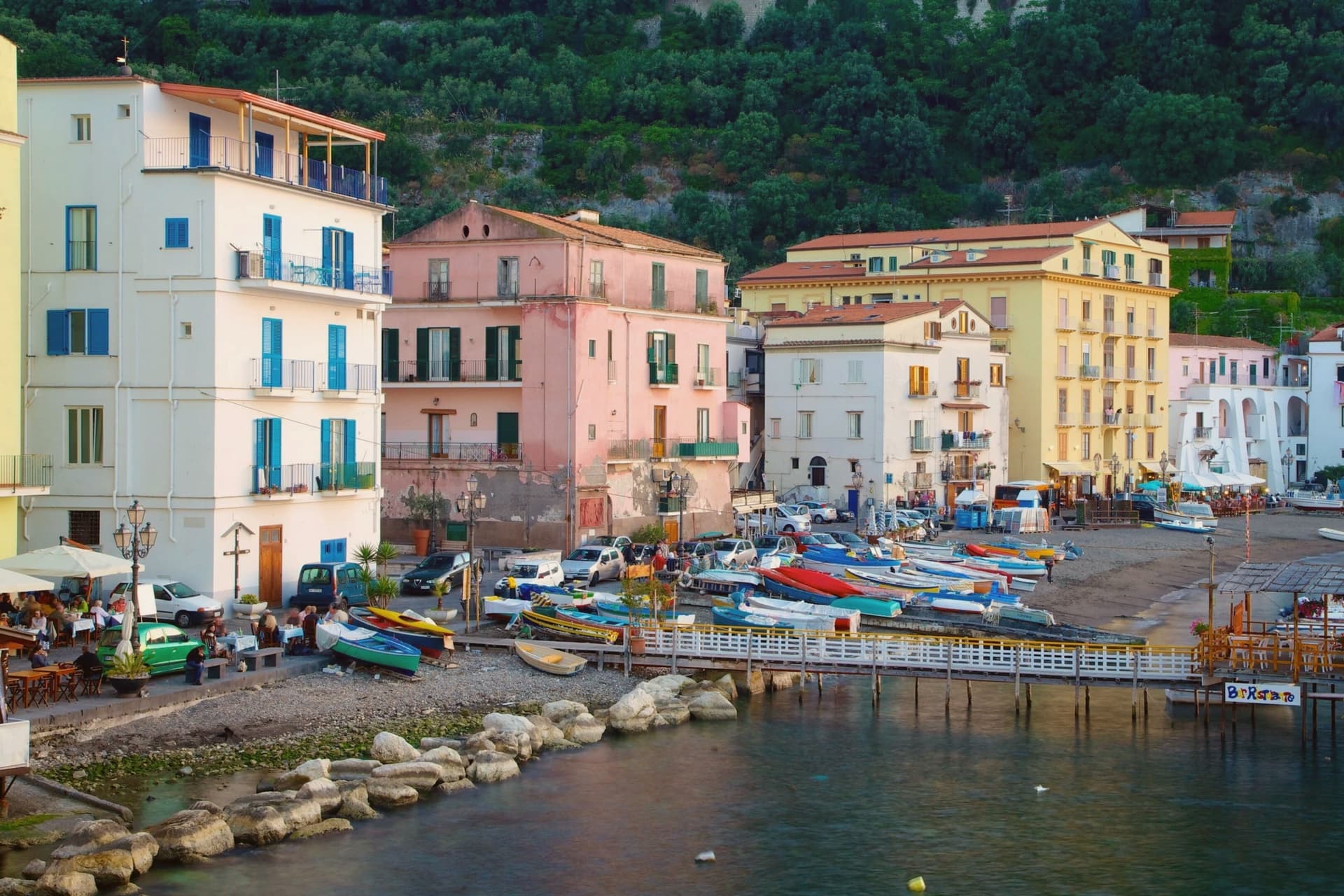
The current population is 15,407. The old town sits above, gathered around the Duomo and the cloister of San Francesco a few minutes apart, while Marina Grande lies below the cliff, reached through the ancient Greek gate, its harbor still working and its trattorie facing the bay.
Terraces of lemon groves ring the slopes above town, the same femminello sorrentino IGP fruit that supplies the limoncello sold through the centro storico. Piazza Tasso, at the head of the old town, is where Corso Italia begins and where the statue of Torquato Tasso stands; the poet was baptized in the cathedral below.
A cliff town facing the bay, its upper streets given to churches and squares, its lower shore to fishing and the harbor, and its surrounding slopes turned over entirely to the lemon that still funds much of what happens in between.
Ristorante O' Canonico 1898, Ristorante O' Parrucchiano, Terrazza Bosquet and 8 more have been named by a guide.
What to see in Sorrento
- Duomo di Sorrento. Eleventh-century cathedral rebuilt in Romanesque style in the fifteenth century, with a baroque interior and the baptistery where Torquato Tasso was christened.
- Chiostro di San Francesco. Fourteenth-century cloister of tuff arches and crossed columns, the marble façade redone in 1926, still used for civic weddings and chamber concerts.
- Museo Correale di Terranova. Decorative arts museum in a seventeenth-century villa opened in 1924, with Neapolitan porcelain, period furniture and seventeenth-century painting.
How to get to Sorrento
There is a railway station in the town, so you can arrive without a car and never need one while you are here. Napoli is roughly 57 minutes away by road.
Our tip
May, June, September and October are the months that work for Sorrento. The sea is warm enough to swim, the temperatures sit in the mid-twenties, and the centro storico is busy without being unworkable. July and August are crowded almost beyond use.
Vico Equense
Why visit Vico Equense
Vico Equense sits on a block of tuff and limestone above the Bay of Napoli, twenty-five kilometers from the city and the first town on the Sorrento peninsula coming from the north. A seventh-century BC pre-Roman necropolis predates the Latin Aequana that Roman patricians built here for their villas, and the finds from that older settlement, funerary objects excavated in the 1960s and 1970s, sit now in a museum founded in 1966.
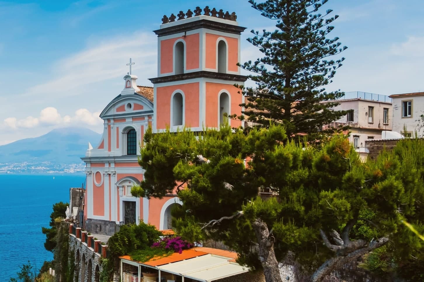
The medieval town that survives was walled by the Angevins after 1284, when Charles II ordered a fortress built on the cliff as both stronghold and residence, and the diocese's cathedral rose on a neighboring clifftop in the same century, before losing its status as a see in 1818. Behind the town, the limestone mass of the Lattari range closes off the land side, reached since 1952 by cable car from the coast at Castellammare.
Pizza by the meter, the town's best-known export, was invented here by Luigi Dell'Amura, called Gigino, in the 1930s, and his restaurant in the centro still serves it. What holds the town together is the sequence itself: a pre-Roman settlement, a Roman villa town, an Angevin fortress and a bishopric, and finally a twentieth-century dish, each layer built on a narrow shelf of rock between the mountain and the bay.
Torre del Saracino, Antica Osteria Nonna Rosa, Cannavacciuolo Countryside and 8 more have been named by a guide.
What to see in Vico Equense
- Chiesa dell'Annunziata. The church stands at the edge of the cliff, its Gothic interior at odds with the Baroque face it was given later. The old cathedral of a diocese that no longer has a seat here.
- Castello Giusso. Angevin castle built between 1284 and 1289 at the order of Charles II of Anjou, with a Renaissance residential wing and gardens above the bay.
- Antiquarium Silio Italico. Archaeological museum founded in 1966, with funerary objects from a seventh-century BC pre-Roman necropolis excavated in the 1960s and 1970s.
How to get to Vico Equense
There is a railway station in the town, so you can arrive without a car and never need one while you are here. Napoli is roughly 55 minutes away by road.
Our tip
May through September is the working season for Vico Equense. June and September are the best months: warm sea, fewer day-trippers than July and August, and the Monte Faito cable car operating on a full schedule. July and August are crowded and hot at sea level, though the Faito plateau stays cooler at around twenty-two degrees. Sagra del Riavulillo falls in the season.
More from Anywhere Italy
 The 9 best towns with a serious restaurant in the province of Napoli
- The best hidden beach towns in Campania
- The best towns with a serious restaurant that you can reach by train in Campania
- The best beach towns you can reach by train in Campania
 The best towns with a serious restaurant that eat well within 90 minutes of Napoli
- The best towns worth staying overnight in the province of Napoli