
The 9 best olive oil towns in Campania
Olive harvest in Campania runs from late autumn into the cold, and it changes the smell of whole valleys. The oil pressed here tastes of the ground it came from: peppery and grassy on the limestone ridges inland, softer and almond-sweet where the groves lean out over the sea. Terraces are held up by dry stone walls, houses are built of tufa and local sandstone, and the frantoio at the edge of town works day and night for a few weeks while everyone queues with crates. Bread, raw oil, salt and a tomato is a real meal in this region, and in November it is the best one going.
Most visitors to Campania spend their time on the Amalfi Coast, on the ferries out of Sorrento and in the ruins at Pompeii, which is where the coaches stop and the lemon-print shops multiply. The scenery earns the attention, and the coast road in August moves at walking pace because of it. Very little of that traffic has anything to do with agriculture. The groves on the slopes above the same road are worked by people the visitors never meet.
The olive country carries on well past the postcard, up into Irpinia and the Sannio, along the Cilento cliffs, over the ridge behind the Sorrentine peninsula. Fewer people go to these places, and the ones who do tend to come for the mill rather than the view. Each town in this list belongs to the national association of Italian olive-oil towns, which means the oil is a matter of local record and not a souvenir. They are worth a detour in the weeks around the harvest, and better still when the new oil is on the table.
Of the 66 communes we have mapped in Campania, 9 qualify as olive oil towns: each belongs to the national association of olive-oil towns. The smallest, Zungoli, has 942 residents.
Elsewhere in the catalogue: The best olive oil towns within 90 minutes of Napoli and The best olive oil towns within two hours of Salerno.
Zungoli
Why visit Zungoli
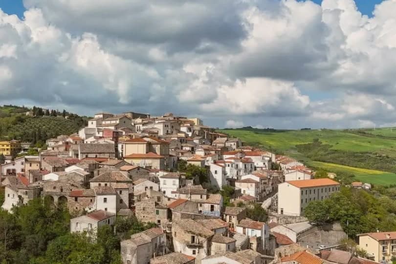
Zungoli sits on the eastern edge of the province of Avellino, one of the higher villages in Irpinia, with the Ufita valley on one side and the Daunian Mountains on the other. The settlement dates to around 900 AD.
Frederick II made it a universitas in 1232, by which point a Norman captain had already built the first fortification and left the place his name. The houses of the centro storico climb the ridge around that castle, and the ground beneath them is hollow: the whole old quarter sits over a network of caves cut by hand in the Byzantine period, long before the cheese and oil that now fill them.
Above ground the stone and the towers date the village; below it, the caves keep it at a constant temperature, which is why what was dug for one purpose is still put to use for another.
What to see in Zungoli
- Castello dei Susanna. The castle's three surviving towers rise over the roofline of the village, the fourth lost to the 1456 earthquake; the walls are the highest point on the ridge.
- Grotte Bizantine. The cave network runs beneath the streets, low and cool, still stacked with wheels of Caciocavallo Podolico and jars of oil the way it has been used for centuries.
- Centro storico medievale. Stone alleys and stairways around the castle on a 657-meter ridge, a Borgo più Bello d'Italia and Bandiera Arancione with views toward the Daunian Mountains.
How to get to Zungoli
Foggia is roughly 81 minutes away by road.
Our tip
April through June and September into October are the dry months on the Irpinia ridge, when the Ufita valley is green and the cave temperature stays even for cheese tasting. July and August touch the low thirties, lighter than the coastal heat but still drying the surrounding pasture; the tuff caves below the houses become the cool refuge. November through March is cold, with rain and occasional snow above six hundred meters, the castle silhouette appearing through low fog.
Lapio
Why visit Lapio
The name of the grape behind the local wine, 'Apianum', comes from the Roman word for bee, api, because the grape was said to be sweet enough to draw them. It has been grown across the Irpinia hills east of Avellino since at least the 1st century AD, though it only became a serious modern DOCG from the 1990s onward, thanks to producers here and in Montefredane, Summonte, and the neighbouring villages.
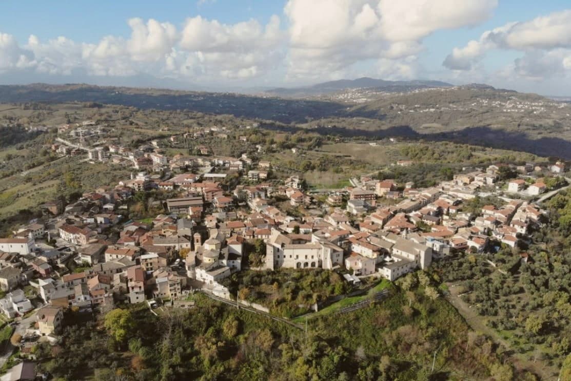
The comune itself sits at 590m on a hilltop, its narrow stone-paved vicoli climbing from the central piazza up to the castle at the high point, past the Chiesa Madre di San Pietro Apostolo and the Convento dei Cappuccini just outside the walls. The four Città designations held here, del Vino, dell'Olio, del Miele, della Nocciola, are not scattered honours but a single picture: Fiano and Aglianico from the vineyards, Irpinia DOP oil from the terraces, chestnut and multifloral honey from the Apennine forests above town, and the hazelnut trade that makes Avellino province the second-largest producer in Italy after Cuneo.
Beyond the comune: Avellino 24 km west, Mirabella Eclano with its Roman Forum and Carro di San Pellegrino procession 15 km north, and the Partenio and Sannio mountains immediately east, whose forests supply both the honey and the local game. The food follows the same logic: pasta al ragù di castrato, brodo di tagliolini con scarola, Caciocavallo Podolico matured 12 or more months on Apennine pastures, torrone tenero made with hazelnuts and honey, and the wine with all of it.
Depopulation has cut the town from 2,400 residents in 1951 to 1,428 today, but the surrounding land, vine, olive, forest, and hazelnut grove, still accounts for nearly everything the place is known for.
What to see in Lapio
- Fiano di Avellino DOCG cellars. Lapio is one of the historic cru villages, 'Apianum' grape since Roman times, modern DOCG only since 1990s. 10+ cellars in the comune + immediate neighbours open for tastings.
- Castello Filangieri. 11th-c Norman castle rebuilt by the Filangieri family in the 16th c. Anchors the high point of the medieval centro with the panoramic view across the Sabato river valley + the Partenio massif.
- Centro storico + Chiesa Madre. Intact stone-paved vicoli climbing from the central piazza to the castle. The 15th-c Chiesa Madre di San Pietro Apostolo + the Convento dei Cappuccini just outside the walls.
How to get to Lapio
There is a railway station in the town, so you can arrive without a car and never need one while you are here. Salerno is roughly 59 minutes away by road.
Our tip
Lapio is best May–June and September–October. The Festa del Fiano in late September is the year's headline. October is harvest in both the Fiano vineyards and the surrounding hazelnut orchards.
Cerreto Sannita
Why visit Cerreto Sannita
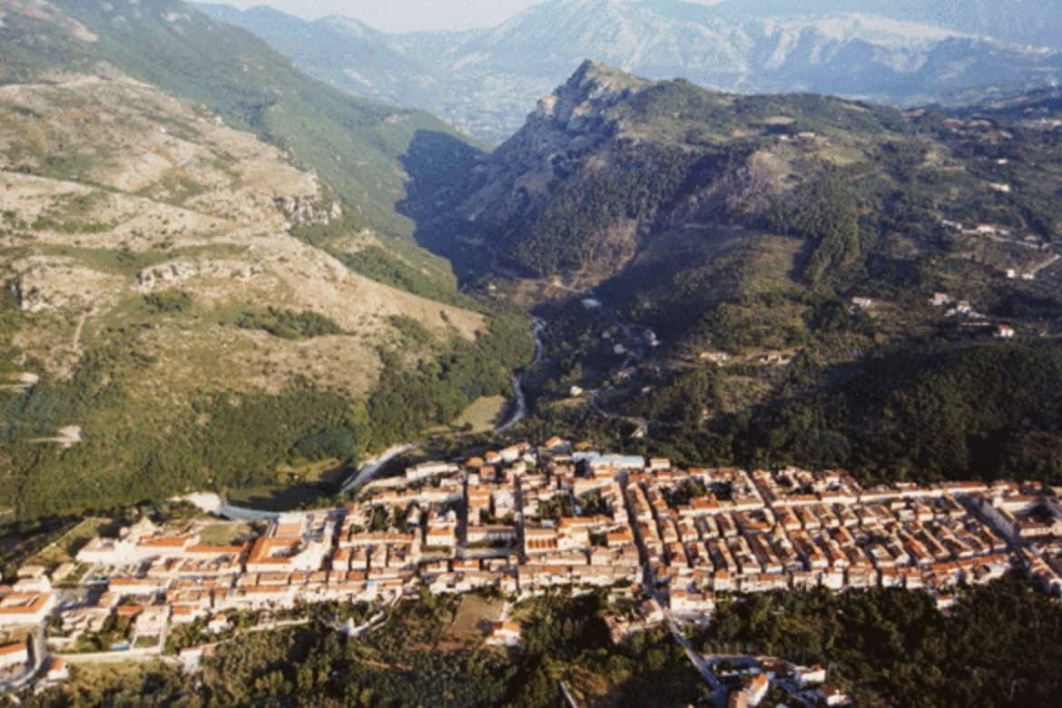
Cerreto Sannita sits at 290 meters in the Titerno valley of the Sannio, fifty-five kilometers northeast of Naples, with the Matese massif rising behind. The town was rebuilt at the order of Count Marzio Carafa, his brother Marino, and Bishop Giovanni Battista de Bellis, and the resulting grid runs orthogonally around a central piazza, a rare case of late-baroque urban planning in southern Italy.
The other anchor is ceramics, an industry the town has long shared with its neighbour. Workshops in both places have produced majolica since at least the sixteenth century, and the State Art Institute revived the craft in the mid-twentieth.
Workshops still turn out ceremonial plates, lobed jugs, apothecary jars and riggiole tiles painted with wind-rose and garland motifs. The town is a Bandiera Arancione, a Cittaslow, and one of Italy's official Città della Ceramica.
What results is a town whose street plan and whose craft both trace back to the same recovery: one rebuilt the ground it stands on, the other kept its hands busy on top of it.
What to see in Cerreto Sannita
- Cattedrale della Santissima Trinità. Baroque facade and tiled dome at the centre of the new town plan, standing where the piazza anchors the orthogonal grid.
- Museo Civico e della Ceramica Cerretese. Civic museum dedicated to four centuries of local majolica, with ceremonial plates, riggiole tiles and apothecary jars from Cerreto and San Lorenzello workshops.
- Chiesa di San Martino. Late seventeenth-century church with painted majolica floor of Cerreto tiles, one of the best preserved riggiole pavements in the Sannio.
How to get to Cerreto Sannita
Napoli is roughly 85 minutes away by road.
Our tip
April through June and September into October are the dry, walkable months in the Titerno valley, when the Matese is still green and the ceramic workshops keep regular hours. July and August push the valley into the mid-thirties; the orthogonal centro storico holds shade well enough, but afternoons go quiet between two and six. November through March is winter on the Matese flank, with cold rain and occasional snow above the town and several workshops on reduced hours.
Caiazzo
Why visit Caiazzo
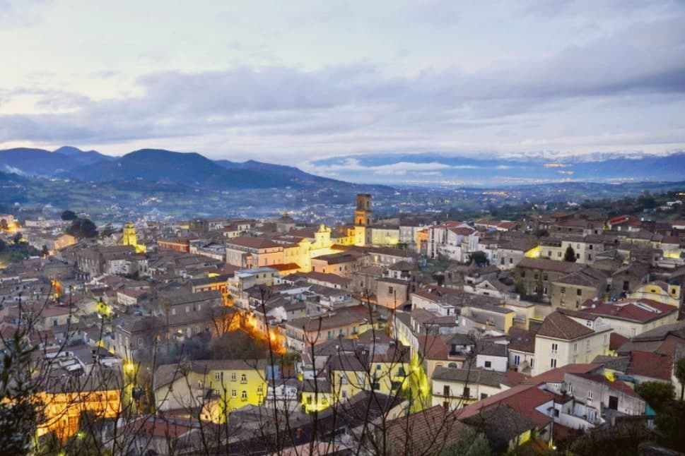
Caiazzo sits at 200 meters on a small hill above the Volturno, forty kilometres north of Naples, between the Matese foothills and the Caserta plain. The town is older than the surrounding province: Caiatia was already a Samnite then Roman centre, and the medieval cathedral preserves a Lombard crypt under its eleventh-century floor.
What pulls visitors today is not the cathedral but a pizzeria. In 2012 Franco Pepe, third-generation baker, opened Pepe in Grani in an eighteenth-century palazzo on Vico San Giovanni Battista, working long-fermented doughs with local Pallagrello flour, Conciato Romano cheese and Caiazzo olive oil.
Tre spicchi from Gambero Rosso for ten straight years and a Michelin world-best ranking in 2018 turned the centro storico into a destination that handles 800 pizzas a day. Caiazzo is a Cittaslow, a Città del Vino for Pallagrello and Casavecchia, and a Città dell'Olio.
Pepe in Grani have been named by a guide.
What to see in Caiazzo
- Cattedrale di Santa Maria Assunta. Eleventh-century cathedral with a Lombard crypt beneath the floor, baroque interior and the relics of San Stefano Minicillo, patron of Caiazzo.
- Castello di Caiazzo. Medieval castle of Lombard origin on the highest point of the centro storico, remodelled under the Normans and later princes of Caiazzo.
- Pepe in Grani. Franco Pepe's pizzeria in an eighteenth-century palazzo on Vico San Giovanni Battista, ranked best in the world by Michelin in 2018.
How to get to Caiazzo
There is a railway station in the town, so you can arrive without a car and never need one while you are here. Napoli is roughly 53 minutes away by road.
Our tip
April through June and September into October are the cleanest months in Caiazzo, when the Volturno valley is green and the Pepe in Grani tables are easier to book at lunch. July and August push the Caserta plain past thirty-five degrees and the centro storico empties between two and six in the afternoon. Harvest runs September and October for Pallagrello and Casavecchia and pulls weekend wine visitors.
Anacapri
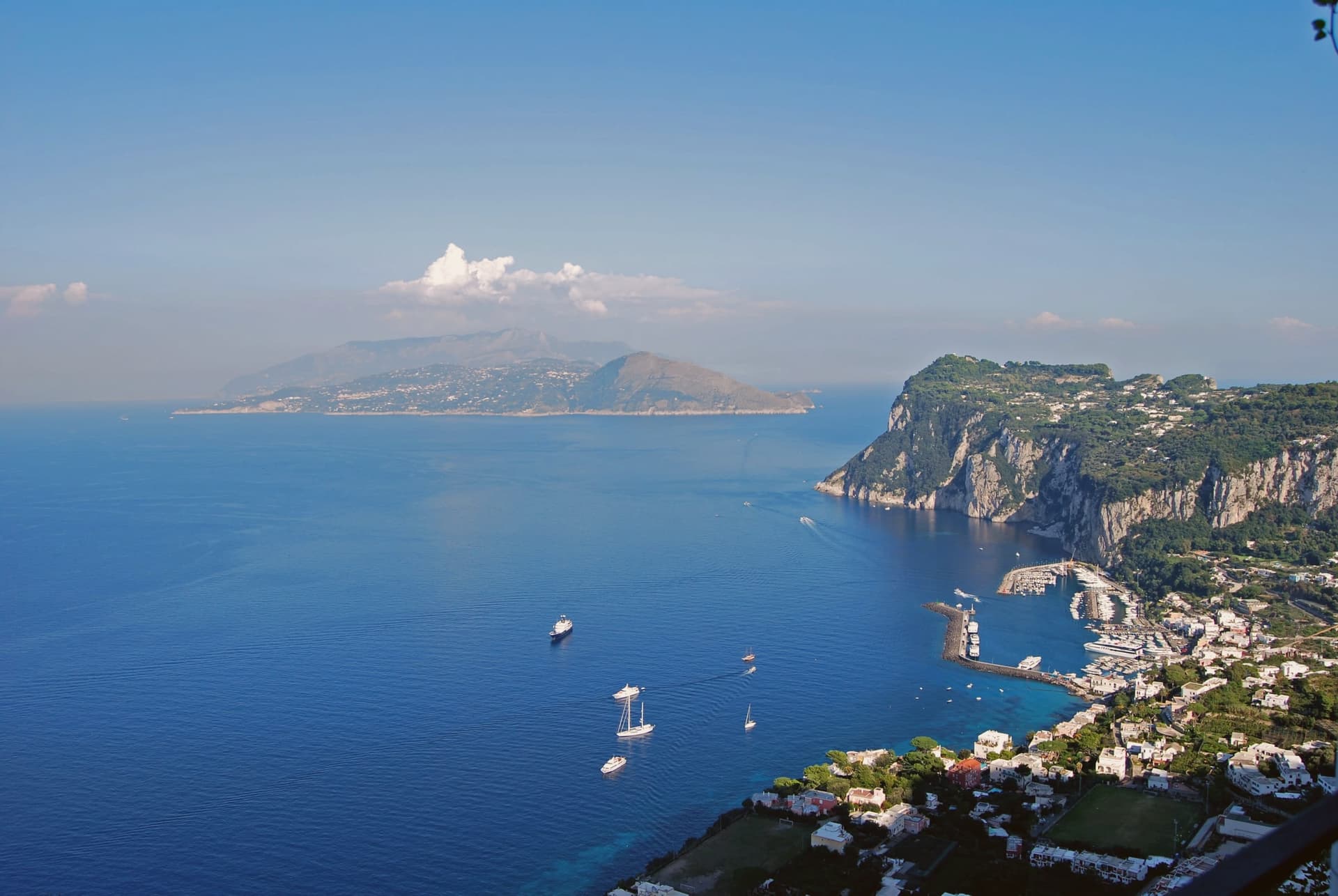
Why visit Anacapri
Anacapri occupies the western, higher plateau of Capri, about 150 meters above the harbour town, at 275 meters at the municipal centre and rising to 589 at Monte Solaro. The Ancient Greek prefix ana means up: the name simply says the upper one.
Until 1874 the only link between the two communes was a stairway of some 800 steps, cut by Greek settlers in the seventh or sixth century BC, not by Phoenicians despite what its common name suggests. In 1895 the Swedish physician Axel Munthe began building his villa on the ledge above those steps, on the ruins of one of Tiberius's residences and a tenth-century chapel.
His 1929 memoir turned the place into a literary destination. The two communes of Capri, one at sea level and one on the plateau above, were for centuries connected only by that stair cut into the rock, and a settlement reachable only on foot from its lower twin is a different kind of place than one arrived at by road.
L'Olivo, Da Gelsomina, Il Riccio and 2 more have been named by a guide.
What to see in Anacapri
- Villa San Michele. Neoclassical villa and garden with an antiquities collection and a granite Sphinx set over the harbour, facing east toward Vesuvius.
- Monte Solaro. Reached by a single-seat chairlift from Piazza Vittoria, the summit opens onto views across the whole of Capri.
- Faro di Punta Carena. Second-tallest lighthouse in Italy, built in 1862 and operational since 1867, at the southwestern tip of the island.
How to get to Anacapri
Our tip
May, June, September and the first half of October are the months Anacapri stays usable: blue water at Punta Carena, the Solaro chairlift running, and a degree or two cooler than Capri Marina below. July and August bring the day-trippers off the Naples and Sorrento ferries; the centro of Capri saturates by ten and Anacapri carries the spillover by lunchtime. Villa San Michele books out in advance.
Camerota
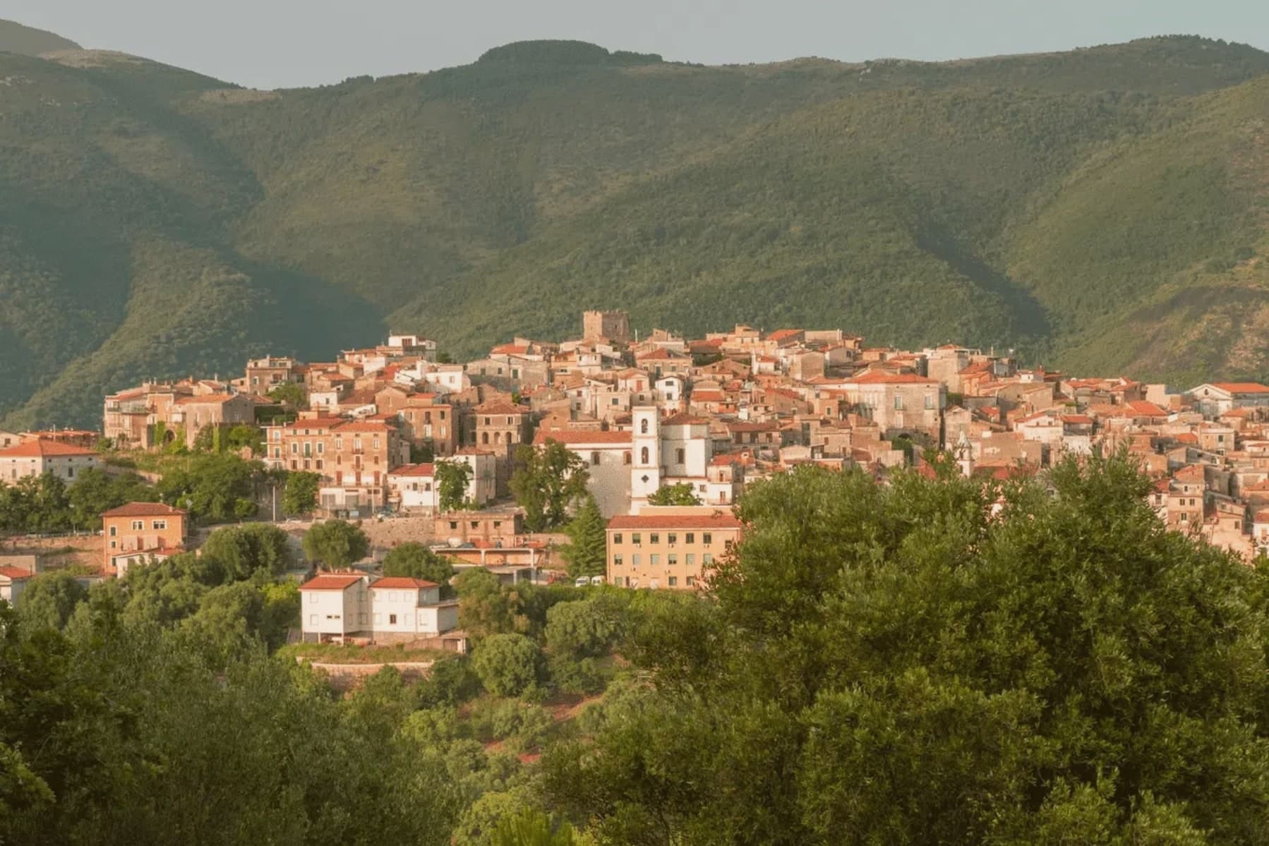
Why visit Camerota
Camerota's hilltop sits six kilometres inland from its own marina, with two further hamlets, Lentiscosa and Licusati, scattered between the summit and the sea, so the town is really four settlements bound to one name rather than a single center. That name probably comes from the Greek kamaròtos, curved, after the limestone arches worked into the coast below.
The hill above stays a medieval center, nearly empty through winter and full in August, its slopes also carrying Cilento DOP olive oil down toward the water. The coast beneath it is a different register entirely: fishing village, protected marine reserve, and a run of sea caves whose excavated layers reach back through the Chalcolithic to Neanderthal occupation, among the longest such sequences on the Tyrrhenian.
What holds the two together is the geography itself, a limestone hill giving its shape to both the arches that named it and the caves that preserved what lived along its shore.
What to see in Camerota
- Grotte di Marina di Camerota. Grotta della Cala and Grotta di San Biagio sit cut into the sea cliffs, reached along the coast rather than from the hilltop, the caves themselves unassuming from outside despite what has come out of them.
- Costa degli Infreschi e della Masseta. The marine area runs between the Marina and Scario, cold freshwater surfacing straight into the sea, a stretch reachable only on foot or by boat, with no road running along it.
- Castello Marchesale di Camerota. Norman in origin, remodelled under the Marchesi, standing on the highest point of the town with the Gulf of Policastro laid out below.
How to get to Camerota
Salerno is roughly 130 minutes away by road.
Our tip
May through September is the open Cilento beach season, with Marina di Camerota filling between late June and August and the boat trips to Cala Bianca and the Infreschi springs running daily. Mid-summer touches the high thirties; the hilltown at 422 meters stays a few degrees cooler and the cave temperature holds at sixteen all year. April and October are quiet and dry, the right window to walk the Bulgheria slopes and visit Grotta della Cala without queues. Gusto Italia falls in August.
Massa Lubrense
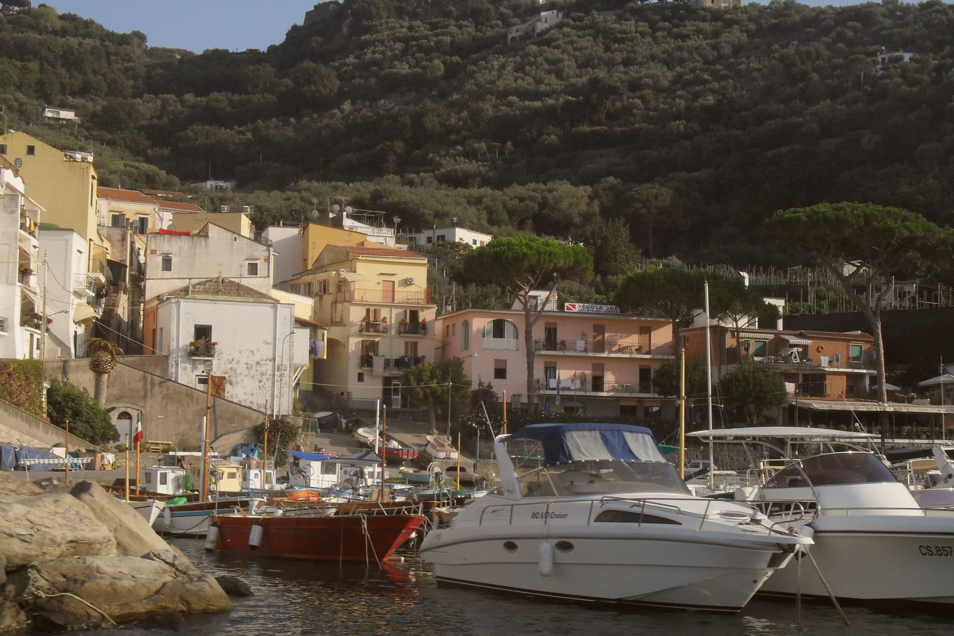
Why visit Massa Lubrense
Massa Lubrense holds the western tip of the Sorrentine Peninsula, the largest municipal area on the peninsula and the closest land to Capri, three nautical miles across the Bocche di Capri. The hilltop centro sits at 121 meters; the commune's eighteen frazioni spread between the Tyrrhenian and the Gulf of Salerno, including Termini, Nerano, Sant'Agata sui Due Golfi and the Marina della Lobra.
Punta Campanella, the cape at the end, has the remains of a Roman sanctuary of Athena and a sixteenth-century watchtower against Saracen raids; the surrounding sea is a protected marine area established in 1997. The commune holds a Bandiera Blu, a Spiga Verde, and Città dell'Olio status: the Penisola Sorrentina DOP olive groves climb the hills above the bays.
Spaghetti alla Nerano, courgette and provolone del Monaco, is the dish that came out of these kitchens in the 1950s.
Ristorante Antico Francischiello da Peppino, Quattro Passi, Relais Blu and 6 more have been named by a guide.
What to see in Massa Lubrense
- Punta Campanella. Cape at the western tip of the peninsula, with the ruins of a Roman sanctuary of Athena, a watchtower, and the marine reserve established in 1997.
- Marina del Cantone. Pebble bay at Nerano, Italy's largest pebble beach by some measures and the kitchen where spaghetti alla Nerano was created.
- Chiesa di Santa Maria della Lobra. Sixteenth-century mother church above the small Marina della Lobra, with a wooden coffered ceiling and a former Franciscan convent attached.
How to get to Massa Lubrense
Napoli is roughly 69 minutes away by road.
Our tip
May, June, September and early October are the months Massa Lubrense was built for. The water around Punta Campanella sits above twenty degrees, the marine reserve runs daily boat tours, and the Sentiero degli Dei from Bomerano descends through olive groves in stable weather. July and August are full: the parking at Marina del Cantone closes by mid-morning and the SS145 from Sorrento backs up.
Sessa Aurunca
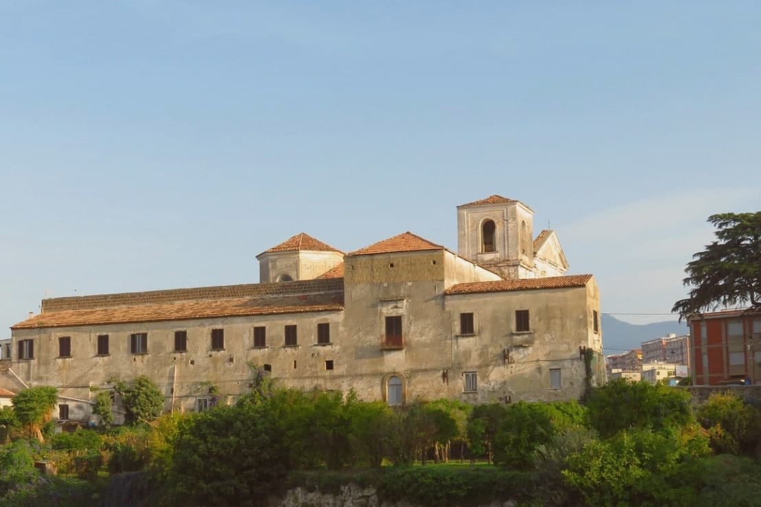
Why visit Sessa Aurunca
Sessa Aurunca sits at 203 meters on the southwest slope of the extinct volcano Roccamonfina, between the Garigliano river and the Aurunci hills, forty kilometers west-northwest of Caserta. The Aurunci, the Italic people who held this land before Rome, gave the town its name; the Latin colony of Suessa Aurunca was founded here in 313 BC on the road between Capua and Rome.
The Roman theater on the slope below the cathedral is one of the largest in southern Italy, with stage decoration found in the 2000s excavations now on display in the Castello Ducale. The Cattedrale dei Santi Pietro e Paolo was built in 1103 over an Augustan-era temple, with twelve antique columns in the nave, an ambon and Easter candelabrum covered in Cosmatesque marble inlay, and a Byzantine-influenced apse.
The commune is Città dell'Olio for the Aurunci olive groves, Città del Tartufo for the truffles of the Roccamonfina foothills, and lies on the Via Francigena del Sud between Rome and Brindisi.
What to see in Sessa Aurunca
- Cattedrale dei Santi Pietro e Paolo. Romanesque cathedral consecrated in 1113 with twelve antique columns, a Cosmatesque ambon and paschal candelabrum, and a Byzantine apse.
- Teatro Romano di Sessa Aurunca. First-century Roman theater on the slope below the cathedral, one of the largest in southern Italy, with sculpted stage decoration recovered after 2000.
- Castello Ducale. Medieval fortress rebuilt by the Lombards, the Normans and the Aragonese, now housing the civic museum with Roman finds from the theater.
How to get to Sessa Aurunca
There is a railway station in the town, so you can arrive without a car and never need one while you are here. Napoli is roughly 72 minutes away by road.
Our tip
April through early June and September into October are the strongest months. The Roccamonfina slopes green and the trails through the chestnut woods open. The Cattedrale opens longer hours and the Roman theater is walkable in shirt sleeves. Festa Popolare della Tammorra falls in July.
Ariano Irpino
Why visit Ariano Irpino
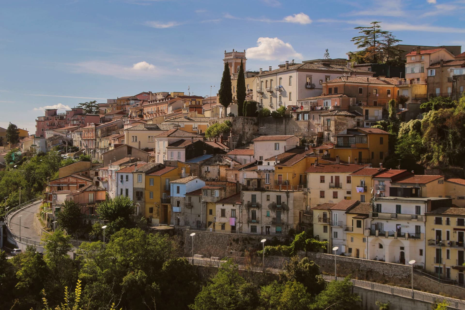
Ariano Irpino rises on three hills, Castello, Calvario and San Bartolomeo, at 788 meters above sea level, where the Apennines narrow into the pass between Campania and Apulia. The Lombards held it, the Normans rebuilt the castle, and in the summer of 1140 Roger II convened the Assizes of Ariano, the forty-clause legal code that unified Norman, Lombard, Byzantine, Latin canon, Muslim and Jewish law for the Kingdom of Sicily.
The cathedral, dedicated to the Assumption, was completed in its current form in 1736. Ariano's majolica, glazed ceramic made here in waves of style since the medieval period, hit its peak in the eighteenth century with eleven kilns and twenty-nine craftsmen; the Museo Civico e della Ceramica in Palazzo Forte holds more than 250 pieces from the fourteenth century forward.
Known as Ariano di Puglia until 1930, the town carries both the Città dell'Olio and Città della Ceramica designations.
Maeba Restaurant, La Pignata have been named by a guide.
What to see in Ariano Irpino
- Castello Normanno. Norman fortress on the highest of the three hills, anchor of the Assizes of Ariano in 1140 and the strategic pass between Campania and Apulia.
- Cattedrale di Santa Maria Assunta. Cathedral of the Ariano-Lacedonia diocese, completed in its current form in 1736 by bishop Filippo Tipaldi.
- Museo Civico e della Ceramica. Civic and Ceramics Museum in Palazzo Forte, over 250 majolica pieces from the fourteenth century onward, the record of Ariano's kiln tradition.
How to get to Ariano Irpino
There is a railway station in the town, so you can arrive without a car and never need one while you are here. Foggia is roughly 64 minutes away by road.
Our tip
May through October is the open season at 788 meters: warm days, cool nights, and clear air across the Ufita valley. July and August are tolerable up here while the Foggia plain bakes; the August Festa della Madonna fills the Tricolle. April and November are shoulder months with shifting weather.
More from Anywhere Italy
- The best olive oil towns within 90 minutes of Napoli
- The best olive oil towns within two hours of Salerno
- The best olive oil towns within two hours of Naples
 The best hidden beach towns in Campania
- The 6 best beach towns with a serious restaurant in Campania
 The best hidden towns worth staying overnight in Campania