
The best hill towns in the province of Terni
Southern Umbria stacks its towns upright. The ground here is tufa, travertine and limestone, quarried on the spot and piled into walls that hold the streets in place, so a lane arrives at a gate and then simply turns into a stairway. Below the walls sit olive terraces, oak and holm oak woods, and the wide green trench of the Tiber, and in late autumn the presses run and the new oil comes out of the frantoi peppery enough to catch the throat. The eating is inland and unshowy: strangozzi with tomato and garlic, wild boar in winter, black truffle shaved over eggs, mineral water bottled from the San Gemini springs, wines off the Orvieto and Amelia slopes. Spring brings broom and the smell of hot stone, and by August the shade on the north side of a hill town is worth walking uphill for.
Most people come to Umbria for Assisi, and the basilica earns its coaches. The town is a single ridge with one main street and a fixed set of doors, which means the pilgrim groups, the school trips and the day visitors from Perugia all funnel through the same few metres of stone at the same hours. Add the Cascata delle Marmore on a summer Sunday, when the sluice opens and the crowd forms for the release, and you have the Umbria that everyone photographs. It is worth seeing. It is also the version of the region with the longest queues and the least room to sit down.
The same hills carry on south, and they do not thin out. Between the Tiber and the Nera, out towards the Lazio border and up into the folds below the Martani range, the province of Terni holds one hill town after another, each on ground too steep to sprawl, each with its walls, its Romanesque church and its view down over the terraces. Fewer people go, which mostly means the bar has a free table at midday and the oil is sold by the people who pressed it. These are the towns on this list.
Of the 11 communes we have mapped in the province of Terni, 11 qualify as hill towns: each is an inland hill settlement built on ground too steep to spread. This list is 10 of them. The smallest, Lugnano in Teverina, has 1,428 residents.
Elsewhere in the catalogue: The best towns you can reach by train in the province of Terni and The 9 best hidden hill towns that eat well within 90 minutes of Terni.
Lugnano in Teverina
Why visit Lugnano in Teverina
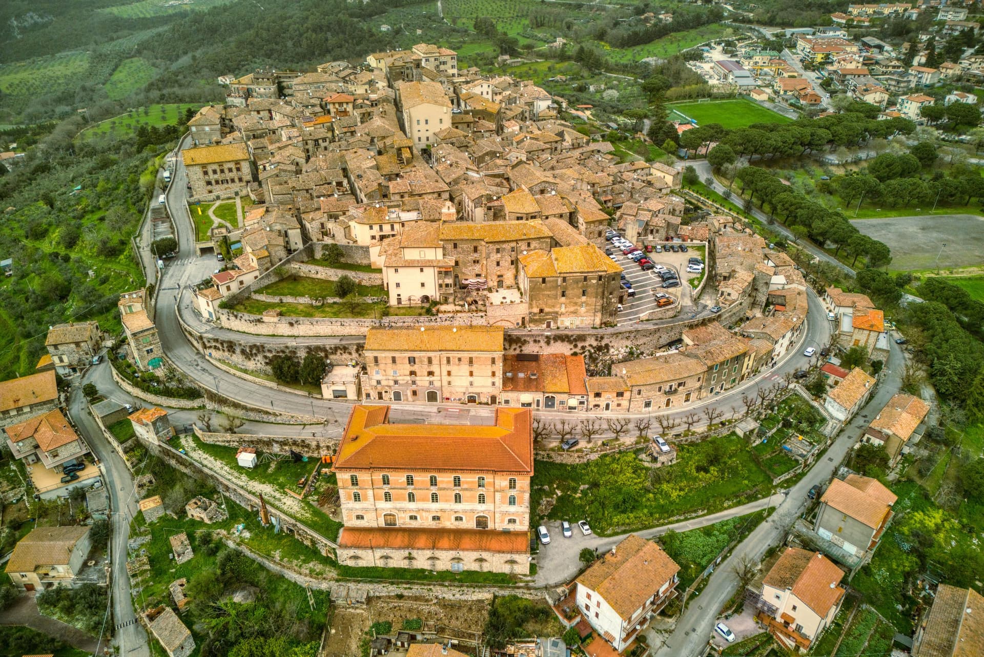
Lugnano in Teverina sits at 441 meters on a ridge above the Tiber, sixty kilometers south of Perugia and twenty-five west of Terni. The town traces its origins to the seventh century, when inhabitants fleeing barbarian invasions sought refuge on the spur after the destruction of nearby Luchiano.
The Collegiata di Santa Maria Assunta, dated 1230 on the inscription of its façade, is built in travertine from quarries by the Tiber, a Romanesque parish church layered over a Lombard-era predecessor, with a cosmatesque pavement and a portico of paired columns. On the hill below, the Villa Romana di Poggio Gramignano, built around the 10s BC, was excavated through the 1980s and again from 2016.
Beneath its collapsed roof archaeologists found a late-fifth-century cemetery of 47 infant and fetal burials, the largest set of child burials in Roman Italy, interpreted as a catastrophic die-off from Plasmodium falciparum malaria. The Olea Mundi olive collection, planted in 2014, holds 1,200 trees from 23 countries.
What to see in Lugnano in Teverina
- Collegiata di Santa Maria Assunta. Romanesque parish church dated 1230 in travertine from Tiber quarries, with cosmatesque pavement and a paired-column portico.
- Villa Romana di Poggio Gramignano. Augustan villa with a late-fifth-century cemetery of 47 infant burials, interpreted as a catastrophic malaria die-off.
- Palazzo Farnese-Ridolfi. Sixteenth-century palace known as the Pennone for its mast-like profile rising above the lower town.
How to get to Lugnano in Teverina
Terni is roughly 40 minutes away by road.
Our tip
April through June and September into October are the months that work. The Tiber valley below stays green into early summer, and the olive harvest carries through November when the Olea Mundi trees come into the frantoi. July and August are hot on the lower Tiber; the centro storico thins between three and six.
Montecchio
Why visit Montecchio
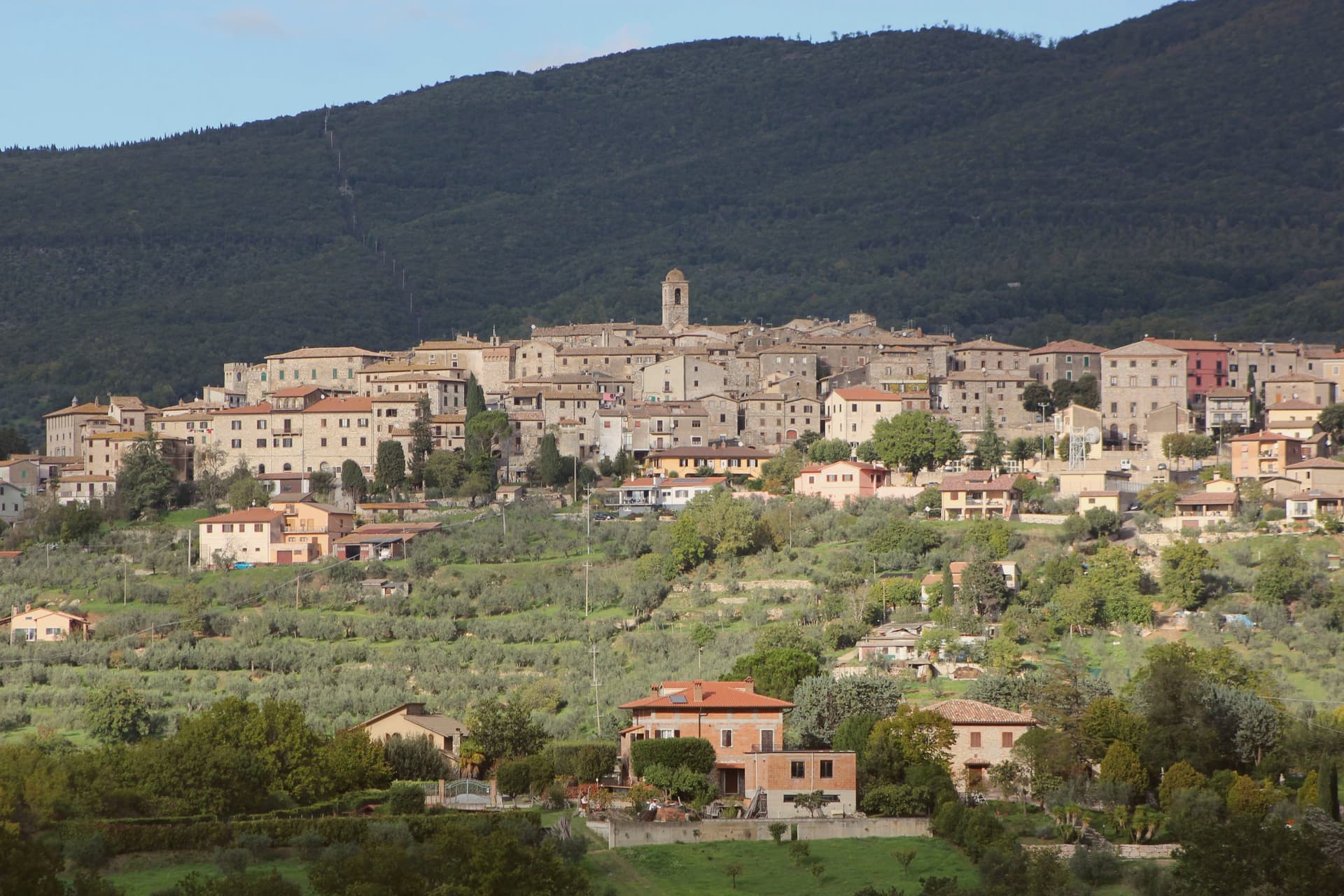
Montecchio sits at 377 meters on a ridge above the Tiber valley, fifty kilometers south of Perugia and thirty northwest of Terni. The territory was inhabited well before Rome: the Vallone di San Lorenzo, about five kilometers below the borgo, holds fifty chamber tombs carved into the soft calcarenite locally called matile, with strong ties to Etruscan Orvieto at its sixth-to-fifth-century BC peak.
The recovered artifacts, now in the Antiquarium of Tenaglie, document a wealthy pre-Roman community. The settlement of Montecchio is first documented in 1154; the castle was raised around 1165 by the Chiaravalle family and passed through the Alviano, Baschi, Colonna and Atti before becoming independent of Baschi in 1948.
Tenaglie, on the opposite ridge, is dominated by Palazzo Ancajani, built in the early 1700s on the foundations of an earlier fortification. The territory holds Borghi più belli, Città dell'Olio and Comuni Virtuosi standing together.
What to see in Montecchio
- Necropoli del Vallone di San Lorenzo. Pre-Roman necropolis 5 km below the borgo, 50 chamber tombs carved in matile rock with klinai-shaped benches, peak 6th-5th century BC.
- AMAT Antiquarium di Tenaglie. Archaeological museum in the Tenaglie frazione displaying the necropolis finds, with strong evidence of Etruscan Orvieto influence.
- Palazzo Ancajani (Tenaglie). Early 18th-century palace on a rocky ridge facing Montecchio, built by Filippo Ancajani over an earlier fortification.
How to get to Montecchio
Terni is roughly 57 minutes away by road.
Our tip
April through June and September into October are the months locals prefer. The necropolis trail through holm oak and juniper is at its best in spring, and the slopes above the Tiber stay golden into late autumn. July and August push temperatures past thirty-five degrees in the valley; the upper borgo holds the breeze and the tomb chambers stay cool year-round. Fiera della Castagna falls in the season.
Allerona
Why visit Allerona
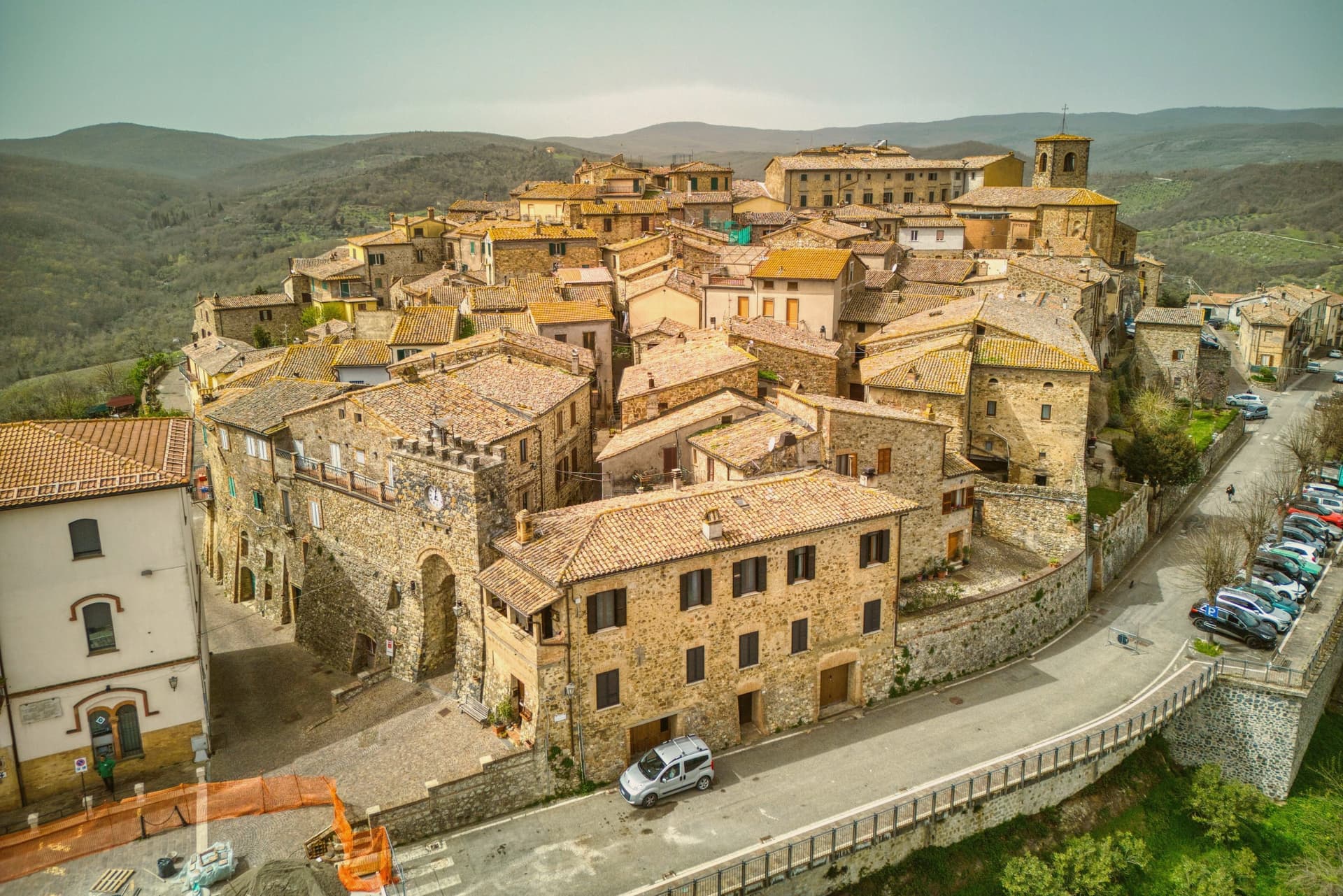
Allerona sits at 472 meters on a ridge between the Paglia valley and the Valdichiana, fifty kilometers southwest of Perugia and twenty north of Orvieto. The site was a Roman waystation called vicus Lerona, crossed by the Via Cassia and the Via Traiana Nova between Rome and Chiusi.
Paved sections and two milestones still surface in the surrounding fields. The medieval castle, built in 1275 by the Monaldeschi and Filippeschi families as Orvieto's northern bulwark, was destroyed at the end of the fifteenth century by Charles V and rebuilt afterward.
In 1595 the community freed itself from Orvieto and the Monaldeschi rule and wrote its own statutes. The centro storico keeps its original urban fabric: stone houses without plaster, two surviving gates called Porta del Sole and Porta della Luna, and a small grid of lanes that has not changed shape in five hundred years.
What to see in Allerona
- Chiesa di Santa Maria Assunta. Twelfth-century Romanesque church on the central square, renovated in neo-Gothic style 1892-1897 with terracotta pulpit and Viligiardi fresco cycle.
- Chiesa di San Michele Arcangelo. Twelfth-century church, the second pole of the medieval religious layout alongside Santa Maria Assunta.
- Borgo medievale. Unplastered stone houses, two surviving gates Porta del Sole and Porta della Luna, fragments of the 1275 Monaldeschi walls.
How to get to Allerona
Terni is roughly 75 minutes away by road.
Our tip
April through June brings the Paglia valley green and evenings cool enough to walk the ridge after dinner. September and October are the gold months. July and August reach into the mid-thirties in the lower valleys; the ridge at 472 meters stays a few degrees cooler, but the unplastered stone holds heat into the night and the centro storico empties between two and six.
Acquasparta
Why visit Acquasparta
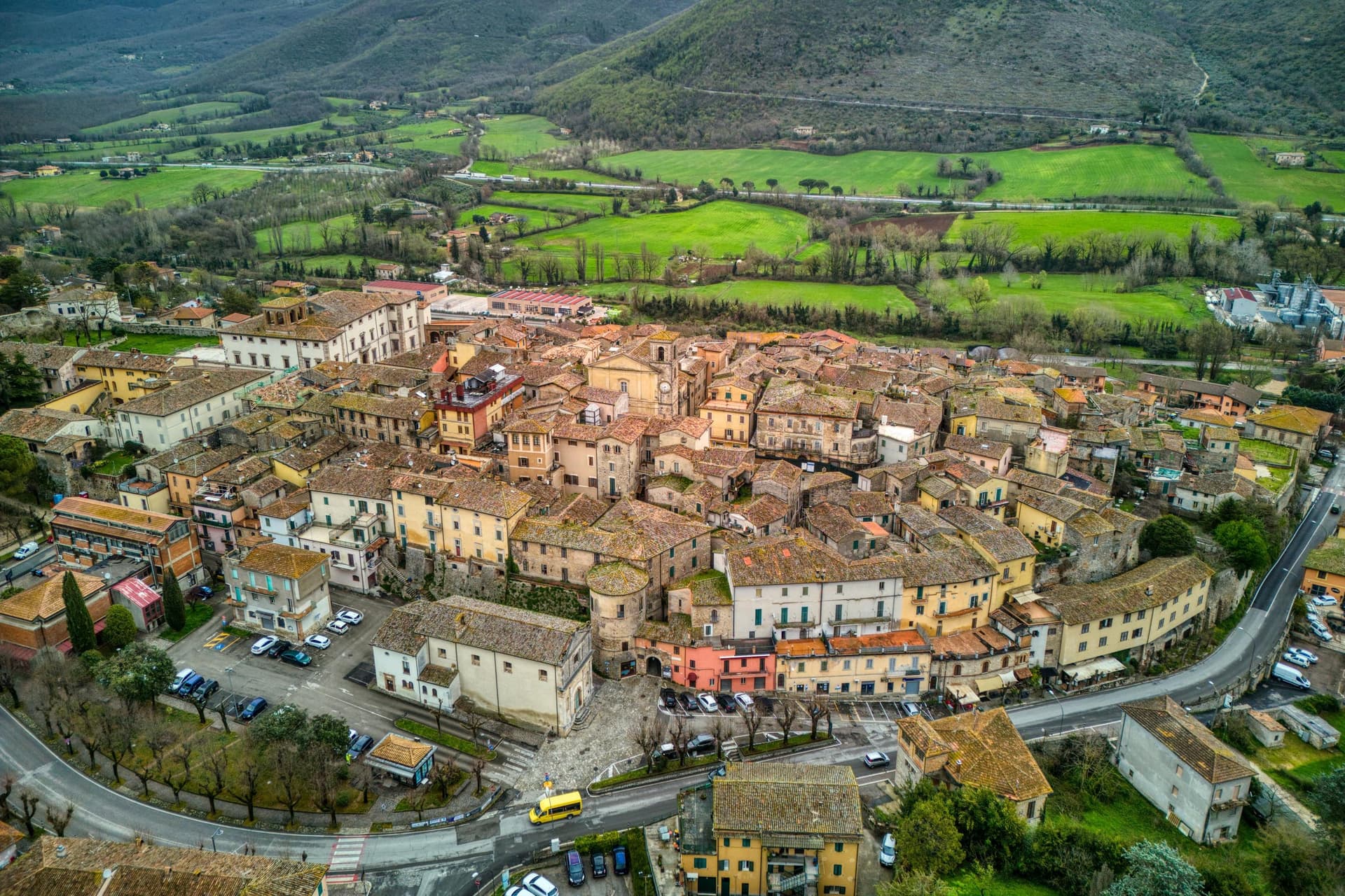
Acquasparta sits at 350 meters on a hill above the Naia valley, fifty kilometers south of Perugia and thirteen north of the UNESCO town of Spoleto. The medieval upper town is walled around the palace at its center, its lanes climbing toward the piazza named for Federico Cesi.
In 1588 Pope Sixtus V raised the territory to a duchy under the Cesi family, and it was Federico Cesi, the cardinal's descendant, who brought his young Accademia dei Lincei here from Rome in the early seventeenth century to convene around his cabinet of natural specimens: Galileo Galilei was among those who came, staying at the palace in 1624 to demonstrate his microscope. Outside the walls, the Furapane and Amerino springs draw on a different history, met by the Roman censor Flaminio in the second century BC and still bottled commercially now.
The town holds both threads at once, a duchy's palace turned briefly into a meeting place for the new science, and a valley whose waters were already known to antiquity. Together with the medieval upper town, they earned Acquasparta its listing among the Borghi più belli.
What to see in Acquasparta
- Palazzo Cesi. The architectural anchor of the centro storico, where the cabinet of natural specimens once gathered by Federico Cesi drew the Accademia dei Lincei into session.
- Centro storico. Medieval upper town walled around the palace, with narrow stepped lanes climbing toward Piazza Federico Cesi.
- Chiesa di Santa Cecilia. Main parish church near the palace, with a Renaissance interior and altarpieces from the Umbrian school.
How to get to Acquasparta
There is a railway station in the town, so you can arrive without a car and never need one while you are here. Terni is roughly 21 minutes away by road.
Our tip
April through June and September into October are the dependable months. The Stagione Lincea, a summer programme of conferences and concerts in Palazzo Cesi, runs through July and August around the legacy of Federico Cesi and Galileo. July and August are warm in the Naia valley but the palace and the centro storico hold shade well.
Stroncone
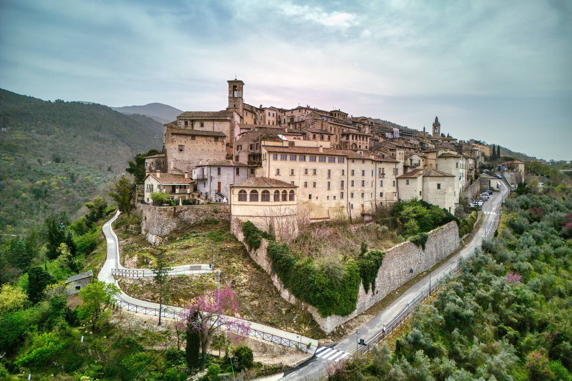
Why visit Stroncone
Stroncone sits at 451 meters on an olive-covered hill eight kilometers south of Terni, in the Conca Ternana on the western slope of the Apennine. The name traces to Duke Ugone of Spoleto, whose castrum Hugonis evolved through Castrugone and Strungone to the present form.
A group settled here around the tenth century and built a castle; Stroncone first appears in documents in 1012, when Giovanni di Pietro made a donation to the monastery of San Simeone. Pope Innocent III granted municipal self-rule in 1215.
The Convento di San Francesco, south of the walls, is one of the older Franciscan foundations in Umbria, founded by tradition by Francis himself in 1213, two years before papal recognition of the order. The medieval circuit walls remain almost complete, with the original gates framing a network of stepped lanes that climb to the small main square.
The Cammino di San Francesco passes through, picking up walkers between Rieti and Assisi.
What to see in Stroncone
- Convento di San Francesco. Franciscan convent south of the walls, founded by tradition by Saint Francis in 1213, two years before papal recognition of the order.
- Centro storico. Walled medieval core with original gates intact, climbing through stepped lanes to the small main square at the top of the hill.
- Chiesa di San Giovanni Decollato. Main parish church at the heart of the borgo, with frescoed interior and a Renaissance baptismal font.
How to get to Stroncone
There is a railway station in the town, so you can arrive without a car and never need one while you are here. Terni is roughly 18 minutes away by road.
Our tip
April through June and September into October are the months for Stroncone. Olive harvest carries the autumn rhythm into late November, and the frantoi work into the evening through October and November. July and August are warm in the Conca Ternana but the hill is high enough that nights cool quickly. Sagra De u Cecu Maritu falls in July.
San Gemini
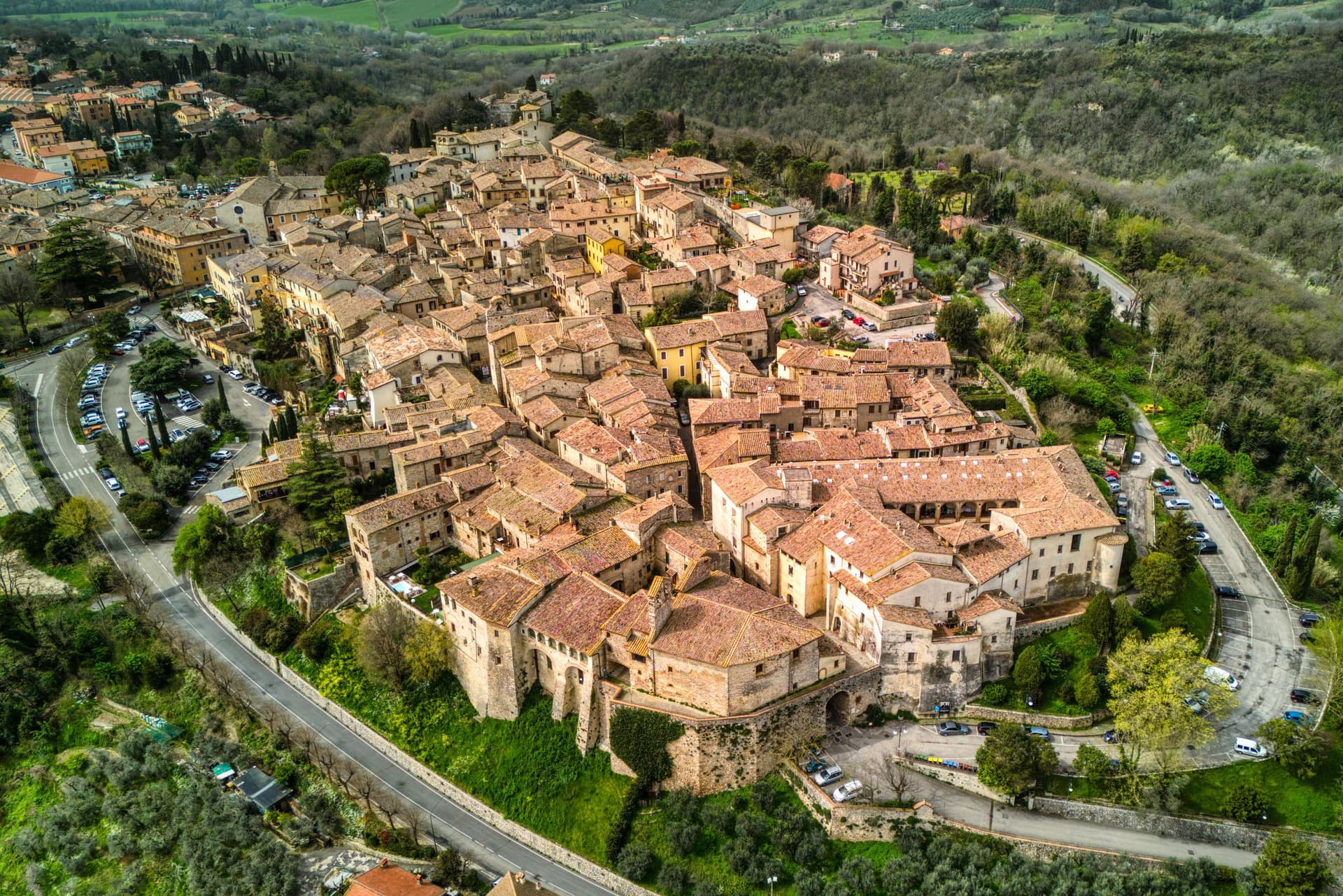
Why visit San Gemini
San Gemini sits at 337 meters on the southern slope of the Monti Martani, ten kilometers northwest of Terni. The archaeological park to the north preserves a stretch of polygonal Roman paving, a gate or honorary arch, an amphitheater, mosaic floors and the remains of an aqueduct, all part of a municipium abandoned probably after an earthquake.
The mineral springs rise just outside the populated centre, close enough that the town and the water source share the same ground without sharing a single street. The walled core steps down the slope in two halves that still define the town's rhythm: the district built around the old fortified height and the district gathered around the main square, each fielding its own team when the joust between them runs its course every year.
The cathedral, rebuilt in the nineteenth century but keeping a portal a great deal older, and the Gothic church on the square, each anchor their own end of the settlement. The Corpus Domini Infiorata blankets the procession route with petal mosaics nine weeks after Easter.
A hill town this size holding a Roman ruin, a bottled spring and a rivalry that still stages a joust suggests a place where the past was never cleared away to make room for the present, only built alongside it.
What to see in San Gemini
- Parco Archeologico di Carsulae. Roman municipium four kilometers north of San Gemini, with the Via Flaminia paving, the Arco di San Damiano, amphitheater and aqueduct remains.
- Chiesa di San Francesco. Thirteenth-century Gothic church on the main square, single nave with pointed arches, alongside Palazzo Canova.
- Duomo di San Gemine. Originally twelfth-century late Gothic cathedral, rebuilt in the nineteenth century by Livoni with consultation from Antonio Canova, keeping a fifteenth-century portal.
How to get to San Gemini
There is a railway station in the town, so you can arrive without a car and never need one while you are here. Terni is roughly 16 minutes away by road.
Our tip
April through June and September into October are the dependable months. The Infiorata di Corpus Domini covers the procession route with petal mosaics nine weeks after Easter, usually early June. The Giostra dell'Arme runs over two weeks at the end of September into early October, the rioni in fifteenth-century costume, the joust in the main piazza. Giostra dell'Arme falls in September.
Amelia
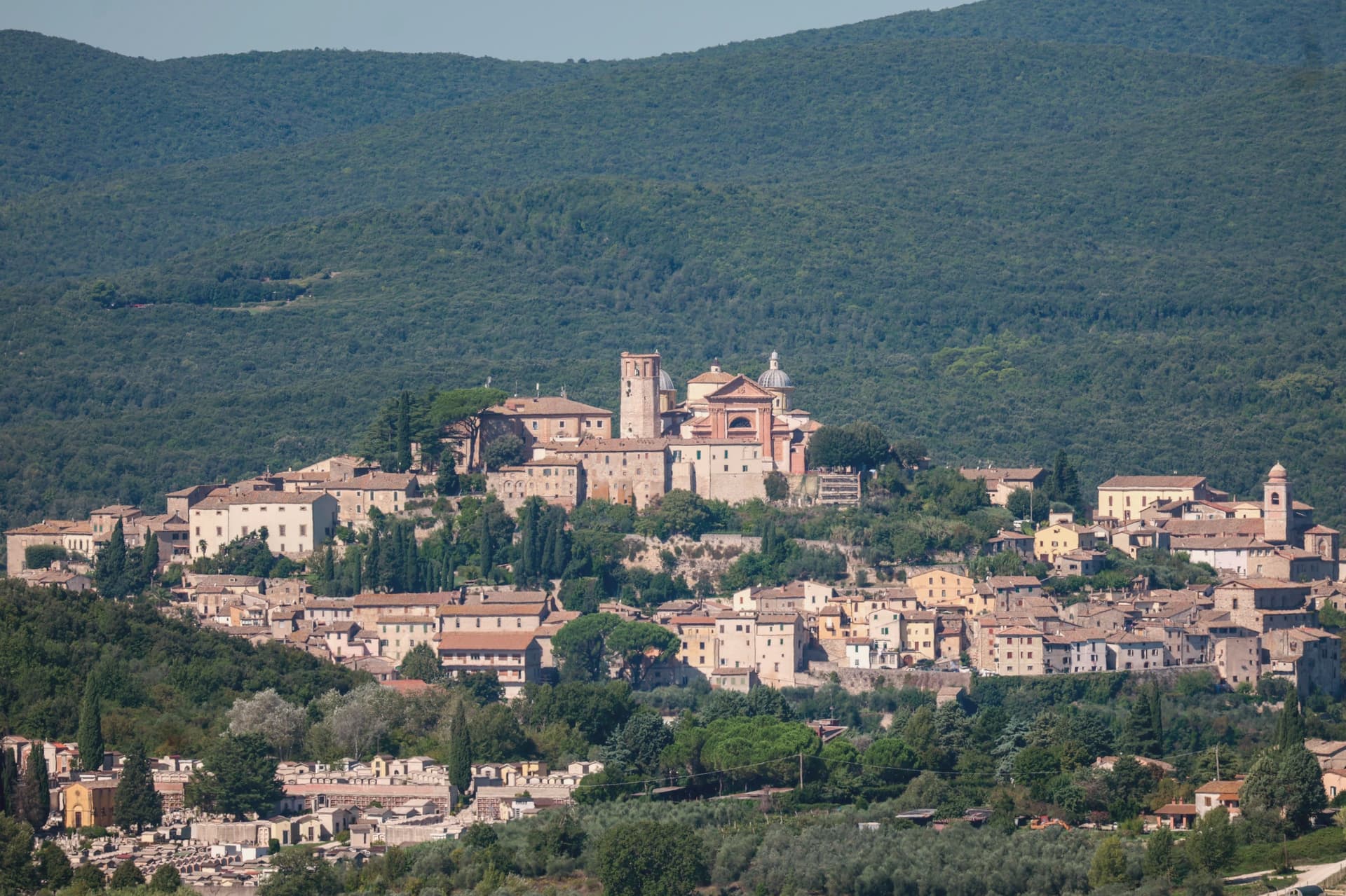
Why visit Amelia
Amelia sits on a hill between the Tiber and the Nera, sixty kilometers south of Perugia and close to the Lazio border. The walls that ring the town predate the Roman conquest, and when Amelia later became a Roman municipium, the town built outward and downward at once: terraces and roads above ground, and below the main square, a system of parallel cisterns cut to hold the settlement's water.
The gate on the old Via Amerina still marks the approach from outside, its current travertine form the result of sixteenth-century rework. Just beyond it, a bronze cuirassed general over two meters tall lay buried until 1963, when it surfaced and was moved into the town's archaeological museum.
The cathedral at the upper end of the centro storico carries its own layer of history, re-dedicated in the ninth century under a pope, and stands apart from the defensive and civic works that dominate the rest of the town's fabric. Amelia joined the Cittaslow network in 2004, and each summer the chamber-music festival founded in 1968 turns the town's attention outward to a different country's repertoire.
The town's layers sit on top of each other rather than beside each other: pre-Roman defense, Roman engineering, medieval faith, and a modern festival calendar all occupying the same small hill in sequence.
What to see in Amelia
- Mura poligonali. Up to 6 meters high in places, the blocks fitted without mortar along the line that still defines the edge of the old town.
- Cisterne romane. The chambers measure 57.5 by 19.6 meters and sit directly beneath the paving of Piazza Matteotti, invisible from the square above.
- Duomo di Santa Firmina. Cathedral re-dedicated to Saint Firmina around 872 under Pope Adrian II, at the upper end of the centro storico.
How to get to Amelia
Terni is roughly 33 minutes away by road.
Our tip
April through June and September into October are the working months: dry air, light on the polygonal walls, evenings on the Cittaslow corso. The Festival delle Nazioni runs late August into early September and draws audiences from Rome and beyond. July and August reach the mid-thirties; at 406 meters the centro storico breathes better than the Terni basin but afternoons still empty. Palio dei Colombi falls in July.
Narni
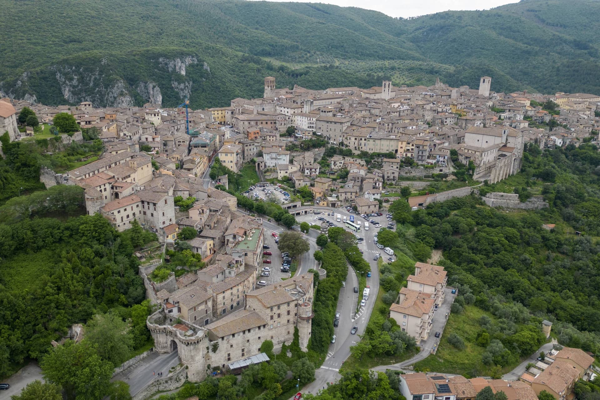
Why visit Narni
The old town sits on a travertine outcrop 240m above the Nera valley, and its Roman name came from the Nar, the river's older name before it became the Nera. Lewis read the word in an atlas as a boy and kept it for thirty years before it resurfaced in his fiction; he never visited, and the resemblance stops at the name, though the comune now runs an annual 'Le notti di Narnia' summer festival and a small themed museum around the connection.
The marker for the geographical centre sits at the foot of the old town, on the side of the road below the centro, a fact of surveying rather than of history, and it sits oddly alongside the older Roman and medieval claims the town makes on the visitor. The town itself reads in layers.
At the summit is the Piazza dei Priori, a medieval set-piece anchored by the 13th-c Palazzo dei Priori, and near it the Cattedrale di San Giovenale, 12th-c Romanesque with a 14th-c Gothic façade added later. Also at the high point stands the papal fortress built for a cardinal in 1370, square in plan with four corner towers, looking down over the valley where the Nera meets the Tiber.
Below the centro, where the ground drops toward the river, is where the Roman bridge crossed at height before losing all but one arch, a crossing later painted by both Corot and Turner. The horse-jousting pageant between the town's three terzieri, Mezule, Fraporta, and Santa Maria, runs on the second Sunday of May and has done, in its current form, since 1371, older than the fortress above it.
Underneath the town, reached through an ordinary-looking church, is a sealed underground world of cells and a former torture chamber that has nothing to do with any of the above except that it was carved into the same hill, found again only by accident in the twentieth century. The food follows the same logic as the setting: strangozzi with truffle, since Narni sits on the edge of the Valnerina truffle zone, along with porchetta, pecorino, and the local Ciliegiolo and Sangiovese.
What holds it together is verticality: a town built up along a ridge and then, unknown to most who walk through it, dug down, so that the fortress at the top, the bridge at the base, and the cells beneath are all separated by the same hill that gives the valley its view.
What to see in Narni
- Narni Sotterranea. The complex sits under the Chiesa di San Domenico: church, cells, and torture chamber, found by accident by local cavers. The graffiti on the cell walls includes a complete personal-symbology code left by a Freemason inmate that took decades to work out.
- Rocca Albornoz. The fortress occupies the high point of the town: square plan, four corner towers, and a view across the valley where the Nera meets the Tiber.
- Ponte d'Augusto. What remains is one arch of a bridge that once crossed the Nera at 60 metres height. Corot painted it in 1826, Turner in 1819.
How to get to Narni
There is a railway station in the town, so you can arrive without a car and never need one while you are here. Terni is roughly 17 minutes away by road.
Our tip
Narni is best April–June and September–October. The Corsa all'Anello on the second Sunday of May is the year's headline event — book accommodation 2 months ahead. Summer is hot in the Tiber valley but the 240m elevation gives some relief. Sagra della Pizza al Forno falls in July.
Orvieto
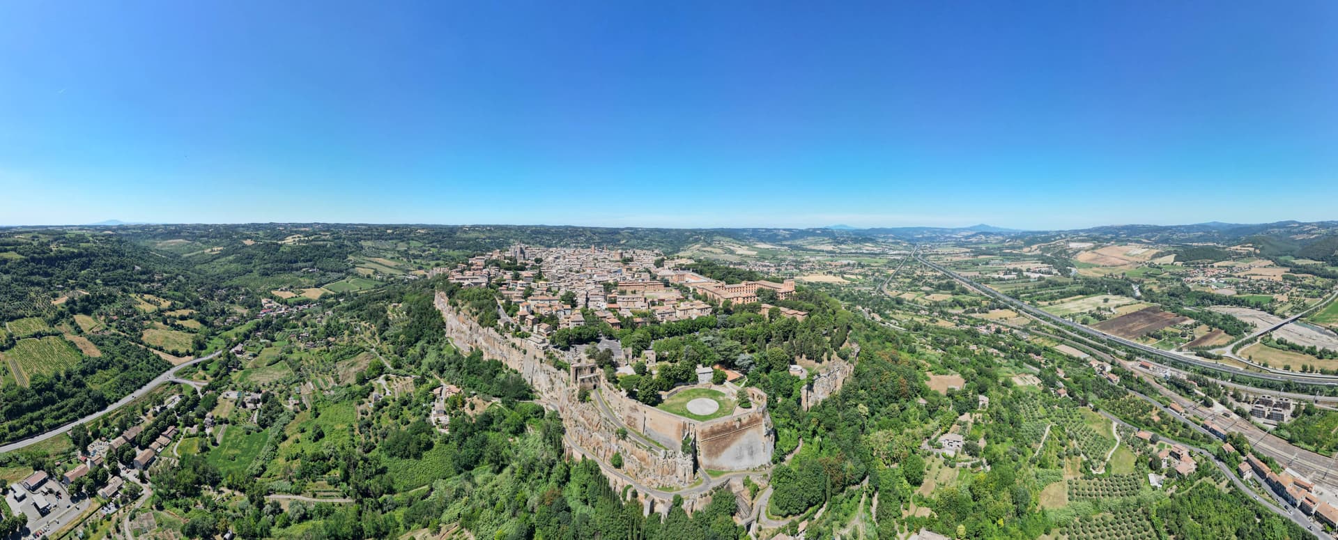
Why visit Orvieto
Orvieto sits on a flat-topped butte of volcanic tuff at 325 meters, the cliffs 195 meters above the surrounding plain. The town began as Velzna, a flourishing Etruscan metropolis, and the Romans destroyed it in 264 BC.
The medieval town that replaced it on the same plateau became a papal refuge in the 13th century, when popes left Rome for the safety of the height. The town's layers sit one below the other rather than side by side: the cliff face is honeycombed with Etruscan and medieval cavities, cisterns and pigeon roosts cut into the same tuff that the necropolis at its foot was carved into during the 6th century BC, while the cathedral and its chapel occupy the surface above, and the well descends back down through the rock to reach water.
What looks from a distance like a single stone crown is in fact three towns stacked in the same column of tuff: the dead below, the popes and their cathedral on top, and a passage cut straight through the middle to keep the town supplied.
What to see in Orvieto
- Duomo di Orvieto. The polychrome marble façade rises in tiers of mosaic and sculpture, the decorative Gothic worked into bands of color rather than left plain stone.
- Cappella di San Brizio. The Last Judgment fills the chapel wall to wall, figures twisting and falling across the vault and lunettes inside the cathedral.
- Pozzo di San Patrizio. Sunk for Pope Clement VII, the shaft drops 53 meters, lit by windows cut into the walls of the two ramps so the descent is never dark. Antonio da Sangallo the Younger designed it to move water and mules at once, without either crossing the other's path.
How to get to Orvieto
There is a railway station in the town, so you can arrive without a car and never need one while you are here. Terni is roughly 56 minutes away by road.
Our tip
April through June and September into October are the months for Orvieto. The plateau holds the long light, the Paglia valley below is green or gold, and the white wine of the surrounding vineyards is poured at every osteria. Umbria Jazz Winter runs around New Year and fills the Teatro Mancinelli; the Corpus Domini procession on the second Sunday after Pentecost is the most concentrated religious event of the year. Anticamente a Orvieto falls in the season.
Terni
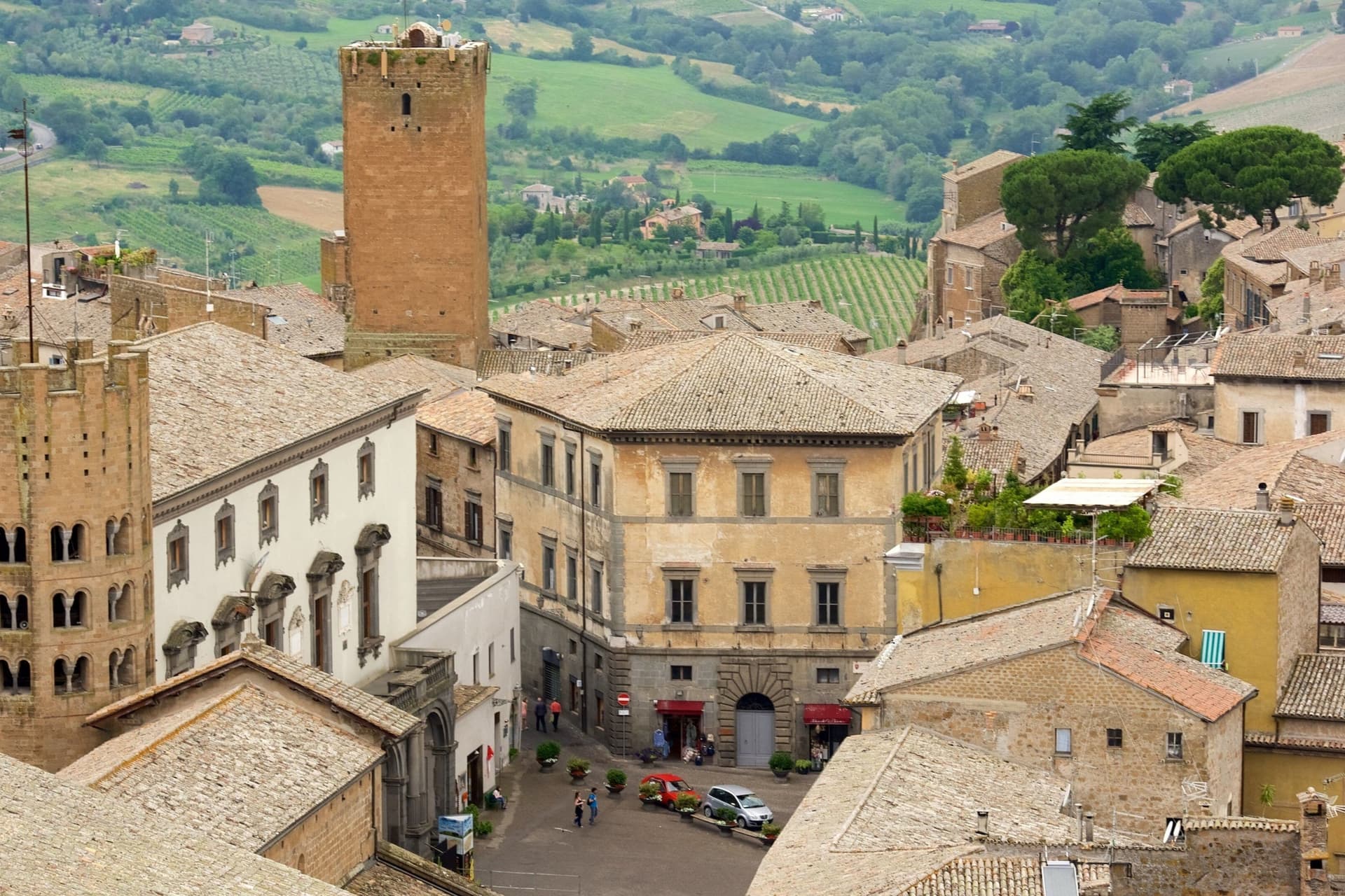
Why visit Terni
Terni is the Roman Interamna, the town between two rivers, and it shows its history in layers. The Anfiteatro Fausto of 32 AD sits in the city park, the Duomo keeps a sixth-century crypt, and Palazzo Spada, the town hall, may be the last work of Antonio da Sangallo the Younger.
From the nineteenth century the water of the Nera drove steelworks, arms factories and jute mills, and that made Terni a target: Allied raids from August 1943 destroyed or damaged 40 percent of its buildings. The 12,000-ton steel press in Piazza Dante is the city's own monument to that past.
Terni is also the city of Saint Valentine, its third-century bishop, whose basilica on the edge of town holds his remains. Seven kilometers up the Valnerina, the Romans cut a channel through the cliff at Marmore in the third century BC and made a waterfall of 165 meters.
Lake Piediluco lies just beyond it, and the ruins of Carsulae sit on the Via Flaminia to the north.
What to see in Terni
- Cascata delle Marmore. Falls of 165 meters made by the Romans to drain the Rieti plain. The water is released on a timetable, so check the opening hours before going.
- Basilica di San Valentino. Built on the hill where followers buried the town's bishop after his martyrdom in 273; the present church dates from 1618 and keeps his remains.
- Anfiteatro Fausto. Roman amphitheater of 32 AD in the park of La Passeggiata, with walls of two-tone reticulated stonework.
How to get to Terni
There is a railway station in the town, so you can arrive without a car and never need one while you are here. Perugia is roughly 69 minutes away by road.
Our tip
Terni works in any season. February is the city's month: the feast of San Valentino on the 14th fills the basilica and the streets around it. Spring and summer are when the Cascata delle Marmore runs most often, since the water is released on a timetable, and on 1 May the Cantamaggio parades decorated floats through the center to welcome the season. Fiera del Disco falls in the season.
More from Anywhere Italy
- The best towns you can reach by train in the province of Terni
 The 9 best hidden hill towns that eat well within 90 minutes of Terni
 The 10 best hidden hill towns you can reach by train within 90 minutes of Terni
 The best hill towns with a food festival within 90 minutes of Terni
- The prettiest villages you can reach by train within 90 minutes of Terni
 The best towns you can reach by train that eat well within 90 minutes of Terni