
The prettiest villages you can reach by train within 90 minutes of Terni
The country around Terni is stone and water. Travertine quarried nearby gives whole village walls their pale grey weight, while further west the tufa of the Tiber valley makes façades that look softer, warmer, almost sandy. Between them run olive terraces that go silver in the wind and produce oil pressed cold in late autumn, poured over bruschetta in bars that also serve strangozzi with black truffle from the hills above the Nera. Spring brings wild asparagus onto the menus, autumn brings mushrooms and the smell of woodsmoke, and the regional trains keep running through both.
Almost everyone arriving in this part of Umbria is heading for Assisi, and the basilica earns the crowd it gets. Coaches stack up below the walls from morning, the main street funnels visitors past the same window displays, and by midday the town belongs to groups following a raised umbrella. Orvieto absorbs another share, and Perugia the rest. All three are worth the time, and all three are busy in a way that flattens what makes a small Umbrian town feel like itself.
The same hills, the same travertine, the same oil and the same trains continue well past those stops. The villages here sit on the Rome to Ancona line, the Orte branches and the short local runs out of Terni, close enough that a morning departure gives you a whole day in a place where fewer people go. Each has passed the national assessment of Italy's most beautiful villages, and we have confirmed each can be reached without a car.
Of the 36 communes we have mapped within 90 minutes of Terni, 8 qualify as prettiest villages you can reach by train: each has passed the national assessment of Italy's most beautiful villages, and we have confirmed each is reachable without a car. The smallest, Vallo di Nera, has 345 residents.
Two more lists worth reading alongside this one: The 10 best hidden hill towns you can reach by train within 90 minutes of Terni and The 10 prettiest hidden villages you can reach by train in Umbria.
Vallo di Nera
Why visit Vallo di Nera
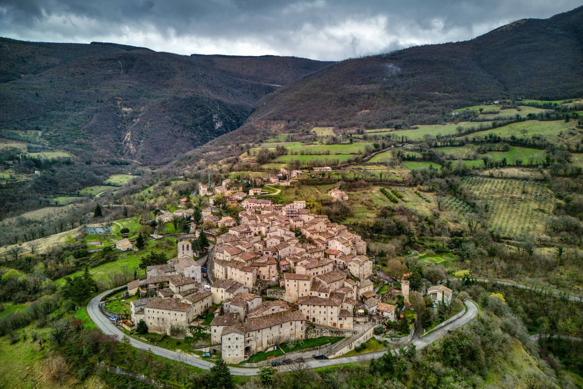
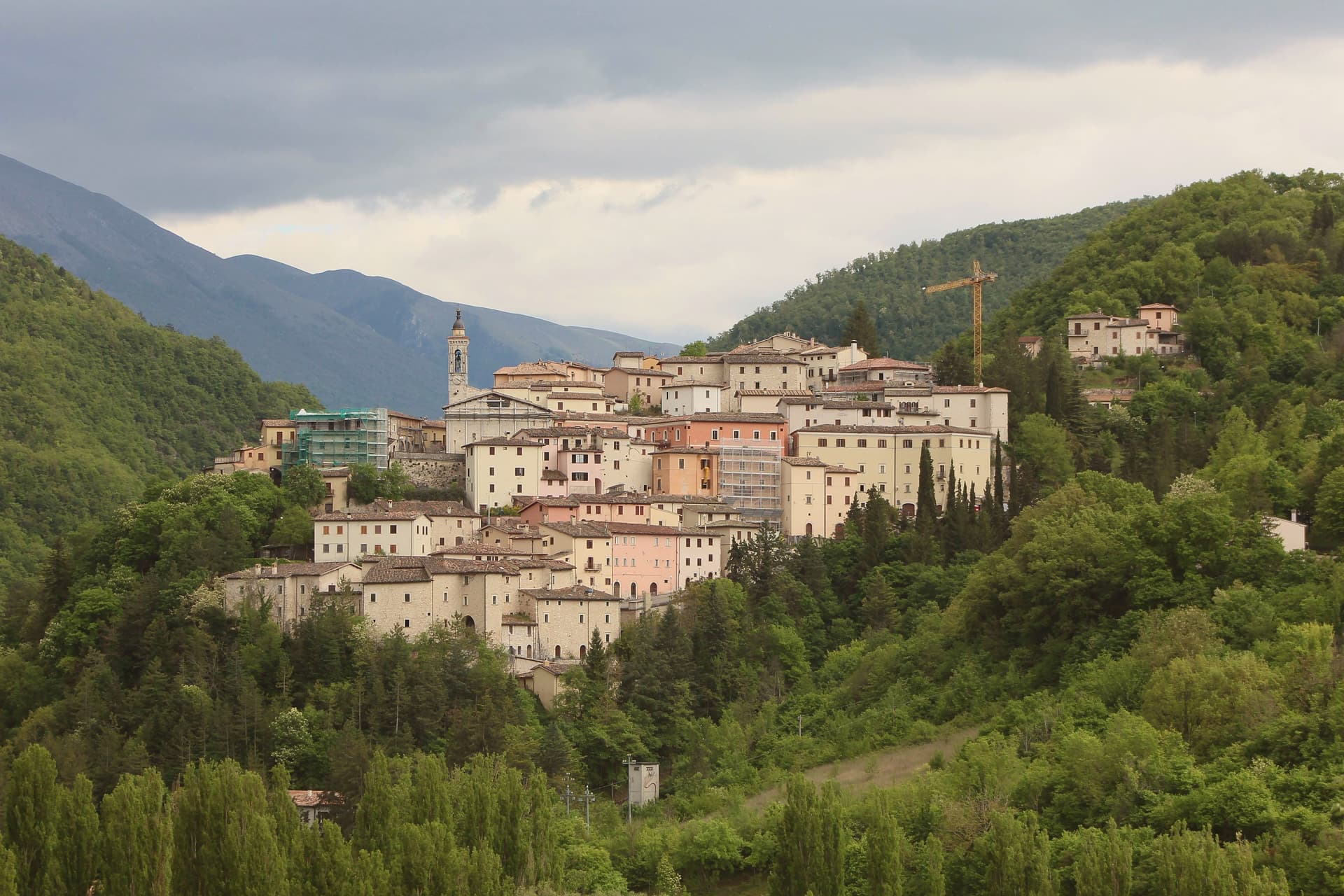
Vallo di Nera sits at 467 meters on a spur of the upper Valnerina, above the Nera river. The town of Spoleto granted the men of Vallo permission to build a castle here in 1217, on the hill where an earlier fortress had stood; the stone houses, the walls and the two symmetrical gates, Portella and Portaranne, have barely changed in eight centuries.
Inside, the village climbs in concentric rings to the Chiesa di Santa Maria Assunta at the top, built in 1176 and given to the Franciscans in the 13th century, who turned a defensive tower into a bell tower and frescoed the apse with a cycle of the Giotto school dated 1383. The Procession of the Whites, traceable to 1401, still leaves the church each year.
The population today is 345, smaller than at any point in the medieval records. Black truffle from the woods above and olive oil from the slopes down to the river are the surviving trades.
We confirmed you can reach this one by train.
What to see in Vallo di Nera
- Chiesa di Santa Maria Assunta. Built 1176, Franciscan from the 13th century, with frescoes of the Giotto school dated 1383 in the apse, by Cola di Pietro da Camerino among others.
- Medieval walls. Twelfth-century walls and towers still encircle the village, with two original symmetrical gates, Portella and Portaranne.
- Centro storico. Light stone houses leaning against each other on three concentric rings, with embrasures, narrow alleys and stone portals preserved since 1217.
How to get to Vallo di Nera
There is a railway station in the town, so you can arrive without a car and never need one while you are here. Terni is roughly 53 minutes away by road.
Our tip
April through June and September into October are the months for Vallo di Nera. The Valnerina is green, the Nera river runs cold, and the trails up to Sellano or down to Scheggino are walkable. July and August push the valley into the mid-thirties; the stone houses hold their cool but most of the 345 residents close shutters between two and six.
Greccio
Why visit Greccio
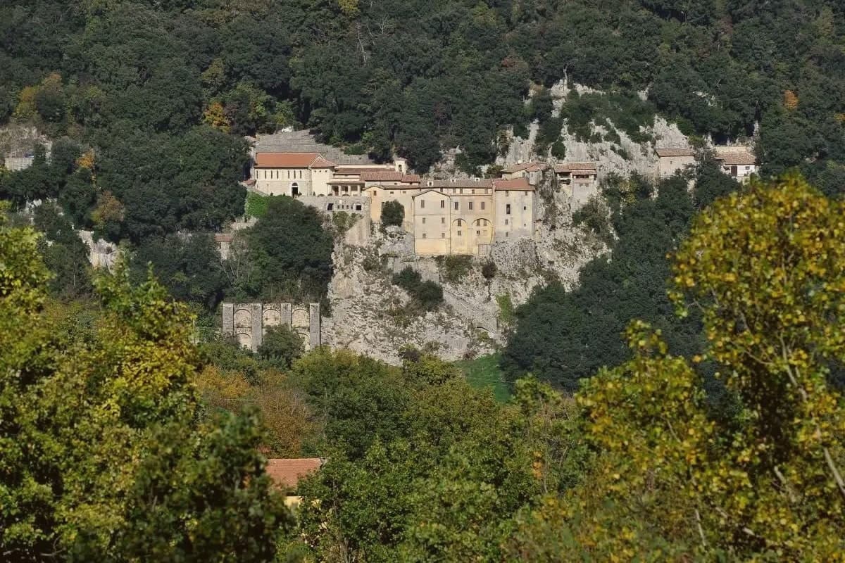
Greccio sits at 705 meters on a forested ridge above the Rieti valley, fifteen kilometers from Rieti in the Sabina. Francis of Assisi came here in December 1223, recalling his pilgrimage to Bethlehem fifteen years earlier, and asked the local lord Giovanni Velita for a cave where he could stage a representation of the Nativity.
On Christmas Eve the friars and villagers gathered in the rock chamber with a manger, an ox and a donkey; one of the friars said Mass and Francis preached. Greccio has been making versions of that scene every Christmas for eight centuries, and the Cappella del Presepio was built into the cave itself in 1228, the year of Francis's canonisation.
The medieval village runs along the ridge above the sanctuary, separated from it by the wooded slopes of the Monte Salto del Cieco reserve, so the walled center and the cave church remain two distinct places linked by a single climb through beech and oak woodland. Greccio is one of four shrines forming the Sacred Valley of Rieti, and the arrangement of a hilltop village standing apart from its own founding cave is what gives the place its shape: a settlement that grew beside a site it did not begin as, built to keep watch over a single night eight centuries old.
We confirmed you can reach this one by train.
What to see in Greccio
- Santuario Francescano. Sanctuary built around the rock chamber where the manger, ox and donkey were assembled, its Cappella del Presepio carved directly into the cave wall.
- Museo Internazionale del Presepio. Crèches and presepi from cultures across the world, gathered inside the sanctuary complex.
- Centro storico medievale. Walled medieval village on the ridge above the sanctuary, with stone houses, vaulted passages and the original village gates.
How to get to Greccio
There is a railway station in the town, so you can arrive without a car and never need one while you are here. Terni is roughly 28 minutes away by road.
Our tip
May through September is the main outdoor window at 705 meters. The Rieti valley is green into June and the cool ridge stays workable through midsummer. October draws walkers for the autumn colour in the Salto del Cieco reserve.
Magliano Sabina
Why visit Magliano Sabina
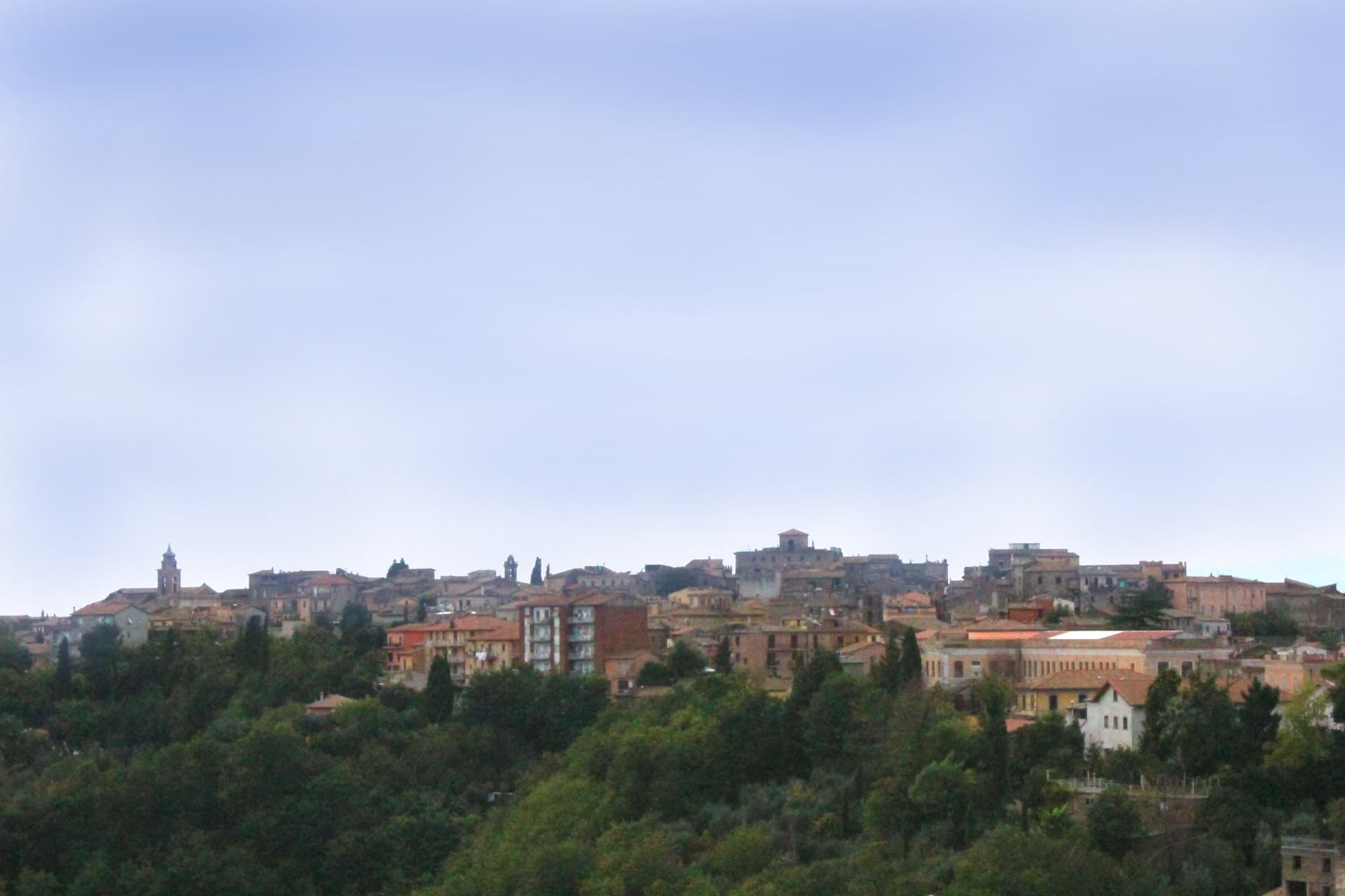
Magliano Sabina sits at 222 meters on a terrace above the Tiber valley, fifty kilometers north of Rome on the border between Lazio and Umbria. The hill above the river was Sabine ground; the Roman town of Ocriculum, just across in modern Umbria, was the regional anchor.
The medieval centre grew up under the Benedictine abbey of Farfa and passed to the Holy See in the fourteenth century, and the diocesan seat later moved up from the older episcopal site at Vescovio, in the comune's own territory, to the town's upper church. The upper town, walled and gathered around the Palazzo Comunale and the cathedral, occupies the terrace edge; the Vescovio remains lie apart in the surrounding countryside, marking where the diocese first sat before the seat moved uphill into Magliano itself.
From the ridge the ground gives way west to the Tiber and then climbs into Monte Soratte on the far bank, a view that alone earned the town membership in the Borghi più belli d'Italia in 2003. The town's standing, then, rests less on any single monument than on the relation between an old river crossing, an abbey's authority, and a line of sight that has drawn notice since antiquity.
We confirmed you can reach this one by train.
What to see in Magliano Sabina
- Cattedrale di San Liberatore. The cathedral stands on Piazza Duomo, its stone façade the dominant note of the square and the seat around which the diocese has organized itself since the medieval period.
- Chiesa di San Pietro. Twelfth-century Romanesque church, one of the oldest standing buildings in town, with its original masonry preserved.
- Centro storico. Medieval upper town on the Tiber terrace, with the Palazzo Comunale, the diocesan seat and surviving sections of the village walls.
How to get to Magliano Sabina
There is a railway station in the town, so you can arrive without a car and never need one while you are here. Terni is roughly 41 minutes away by road.
Our tip
April through June and September through October are the strongest months in the Tiber valley. The Sabine olive country is green in spring and the panorama toward Monte Soratte opens cleanest after rain clears the haze. July and August touch the mid-thirties; the centro storico stays cooler than the river plain below, but the open ridge walks empty around midday.
Massa Martana
Why visit Massa Martana
Massa Martana is here for the Roman road. The Via Flaminia (the original 220 BC consular road from Rome north over the Apennines to Rimini, the spine of Roman Italian infrastructure for 500+ years) passes directly through the village — and Massa Martana sits at exactly the point where the road begins climbing into the Apennine pre-massif, with sections of the original Roman paving still visible in the surrounding countryside.
This made the area an important late-antique Christian community: the Catacombe di Villa San Faustino (3-4 km north of the centro) are the only Roman-era Christian catacombs in all of Umbria — discovered 1968, in continuous use from the 3rd to the 6th c AD, with 200+ tombs, original frescoes, and Latin inscriptions. The Abbazia dei Santi Fidenzio e Terenzio (9th-c Benedictine, on the hill above town, with surviving Carolingian elements + 12th-c restorations) is the other major monastic-era survivor.
The town itself is 3,613 residents at 351m altitude in central Umbria, 17 km southeast of Todi, with a medieval-Renaissance centro that was severely damaged by the 26 September 1997 Marche-Umbria earthquake (the same event that brought down the vault of the Basilica di San Francesco in Assisi). The reconstruction was completed in stages through 2010, and the town was re-inscribed on the Borghi più belli d'Italia list after restoration.
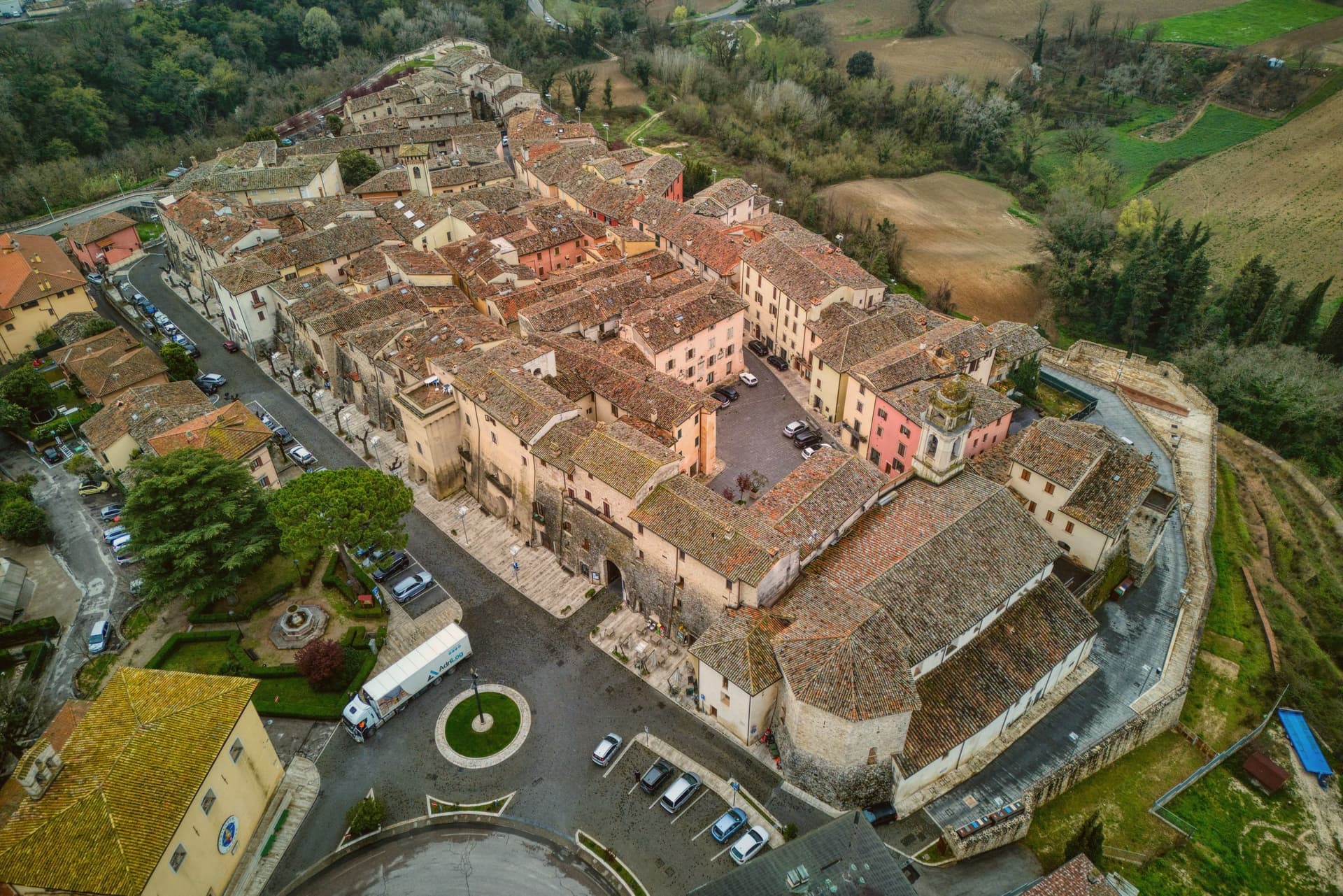
Today the centro reads as a meticulously restored small medieval ensemble — the Porta Santa Maria, the Chiesa Madre di San Felice (rebuilt), the Palazzo Comunale, the Torre Civica. Surroundings: the Monti Martani limestone massif (the prehistoric source of the Martana name) rises immediately east, with marked hiking trails, the Lago di Corbara just south, and the Todi UNESCO-fortified town 17 km away.
The food is Umbrian: strangozzi with truffle (Umbria's signature pasta), porchetta, salumi, Pecorino, the local Sagrantino di Montefalco 25 km west. The Festa di San Felice (25 January) and the Sagra del Tartufo (October) are the year's main events.
We confirmed you can reach this one by train.
What to see in Massa Martana
- Via Flaminia Roman road. Original 220 BC consular road from Rome to Rimini passes directly through. Sections of Roman paving visible in the surrounding countryside — the spine of Roman Italian infrastructure for 500+ years.
- Catacombe di Villa San Faustino. The only Roman-era Christian catacombs in all of Umbria — 3-4 km north of the centro, in use 3rd-6th c AD, with 200+ tombs, original frescoes, Latin inscriptions. Guided tours.
- Abbazia dei Santi Fidenzio e Terenzio. 9th-c Benedictine abbey on the hill above town. Surviving Carolingian elements + 12th-c restorations. The most important monastic survivor in the comune.
How to get to Massa Martana
There is a railway station in the town, so you can arrive without a car and never need one while you are here. Terni is roughly 32 minutes away by road.
Our tip
Massa Martana is best April–June and September–October. The Sagra del Tartufo in October is the year's culinary highlight. Festa di San Felice (25 January) is the winter patronal event.
Acquasparta
Why visit Acquasparta
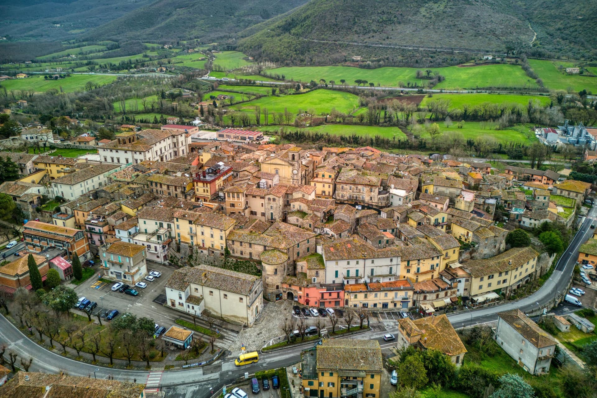
Acquasparta sits at 350 meters on a hill above the Naia valley, fifty kilometers south of Perugia and thirteen north of the UNESCO town of Spoleto. The medieval upper town is walled around the palace at its center, its lanes climbing toward the piazza named for Federico Cesi.
In 1588 Pope Sixtus V raised the territory to a duchy under the Cesi family, and it was Federico Cesi, the cardinal's descendant, who brought his young Accademia dei Lincei here from Rome in the early seventeenth century to convene around his cabinet of natural specimens: Galileo Galilei was among those who came, staying at the palace in 1624 to demonstrate his microscope. Outside the walls, the Furapane and Amerino springs draw on a different history, met by the Roman censor Flaminio in the second century BC and still bottled commercially now.
The town holds both threads at once, a duchy's palace turned briefly into a meeting place for the new science, and a valley whose waters were already known to antiquity. Together with the medieval upper town, they earned Acquasparta its listing among the Borghi più belli.
We confirmed you can reach this one by train.
What to see in Acquasparta
- Palazzo Cesi. The architectural anchor of the centro storico, where the cabinet of natural specimens once gathered by Federico Cesi drew the Accademia dei Lincei into session.
- Centro storico. Medieval upper town walled around the palace, with narrow stepped lanes climbing toward Piazza Federico Cesi.
- Chiesa di Santa Cecilia. Main parish church near the palace, with a Renaissance interior and altarpieces from the Umbrian school.
How to get to Acquasparta
There is a railway station in the town, so you can arrive without a car and never need one while you are here. Terni is roughly 21 minutes away by road.
Our tip
April through June and September into October are the dependable months. The Stagione Lincea, a summer programme of conferences and concerts in Palazzo Cesi, runs through July and August around the legacy of Federico Cesi and Galileo. July and August are warm in the Naia valley but the palace and the centro storico hold shade well.
Stroncone
Why visit Stroncone
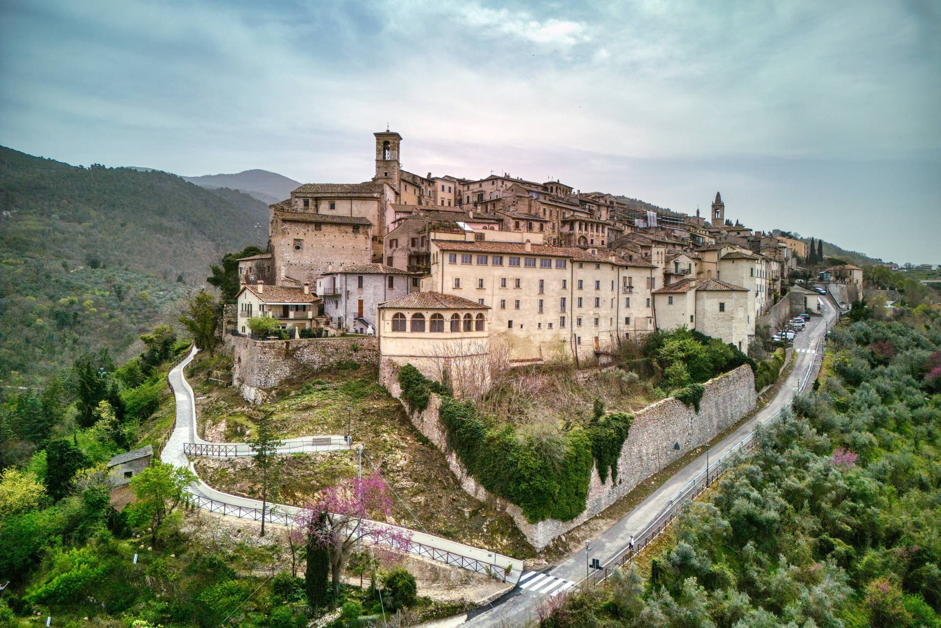
Stroncone sits at 451 meters on an olive-covered hill eight kilometers south of Terni, in the Conca Ternana on the western slope of the Apennine. The name traces to Duke Ugone of Spoleto, whose castrum Hugonis evolved through Castrugone and Strungone to the present form.
A group settled here around the tenth century and built a castle; Stroncone first appears in documents in 1012, when Giovanni di Pietro made a donation to the monastery of San Simeone. Pope Innocent III granted municipal self-rule in 1215.
The Convento di San Francesco, south of the walls, is one of the older Franciscan foundations in Umbria, founded by tradition by Francis himself in 1213, two years before papal recognition of the order. The medieval circuit walls remain almost complete, with the original gates framing a network of stepped lanes that climb to the small main square.
The Cammino di San Francesco passes through, picking up walkers between Rieti and Assisi.
We confirmed you can reach this one by train.
What to see in Stroncone
- Convento di San Francesco. Franciscan convent south of the walls, founded by tradition by Saint Francis in 1213, two years before papal recognition of the order.
- Centro storico. Walled medieval core with original gates intact, climbing through stepped lanes to the small main square at the top of the hill.
- Chiesa di San Giovanni Decollato. Main parish church at the heart of the borgo, with frescoed interior and a Renaissance baptismal font.
How to get to Stroncone
There is a railway station in the town, so you can arrive without a car and never need one while you are here. Terni is roughly 18 minutes away by road.
Our tip
April through June and September into October are the months for Stroncone. Olive harvest carries the autumn rhythm into late November, and the frantoi work into the evening through October and November. July and August are warm in the Conca Ternana but the hill is high enough that nights cool quickly. Sagra De u Cecu Maritu falls in July.
San Gemini
Why visit San Gemini
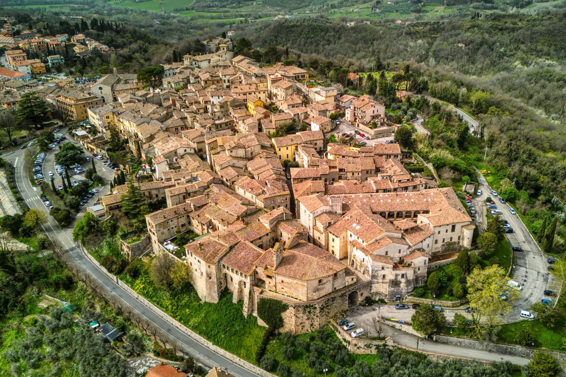
San Gemini sits at 337 meters on the southern slope of the Monti Martani, ten kilometers northwest of Terni. The archaeological park to the north preserves a stretch of polygonal Roman paving, a gate or honorary arch, an amphitheater, mosaic floors and the remains of an aqueduct, all part of a municipium abandoned probably after an earthquake.
The mineral springs rise just outside the populated centre, close enough that the town and the water source share the same ground without sharing a single street. The walled core steps down the slope in two halves that still define the town's rhythm: the district built around the old fortified height and the district gathered around the main square, each fielding its own team when the joust between them runs its course every year.
The cathedral, rebuilt in the nineteenth century but keeping a portal a great deal older, and the Gothic church on the square, each anchor their own end of the settlement. The Corpus Domini Infiorata blankets the procession route with petal mosaics nine weeks after Easter.
A hill town this size holding a Roman ruin, a bottled spring and a rivalry that still stages a joust suggests a place where the past was never cleared away to make room for the present, only built alongside it.
We confirmed you can reach this one by train.
What to see in San Gemini
- Parco Archeologico di Carsulae. Roman municipium four kilometers north of San Gemini, with the Via Flaminia paving, the Arco di San Damiano, amphitheater and aqueduct remains.
- Chiesa di San Francesco. Thirteenth-century Gothic church on the main square, single nave with pointed arches, alongside Palazzo Canova.
- Duomo di San Gemine. Originally twelfth-century late Gothic cathedral, rebuilt in the nineteenth century by Livoni with consultation from Antonio Canova, keeping a fifteenth-century portal.
How to get to San Gemini
There is a railway station in the town, so you can arrive without a car and never need one while you are here. Terni is roughly 16 minutes away by road.
Our tip
April through June and September into October are the dependable months. The Infiorata di Corpus Domini covers the procession route with petal mosaics nine weeks after Easter, usually early June. The Giostra dell'Arme runs over two weeks at the end of September into early October, the rioni in fifteenth-century costume, the joust in the main piazza. Giostra dell'Arme falls in September.
Vitorchiano
Why visit Vitorchiano
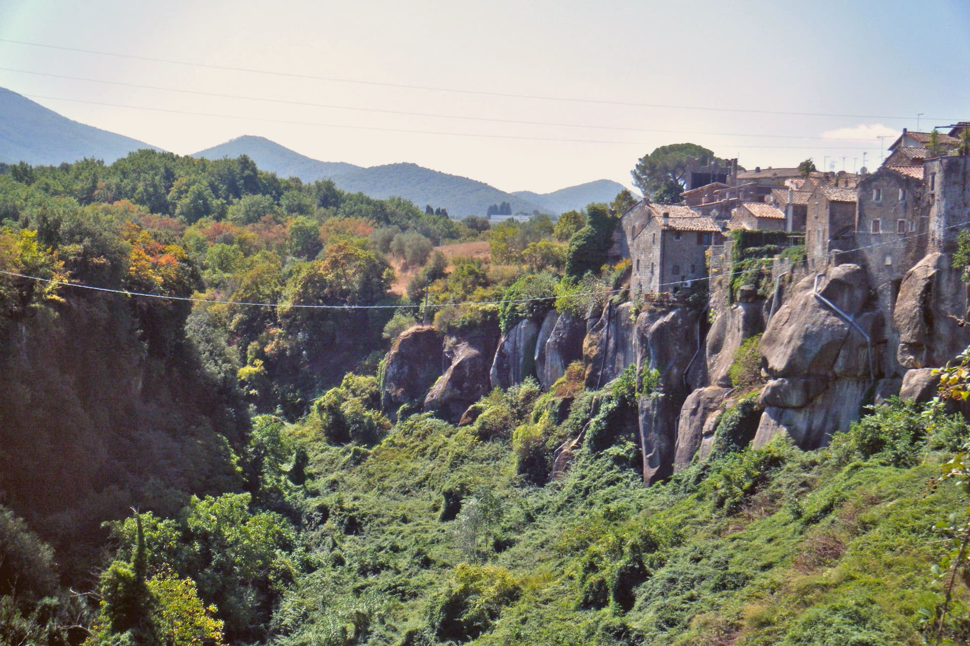
Vitorchiano sits at 285 meters on a single bank of peperino. Two ravines flank the town and meet at the Vezza torrent below, which is why the old center reads as an island of dark stone with the land falling away on both sides.
The quarries below the town are still working, and Vitorchiano peperino now ships to Canada, Japan and the Middle East, so the same rock that holds up the walls and staircases overhead also travels out from underneath the town in the other direction. The statue on the ridge was carved from a single block of that local stone by sculptors who came from the other side of the world to work it, which is its own kind of trade: peperino leaving Vitorchiano to be known abroad, and a foreign hand arriving to shape what stayed.
Above the rooftops, the Belvedere gives the wider frame the streets below cannot, the Cimini hills and the Tiber valley spread out past the ravine. Vitorchiano holds three institutional signals at once: Borghi più belli, Bandiera Arancione TCI, Città della Nocciola.
A small town, then, defined less by any one of its parts than by how completely the stone underneath it accounts for all of them.
We confirmed you can reach this one by train.
What to see in Vitorchiano
- Centro storico in peperino. Medieval old town cut from a single volcanic boulder, walls and houses built in dark Vitorchiano peperino quarried below.
- Moai di Vitorchiano. Six-meter peperino statue carved in 1990 by eleven sculptors of the Atan family from Easter Island, the only true Moai outside Rapa Nui.
- Belvedere. Cliff-edge terrace at the eastern end of the borgo, view across the Vezza ravine to the Cimini hills and the Tiber valley.
How to get to Vitorchiano
There is a railway station in the town, so you can arrive without a car and never need one while you are here. Terni is roughly 53 minutes away by road.
Our tip
April through June brings the Cimini hills into green and Vitorchiano into clear light, the peperino dark against new leaves. September and October are the harvest months for hazelnuts and the calmest period in the borgo. July and August touch the mid-thirties; the centro storico empties between two and five in the afternoon. Sagra del Cavatello falls in July.
More from Anywhere Italy
- The 10 best hidden hill towns you can reach by train within 90 minutes of Terni
- The 10 prettiest hidden villages you can reach by train in Umbria
- The 7 best small towns you can reach by train in Umbria
 The prettiest villages that eat well within 90 minutes of Terni
- The best towns you can reach by train that eat well within 90 minutes of Terni
- The prettiest villages you can reach by train in Lazio