
The 9 best hidden hill towns that eat well within 90 minutes of Terni
The country between the Nera and the Tiber is built from tufa and grey limestone, and the towns sit on the high ground because that is where it was safe to sit. Autumn is the season that repays the drive: black truffle from the Valnerina grated over ciriole, wild boar cooked long with juniper, new oil from the Amelia terraces that tastes of cut grass and pepper. Lunch runs late and the dining rooms are small, often a handful of tables under a barrel vault, with the day's menu spoken rather than printed. In spring the same roads pass through broom and wild fennel, and the artichokes come in from the Sabina.
Most people arriving in Umbria for the food point the car at Orvieto, or push north to Assisi and Perugia, and both deserve the attention they get. Orvieto in particular concentrates the crowds: the cathedral, the classico wine, the restaurants along the corso that fill by half past twelve from Easter to October. Coach parking, timed tickets, a queue for the funicular. It is a good place to eat, which is exactly why booking is a matter of weeks rather than days.
The same hills keep going south and west, past the motorway, into the tufa gorges around Calcata and up the Cimini slopes above Caprarola, and the cooking does not thin out. Fewer people eat in these towns because fewer people stop in them, and the kitchens are largely feeding locals with visitors as an afterthought. Each town here holds an inland hill position and a table a dining guide has thought worth naming.
Of the 36 communes we have mapped within 90 minutes of Terni, 12 qualify as hill towns that eat well: each is an inland hill settlement, and a dining guide has named a table in each. This list is the hidden ones, 9 in all, ordered smallest first. The smallest, Calcata, has 905 residents.
Elsewhere in the catalogue: The prettiest villages that eat well within 90 minutes of Terni and The 10 best hidden hill towns you can reach by train within 90 minutes of Terni.
Calcata
Why visit Calcata
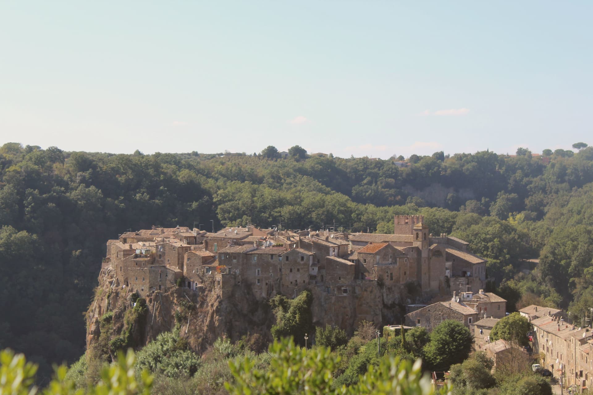
Calcata sits on a tufa cliff above the Treja valley, forty kilometers north of Rome. The Anguillara family walled and castled it in the 13th century.
In 1935 the Italian government condemned the village as structurally unsafe and ordered residents to move down to the new town in the valley below. Most did.
The empty houses on the cliff were re-occupied by artists, hippies and a small bohemian community from the late 1960s onward; they cleared the alleys, opened studios and bars, and turned an officially uninhabitable village into one of Lazio's strangest functioning settlements. The Holy Foreskin relic of Jesus was kept in the parish church here from 1527, taken from the Sancta Sanctorum during the Sack of Rome, and was an active object of pilgrimage until the relic was stolen in 1983 and the Vatican suppressed its cult.
Calcata Vecchia is now a single street of workshops on a cliff edge above the Parco della Valle del Treja.
La Piazzetta have been named by a guide.
What to see in Calcata
- Calcata Vecchia. Medieval village on a tufa cliff, condemned in 1935 and re-occupied from the 1960s by artists and craftspeople.
- Castello Anguillara. 13th-century baronial castle of the Anguillara family, partially restored, now owned by the Treja Valley park.
- Chiesa del Santissimo Nome di Gesù. Parish church that held the Holy Foreskin relic from 1527 until its theft in 1983.
How to get to Calcata
Terni is roughly 66 minutes away by road.
Our tip
April through June and September through October are when Calcata works. The Treja valley below is in leaf, the cliff in sun, the workshops and bars in the old village all open. July and August push past thirty degrees and the artist community thins out.
Bassano in Teverina
Why visit Bassano in Teverina
Bassano in Teverina sits at 304 meters on a tufa spur on the eastern offshoots of the Cimini hills, where Lazio meets Umbria above the Tiber valley. It is the smallest commune in the Tuscia Viterbese: 1,260 residents on a hill above the river.
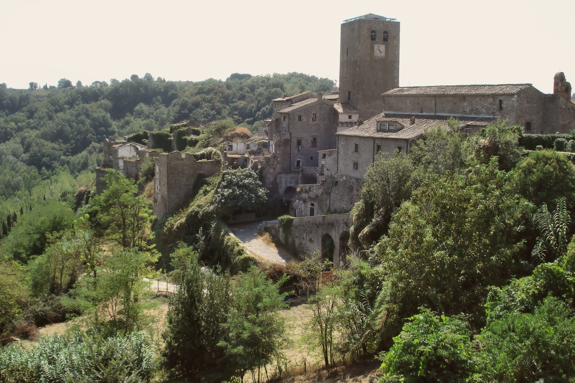
The town is built around the Torre dell'Orologio, a twenty-five-meter peperino tower with a hand-painted majolica clock from around 1700 on its face. Inside it, walled into the structure, stands the Romanesque bell tower of the older church of the Madonna dei Lumi, built around 1100 and embedded within the new tower between 1559 and 1571 by the Madruzzo family.
The inner bell tower is one of the rare Italian campanili animati, with anthropomorphic figures carved into its peperino columns. The Madonna della Quercia chapel, built 1674-1678, stands around the oak where a tile of the Madonna and Child was found.
Bassano is a Borgo più Bello and a Città della Nocciola of the Tonda Gentile Romana DOP.
Olivo Ristorante dell'Olivo Country Club have been named by a guide.
What to see in Bassano in Teverina
- Torre dell'Orologio. Twenty-five-meter peperino tower of around 1500 with majolica clock face from 1700, built around an older Romanesque bell tower by the Madruzzo family.
- Campanile Animato (Madonna dei Lumi). Eleventh-century Romanesque bell tower walled inside the Torre dell'Orologio, with anthropomorphic figures carved into its peperino columns.
- Santuario della Madonna della Quercia. Built 1674-1678 around the oak where a tile of the Madonna and Child was found, on the road below the centro storico.
How to get to Bassano in Teverina
Terni is roughly 36 minutes away by road.
Our tip
April through June and September through October are the months for Bassano. Hazelnut groves leaf out in late April, harvest comes in late August into September, and the Tiber valley clears of haze in autumn. July and August touch the mid-thirties; the small centro storico empties in the afternoon heat.
Arrone
Why visit Arrone
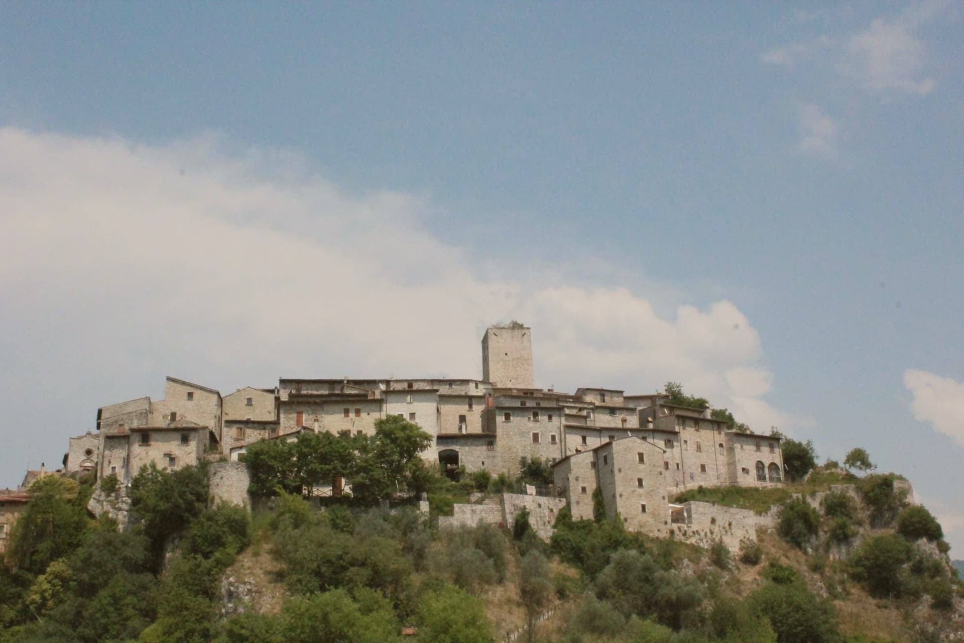
Arrone sits at 243 meters on the left bank of the Nera in the lower Valnerina, the upper part of the village a 9th- or 10th-century noble castle with its walls and alleys still in their medieval layout. The town grew up around the fortified hill and spread along the river as the danger faded.
The Cascata delle Marmore, the largest man-made waterfall in the world at 165 meters across three tiers, is five kilometers downstream; the Romans cut the original channel in 271 BC to drain the marshes around Rieti, and successive interventions through the 16th century gave the falls their present form. The Cammino di San Francesco passes through, and the village is the base for kayaking and rafting on the lower Nera.
The Chiesa di San Giovanni Battista in the upper castle holds 15th-century frescoes of the Umbrian school, and the collegiate Chiesa di Santa Maria in the lower village was rebuilt in the 16th century on Romanesque foundations.
Osteria dello Sportello have been named by a guide.
What to see in Arrone
- Castello di Arrone. Upper part of the village, the 9th-10th century castle, walls and steep medieval alleys preserved to the original layout.
- Chiesa di San Giovanni Battista. Fourteenth-century church inside the upper castle, with 15th-century frescoes of the Umbrian school, including a Madonna and saints.
- Chiesa Collegiata di Santa Maria. Sixteenth-century collegiate church in the lower village, rebuilt on Romanesque foundations, with frescoes by Vincenzo Tamagni.
How to get to Arrone
Terni is roughly 34 minutes away by road.
Our tip
April through June and September into October are the months for Arrone. The Nera runs full from snowmelt and spring rain, the rafting season opens, and the Cascata delle Marmore releases on a fixed schedule that suits the morning light. July and August touch the mid-thirties in the lower Valnerina; the falls cool the air around the basin, and the Cammino di San Francesco walkers pass through early.
Caprarola
Why visit Caprarola
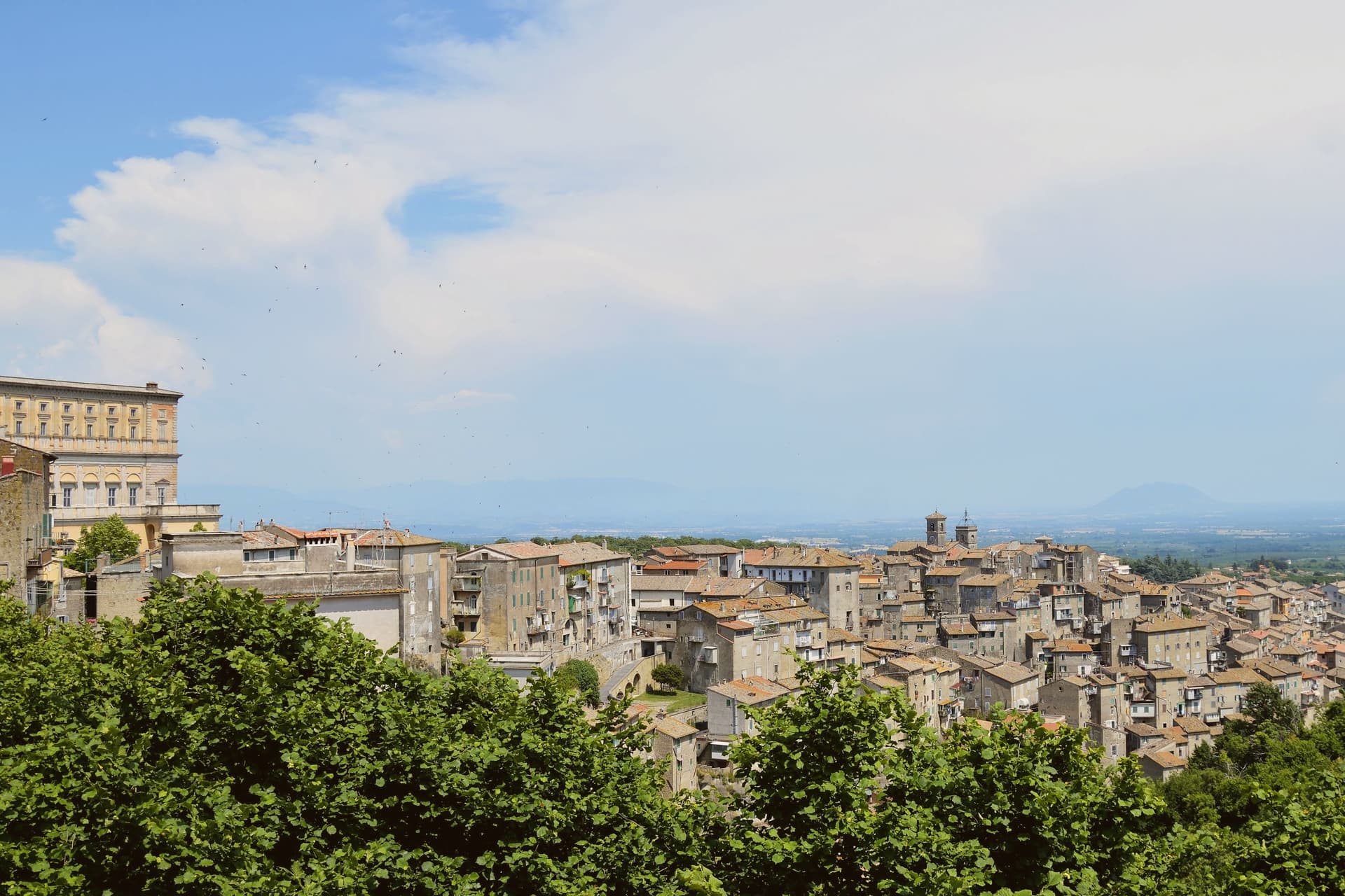
Caprarola stands at about 510 meters on the volcanic slopes of the Cimini, six kilometers east of Lago di Vico. The town is built on a single axis that climbs from the lower village to the Villa Farnese, the pentagonal Renaissance palace that organises everything below it.
Antonio da Sangallo the Younger designed the original fortress in 1530; after Sangallo's death the work was suspended, and Cardinal Alessandro Farnese the Younger reassigned it to Vignola in 1559. Vignola kept the pentagonal plan but turned it from a fortress into a Mannerist residence, with a circular colonnaded courtyard at its center, a scala regia spiraling between floors and the fresco cycles of the Zuccari brothers.
The plan was the model later copied for the Pentagon in Washington. Behind the villa, the Giardini Farnese climb into the chestnut and beech woods of the Cimini.
Caprarola is part of the Città della Nocciola and Città del Castagno networks, a recognition of the volcanic soils that produce both.
Trattoria del Cimino, Vineria Vignola Salumeria e cucina have been named by a guide.
What to see in Caprarola
- Villa Farnese. Pentagonal Mannerist palace by Vignola, built 1559-1573 on Sangallo's earlier fortress plan, with a circular colonnaded courtyard.
- Giardini Farnese. Sixteenth-century formal garden and casino di caccia behind the villa, climbing into the chestnut woods of the Cimini.
- Lago di Vico. Volcanic crater lake at 510 meters, one of the highest of the major Italian lakes, shared with Ronciglione.
How to get to Caprarola
Terni is roughly 67 minutes away by road.
✷ We have written about Caprarola
“We went there on a Saturday in July, straight from Ronciglione, since it is about a 15-minute drive. We expected hordes. I don’t remember exactly, but I’m sure there were no more than 10 people there, including us two. Literally no one was there. The garden, which is huge and worth a trip alone, was completely empty and only for us.”
Read our piece on Caprarola →Caprarola | The town that became a driveway
Our tip
April through June and September into October are the months for the villa and the Cimini woods, when the chestnut canopy holds shade and Lago di Vico is at its clearest. July and August push the lower town into the low thirties; the high ceilings of the Villa Farnese keep visitors cool through the heat. The hazelnut harvest runs late August and September, the chestnut harvest follows in October, and both fill the surrounding sagre. Hazelnut Festival falls in August.
Magliano Sabina
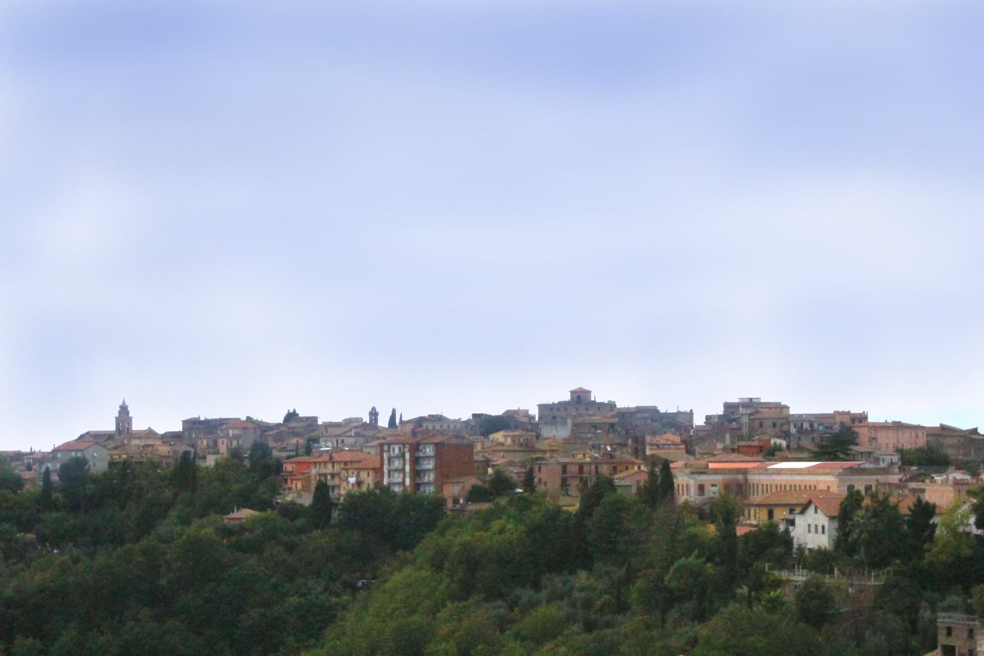
Why visit Magliano Sabina
Magliano Sabina sits at 222 meters on a terrace above the Tiber valley, fifty kilometers north of Rome on the border between Lazio and Umbria. The hill above the river was Sabine ground; the Roman town of Ocriculum, just across in modern Umbria, was the regional anchor.
The medieval centre grew up under the Benedictine abbey of Farfa and passed to the Holy See in the fourteenth century, and the diocesan seat later moved up from the older episcopal site at Vescovio, in the comune's own territory, to the town's upper church. The upper town, walled and gathered around the Palazzo Comunale and the cathedral, occupies the terrace edge; the Vescovio remains lie apart in the surrounding countryside, marking where the diocese first sat before the seat moved uphill into Magliano itself.
From the ridge the ground gives way west to the Tiber and then climbs into Monte Soratte on the far bank, a view that alone earned the town membership in the Borghi più belli d'Italia in 2003. The town's standing, then, rests less on any single monument than on the relation between an old river crossing, an abbey's authority, and a line of sight that has drawn notice since antiquity.
Degli Angeli have been named by a guide.
What to see in Magliano Sabina
- Cattedrale di San Liberatore. The cathedral stands on Piazza Duomo, its stone façade the dominant note of the square and the seat around which the diocese has organized itself since the medieval period.
- Chiesa di San Pietro. Twelfth-century Romanesque church, one of the oldest standing buildings in town, with its original masonry preserved.
- Centro storico. Medieval upper town on the Tiber terrace, with the Palazzo Comunale, the diocesan seat and surviving sections of the village walls.
How to get to Magliano Sabina
There is a railway station in the town, so you can arrive without a car and never need one while you are here. Terni is roughly 41 minutes away by road.
Our tip
April through June and September through October are the strongest months in the Tiber valley. The Sabine olive country is green in spring and the panorama toward Monte Soratte opens cleanest after rain clears the haze. July and August touch the mid-thirties; the centro storico stays cooler than the river plain below, but the open ridge walks empty around midday.
Massa Martana
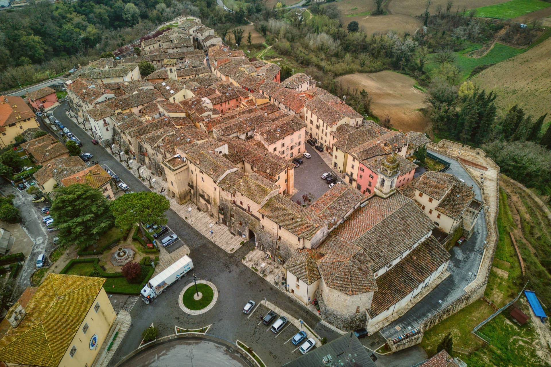
Why visit Massa Martana
Massa Martana is here for the Roman road. The Via Flaminia (the original 220 BC consular road from Rome north over the Apennines to Rimini, the spine of Roman Italian infrastructure for 500+ years) passes directly through the village — and Massa Martana sits at exactly the point where the road begins climbing into the Apennine pre-massif, with sections of the original Roman paving still visible in the surrounding countryside.
This made the area an important late-antique Christian community: the Catacombe di Villa San Faustino (3-4 km north of the centro) are the only Roman-era Christian catacombs in all of Umbria — discovered 1968, in continuous use from the 3rd to the 6th c AD, with 200+ tombs, original frescoes, and Latin inscriptions. The Abbazia dei Santi Fidenzio e Terenzio (9th-c Benedictine, on the hill above town, with surviving Carolingian elements + 12th-c restorations) is the other major monastic-era survivor.
The town itself is 3,613 residents at 351m altitude in central Umbria, 17 km southeast of Todi, with a medieval-Renaissance centro that was severely damaged by the 26 September 1997 Marche-Umbria earthquake (the same event that brought down the vault of the Basilica di San Francesco in Assisi). The reconstruction was completed in stages through 2010, and the town was re-inscribed on the Borghi più belli d'Italia list after restoration.
Today the centro reads as a meticulously restored small medieval ensemble — the Porta Santa Maria, the Chiesa Madre di San Felice (rebuilt), the Palazzo Comunale, the Torre Civica. Surroundings: the Monti Martani limestone massif (the prehistoric source of the Martana name) rises immediately east, with marked hiking trails, the Lago di Corbara just south, and the Todi UNESCO-fortified town 17 km away.
The food is Umbrian: strangozzi with truffle (Umbria's signature pasta), porchetta, salumi, Pecorino, the local Sagrantino di Montefalco 25 km west. The Festa di San Felice (25 January) and the Sagra del Tartufo (October) are the year's main events.
Fontana delle Pere have been named by a guide.
What to see in Massa Martana
- Via Flaminia Roman road. Original 220 BC consular road from Rome to Rimini passes directly through. Sections of Roman paving visible in the surrounding countryside — the spine of Roman Italian infrastructure for 500+ years.
- Catacombe di Villa San Faustino. The only Roman-era Christian catacombs in all of Umbria — 3-4 km north of the centro, in use 3rd-6th c AD, with 200+ tombs, original frescoes, Latin inscriptions. Guided tours.
- Abbazia dei Santi Fidenzio e Terenzio. 9th-c Benedictine abbey on the hill above town. Surviving Carolingian elements + 12th-c restorations. The most important monastic survivor in the comune.
How to get to Massa Martana
There is a railway station in the town, so you can arrive without a car and never need one while you are here. Terni is roughly 32 minutes away by road.
Our tip
Massa Martana is best April–June and September–October. The Sagra del Tartufo in October is the year's culinary highlight. Festa di San Felice (25 January) is the winter patronal event.
Stroncone
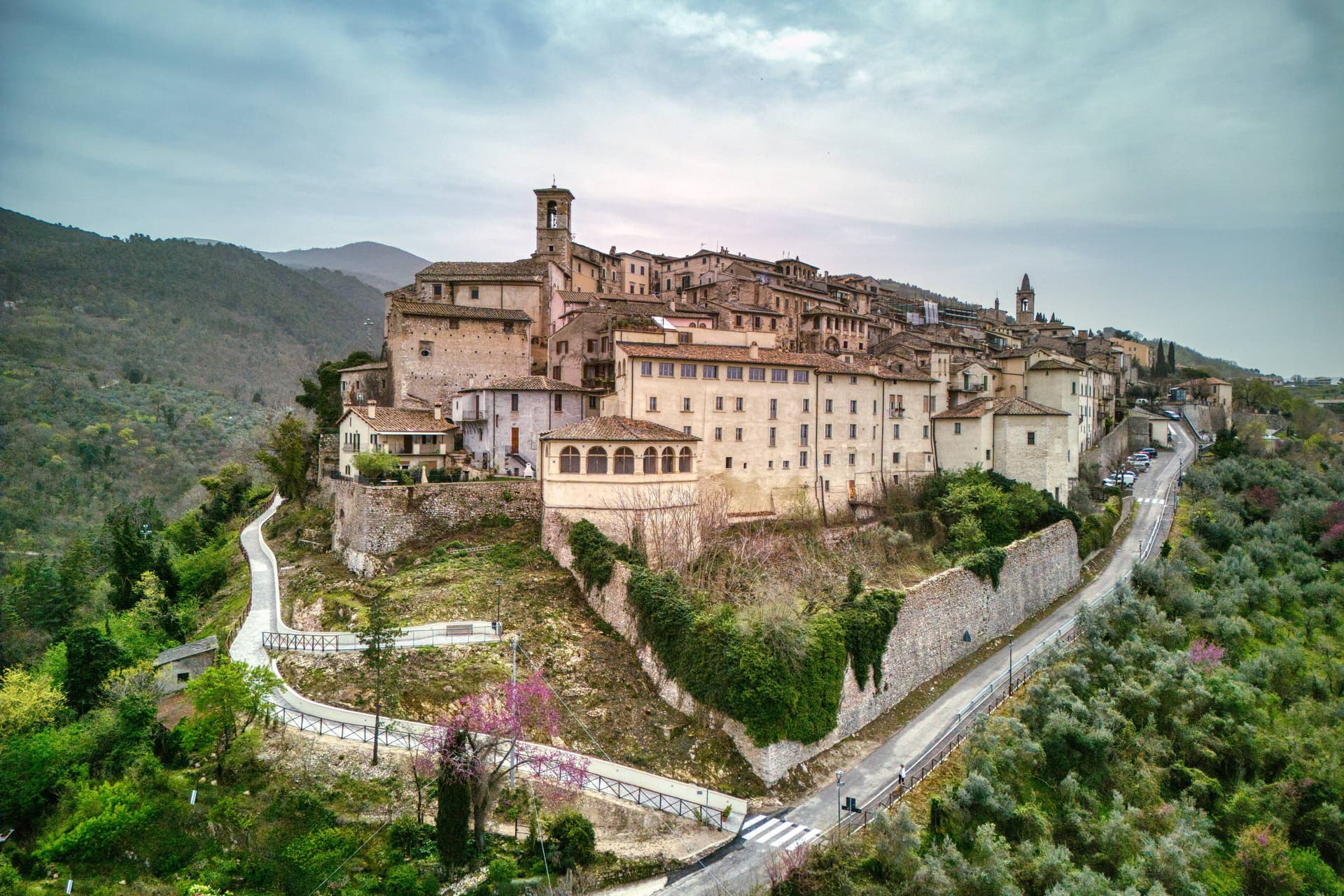
Why visit Stroncone
Stroncone sits at 451 meters on an olive-covered hill eight kilometers south of Terni, in the Conca Ternana on the western slope of the Apennine. The name traces to Duke Ugone of Spoleto, whose castrum Hugonis evolved through Castrugone and Strungone to the present form.
A group settled here around the tenth century and built a castle; Stroncone first appears in documents in 1012, when Giovanni di Pietro made a donation to the monastery of San Simeone. Pope Innocent III granted municipal self-rule in 1215.
The Convento di San Francesco, south of the walls, is one of the older Franciscan foundations in Umbria, founded by tradition by Francis himself in 1213, two years before papal recognition of the order. The medieval circuit walls remain almost complete, with the original gates framing a network of stepped lanes that climb to the small main square.
The Cammino di San Francesco passes through, picking up walkers between Rieti and Assisi.
Mammé have been named by a guide.
What to see in Stroncone
- Convento di San Francesco. Franciscan convent south of the walls, founded by tradition by Saint Francis in 1213, two years before papal recognition of the order.
- Centro storico. Walled medieval core with original gates intact, climbing through stepped lanes to the small main square at the top of the hill.
- Chiesa di San Giovanni Decollato. Main parish church at the heart of the borgo, with frescoed interior and a Renaissance baptismal font.
How to get to Stroncone
There is a railway station in the town, so you can arrive without a car and never need one while you are here. Terni is roughly 18 minutes away by road.
Our tip
April through June and September into October are the months for Stroncone. Olive harvest carries the autumn rhythm into late November, and the frantoi work into the evening through October and November. July and August are warm in the Conca Ternana but the hill is high enough that nights cool quickly. Sagra De u Cecu Maritu falls in July.
San Gemini
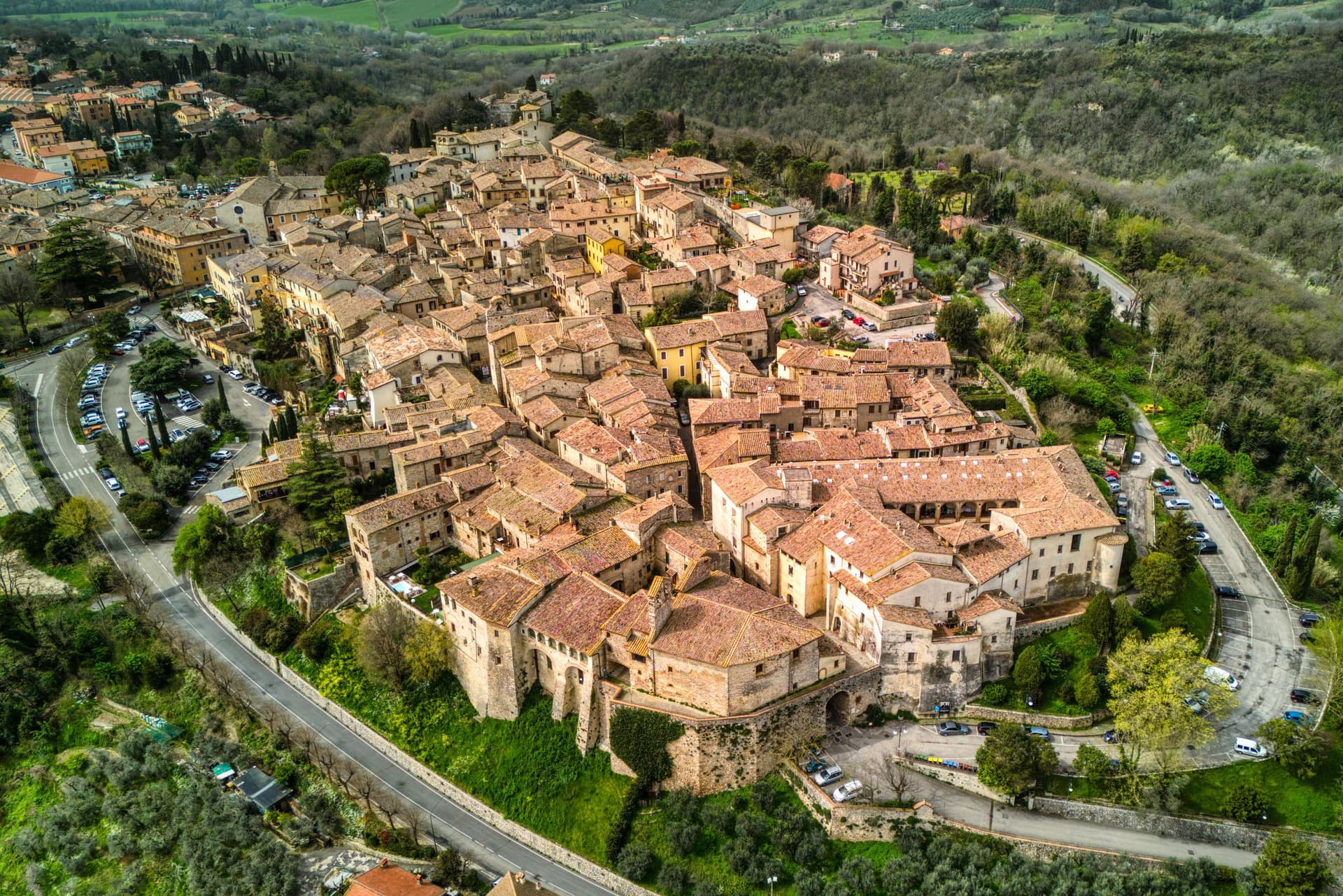
Why visit San Gemini
San Gemini sits at 337 meters on the southern slope of the Monti Martani, ten kilometers northwest of Terni. The archaeological park to the north preserves a stretch of polygonal Roman paving, a gate or honorary arch, an amphitheater, mosaic floors and the remains of an aqueduct, all part of a municipium abandoned probably after an earthquake.
The mineral springs rise just outside the populated centre, close enough that the town and the water source share the same ground without sharing a single street. The walled core steps down the slope in two halves that still define the town's rhythm: the district built around the old fortified height and the district gathered around the main square, each fielding its own team when the joust between them runs its course every year.
The cathedral, rebuilt in the nineteenth century but keeping a portal a great deal older, and the Gothic church on the square, each anchor their own end of the settlement. The Corpus Domini Infiorata blankets the procession route with petal mosaics nine weeks after Easter.
A hill town this size holding a Roman ruin, a bottled spring and a rivalry that still stages a joust suggests a place where the past was never cleared away to make room for the present, only built alongside it.
Origine al Grand Hotel San Gemini have been named by a guide.
What to see in San Gemini
- Parco Archeologico di Carsulae. Roman municipium four kilometers north of San Gemini, with the Via Flaminia paving, the Arco di San Damiano, amphitheater and aqueduct remains.
- Chiesa di San Francesco. Thirteenth-century Gothic church on the main square, single nave with pointed arches, alongside Palazzo Canova.
- Duomo di San Gemine. Originally twelfth-century late Gothic cathedral, rebuilt in the nineteenth century by Livoni with consultation from Antonio Canova, keeping a fifteenth-century portal.
How to get to San Gemini
There is a railway station in the town, so you can arrive without a car and never need one while you are here. Terni is roughly 16 minutes away by road.
Our tip
April through June and September into October are the dependable months. The Infiorata di Corpus Domini covers the procession route with petal mosaics nine weeks after Easter, usually early June. The Giostra dell'Arme runs over two weeks at the end of September into early October, the rioni in fifteenth-century costume, the joust in the main piazza. Giostra dell'Arme falls in September.
Amelia
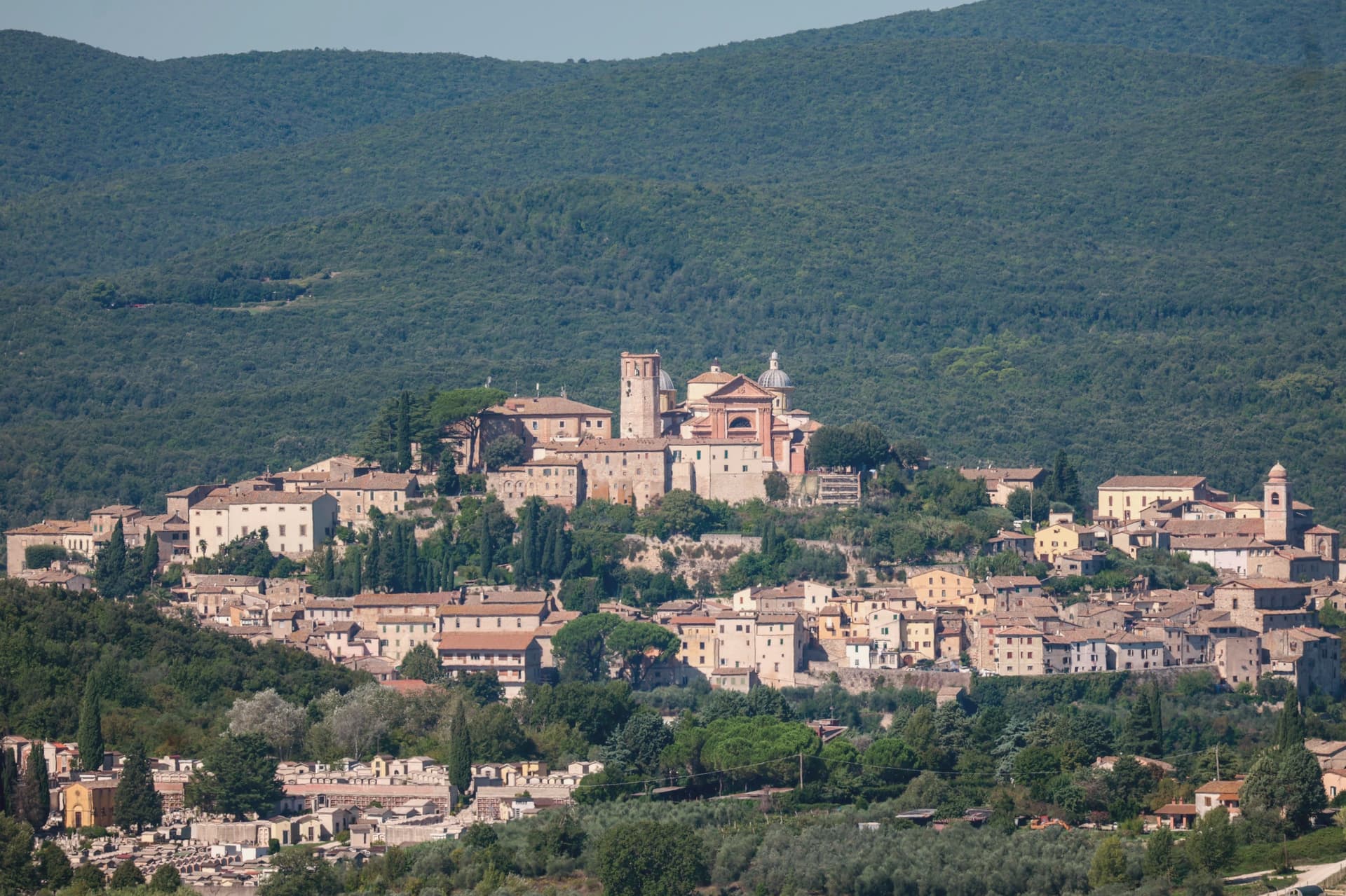
Why visit Amelia
Amelia sits on a hill between the Tiber and the Nera, sixty kilometers south of Perugia and close to the Lazio border. The walls that ring the town predate the Roman conquest, and when Amelia later became a Roman municipium, the town built outward and downward at once: terraces and roads above ground, and below the main square, a system of parallel cisterns cut to hold the settlement's water.
The gate on the old Via Amerina still marks the approach from outside, its current travertine form the result of sixteenth-century rework. Just beyond it, a bronze cuirassed general over two meters tall lay buried until 1963, when it surfaced and was moved into the town's archaeological museum.
The cathedral at the upper end of the centro storico carries its own layer of history, re-dedicated in the ninth century under a pope, and stands apart from the defensive and civic works that dominate the rest of the town's fabric. Amelia joined the Cittaslow network in 2004, and each summer the chamber-music festival founded in 1968 turns the town's attention outward to a different country's repertoire.
The town's layers sit on top of each other rather than beside each other: pre-Roman defense, Roman engineering, medieval faith, and a modern festival calendar all occupying the same small hill in sequence.
Tenuta del Gallo have been named by a guide.
What to see in Amelia
- Mura poligonali. Up to 6 meters high in places, the blocks fitted without mortar along the line that still defines the edge of the old town.
- Cisterne romane. The chambers measure 57.5 by 19.6 meters and sit directly beneath the paving of Piazza Matteotti, invisible from the square above.
- Duomo di Santa Firmina. Cathedral re-dedicated to Saint Firmina around 872 under Pope Adrian II, at the upper end of the centro storico.
How to get to Amelia
Terni is roughly 33 minutes away by road.
Our tip
April through June and September into October are the working months: dry air, light on the polygonal walls, evenings on the Cittaslow corso. The Festival delle Nazioni runs late August into early September and draws audiences from Rome and beyond. July and August reach the mid-thirties; at 406 meters the centro storico breathes better than the Terni basin but afternoons still empty. Palio dei Colombi falls in July.
More from Anywhere Italy
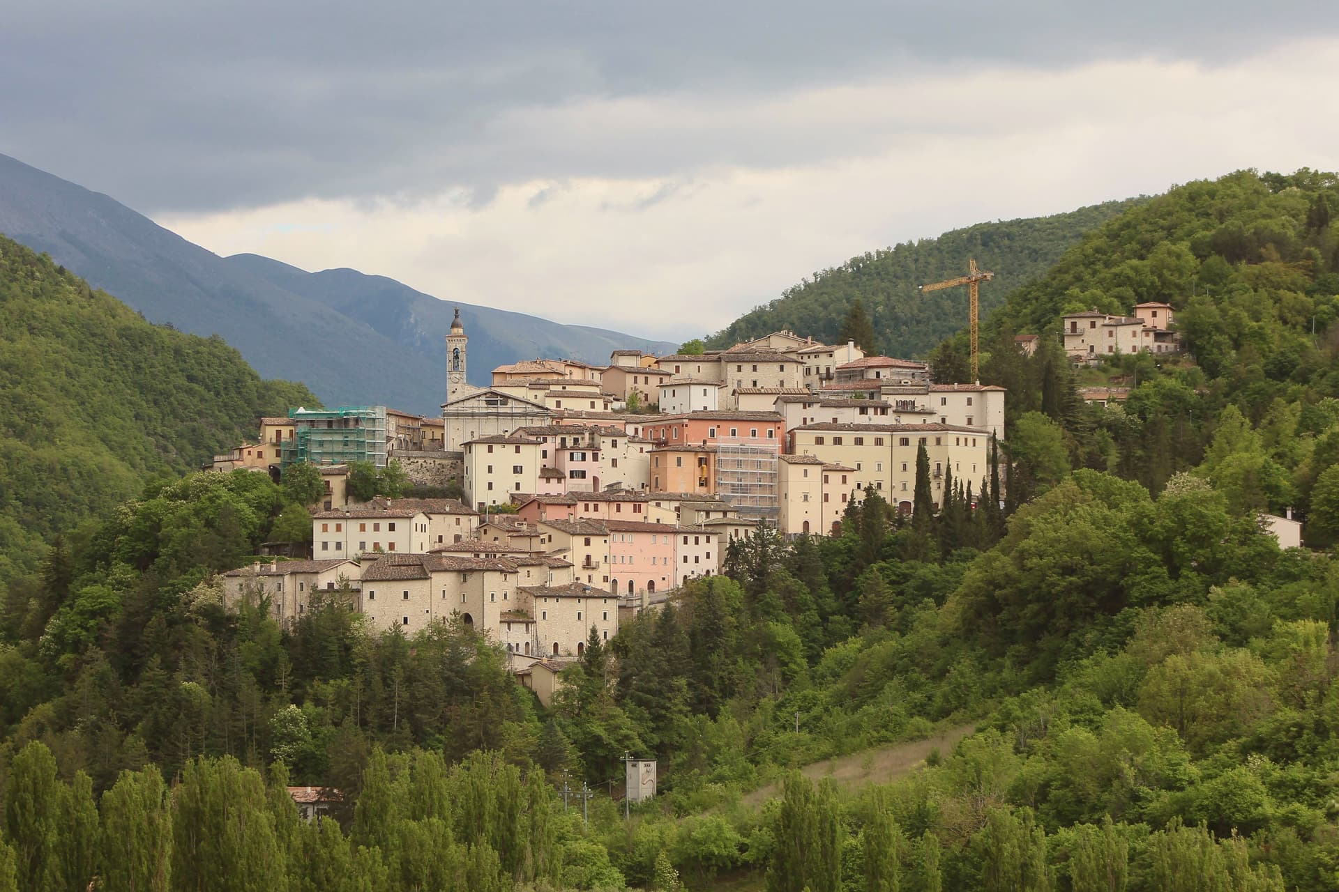 The prettiest villages that eat well within 90 minutes of Terni
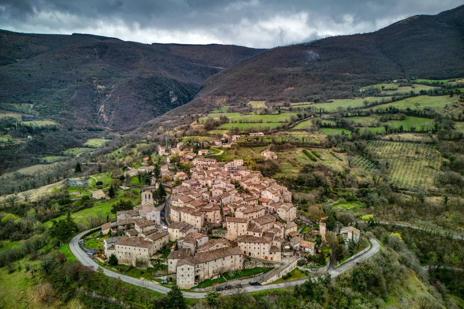 The 10 best hidden hill towns you can reach by train within 90 minutes of Terni
- The best towns you can reach by train that eat well within 90 minutes of Terni
- The best hidden hill towns that eat well in the province of Viterbo
- The best small towns that eat well in Umbria
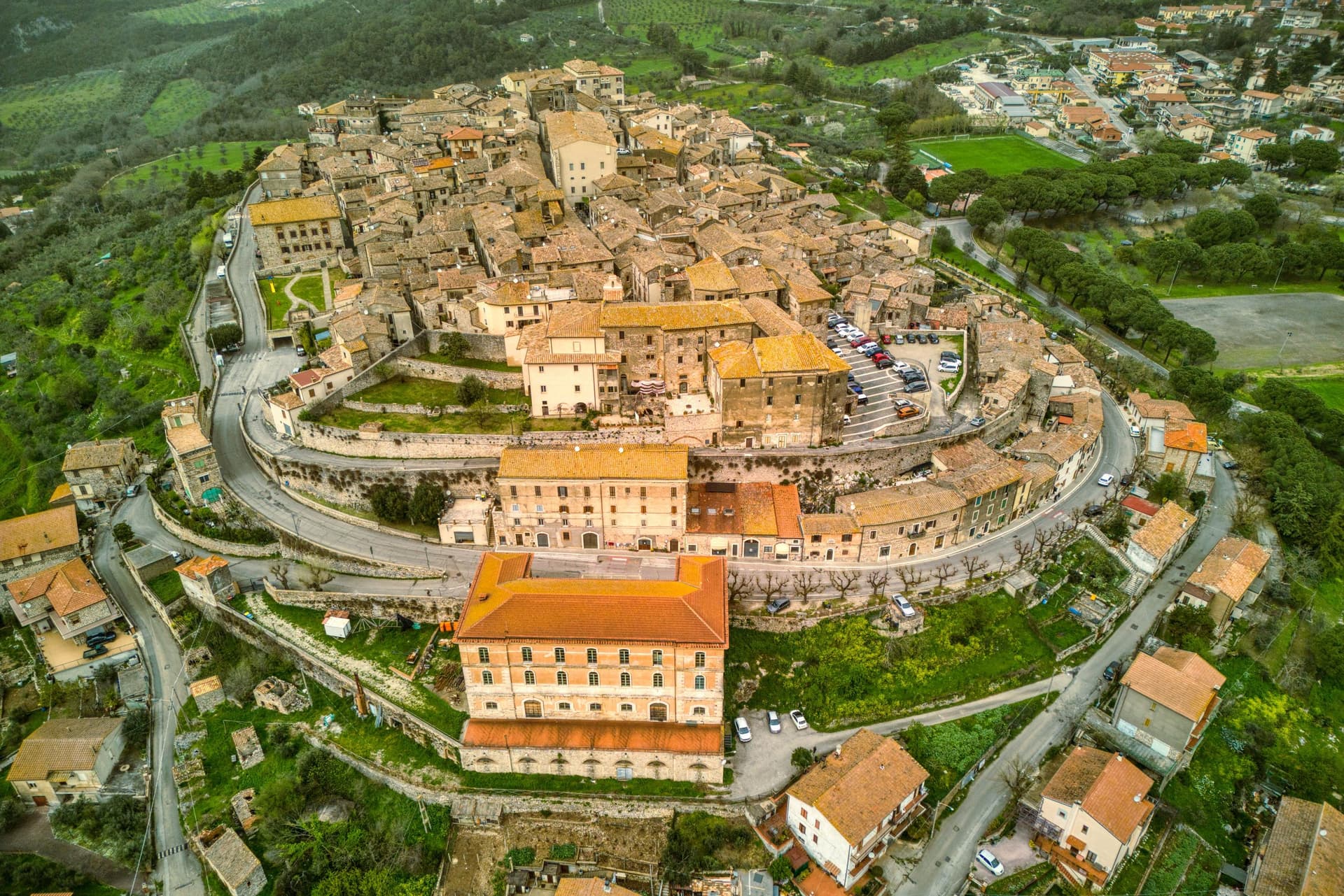 The best hill towns in the province of Terni