The best coastal towns in the province of Sassari
The north of Sardinia is built out of granite and limestone, and the sea reads the difference. West of Sassari the coast runs in red cliffs and long dune beaches backed by juniper, and the water turns the flat green of shallow sand. East towards the Straits of Bonifacio the rock breaks into boulders scoured smooth by the mistral, with pines growing sideways out of them. The food follows the same split: lobster served Catalan style with tomato and onion in the west, sea urchins in late winter, mullet roe grated over pasta, cork oak country a short drive inland where the sheep cheese comes from. Late May and September are the good months, warm sea and empty car parks.
Most people arriving in this part of the island head straight for the Costa Smeralda, to Porto Cervo and the resorts strung along that stretch of Gallura. The marinas are handsome and the water is that colour, but the prices were set for yacht owners and the road behind the beaches jams solid through August. The famous coast is also short, a narrow band of purpose-built development that tells you very little about how Sardinia actually lives.
The granite does not stop at the boundary of the resort, and neither does the sand. The same coast continues west past the Asinara gulf and north to the islands scattered off the tip of the province, past medieval strongholds on sea rock and Aragonese towers and fishing harbours that still land fish. These are the towns on that longer coastline, all of them on the water, and fewer people go.
Of the 10 communes we have mapped in the province of Sassari, 7 qualify as coastal towns: each sits directly on the sea. The smallest, Stintino, has 1,549 residents.
If you are still choosing, we have also written The best beach towns in Sardegna and The best coastal towns that eat well in Sardegna.
Stintino
Why visit Stintino
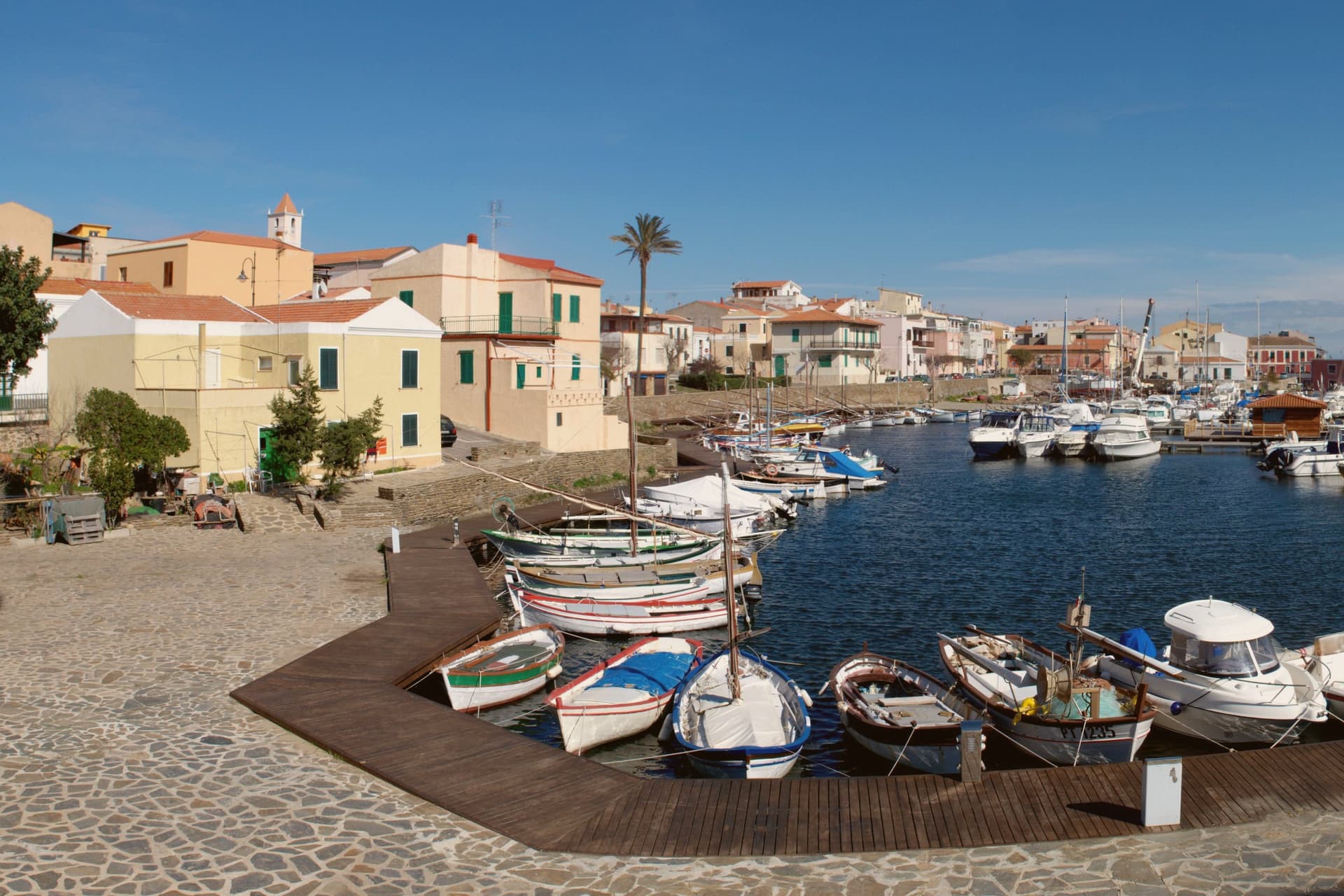
Stintino occupies a thin headland at the north-western edge of Sardinia, facing the narrow Fornelli strait and the island beyond it. The village itself did not exist before 1885, when the Italian state expropriated the population living on that island to build a prison and agricultural penal colony there.
The displaced families resettled on this side of the strait, and the fishing community they founded kept the name of their old home in altered form: Stintino, from the Sardinian for 'small intestine', a reference to the long narrow port-canal that still splits the village in two. The island prison closed in 1997 and the land became a national park the year after, now counted among the more strictly protected coastlines in the Mediterranean.
Stintino remains its only point of embarkation. The village on this side stays small and largely seasonal: a working harbour, one main street, little more.
What draws people is two kilometres north, where the coast opens into the shallow-shelf beach and its watchtower. The arrangement is telling: a settlement built entirely by displacement, whose only industry now is ferrying visitors to the very island its founders were forced to leave.
What to see in Stintino
- Spiaggia della Pelosa. The dune-backed sweep of shallow water fronting the watchtower islet. Capped at 1,500 visitors a day, booking required online, the shelf stays shallow far out from shore.
- Parco Nazionale dell'Asinara. The island lies across the Fornelli strait, reachable only from this harbour. Former prison colony from 1885 to 1997, now left to run wild as a reserve.
- Torre della Pelosa. The watchtower on the islet at the end of La Pelosa beach, built to watch for Barbary corsairs and now standing as the beach's silhouette.
How to get to Stintino
Sassari is roughly 40 minutes away by road.
Our tip
May through October is the season on the north-west coast. May and June are the best months for La Pelosa — water already warm, the 1,500-visitor cap rarely hit, accommodation reasonable. July and August fill the ticket allocation by mid-morning; book La Pelosa access two months ahead online or accept a different beach for those weeks.
Badesi
Why visit Badesi
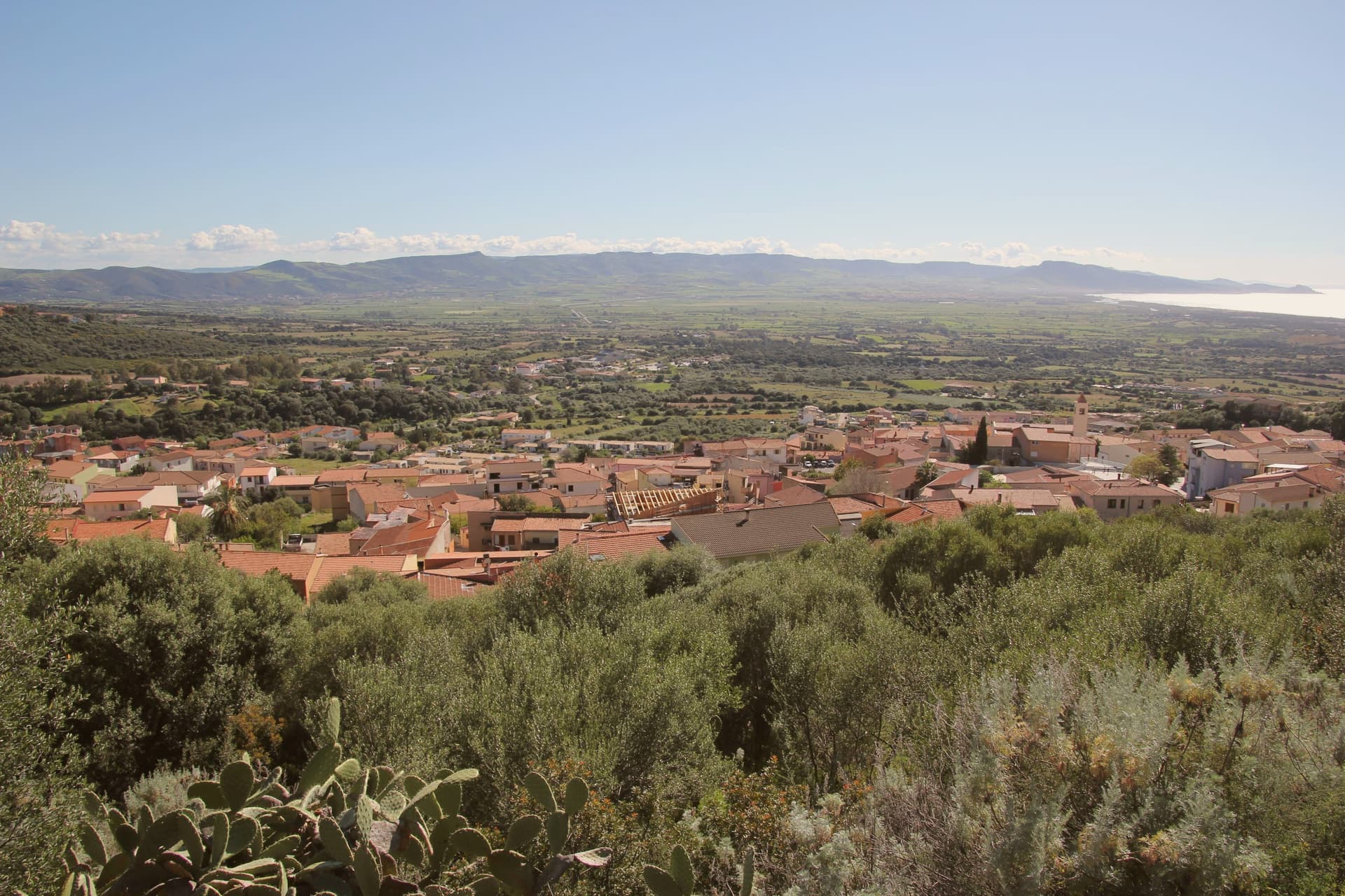
Badesi sits on a hill at 102 meters above the Gulf of Asinara, its municipal territory running north to the dunes and down to the river that forms the natural boundary between Gallura and Anglona. The village formed in the eighteenth century, when shepherding families settled in a Spanish baron's fief and gathered around the parish church built in the early twentieth century.
Badesi became an autonomous comune in 1969, later than the settlement itself, which had already taken shape around the church a generation before. The pattern of the place follows this same line from hill to water: a village core inland, vineyard hillsides around it, and a coastal strip of dunes and river mouth at the far edge of the same territory, held together by the Coghinas, which both feeds the wetlands and marks where Gallura gives way to Anglona.
What began as a shepherding settlement in a feudal fief has ended up governing a stretch of coast and river protected for its water quality and its birdlife, the same land put to grazing now carrying a wine designation and a conservation status instead.
The beach here holds the national bathing award, which a comune has to win back every year on water quality, beach management and safety.
What to see in Badesi
- Spiaggia di Li Junchi. Eight-kilometer beach of fine white sand and juniper-covered dunes from Isola Rossa to the Coghinas mouth, holder of the Bandiera Blu.
- Vermentino di Gallura vineyards. Hilltop vineyards inside the only DOCG zone in Sardinia, white-wine producers concentrated north and west of the village.
- Foce del Coghinas. River mouth marking the boundary between Gallura and Anglona, an EU-protected site for migratory birds nesting in the reed beds.
How to get to Badesi
Sassari is roughly 53 minutes away by road.
Our tip
May through October is the season at Li Junchi. The sea is swimmable from mid-May, the dunes are walkable, and the vineyards on the hills above the beach work through their cycle from flowering to September harvest. July and August are crowded with Italian, German, and French families, and the Delphina resorts above the dunes fill. Sagra delle lumache falls in July.
Palau
Why visit Palau
Palau is young by Italian standards. The first houses went up in the first half of the 19th century, when shepherds from Tempio Pausania came down to the coast for summer pasture.
The dialect spoken is Gallurese, the same as inland Tempio, a trace of where the town's founders came from. The town's shape follows its coast: a working port at the center, the headland with its granite outcrop to the east, the fortress on the high ground behind, and the windsurfing peninsula out to the west.
None of these sit far from each other, so a settlement built for shepherds' summer pasture became, in the same stretch of shoreline, a naval lookout, a ferry gateway, and a wind sport venue without much distance between any of them.
The beach here holds the national bathing award, which a comune has to win back every year on water quality, beach management and safety.
What to see in Palau
- Roccia dell'Orso. Recorded by Greek and Roman navigators as a landmark for the strait. The climb up to it gives a view over the port and across to La Maddalena.
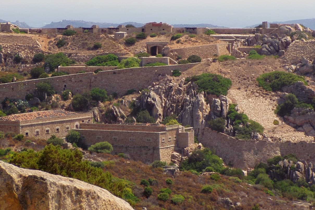
- Fortezza di Monte Altura. Built 1887-1889 as part of the defensive belt protecting the naval base across the water. Open for guided visits, standing above the town rather than in it.
- Isola dei Gabbiani. A tied-island peninsula, meaning it connects to the mainland by a low sandy bar rather than open water. The shallows on the sheltered side make it navigable even for beginners.
How to get to Palau
There is a railway station in the town, so you can arrive without a car and never need one while you are here. Sassari is roughly 115 minutes away by road.
Our tip
May through October is the working season: ferries every half hour, beaches at the right temperature, the mistral cooling the afternoons. July and August are the busy months when the campgrounds fill and the ferry queues stretch back to the roundabout. June and September are easier, same water, fewer people.
Santa Teresa Gallura
Why visit Santa Teresa Gallura
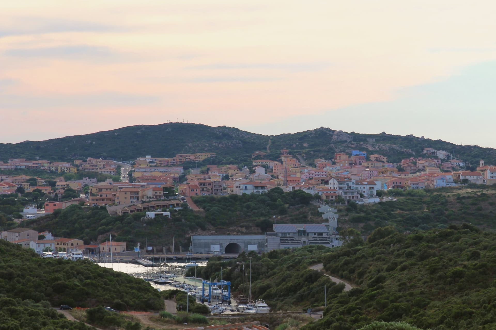
Santa Teresa Gallura sits on the northern tip of Sardinia, facing the Strait of Bonifacio. Corsica is 11 kilometers away across the water, the closest point between the two islands.
The town was founded on August 12, 1808 by King Vittorio Emanuele I of Savoy and named for his wife Maria Teresa of Austria-Este, built over the older settlement of Longonsardo and laid out on a regular grid borrowed from Turin. Before the Savoy refoundation, Philip II of Spain had already raised the Torre di Longonsardo on the headland in the 1570s, one of the coastal towers built to watch for North African raiders.
Capo Testa, the granite peninsula west of town, is a Hercynian outcrop weathered into round boulders and arches, with a lighthouse at its tip and the Cala di l'Ea wind-carved cove on its eastern shore. Rena Bianca, the town beach, has held the Bandiera Blu since 1987.
The beach here holds the national bathing award, which a comune has to win back every year on water quality, beach management and safety. It is also rated for accessibility, which most of this coast is not.
What to see in Santa Teresa Gallura
- Torre di Longonsardo. Late 16th-century Spanish coastal watchtower built under Philip II, the headland landmark above the town and a free viewpoint.
- Spiaggia Rena Bianca. Town beach of white sand and shallow turquoise water, Bandiera Blu holder since 1987, a short walk from the central piazza.
- Capo Testa. Granite peninsula west of town shaped by erosion into round boulders, arches and natural pools, with a working lighthouse at the western tip.
How to get to Santa Teresa Gallura
Sassari is roughly 114 minutes away by road.
Our tip
May through October is the open season. May and June bring warm but not yet stifling water, with the maquis still flowering. July and August are the loud months when the campgrounds fill, ferry traffic peaks, and Rena Bianca packs out by ten in the morning.
Castelsardo
Why visit Castelsardo
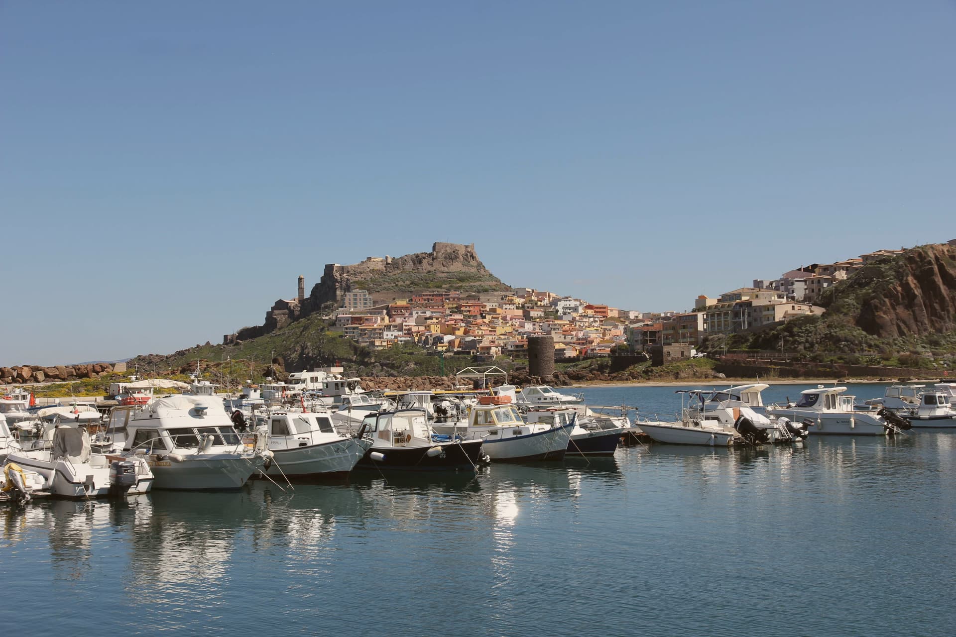
Castelsardo sits at 114 meters on a rock above the Gulf of Asinara, twenty-five kilometers north of Sassari. The Doria family of Genoa built the castle in the early twelfth century to control the gulf, and it served as the residence of Brancaleone Doria and Eleonora d'Arborea until 1448, when the Aragonese took it and renamed it Castel Aragonese.
The Spanish turned it into a defensive fort with towers and bastions, and it kept that name until the Savoys took over in the eighteenth century and gave it the present name. The old town climbs the rock in a single line from the harbour to the castle at its summit, the walled village wrapped around the slope between the two.
Below the castle, the cathedral stands on its own terrace above the sea, its tiled bell tower placed so it can be picked out from boats well offshore. Six kilometers east, on the road out of town, the Roccia dell'Elefante sits apart from this vertical arrangement, a single eroded outcrop rather than part of the settlement.
Three rulers in succession, Genoese, Aragonese, Savoyard, each left their mark on the same rock without erasing what came before: the castle they fought over, the church they built beneath it, and the harbour they all needed at its foot.
The beach here holds the national bathing award, which a comune has to win back every year on water quality, beach management and safety.
What to see in Castelsardo
- Castello dei Doria. Tops the walled village at its highest point, the rock dropping to the harbour below. Its rooms now hold the museum devoted to the town's weaving craft.
- Cattedrale di Sant'Antonio Abate. Gothic core with seventeenth-century Renaissance and Baroque additions, tiled bell tower visible from sea, Maestro di Castelsardo altarpiece inside.
- Museo dell'Intreccio Mediterraneo. Recreated workshops and historical pieces set inside the castle's rooms, tracing how asphodel and dwarf palm are cut, stripped and worked into baskets and sieves.
How to get to Castelsardo
Sassari is roughly 35 minutes away by road.
Our tip
May through October is the working season on the Gulf of Asinara. The Bandiera Blu beaches at Lu Bagnu and around Castelsardo open from May, and the castle terrace catches the gulf light best in early or late summer. July and August fill the centro storico with day-trippers from Sassari and the Costa Smeralda.
La Maddalena
Why visit La Maddalena
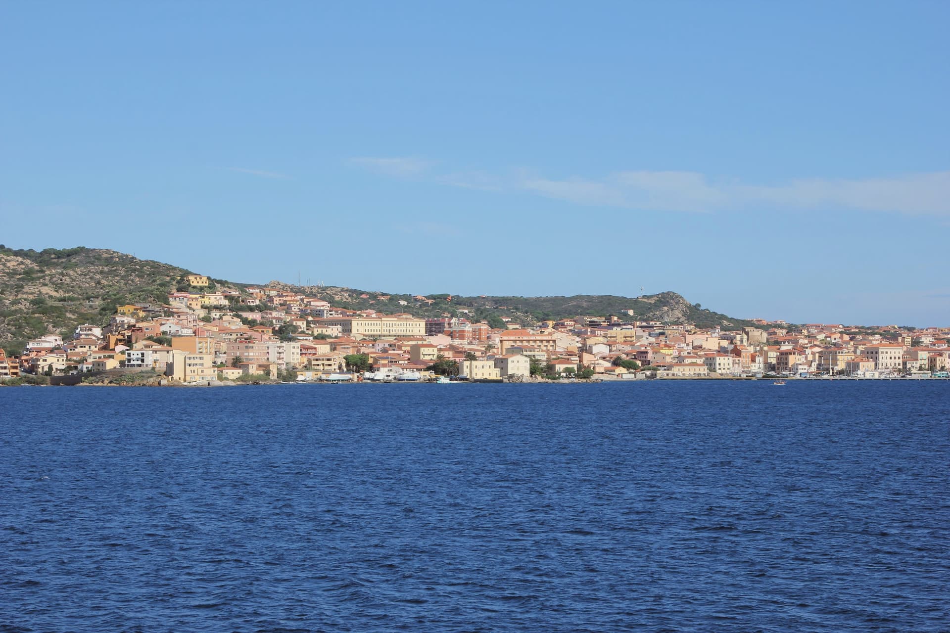
La Maddalena occupies the main island of the archipelago of the same name, sixty-two granite islands and islets in the Strait of Bonifacio between northern Sardinia and southern Corsica. The town is the only inhabited centre of the chain and the gateway to the Parco Nazionale dell'Arcipelago di La Maddalena, on the UNESCO tentative list since 2006.
A six-hundred-metre causeway links the main island to Caprera, where Giuseppe Garibaldi settled in 1856 and lived for twenty-five years until his death in 1882. His house, the Compendio Garibaldino, is a national monument with the memorial chapel and the original rooms preserved as he left them.
Admiral Horatio Nelson anchored the British Mediterranean fleet here in 1803-04 and donated a crucifix and two silver candelabra to the parish church of Santa Maria Maddalena, where they are still kept. The waters around Spargi, Budelli and Santa Maria carry the Bandiera Blu rating.
The beach here holds the national bathing award, which a comune has to win back every year on water quality, beach management and safety. It is also rated for accessibility, which most of this coast is not.
What to see in La Maddalena
- Compendio Garibaldino di Caprera. Giuseppe Garibaldi's house and burial place on the island of Caprera, occupied from 1856 to his death in 1882, now a national museum with the original furnishings.
- Chiesa di Santa Maria Maddalena. Parish church on Piazza Santa Maria Maddalena, holding the crucifix and silver candelabra donated by Admiral Nelson in 1804 during the British fleet's stay.
- Arcipelago di La Maddalena. National park of sixty-two islands and islets, with the famous pink beach of Budelli, Spargi, Santa Maria and Razzoli, on the UNESCO tentative list.
How to get to La Maddalena
Our tip
May through October is the season the archipelago opens fully: ferries from Palau every fifteen minutes, boat tours of Spargi and Budelli, the Compendio Garibaldino accessible without crowding. July and August carry the heaviest yacht traffic in northern Sardinia and the famous pink beach of Budelli is off-limits to walkers. June and late September are the best windows for swimming and beach access without the August peak.
Alghero
Why visit Alghero
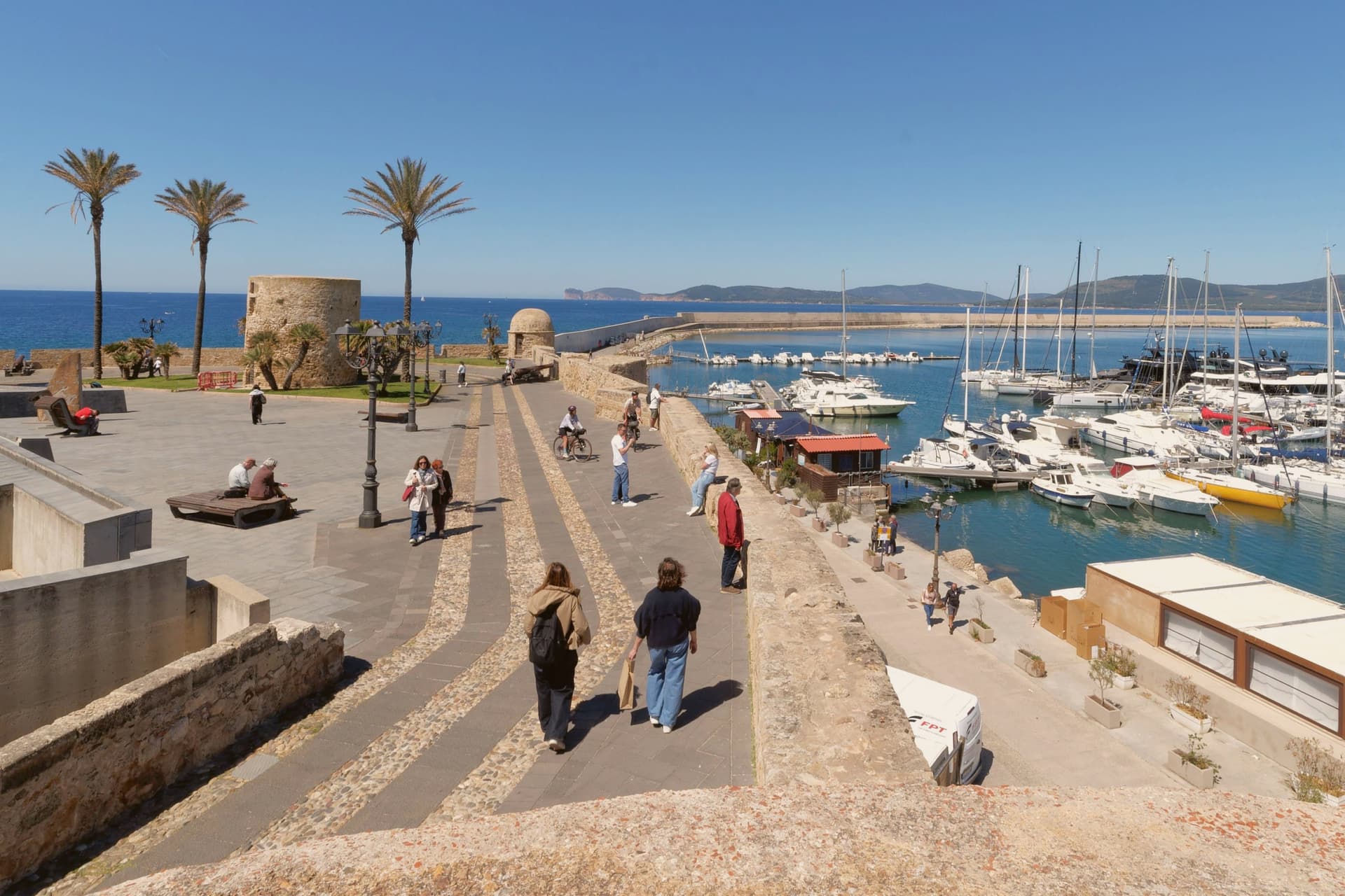
Alghero sits on the northwestern coast of Sardinia at the head of its own bay. The Doria of Genoa founded it in 1102.
The Catalan-Aragonese took it in 1353, expelled the Sardinians and Ligurians, and in 1354 Peter IV of Aragon repopulated the town with Catalan settlers. Four centuries of Catalan, then Spanish, rule left a language behind: about 24 percent of the population still has Algherese Catalan as a mother tongue, and 88 percent understand it, a fact that keeps the walled old town legible as something other than a museum piece.
Eleven kilometers west, the coast rises into a limestone promontory and the natural park around it, the point where the city's own bay gives way to open cliff. North of the city, Vermentino and Cannonau vineyards carry both Città del Vino and Città dell'Olio designations, a rural counterpart to the walled maritime center.
The town reads, then, as a layered thing: a Doria foundation overwritten by an Aragonese one, held between a fortified seafront and a wine country, with the language of the fourteenth-century settlers still spoken in the streets it was resettled to serve.
What to see in Alghero
- Cattedrale di Santa Maria. Catalan Gothic building with a late Renaissance and Baroque interior, three naves inside, the bell tower a signature of the old town skyline.
- Bastioni Marco Polo. Golden sandstone walls with a string of defensive towers, forming the seaward edge of the centro storico.
- Grotta di Nettuno. Karst cave at Capo Caccia with stalactites and underground pools, reached by the 656-step Escala del Cabirol or by boat from the marina.
How to get to Alghero
There is a railway station in the town, so you can arrive without a car and never need one while you are here. Sassari is roughly 35 minutes away by road.
Our tip
May through October is the season in Alghero. The bay opens, the ferries from Genova and Civitavecchia run full, and the centro storico fills with day-trippers and Catalan visitors who treat the place as a long-lost cousin. July and August are hot and crowded, with Capo Caccia and the Lazzaretto beaches reaching capacity by mid-morning. Oktoberfest Alghero falls in September.