
Mountain towns
Mountain towns in Abruzzo
36 towns
Towns inside a named range: the Alps, the Dolomites, the Apennines, the Pollino, the Aspromonte. Around 800 metres and up, where the season decides the trip.
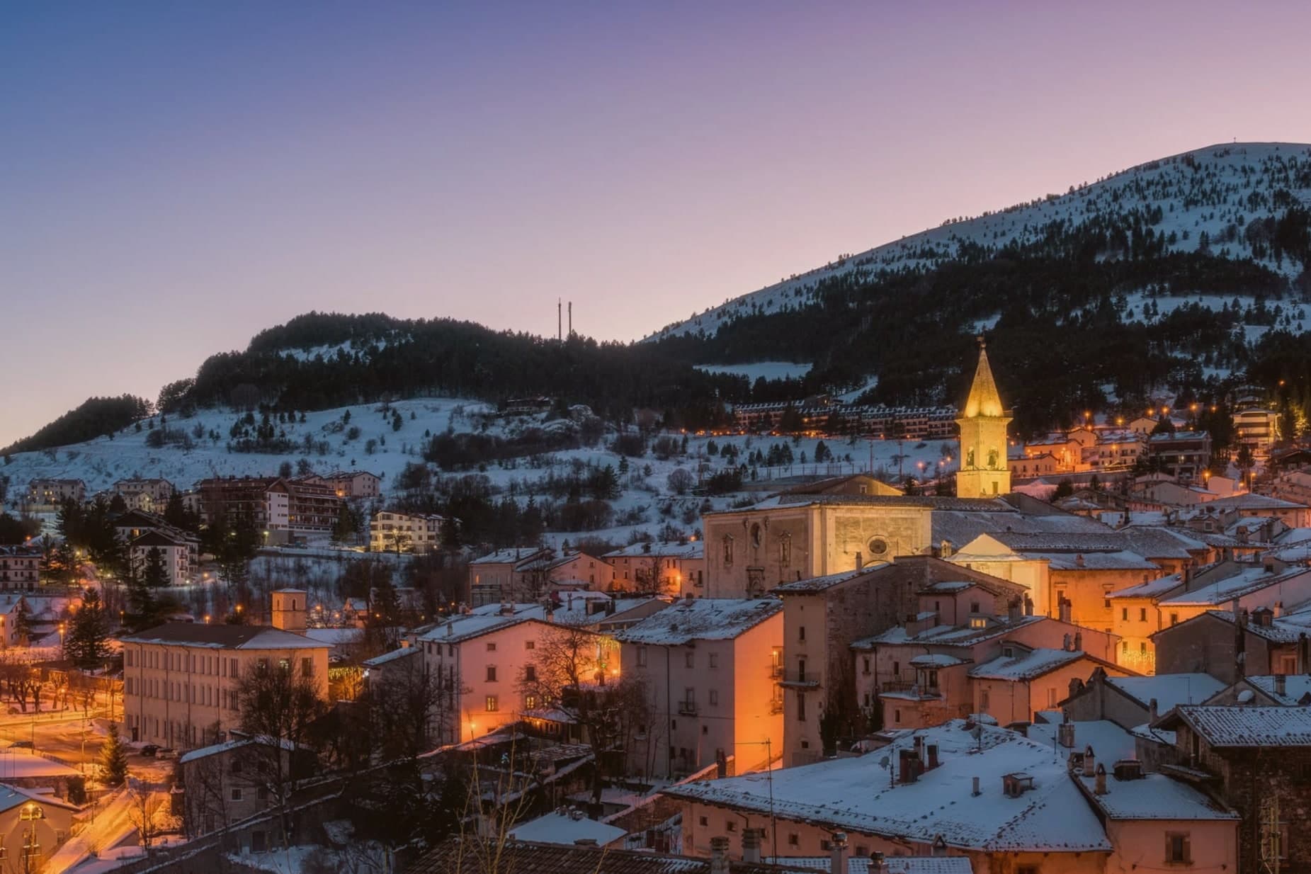
Pescocostanzo
Province: L'Aquila · 1,395 m
A planned Renaissance town at 1,395 meters on the Quarto Grande plateau, with bobbin lace, wrought iron, and the wood ceilings of a five-nave church.
Ovindoli
Province: L'Aquila · 1,375 m
At 1,375 meters on the Altopiano delle Rocche, the closest serious ski station to Rome, working since 1959 on the slopes of Monte Magnola.
Castel del Monte
Province: L'Aquila · 1,346 m
At 1,346 meters under Monte Bolza facing Rocca Calascio, the capital of shepherds, whose wool reached the Medici and whose witches return each August.
Rivisondoli
Province: L'Aquila · 1,320 m
At 1,320 meters on the Cinque Miglia plateau, a village known for its Epiphany living nativity.
Santo Stefano di Sessanio
Province: L'Aquila · 1,250 m
A Medici outpost at 1,250 meters, restored building by building since 1999 into Italy's first scattered hotel.
Roccaraso
Province: L'Aquila · 1,236 m
At 1,236 meters, the south of Italy's largest ski resort, leveled in 1943 and rebuilt from rubble.
Calascio
Province: L'Aquila · 1,200 m
A village of 125 people under the highest castle in the Apennines, cast as the monk's refuge in Ladyhawke.
Pescasseroli
Province: L'Aquila · 1,167 m
At 1,167 meters at the head of the Sangro valley, capital of Italy's oldest national park and birthplace of Benedetto Croce.
Cappadocia
Province: L'Aquila · 1,102 m
A 575-resident Marsican borgo at 1,102m in Abruzzo's western mountains, known for a cave system many mistake for the wrong country entirely.
Castelvecchio Calvisio
Province: L'Aquila · 1,067 m
118 people at 1,067 meters on a ridge above the Tirino, inside a fortified ellipse of stone walls with alleys orthogonal to its perimeter.
Barrea
Province: L'Aquila · 1,066 m
A 1,066-meter spur above an artificial lake at the heart of the Abruzzo National Park, with a Samnite necropolis and an 11th-century di Sangro castle.
Campo di Giove
Province: L'Aquila · 1,064 m
At 1,064 meters under the southwestern Maiella, the highest village in the park, named for a Roman temple to Jupiter.
Scanno
Province: L'Aquila · 1,057 m
A 1,057-meter Sagittario valley village where women in black still walk the alleys photographed by Cartier-Bresson and Giacomelli.
Scontrone
Province: L'Aquila · 1,038 m
A 1,038-meter borgo above the Sangro gorge, with two dozen emigration-themed murals and a paleontological site of European importance.
Pietracamela
Province: Teramo · 1,005 m
A village of 218 people clinging at 1,005 meters under the north wall of Corno Piccolo, birthplace of Italian Apennine climbing in 1925.
Sante Marie
Province: L'Aquila · 950 m
A 950-meter Marsica village and the trailhead of the Cammino dei Briganti, the seven-day brigand trail through the Cartore band's territory.
Villalago
Province: L'Aquila · 930 m
A 930-meter village above three lakes, named for the nine that once filled the valley, with a hermit's cave on the water's edge.
Alfedena
Province: L'Aquila · 914 m
At 914 meters at the head of the upper Sangro valley, the Samnite Aufidena, with a 15,000-tomb necropolis and a Roman conquest in 298 BC.
Civita d'Antino
Province: L'Aquila · 904 m
At 904 meters above the Roveto valley, the ancient Marsi town that became a Danish painters' colony from 1883 until the 1915 earthquake.
Castel di Sangro
Province: L'Aquila · 805 m
At 805 meters where the Sangro meets the Zittola, a Samnite-Roman town whose amateur football club reached Serie B and whose hilltop was fought over in 1943.
Monteferrante
Province: Chieti · 800 m
At 800 meters on a terrace above the Sangro valley, a 12th-century Caracciolo feud of 106 people facing the Maiella.
Navelli
Province: L'Aquila · 760 m
At 760 meters above the Navelli plain, the pyramid of stone houses growing the saffron a 13th-century Dominican brought from Spain.
Rocca di Botte
Province: L'Aquila · 750 m
At 750 meters on the Carseolani slopes between Abruzzo and Lazio, the birthplace of an eleventh-century hermit and a fief of the Colonna.
Montelapiano
Province: Chieti · 740 m
At 740 meters on a limestone marl ridge in the middle Sangro valley, the smallest non-Alpine comune in Italy, population 67.
Tagliacozzo
Province: L'Aquila · 740 m
A Marsica town at 740 meters, built around a ducal palace and a battle that once decided the fate of southern Italy.
Pescina
Province: L'Aquila · 735 m
A Marsica town at 735 meters, on the rim of the drained Fucino basin, that lost five thousand of six thousand people in a single morning in 1915.
Capistrello
Province: L'Aquila · 734 m
At 734 meters where the upper Liri valley meets the Marsica, the village where an emperor's tunnel emptied a lake into a river.
L'Aquila
Province: L'Aquila · 721 m
The regional capital at 721 meters, founded by Frederick II around 1240 and still reconstructing after the 2009 earthquake.
Goriano Sicoli
Province: L'Aquila · 720 m
At 720 meters in the Subequana valley, a medieval village drawn by M.C. Escher in 1929 keeps a May ritual folklorists trace to Demeter.
Scurcola Marsicana
Province: L'Aquila · 700 m
At 700 meters below Monte San Nicola, the field where a medieval battle ended Swabian power in southern Italy.
Introdacqua
Province: L'Aquila · 670 m
At 670 meters in the Valle Peligna, the spring-fed village whose Latin name means inside the waters, now a magnet for foreign residents.
Lama dei Peligni
Province: Chieti · 669 m
A 669-meter Majella village known for chamois, the Cavallone cave, and a prehistoric burial dug from Fonterossi dated 7000 to 5000 BC.
Pettorano sul Gizio
Province: L'Aquila · 656 m
At 656 meters above the Gizio river, a Cantelmo fortress town that guarded the gateway to the Peligna valley for four hundred years.
Pacentro
Province: L'Aquila · 650 m
A medieval village at 650 meters under the Caldora castle towers, where every September a barefoot race honors a Madonna and a pop singer's grandparents.
Carsoli
Province: L'Aquila · 616 m
A 616-meter mountain town in the Marsica, built next to the ruins of a 4th-century BC Roman fortress town.
Anversa degli Abruzzi
Province: L'Aquila · 604 m
At 604 meters above the Sagittario Gorges, a cliff village built around a Norman castle rebuilt by the Counts of Sangro.
The slow-trip planner
Plan a slow trip across the towns travelers skip.
Answer five questions. We will shape a geographically coherent slow trip from the 1,000 Italian towns most travelers skip. Yours to save and share.
From elsewhere in Italy
Five more towns to discover
Visso
Province: Macerata
The northern Sibillini gate at 607 meters where the Nera meets the Ussita, holding one of two surviving manuscripts of Leopardi's L'Infinito.
Goriano Sicoli
Province: L'Aquila
At 720 meters in the Subequana valley, a medieval village drawn by M.C. Escher in 1929 keeps a May ritual folklorists trace to Demeter.
Ugento
Province: Lecce
A Messapian-Roman town five kilometers from the Ionian, where a Baroque castle sits on the walls of the ancient city of Ozan.
Fontanellato
Province: Parma
A Parma-plain town built around the Rocca Sanvitale, the moated fortress at its center.
Pescina
Province: L'Aquila
A Marsica town at 735 meters, on the rim of the drained Fucino basin, that lost five thousand of six thousand people in a single morning in 1915.