
Calabria · Cosenza
Trebisacce
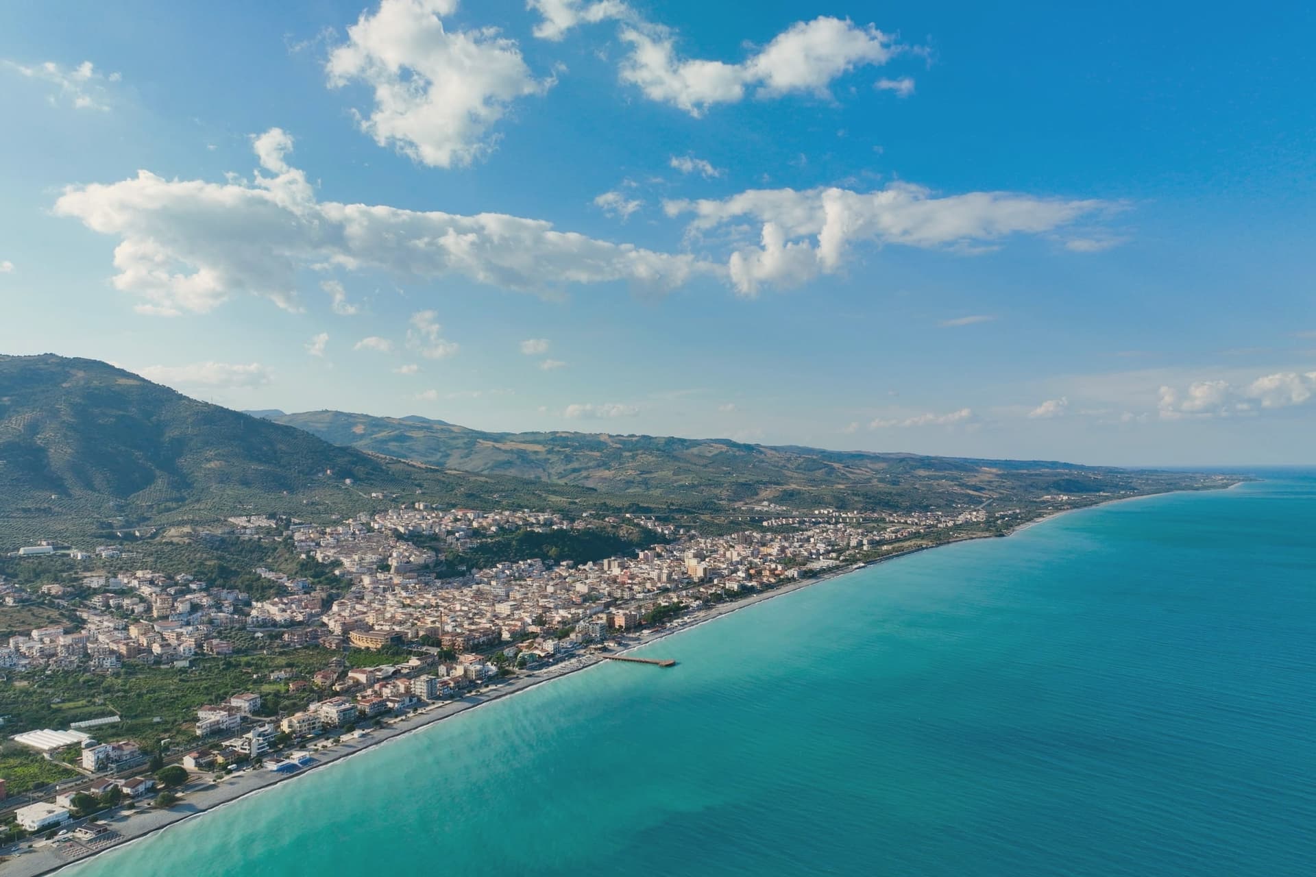
A Bronze Age plateau above the Ionian Sea whose name comes from the Greek for small table, with a Byzantine mother church below.
- Best time
- May–Sep
- By car
- 2 h 25 min from Bari
- By train
- Station in the comune
- Population
- 8,577
Known for
BROGLIO
Bronze Age site east of the centro storico with Mycenaean pottery, proof of Mediterranean trade by the second millennium BC.
BYZANTINE CHURCH
San Nicola di Mira, built in 1040 with a trullo-shaped dome, the oldest surviving building on the plateau.
IONIAN COAST
Plateau old town above a Bandiera Blu and Spighe Verdi coastline on the Gulf of Taranto, twenty kilometres from Sibari.
CLEMENTINE DI CALABRIA
The commune lies inside the Clementine di Calabria IGP production zone.
When to visit
Best · May–Sep
- J14°
- F15°
- M15°
- A18°
- M23°
- J29°
- J32°
- A32°
- S28°
- O23°
- N18°
- D15°
- Best
- Hot or crowded
- Quiet
- Mostly closed
Daytime averages, 2020–2024. The sea is warmest in July at 28° and coldest in February at 15°. Weather data by Open-Meteo.com.
The festa: Leonardo di Noblac, 6 November
Why come
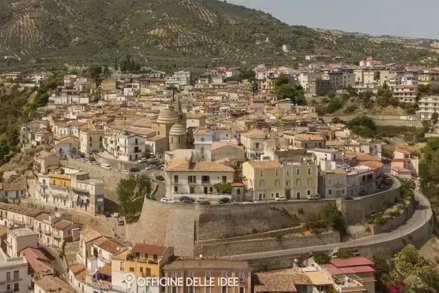
Trebisacce sits in the upper-Cosenza arc, on a hill whose flat top gave the town its name: the Greek Trapezàkion, small table, a literal description of the tabular ground the old town stands on. In antiquity the settlement held the road between Metaponto and Sybaris, twenty kilometres south on the Sibari plain, a position that put it on the trade routes long before the medieval walls went up. The lower modern town runs along the seafront below; the plateau above keeps the old streets, the mother church, and the walls raised in the sixteenth century against Saracen raids.
Inland and uphill, past the modern town, a rock-cut chapel sits inside a pine forest on Monte Mostarico, a different register of building from the stone church and the archaeological trenches below. Read together, the layers, coastal plain, tabular hill, and inland forest, describe a town that has always faced two ways: out to the sea route and up to the higher, quieter ground behind it.
The Sunday letter
Trebisacce is on our list. Its letter is still to come.
We are writing about all 1,000 of these towns, one at a time, in a free letter every Sunday: the photo, the food, the festa. That is our mission. Sign up and you will be there when Trebisacce comes up. By Peter & Sophia, from Pietrasanta.
Read on
Trebisacce in our articles
 The best hidden beach towns you can reach by train in the province of Cosenza6 towns, Trebisacce among them.
 The best towns that eat well in the province of Cosenza6 towns, Trebisacce among them.
 The best towns you can reach by train that eat well in Calabria7 towns, Trebisacce among them.
 The 8 best coastal towns that eat well in Calabria8 towns, Trebisacce among them.
How to get there
From Lamezia / Reggio (SUF), about 2 hours by car.
Bari / Brindisi (BRI) is about 2h 31m away.
By car from the centre of Bari 2h 25m, Salerno 2h 52m or Lecce 3 hours.
There is a railway station in the comune, so you can arrive without a car.
Coming from Bari?
What to see
Chiesa di San Nicola di Mira
Trullo-shaped dome and a tall pyramidal bell tower stand over the centro storico, the church's mass still setting the skyline of the old town.
Broglio di Trebisacce
Excavated since 1979, the site has also given up a Hellenic necropolis alongside the Mycenaean finds, layered evidence of the plateau's long occupation.
Centro storico sul plateau
Old town on the tabular hill that gives Trebisacce its name, ringed by sixteenth-century walls built against Saracen raids.
Lungomare ionico
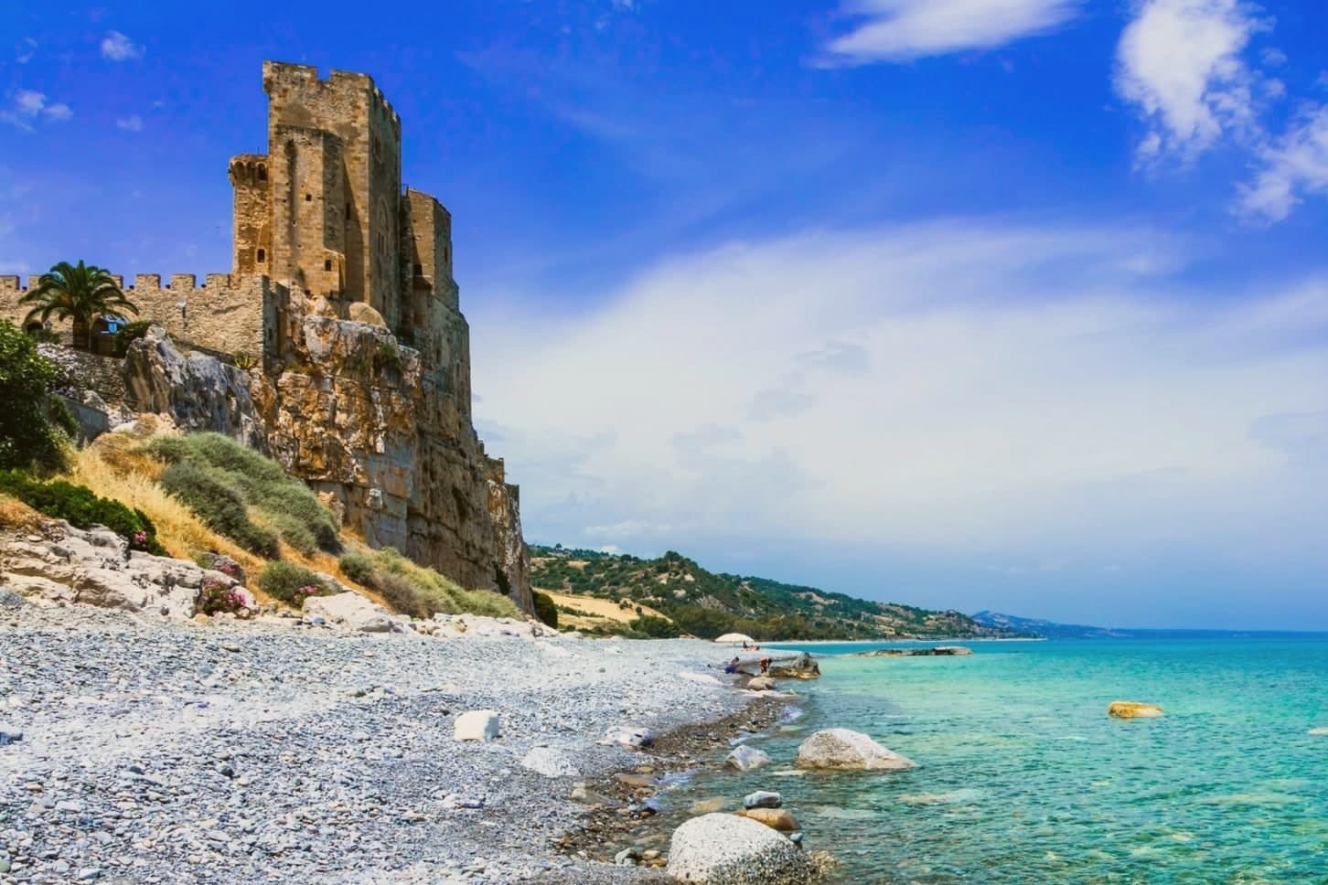
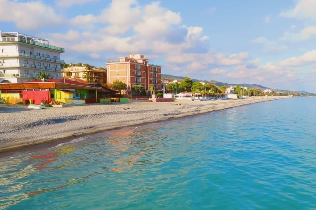
Beach strip carrying the Bandiera Blu and Spighe Verdi recognitions on the Gulf of Taranto, with views across to the Sibari plain.
Chiesa Rupestre di San Giuseppe
Rural rock-cut chapel inside a pine forest on Monte Mostarico, above the modern town toward the inland hills.
The slow-trip planner
Building a trip? Find where Trebisacce fits in a slow Italy circuit.
Answer five questions. We will shape a geographically coherent slow trip from the 1,000 Italian towns most travelers skip. Yours to save and share.
We recommend
Where to eat
Not our picks, but places the guides put their name to: a Michelin star, a Gambero Rosso fork, a Slow Food snail, a Michelin Key for the hotels. Worth a table, a counter, or a night when you pass through.
La RotondaRistorante
La Rotonda carries a Gambero Rosso listing.
Living here
- Population 8,577
- In-betweeni
- Pharmacy in town
- High school within a 30-minute drive
- Train station in the comune
- Nearest airport Lamezia / Reggio, 2 h 7 min drive
- Regional capital Catanzaro, 2 h 22 min drive
Common questions
- What is Trebisacce known for?
- Trebisacce is a Bronze Age plateau above the Ionian Sea whose name comes from the Greek for small table, with a Byzantine mother church below.
- Where is Trebisacce?
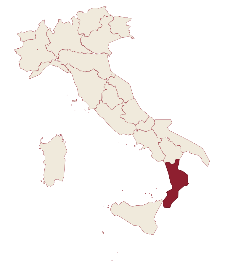
- Trebisacce is a comune in the province of Cosenza, in Calabria, at 73 meters above sea level.
- What is the nearest airport to Trebisacce?
- Lamezia / Reggio (SUF), about 2 hours by car.
- Can you get to Trebisacce without a car?
- Yes. There is a railway station in the comune, so you can arrive by train.
- How long is the drive from Bari to Trebisacce?
- About 2h 25m by car.
- When is the best time to visit Trebisacce?
- Best in May–Sep. July is the warmest month, averaging 32 degrees, and November the wettest, with about 11 rain days.
- Is there a sagra or a festival in Trebisacce?
- The town keeps its patron saint's day: Leonardo di Noblac, 6 November.
- Which other towns are like Trebisacce?
- Soverato, Cariati and Villapiana.
- How many people live in Trebisacce?
- 8,577 at the 2023 count.
Tags & datadesignations · numbers · sources
Recognised as
The numbers
- Elevation: 73 m
- Population: 8,577
- Surface area: 26.72 km²
These figures were compiled from public directories: ISTAT, OpenStreetMap and Wikidata, and from the official listings of the guides named on this page. Town details change; verify with official sources before you travel.
Similar
Towns like Trebisacce
Soverato
Province: Catanzaro
both on the Ionian coast · both between 3,000 and 10,000 people
Cariati
Province: Cosenza
both on the Ionian coast · both between 3,000 and 10,000 people
Villapiana
Province: Cosenza
both on the Ionian coast · both between 3,000 and 10,000 people
Bagnara Calabra
Province: Reggio di Calabria
both between 3,000 and 10,000 people · both near sea level
Bernalda
Province: Matera
both on the Ionian coast · both near sea level
Otranto
Province: Lecce
both between 3,000 and 10,000 people · both near sea level
🎨 Borghi più belli d'Italia
More Borghi più belli d'Italia towns in Calabria
Aiello Calabro
Province: Cosenza
A hilltop borgo at 502 meters in the Tyrrhenian hinterland of Cosenza, ruled for two centuries by the Cybo-Malaspina from Massa Carrara.
Aieta
Province: Cosenza
An eagle's-nest village in the western Pollino, with one of the few sixteenth-century Renaissance palazzi standing in Calabria.
Altomonte
Province: Cosenza
A hill town in the Esaro valley built around the highest Gothic-Angevin church in Calabria.
Badolato
Province: Catanzaro
A medieval borgo of thirteen churches at 240 meters above the Ionian, which took in 350 Kurdish refugees in 1997 and started its own slow rebirth.
Bova
Province: Reggio di Calabria
The capital of the Bovesìa, a 416-resident Aspromonte hilltop borgo at 820m and the cultural centre of the Grecanic minority, where the Calabrian-Greek dialect descended from Byzantine-era Greek is still spoken by elders.