
The prettiest villages in the province of Cosenza
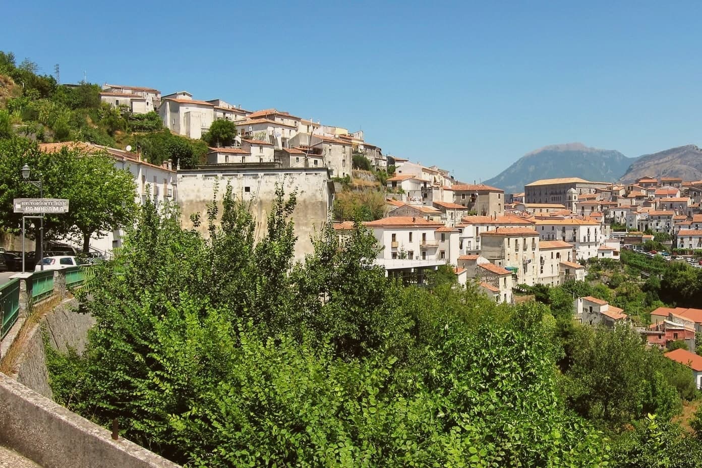
Cosenza is the province where Calabria goes vertical. Villages sit on sandstone spurs above olive terraces and chestnut woods, their houses built from local stone and roofed in curved tiles that fade to the colour of dust, with the Pollino mountains behind and the sea visible on clear days from both flanks. The food follows the altitude: pork and chilli and hard sheep's cheese in the hills, swordfish and lemons and figs nearer the water, and everywhere the flat bread and dried peppers that get strung along the walls in late summer. Spring brings orchid meadows on the high pastures, autumn brings mushrooms and the chestnut fairs, and the churches keep Byzantine and Norman work that nobody queues to see.
people who come to this part of Calabria mostly come for the Tyrrhenian resorts. Tropea, with its cliff and its Santa Maria dell'Isola, absorbs the great bulk of the region's summer traffic, and its lanes in August move at the pace of the slowest sunhat. It is beautiful, and it is also the single most photographed spot in Calabria, which means car parks, queues for granita and a beach where towels are laid to a grid.
The same coastline and the same mountains carry on well past it. Inland from the Cosenza shore the ridges are lined with villages that hold the national association's assessment for Italy's most beautiful, some looking down on the Tyrrhenian, some facing the Ionian across the plain of Sibari, others tucked under the Pollino peaks where the language still carries Albanian and Occitan traces. Fewer people go, the bar in the piazza is still the village bar, and a room in one of them costs a fraction of a night on the famous cliff.
Of the 26 communes we have mapped in the province of Cosenza, 9 qualify as prettiest villages: each has passed the assessment of the national association of Italy's most beautiful villages. The smallest, Aieta, has 753 residents.
Two more lists worth reading alongside this one: The best hill towns in the province of Cosenza and The best towns that eat well in the province of Cosenza.
Aieta
Why visit Aieta
Aieta sits at 524 metres in the western Pollino, eight kilometres above the Tyrrhenian coast at Praia a Mare. The name comes from the Greek aetós, eagle, a description of the spur the village holds.
The Palazzo Martirano-Spinelli is the reason most visitors climb the road in: a U-shaped sixteenth-century Renaissance building with a five-arch loggia on Tuscan columns in local grey stone, one of the rare full Renaissance palazzi in the whole region. The Marquises Cosentino built it; it passed to the Cosentino-Scalea line in 1571 and to the Spinelli in 1767, was declared a national monument in 1913, and became municipal property in 1980.
Around it, the centro storico keeps a tight network of stone-portalled houses worked by mason families between the seventeenth and eighteenth centuries. The mother church of Santa Maria della Visitazione and the Convent of the Minor Observant Fathers, founded in 1520, complete the centre.
The population sits at 753.
What to see in Aieta
- Palazzo Martirano-Spinelli. Sixteenth-century Renaissance palazzo with a U-shaped plan and a five-arch loggia on Tuscan columns, one of the few in Calabria; national monument since 1913.
- Chiesa di Santa Maria della Visitazione. Sixteenth-century mother church on the upper level of the centro storico, anchoring the religious life of the village.
- Convento dei Minori Osservanti. Franciscan convent founded in 1520 with sixteenth-century wooden choir stalls and a set of carved wooden saint statues.
How to get to Aieta
Salerno is roughly 140 minutes away by road.
Our tip
At 524 metres in the western Pollino, Aieta runs cooler than the Praia a Mare coast below. April through October is the working window: green hills, mild evenings, the Palazzo open for visits and the Convent accessible. July and August stay tolerable in the low thirties, though midday in the centro storico empties as residents step indoors.
Aiello Calabro
Why visit Aiello Calabro
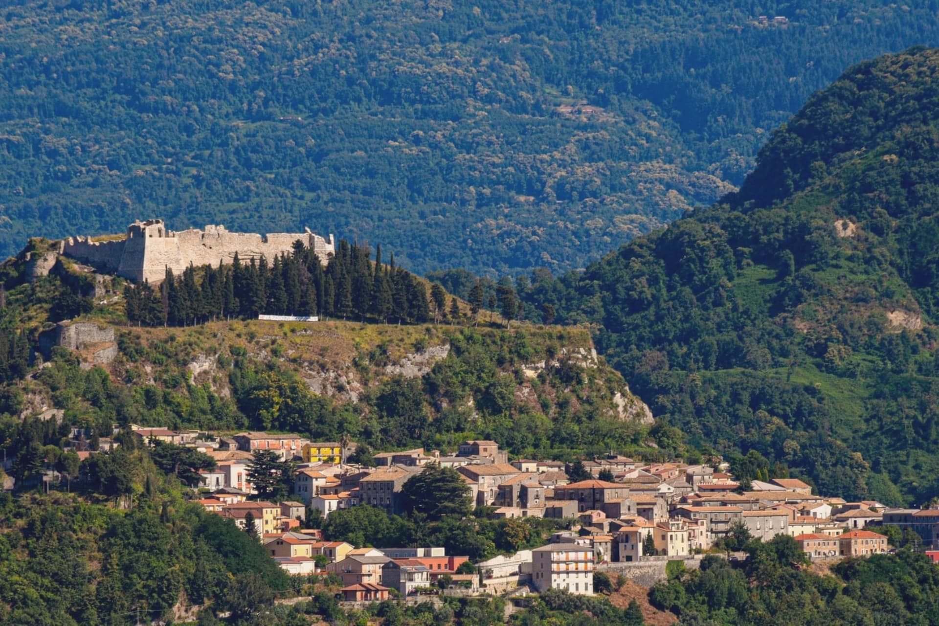
Aiello Calabro sits at 502 meters on a ridge in the Tyrrhenian hinterland, twenty kilometers from Cosenza and about fifteen from the sea. Archaeological tombs from around 550 BC found in the Valle locality place the area inside the orbit of ancient Temesa, between the Oliva and Savuto rivers.
Roberto il Guiscardo's Normans took the town in 1065 after a four-month siege. In 1566 the Cybo-Malaspina, a Ligurian-Tuscan dynasty from Massa, bought the fief for 38,000 ducats; they held it as marquisate, then duchy, until feudalism was abolished.
The family's sixteenth-century palace still stands in the historic center, alongside the ruins of the medieval castle and the tenth-century Chiesa Madre that holds the relics of San Geniale. A 1905 earthquake destroyed much of the settlement and the population has fallen ever since.
The town joined the Borghi più belli d'Italia in recognition of the preserved medieval grid.
What to see in Aiello Calabro
- Palazzo Cybo-Malaspina. Sixteenth-century palace built by the Ligurian-Tuscan family that ruled Aiello for two centuries, with the Cappella di Alfonso Cybo inside.
- Castello medievale. Ruins of the medieval fortress on the highest point of the ridge, called one of the first fortresses of the kingdom by Leandro Alberti in 1525.
- Chiesa Madre di Santa Maria Maggiore. Tenth-century mother church on the lower ridge, holding the relics of San Geniale, patron of the town.
How to get to Aiello Calabro
Reggio Calabria is roughly 117 minutes away by road.
Our tip
April through June and September into October are the best months. The ridge at 502 meters catches the sea breeze from the Tyrrhenian, and temperatures stay below thirty most days. July and August push past thirty-five degrees; the centro storico empties at midday.
Oriolo
Why visit Oriolo
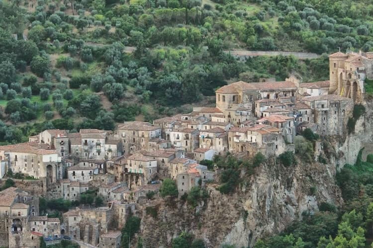
Oriolo sits on a sandstone outcrop at 450 meters above the Ferro valley, on the eastern slopes of the Pollino National Park and twenty kilometers inland from the Ionian Sea. The settlement grew up as a refuge for coastal populations fleeing Saracen raids, and twelfth-century Greek documents already record the toponym Orzoùlon, from the Latin Hordeolus meaning barleycorn.
The Aragonese castle on the highest rock spur dates back to Byzantine foundations and was rebuilt by the Sanseverino family; in 1552 Marcello Pignone bought the barony for 12,000 ducats and turned the fortress into a noble residence, painted and frescoed. In 1647 it was besieged during the Masaniello revolt.
The Church of San Giorgio, with a Renaissance portal, anchors the lower part of the borgo. The town carries both the Borghi più belli d'Italia and Bandiera Arancione signals, a combination rare in this corner of the Pollino.
What to see in Oriolo
- Castello di Oriolo. Aragonese fortress on the highest sandstone spur, rebuilt by the Sanseverino family on Byzantine foundations, later residence of the Pignone marquises.
- Chiesa di San Giorgio. Mother church of the borgo with a Renaissance portal, named for the patron saint of Oriolo.
- Centro storico. Medieval walled borgo preserving its original urban layout of stepped alleys converging on the castle rock.
How to get to Oriolo
Taranto is roughly 114 minutes away by road.
Our tip
April through June and September into October are the dry, walkable months in Oriolo, when the Ferro valley turns green and temperatures stay in the low twenties. July and August are hot, often above thirty degrees on the exposed outcrop, and the borgo empties from mid-afternoon. November through March is quiet: many shops close, the wind comes off the Pollino, and the castle rock catches early morning fog from the river below.
San Nicola Arcella
Why visit San Nicola Arcella
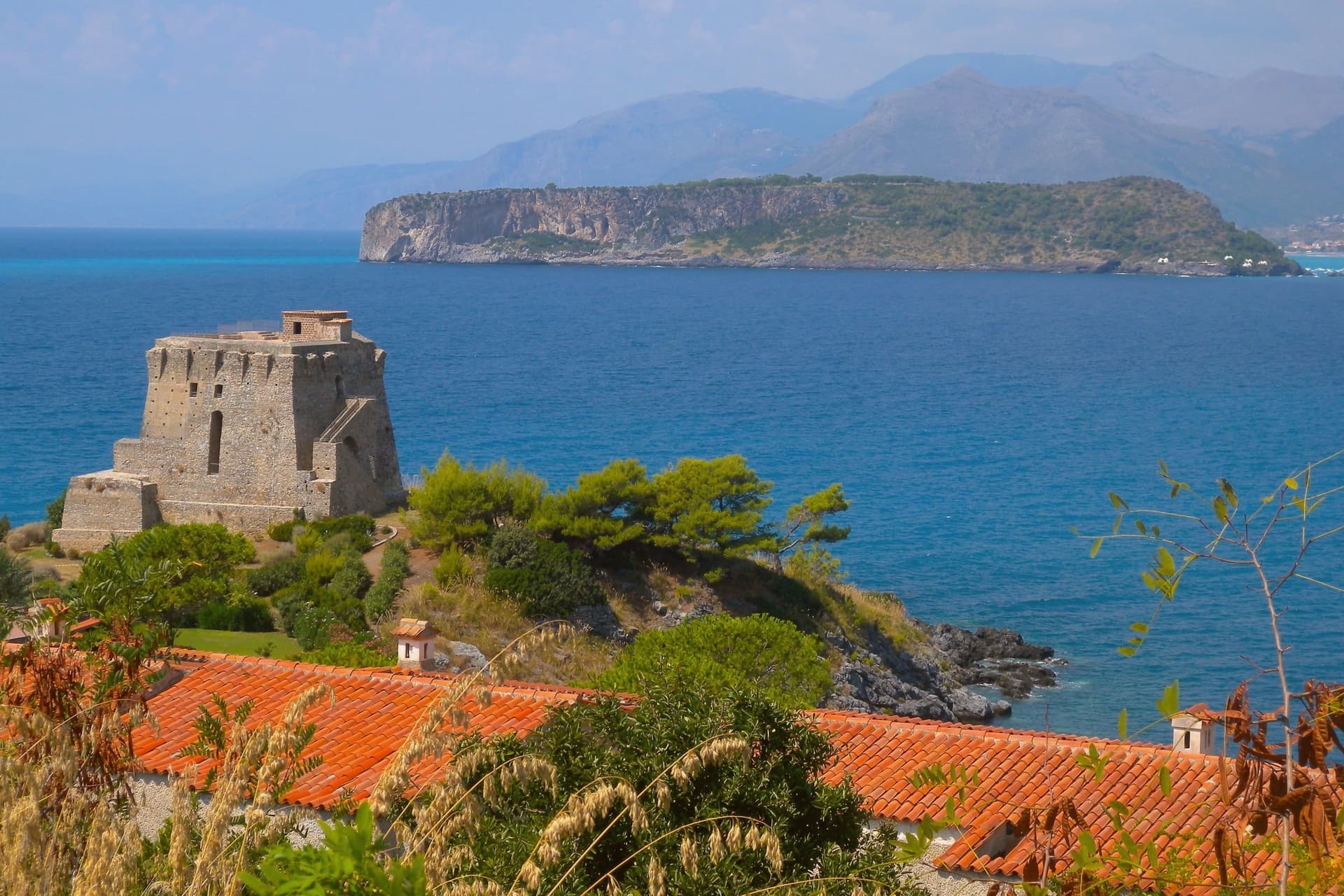
San Nicola Arcella sits at 110 meters on a cliff above the Tyrrhenian Sea in the northern Riviera dei Cedri, between Scalea and Praia a Mare. The settlement traces back to the Greek colony of Lao and its Roman successor Lavinium on the same stretch of coast.
The hilltop relocation followed the Saracen raids of the early Middle Ages, when villagers moved uphill behind a watch tower, and the Arcella part of the name comes from the rock the village sits on. Prince Pietro Lanza Branciforte, who married the last heir of the Spinelli di Scalea family in the nineteenth century, expanded the fishing economy and built out the urban core, which became an autonomous commune in 1811.
That core still sits on the rock the raids drove people to, while the watchtower built for the same defense on the southern headland later found a second use as a writer's study. The village today is the sum of that retreat uphill and that later reuse: a defensive settlement that outlasted the danger it was built for and let the coast below it, arch, cove and all, become the draw instead.
What to see in San Nicola Arcella
- Spiaggia dell'Arco Magno. Inner cove reached only on foot or by boat, framed by a stone arch carved into the headland by the sea.
- Torre Crawford. Sixteenth-century anti-piracy watchtower on the southern headland, used as a study by American novelist Francis Marion Crawford in the 1890s.
- Centro storico. Hilltop core perched on the rock, rebuilt under the Lanza Branciforte princes in the nineteenth century around the parish church and the old casale.
How to get to San Nicola Arcella
Salerno is roughly 120 minutes away by road.
Our tip
May through September runs the whole village. Boats start the Arco Magno shuttle in late May, the Bandiera Blu beaches fill from mid-June, and July and August bring the heaviest crowds onto a small headland. Heat sits in the high twenties on the cliff; midday on the inner beach is reflected off the rock walls and harder than the open coast.
Fiumefreddo Bruzio
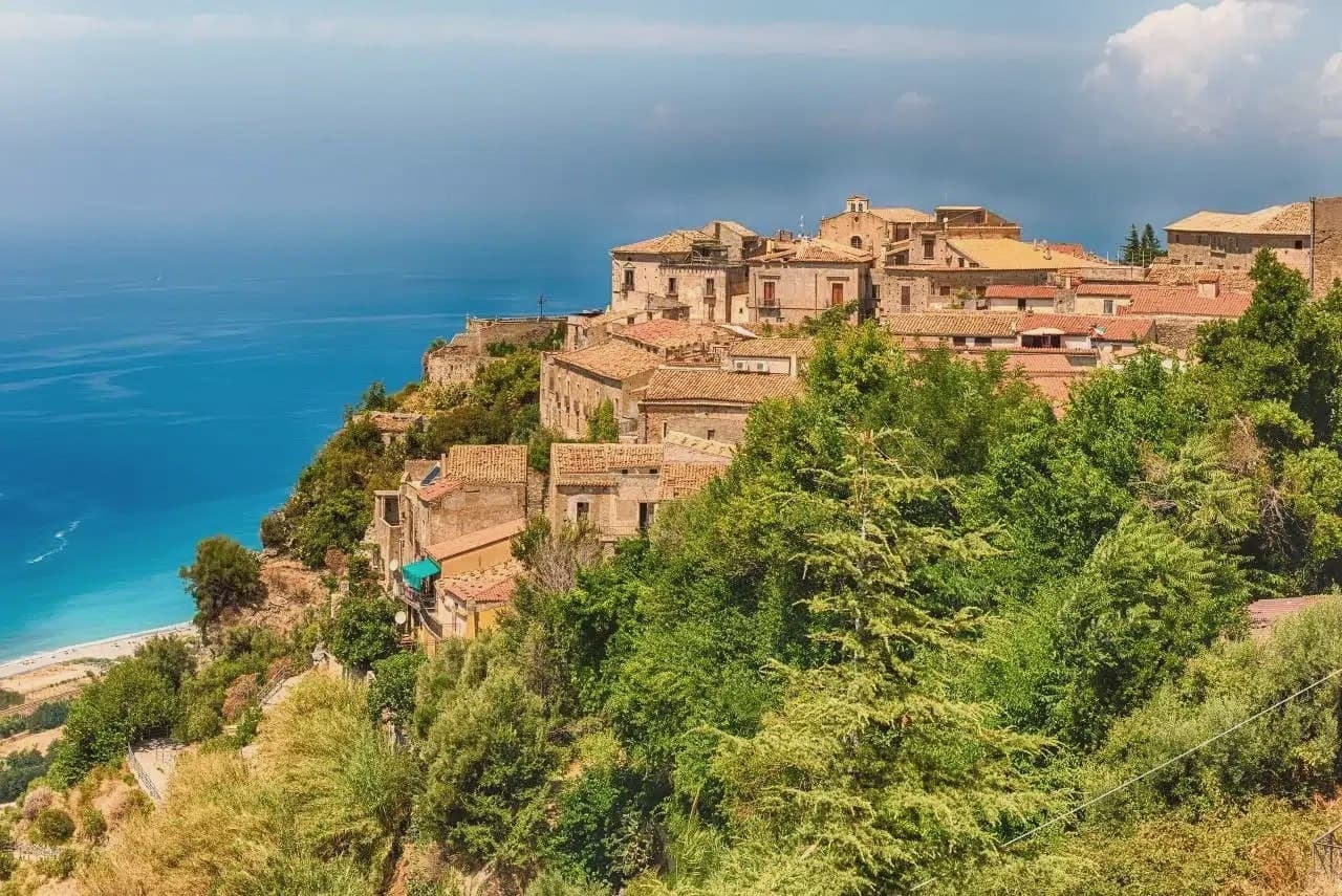
Why visit Fiumefreddo Bruzio
Fiumefreddo Bruzio sits at 220 metres on a hill above the Tyrrhenian, in the southern part of Cosenza province. The territory runs from sea level on the lungomare up to the peak behind the town, so the walk from shore to centro storico to mountain flank covers the whole of the place in one climb.
The castle occupies the high point of the settlement, sieged and nearly destroyed by French troops in 1806-1807 before recovering the Renaissance portal added centuries earlier. The mother church, San Michele Arcangelo, anchors the religious life of the centro storico separately from the castle, holding paintings by Solimena and Pascaletti since 1540.
What ties the upper town together now is the later layer left by the painter, who worked here each summer from the 1970s and scattered murals and sculptures through the lanes, the church dome, and the castle room he frescoed at 81. The result is a hill town where a medieval defensive core, a sixteenth-century church, and a twentieth-century painter's late work all occupy the same small radius of stone streets, with the mountain behind and the sea below holding the whole arrangement in place.
What to see in Fiumefreddo Bruzio
- Castello della Valle. Castle with a sixteenth-century Renaissance portal. Inside, the Stanza dei Desideri carries Salvatore Fiume's frescoes.
- Chiesa Matrice di San Michele Arcangelo. Mother church built in 1540 holding paintings by Francesco Solimena and Giuseppe Pascaletti, the main religious building of the town.
- Chiesa di San Rocco. Small church whose dome carries a Fiume painting, one point in his wider intervention across the centro storico.
How to get to Fiumefreddo Bruzio
Reggio Calabria is roughly 135 minutes away by road.
Our tip
May through September is the working season: warm Tyrrhenian sea below, mild hilltop temperatures at 220 metres, and the castle open for visits. June stays in the high twenties on the hill; July and August can push past thirty-five, and the lungomare three kilometres downhill fills with summer residents from Cosenza. September is the better month for the castle frescoes and the centro storico walks, with the air clearer toward Monte Cocuzzo. Mercato Settimanale Di Fiumefreddo Bruzio falls in September.
Rocca Imperiale
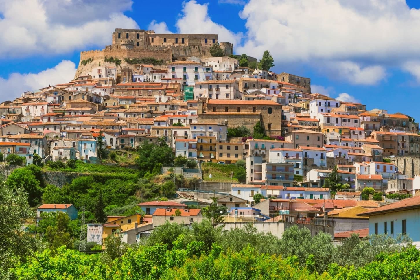
Why visit Rocca Imperiale
Rocca Imperiale is the northernmost commune of Calabria, pressed against the Basilicata border on the Ionian coast. The hilltop borgo sits a kilometre inland from the long sandy Marina, the two connected by the slope the town has always used to move between fortress and shore.
The castle stands on a defensible hill chosen to command the coastal route between Taranto and Reggio Calabria, and the borgo grew downhill from it in tight medieval grids of whitewashed houses and narrow vicoli, with the Chiesa Madre dell'Assunta, a 15th-century church with a Madonna by Pietro Bernini, father of Gian Lorenzo, anchoring the central piazza. Inland and upland frame the town on the other side: the Pollino park lies 30 km west and the Sila highlands further south, making Rocca a base for both while the coastal frazione below handles the beach trade.
The food is north-Calabrian-meets-Lucanian: peperoni cruschi, pasta with lardo and chilli, pesce azzurro from the Ionian, and the lemon grown only in the surrounding belt, used in liqueurs and the local pasta al limone. The Festa del Limone in early August is the year's main event.
The town works because its geography does the sorting: fortress and church hold the hill, the lemon groves hold the middle slope, and the marina holds the shore, each part visible from the others across the same short drop to the sea.
What to see in Rocca Imperiale
- Castello Federiciano (1225). Frederick II Hohenstaufen's square fortress with four corner towers (two cylindrical) commanding the Ionian coastal route. Open as a cultural centre.
- Centro storico (Borghi più belli). Whitewashed houses in tight medieval vicoli cascading downhill from the castle. The Chiesa Madre dell'Assunta has a Pietro Bernini Madonna.
- Rocca Imperiale Marina (Bandiera Blu). Long sandy Ionian beach 1 km below the borgo, holding the Bandiera Blu every recent year for water clarity and beach management.
How to get to Rocca Imperiale
There is a railway station in the town, so you can arrive without a car and never need one while you are here. Taranto is roughly 81 minutes away by road.
Our tip
Rocca Imperiale is best May–June and September–October — the borgo cool in the morning, the Marina swimmable, the lemon orchards in flower or harvest. July–August fills the Marina with Italian families and the Festa del Limone (early August) is the biggest event. The borgo stays atmospheric in winter but most amenities at the Marina close November–March.
Morano Calabro
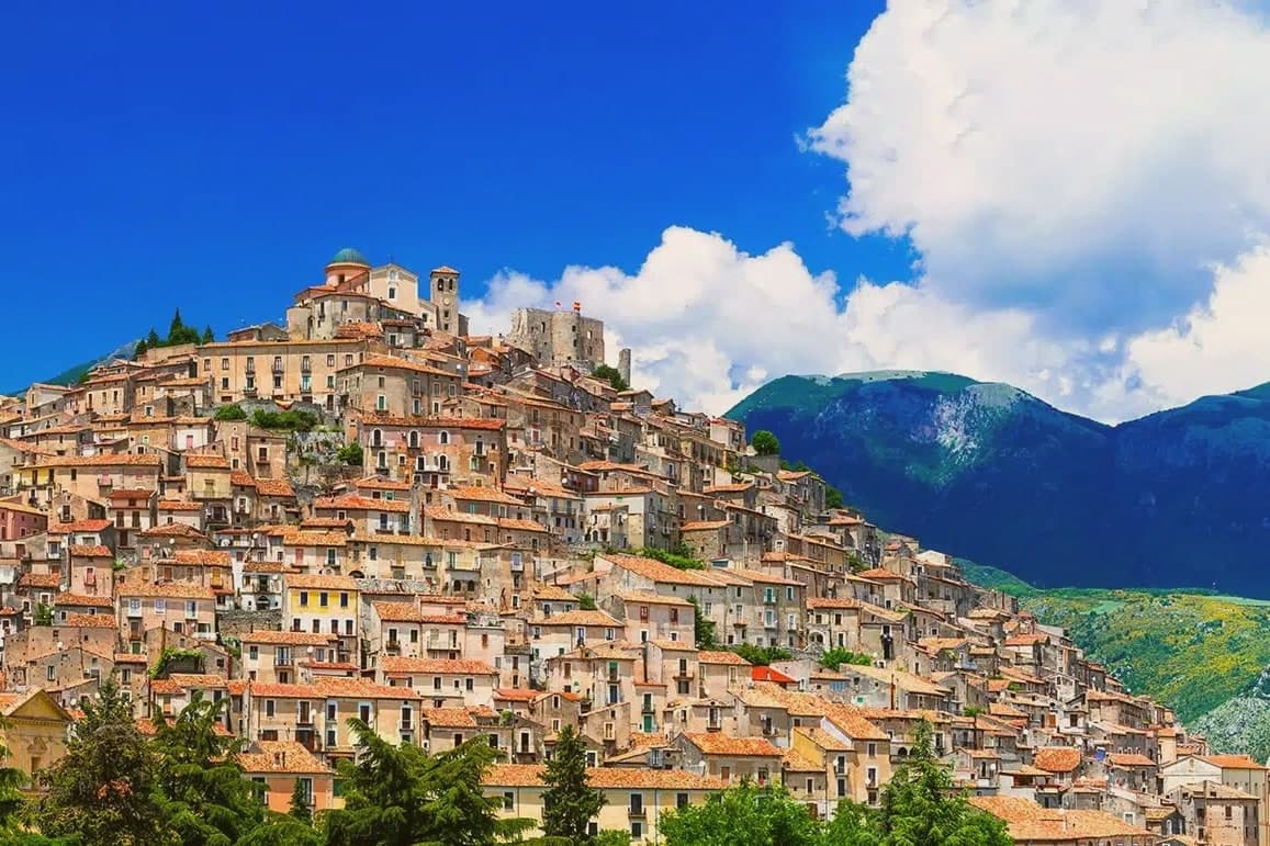
Why visit Morano Calabro
Morano Calabro stands at 694 meters, folded around a conical hill at the edge of the national park. The Roman settlement appears as Muranum on the Lapis Pollae milestone, a station on the Via Popilia that ran between Capua and Reggio, which places the town on a road line far older than the castle above it.
The Battle of Campo Tenese in 1806 cut through these hills when the First French Empire crushed the Bourbon army on the plain east of town, a piece of history the hill itself does not show but the surrounding ground carries. The centro storico climbs from its lower gates up to the summit in the concentric rings the town is known for, with its churches and the monastic complex set into the slope rather than gathered at any single point.
The mountain rises immediately north of the last houses, so the built town and the park meet without any transition between them. What Morano amounts to, then, is a settlement whose Roman road station, medieval hill town, and battlefield history are all still legible in the same short climb from the plain to the summit.
What to see in Morano Calabro
- Castello Normanno-Svevo. The ruins sit on the summit, roofless walls open to the sky, with the rings of houses falling away below in the pattern that gave the town its nickname.
- Collegiata di Santa Maria Maddalena. Founded around 1097, enlarged in the sixteenth century, with a neoclassical façade completed in the nineteenth and a Baroque interior.
- Chiesa di Santi Pietro e Paolo. Archpriest's church near the castle, with foundations dating to around the year 1000, the oldest surviving sacred building in the village.
How to get to Morano Calabro
Salerno is roughly 110 minutes away by road.
Our tip
At 694 meters the climate runs cooler than the Tyrrhenian coast an hour west. May through October is the working season: green slopes, mild evenings, and the high Pollino trails open by late spring. July and August stay manageable into the high twenties, though midday in the centro storico still pushes residents indoors.
Altomonte
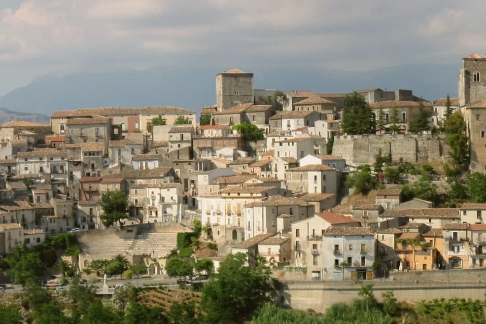
Why visit Altomonte
Altomonte sits at 455 meters in the Valle dell'Esaro, forty-five kilometers north of Cosenza, between the Pollino slopes and the Ionian plain. The village is built around the church, its stairways and alleys climbing the hillside toward the square in front of it, which gives the settlement its layout and its nickname as Calabria's wedding village.
The Dominicans took over the church in 1443 and founded the convent that now houses library and museum, joining under one roof the religious life of the town and the collection that grew out of it. Altomonte is one of I Borghi più belli d'Italia, a Cittaslow, and a Città dell'Olio and del Pane.
The recognitions and the produce sit alongside the medieval fabric rather than apart from it: a small hill town whose civic identity, from bread ovens to heritage listings, has grown around the same core the church and its square have held since the fourteenth century.
What to see in Altomonte
- Chiesa di Santa Maria della Consolazione. Built on a Norman foundation of 1070, raised over it by Filippo Sangineto. French stonework distinguishes the interior, the reason the church is ranked above any other Gothic-Angevin building in the region.
- Museo Civico di Altomonte. Housed in the former Dominican convent, with Simone Martini's panel of Saint Ladislaus commissioned by Filippo Sangineto in 1326 in Siena.
- Castello Normanno-Aragonese. Hilltop castle of Norman origin remodelled under the Aragonese, dominating the centro storico and the Esaro valley below.
How to get to Altomonte
Salerno is roughly 146 minutes away by road.
Our tip
April, May, June and September into October are the right months to walk Altomonte's stairways without sweating and to enter the Consolazione church when the afternoon light hits the rose window. July and August reach the mid-thirties on the Esaro plain, though the 455-meter perch holds an evening breeze the lowland towns do not get. November through March is quiet: many restaurants close midweek and the museum keeps shorter hours.
Trebisacce
Why visit Trebisacce
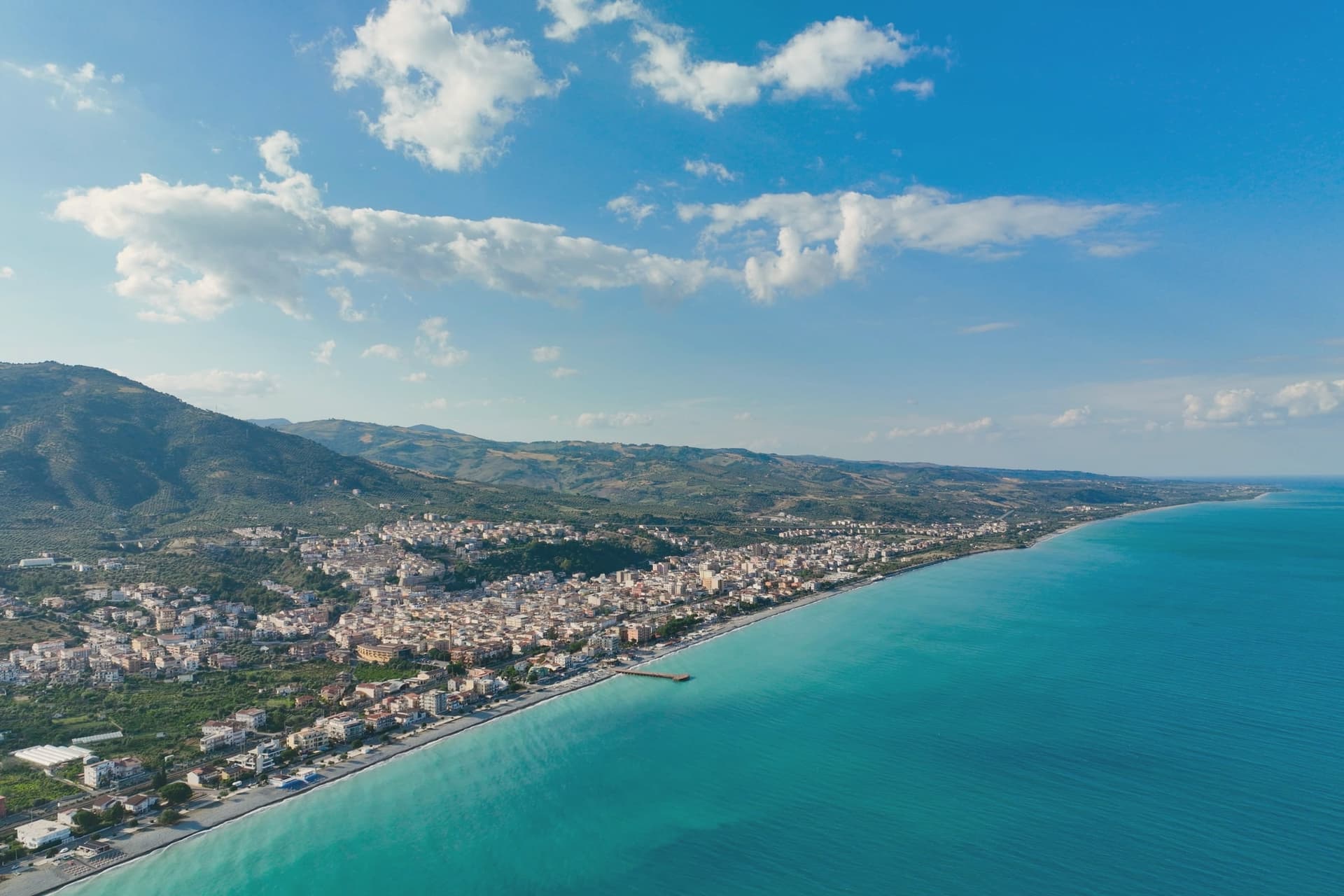
Trebisacce sits at 73 meters in the upper-Cosenza arc, on a hill whose flat top gave the town its name: the Greek Trapezàkion, small table, a literal description of the tabular ground the old town stands on. In antiquity the settlement held the road between Metaponto and Sybaris, twenty kilometres south on the Sibari plain, a position that put it on the trade routes long before the medieval walls went up.
The lower modern town runs along the seafront below; the plateau above keeps the old streets, the mother church, and the walls raised in the sixteenth century against Saracen raids. Inland and uphill, past the modern town, a rock-cut chapel sits inside a pine forest on Monte Mostarico, a different register of building from the stone church and the archaeological trenches below.
Read together, the layers, coastal plain, tabular hill, and inland forest, describe a town that has always faced two ways: out to the sea route and up to the higher, quieter ground behind it.
What to see in Trebisacce
- Chiesa di San Nicola di Mira. Trullo-shaped dome and a tall pyramidal bell tower stand over the centro storico, the church's mass still setting the skyline of the old town.
- Broglio di Trebisacce. Excavated since 1979, the site has also given up a Hellenic necropolis alongside the Mycenaean finds, layered evidence of the plateau's long occupation.
- Centro storico sul plateau. Old town on the tabular hill that gives Trebisacce its name, ringed by sixteenth-century walls built against Saracen raids.
How to get to Trebisacce
There is a railway station in the town, so you can arrive without a car and never need one while you are here. Taranto is roughly 104 minutes away by road.
Our tip
May and June bring warm sea and the lungomare opening, with the plateau still cool in the evenings. July and August are hot on the Ionian coast and the modern town fills with summer residents from the Sibari plain and Basilicata. September is the better month: water still in the mid-twenties, beach umbrellas thinned out, restaurants quieter.
More from Anywhere Italy
- The best hill towns in the province of Cosenza
- The best towns that eat well in the province of Cosenza
 The best hidden beach towns in Calabria
- The best hidden towns that eat well in Calabria
- The best small coastal towns in Calabria
 The best hidden beach towns you can reach by train in the province of Cosenza