
The best towns that eat well in the province of Cosenza
The province of Cosenza feeds people seriously, and it does so with a short list of ingredients used well. In the Sila the cooking runs to pork cured with peperoncino, mushrooms from the pine woods, potatoes grown in volcanic-dark soil, caciocavallo silano and pasta rolled around a knitting needle. Down on the coast it turns to anchovies, swordfish, red onion from the Ionian flats, figs dried in September and citrus that scents whole streets in winter. The houses are stone and rendered brick, stacked on ridges, and the good tables are often a room off a courtyard rather than a place with a view.
In practice most visitors to Calabria eat where the traffic goes, which means the seafront strips of Tropea and the coach stops around the Riace Bronzes in Reggio. Both are worth their reputation, and both are busy from June onwards, when kitchens cook for volume and menus flatten into the same fritto misto and swordfish steak up and down the promenade. Cosenza's own historic centre gets a lunch crowd and little else, because people treat the city as a road to somewhere else.
The cooking does not stop at the resort towns. It carries up into the Sila plateau, along the Riviera dei Cedri and round the Ionian curve towards the Pollino, into places where fewer people go and where a national or international dining guide has still gone to the trouble of naming a table. That is what the towns below have in common: a kitchen someone drove a long way to write about, in a comune most itineraries pass without stopping.
Of the 26 communes we have mapped in the province of Cosenza, 6 qualify as towns that eat well: a national or international dining guide has named a table in each. The smallest, San Nicola Arcella, has 1,957 residents.
Elsewhere in the catalogue: The best hidden towns that eat well in Calabria and The 8 best coastal towns that eat well in Calabria.
San Nicola Arcella
Why visit San Nicola Arcella
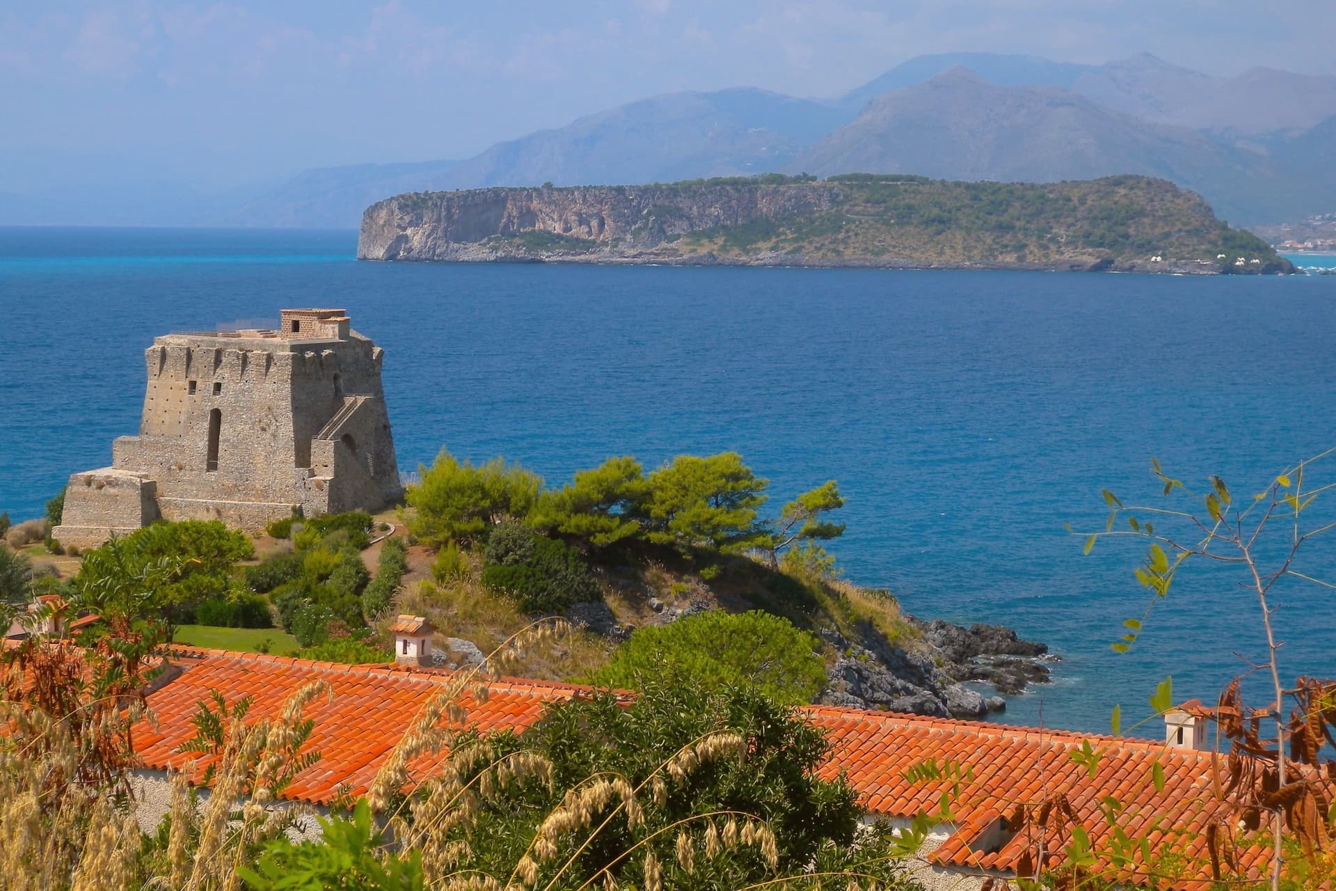
San Nicola Arcella sits at 110 meters on a cliff above the Tyrrhenian Sea in the northern Riviera dei Cedri, between Scalea and Praia a Mare. The settlement traces back to the Greek colony of Lao and its Roman successor Lavinium on the same stretch of coast.
The hilltop relocation followed the Saracen raids of the early Middle Ages, when villagers moved uphill behind a watch tower, and the Arcella part of the name comes from the rock the village sits on. Prince Pietro Lanza Branciforte, who married the last heir of the Spinelli di Scalea family in the nineteenth century, expanded the fishing economy and built out the urban core, which became an autonomous commune in 1811.
That core still sits on the rock the raids drove people to, while the watchtower built for the same defense on the southern headland later found a second use as a writer's study. The village today is the sum of that retreat uphill and that later reuse: a defensive settlement that outlasted the danger it was built for and let the coast below it, arch, cove and all, become the draw instead.
Trattoria La Quercia have been named by a guide.
What to see in San Nicola Arcella
- Spiaggia dell'Arco Magno. Inner cove reached only on foot or by boat, framed by a stone arch carved into the headland by the sea.
- Torre Crawford. Sixteenth-century anti-piracy watchtower on the southern headland, used as a study by American novelist Francis Marion Crawford in the 1890s.
- Centro storico. Hilltop core perched on the rock, rebuilt under the Lanza Branciforte princes in the nineteenth century around the parish church and the old casale.
How to get to San Nicola Arcella
Salerno is roughly 120 minutes away by road.
Our tip
May through September runs the whole village. Boats start the Arco Magno shuttle in late May, the Bandiera Blu beaches fill from mid-June, and July and August bring the heaviest crowds onto a small headland. Heat sits in the high twenties on the cliff; midday on the inner beach is reflected off the rock walls and harder than the open coast.
Altomonte
Why visit Altomonte
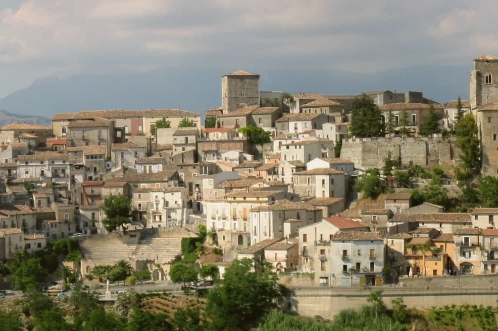
Altomonte sits at 455 meters in the Valle dell'Esaro, forty-five kilometers north of Cosenza, between the Pollino slopes and the Ionian plain. The village is built around the church, its stairways and alleys climbing the hillside toward the square in front of it, which gives the settlement its layout and its nickname as Calabria's wedding village.
The Dominicans took over the church in 1443 and founded the convent that now houses library and museum, joining under one roof the religious life of the town and the collection that grew out of it. Altomonte is one of I Borghi più belli d'Italia, a Cittaslow, and a Città dell'Olio and del Pane.
The recognitions and the produce sit alongside the medieval fabric rather than apart from it: a small hill town whose civic identity, from bread ovens to heritage listings, has grown around the same core the church and its square have held since the fourteenth century.
Barbieri have been named by a guide.
What to see in Altomonte
- Chiesa di Santa Maria della Consolazione. Built on a Norman foundation of 1070, raised over it by Filippo Sangineto. French stonework distinguishes the interior, the reason the church is ranked above any other Gothic-Angevin building in the region.
- Museo Civico di Altomonte. Housed in the former Dominican convent, with Simone Martini's panel of Saint Ladislaus commissioned by Filippo Sangineto in 1326 in Siena.
- Castello Normanno-Aragonese. Hilltop castle of Norman origin remodelled under the Aragonese, dominating the centro storico and the Esaro valley below.
How to get to Altomonte
Salerno is roughly 146 minutes away by road.
Our tip
April, May, June and September into October are the right months to walk Altomonte's stairways without sweating and to enter the Consolazione church when the afternoon light hits the rose window. July and August reach the mid-thirties on the Esaro plain, though the 455-meter perch holds an evening breeze the lowland towns do not get. November through March is quiet: many restaurants close midweek and the museum keeps shorter hours.
Spezzano della Sila
Why visit Spezzano della Sila
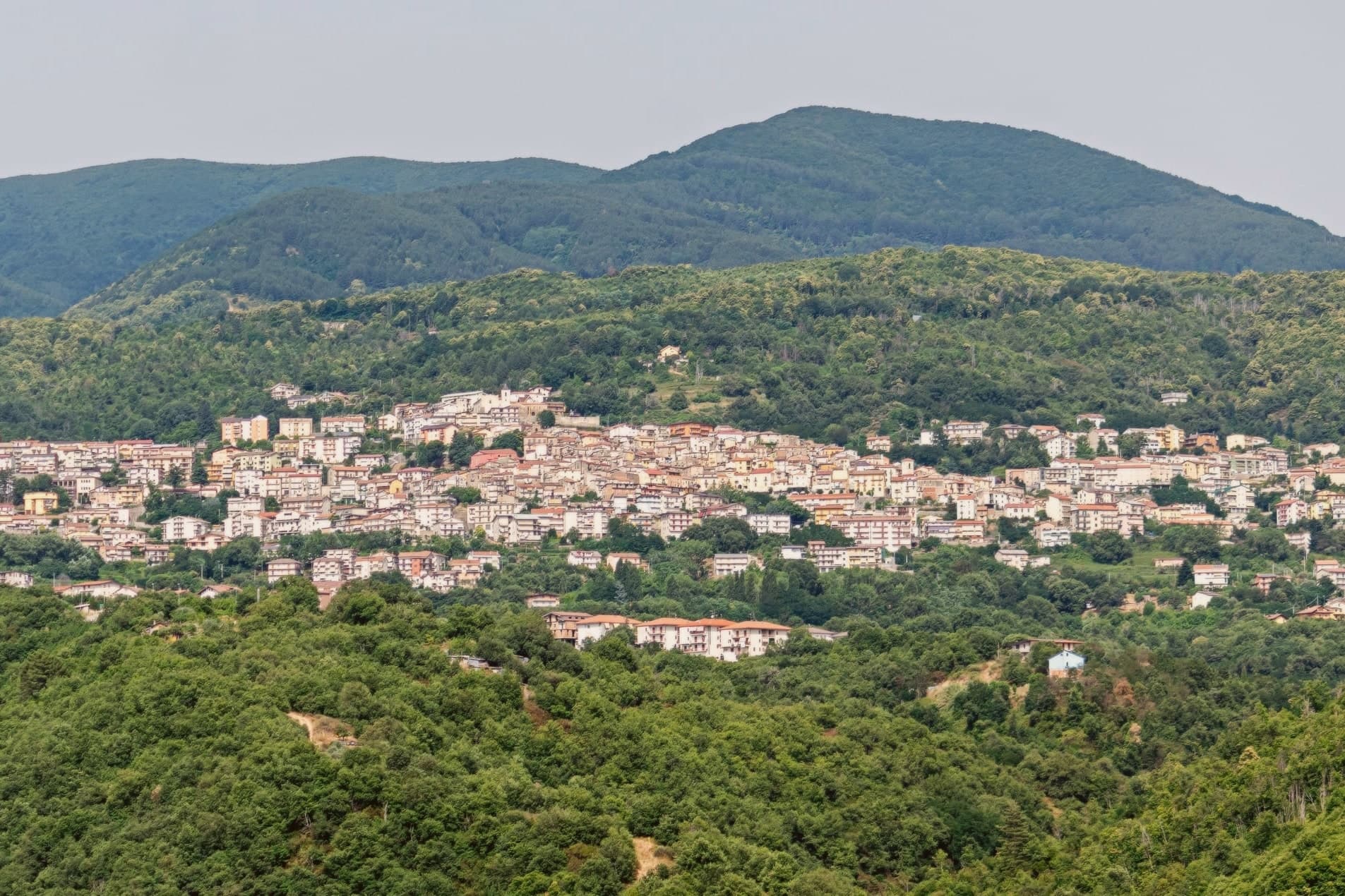
The town sits on the Presila Cosentina, twenty kilometers east of Cosenza and on the western edge of the Sila plateau. The borough likely formed at the end of the tenth century, after the Arab raids on Cosenza pushed settlement inland toward higher ground.
The commune's territory reaches well beyond the historic centre. The mountain hamlets of Croce di Magara and Moccone fall inside its boundary alongside the resort frazione, and with them a share of the national park itself: its visitor centre and wildlife enclosures, its stand of centuries-old pines, and part of the largest lake in Calabria.
Snow closes the high pastures in winter; in summer the same ground turns to hiking, mushroom-gathering and grazing country. The old village below and the high plateau above are administratively one place, even though little of daily life in one resembles the other.
La Tavernetta al San Lorenzo si Alberga have been named by a guide.
What to see in Spezzano della Sila
- Santuario di San Francesco da Paola. Convent with attached cloister at the head of the historic centre, the building around which the old town still gathers.
- Chiesa di San Pietro. Parish church in the old village, the main religious anchor of the Spezzano centro storico.
- Chiesa di San Biagio. Smaller historic church dedicated to the town's patron, part of the network of religious buildings inside the borgo.
How to get to Spezzano della Sila
There is a railway station in the town, so you can arrive without a car and never need one while you are here. Reggio Calabria is roughly 170 minutes away by road.
Our tip
May through October is the long Sila season: the lifts on Monte Curcio stop, the plateau opens up to hikers, and Lake Cecita fills with anglers and picnickers. July and August are the busiest months because the cool air pulls Cosenza and Catanzaro residents up the hill to escape the coast. September and October bring porcini and chestnuts. Sagra della Cucuzza falls in July.
Trebisacce
Why visit Trebisacce
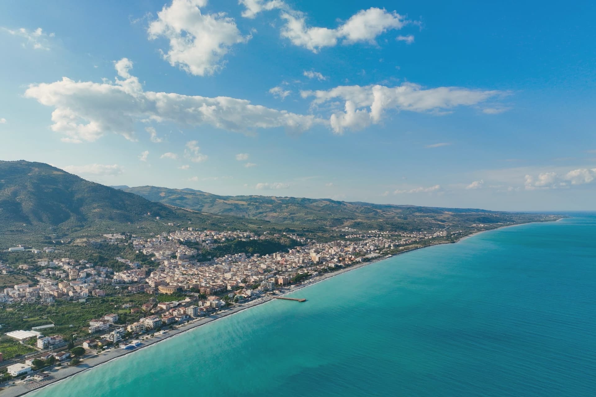
Trebisacce sits at 73 meters in the upper-Cosenza arc, on a hill whose flat top gave the town its name: the Greek Trapezàkion, small table, a literal description of the tabular ground the old town stands on. In antiquity the settlement held the road between Metaponto and Sybaris, twenty kilometres south on the Sibari plain, a position that put it on the trade routes long before the medieval walls went up.
The lower modern town runs along the seafront below; the plateau above keeps the old streets, the mother church, and the walls raised in the sixteenth century against Saracen raids. Inland and uphill, past the modern town, a rock-cut chapel sits inside a pine forest on Monte Mostarico, a different register of building from the stone church and the archaeological trenches below.
Read together, the layers, coastal plain, tabular hill, and inland forest, describe a town that has always faced two ways: out to the sea route and up to the higher, quieter ground behind it.
La Rotonda have been named by a guide.
What to see in Trebisacce
- Chiesa di San Nicola di Mira. Trullo-shaped dome and a tall pyramidal bell tower stand over the centro storico, the church's mass still setting the skyline of the old town.
- Broglio di Trebisacce. Excavated since 1979, the site has also given up a Hellenic necropolis alongside the Mycenaean finds, layered evidence of the plateau's long occupation.
- Centro storico sul plateau. Old town on the tabular hill that gives Trebisacce its name, ringed by sixteenth-century walls built against Saracen raids.
How to get to Trebisacce
There is a railway station in the town, so you can arrive without a car and never need one while you are here. Taranto is roughly 104 minutes away by road.
Our tip
May and June bring warm sea and the lungomare opening, with the plateau still cool in the evenings. July and August are hot on the Ionian coast and the modern town fills with summer residents from the Sibari plain and Basilicata. September is the better month: water still in the mid-twenties, beach umbrellas thinned out, restaurants quieter.
Belvedere Marittimo
Why visit Belvedere Marittimo
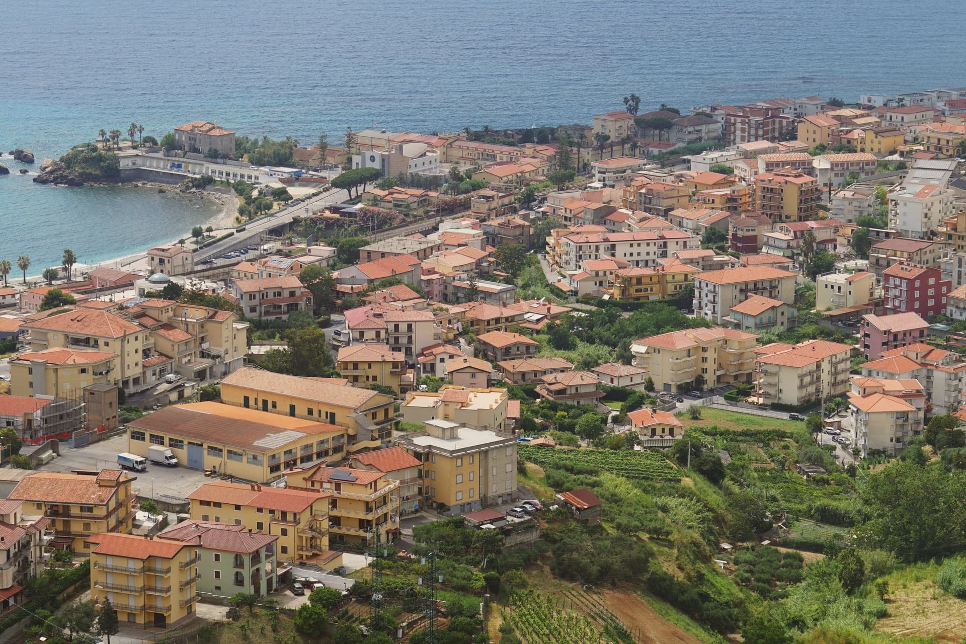
Belvedere Marittimo sits at 150 meters on the Tyrrhenian, fifty kilometers west of Cosenza. The municipal territory runs from Santa Litterata to Calabaja along the coast and climbs behind into the Pollino foothills, where the national park covers part of the commune: a town split between shoreline and mountain, with the built-up center held on the high ground between the two.
The Normans raised the original fortress around the year 1000 under Roger I, choosing the highest hill above the sea for it. Belvedere men sailed in the fleet at the Battle of Lepanto in 1571.
The relics kept in the Capuchin convent for more than three centuries gave the town its local title, Città dell'Amore, and the Riviera dei Cedri, the forty-kilometer run of coast from Tortora south to here, takes its name from the citron still grown on the hillsides above the houses. What holds the town together is the vertical arrangement: castle on the hilltop, convent below it, citron groves on the slopes, and the sea at the bottom, each layer named for what it has kept longest.
Sapori & Saperi have been named by a guide.
What to see in Belvedere Marittimo
- Castello Aragonese. Built by the Normans around 1000, the fortress was reworked under Ferdinand of Aragon with ceremonial gates added alongside the crenellated walls. It commands the hill above the town and the sea below.
- Convento dei Cappuccini. The convent holding the relics of San Valentino sits away from the shoreline crowds, its quiet a contrast to the title the town has taken from it.
- Riviera dei Cedri. The stretch running from Tortora south to Belvedere passes beneath hillsides still planted with cedro, the citron visible above the rooftops.
How to get to Belvedere Marittimo
Salerno is roughly 163 minutes away by road.
Our tip
May through September is the working season on the Riviera dei Cedri. The Lido fills in July and August with Italian families, June and September are the gentler months for warm sea and an open table at the lungomare. The Castello Aragonese is best in the cooler hours, the spring before the heat and the late afternoons of summer.
San Giovanni in Fiore
Why visit San Giovanni in Fiore
San Giovanni in Fiore sits at 1,049 meters at the center of Sila Grande, inside Sila National Park, the largest mountain commune in Italy by population above 1,000 meters altitude. The town grew from the abbey founded here in 1188 by the Calabrian monk and medieval theologian whom many historians consider the most influential apocalyptic thinker of the Middle Ages.
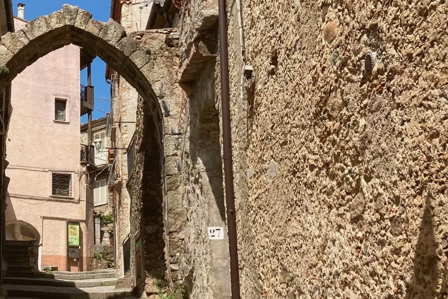
The abbey gave the settlement its shape: the old town climbs Monte Difesa around the complex, and the built-up core still reads as a place that grew outward from a religious house rather than a market or a port. The municipal territory reaches well beyond that core, stretching across the Sila plateau to take in Lorica, the lake village at 1,314 meters, so that a single commune holds both a mountain town built around a medieval abbey and a lake station given over to hiking and skiing.
The town is in the Città del Vino network. Calabrian emigration history has its capital here, the population of half a century ago halved by departures to Argentina, North America and northern Italy.
A place, then, that reached its greatest size as a religious and demographic center and has spent the decades since sending its people elsewhere while its territory grew to include a second, quite different kind of settlement at altitude.
Hyle, Brillo Parlante have been named by a guide.
What to see in San Giovanni in Fiore
- Abbazia Florense. Founded by Gioacchino da Fiore in 1188, the abbey burned in 1214 and was rebuilt by 1230. The Latin-plan complex survives with a large central cloister ringed by ogival arches.
- Centro Internazionale di Studi Gioachimiti. Housed in the abbey complex, the center for Joachimist Studies holds a medieval library and the working archive on Gioacchino's writings.
- Lorica. Sila lake village at 1,314 meters within the municipality, a year-round mountain station on Lago Arvo with summer hiking and winter skiing.
How to get to San Giovanni in Fiore
There is a railway station in the town, so you can arrive without a car and never need one while you are here. Reggio Calabria is roughly 176 minutes away by road.
Our tip
June through September is the green season in Sila Grande. The lakes around Lorica fill with Calabrian families escaping the coastal heat, the high pastures bloom, and the abbey is at its quietest in the early mornings. December through March is the second season: snow on the plateau, skiing at Lorica and Camigliatello, the town transformed from a mountain capital into a winter destination.
More from Anywhere Italy
- The best hidden towns that eat well in Calabria
- The 8 best coastal towns that eat well in Calabria
- The best towns you can reach by train that eat well in Calabria
 The prettiest villages in the province of Cosenza
 The best hidden towns inside a national park in the province of Cosenza
 The best hidden towns you can reach by train in the province of Cosenza