The 8 best coastal towns that eat well in Calabria
Calabria eats from two seas at once. On the Tyrrhenian side the swordfish boats work the Strait, and the fish comes to table grilled plain with oil and oregano or rolled into involtini with breadcrumbs and capers. On the Ionian side the fields behind the beach give sweet red onions, aubergine, bergamot and the chillies that go into nduja, spread hot on bread while the sun goes down. The building stone changes as you move, tufa and sandstone on the northern cliffs, brick and render on the terraces of the south, and almost every historic centre sits on a rock above its own marina. Late June through September is when the beach bars, the ice cream counters and the fish restaurants all run at once.
Most people who come to the region for a week go to Scilla, stand on the rock beneath the castle, photograph the fishermen's houses at Chianalea with their feet in the water and eat swordfish at one of the tables along the same alley. It is a good place and the reputation is earned, which is why the alley is shoulder to shoulder in August and the car parks above fill by mid morning. The coach traffic from the cruise berths at Reggio and Messina compresses all of it into a few hours in the middle of the day.
The same seas continue for hundreds of kilometres in both directions, and so do the swordfish, the prawns and the onions. North of the Strait the Tyrrhenian coast runs up past cliffs and sea caves to the Riviera dei Cedri; south and east the Ionian shore opens into long sandy bays with fortified towns behind them. The towns here sit directly on that water, and in each one a dining guide has singled out a table, which is a reasonable proxy for a kitchen that takes the local catch seriously. Fewer people stop, and dinner is easier to book.
Of the 45 communes we have mapped in Calabria, 8 qualify as coastal towns that eat well: each sits directly on the sea, and a dining guide has named a table in each. The smallest, San Nicola Arcella, has 1,957 residents.
Elsewhere in the catalogue: The best hidden towns that eat well in Calabria and The best towns you can reach by train that eat well in Calabria.
San Nicola Arcella
Why visit San Nicola Arcella
San Nicola Arcella sits at 110 meters on a cliff above the Tyrrhenian Sea in the northern Riviera dei Cedri, between Scalea and Praia a Mare. The settlement traces back to the Greek colony of Lao and its Roman successor Lavinium on the same stretch of coast.
The hilltop relocation followed the Saracen raids of the early Middle Ages, when villagers moved uphill behind a watch tower, and the Arcella part of the name comes from the rock the village sits on. Prince Pietro Lanza Branciforte, who married the last heir of the Spinelli di Scalea family in the nineteenth century, expanded the fishing economy and built out the urban core, which became an autonomous commune in 1811.
That core still sits on the rock the raids drove people to, while the watchtower built for the same defense on the southern headland later found a second use as a writer's study. The village today is the sum of that retreat uphill and that later reuse: a defensive settlement that outlasted the danger it was built for and let the coast below it, arch, cove and all, become the draw instead.
Trattoria La Quercia have been named by a guide.
What to see in San Nicola Arcella
- Spiaggia dell'Arco Magno. Inner cove reached only on foot or by boat, framed by a stone arch carved into the headland by the sea.
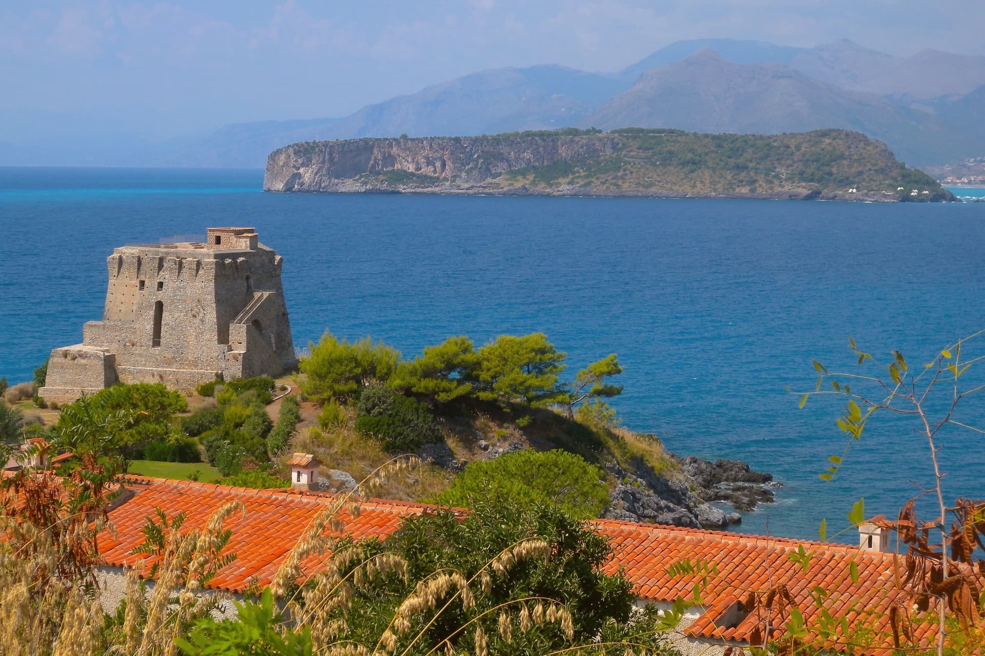
- Torre Crawford. Sixteenth-century anti-piracy watchtower on the southern headland, used as a study by American novelist Francis Marion Crawford in the 1890s.
- Centro storico. Hilltop core perched on the rock, rebuilt under the Lanza Branciforte princes in the nineteenth century around the parish church and the old casale.
How to get to San Nicola Arcella
Salerno is roughly 120 minutes away by road.
Our tip
May through September runs the whole village. Boats start the Arco Magno shuttle in late May, the Bandiera Blu beaches fill from mid-June, and July and August bring the heaviest crowds onto a small headland. Heat sits in the high twenties on the cliff; midday on the inner beach is reflected off the rock walls and harder than the open coast.
Tropea
Why visit Tropea
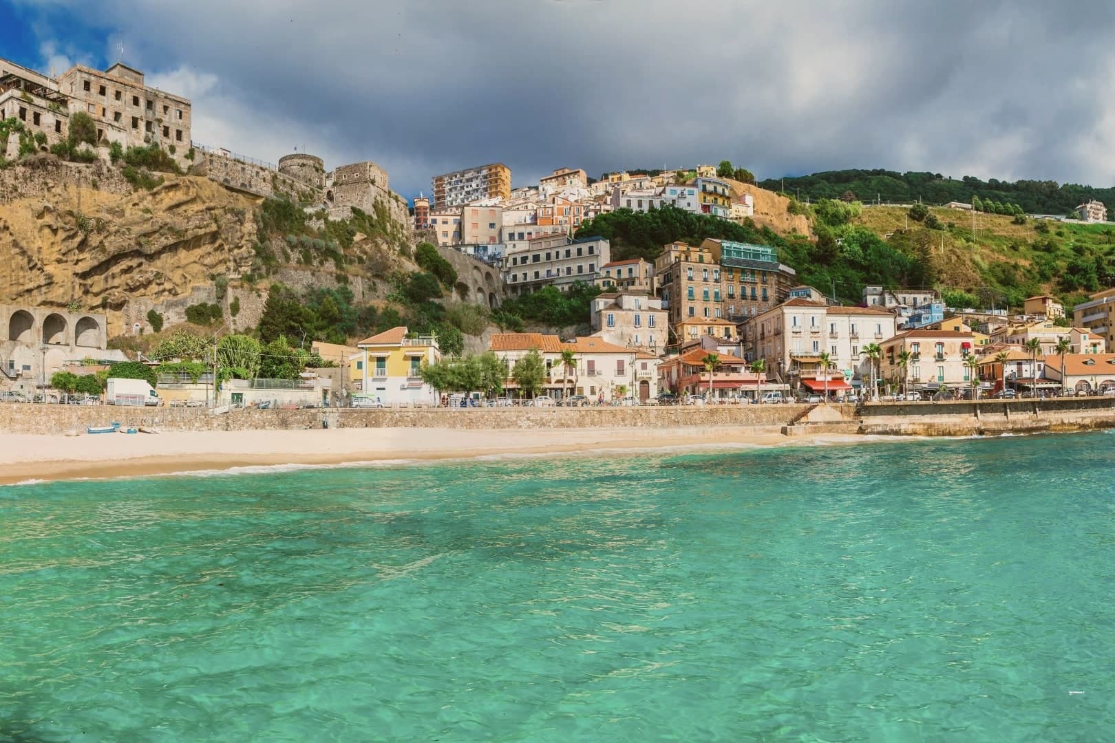
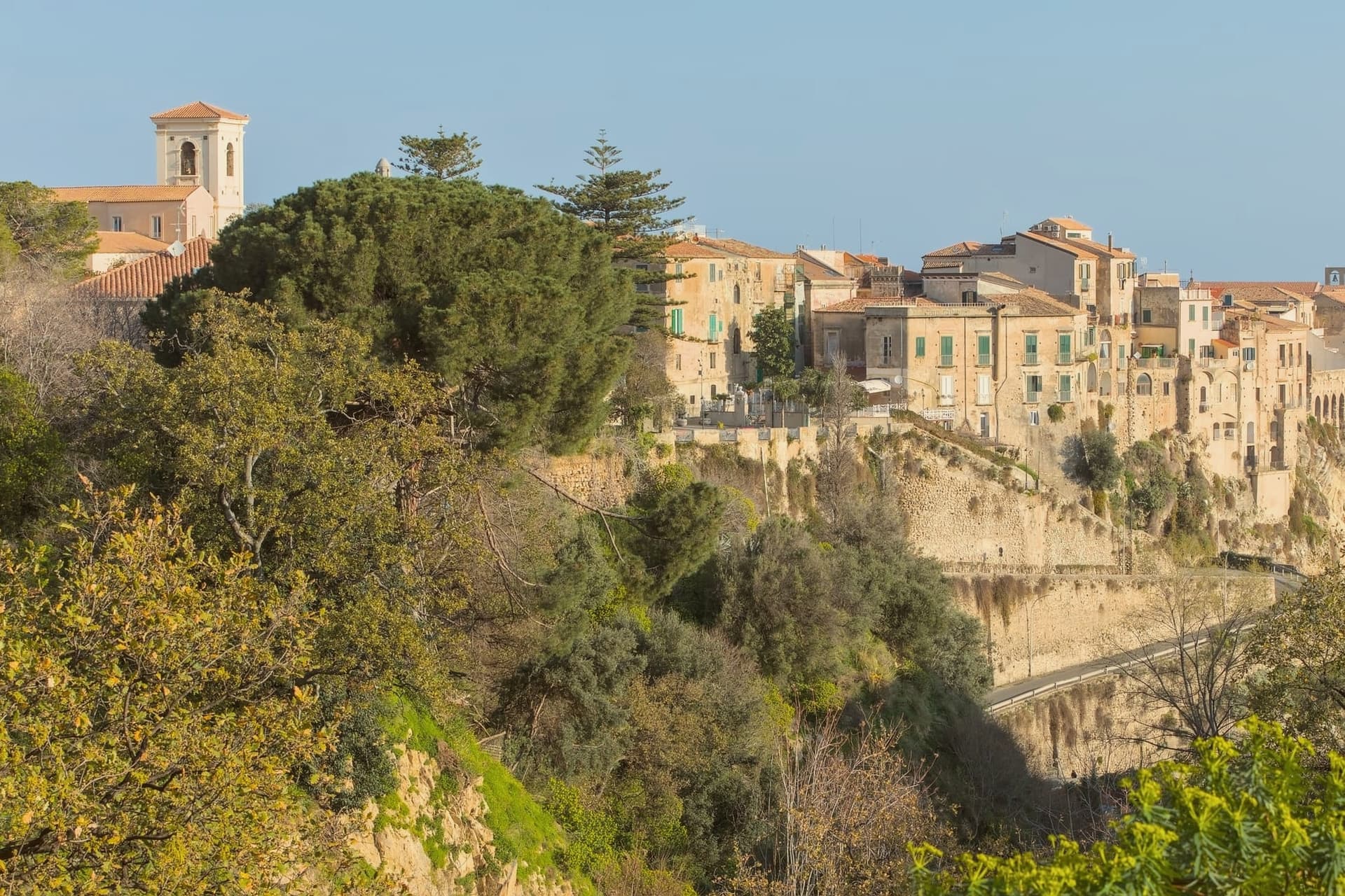
Tropea stands on a tufa cliff fifty metres above the Tyrrhenian Sea, on the stretch of Calabria's west coast marketed as the Costa degli Dei. The town has been a port since Roman times and a bishopric since the eighth century, with Norman and Aragonese phases visible in its walls and palazzi.
The Cattedrale di Maria Santissima di Romania was built by the Normans and reworked in the Baroque period; it holds a fifteenth-century wooden crucifix and a Madonna panel attributed to the school of Giotto. The Santuario di Santa Maria dell'Isola, originally a fourth-century cell, sits on a rocky outcrop thirty-three metres above the sea, reached by a staircase cut into the cliff.
The cipolla rossa di Tropea PGI, said to have been introduced by the Phoenicians and noted by Aristotle and Strabo, grows on the volcanic soils just inland. Tropea was named Borgo dei Borghi 2021 by RAI.
De' Minimi have been named by a guide.
What to see in Tropea
- Santuario di Santa Maria dell'Isola. Norman-era monastery on a tufa sea rock thirty-three metres above the water, reached by a staircase cut into the cliff.
- Cattedrale di Maria Santissima di Romania. Norman cathedral reworked in the Baroque period, with a fifteenth-century wooden crucifix and a Madonna panel attributed to the school of Giotto.
- Centro storico sulla rupe. Tufa cliff town fifty metres above the sea, with noble palazzi from the Norman to Aragonese periods along Corso Vittorio Emanuele.
How to get to Tropea
There is a railway station in the town, so you can arrive without a car and never need one while you are here. Reggio Calabria is roughly 88 minutes away by road.
Our tip
Tropea's season runs from late May to mid-September. May and June bring warm sea and the lungomare back to life. July and August are heavy: the centro storico fills with day-trippers from the rest of Italy, parking spreads into the inland frazioni, and the Spiaggia della Rotonda is shoulder-to-shoulder. Ferragosto a Tropea - Processione a mare della Madonna dell'Isola falls in August.
Trebisacce
Why visit Trebisacce
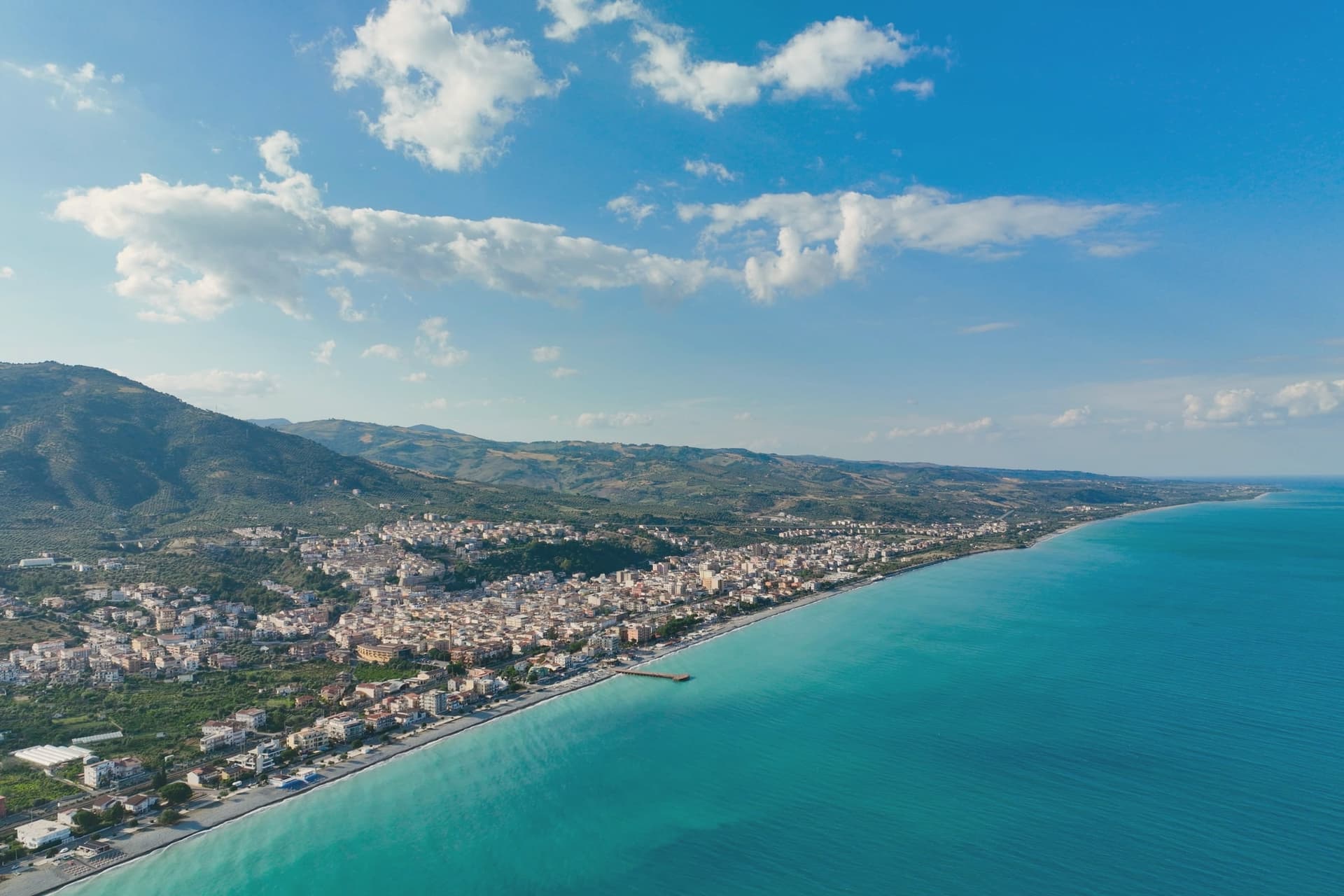
Trebisacce sits at 73 meters in the upper-Cosenza arc, on a hill whose flat top gave the town its name: the Greek Trapezàkion, small table, a literal description of the tabular ground the old town stands on. In antiquity the settlement held the road between Metaponto and Sybaris, twenty kilometres south on the Sibari plain, a position that put it on the trade routes long before the medieval walls went up.
The lower modern town runs along the seafront below; the plateau above keeps the old streets, the mother church, and the walls raised in the sixteenth century against Saracen raids. Inland and uphill, past the modern town, a rock-cut chapel sits inside a pine forest on Monte Mostarico, a different register of building from the stone church and the archaeological trenches below.
Read together, the layers, coastal plain, tabular hill, and inland forest, describe a town that has always faced two ways: out to the sea route and up to the higher, quieter ground behind it.
La Rotonda have been named by a guide.
What to see in Trebisacce
- Chiesa di San Nicola di Mira. Trullo-shaped dome and a tall pyramidal bell tower stand over the centro storico, the church's mass still setting the skyline of the old town.
- Broglio di Trebisacce. Excavated since 1979, the site has also given up a Hellenic necropolis alongside the Mycenaean finds, layered evidence of the plateau's long occupation.
- Centro storico sul plateau. Old town on the tabular hill that gives Trebisacce its name, ringed by sixteenth-century walls built against Saracen raids.
How to get to Trebisacce
There is a railway station in the town, so you can arrive without a car and never need one while you are here. Taranto is roughly 104 minutes away by road.
Our tip
May and June bring warm sea and the lungomare opening, with the plateau still cool in the evenings. July and August are hot on the Ionian coast and the modern town fills with summer residents from the Sibari plain and Basilicata. September is the better month: water still in the mid-twenties, beach umbrellas thinned out, restaurants quieter.
Soverato
Why visit Soverato
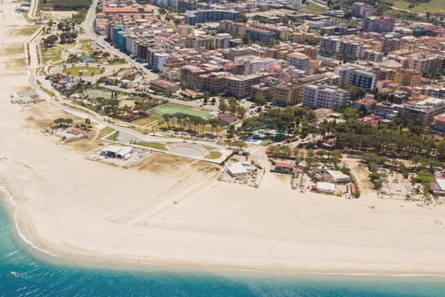
Soverato sits in the province of Catanzaro, on the narrow waist where Calabria almost touches itself, its coast facing the Ionian. The modern town runs along the shore, while inland and uphill lies the older settlement, built before an earthquake in 1783 leveled what came before it; the church of Madonna Addolorata still marks that older core, separate from the seafront strip that draws the summer crowds.
Statistical surveys describe Soverato as the highest per-capita income commune in Calabria, and the town has drawn tourists since the mid-2010s, its medical services, schools and long bathing season making it the regional anchor for the coast between Catanzaro and Locri. The wealth and the tourism trace back to the same geography: a beach town that grew rich enough to become the service center for the stretch of coast around it, while its older self stayed on the hill above.
Brezza fish and chill have been named by a guide.
What to see in Soverato
- Spiaggia di Soverato. The beach carries both Bandiera Blu and Bandiera Verde status, the latter marking it as paediatric-friendly. The Gulf of Squillace here stays shallow well out from shore.
- Torre di Carlo V. The tower stands on the seafront as one link in a chain of coastal towers raised against Saracen raids, and remains the most visible historic structure in town.
- Giardino Botanico Santicelli. The garden was laid out in 1980 on ground once used for waste, an early instance of urban land reclamation in the south, now holding Mediterranean and tropical plant collections.
How to get to Soverato
There is a railway station in the town, so you can arrive without a car and never need one while you are here. Reggio Calabria is roughly 110 minutes away by road.
Our tip
May through September is the long Ionian season. Water warms early, the beach establishments are open from late spring, and by July and August the lungomare runs at full social tilt, with a nightlife reputation that pulls people from Catanzaro and Crotone. June and September are the calmer bathing months, with the same warm water and fewer crowds. Mercato Settimanale Di Soverato falls in May.
Pizzo
Why visit Pizzo
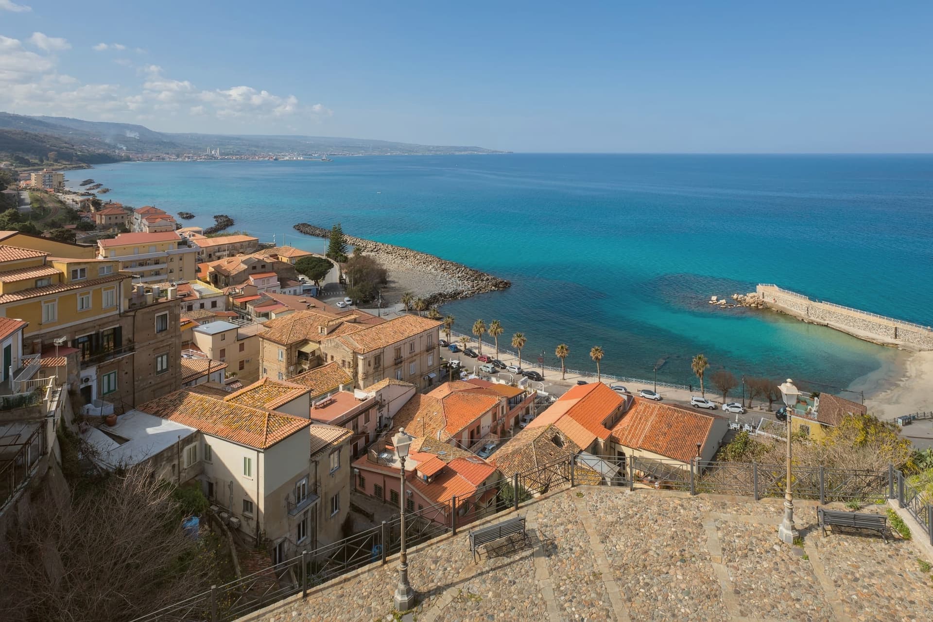
Pizzo sits on a tuff promontory rising about 70 meters above the Tyrrhenian, at the northern end of the Costa degli Dei. The town's name for its own fortress, Castello Aragonese, has largely given way to Castello Murat, after the brother-in-law of Napoleon who landed here in October 1815 hoping to retake the throne of Naples, was captured by townspeople, and was court-martialled in the building he is now remembered by.
The tartufo gelato has a separate history entirely: developed by local gelato-makers in the twentieth century, hand-moulded into a hemisphere with a molten chocolate centre and dusted with cocoa, it earned IGP status in 2007, the first gelato in Europe to do so. Two unrelated claims to fame, a captured king and a dessert, meet on summer evenings in the cliff-edge piazza where the town still gathers.
Pizzo's identity rests on that pairing: a fortress town that turned a moment of political violence and a piece of confectionery into the same civic memory.
Locanda Toscano, San Domenico Ristorante have been named by a guide.
What to see in Pizzo
- Castello Aragonese (Murat). Fifteenth-century fortress on the headland, its main hall preserved as the room where Joachim Murat's court-martial and execution took place, now a museum to the Napoleonic king.
- Chiesa di Piedigrotta. Set into the cliff north of town, reached through low tufa passages that open into chambers where the carved figures stand at full height, worn smooth in places by damp and time.
- Piazza della Repubblica. Cliff-edge piazza with cafés and gelaterie, the social centre of the town and the place to eat tartufo in summer.
How to get to Pizzo
There is a railway station in the town, so you can arrive without a car and never need one while you are here. Reggio Calabria is roughly 75 minutes away by road.
Our tip
May through September is the working season. Water warms by late May, the gelaterie around Piazza della Repubblica run from morning to past midnight in July and August, and the town fills with weekenders from Vibo Valentia and Cosenza. June and September are the calmer bathing months. Sagra del Tonno falls in September.
Belvedere Marittimo
Why visit Belvedere Marittimo
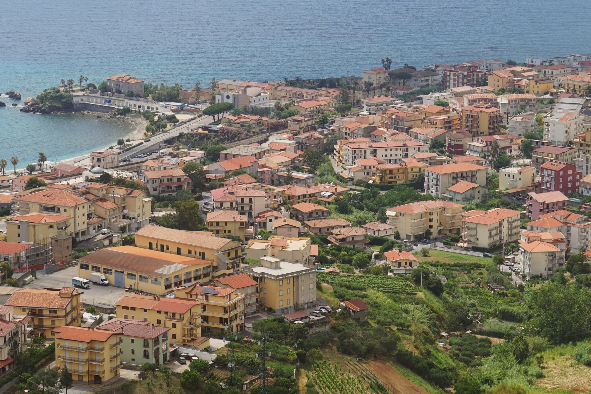
Belvedere Marittimo sits at 150 meters on the Tyrrhenian, fifty kilometers west of Cosenza. The municipal territory runs from Santa Litterata to Calabaja along the coast and climbs behind into the Pollino foothills, where the national park covers part of the commune: a town split between shoreline and mountain, with the built-up center held on the high ground between the two.
The Normans raised the original fortress around the year 1000 under Roger I, choosing the highest hill above the sea for it. Belvedere men sailed in the fleet at the Battle of Lepanto in 1571.
The relics kept in the Capuchin convent for more than three centuries gave the town its local title, Città dell'Amore, and the Riviera dei Cedri, the forty-kilometer run of coast from Tortora south to here, takes its name from the citron still grown on the hillsides above the houses. What holds the town together is the vertical arrangement: castle on the hilltop, convent below it, citron groves on the slopes, and the sea at the bottom, each layer named for what it has kept longest.
Sapori & Saperi have been named by a guide.
What to see in Belvedere Marittimo
- Castello Aragonese. Built by the Normans around 1000, the fortress was reworked under Ferdinand of Aragon with ceremonial gates added alongside the crenellated walls. It commands the hill above the town and the sea below.
- Convento dei Cappuccini. The convent holding the relics of San Valentino sits away from the shoreline crowds, its quiet a contrast to the title the town has taken from it.
- Riviera dei Cedri. The stretch running from Tortora south to Belvedere passes beneath hillsides still planted with cedro, the citron visible above the rooftops.
How to get to Belvedere Marittimo
Salerno is roughly 163 minutes away by road.
Our tip
May through September is the working season on the Riviera dei Cedri. The Lido fills in July and August with Italian families, June and September are the gentler months for warm sea and an open table at the lungomare. The Castello Aragonese is best in the cooler hours, the spring before the heat and the late afternoons of summer.
Bagnara Calabra
Why visit Bagnara Calabra
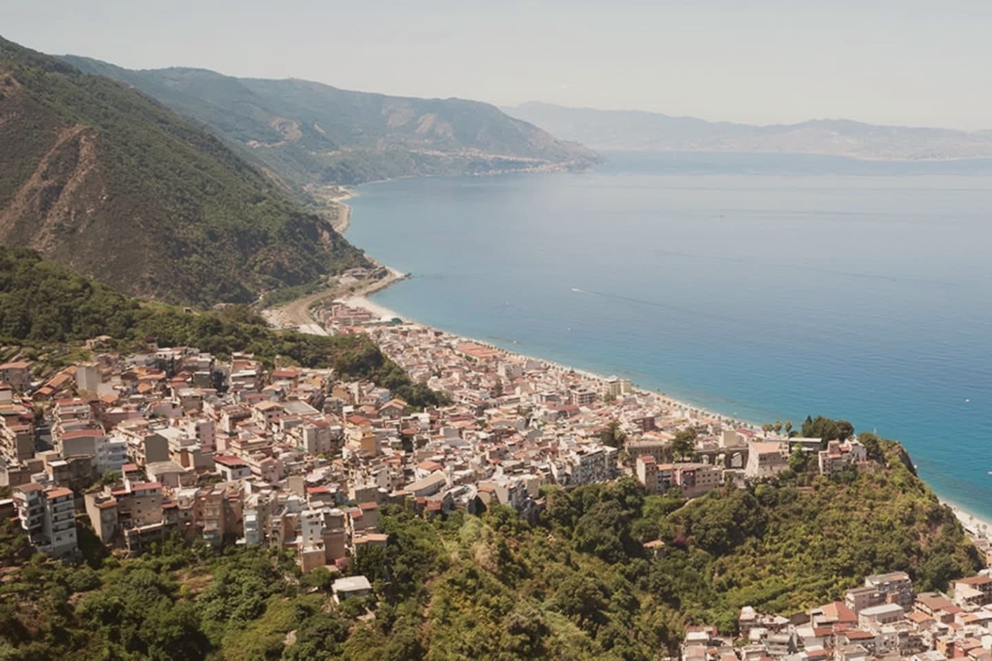
Bagnara Calabra is built into the hills above the Tyrrhenian on the Costa Viola, twenty-five kilometers north of Reggio Calabria, with the Strait of Messina opening to the south. The first organized settlement on record was the Abbey of Santa Maria and the Twelve Apostles, founded around 1085 by Roger I of Sicily.
Two things still define the town. Swordfish: Bagnara is the small capital of Calabrian swordfish, and the local fleet still uses the felucca or passerella, a tall-masted boat with a lookout high above the deck and a long bowsprit walkway from which the harpooner strikes; the practice goes back centuries and is shared with Scilla, six kilometers south.
Torrone: Bagnara torrone, a nougat of honey, sugar and almonds, has been made in the town since the eighteenth century and carries IGP status. The Bagnarote women, who carried the catch on their heads up the hills, are a fixture in Calabrian folklore.
Taverna Kerkira have been named by a guide.
What to see in Bagnara Calabra
- Basilica di Maria SS. del Rosario. Eighteenth-century basilica rebuilt after the 1908 earthquake, the main religious anchor of the town.
- Castello Emmarita. Ruins of a medieval fortress on the hill above town, with views down to the Tyrrhenian and across to Sicily.
- Spiagge della Costa Viola. Pebble and dark-sand beaches under steep cliffs, named for the violet light the coast takes at sunset.
How to get to Bagnara Calabra
There is a railway station in the town, so you can arrive without a car and never need one while you are here. Reggio Calabria is roughly 23 minutes away by road.
Our tip
May through September is the bathing and swordfish season. Water warms by late May, the felucche head out in early summer, and the beaches under the Costa Viola fill in July and August. The Festa di Maria SS. del Rosario in early September is the main event of the religious calendar. Gran Galà del Pesce Spada falls in July.
Isola di Capo Rizzuto
Why visit Isola di Capo Rizzuto
Isola di Capo Rizzuto is a promontory in the province of Crotone; despite the name, it has been joined to the mainland for centuries. The commune's population, around 17,000, spreads across more than fifteen frazioni, most set back from the cliffs on a flat agricultural plateau planted with olives and grain.
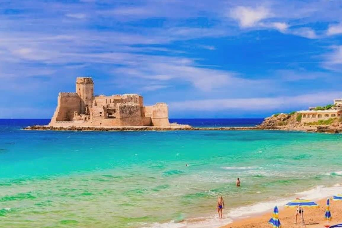
Le Castella is one of these frazioni, the one built around the castle on its islet, and it draws the eye that the inland villages do not. The sea is administered as the Area Marina Protetta Capo Rizzuto, stretching across both Isola and neighboring Crotone, its zones running along the Costa dei Saraceni from the cliffs at Capo Cimiti down to Praialonga.
The Saracen towers built along this same stretch, Torre Vecchia, Torre Scifo, Torre Marinella, mark the headlands where the coast was once watched for raids, a line of defense that runs parallel to the modern line of protected water. Inland farming, a fortified shoreline, and a marine reserve now share the same short stretch of coast: the plateau feeds the towns, the towers still stand as their old lookout, and the sea in front of them is protected rather than patrolled.
Ruris have been named by a guide.
What to see in Isola di Capo Rizzuto
- Castello Aragonese di Le Castella. The fortress sits apart from the coast on its own islet, reached by the sandbar underfoot; the walls close around a small courtyard, and the sea shows on every side.
- Area Marina Protetta Capo Rizzuto. Divers enter the integral zones under licence, where the water is clearest and the rules strictest; the fishermen who work the general zones nearby operate under the same protected status.
- Spiagge della Costa dei Saraceni. Fine sand alternates with red cliffs along Capo Cimiti, Capo Bianco and Praialonga, the color of the rock changing the water's tone from one cove to the next.
How to get to Isola di Capo Rizzuto
Reggio Calabria is roughly 156 minutes away by road.
Our tip
May through September is the season the marine reserve was made for. Water clarity peaks in late May and June, before the high-summer crowds arrive in late July and August, when temperatures push past thirty-three degrees and the small coast road jams between Capo Rizzuto and Le Castella. September and early October are the better diving months, with warm water and emptier beaches.