
Piedmont · Novara
Orta San Giulio
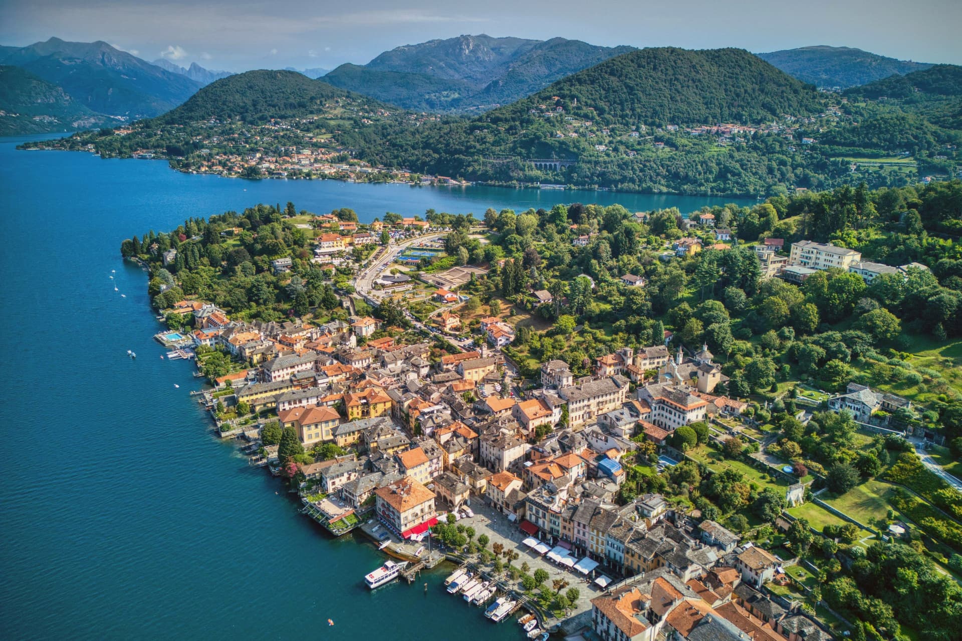
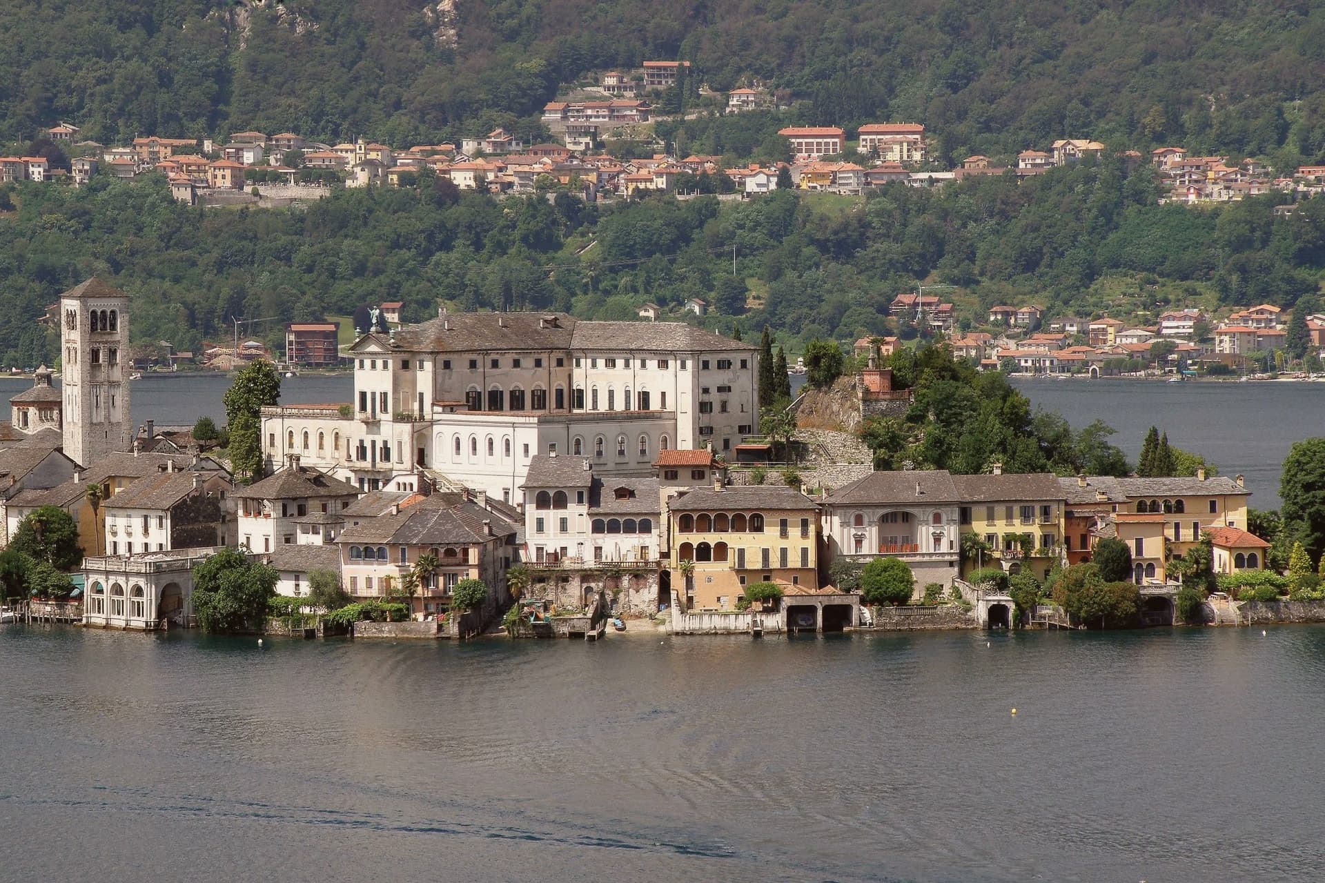
A promontory facing an islet basilica, with a UNESCO complex of Francis-of-Assisi chapels on the hill above.
- Best time
- Apr–Oct
- By car
- 1 h 8 min from Milan
- By train
- Station in the comune
- Population
- 1,047
Known for
SACRO MONTE
UNESCO inscription of 2003, twenty Francis-of-Assisi chapels on San Nicolao hill, modelled on Varallo and begun under Abbot Canobio in 1583.
ISOLA DI SAN GIULIO
The lake's only island, with a fourth-century Romanesque basilica and a Benedictine convent on the site of a medieval castle.
PIAZZA MOTTA
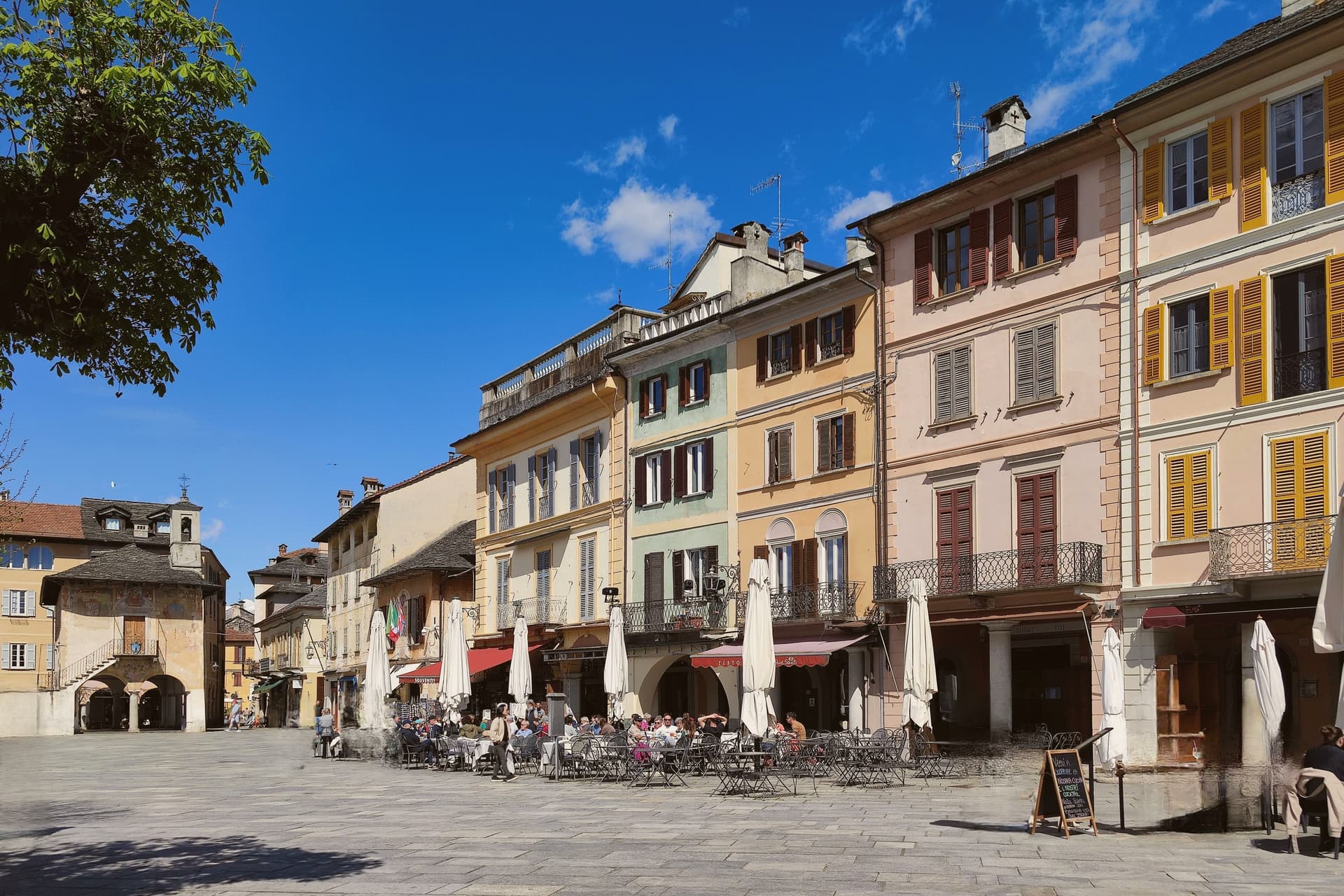
Lakefront square framed by the 1582 broletto of the Comunità della Riviera, the autonomous federation of lake towns that ran until the 1700s.
When to visit
Best · Apr–Oct
- J9°
- F12°
- M13°
- A17°
- M21°
- J25°
- J28°
- A28°
- S23°
- O18°
- N13°
- D9°
- Best
- Hot or crowded
- Quiet
- Mostly closed
Daytime averages, 2020–2024. Weather data by Open-Meteo.com.
Why come
The town occupies a promontory pushed into the eastern shore of the lake, facing the small island 275 meters long and 140 meters wide. The two are close enough that the island reads as an extension of the town rather than a separate place, and a five-minute motorboat from the piazza is the only way across. The old town holds three Tier-A signals at once: Borghi più belli, Bandiera Arancione, and the UNESCO inscription of 2003.
The relationship between the three parts of the town explains how it works: the waterfront square and its lanes sit at lake level, facing the island directly across the water, while the hill above holds the devotional complex, reached by climbing away from the shore rather than along it. Piazza Motta was also the seat of the Comunità della Riviera di San Giulio, an autonomous federation of lake towns that survived from the Middle Ages to the mid-eighteenth century, which is why the square, not the hill or the island, was built as a civic center. What results is a town in three registers at once: civic life at the water's edge, monastic life offshore, and devotional life on the hill above, each occupying its own ground and visible from the others.
The Sunday letter
Orta San Giulio is on our list. Its letter is still to come.
We are writing about all 1,000 of these towns, one at a time, in a free letter every Sunday: the photo, the food, the festa. That is our mission. Sign up and you will be there when Orta San Giulio comes up. By Peter & Sophia, from Pietrasanta.
Read on
Orta San Giulio in our articles
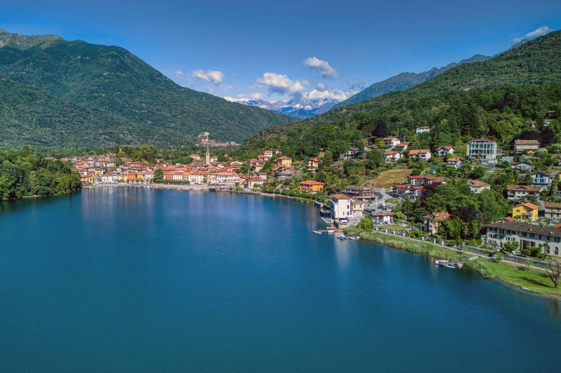 The best lake towns that eat well within 90 minutes of Novara6 towns, Orta San Giulio among them.
 The best small towns you can reach by train that have a serious restaurant in Piemonte6 towns, Orta San Giulio among them.
 The best towns with a World Heritage site within 90 minutes of Milan6 towns, Orta San Giulio among them.
 The prettiest villages that eat well in Piemonte6 towns, Orta San Giulio among them.
How to get there
From Turin (TRN), about 1h 33m by car.
Milan (BGY) is about 1h 36m away.
By car from the centre of Brescia 2 hours.
There is a railway station in the comune, so you can arrive without a car.
Coming from Milan, Turin or Genoa?
Coming by train into Milano Centrale? Orta San Giulio is about 1h 8m away by road.
What to see
Basilica di San Giulio
Serpentine ambo inside and a silver shrine dated 1697. Reached by boat, the basilica stands close to the water's edge, the focal point of the view from every point on the promontory.
Piazza Motta and Palazzo della Comunità
The broletto's arcades face the water directly, and the square narrows toward the boat landing where the crossing to the island begins.
Sacro Monte di Orta
The chapels climb the wooded hillside in sequence, each framing a scene, with the town and the lake opening up in views between them as the path gains height.
Isola di San Giulio
A convent and an ex-seminary, built in 1844, stand over the ruins of the medieval castle, filling most of the small island's ground.
Centro storico
Pedestrian-only old town along the promontory, lanes of stone houses with painted facades stepping down to the lake.
The slow-trip planner
Building a trip? Find where Orta San Giulio fits in a slow Italy circuit.
Answer five questions. We will shape a geographically coherent slow trip from the 1,000 Italian towns most travelers skip. Yours to save and share.
We recommend
Where to eat and stay
Not our picks, but places the guides put their name to: a Michelin star, a Gambero Rosso fork, a Slow Food snail, a Michelin Key for the hotels. Worth a table, a counter, or a night when you pass through.
Villa CrespiRistorante
Villa Crespi carries three Michelin stars, three Gambero Rosso forks (93/100), plus a place in L'Espresso's Top 300, among other nods.
Andrea Monesi - Locanda di OrtaRistorante
Andrea Monesi - Locanda di Orta carries one Michelin star.
Laqua by the LakeHotel
Laqua by the Lake holds one Michelin Key.
Villa CrespiHotel
One Michelin Key, at Villa Crespi.
Living here
- Population 1,047
- In-betweeni
- Pharmacy in town
- High school within a 30-minute drive
- Train station in the comune
- Nearest airport Turin, 1 h 33 min drive
- Regional capital Torino, 1 h 33 min drive
Common questions
- What is Orta San Giulio known for?
- Orta San Giulio is a promontory facing an islet basilica, with a UNESCO complex of Francis-of-Assisi chapels on the hill above.
- Where is Orta San Giulio?
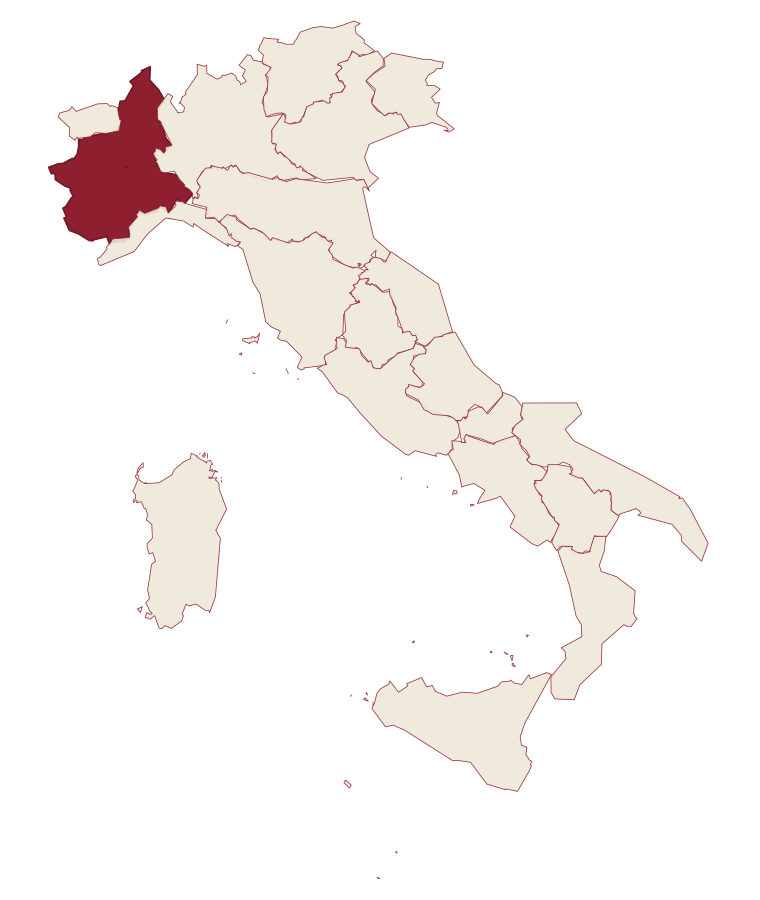
- Orta San Giulio is a comune in the province of Novara, in Piedmont, at 294 meters above sea level.
- What is the nearest airport to Orta San Giulio?
- Turin (TRN), about 1h 33m by car.
- Can you get to Orta San Giulio without a car?
- Yes. There is a railway station in the comune, so you can arrive by train.
- How long is the drive from Brescia to Orta San Giulio?
- About 2 hours by car.
- When is the best time to visit Orta San Giulio?
- Best in Apr–Oct. August is the warmest month, averaging 28 degrees, and May the wettest, with about 19 rain days.
- Which other towns are like Orta San Giulio?
- Mergozzo, Ghiffa and Porto Ceresio.
- How many people live in Orta San Giulio?
- 1,047 at the 2023 count.
Tags & datadesignations · numbers · sources
The numbers
- Elevation: 294 m
- Population: 1,047
- Surface area: 6.65 km²
These figures were compiled from public directories: ISTAT, OpenStreetMap and Wikidata, and from the official listings of the guides named on this page. Town details change; verify with official sources before you travel.
Similar
Towns like Orta San Giulio
Mergozzo
Province: Verbano-Cusio-Ossola
both lake towns · both under 3,000 people
Ghiffa
Province: Verbano-Cusio-Ossola
both lake towns · both under 3,000 people
Porto Ceresio
Province: Varese
both lake towns · both under 3,000 people
Dervio
Province: Lecco
both lake towns · both under 3,000 people
Gozzano
Province: Novara
both lake towns · both hill towns
Monte Isola
Province: Brescia
both lake towns · both under 3,000 people
🎨 Borghi più belli d'Italia
More Borghi più belli d'Italia towns in Piedmont
Barolo
Province: Cuneo
A Langhe borgo at 301 meters whose Castello Falletti gave its name to the wine the Marchesi turned dry in the 1830s with Cavour's help.
Biella
Province: Biella
A wool city at 417 meters in the Alpine foothills, where the medieval Piazzo sits above the modern Piano, connected by a funicular since 1885.
Candelo
Province: Biella
A Biellese commune at 350 meters whose Ricetto, a 13th-century fortified shelter of two hundred stone cellule, is the best-preserved in Piedmont.
Castagnole delle Lanze
Province: Asti
An Asti hill town at 298 meters between Langhe and Monferrato, with two Baroque churches and a nineteenth-century astronomical tower.
Cella Monte
Province: Alessandria
A 465-person Monferrato Casalese borgo at 268 meters, built entirely from a sandstone found only here, riddled underneath with cellars carved into the same stone.