
The prettiest villages within 90 minutes of Novara
The country around Novara changes character faster than its flatness suggests. Paddy fields flood silver in spring and turn the air loud with frogs, then give way northwards to the Biellese foothills, where houses are built of grey river stone and roofed in slabs of local gneiss, and eastwards to the sandstone ridges of the Monferrato, dug through with cellars cut into marine rock. The cooking follows the ground: risotto made with Carnaroli grown a few fields away, paniscia thick with beans and salami, goose from the Lomellina, robiola from the hills, Ghemme and Gattinara from the Nebbiolo slopes above the Sesia. Autumn is the season that suits it best, when the mist sits low over the canals and the wine towns are pressing.
Most people arriving in this corner of Piedmont are heading for Lake Maggiore, and specifically for Stresa, where the ferries leave for the Borromean Islands and the belle époque hotels line the promenade. It is a fair thing to want. It also means car parks full by mid-morning in summer, queues on the jetty and lakefront restaurants working at a volume that flattens the cooking. The lake is beautiful and the crowd on it is entirely predictable.
The same landscape carries on past the lakefront. The Ossola valleys keep their stone villages and their old customs posts, the Biellese keeps its wool towns and walled borghi, the Monferrato keeps its cellars, and the canal country south of Milan keeps its farmsteads and water mills. These are the villages that passed the national assessment of Italy's most beautiful, sitting close enough to Novara for a morning's drive, with fewer people on the streets when you get there.
Of the 24 communes we have mapped within 90 minutes of Novara, 6 qualify as prettiest villages: each has passed the national assessment of Italy's most beautiful villages. The smallest, Cella Monte, has 465 residents.
Elsewhere in the catalogue: The best hill towns within 90 minutes of Novara and The best towns with a serious restaurant that eat well within 90 minutes of Novara.
Cella Monte
Why visit Cella Monte
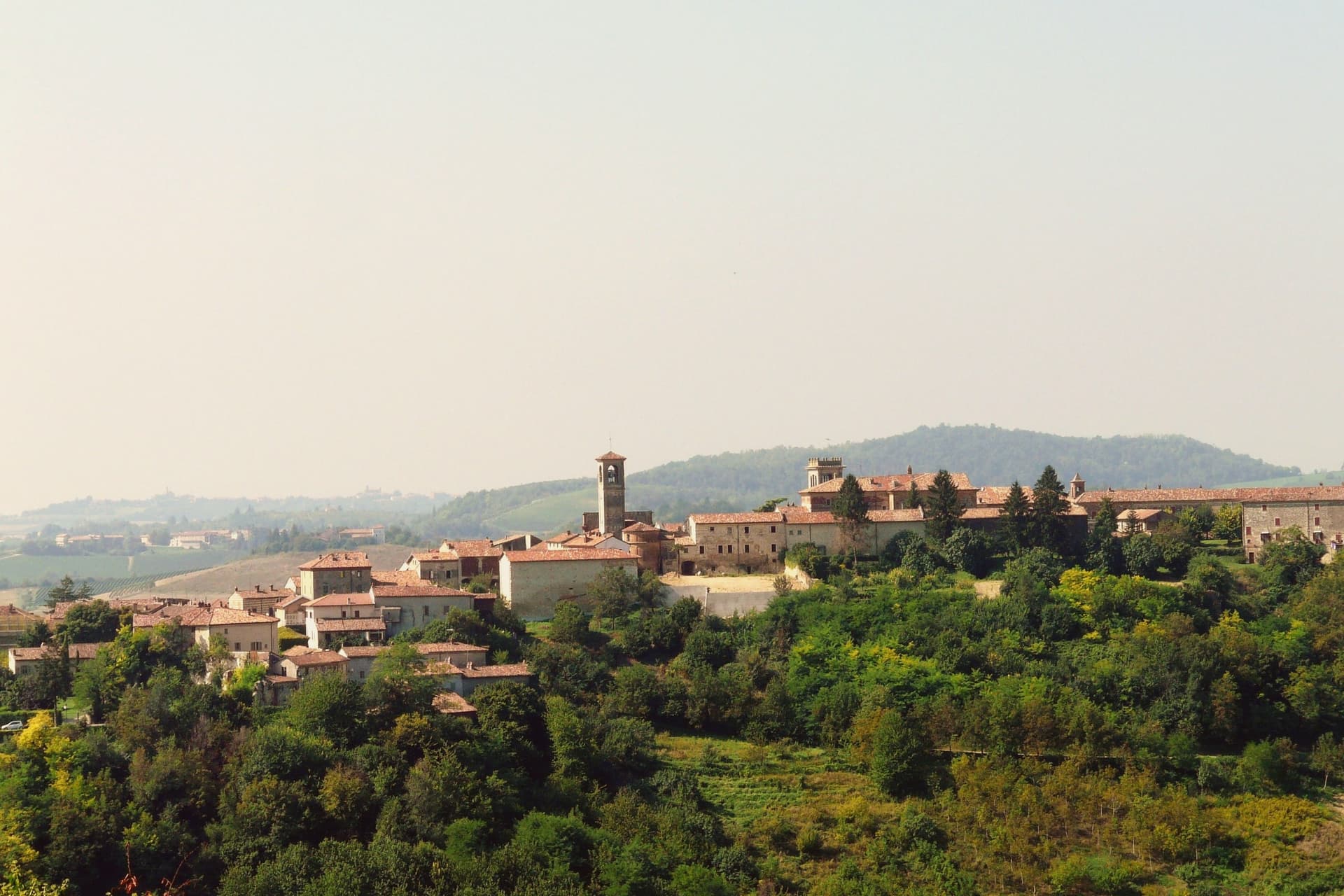
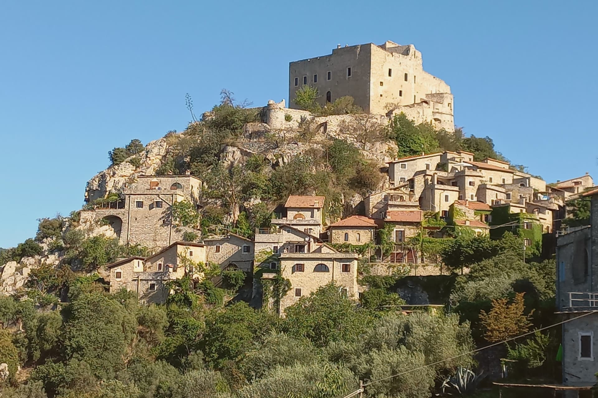
Cella Monte sits at 268 meters in the Monferrato Casalese hills, ten kilometers south-west of Casale Monferrato. The commune holds 465 people.
The defining material is pietra da cantoni, a soft sandstone formed when the Padana sea retreated more than 20 million years ago, found only in this stretch of hill country. The village is built out of nothing else: walls, arches, courtyards and retaining structures all in the same yellow-grey block, so that the church, the palazzo and the ordinary houses of the centro storico read as one continuous fabric rather than separate buildings in a shared style.
Underneath that surface the same stone was hollowed out again. Each infernot sits off a family wine cellar, cut into the sandstone itself, and the cold, dark, still air below ground did what the rooms above could not: keep the best bottles at constant temperature, undisturbed by light, draught or noise.
The village above is stone assembled; the village below is stone removed. Cella Monte is best understood as that pairing, a single sandstone worked in two opposite directions, one raising the borgo and the other hollowing out beneath it.
What to see in Cella Monte
- Infernot di Cella Monte. Small cells reached from the family wine cellar, dark, windless and at constant temperature, built to hold the household's best bottles rather than the everyday stock.
- Ecomuseo della Pietra da Cantoni. Museum of stone and infernot construction, laid out across rooms whose restoration exposed the palazzo's older fabric beneath later plaster and masonry.
- Palazzo Volta. Restored noble palazzo in the centro storico, home of the Ecomuseo, with a fifteenth-century loggia recovered under later masonry.
How to get to Cella Monte
Novara is roughly 55 minutes away by road.
Our tip
April through June brings the Monferrato vineyards into leaf and the borgo's stone into its full yellow-grey colour. September and October are harvest, the months the infernot fill again, and the Ecomuseo runs its strongest programme. July and August get hot on the south-facing slopes; the infernot, dug straight into sandstone at constant temperature year-round, are the natural refuge between two and five in the afternoon.
Orta San Giulio
Why visit Orta San Giulio
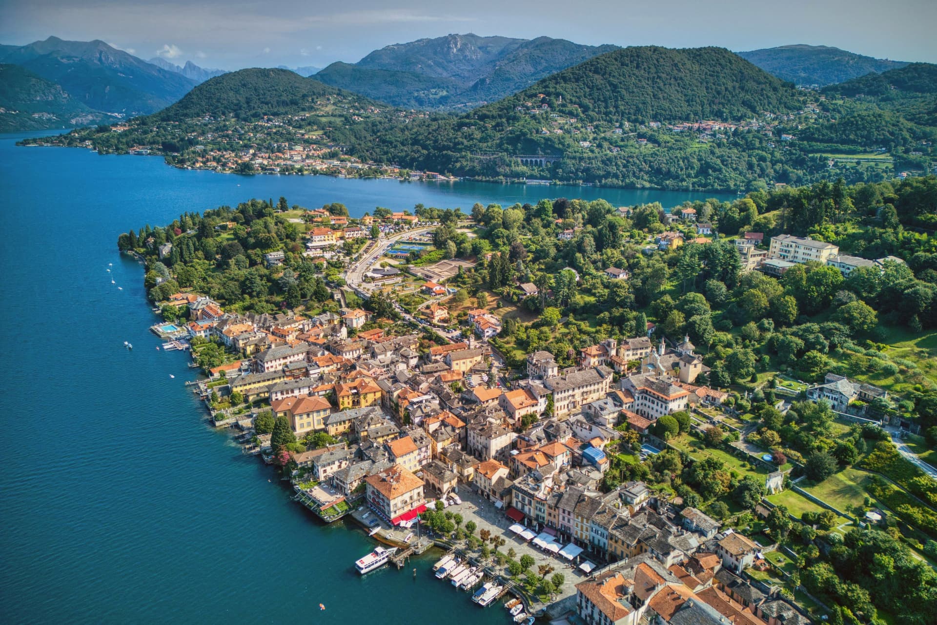
The town occupies a promontory pushed into the eastern shore of the lake, facing the small island 275 meters long and 140 meters wide. The two are close enough that the island reads as an extension of the town rather than a separate place, and a five-minute motorboat from the piazza is the only way across.
The old town holds three Tier-A signals at once: Borghi più belli, Bandiera Arancione, and the UNESCO inscription of 2003. The relationship between the three parts of the town explains how it works: the waterfront square and its lanes sit at lake level, facing the island directly across the water, while the hill above holds the devotional complex, reached by climbing away from the shore rather than along it.
Piazza Motta was also the seat of the Comunità della Riviera di San Giulio, an autonomous federation of lake towns that survived from the Middle Ages to the mid-eighteenth century, which is why the square, not the hill or the island, was built as a civic center. What results is a town in three registers at once: civic life at the water's edge, monastic life offshore, and devotional life on the hill above, each occupying its own ground and visible from the others.
What to see in Orta San Giulio
- Basilica di San Giulio. Serpentine ambo inside and a silver shrine dated 1697. Reached by boat, the basilica stands close to the water's edge, the focal point of the view from every point on the promontory.
- Piazza Motta and Palazzo della Comunità. The broletto's arcades face the water directly, and the square narrows toward the boat landing where the crossing to the island begins.
- Sacro Monte di Orta. The chapels climb the wooded hillside in sequence, each framing a scene, with the town and the lake opening up in views between them as the path gains height.
How to get to Orta San Giulio
There is a railway station in the town, so you can arrive without a car and never need one while you are here. Novara is roughly 46 minutes away by road.
Our tip
April through June brings the Sacro Monte chapels into the chestnut shade and the lake water warm enough for the open-air bars on Piazza Motta. July and August fill the ferry to the island and the piazza turns over by the hour; the centro pedestrian zone slows to a queue at lunch. September and October are the clearest window: low light on the basilica across the water, fewer day-trippers from Milano, and the Sacro Monte path almost empty after eleven.
Vogogna
Why visit Vogogna
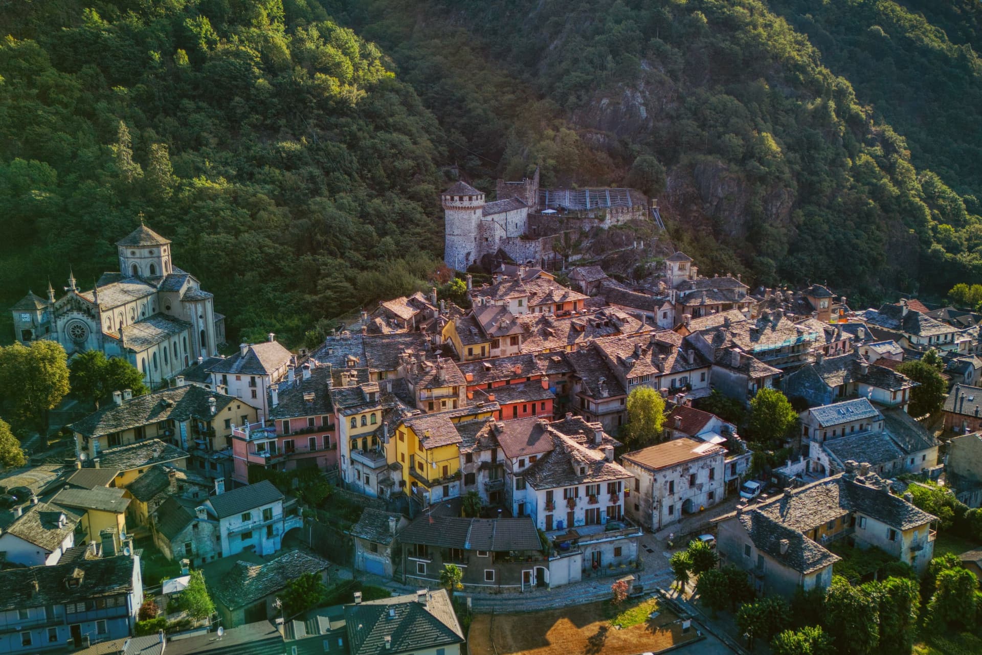
Vogogna sits at 226 meters on the floor of Val d'Ossola, at the narrow point of the valley where the Toce bends south toward Lago Maggiore. The castle went up on the spur above the village as part of a broader reinforcement of the Duchy of Milan against Swiss incursions over the Sempione, built alongside an older fortified rock that had already held the same defensive line.
Together they anchored the town's promotion to administrative seat for the lower half of the valley, in balance with Domodossola further up, which held the upper half. Spanish rule from the sixteenth century onward reduced the castle's strategic weight, and in 1798 it passed into municipal hands, used at one stage as a prison, before the long restoration that closed in 2005.
The borgo carries Borghi più belli d'Italia and the Bandiera Arancione, and Val Grande National Park borders the commune on the west. What the town amounts to is a lower valley's seat of government grown around a fortress that outlived its military purpose by centuries, wedged between wilderness on one side and the river's bend on the other.
What to see in Vogogna
- Castello Visconteo. Restored from 1990 to 2005, the castle is now open to visitors with a multimedia conference room installed inside its walls.
- Rocca di Vogogna. Earlier fortified rock above the Visconti castle, the original medieval defensive post over the narrow point of the Toce valley.
- Centro storico. Medieval core below the castle with stone houses, narrow streets and the Palazzo Pretorio, the historic administrative seat of Ossola Inferiore.
How to get to Vogogna
There is a railway station in the town, so you can arrive without a car and never need one while you are here. Novara is roughly 75 minutes away by road.
Our tip
April through June brings clear walking weather to the Toce valley, with the upper Val Grande slopes drying out and the Visconti castle terraces open for full hours. September and October are the harvest months in Ossola, when chestnut woods turn on the lower slopes and the cooler air carries the view from the Rocca down the valley toward Lago Maggiore. July and August warm the valley floor, but the stone houses of the centro storico keep the streets shaded.
Cassinetta di Lugagnano
Why visit Cassinetta di Lugagnano
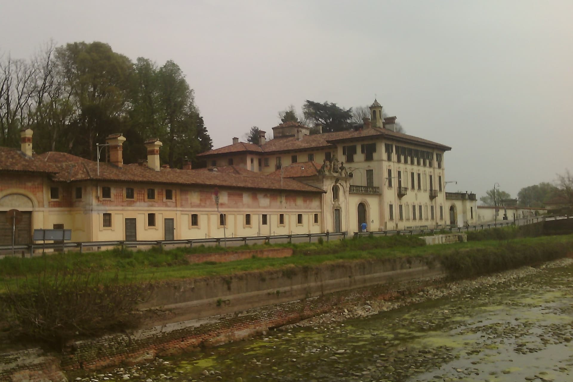
The commune was formed from two older settlements on opposite banks of the canal: Lugagnano, Roman in origin and once called Lucanianus, and Cassinetta, dating to the fourteenth century. The humpbacked bridge that joins them carries the 1584 statue of San Carlo Borromeo.
The town sits at 120 meters, twenty kilometers west of Milan and just outside Abbiategrasso, on the route the Naviglio Grande traces between Milan and the Lago Maggiore, the reason Milanese nobility chose this stretch of water for their country houses from the sixteenth century on. That same 2007 decision to refuse new building and force reuse of existing stock brought the town into the Borghi più belli and Comuni Virtuosi networks.
A town built by families adding country houses along a single waterway, then choosing, four centuries later, to stop building and preserve what stands.
What to see in Cassinetta di Lugagnano
- Villa Visconti Castiglioni Maineri. Formal Italian garden fronting the canal, partly attributed to Ruggero Bascapè.
- Villa Negri-Morosini. Country villa of the Negri-Morosini family on the canal bank, with frescoed interior rooms and outbuildings around a courtyard.
- Villa Trivulzio. Trivulzio family country residence, one link in the chain of aristocratic retreats strung along the water.
How to get to Cassinetta di Lugagnano
There is a railway station in the town, so you can arrive without a car and never need one while you are here. Novara is roughly 37 minutes away by road.
Our tip
April through June and September into October are the months Cassinetta works best. The Naviglio runs full, the towpaths to Abbiategrasso and Robecco sul Naviglio are open to walkers and cyclists, and the villas keep regular visiting hours during the open garden seasons. July and August are humid on the plain; mosquitoes off the canal pick up in late afternoon and the towpath sun gets heavy without shade.
Candelo
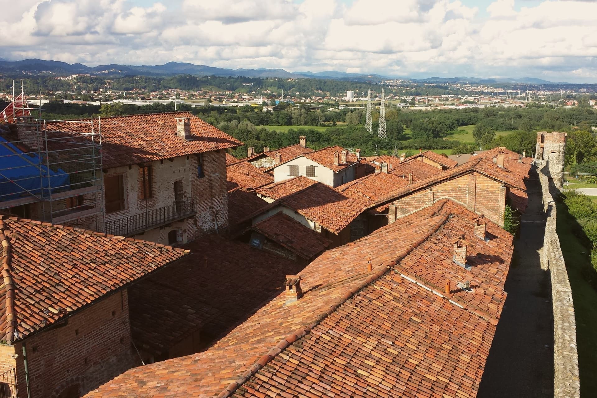
Why visit Candelo
Candelo sits at 350 meters on the right bank of the Cervo torrent, ten kilometers from Biella, with a third of its territory on the Baraggione plateau, a wild grassland of about 5,000 hectares now protected as the Riserva Naturale delle Baragge. The Ricetto is what people come for.
It is a late-medieval fortified shelter built by the local farming community in the thirteenth and fourteenth centuries: roughly two hundred stone cellule arranged on a pentagonal plan of 13,000 square meters, crossed by five east-west rue and two transverse, the perimeter walls running 470 meters. Goods, grain, wine and forage were stored here under the protection of the local lord.
Only in extreme attack did the population itself withdraw inside. It is the best-preserved structure of its kind in Piedmont.
Candelo joined the Borghi più belli d'Italia in 2002 and has held the Bandiera Arancione of the Touring Club Italiano since 2007.
What to see in Candelo
- Ricetto di Candelo. Thirteenth- to fourteenth-century fortified shelter on a pentagonal plan, with about two hundred stone cellule and 470 meters of walls.
- Rue del Ricetto. Five east-west streets and two transverse, paved in river stone, the cellule grouped along them for storing grain and wine.
- Chiesa di Santa Maria Maggiore. Parish church of Candelo next to the Ricetto, on the centro storico side of the town.
How to get to Candelo
Novara is roughly 54 minutes away by road.
Our tip
April through June brings the Baraggia into bloom and the Ricetto walls dry enough for the swallows. September and October are the harvest months on the Cervo plain, with vineyards on the Coste della Sesia turning to gold. July and August can sit humid in the river basin; the cellule, half-underground in places, hold cool inside even when the piazza is hot.
Biella
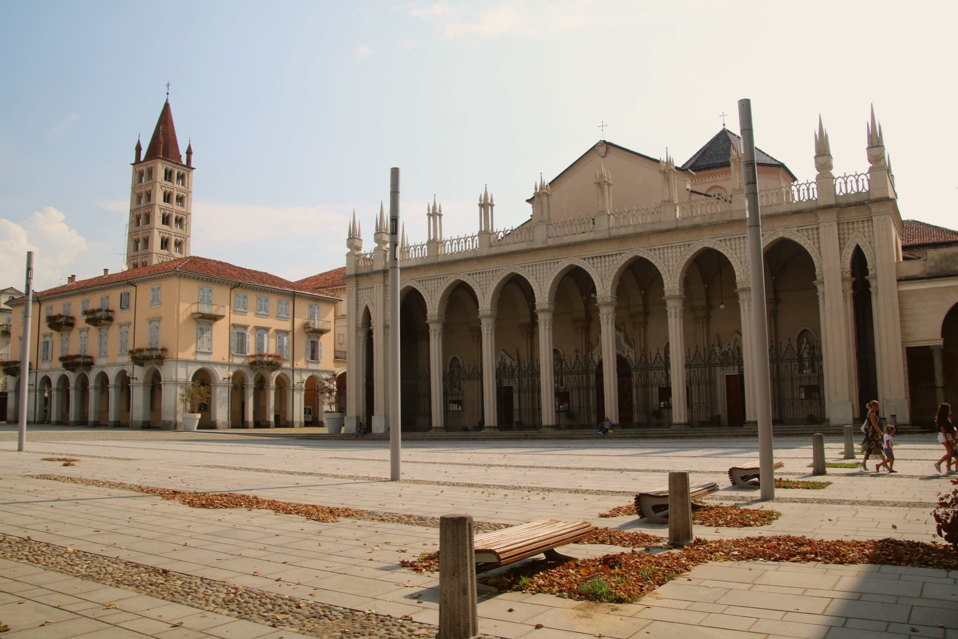
Why visit Biella
Biella sits at 417 meters at the foot of the Biellese Alps, in a basin where fast Alpine streams cut down from Mont Mars and the Oropa range. The statutes of 1245 already named the woolworkers' and weavers' guilds, and the city built itself around them: by the nineteenth century, vertical mills along the streams had turned Biella into the Manchester of Italy.
The names still on the labels, Zegna, Cerruti, Loro Piana, Piacenza, Fila, were founded here. The upper town, Biella Piazzo, sits above the modern Piano on a small hill, reached since 1885 by a water-counterbalance funicular that still runs the same 60-meter climb.
The Romanesque Baptistery on Piazza Duomo is the city's oldest stone, ninth or tenth century, set next to the cathedral. Above the city, the Sacro Monte di Oropa belongs to the UNESCO Sacri Monti site, and Biella was named a UNESCO Creative City for Crafts and Folk Art in 2019.
What to see in Biella
- Biella Piazzo. Medieval upper town on a small hill above the modern Piano, with arcaded palazzi and narrow stone streets, reached by funicular since 1885.
- Funicolare del Piazzo. Historic funicular opened in December 1885, covering a 60-meter altitude gradient in 177 meters between Via Curiel and Via Avogadro.
- Battistero di Biella. Romanesque baptistery on Piazza Duomo, ninth to tenth century, the oldest standing monument in the city.
How to get to Biella
There is a railway station in the town, so you can arrive without a car and never need one while you are here. Novara is roughly 63 minutes away by road.
Our tip
April through June brings green pastures on the Biellese Alps and clean light off the streams that built the mills. September and October are the dry, gold months, when the chestnut woods around Oropa turn and the textile fairs run in town. July and August stay cooler than the Po Valley but can sit humid; the upper Piazzo holds breeze that the Piano does not. Bolle di Malto - Salone Italiano della Birra falls in August.
More from Anywhere Italy
- The best hill towns within 90 minutes of Novara
- The best towns with a serious restaurant that eat well within 90 minutes of Novara
 The prettiest villages that eat well in Piemonte
 The best hill towns within 90 minutes of Milan
- The best lake towns that eat well within 90 minutes of Novara
 The best towns known for their meat within two hours of Turin