
The best lake towns that eat well within 90 minutes of Novara
The water changes the cooking here. On Maggiore, Orta and the little glacial pool at Mergozzo, menus run to lavarello and perch fried in butter and sage, pike in a green sauce heavy with capers and parsley, risotto made with rice from the paddies that begin where the hills stop. The shore towns are built in pale Baveno granite and Candoglia marble, the same pink-veined stone that went into Milan's Duomo, and their arcaded lakefronts face east into the morning. Spring brings camellias and azaleas across the botanical gardens; autumn brings mist off the water, chestnuts, and the season for game and mushrooms brought down from the Val Grande. Boats keep running well past the summer crowds.
Most people arriving from Milan or Malpensa point themselves at Lake Como, and specifically at Bellagio, where the ferry queues stack up on the promenade by mid-morning and the lakefront restaurants turn tables at a rate that shows in the food. Como is beautiful and entirely aware of it. Prices on the shore reflect a market of people who will only eat there once. Novara is closer to the western lakes than to any of that.
The same water, the same rice plain and the same kitchens carry on north and west of Novara, up the Piedmontese and Lombard side of Maggiore and over the ridge to Orta. These are working lakeside towns with ferry docks, granite quarries in their history, and cooks a dining guide has thought worth naming. Fewer people get off the train at them. They are close enough to Novara, Milan and the airport to be a lunch and an afternoon on the water.
Of the 24 communes we have mapped within 90 minutes of Novara, 6 qualify as lake towns that eat well: each sits on a lake shore, and a dining guide has named a table in each. The smallest, Orta San Giulio, has 1,047 residents.
Two more lists worth reading alongside this one: The best towns with a serious restaurant that eat well within 90 minutes of Novara and The best lake towns within two hours of Turin.
Orta San Giulio
Why visit Orta San Giulio
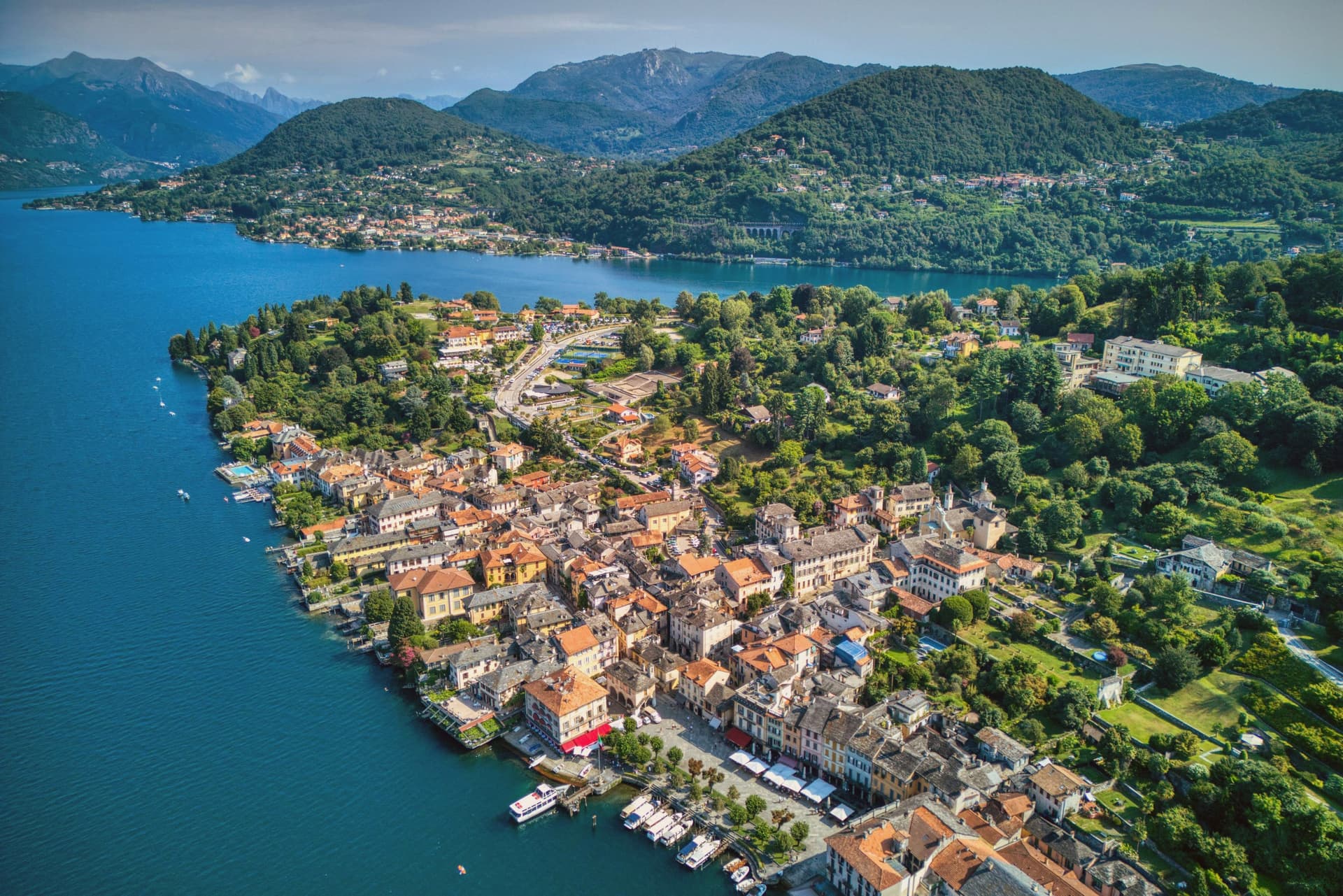
The town occupies a promontory pushed into the eastern shore of the lake, facing the small island 275 meters long and 140 meters wide. The two are close enough that the island reads as an extension of the town rather than a separate place, and a five-minute motorboat from the piazza is the only way across.
The old town holds three Tier-A signals at once: Borghi più belli, Bandiera Arancione, and the UNESCO inscription of 2003. The relationship between the three parts of the town explains how it works: the waterfront square and its lanes sit at lake level, facing the island directly across the water, while the hill above holds the devotional complex, reached by climbing away from the shore rather than along it.
Piazza Motta was also the seat of the Comunità della Riviera di San Giulio, an autonomous federation of lake towns that survived from the Middle Ages to the mid-eighteenth century, which is why the square, not the hill or the island, was built as a civic center. What results is a town in three registers at once: civic life at the water's edge, monastic life offshore, and devotional life on the hill above, each occupying its own ground and visible from the others.
Villa Crespi, Andrea Monesi - Locanda di Orta have been named by a guide.
What to see in Orta San Giulio
- Basilica di San Giulio. Serpentine ambo inside and a silver shrine dated 1697. Reached by boat, the basilica stands close to the water's edge, the focal point of the view from every point on the promontory.
- Piazza Motta and Palazzo della Comunità. The broletto's arcades face the water directly, and the square narrows toward the boat landing where the crossing to the island begins.
- Sacro Monte di Orta. The chapels climb the wooded hillside in sequence, each framing a scene, with the town and the lake opening up in views between them as the path gains height.
How to get to Orta San Giulio
There is a railway station in the town, so you can arrive without a car and never need one while you are here. Novara is roughly 46 minutes away by road.
Our tip
April through June brings the Sacro Monte chapels into the chestnut shade and the lake water warm enough for the open-air bars on Piazza Motta. July and August fill the ferry to the island and the piazza turns over by the hour; the centro pedestrian zone slows to a queue at lunch. September and October are the clearest window: low light on the basilica across the water, fewer day-trippers from Milano, and the Sacro Monte path almost empty after eleven.
Mergozzo
Why visit Mergozzo
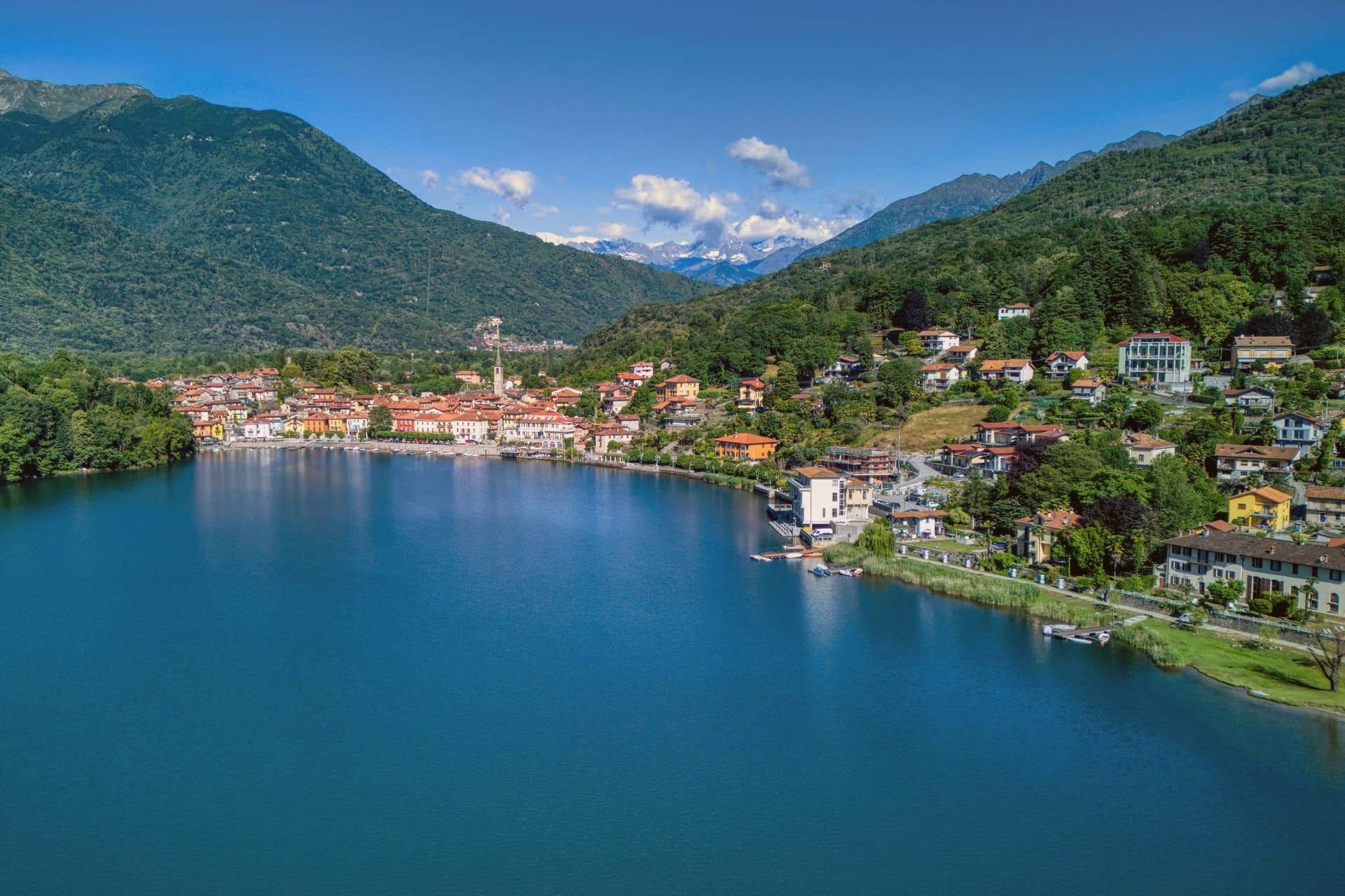
The lake is 74 meters deep and sits at 204 meters, separated in antiquity from its larger neighbor when sediment from the Toce river closed the channel between them. The village faces the water from the western shore, folded behind a lakefront piazza where the parish church holds a painting from 1623 already showing the elm that gives the square its character.
Behind the piazza, narrow stone-paved lanes called strece climb toward terraced gardens, the houses built of the same granite quarried on neighboring Montorfano hill. Stone has long been the local economy, tying Mergozzo to the wider region: the same quarries that cut the lanes' paving supplied material used in Rome and across northern Italy.
Trailheads above the village lead into Val Grande, so the same slopes that shelter the piazza from behind also open, higher up, onto one of the wildest valley systems in the Alps. What holds the place together is this stacking of scales: a small, closed-off lake at the bottom, a worked hillside of stone above it, and beyond that, wilderness.
La Fugascina Ristorante, La Quartina have been named by a guide.
What to see in Mergozzo
- L'Olmo di Mergozzo. Hollow-trunked field elm on the lakefront piazza, still standing and shading the square it has watched over for generations.
- Lago di Mergozzo. 2.5 km lake separated from Lago Maggiore by Toce sediment, motorboat-free and ranked among Europe's cleanest waters.
- Centro storico. Stone-paved lanes (strece) and granite houses climbing the slope behind the lakefront piazza.
How to get to Mergozzo
There is a railway station in the town, so you can arrive without a car and never need one while you are here. Novara is roughly 67 minutes away by road.
Our tip
April through June and September into October are the months the lakefront works best: mild water, open trattorie and Val Grande trails clear of snow but cool enough to walk. July and August fill the small beach and the parking lots, though Mergozzo never reaches the volume of nearby Stresa on Maggiore. November through March is quiet.
Stresa
Why visit Stresa
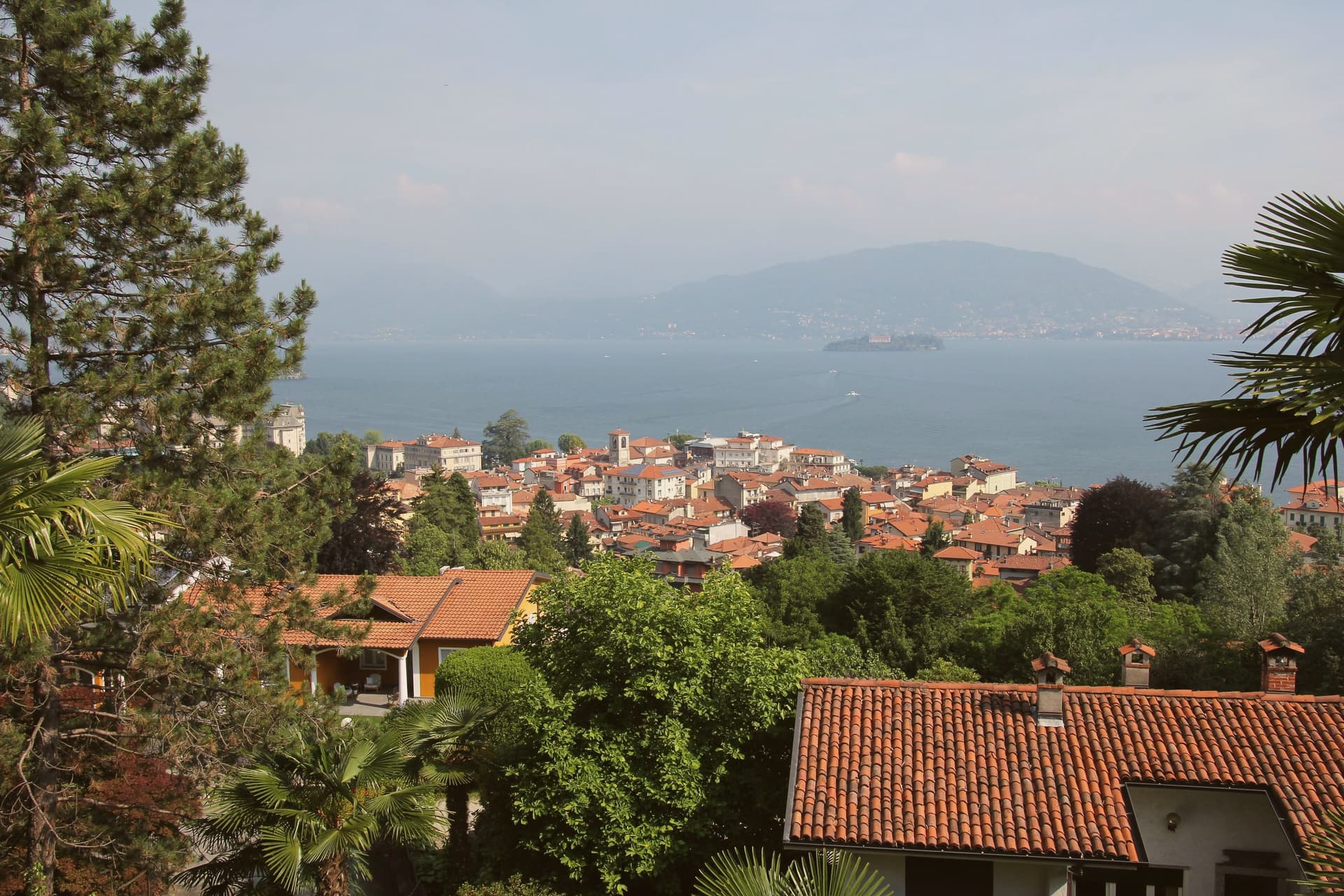
Stresa sits at 200 meters on the western shore of Lake Maggiore, ninety kilometers north of Milano on the line of the Simplon railway. The town first appears in documents in 998, as Strixsya.
From the seventeenth century the lake stage here belonged to the Borromeo family: the palazzo on what had been called l'isola inferiore was begun in 1632, the island renamed after its patron's wife. The other two islands of the group lie 400 meters offshore alongside it, reached by regular ferry from the two town piers, one still inhabited, one given to its park.
Villa Pallavicino, established 1855, sits apart from this cluster on the southern edge of town, its own botanical and wildlife ground answering the islands' gardens without belonging to the same estate. The town's other identity, as a resort, dates to 1863 and the lakefront hotel building that opened international tourism here, later drawing the festival that has filled the town each late summer since 1962.
What Stresa amounts to is a small lake shore town organized almost entirely around water it faces rather than land it occupies: the islands offshore, the piers that reach them, and a lakefront built for arrival rather than settlement.
La Botte, Lo Stornello, Osteria Mercato and 5 more have been named by a guide.
What to see in Stresa
- Isola Bella. The island sits close to the town piers, its terraced Baroque gardens rising in tiers above the water and the palazzo facing the lakefront directly.
- Isola Madre. The largest of the group, given over almost entirely to its park: paths through subtropical planting and glimpses of the villa between the trees.
- Isola dei Pescatori. The one island still lived in year-round, its lanes narrow between the houses and the trattorie facing the water where the fishing boats once worked.
How to get to Stresa
There is a railway station in the town, so you can arrive without a car and never need one while you are here. Novara is roughly 57 minutes away by road.
Our tip
April through June is the green window on Lake Maggiore: Isola Bella's terraced gardens in flower, the ferries running full timetable, and the lakefront promenade open without the August press. July and August are warm and crowded; the centro empties between two and four in the afternoon heat, and the islands fill on day trips from Milano. The Settimane Musicali run from late August into September, the busiest cultural weeks of the year.
Baveno
Why visit Baveno
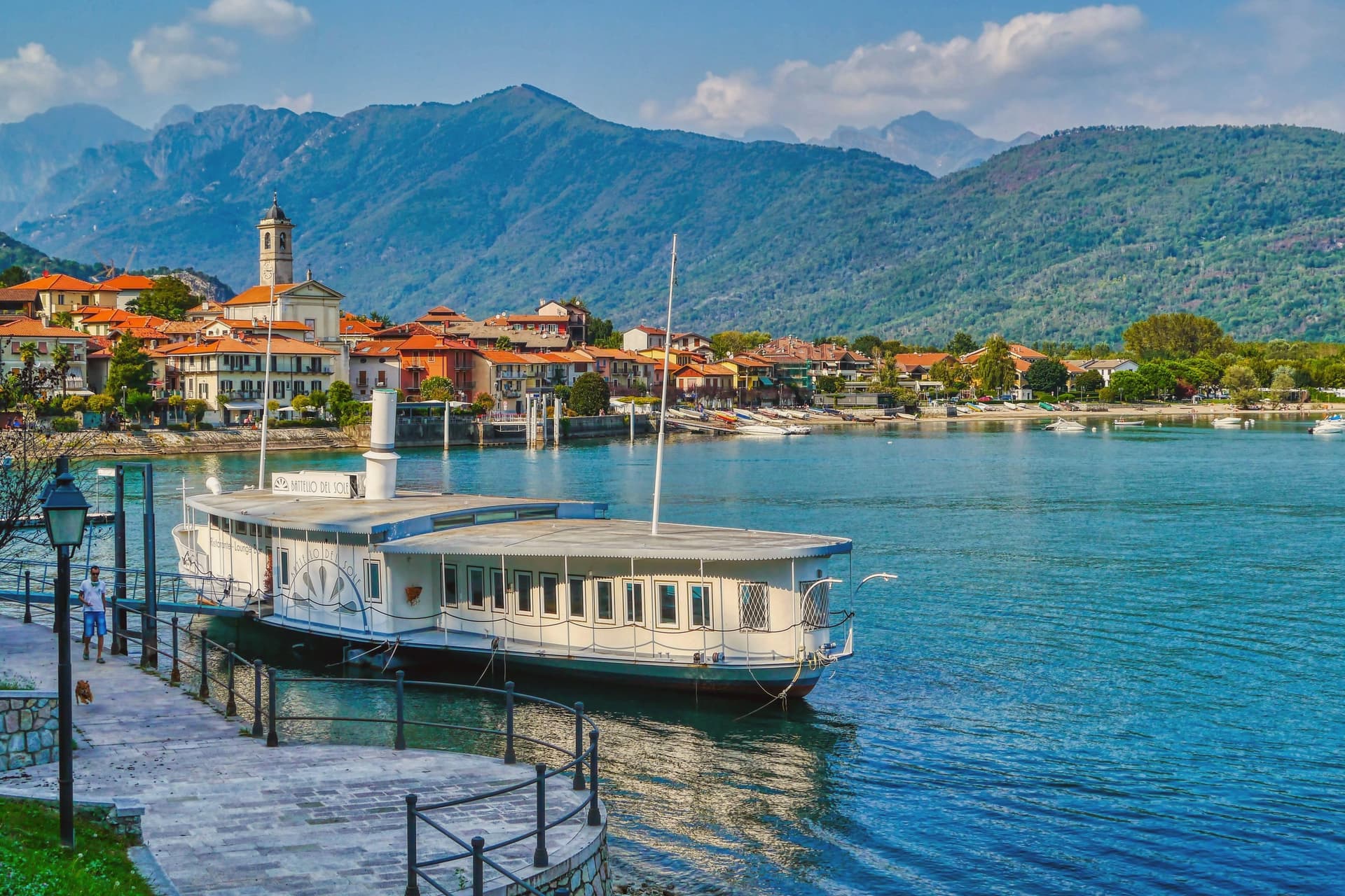
Baveno sits at 205 meters on the west shore of the lake, twenty-one kilometers north-west of Arona. The town was occupied in the Iron Age by the Lepontii, a tribe of the Ligures, before the Romans reached the lake, and its historic core still gathers around the raised church and its baptistery above the shore road.
To the north-west, the granite quarries have cut into the hillside since the early sixteenth century, and the stone they produced left Baveno for Milan and Rome, built into a cathedral, a basilica, and a shopping gallery. Along the water, a line of nineteenth-century villas marks the period when Lake Maggiore became a fixed point on the European Grand Tour, and from that same shore the Isole Borromee sit a ten-minute ferry away, close enough that the gulf reads as one continuous view rather than a lake and its islands.
The town's quarries built landmarks elsewhere while its own shore stayed a place people came to look at the water.
SottoSopra have been named by a guide.
What to see in Baveno
- Chiesa dei Santi Gervasio e Protasio. The two Romanesque buildings, church and baptistery, form the religious centre of the historic core, raised above the road that runs along the water.
- Cave di Granito Rosa. The quarries lie north-west of town, cut into the hillside, the source of stone that traveled to two large churches and a shopping gallery.
- Golfo Borromeo. The gulf opens out between Baveno and Stresa, the water broken by three islands, Isola Bella, Isola dei Pescatori and Isola Madre, each reachable within minutes.
How to get to Baveno
There is a railway station in the town, so you can arrive without a car and never need one while you are here. Novara is roughly 55 minutes away by road.
Our tip
April through June and September into October are the best months on the Borromean Gulf. The lake stays cool, the ferries to Isola Bella run a full timetable, and the lakeside promenade carries traffic without congestion. July and August are warm and crowded: full hotels, restaurant queues, and ferry decks pressed shoulder to shoulder on the short hop from Stresa.
Laveno-Mombello
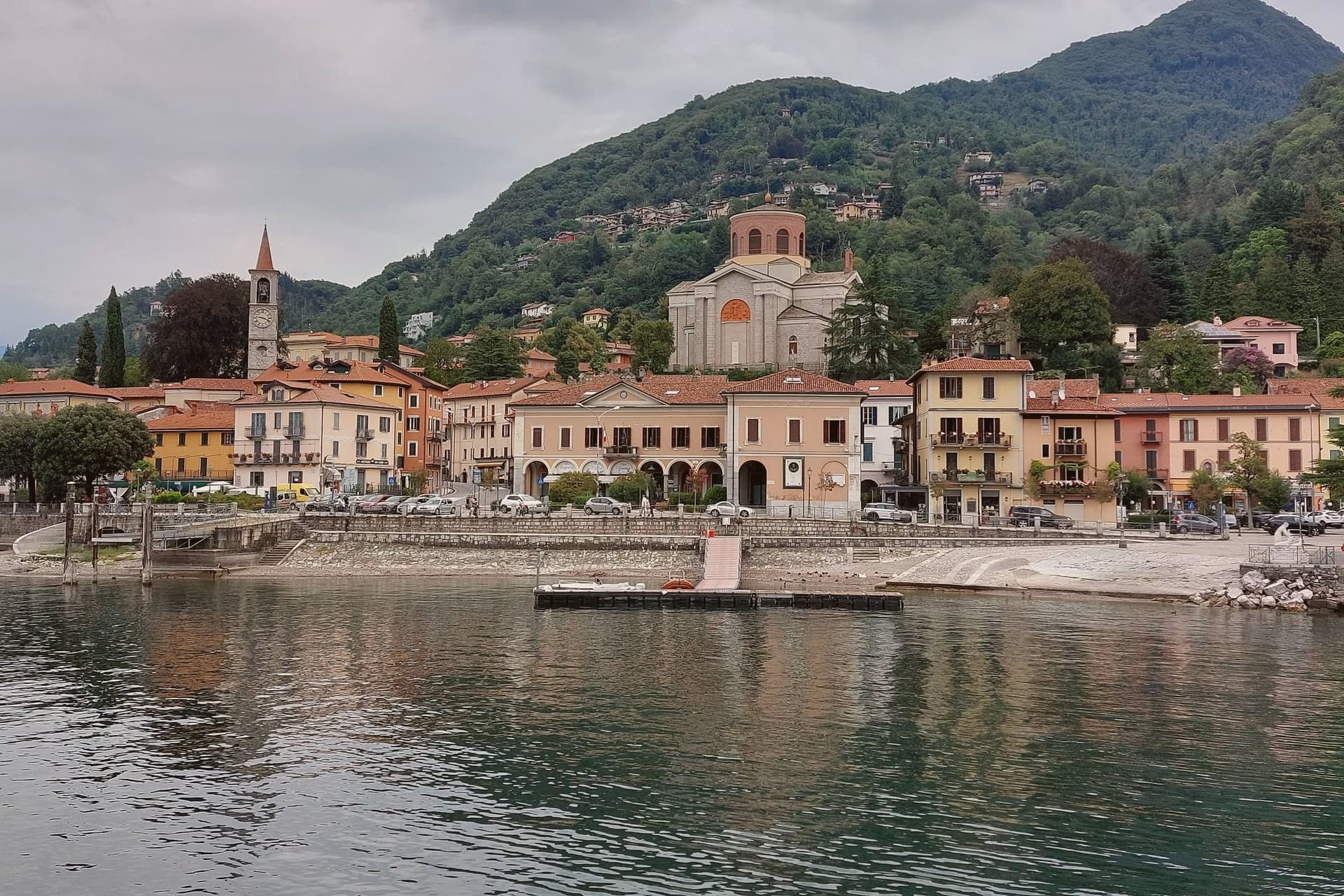
Why visit Laveno-Mombello
Laveno-Mombello sits on Lake Maggiore's eastern shore in the province of Varese, where a limestone wall drops directly to the water at the town's back. The ferry here crosses to Verbania and the Borromean Islands on the opposite shore, making the town as much a hinge point between Lombardia and Piemonte as a destination in itself.
Cerro, the lakefront hamlet folded into the town, kept the workshops after the ceramics factories closed in the 1990s, and its Palazzo Perabò now holds the museum that charts that industry from 1856 forward. South along the shore, a fifteen-minute drive reaches the monastery built into the cliff face, reachable by stairs, lift or boat where the road does not reach directly.
The town's shape follows the lake and the rock in equal measure: industry and transit at the shoreline, the mountain rising straight behind it, and the monastery holding on to the cliff a short way south as if the same geology that made Laveno a port also made it a place for building into stone.
La Tavola have been named by a guide.
What to see in Laveno-Mombello
- MIDeC – Museo Internazionale Design Ceramico. Ceramics design museum in the sixteenth-century Palazzo Perabò at Cerro, covering Laveno production from 1856 to the 1990s.
- Sasso del Ferro. Limestone summit reached by the bucket funicular, with a terrace looking across Lake Maggiore to Lago d'Orta and the southern Alps.
- Santa Caterina del Sasso. Fourteenth-century monastery clinging to a cliff above Lake Maggiore, fifteen minutes south, reached by stairs, lift or boat.
How to get to Laveno-Mombello
There is a railway station in the town, so you can arrive without a car and never need one while you are here. Novara is roughly 74 minutes away by road.
Our tip
April through October covers the working calendar. The Sasso del Ferro funicular runs most days from spring through autumn, weather permitting, and is unreliable in winter. May, June, September and October are the calmest weeks on the eastern shore.
Arona
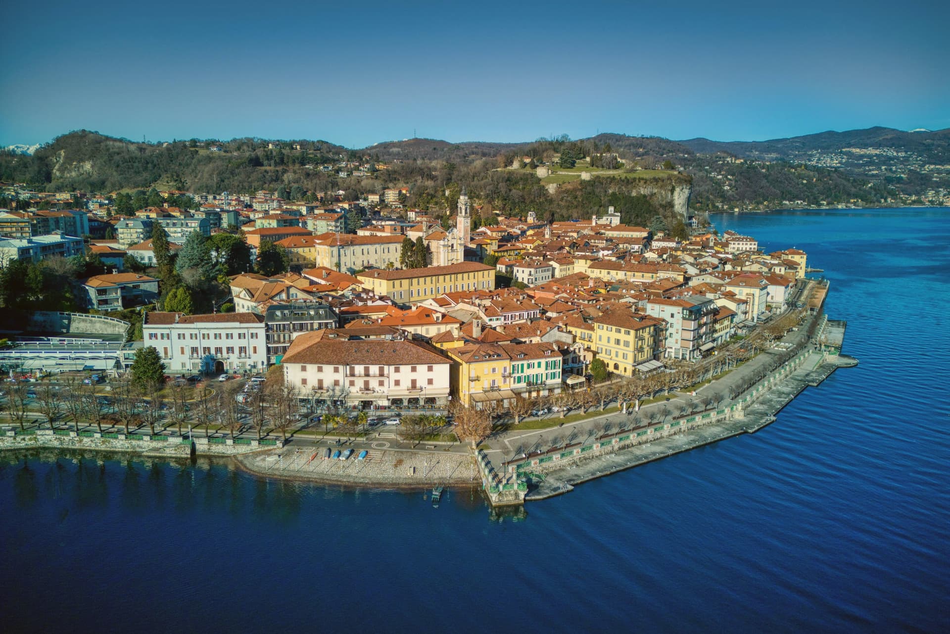
Why visit Arona
Arona sits ninety kilometers north of Milano, the first stop most travellers reach when they leave the city for the lakes. The town came under the Borromeo family in 1439 and stayed there for centuries: the castle on the hill above town was their stronghold, and the next hill over holds the statue raised in the family's honor, so the two high points of Arona both belong to the same lineage looking down on the water and on each other.
The lakefront below connects the two hills to the church on the shore and to the promenade that runs north with Angera visible across the water on the Lombard side. The natural park on the southern edge of the commune sits apart from this Borromeo core, its pile-dwelling remains far older than anything else in town and unconnected to the family's centuries of rule.
What the place adds up to is a town organized around one family's presence in stone and copper, with a much older, unrelated settlement preserved at its edge.
Condividere, Castagneto, Strattoria and 1 more have been named by a guide.
What to see in Arona
- Sancarlone. Copper colossus of San Carlo Borromeo, designed by Il Cerano and built between 1614 and 1698, standing above the Sacro Monte.
- Rocca di Arona. Ruined fortress on the hill above town, the walls broken into towers since the demolition, with views over the water below.
- Collegiata di Santa Maria Nascente. Late medieval church on the lakefront, holding a polyptych by Gaudenzio Ferrari completed in 1511.
How to get to Arona
There is a railway station in the town, so you can arrive without a car and never need one while you are here. Novara is roughly 49 minutes away by road.
Our tip
April through June and September into October are the best months on the south shore of Lake Maggiore. The lake stays cool, the lungolago carries traffic without congestion, and the ferries run a full timetable to Angera and the Borromeo islands further north. July and August are warm and busy: ferry queues, full hotels, and the southern lake basin gathering most of the day-trip volume from Milano.
More from Anywhere Italy
- The best towns with a serious restaurant that eat well within 90 minutes of Novara
- The best lake towns within two hours of Turin
 The best lake towns you can reach by train in Piemonte
- The best small lake towns in Piemonte
 The best small towns you can reach by train that have a serious restaurant in Piemonte
- The best lake towns in the province of Verbano-Cusio-Ossola