
Marche · Pesaro e Urbino
Gabicce Mare
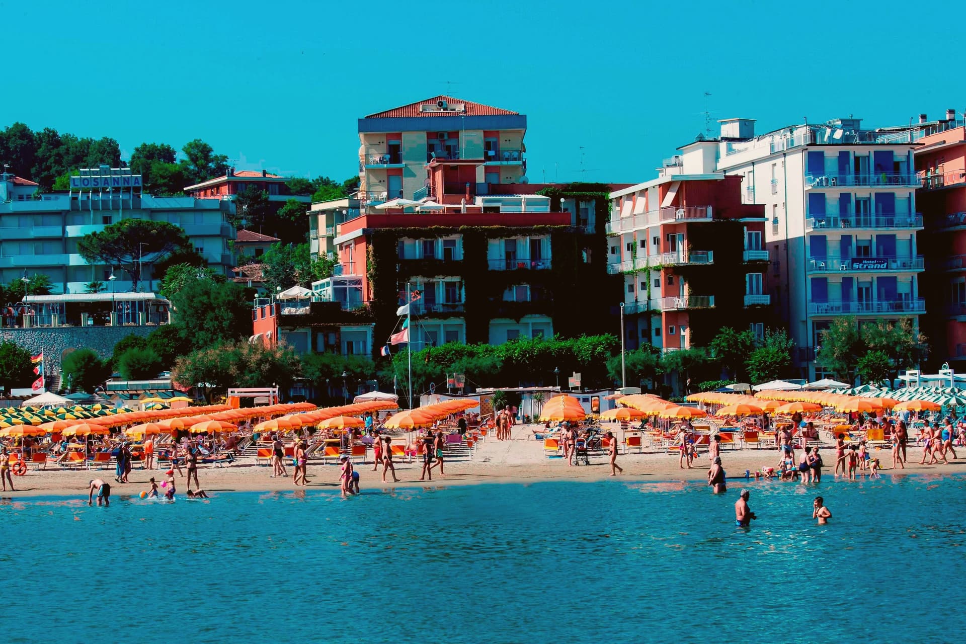
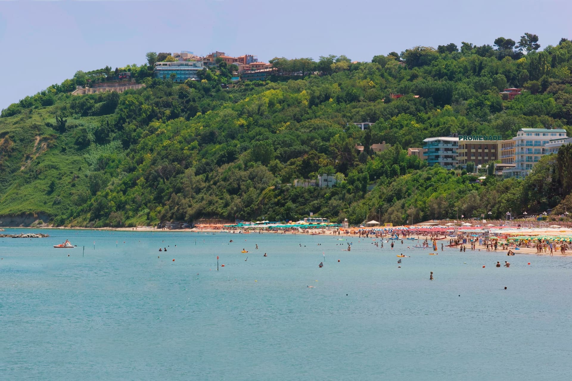
The northernmost Marche seaside on the Adriatic, where the coast meets the cliffs of the Parco del San Bartolo at the Romagna border.
- Best time
- May–Sep
- By car
- 26 min from Rimini
- By train
- Station in the comune
- Population
- 5,496
Known for
RIVIERA ROMAGNOLA
Northernmost Marche seaside, culturally part of the Riviera Romagnola continuum running up to Cervia, with a Bandiera Blu beach.
PARCO DEL SAN BARTOLO
1,600 hectares of cliff and ridge between Gabicce and Pesaro, established 1994, the only high coast of the central Adriatic.
GABICCE MONTE
Hilltop frazione above the beach with the wide view over both coasts, the Cattolica strip north and the San Bartolo cliffs south.
When to visit
Best · May–Sep
- J10°
- F12°
- M14°
- A17°
- M21°
- J27°
- J30°
- A29°
- S25°
- O21°
- N15°
- D11°
- Best
- Hot or crowded
- Quiet
- Mostly closed
Daytime averages, 2020–2024. The sea is warmest in August at 29° and coldest in January at 9°. Weather data by Open-Meteo.com.
Why come
Gabicce Mare sits on the Adriatic at the northernmost point of the Marche, sixteen kilometers north of Pesaro and bordering Cattolica in Emilia-Romagna's province of Rimini. South of the beach, the cliffs of Monte San Bartolo rise abruptly, the only stretch of high coast between Trieste and the Conero, so the town marks the hinge where a long flat sand shore gives way to headland. Sixteenth-century maps placed the Romagna border further south than it runs today, taking in the upper hamlet inside what is now the park.
The archaeological record on the headland runs from the Neolithic at Monte Castellaro through a Roman site on the Via Flaminia to a lost Greek-origin port below the cliffs, layers of settlement stacked on the same few kilometers of high ground. The town is really two places joined by geography rather than one: a beach that belongs to the sand coast running north, and a cliff and ridge system that belongs to the rock coast running south. Nowhere else on this shore does the flat Adriatic strip end so abruptly against high ground.
The Sunday letter
Gabicce Mare is on our list. Its letter is still to come.
We are writing about all 1,000 of these towns, one at a time, in a free letter every Sunday: the photo, the food, the festa. That is our mission. Sign up and you will be there when Gabicce Mare comes up. By Peter & Sophia, from Pietrasanta.
Read on
Gabicce Mare in our articles
 The best hidden coastal towns in Marche6 towns, Gabicce Mare among them.
 The best towns with a serious restaurant in the province of Pesaro e Urbino6 towns, Gabicce Mare among them.
 The best coastal towns you can reach by train in Marche7 towns, Gabicce Mare among them.
 The best hidden towns you can reach by train that eat well in Marche8 towns, Gabicce Mare among them.
How to get there
From Rimini (RMI), about 41 minutes by car.
Ancona / Pescara (AOI) is about 58 minutes away.
By car from the centre of Ancona 1h 11m or Bologna 1h 35m.
There is a railway station in the comune, so you can arrive without a car.
Coming from Bologna?
Coming by train into Rimini? Gabicce Mare is about 25 minutes away by road.
What to see
Spiaggia di Gabicce Mare
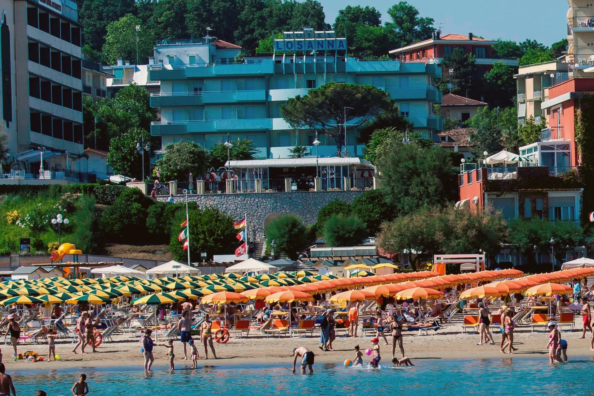
Sand beach at the southernmost extension of the Riviera Romagnola strip, the family beach end of the upper Marche coast, backed by the town rather than the cliffs.
Parco Naturale del Monte San Bartolo
Cliffs, ridge and a run of Renaissance villas above the sea, with fossil fish embedded in the rock face.
Gabicce Monte
The hamlet climbs above the seafront rather than sitting on it, so the same stretch of coast reads differently from up here, the beach town below, the cliff line running south.
Vallugola e Colombarone
A lost Greek-origin port site and the archaeological remains of a late-Roman villa on the Via Flaminia, both reached within the park's grounds.
Fiorenzuola di Focara
A cliff-top medieval village reached inside the park, mentioned by Dante in Inferno V, once the marker of the historic Romagna-Marche border.
The slow-trip planner
Building a trip? Find where Gabicce Mare fits in a slow Italy circuit.
Answer five questions. We will shape a geographically coherent slow trip from the 1,000 Italian towns most travelers skip. Yours to save and share.
We recommend
Where to eat
Not our picks, but places the guides put their name to: a Michelin star, a Gambero Rosso fork, a Slow Food snail, a Michelin Key for the hotels. Worth a table, a counter, or a night when you pass through.
Dalla GiocondaRistorante
Dalla Gioconda carries three Gambero Rosso forks (90/100), plus a place in L'Espresso's Top 300.
PosillipoRistorante
One Gambero Rosso fork (76/100) for Posillipo, and a spot in the Michelin Guide.
Living here
- Population 5,496
- Commuter belti
- Pharmacy in town
- High school within a 30-minute drive
- Train station in the comune
- Nearest airport Rimini, 41 min drive
- Market day Thursday
- Regional capital Ancona, 1 h 11 min drive
Common questions
- What is Gabicce Mare known for?
- Gabicce Mare is the northernmost Marche seaside on the Adriatic, where the coast meets the cliffs of the Parco del San Bartolo at the Romagna border.
- Where is Gabicce Mare?
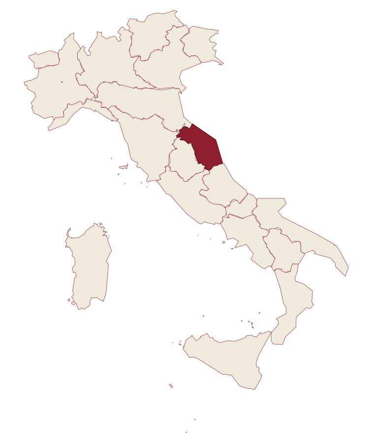
- Gabicce Mare is a comune in the province of Pesaro e Urbino, in Marche, at 8 meters above sea level.
- What is the nearest airport to Gabicce Mare?
- Rimini (RMI), about 41 minutes by car.
- Can you get to Gabicce Mare without a car?
- Yes. There is a railway station in the comune, so you can arrive by train.
- How long is the drive from Ancona to Gabicce Mare?
- About 1h 11m by car.
- When is the best time to visit Gabicce Mare?
- Best in May–Sep. July is the warmest month, averaging 30 degrees, and January the wettest, with about 10 rain days.
- Which other towns are like Gabicce Mare?
- Aquileia, Campi Salentina and Gradara.
- How many people live in Gabicce Mare?
- 5,496 at the 2023 count.
Tags & datadesignations · numbers · sources
Recognised as
The numbers
- Elevation: 8 m
- Population: 5,496
- Surface area: 4.94 km²
These figures were compiled from public directories: ISTAT, OpenStreetMap and Wikidata, and from the official listings of the guides named on this page. Town details change; verify with official sources before you travel.
Featured on
Gabicce Mare appears on this themed pick from our Collections:
Similar
Towns like Gabicce Mare
Aquileia
Province: Udine
both on the Adriatic coast · both between 3,000 and 10,000 people
Campi Salentina
Province: Lecce
both on the Adriatic coast · both between 3,000 and 10,000 people
Gradara
Province: Pesaro e Urbino
both on the Adriatic coast · both between 3,000 and 10,000 people
Otranto
Province: Lecce
both on the Adriatic coast · both between 3,000 and 10,000 people
Fossacesia
Province: Chieti
both on the Adriatic coast · both between 3,000 and 10,000 people
Numana
Province: Ancona
both on the Adriatic coast · both between 3,000 and 10,000 people
🟦 Bandiera Blu
More Bandiera Blu towns in Marche
Fermo
Province: Fermo
The provincial capital on the Sabulo hill at 319 meters, with 2,200 square meters of Augustan Roman cisterns running under the centro storico.
Grottammare
Province: Ascoli Piceno
A double town on the Riviera delle Palme, with a palm-lined seafront and a medieval upper borgo where Pope Sixtus V was born.
Mondolfo
Province: Pesaro e Urbino
A walled hill borgo at 144 meters above the Adriatic, with the frazione of Marotta and its beach below.
Numana
Province: Ancona
A Conero coastal town at 56 meters above its port, the Picene harbour that traded with Greek ships from the sixth century BC.
Pesaro
Province: Pesaro e Urbino
The Adriatic port at the mouth of the Foglia, founded as Roman Pisaurum in 184 BC and given to the world by Rossini in 1792.