
The best hidden coastal towns in Marche
The Marche coast is the Adriatic at its least theatrical, which is much of the reason to go. South of Ancona the Monte Conero headland drops in pale limestone straight into water that turns milky green over white stone, and the beaches below are shingle rather than sand, reached by boat or by paths through holm oak and broom. North of the river mouths the shore flattens into long sandy strands backed by brick and stucco houses, kitchen gardens, and rows of umbrella pines. Brodetto, the local fish stew, changes recipe from port to port, and the wine that goes with it is Verdicchio or the light Bianchello del Metauro grown on the hills just inland. May and September are the good months, when the sea is warm and the beach clubs are still open but not full.
Most visitors to this stretch stop at Rimini, or push a little further to Ancona for the ferry, and in August the Romagna riviera north of the regional border absorbs an enormous share of the Adriatic's holiday traffic. The reasons are practical: the motorway and the main railway line run along the coast, the hotels are numerous and cheap, and the sand is wide and groomed. It works, and it is loud, and by mid-August the front is a continuous wall of parasols. The Conero beaches suffer their own version of this, with car parks full by mid-morning and shuttle buses running to the sand.
The coast does not stop where the crowds do. The same limestone headland, the same brodetto, the same shallow warm sea continue north and south past the well-known names, into towns that sit directly on the water but see fewer people through the gate. Some are proper fishing harbours, some are hill villages that keep a beach at the bottom of the road, and a couple hold sanctuaries and castles that pull their own pilgrims rather than sunbathers. These are the smaller places on that shore, and they are worth the detour off the coastal road.
Of the 63 communes we have mapped in Marche, 10 qualify as coastal towns: each sits directly on the sea. This list is the hidden ones, 6 in all, ordered smallest first. The smallest, Numana, has 3,741 residents.
Elsewhere in the catalogue: The 10 best hidden towns with a serious restaurant in Marche and The best coastal towns within 90 minutes of Ancona.
Numana
Why visit Numana
Numana sits fifteen kilometers south of Ancona, on a cliff overlooking the Adriatic at the foot of the promontory that shapes this stretch of coast. The old town, Numana alta, runs along the ridge in continuity with Sirolo, while Numana bassa wraps around the port below, so the visitor moves between two settlements joined by a single slope rather than one town with two names.
The place was a Picene harbour that traded with Greek and Etruscan ships from the sixth century BC, and a major centre of pre-Roman Italy before the rise of Ancona pushed it into decline around 500 BC. That decline is what left the burial grounds undisturbed long enough to be excavated centuries later, and it is also why the town's oldest identity is archaeological rather than architectural: a harbour that mattered, stopped mattering, and was rediscovered through what it buried.
The beach here holds the national bathing award, which a comune has to win back every year on water quality, beach management and safety.
What to see in Numana
- Antiquarium Statale di Numana. Opened 1974, holding more than five hundred Picene burials from the Conero necropolises, plus a sixth-century BC limestone warrior's head found on a Numana beach in 1892.
- Santuario del Crocifisso. Rebuilt in 1969 on a 1566 foundation, the current structure standing on a sanctuary site with roots three centuries older than the rebuild itself.
- Porto di Numana. Working fishing and pleasure port at the foot of the cliff, with daily boat services along the Conero cliffs to the otherwise inaccessible Due Sorelle beach.
How to get to Numana
Ancona is roughly 30 minutes away by road.
Our tip
May through September are the months for Numana. The Conero water clears from late May and stays warm through September, with the port's daily boats running to Due Sorelle and the other Conero cliff beaches. July and August are the busiest weeks of the Marche coast: parking is metered into the late evening and the Numana bassa restaurants book ahead.
Sirolo
Why visit Sirolo
Sirolo sits at 125 meters, twenty kilometers from Ancona, on ground that belonged to the Conti Cortesi family. The medieval village kept one of the two original castle towers, folded now into the parish church, and the belvedere above Piazza Vittorio Veneto looks out across the bay.
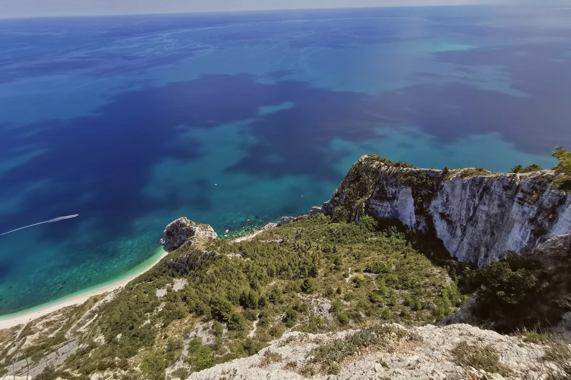
Below town, the ridge drops toward the Picene necropolis of I Pini, and further down still toward the water. The mountain above the village and the water below it are the same geology: limestone that falls straight into the sea rather than tapering through a coastal plain, which is why the village sits on a clifftop rather than a shoreline.
Upper Sirolo is the castle, the church and the theatre, all cut from the same pale stone. Lower Sirolo is reached by boat or by trail, down through the park to the cove where the sea stacks stand.
The grave goods from the necropolis have left town entirely, kept at the Antiquarium in neighbouring Numana, so what remains above ground here is the tomb site itself rather than its contents. The town doubles in summer and empties again in October: a place shaped less by what happens in it than by the drop between its two levels, the built one and the wild one.
The beach here holds the national bathing award, which a comune has to win back every year on water quality, beach management and safety.
What to see in Sirolo
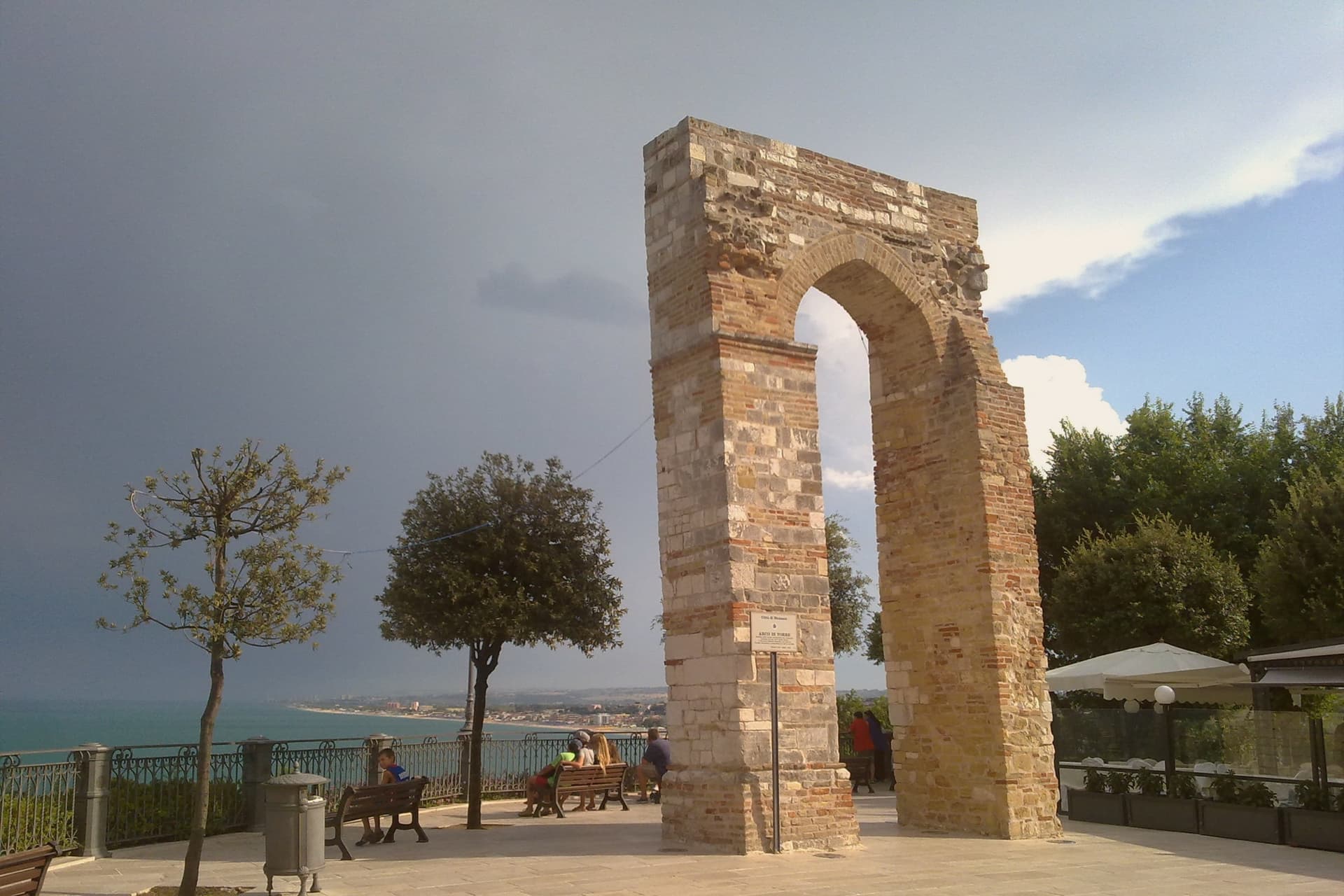
- Centro storico. Medieval village on the clifftop with the Arco Gotico from around the year 1000, the Piazzetta and a belvedere looking out across the Adriatic.
- Chiesa di San Nicolò di Bari. Eighteenth-century parish church built over a thirteenth-century structure, incorporating one of the two surviving towers of the medieval Sirolo castle.
- Teatro Cortesi. Municipal theatre inaugurated in 1875, built in white Conero stone, restored and reopened in 1989.
How to get to Sirolo
Ancona is roughly 31 minutes away by road.
Our tip
May through September is the window for Sirolo. The water warms enough for the Conero beaches from late May, the boat shuttle to the Due Sorelle runs daily through summer, and the belvedere stays cool when the Adriatic plain below is hot. July and August are the busiest weeks: parking limits in the centro storico, queues for Spiaggia Urbani and Sassi Neri, evening passeggiate spilling out of every trattoria.
Gradara
Why visit Gradara
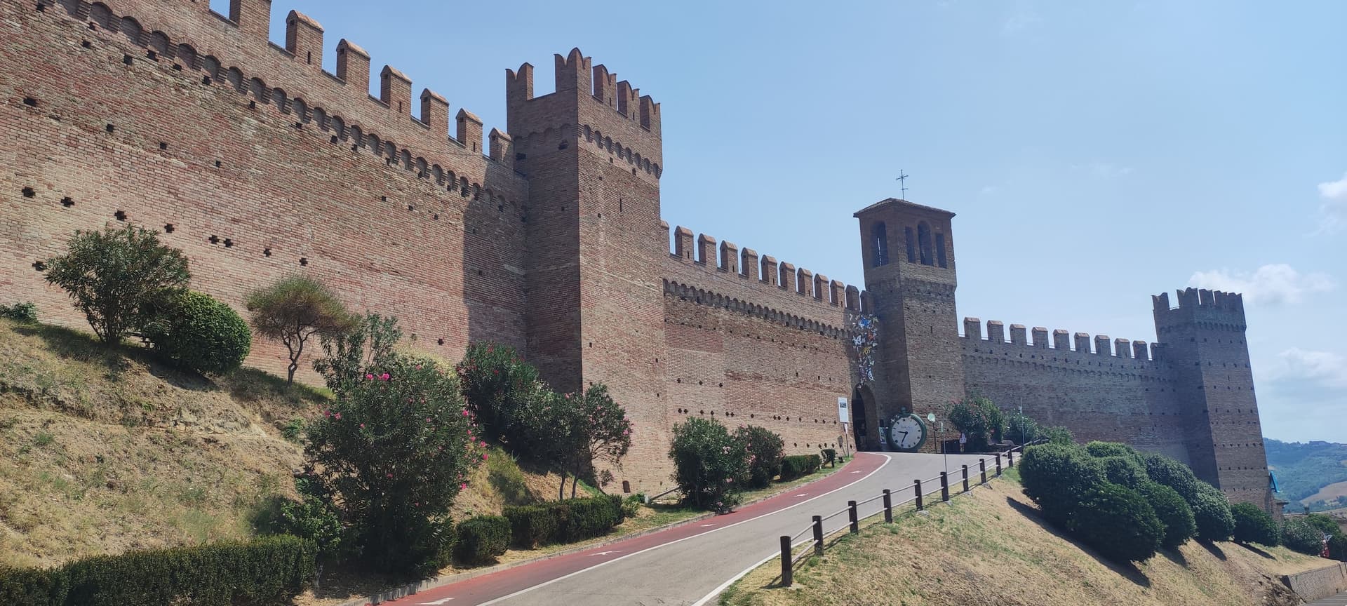
Gradara sits at 142 meters on a hill three kilometers from the Adriatic, at the northern border of the Marche with Romagna. The castle was begun in the twelfth century by Pietro and Ridolfo del Grifo and completed in the fifteenth, when the Malatesta extended the double ring of walls that still runs almost 800 meters around the borgo.
In the fifth canto of the Inferno, Dante placed Paolo and Francesca here: around 1275 Guido da Polenta of Ravenna married his daughter Francesca to Giovanni Malatesta and sent his younger brother Paolo as proxy. The two fell in love.
Gianciotto Malatesta caught them and killed both. Whether the killing happened at Gradara, Pesaro or Rimini is disputed among scholars; tradition keeps it here.
The borgo was voted Borgo dei Borghi by RAI viewers in 2018. The Castello and the Camerino di Lucrezia draw most visitors.
Olive groves around the walls supply the Cartoceto DOP oil.
What to see in Gradara
- Castello di Gradara. Twelfth-century rocca completed by the Malatesta in the fifteenth century, one of the best-preserved medieval fortresses in Italy, with the Camerino di Lucrezia frescoed cycle.
- Mura medievali. Double ring of fourteenth and fifteenth-century walls running almost 800 meters around the borgo, walkable along the camminamento.
- Camera di Paolo e Francesca. Frescoed chamber inside the castle, traditionally identified as the room where Dante set the killing of the two lovers.
How to get to Gradara
Rimini is roughly 30 minutes away by road.
Our tip
May through September is the working season for Gradara. The hill is dry from late April, the castle and walls are open every day, and the literary park below the rocca turns green into June. July and August bring the heaviest crowds: the proximity to Cattolica and Gabicce Mare puts seaside families on the castle road and the borgo's narrow streets fill from mid-morning. Giovedì al Castello - Rievocazione storica falls in August.
Gabicce Mare
Why visit Gabicce Mare
Gabicce Mare sits on the Adriatic at the northernmost point of the Marche, sixteen kilometers north of Pesaro and bordering Cattolica in Emilia-Romagna's province of Rimini. South of the beach, the cliffs of Monte San Bartolo rise abruptly, the only stretch of high coast between Trieste and the Conero, so the town marks the hinge where a long flat sand shore gives way to headland.
Sixteenth-century maps placed the Romagna border further south than it runs today, taking in the upper hamlet inside what is now the park. The archaeological record on the headland runs from the Neolithic at Monte Castellaro through a Roman site on the Via Flaminia to a lost Greek-origin port below the cliffs, layers of settlement stacked on the same few kilometers of high ground.
The town is really two places joined by geography rather than one: a beach that belongs to the sand coast running north, and a cliff and ridge system that belongs to the rock coast running south. Nowhere else on this shore does the flat Adriatic strip end so abruptly against high ground.
The beach here holds the national bathing award, which a comune has to win back every year on water quality, beach management and safety.
What to see in Gabicce Mare
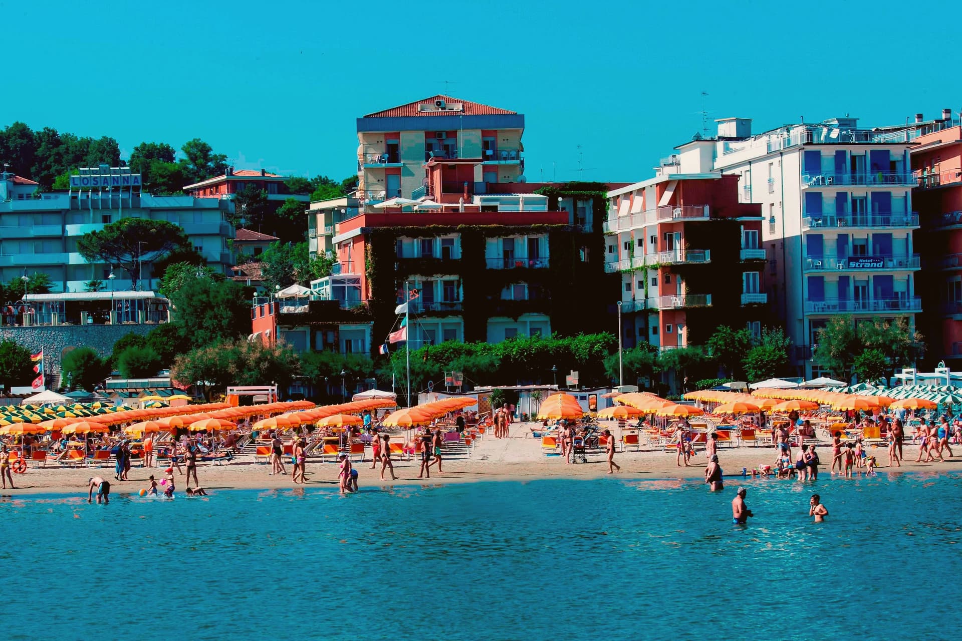
- Spiaggia di Gabicce Mare. Sand beach at the southernmost extension of the Riviera Romagnola strip, the family beach end of the upper Marche coast, backed by the town rather than the cliffs.
- Parco Naturale del Monte San Bartolo. Cliffs, ridge and a run of Renaissance villas above the sea, with fossil fish embedded in the rock face.
- Gabicce Monte. The hamlet climbs above the seafront rather than sitting on it, so the same stretch of coast reads differently from up here, the beach town below, the cliff line running south.
How to get to Gabicce Mare
There is a railway station in the town, so you can arrive without a car and never need one while you are here. Rimini is roughly 26 minutes away by road.
Our tip
May through September is the window for Gabicce Mare. The Adriatic warms by mid-May, the beach reaches full Bandiera Blu service through summer, and the San Bartolo cliff trails are open and dry. July and August touch the low thirties on the sand and the resort runs at peak with the Riviera Romagnola crowds from Rimini and Cattolica spilling south.
Loreto
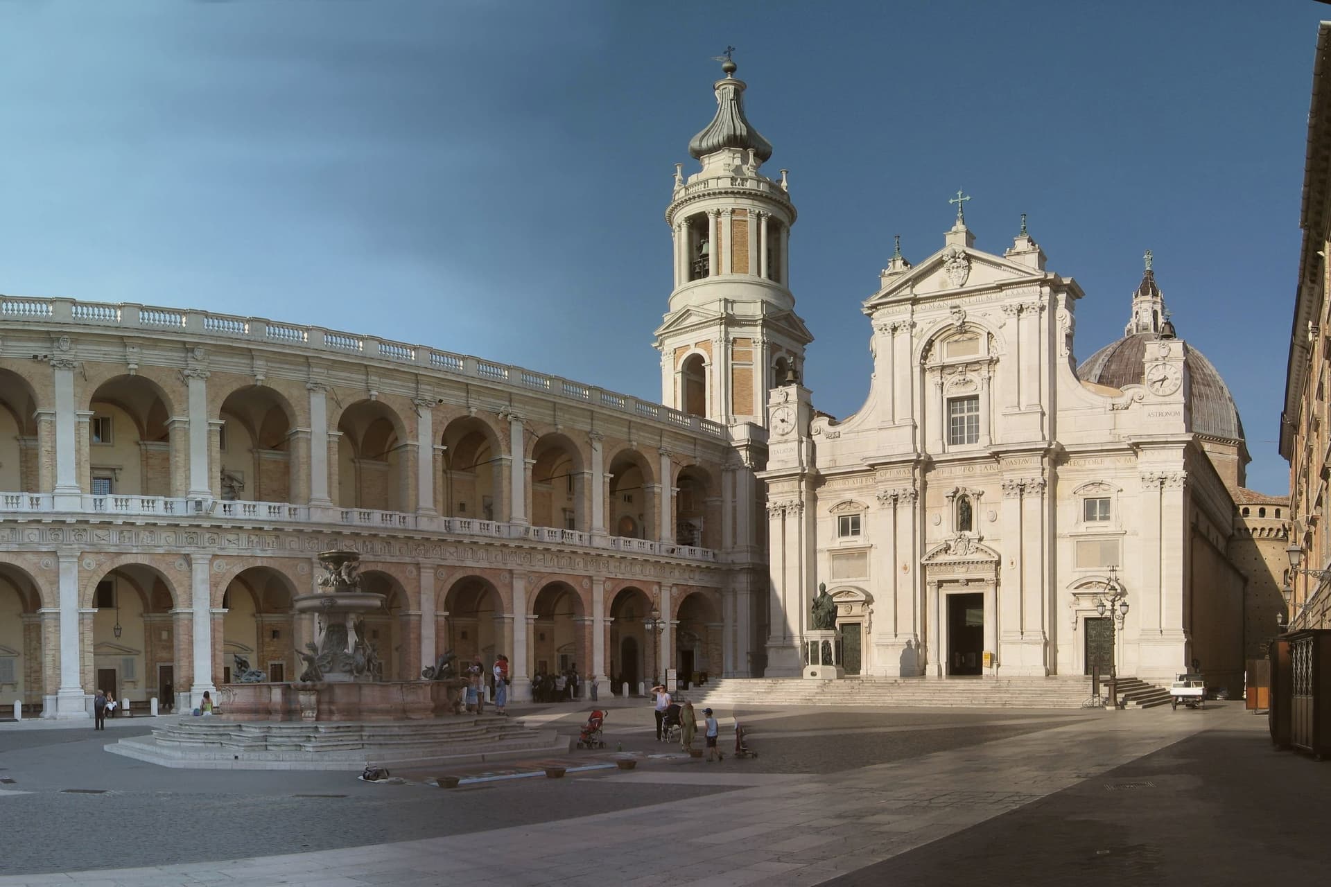
Why visit Loreto
Loreto sits at 127 meters on the right bank of the Musone, twenty-two kilometers southeast of Ancona and four from the Adriatic. According to tradition, on the night between 9 and 10 December 1294 angels carried the Holy House of the Virgin from Nazareth to a laurel grove on this hill, after a brief stop in Illyria following the Crusader expulsion of 1291.
Historical sources note that the Angeli were a Despot family of Epirus who organized the translation by sea. The three stone walls of the Santa Casa, 9.5 by 4 meters, stand at the heart of the Basilica della Santa Casa, built between 1469 and 1587 over and around them.
Bramante designed the marble revetment that wraps the house; Sansovino, Sangallo and Antonio da Sangallo il Giovane all worked on the building. Around four million pilgrims arrive each year, making Loreto one of the principal Marian sanctuaries in Catholic Europe and the source of the Litany of Loreto.
What to see in Loreto
- Basilica della Santa Casa. Built between 1469 and 1587 around the three walls of the Holy House from Nazareth, with contributions from Bramante, Sansovino and the Sangallo family.
- Santa Casa. The 9.5 by 4 meter stone house of Mary at the heart of the basilica, wrapped in Bramante's marble revetment, focus of pilgrimage since 1294.
- Piazza della Madonna. The main square in front of the basilica, enclosed by the Palazzo Apostolico of Bramante and Sansovino, holds the Fontana Maggiore of Carlo Maderno.
How to get to Loreto
There is a railway station in the town, so you can arrive without a car and never need one while you are here. Ancona is roughly 28 minutes away by road.
Our tip
May through September is the main pilgrim season at Loreto. The basilica is open every day, the train link from Ancona runs hourly, and the Adriatic four kilometers below stays cool enough for an afternoon trip. Two dates anchor the year: 25 March, the Annunciation, draws a major liturgy in the basilica, and 10 December, the anniversary of the translation, brings night-time fires across the surrounding hills under the name Venuta. Festa della Birra di Altötting falls in September.
Mondolfo
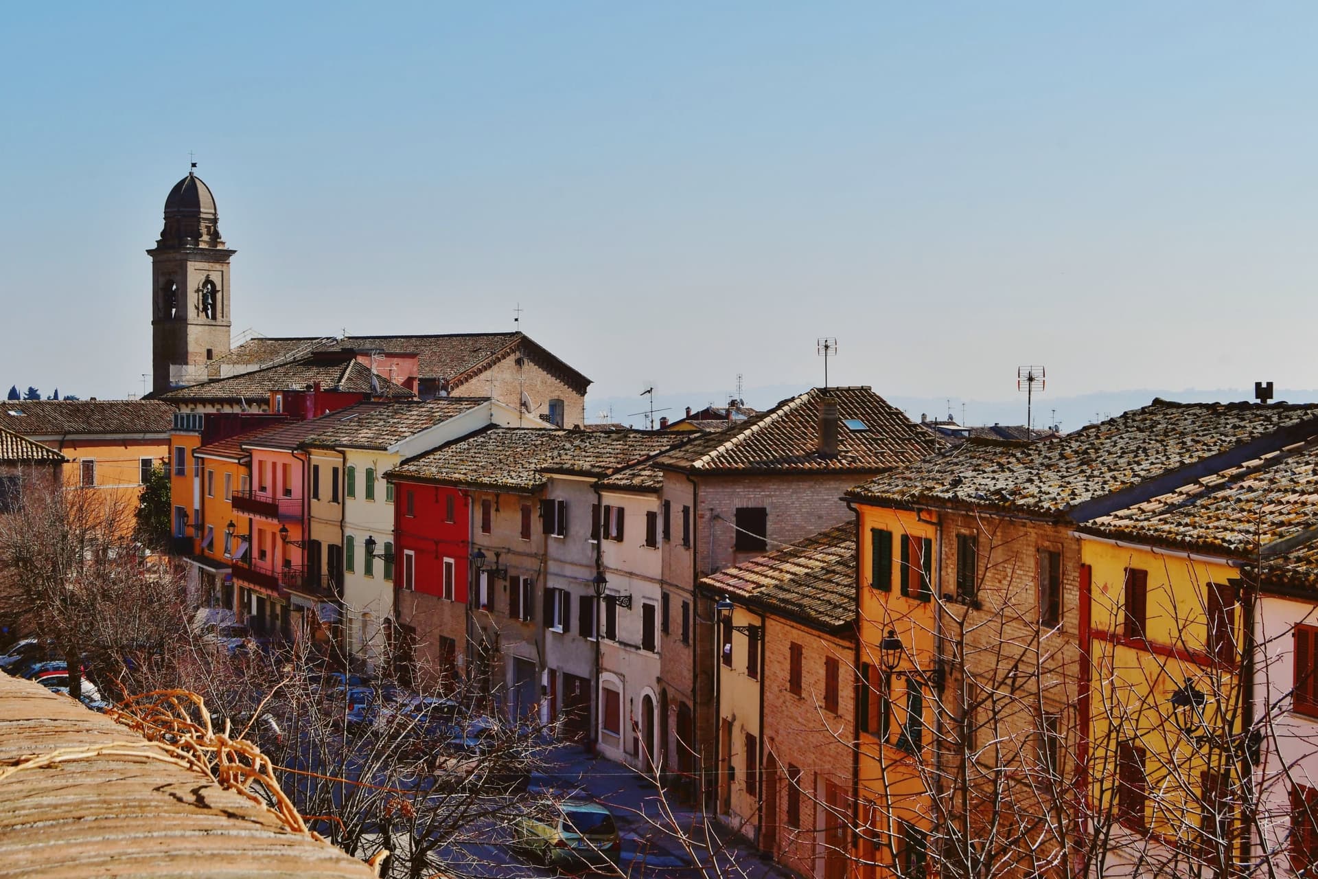
Why visit Mondolfo
Mondolfo sits at 144 meters on a ridge above the Adriatic between Pesaro and Senigallia, with the coastal frazione on the beach four kilometers below. A Byzantine castle stood here in the sixth and seventh centuries, and the present settlement formed around it in the early eleventh, when the Montoffo feudal family gave the town its name.
The Malatesta took the castle in the fourteenth century, then Sigismondo Pandolfo Malatesta lost it to Pope Pius II in 1463, at which point the walls and bastion that still anchor the southwest corner were rebuilt. The friary and church at the heart of the old town were rebuilt twice, first by Antonio di Pietro da Vercelli in 1466 and again under Domenico da Como in 1593.
Mondolfo joined the Borghi più belli d'Italia and holds recognitions for both its coast and its farmland. The town is a single history in two elevations: the ridge held the castle and later the fortified center, while the shore below, reached across the four kilometers of farmland now recognized for its management, grew into the seafront community that carries the coastal recognitions today.
What began as a Byzantine strongpoint and passed through Malatesta and papal hands still reads as a hill town looking down at its own beach.
The beach here holds the national bathing award, which a comune has to win back every year on water quality, beach management and safety. It is also rated for accessibility, which most of this coast is not.
What to see in Mondolfo
- Mura Roveresche. Roughly 600 meters of fifteenth-century walls and the south-west bastion, redesigned by the Della Rovere for early artillery defense after 1463.
- Complesso Monumentale di Sant'Agostino. Augustinian friary and church from the late thirteenth century, rebuilt in 1466 and again in 1593, now home to the civic museum and the Sant'Agostino complex.
- Centro storico. Walled hill borgo with narrow streets, the Palazzo del Comune and the Chiesa di Santa Giustina at the heart of the perimeter.
How to get to Mondolfo
There is a railway station in the town, so you can arrive without a car and never need one while you are here. Ancona is roughly 44 minutes away by road.
Our tip
May through September is the main window for Mondolfo. The Marotta seafront opens from late spring, the Bandiera Blu lido water clears from June, and the hill borgo above stays a few degrees cooler than the beach. July and August fill the lungomare with the worst of the coast traffic; the walled borgo above keeps quieter. Festa del Mare falls in August.
More from Anywhere Italy
- The 10 best hidden towns with a serious restaurant in Marche
- The best coastal towns within 90 minutes of Ancona
- The best coastal towns you can reach by train in Marche
 The best hidden towns you can reach by train that eat well in Marche
 The 9 best towns inside a nature park in Marche
- The best coastal towns within two hours of Bologna