
The 10 best hidden towns with a serious restaurant in Marche
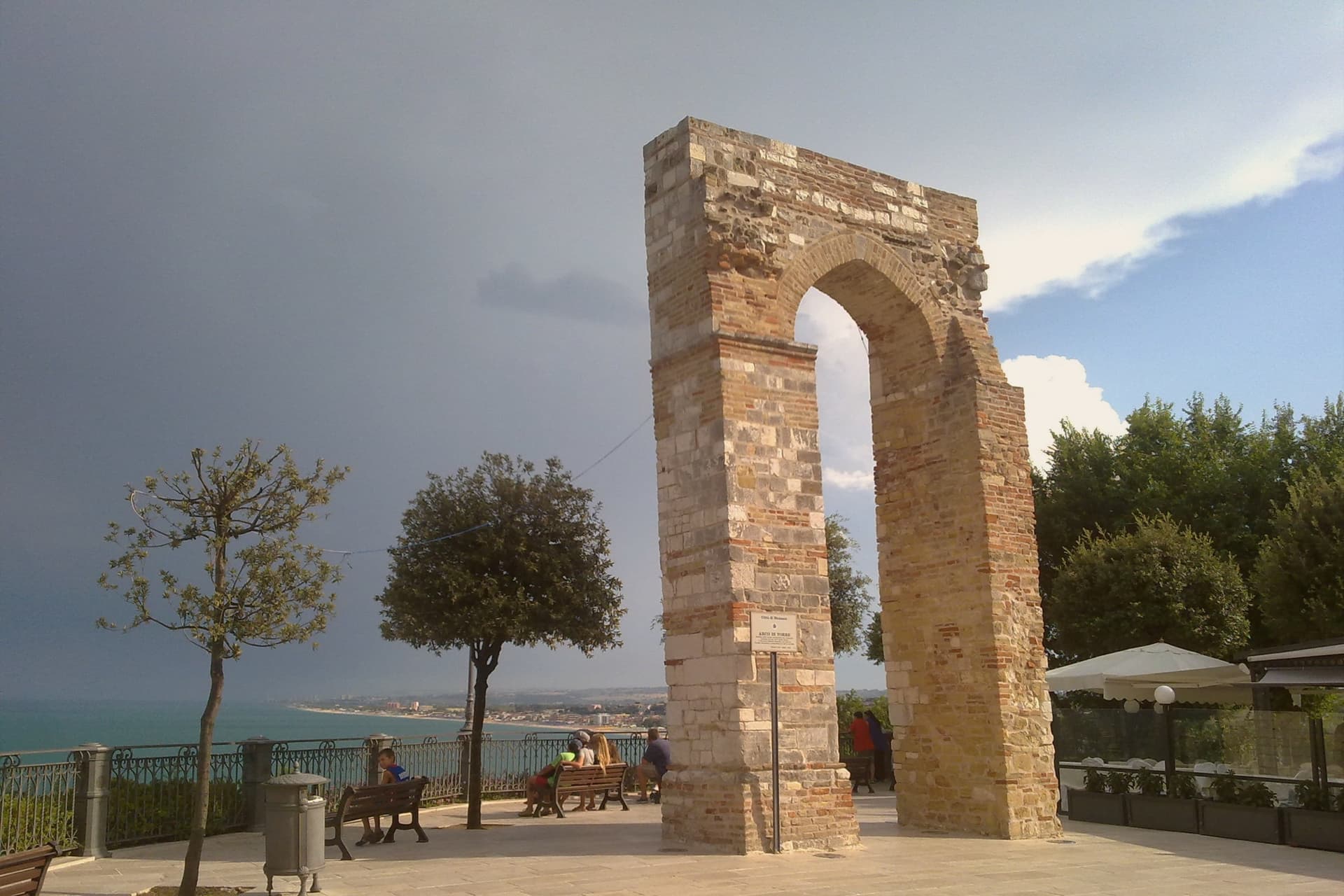
Marche eats the way it builds: brick and travertine, nothing wasted, everything set into the slope of a hill. Autumn brings white truffles up out of the oak woods around the Metauro valley, and they arrive on tagliatelle without ceremony, weighed at the table. Further south the hills tighten into ridges of stone houses the colour of pale biscuit, with vincotto and stuffed olives and casciotta cheese made from ewes' milk. On the coast the limestone of Monte Conero drops straight into clear water, and the fish is grilled, or served raw with lemon and good oil, in dining rooms that take the cooking as seriously as any city.
The reputation for eating well in this region has settled on one place above all others, and that place is Senigallia. Its long sand beach and its famous kitchens draw diners from Milan and beyond, and tables are booked far in advance through the summer. The town deserves the attention. It also means that a stretch of coast known nationally for its restaurants funnels most of its visitors into the same few streets, at the same hour, in the same weeks of August.
The good cooking does not stop at the town line. The same hills that supply the truffles, the same ewes, the same boats out of the same ports, continue inland to Fossombrone and Treia and San Severino Marche, and along the cliffs to Sirolo and Numana. Fewer people go to these towns to eat, though each holds a restaurant listed by the most demanding of the dining guides. They are worth a detour, and most of them are worth staying the night.
Of the 63 communes we have mapped in Marche, 18 qualify as towns with a serious restaurant: each holds a restaurant listed by the most demanding of the dining guides. This list is the hidden ones, 10 in all, ordered smallest first. The smallest, Numana, has 3,741 residents.
Elsewhere in the catalogue: The 6 best hidden hill towns with a serious restaurant in Marche and The best hill towns with a serious restaurant in Marche.
Numana
Why visit Numana
Numana sits fifteen kilometers south of Ancona, on a cliff overlooking the Adriatic at the foot of the promontory that shapes this stretch of coast. The old town, Numana alta, runs along the ridge in continuity with Sirolo, while Numana bassa wraps around the port below, so the visitor moves between two settlements joined by a single slope rather than one town with two names.
The place was a Picene harbour that traded with Greek and Etruscan ships from the sixth century BC, and a major centre of pre-Roman Italy before the rise of Ancona pushed it into decline around 500 BC. That decline is what left the burial grounds undisturbed long enough to be excavated centuries later, and it is also why the town's oldest identity is archaeological rather than architectural: a harbour that mattered, stopped mattering, and was rediscovered through what it buried.
In Riva a Numana, Casa Rapisarda, Riva Restaurant del View Place Hotel and 1 more have been named by a guide.
What to see in Numana
- Antiquarium Statale di Numana. Opened 1974, holding more than five hundred Picene burials from the Conero necropolises, plus a sixth-century BC limestone warrior's head found on a Numana beach in 1892.
- Santuario del Crocifisso. Rebuilt in 1969 on a 1566 foundation, the current structure standing on a sanctuary site with roots three centuries older than the rebuild itself.
- Porto di Numana. Working fishing and pleasure port at the foot of the cliff, with daily boat services along the Conero cliffs to the otherwise inaccessible Due Sorelle beach.
How to get to Numana
Ancona is roughly 30 minutes away by road.
Our tip
May through September are the months for Numana. The Conero water clears from late May and stays warm through September, with the port's daily boats running to Due Sorelle and the other Conero cliff beaches. July and August are the busiest weeks of the Marche coast: parking is metered into the late evening and the Numana bassa restaurants book ahead.
Sirolo
Why visit Sirolo
Sirolo sits at 125 meters, twenty kilometers from Ancona, on ground that belonged to the Conti Cortesi family. The medieval village kept one of the two original castle towers, folded now into the parish church, and the belvedere above Piazza Vittorio Veneto looks out across the bay.
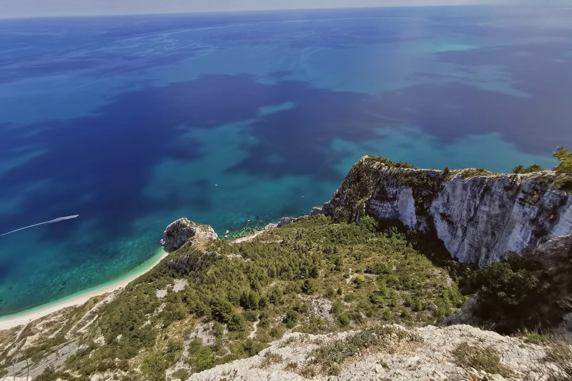
Below town, the ridge drops toward the Picene necropolis of I Pini, and further down still toward the water. The mountain above the village and the water below it are the same geology: limestone that falls straight into the sea rather than tapering through a coastal plain, which is why the village sits on a clifftop rather than a shoreline.
Upper Sirolo is the castle, the church and the theatre, all cut from the same pale stone. Lower Sirolo is reached by boat or by trail, down through the park to the cove where the sea stacks stand.
The grave goods from the necropolis have left town entirely, kept at the Antiquarium in neighbouring Numana, so what remains above ground here is the tomb site itself rather than its contents. The town doubles in summer and empties again in October: a place shaped less by what happens in it than by the drop between its two levels, the built one and the wild one.
Lofficina, Convivio have been named by a guide.
What to see in Sirolo
- Centro storico. Medieval village on the clifftop with the Arco Gotico from around the year 1000, the Piazzetta and a belvedere looking out across the Adriatic.
- Chiesa di San Nicolò di Bari. Eighteenth-century parish church built over a thirteenth-century structure, incorporating one of the two surviving towers of the medieval Sirolo castle.
- Teatro Cortesi. Municipal theatre inaugurated in 1875, built in white Conero stone, restored and reopened in 1989.
How to get to Sirolo
Ancona is roughly 31 minutes away by road.
Our tip
May through September is the window for Sirolo. The water warms enough for the Conero beaches from late May, the boat shuttle to the Due Sorelle runs daily through summer, and the belvedere stays cool when the Adriatic plain below is hot. July and August are the busiest weeks: parking limits in the centro storico, queues for Spiaggia Urbani and Sassi Neri, evening passeggiate spilling out of every trattoria.
Acqualagna
Why visit Acqualagna
Acqualagna sits at 204 meters in the Metauro valley, twelve kilometers from Urbino, on the plain just downstream from the gorge cut by the Candigliano river. The Roman city of Pitinum Mergens stood nearby until Alaric's Goths destroyed it; the survivors founded Montefalcone, the castle from which today's village grew.
The name Acqualagna comes from Aqua Lanea, water of slaughter, after the sixth-century battle fought on that same plain. Three fairs anchor the year: black truffle on the last Sunday of February, summer black on the last Sunday of July, white truffle across the last weekend of October and the two that follow.
The town below and the gorge above read as one unit, a river valley that has carried Roman road traffic, monastic settlement and truffle trade in turn, each leaving its mark on the ground without erasing what came before.
Anticofurlo have been named by a guide.
What to see in Acqualagna
- Gola del Furlo. The gorge narrows between Monte Paganuccio (977 m) and Monte Pietralata (888 m); the 38-meter Roman tunnel, cut in 76 AD, is still driven through by the Via Flaminia today.
- Abbazia di San Vincenzo al Furlo. Medieval Benedictine monastery set into the slopes above the gorge, counted among the oldest religious foundations in the Metauro valley.
- Riserva Naturale Statale Gola del Furlo. Nature reserve established in 2001, covering 3,600 hectares of woodland, grazing land and ridgeline above the river.
How to get to Acqualagna
There is a railway station in the town, so you can arrive without a car and never need one while you are here. Rimini is roughly 81 minutes away by road.
Our tip
April through June and September into October are the months for Acqualagna. The Metauro hills hold their green, the woods around Monte Paganuccio are open for walking, and summer truffle season turns the piazzas over to tasting tables in late July. July and August touch the high twenties; the gorge stays cooler than the valley floor. Fiera Regionale del Tartufo d'Estate falls in August.
Offida
Why visit Offida
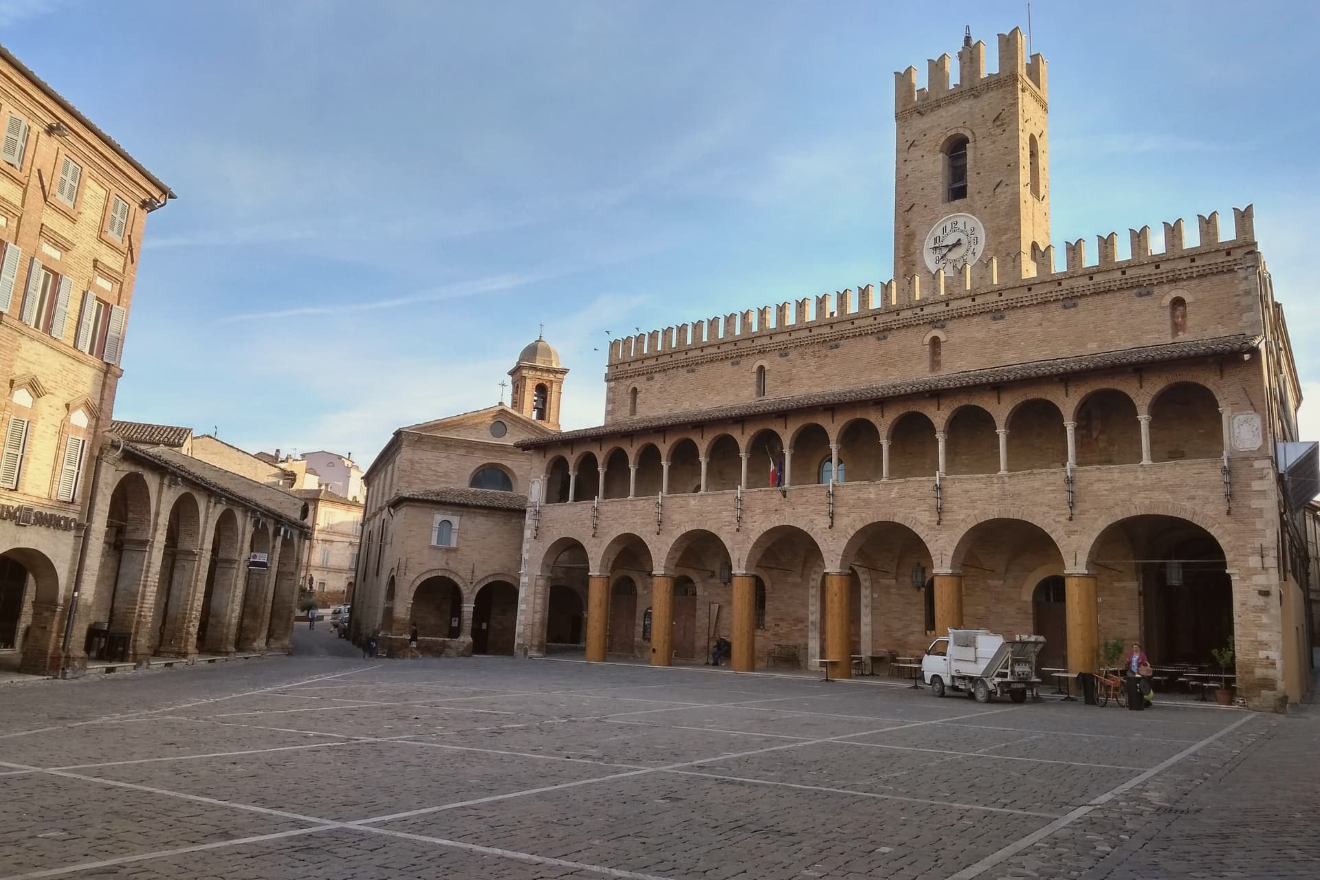
Offida sits at 293 meters on a cliff between the Tesino and Tronto valleys, twenty-three kilometers from Ascoli Piceno. The Chiesa di Santa Maria della Rocca rises on a rock spur at the western edge of the village, surrounded on three sides by cliffs that drop into two valleys: a Romanesque-Gothic temple in brick and travertine, raised by Master Albertino in 1330 on an older Benedictine foundation, with a double row of trilobed arches around the apse.
Inside, the apse and transept hold the fresco cycle of the Master of Offida, an anonymous monk painter who carried Giotto's lesson through the Rimini school, with the Marriage of Saint Catherine and Saint Christopher dated by inscription to 1367. Bobbin lace, merletto a tombolo, has been worked in town since the fifteenth century; the Museo del Merletto in Palazzo De Castellotti holds the collection.
The Carnevale Storico, with the Bove finto run and the Vlurd fire bundles, dates from before Lent in early February.
Osteria Ophis, Blob Caffè & Ristorante have been named by a guide.
What to see in Offida
- Chiesa di Santa Maria della Rocca. Romanesque-Gothic brick-and-travertine church raised in 1330 by Master Albertino on a rock spur west of town, with the Master of Offida fresco cycle dated 1367 in the transept.
- Museo del Merletto a Tombolo. Inside Palazzo De Castellotti, with the lace collection, tools, historical documents and demonstrations of the bobbin-lace work practiced in town since the fifteenth century.
- Palazzo Comunale. Civic palace on the long Piazza del Popolo, with a portico, the Teatro Serpente Aureo and the access to the Museo del Merletto and the archaeological museum.
How to get to Offida
Pescara is roughly 74 minutes away by road.
Our tip
April through June and September into October are the best months for Offida. The hills around the town turn green by April and gold through the September harvest, the wine cellars run open tastings between vendemmia and St. Martin, and the Pecorino and Passerina vineyards stand out along the ridges. Sagra del Chichìripieno falls in August.
Gabicce Mare
Why visit Gabicce Mare
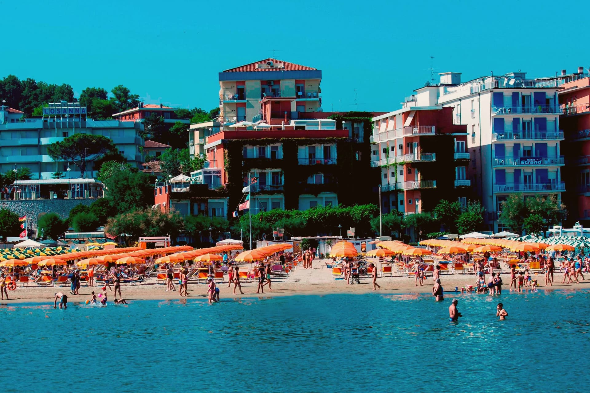
Gabicce Mare sits on the Adriatic at the northernmost point of the Marche, sixteen kilometers north of Pesaro and bordering Cattolica in Emilia-Romagna's province of Rimini. South of the beach, the cliffs of Monte San Bartolo rise abruptly, the only stretch of high coast between Trieste and the Conero, so the town marks the hinge where a long flat sand shore gives way to headland.
Sixteenth-century maps placed the Romagna border further south than it runs today, taking in the upper hamlet inside what is now the park. The archaeological record on the headland runs from the Neolithic at Monte Castellaro through a Roman site on the Via Flaminia to a lost Greek-origin port below the cliffs, layers of settlement stacked on the same few kilometers of high ground.
The town is really two places joined by geography rather than one: a beach that belongs to the sand coast running north, and a cliff and ridge system that belongs to the rock coast running south. Nowhere else on this shore does the flat Adriatic strip end so abruptly against high ground.
Posillipo, Dalla Gioconda have been named by a guide.
What to see in Gabicce Mare
- Spiaggia di Gabicce Mare. Sand beach at the southernmost extension of the Riviera Romagnola strip, the family beach end of the upper Marche coast, backed by the town rather than the cliffs.
- Parco Naturale del Monte San Bartolo. Cliffs, ridge and a run of Renaissance villas above the sea, with fossil fish embedded in the rock face.
- Gabicce Monte. The hamlet climbs above the seafront rather than sitting on it, so the same stretch of coast reads differently from up here, the beach town below, the cliff line running south.
How to get to Gabicce Mare
There is a railway station in the town, so you can arrive without a car and never need one while you are here. Rimini is roughly 26 minutes away by road.
Our tip
May through September is the window for Gabicce Mare. The Adriatic warms by mid-May, the beach reaches full Bandiera Blu service through summer, and the San Bartolo cliff trails are open and dry. July and August touch the low thirties on the sand and the resort runs at peak with the Riviera Romagnola crowds from Rimini and Cattolica spilling south.
Treia
Why visit Treia
Treia stands at 342 meters in the hills between the Potenza and Chienti valleys, thirty-five kilometers from Ancona. The Roman town of Trea lay on the plateau below, a municipium founded shortly after 49 BC that flourished between Augustus and Antoninus Pius.
Around the year 1000 the population moved up to the more defensible hilltop of Montecchio, and the older site emptied. The new town stayed under the name Montecchio until 1790, when Pope Pius VI raised it to the rank of città and restored its Roman name.
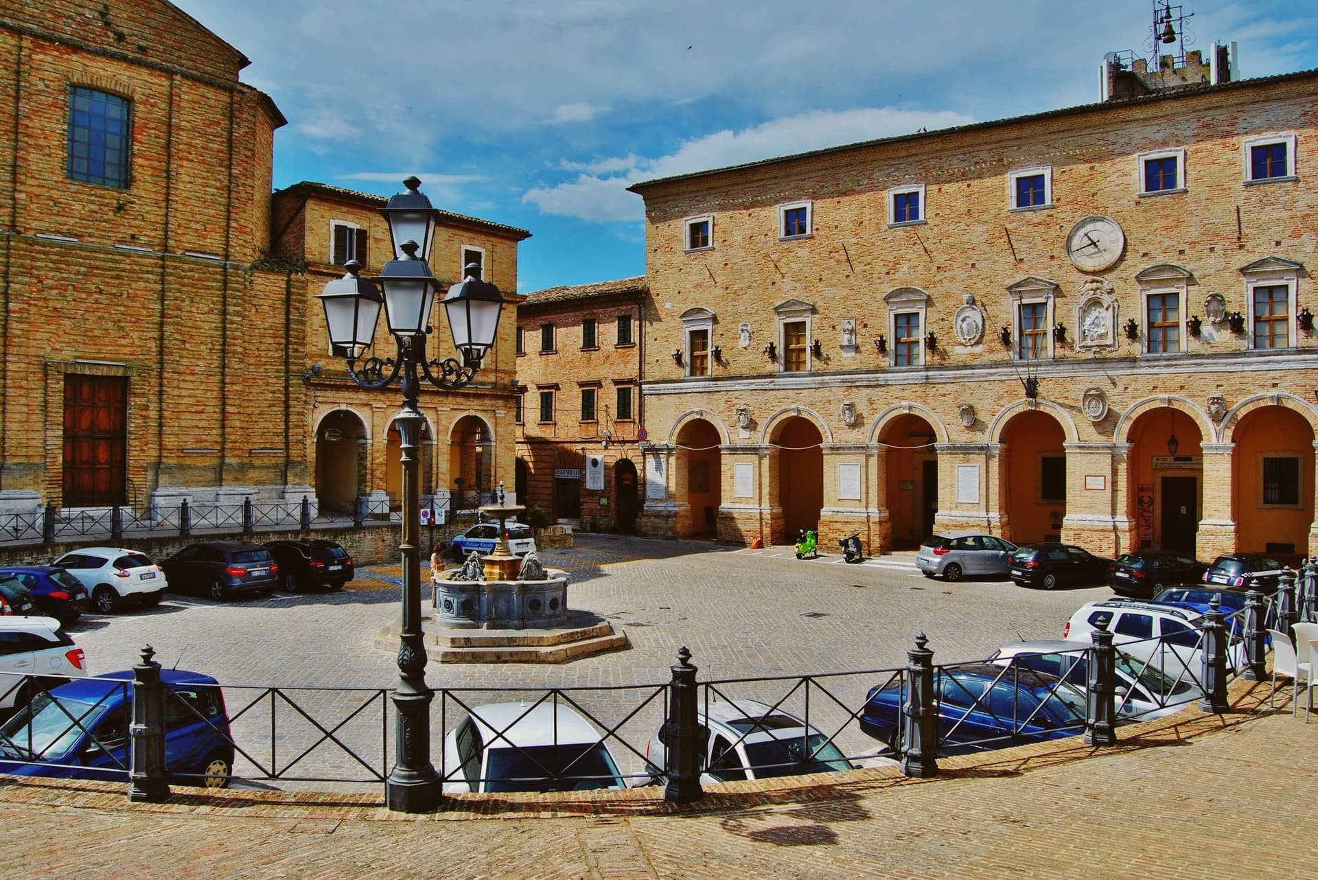
The Piazza della Repubblica, on the highest point of the ridge, is closed at one end by the Cattedrale della Santissima Annunziata and at the other by Giuseppe Valadier's small Accademia Georgica, the eighteenth-century home of an agronomic academy founded in the fifteenth as the Accademia dei Sollevati. The Disfida del Bracciale, an Ottocento street-game in which four contrade compete, has filled the centro storico every first Sunday of August since 1978.
Il Casolare dei Segreti have been named by a guide.
What to see in Treia
- Piazza della Repubblica. Belvedere piazza on the highest point of the ridge, closed by the Cattedrale della Santissima Annunziata at one end and the Accademia Georgica at the other.
- Accademia Georgica. Eighteenth-century Giuseppe Valadier building housing an academy founded in the 1400s, with 1,196 parchments of the municipal archive and over 15,000 volumes.
- Santuario del Santissimo Crocifisso. Cesare Bazzani sanctuary completed in the early twentieth century on the site of an older parish church, holding a sixteenth-century Umbrian fresco and a thirteenth-century crucifix.
How to get to Treia
Ancona is roughly 58 minutes away by road.
Our tip
April through June and September into October are the best months for Treia. The hills between the Potenza and Chienti turn green in spring, the wheat ripens through June, and the autumn light on the long ridge runs gold through October. July and August touch the low thirties; the high point of the centro storico catches a breeze most afternoons, and the Disfida del Bracciale on the first Sunday of August is the busiest weekend of the year. Disfida del Bracciale falls in July.
Fossombrone
Why visit Fossombrone
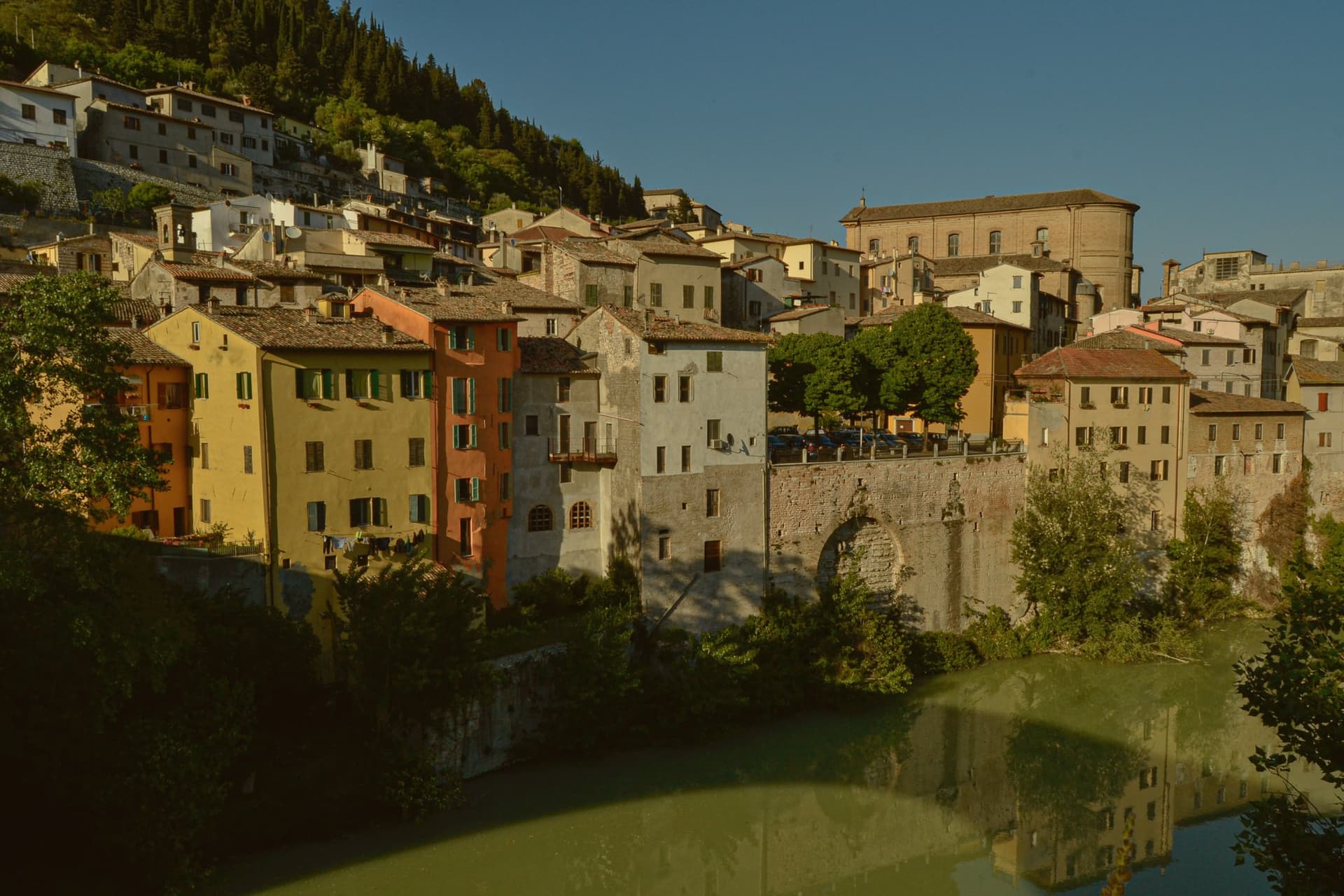
Fossombrone sits on the Metauro river in the foothills of the central Apennines, 30 km inland from Pesaro. The site has been continuously occupied since the 8th century BC: a north-Piceno village, then a partial Celtic settlement, then the Roman colony founded around 120 BC by the consul Caius Sempronius Gracchus.
The town's layers sit stacked in physical order. The Roman city's remains lie in the flat ground just east of the modern centre.
Above it, the medieval and Renaissance town climbs a single long street to the ducal court at its summit. Lower down, the Casa Cattabrini and the cathedral anchor the centro storico by the river.
Upstream, 8 km from the centre, the Metauro narrows into the gorge that gives the town its wider setting, its cliffs cut through by the Roman engineers and now enclosed within a nature reserve. The geography explains the sequence: river valley first, road town second, fortified height last, each built on what the one before had left standing.
Osteria Zanchetti have been named by a guide.
What to see in Fossombrone
- Forum Sempronii (area archeologica). Excavations east of the modern centre reveal the forum, basilica and domus mosaics, with a continuous stratigraphy running from the north-Piceno village through the Roman imperial city. The Via Flaminia ran through the colony.
- Corte Alta. The palace begun by Federico da Montefeltro and completed under the Della Rovere dukes sits at the top of a single long street climbing from the lower town. It holds a small civic museum alongside the frescoed hall.
- Galleria del Furlo (76 AD). The tunnel runs 38 metres through limestone above the narrowing Metauro, with the gorge around it protected as a nature reserve, some of the wildest ground in the Marche.
How to get to Fossombrone
Rimini is roughly 69 minutes away by road.
Our tip
April through October is the open season on the Metauro. May and June are the best months for the Furlo Gorge walks — wildflowers, cool gorge shade, the river running clear. July and August are warm in the valley but the gorge stays cooler than the coast; the Corte Alta keeps regular hours.
San Severino Marche
Why visit San Severino Marche
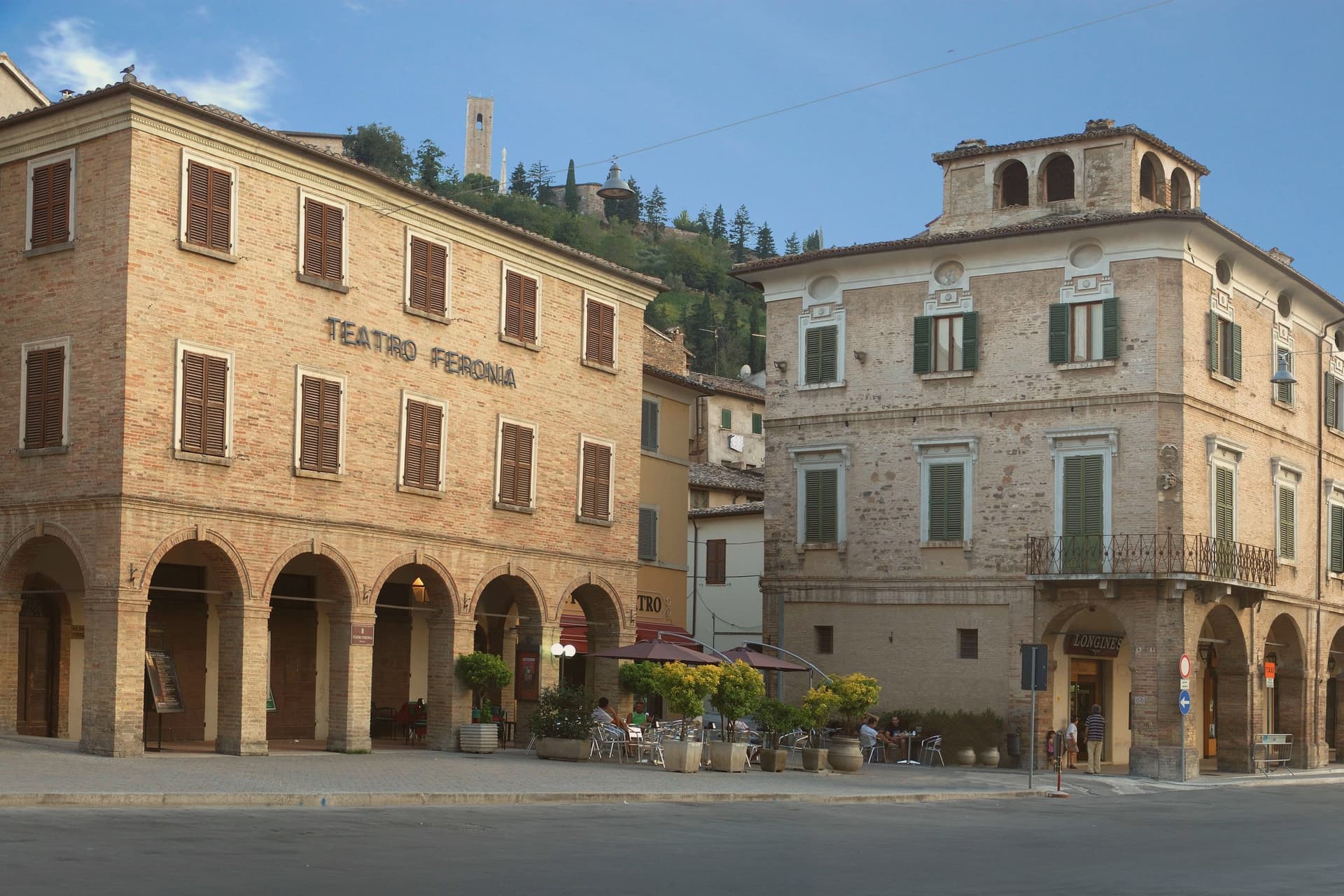
San Severino Marche sits at 235 meters in the Potenza valley, fifty kilometers southwest of Ancona, and the town is built in two distinct pieces rather than one continuous fabric. The medieval Castello occupies the hill above the town, still ringed by surviving city walls, while the Borgo below grew up around its own civic center on the valley floor.
The two parts do different jobs: the hill was governed and defended, walled and towered under the Smeducci dynasty through the fourteenth century, while the valley floor was built for markets and public life, organized around the wide colonnaded ellipse that still serves as the town's gathering space. The Salimbeni brothers, Lorenzo and Jacopo, were born in the town and worked across both halves of it, painting in a hilltop church and in a crypt-church alike, and their frescoes, along with a Vittore Crivelli polyptych, have since been gathered into a civic gallery in the lower town.
That movement of paintings from hill to valley mirrors the town's own shift in weight over time, from a fortified seat of government above to a civic and commercial center below, with the art now sitting closer to the square than to the walls that first sheltered it.
Cavallini have been named by a guide.
What to see in San Severino Marche
- Piazza del Popolo. The elliptical square anchors the lower town, its porticoes running unbroken around the full curve, giving the Borgo a single continuous gathering space rather than a scattering of smaller squares.
- Duomo Vecchio. The bell tower and the raised setting on Monte Nero are what register first, the cathedral standing above the walls rather than among them. Inside, the chapel that once held the Salimbeni Saint John cycle is now empty, the frescoes moved elsewhere in town.
- Torre degli Smeducci. The tower is the only structure on the hill that reads as purely defensive, plain where the church nearby is decorated, and it still dominates the skyline of the upper town.
How to get to San Severino Marche
There is a railway station in the town, so you can arrive without a car and never need one while you are here. Ancona is roughly 71 minutes away by road.
Our tip
April through June and September into October are the working months for San Severino Marche. The Potenza valley turns green from April, the climb to the Duomo Vecchio holds its best light through the autumn afternoons, and the Palio dei Castelli on the second Sunday of June fills both city centers with neighborhood processions. July and August touch the low thirties; the elliptical Piazza del Popolo offers shaded porticoes through the hottest hours and the lower city empties between four and seven.
Urbino
Why visit Urbino
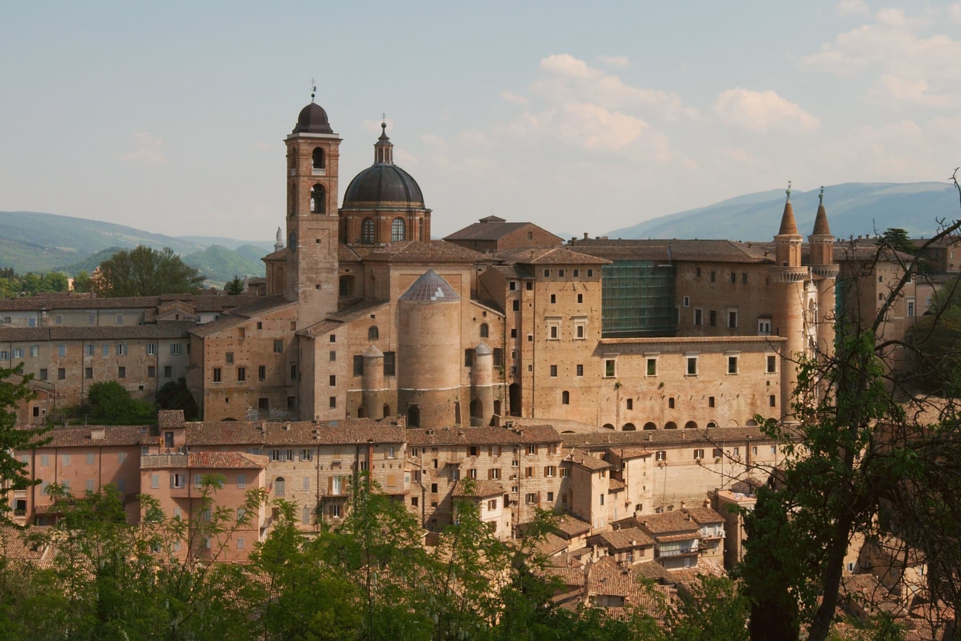
Urbino sits at 451 meters in the Apennine foothills, seventy kilometers north of Perugia, its historic core spread across twin hills with the fortress on the higher of the two and the palace complex below on the other. Federico II da Montefeltro ruled from 1444 to 1482, and under him the town became one of the central courts of the Italian Renaissance: he was condottiere, diplomat, patron and humanist at once, and the building campaign he set running through the 1450s to the 1470s, first under Maso di Bartolomeo, gave the city the asymmetric silhouette that still defines it from a distance.
The university, founded in 1506, keeps that Renaissance investment active in the present rather than fossilized: the centro storico holds roughly 14,000 residents and around 14,000 enrolled students, so the old town runs on a population it did not have in the fifteenth century. The two hills, the ducal seat and the fortress above it, read as the same civic project seen from two elevations: one built to project a court outward, the other to hold the higher ground behind it.
What the 1998 inscription recognizes is that this pairing, court and citadel, survives largely as Federico left it.
Portanova have been named by a guide.
What to see in Urbino
- Palazzo Ducale. Federico da Montefeltro's Renaissance palace begun 1444, completed by Luciano Laurana with the twin torricini facade, now housing the Galleria Nazionale delle Marche.
- Galleria Nazionale delle Marche. One of the most important Renaissance painting collections in Italy, with Raffaello, Piero della Francesca's Flagellazione and Madonna di Senigallia, Paolo Uccello and Tiziano.
- Casa Natale di Raffaello. Fifteenth-century house on Via Raffaello where the painter was born in 1483 in the workshop of his father Giovanni Santi, now a museum of the early years.
How to get to Urbino
There is a railway station in the town, so you can arrive without a car and never need one while you are here. Rimini is roughly 65 minutes away by road.
Our tip
April through June and September into October are the best months for Urbino. The hills hold their green, the city's brick warms in afternoon light, and the long climb to the Fortezza Albornoz is bearable in mild weather. July and August touch the low thirties at 451 meters; the Palazzo Ducale stays cool inside, but the steep streets in afternoon sun are slow going.
Mondolfo
Why visit Mondolfo
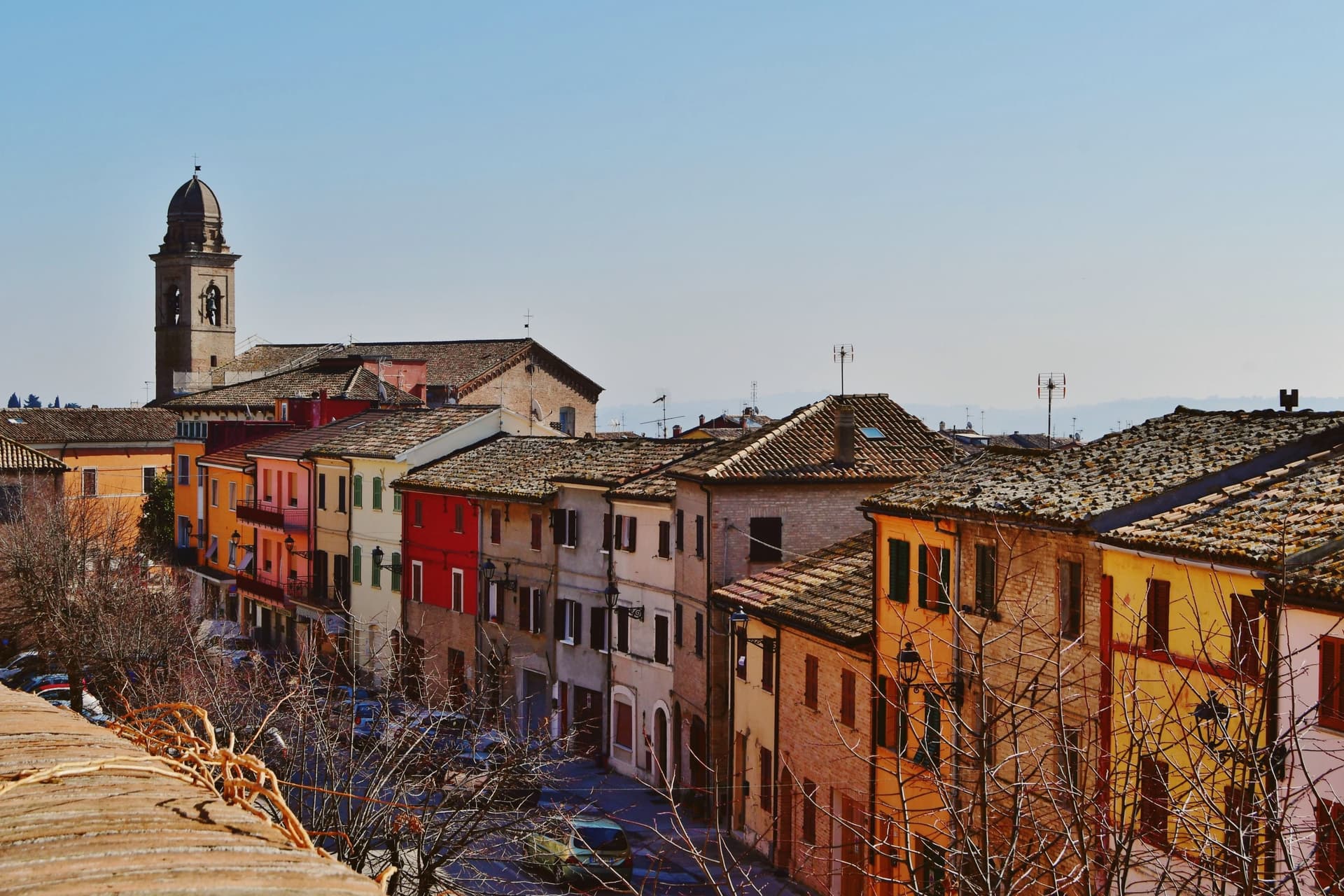
Mondolfo sits at 144 meters on a ridge above the Adriatic between Pesaro and Senigallia, with the coastal frazione on the beach four kilometers below. A Byzantine castle stood here in the sixth and seventh centuries, and the present settlement formed around it in the early eleventh, when the Montoffo feudal family gave the town its name.
The Malatesta took the castle in the fourteenth century, then Sigismondo Pandolfo Malatesta lost it to Pope Pius II in 1463, at which point the walls and bastion that still anchor the southwest corner were rebuilt. The friary and church at the heart of the old town were rebuilt twice, first by Antonio di Pietro da Vercelli in 1466 and again under Domenico da Como in 1593.
Mondolfo joined the Borghi più belli d'Italia and holds recognitions for both its coast and its farmland. The town is a single history in two elevations: the ridge held the castle and later the fortified center, while the shore below, reached across the four kilometers of farmland now recognized for its management, grew into the seafront community that carries the coastal recognitions today.
What began as a Byzantine strongpoint and passed through Malatesta and papal hands still reads as a hill town looking down at its own beach.
Burro & Alici have been named by a guide.
What to see in Mondolfo
- Mura Roveresche. Roughly 600 meters of fifteenth-century walls and the south-west bastion, redesigned by the Della Rovere for early artillery defense after 1463.
- Complesso Monumentale di Sant'Agostino. Augustinian friary and church from the late thirteenth century, rebuilt in 1466 and again in 1593, now home to the civic museum and the Sant'Agostino complex.
- Centro storico. Walled hill borgo with narrow streets, the Palazzo del Comune and the Chiesa di Santa Giustina at the heart of the perimeter.
How to get to Mondolfo
There is a railway station in the town, so you can arrive without a car and never need one while you are here. Ancona is roughly 44 minutes away by road.
Our tip
May through September is the main window for Mondolfo. The Marotta seafront opens from late spring, the Bandiera Blu lido water clears from June, and the hill borgo above stays a few degrees cooler than the beach. July and August fill the lungomare with the worst of the coast traffic; the walled borgo above keeps quieter. Festa del Mare falls in August.
More from Anywhere Italy
- The 6 best hidden hill towns with a serious restaurant in Marche
- The best hill towns with a serious restaurant in Marche
- The best hidden towns you can reach by train that eat well in Marche
- The best towns with a serious restaurant in the province of Pesaro e Urbino
- The best towns with a serious restaurant that eat well within 90 minutes of Ancona
- The best hidden coastal towns in Marche