
The 9 best beach towns in Marche
90 towns visited, 910 to go. Follow along, free: Subscribe on Substack
The Marche coast is a long, low line of sand broken once by a mountain. North of Ancona the beaches are wide and pale, raked flat each morning, backed by stabilimenti with striped umbrellas and bars that serve espresso and then, by noon, cold Verdicchio and fried moscioli. South of the city the cliffs of Monte Conero drop straight into water that turns pale green over the white shingle, and the road above smells of broom and pine. Inland from almost every resort there is an older town of warm brick and travertine on a ridge, reached in minutes, where the fish is cooked as brodetto and the bread comes unsalted. June and September are the good months: the sea is warm, the beach clubs are open, the queue for a lettino is short.
The obvious move is the Riviera del Conero itself, or rather the postcard end of it, and above all the Grotte di Frasassi and Ancona's ferry port funnelling everyone onto the same few strips of shingle in August. Italians know this coast far better than foreign visitors do, and in the middle weeks of summer the Adriatic resorts of Romagna just to the north, Rimini and Riccione, pull traffic down the whole seafront. Parking near the famous beaches is metered, distant and full by mid-morning. The water is still excellent. The elbow room is not.
The same coastline continues in both directions, and the awards for clean water and well-run beaches are spread along all of it rather than concentrated in the places people have heard of. There are sand towns with working fishing fleets, cliff towns with paths down to the shingle, and hill towns with a beach frazione below and an old walled center above. These are the smaller of them, from the Romagna border to the palms of the Piceno, all with bathing water certified clean and beach management that has been checked. Fewer people go, and the brodetto is cheaper.
Of the 63 communes we have mapped in Marche, 9 qualify as beach towns: each holds the national award for clean bathing water and well-run beaches. The smallest, Numana, has 3,741 residents.
Two more lists worth reading alongside this one: The best towns with a serious restaurant that eat well within 90 minutes of Ancona and The best coastal towns you can reach by train in Marche.
Going to the sea? How to find the free beaches in Italy.
Why visit Numana
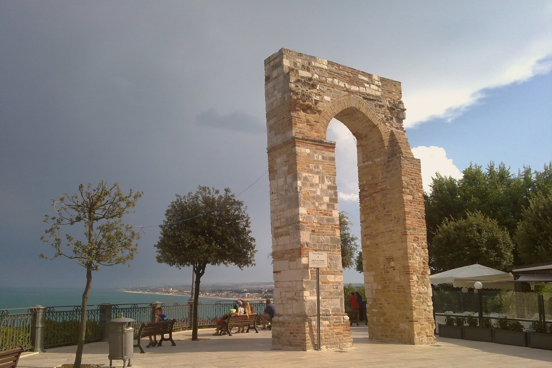
Numana sits fifteen kilometers south of Ancona, on a cliff overlooking the Adriatic at the foot of the promontory that shapes this stretch of coast. The old town, Numana alta, runs along the ridge in continuity with Sirolo, while Numana bassa wraps around the port below, so the visitor moves between two settlements joined by a single slope rather than one town with two names.
The place was a Picene harbor that traded with Greek and Etruscan ships from the sixth century BC, and a major center of pre-Roman Italy before the rise of Ancona pushed it into decline around 500 BC. That decline is what left the burial grounds undisturbed long enough to be excavated centuries later, and it is also why the town's oldest identity is archaeological rather than architectural: a harbor that mattered, stopped mattering, and was rediscovered through what it buried.
The beach here holds the national bathing award, which a comune has to win back every year on water quality, beach management and safety.
What to see in Numana
- Antiquarium Statale di Numana. Opened 1974, holding more than five hundred Picene burials from the Conero necropolises, plus a sixth-century BC limestone warrior's head found on a Numana beach in 1892.
- Santuario del Crocifisso. Rebuilt in 1969 on a 1566 foundation, the current structure standing on a sanctuary site with roots three centuries older than the rebuild itself.
- Porto di Numana. Working fishing and pleasure port at the foot of the cliff, with daily boat services along the Conero cliffs to the otherwise inaccessible Due Sorelle beach.
How to get to Numana
Ancona is about 30 min away by road.
Our tip
May through September are the months for Numana. The Conero water clears from late May and stays warm through September, with the port's daily boats running to Due Sorelle and the other Conero cliff beaches. July and August are the busiest weeks of the Marche coast: parking is metered into the late evening and the Numana bassa restaurants book ahead.
Why visit Sirolo
Sirolo sits at 125 meters, twenty kilometers from Ancona, on ground that belonged to the Conti Cortesi family. The medieval village kept one of the two original castle towers, folded now into the parish church, and the belvedere above Piazza Vittorio Veneto looks out across the bay.
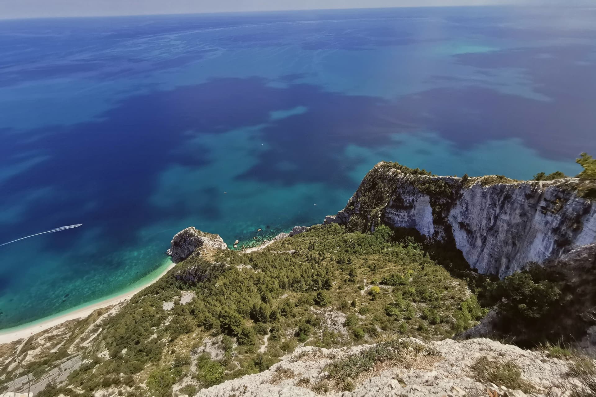
Below town, the ridge drops toward the Picene necropolis of I Pini, and further down still toward the water. The mountain above the village and the water below it are the same geology: limestone that falls straight into the sea rather than tapering through a coastal plain, which is why the village sits on a clifftop rather than a shoreline.
Upper Sirolo is the castle, the church and the theater, all cut from the same pale stone. Lower Sirolo is reached by boat or by trail, down through the park to the cove where the sea stacks stand.
The grave goods from the necropolis have left town entirely, kept at the Antiquarium in neighbouring Numana, so what remains above ground here is the tomb site itself rather than its contents. The town doubles in summer and empties again in October: a place shaped less by what happens in it than by the drop between its two levels, the built one and the wild one.
The beach here holds the national bathing award, which a comune has to win back every year on water quality, beach management and safety.
What to see in Sirolo
- Centro storico. Medieval village on the clifftop with the Arco Gotico from around the year 1000, the Piazzetta and a belvedere looking out across the Adriatic.
- Chiesa di San Nicolò di Bari. Eighteenth-century parish church built over a thirteenth-century structure, incorporating one of the two surviving towers of the medieval Sirolo castle.
- Teatro Cortesi. Municipal theater inaugurated in 1875, built in white Conero stone, restored and reopened in 1989.
How to get to Sirolo
Ancona is about 31 min away by road.
Our tip
May through September is the window for Sirolo. The water warms enough for the Conero beaches from late May, the boat shuttle to the Due Sorelle runs daily through summer, and the belvedere stays cool when the Adriatic plain below is hot. July and August are the busiest weeks: parking limits in the centro storico, queues for Spiaggia Urbani and Sassi Neri, evening passeggiate spilling out of every trattoria.
Why visit Gabicce Mare
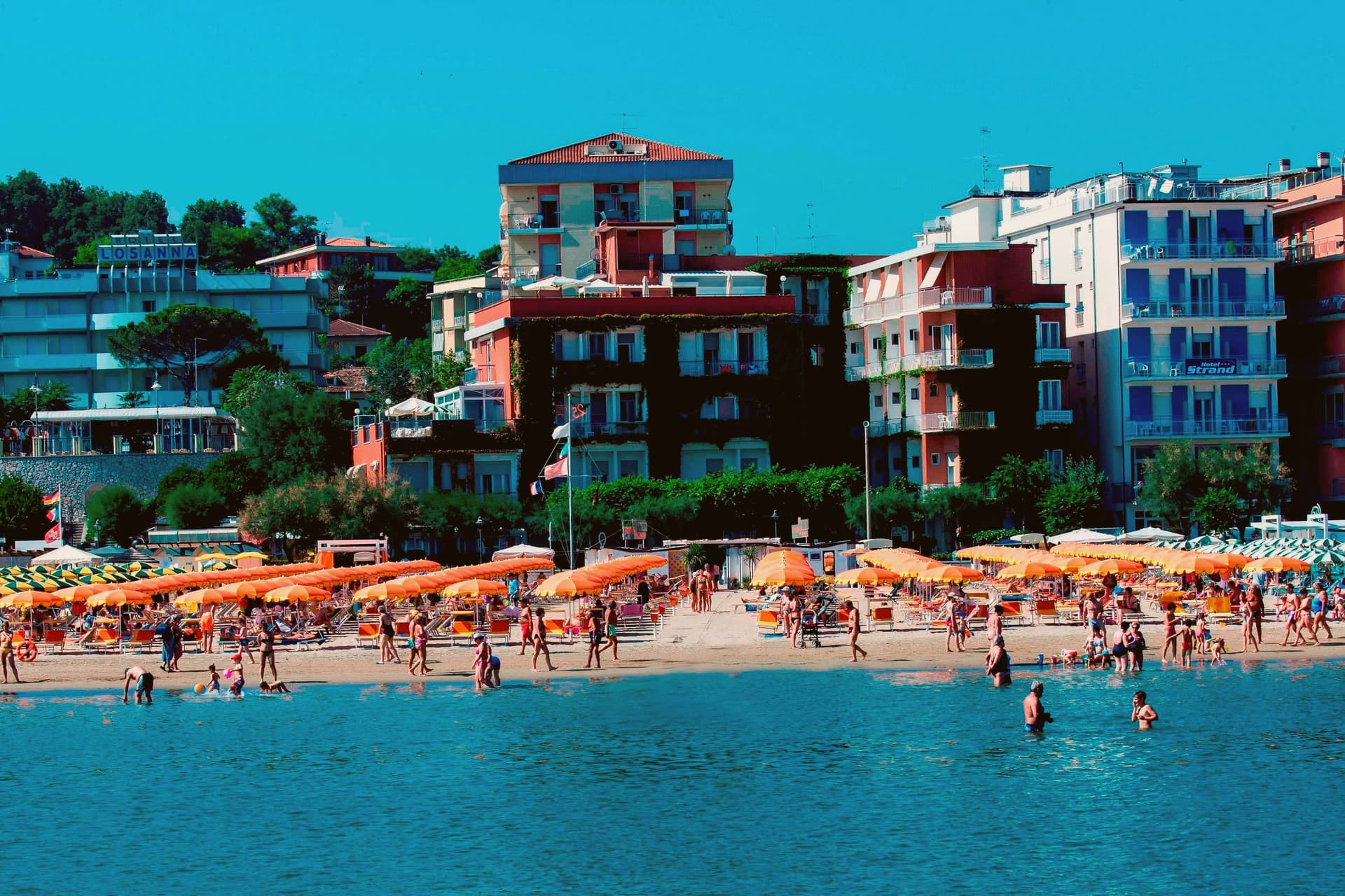
Gabicce Mare sits on the Adriatic at the northernmost point of the Marche, sixteen kilometers north of Pesaro and bordering Cattolica in Emilia-Romagna's province of Rimini. South of the beach, the cliffs of Monte San Bartolo rise abruptly, the only stretch of high coast between Trieste and the Conero, so the town marks the hinge where a long flat sand shore gives way to headland.
Sixteenth-century maps placed the Romagna border further south than it runs today, taking in the upper hamlet inside what is now the park. The archaeological record on the headland runs from the Neolithic at Monte Castellaro through a Roman site on the Via Flaminia to a lost Greek-origin port below the cliffs, layers of settlement stacked on the same few kilometers of high ground.
The town is really two places joined by geography rather than one: a beach that belongs to the sand coast running north, and a cliff and ridge system that belongs to the rock coast running south. Nowhere else on this shore does the flat Adriatic strip end so abruptly against high ground.
The beach here holds the national bathing award, which a comune has to win back every year on water quality, beach management and safety.
What to see in Gabicce Mare
- Spiaggia di Gabicce Mare. Sand beach at the southernmost extension of the Riviera Romagnola strip, the family beach end of the upper Marche coast, backed by the town rather than the cliffs.
- Parco Naturale del Monte San Bartolo. Cliffs, ridge and a run of Renaissance villas above the sea, with fossil fish embedded in the rock face.
- Gabicce Monte. The hamlet climbs above the seafront rather than sitting on it, so the same stretch of coast reads differently from up here, the beach town below, the cliff line running south.
How to get to Gabicce Mare
Rimini is about 26 min away by road. The full route from Bologna.
Our tip
May through September is the window for Gabicce Mare. The Adriatic warms by mid-May, the beach reaches full Bandiera Blu service through summer, and the San Bartolo cliff trails are open and dry. July and August touch the low thirties on the sand and the resort runs at peak with the Riviera Romagnola crowds from Rimini and Cattolica spilling south.
Why visit Mondolfo
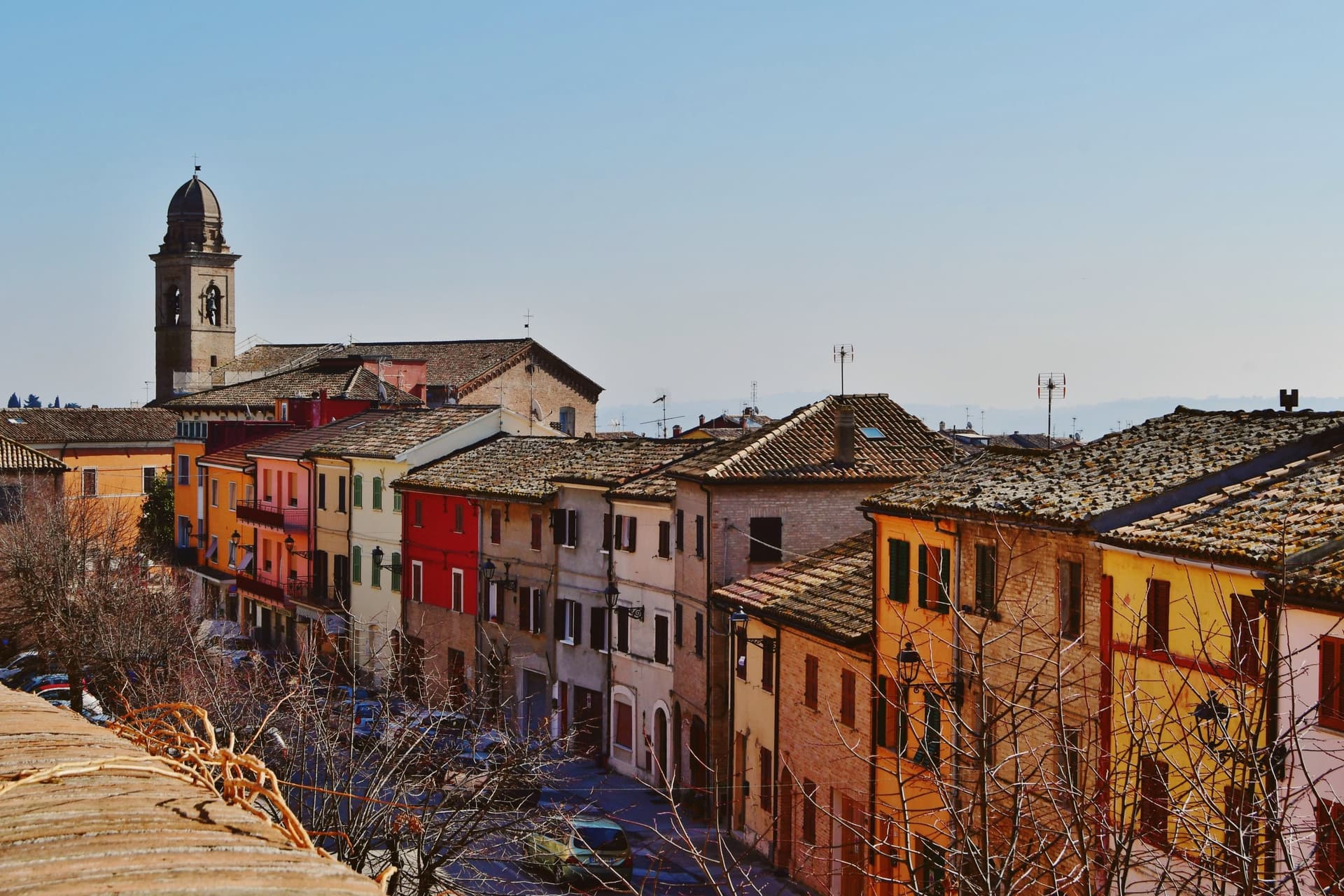
Mondolfo sits at 144 meters on a ridge above the Adriatic between Pesaro and Senigallia, with the coastal frazione on the beach four kilometers below. A Byzantine castle stood here in the sixth and seventh centuries, and the present settlement formed around it in the early eleventh, when the Montoffo feudal family gave the town its name.
The Malatesta took the castle in the fourteenth century, then Sigismondo Pandolfo Malatesta lost it to Pope Pius II in 1463, at which point the walls and bastion that still anchor the southwest corner were rebuilt. The friary and church at the heart of the old town were rebuilt twice, first by Antonio di Pietro da Vercelli in 1466 and again under Domenico da Como in 1593.
Mondolfo joined the Borghi più belli d'Italia and holds recognitions for both its coast and its farmland. The town is a single history in two elevations: the ridge held the castle and later the fortified center, while the shore below, reached across the four kilometers of farmland now recognized for its management, grew into the seafront community that carries the coastal recognitions today.
What began as a Byzantine strongpoint and passed through Malatesta and papal hands still reads as a hill town looking down at its own beach.
The beach here holds the national bathing award, which a comune has to win back every year on water quality, beach management and safety. It is also rated for accessibility, which most of this coast is not.
What to see in Mondolfo
- Mura Roveresche. Roughly 600 meters of fifteenth-century walls and the south-west bastion, redesigned by the Della Rovere for early artillery defense after 1463.
- Complesso Monumentale di Sant'Agostino. Augustinian friary and church from the late thirteenth century, rebuilt in 1466 and again in 1593, now home to the civic museum and the Sant'Agostino complex.
- Centro storico. Walled hill borgo with narrow streets, the Palazzo del Comune and the Chiesa di Santa Giustina at the heart of the perimeter.
How to get to Mondolfo
It has its own railway station. Ancona is about 44 min away by road. The full route from Bologna.
Our tip
May through September is the main window for Mondolfo. The Marotta seafront opens from late spring, the Bandiera Blu lido water clears from June, and the hill borgo above stays a few degrees cooler than the beach. July and August fill the lungomare with the worst of the coast traffic; the walled borgo above keeps quieter.
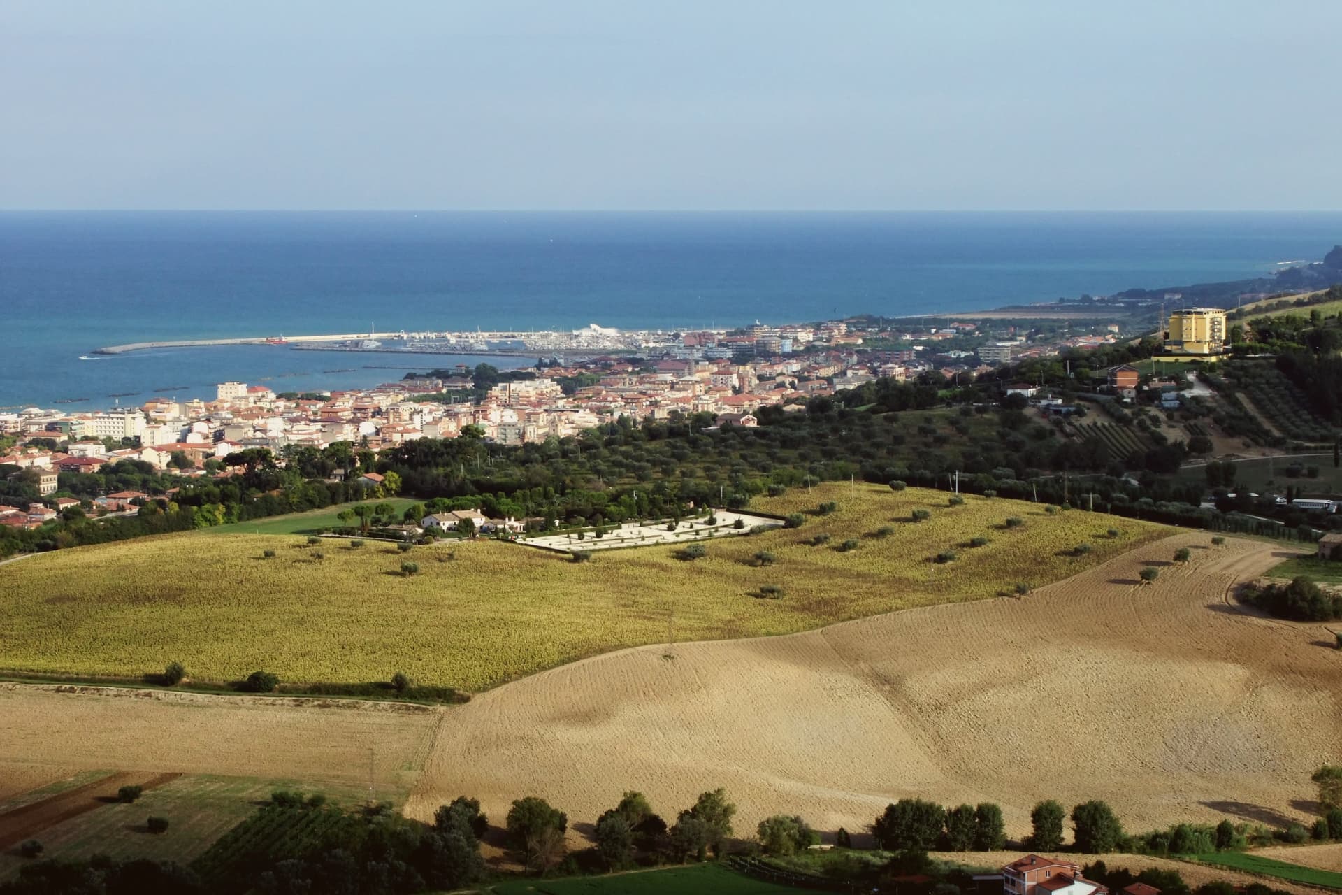
Why visit Porto San Giorgio
The town sits on the central Adriatic between Ancona and Pescara, the working port and the holiday beach of the Fermo valley. The lower town by the water was settled as the harbor of the older inland Fermo, and the castle that still stands above the harbor was built in 1267 by Lorenzo Tiepolo, then Fermo's podestà.
The historic center sits slightly back from the sea, holding the 1818 civic theater and a small but lively summer calendar of seafood festivals, while the seafront itself runs a different register: marina, beach, and the Liberty-era promenade under date palms and umbrella pines, laid out parallel to the sand behind the row of bathing stations. What the layout adds up to is a town divided cleanly by function rather than by age: an inland-facing historic core that keeps the theater and the festival calendar, and a shoreline built in layers from the 13th-century defensive castle down through the Liberty-era promenade to the modern marina and beach, each addition sitting seaward of the last.
The beach here holds the national bathing award, which a comune has to win back every year on water quality, beach management and safety. It is also rated for accessibility, which most of this coast is not.
What to see in Porto San Giorgio
- Rocca Tiepolo. Brick castle with a squat profile and surviving towers, built by Lorenzo Tiepolo to defend the port. It stands as the historic anchor of the seafront, the oldest fixed point on a shoreline otherwise given over to modern bathing establishments.
- Spiaggia (Bandiera Blu). The Bandiera Blu beach runs two kilometers of fine sand on a gentle shelf, lined with classic Adriatic stabilimenti balneari. One of the central Adriatic's reliable family beaches.
- Porto turistico. The marina holds moorings alongside a working fishing fleet that still lands its catch at dawn, so pleasure craft and working boats share the same water.
How to get to Porto San Giorgio
It has its own railway station. Ancona is about 48 min away by road.
Our tip
April through October is the season on the central Adriatic. May and September are the best months: warm sea, the beach stabilimenti running but not at capacity, and the seafront promenade comfortable in the afternoon light. July and August are full: Porto San Giorgio is a popular regional beach destination, the marina at capacity, the fishing-festival calendar at full output.
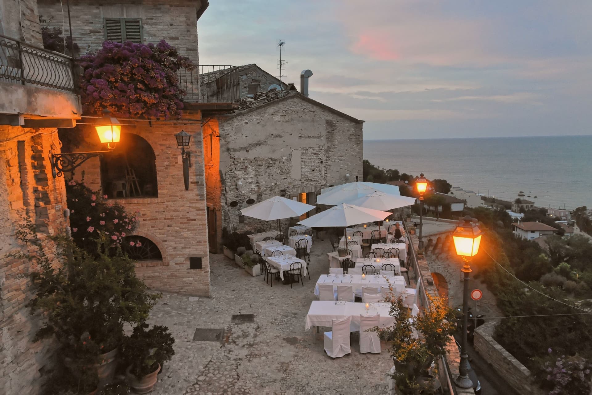
Why visit Grottammare
Grottammare sits on the Ascoli Piceno coast at the mouth of the Tesino. The town splits into two nuclei that never merged: a lungomare on the Adriatic, laid out with palms and Liberty villas in the late nineteenth century, and an older settlement on the hill above, reached by climbing away from the water rather than along it.
Felice Peretti was born in that upper settlement on 13 December 1521, in a house on what became the borgo's central square. He left, rose through the church, and returned as Pope Sixtus V only in monument: two churches he commissioned for his birthplace after 1585, one built beside the house itself and one now holding the collection of objects he sent back from Rome.
The upper town still carries its eleventh-century walls and the traces of an earlier fortress on the Incasato spur, and it has been named among the Borghi più belli d'Italia. The coast below has its own separate recognitions, for water quality and for the management of the hills behind it.
The two halves read as a single biography split in space: the hill holds the birth and the memory, the shore holds the later invention of the town as a seaside resort, and neither nucleus explains itself without the other.
The beach here holds the national bathing award, which a comune has to win back every year on water quality, beach management and safety. It is also rated for accessibility, which most of this coast is not.
What to see in Grottammare
- Paese Alto (Borgo Antico). Brick lanes climb the Incasato hill inside the eleventh-century walls, past the remains of a fortified spur that looks down over the seafront below.
- Chiesa di Santa Lucia. On the central square of the upper town, next to the house of Peretti's birth, a plain sixteenth-century commission from a native son grown powerful.
- Museo Sistino. Inside the Chiesa di San Giovanni Battista, the liturgical objects on display came back to the town only after the local boy had become pope.
How to get to Grottammare
It has its own railway station. Pescara is about 1 h away by road.
Our tip
May through September is the main window for Grottammare. The Bandiera Blu seafront is open from late spring, the palms on Lungomare De Gasperi catch full light from June, and the Paese Alto stays a few degrees cooler than the beach. July and August touch the low thirties on the coast; the upper town shaded lanes are the cool retreat.
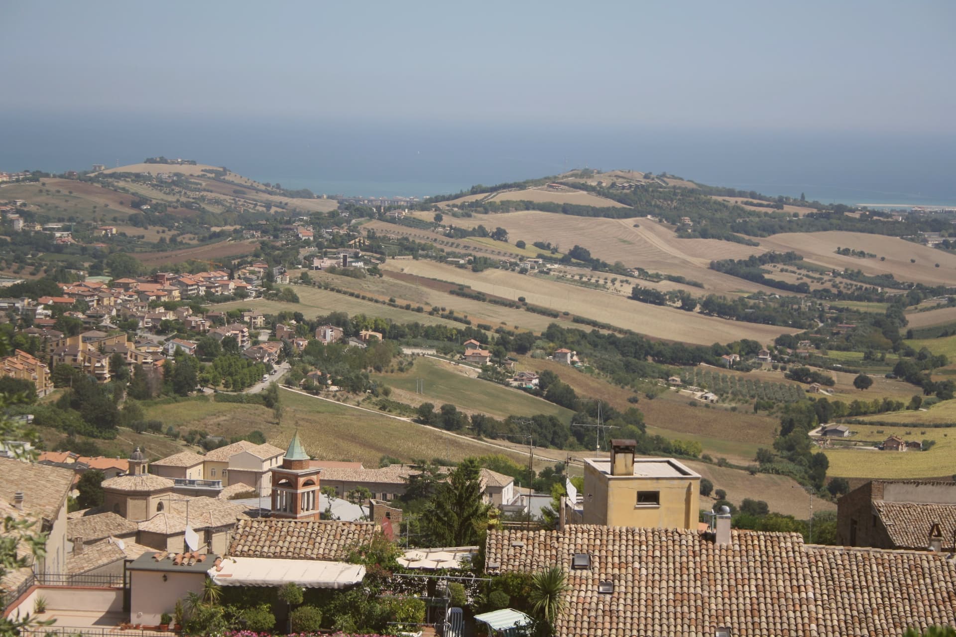
Why visit Fermo
Fermo sits eight kilometers inland from the Adriatic and from the seaside frazione of Lido di Fermo, which holds the commune's Bandiera Blu: a hill town with its own beach attached at a distance, the two connected by the same municipal boundary but separated in character and elevation. The Roman colony of Firmum Picenum was founded on the hilltop in 264 BC after the conquest of the Picentes, with six thousand Latin colonists settled there.
In the tenth century the town became the capital of the Marchia Firmana, the territorial label that eventually gave the region its name. The historic center still reads as a hilltop capital looking down toward a coast it administers rather than touches.
What began as a Latin colony on high ground, gained a name that outgrew it and spread to the whole region, and kept its port at arm's length: the distance between the hill and the shore is not incidental but the shape of how Fermo has always held its territory.
The beach here holds the national bathing award, which a comune has to win back every year on water quality, beach management and safety.
What to see in Fermo
- Cisterne Romane. Thirty barrel-vaulted rooms in three parallel rows under the historic center, opus signinum waterproofing still in place, built to hold 15,000 cubic meters of water.
- Piazza del Popolo. The porticoes meet at the head of the square where the Palazzo dei Priori stands, the arrangement that has organized the civic center since the medieval period.
- Palazzo dei Priori. Built in 1296 by joining a thirteenth-century palace and a church, housing the Pinacoteca Civica, the Sala del Mappamondo and the Sixtus V bronze statue.
How to get to Fermo
Ancona is about 1 h away by road.
Our tip
April through June and September into October are the months for Fermo. The hilltop catches Adriatic light without coastal humidity, the Sabulo's wide views across the Aso and Tenna valleys run clear, and Lido di Fermo's beach eight kilometers below holds its Bandiera Blu status from May. July and August touch the low thirties in the valley but the centro storico stays cooler at 319 meters; the Cavalcata dell'Assunta on August 15 fills the streets with the historic medieval procession dating to 1182.
Why visit Senigallia
Senigallia sits at the mouth of the Misa river on the Adriatic, twenty-five kilometers north of Ancona. The centro storico gathers along the river's right bank, where the arcades face the water, while the fortress stands apart as the town's layered military record, built up over two centuries by successive rulers rather than in one campaign.
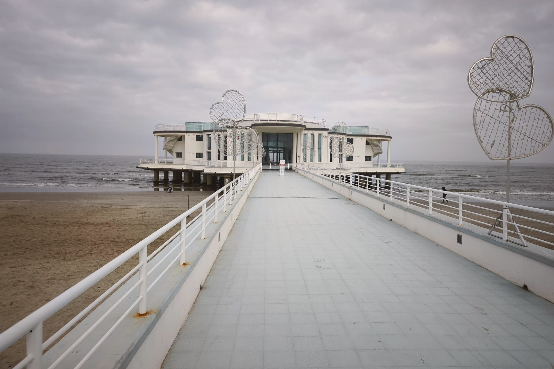
The beach runs south from this old core as a separate register of the town entirely, thirteen kilometers of it, with the pier pavilion marking the center of that beachfront and the restaurant anchoring its southern end. The photographer worked in the town all his life, and the permanent section of his prints sits inland in the Palazzo del Duca rather than anywhere near the coast he might have photographed.
The market arcade, built in the nineteenth century, still does the ordinary work of feeding the town between the historic river frontage and the modern beach economy. Senigallia reads, then, as three towns joined at the river mouth: a fortified old center, a nineteenth-century civic one, and a twentieth-century coastline, each still doing the job it was built for.
The beach here holds the national bathing award, which a comune has to win back every year on water quality, beach management and safety. It is also rated for accessibility, which most of this coast is not.
What to see in Senigallia
- Spiaggia di Velluto. The Bandiera Blu beach, working spine of the town's summer, its sand fine enough underfoot to explain the name.
- Rocca Roveresca. Layered fortress combining Albornoz's fourteenth-century Rocchetta, the 1450 Malatesta keep and the Della Rovere completion by Laurana and Pontelli.
- Rotonda a Mare. Art-deco pier pavilion completed 1933, set on iron piles above the water at the center of the beachfront, restored and used for exhibitions and weddings.
How to get to Senigallia
It has its own railway station. Ancona is about 41 min away by road. The full route from Bologna.
Our tip
May through September is the Senigallia window: the beach bagni open from late May, the Caterraduno radio festival fills late June, the Summer Jamboree rockabilly week runs through early August, and the September sea stays warm through the start of school. July and August touch the high twenties with humid Adriatic evenings; the Velvet Beach and the Rotonda a Mare passeggiata pull the largest crowds of the year. April, May and October are quieter, cooler months for the Rocca Roveresca tours and the Giacomelli rooms at Palazzo del Duca.
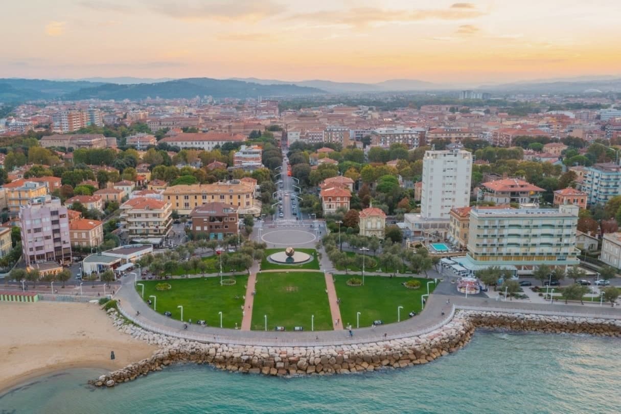
Why visit Pesaro
Pesaro sits at the mouth of the Foglia river on the Adriatic, founded as the Roman colony of Pisaurum in 184 BC on the Via Flaminia and held in turn by Montefeltro, Sforza and Della Rovere lords through the Renaissance. The city was Italian Capital of Culture in 2024.
The centro storico is bookended by two poles: the Rocca Costanza holds one end, a fortress built to defend the town, while the beach runs north from the port along the other, the source of the city's working summer economy rather than its history. Inland and above, on the Monte San Bartolo hills, the Della Rovere and Sforza built their summer villa away from the density of the port town below, a separation of ruling residence from civic center that still marks the geography.
The Palazzo Mosca, in the center, gathers what the town has made and collected: paintings, a modern audio amphitheater, and the maiolica that gave Pesaro its recognition as a city of ceramics. Together the fortress, the villa, the beach and the palazzo describe a town shaped by defense, hillside retreat, coastal work and civic collection, each occupying a different piece of ground rather than competing for the same one.
The beach here holds the national bathing award, which a comune has to win back every year on water quality, beach management and safety.
What to see in Pesaro
- Rocca Costanza. Renaissance fortress commissioned by Costanzo Sforza in the 1470s, four corner bastions and a moat, anchoring the eastern edge of the centro storico.
- Musei Civici di Palazzo Mosca. Civic museum in the former Mosca residence, holding paintings, the Pesaro maiolica collection and the Sonosfera audio amphitheater by David Monacchi.
- Teatro Rossini. Nineteenth-century opera house restored after the 1873 reconstruction, filled for two weeks each August when the Rossini Opera Festival takes over, alongside the Vitrifrigo Arena, for the run of performances.
How to get to Pesaro
It has its own railway station. Rimini is about 40 min away by road. The full route from Bologna.
Our tip
May through September is the Pesaro window: the Velvet Beach opens its bagni from late May, the Rossini Opera Festival fills the second half of August, and the September sea stays warm through the start of school. July and August touch the low thirties with humid Adriatic evenings; the festival nights and the seafront passeggiata draw the largest crowds of the year. April, May and October are cooler, calmer months for the Villa Imperiale guided tours and the museum circuit through Palazzo Mosca.
Read a sample letter
Todi | The Beverly Hills of Umbria
An unusually global town on a clay hill
Letters from the towns we visit. Free.
The button takes you to the letter's own page on Substack, where you leave your email. About the letter
More from Anywhere Italy
- The best towns with a serious restaurant that eat well within 90 minutes of AnconaNear Anconawithin 90 minserious restauranteats well10 towns · smallest 3,741 residents · closest 30 min away
- The best coastal towns you can reach by train in MarcheMarchecoastalby train6 towns · smallest 12,899 residents
- The best coastal towns within 90 minutes of AnconaNear Anconacoastalwithin 90 min6 towns · smallest 3,741 residents · closest 28 min away
- The 10 best hidden towns with a serious restaurant in MarcheMarcheserious restauranthidden10 towns · smallest 3,741 residents
- The best olive oil towns in MarcheMarcheolive oil8 towns · smallest 2,540 residents
- The 6 best towns you can get around without steps in MarcheMarchestep-free6 towns · smallest 1,326 residents