
The best coastal towns within two hours of Bologna
The sea south and east of Bologna is shallow, warm by late spring and lined with sand that runs for miles without interruption. Behind the beaches sit the things that made these places before tourism did: salt pans still worked by hand, canal harbours cut straight into town centres, brick campanili and pastel houses facing the water. The food follows the fishing boats, grilled sardines and razor clams, brodetto thickened with vinegar, piadina folded around squacquerone and rocket. Autumn is the eel season in the lagoons, and the light over the valli then is worth the drive on its own.
Most people heading for the Adriatic from Bologna take the motorway straight to Rimini, and the reasons are obvious: the train is quick, the beach clubs are endless, the nightlife has a reputation that predates everyone currently enjoying it. In August the umbrellas are laid out in rows to the horizon and the seafront traffic barely moves. It works if that is what you want. It is a poor picture of what this coast actually is.
The same shoreline continues in both directions, and the towns along it kept their harbours, their salt, their fortresses and their fish markets. Some sit on lagoon water rather than open sea, some behind pine forest, one under a castle on a hill within sight of the beach. Fewer people go, the parking is easier, and the restaurants are still mostly cooking for locals. All of them are within a couple of hours of Bologna, several by direct train.
Of the 87 communes we have mapped in a 120-minute drive of Bologna, 9 qualify as coastal towns: each is on the sea. The smallest, Gradara, has 4,889 residents.
Elsewhere in the catalogue: The best towns you can reach by train within 45 minutes of Rimini and The best coastal towns you can reach by train in Marche.
Gradara
Why visit Gradara
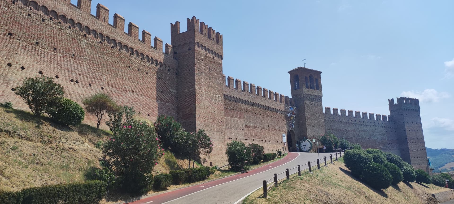
Gradara sits at 142 meters on a hill three kilometers from the Adriatic, at the northern border of the Marche with Romagna. The castle was begun in the twelfth century by Pietro and Ridolfo del Grifo and completed in the fifteenth, when the Malatesta extended the double ring of walls that still runs almost 800 meters around the borgo.
In the fifth canto of the Inferno, Dante placed Paolo and Francesca here: around 1275 Guido da Polenta of Ravenna married his daughter Francesca to Giovanni Malatesta and sent his younger brother Paolo as proxy. The two fell in love.
Gianciotto Malatesta caught them and killed both. Whether the killing happened at Gradara, Pesaro or Rimini is disputed among scholars; tradition keeps it here.
The borgo was voted Borgo dei Borghi by RAI viewers in 2018. The Castello and the Camerino di Lucrezia draw most visitors.
Olive groves around the walls supply the Cartoceto DOP oil.
What to see in Gradara
- Castello di Gradara. Twelfth-century rocca completed by the Malatesta in the fifteenth century, one of the best-preserved medieval fortresses in Italy, with the Camerino di Lucrezia frescoed cycle.
- Mura medievali. Double ring of fourteenth and fifteenth-century walls running almost 800 meters around the borgo, walkable along the camminamento.
- Camera di Paolo e Francesca. Frescoed chamber inside the castle, traditionally identified as the room where Dante set the killing of the two lovers.
How to get to Gradara
Rimini is roughly 30 minutes away by road.
Our tip
May through September is the working season for Gradara. The hill is dry from late April, the castle and walls are open every day, and the literary park below the rocca turns green into June. July and August bring the heaviest crowds: the proximity to Cattolica and Gabicce Mare puts seaside families on the castle road and the borgo's narrow streets fill from mid-morning. Giovedì al Castello - Rievocazione storica falls in August.
Gabicce Mare
Why visit Gabicce Mare
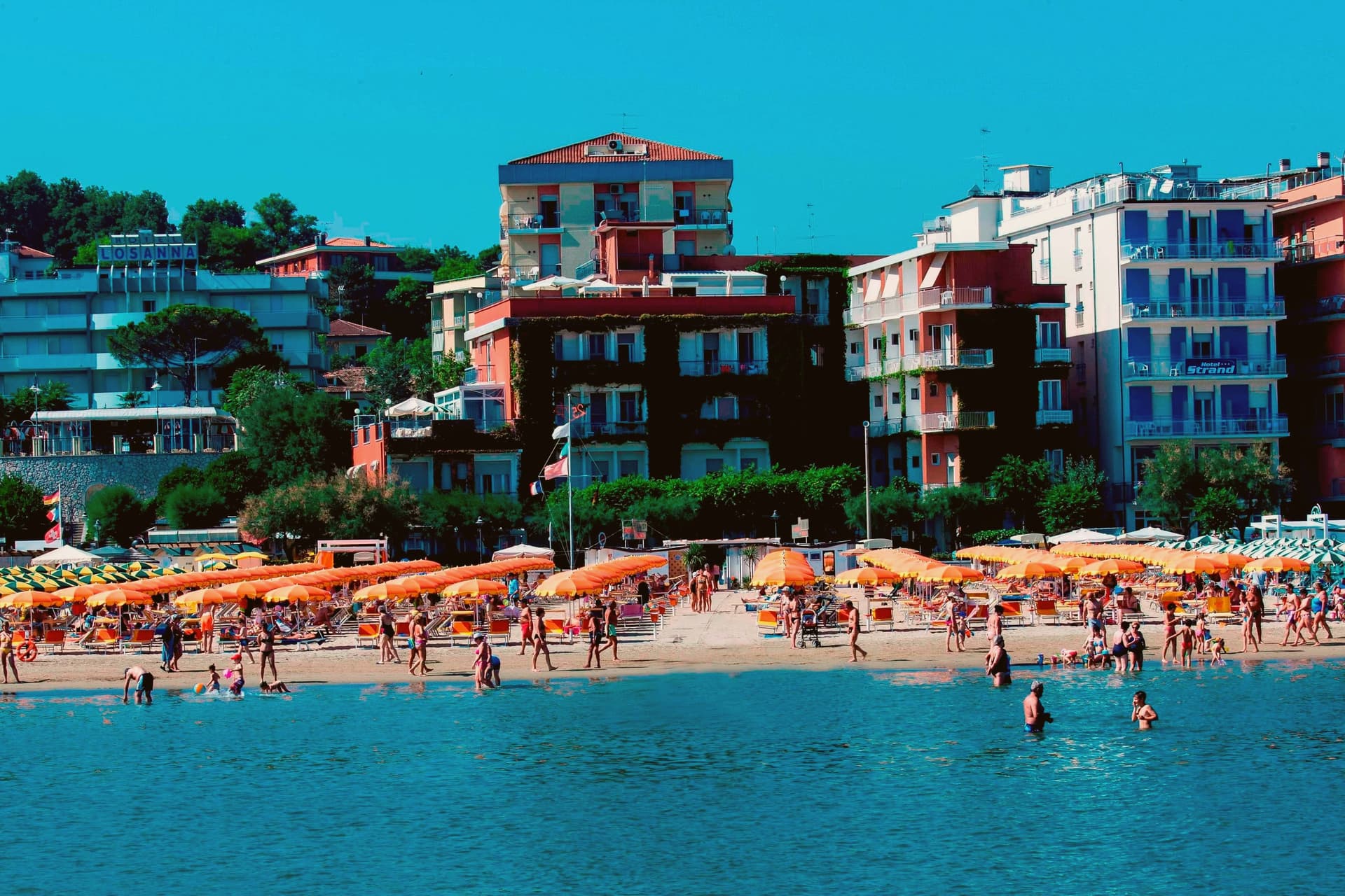
Gabicce Mare sits on the Adriatic at the northernmost point of the Marche, sixteen kilometers north of Pesaro and bordering Cattolica in Emilia-Romagna's province of Rimini. South of the beach, the cliffs of Monte San Bartolo rise abruptly, the only stretch of high coast between Trieste and the Conero, so the town marks the hinge where a long flat sand shore gives way to headland.
Sixteenth-century maps placed the Romagna border further south than it runs today, taking in the upper hamlet inside what is now the park. The archaeological record on the headland runs from the Neolithic at Monte Castellaro through a Roman site on the Via Flaminia to a lost Greek-origin port below the cliffs, layers of settlement stacked on the same few kilometers of high ground.
The town is really two places joined by geography rather than one: a beach that belongs to the sand coast running north, and a cliff and ridge system that belongs to the rock coast running south. Nowhere else on this shore does the flat Adriatic strip end so abruptly against high ground.
The beach here holds the national bathing award, which a comune has to win back every year on water quality, beach management and safety.
What to see in Gabicce Mare
- Spiaggia di Gabicce Mare. Sand beach at the southernmost extension of the Riviera Romagnola strip, the family beach end of the upper Marche coast, backed by the town rather than the cliffs.
- Parco Naturale del Monte San Bartolo. Cliffs, ridge and a run of Renaissance villas above the sea, with fossil fish embedded in the rock face.
- Gabicce Monte. The hamlet climbs above the seafront rather than sitting on it, so the same stretch of coast reads differently from up here, the beach town below, the cliff line running south.
How to get to Gabicce Mare
There is a railway station in the town, so you can arrive without a car and never need one while you are here. Rimini is roughly 26 minutes away by road.
Our tip
May through September is the window for Gabicce Mare. The Adriatic warms by mid-May, the beach reaches full Bandiera Blu service through summer, and the San Bartolo cliff trails are open and dry. July and August touch the low thirties on the sand and the resort runs at peak with the Riviera Romagnola crowds from Rimini and Cattolica spilling south.
Mondolfo
Why visit Mondolfo
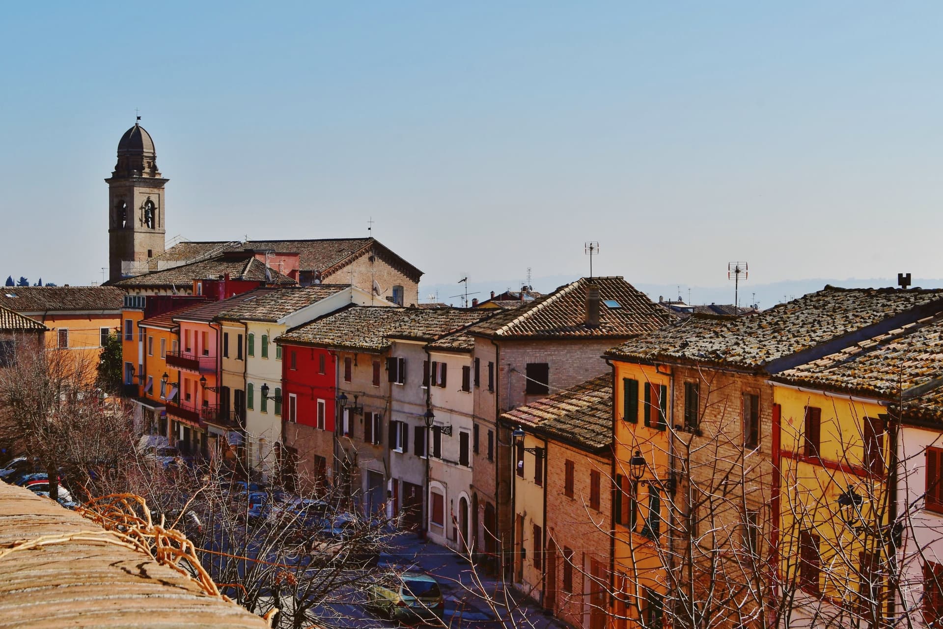
Mondolfo sits at 144 meters on a ridge above the Adriatic between Pesaro and Senigallia, with the coastal frazione on the beach four kilometers below. A Byzantine castle stood here in the sixth and seventh centuries, and the present settlement formed around it in the early eleventh, when the Montoffo feudal family gave the town its name.
The Malatesta took the castle in the fourteenth century, then Sigismondo Pandolfo Malatesta lost it to Pope Pius II in 1463, at which point the walls and bastion that still anchor the southwest corner were rebuilt. The friary and church at the heart of the old town were rebuilt twice, first by Antonio di Pietro da Vercelli in 1466 and again under Domenico da Como in 1593.
Mondolfo joined the Borghi più belli d'Italia and holds recognitions for both its coast and its farmland. The town is a single history in two elevations: the ridge held the castle and later the fortified center, while the shore below, reached across the four kilometers of farmland now recognized for its management, grew into the seafront community that carries the coastal recognitions today.
What began as a Byzantine strongpoint and passed through Malatesta and papal hands still reads as a hill town looking down at its own beach.
The beach here holds the national bathing award, which a comune has to win back every year on water quality, beach management and safety. It is also rated for accessibility, which most of this coast is not.
What to see in Mondolfo
- Mura Roveresche. Roughly 600 meters of fifteenth-century walls and the south-west bastion, redesigned by the Della Rovere for early artillery defense after 1463.
- Complesso Monumentale di Sant'Agostino. Augustinian friary and church from the late thirteenth century, rebuilt in 1466 and again in 1593, now home to the civic museum and the Sant'Agostino complex.
- Centro storico. Walled hill borgo with narrow streets, the Palazzo del Comune and the Chiesa di Santa Giustina at the heart of the perimeter.
How to get to Mondolfo
There is a railway station in the town, so you can arrive without a car and never need one while you are here. Ancona is roughly 44 minutes away by road.
Our tip
May through September is the main window for Mondolfo. The Marotta seafront opens from late spring, the Bandiera Blu lido water clears from June, and the hill borgo above stays a few degrees cooler than the beach. July and August fill the lungomare with the worst of the coast traffic; the walled borgo above keeps quieter. Festa del Mare falls in August.
Comacchio
Why visit Comacchio
Comacchio sits at sea level fifty kilometers east of Ferrara and forty south of the Adriatic delta proper. The town passed through Etruscan hands, then Byzantine rule under the Exarchate of Ravenna, then the Duchy of Ferrara, then Papal government until unification, a succession that left the centro storico layered rather than uniform.
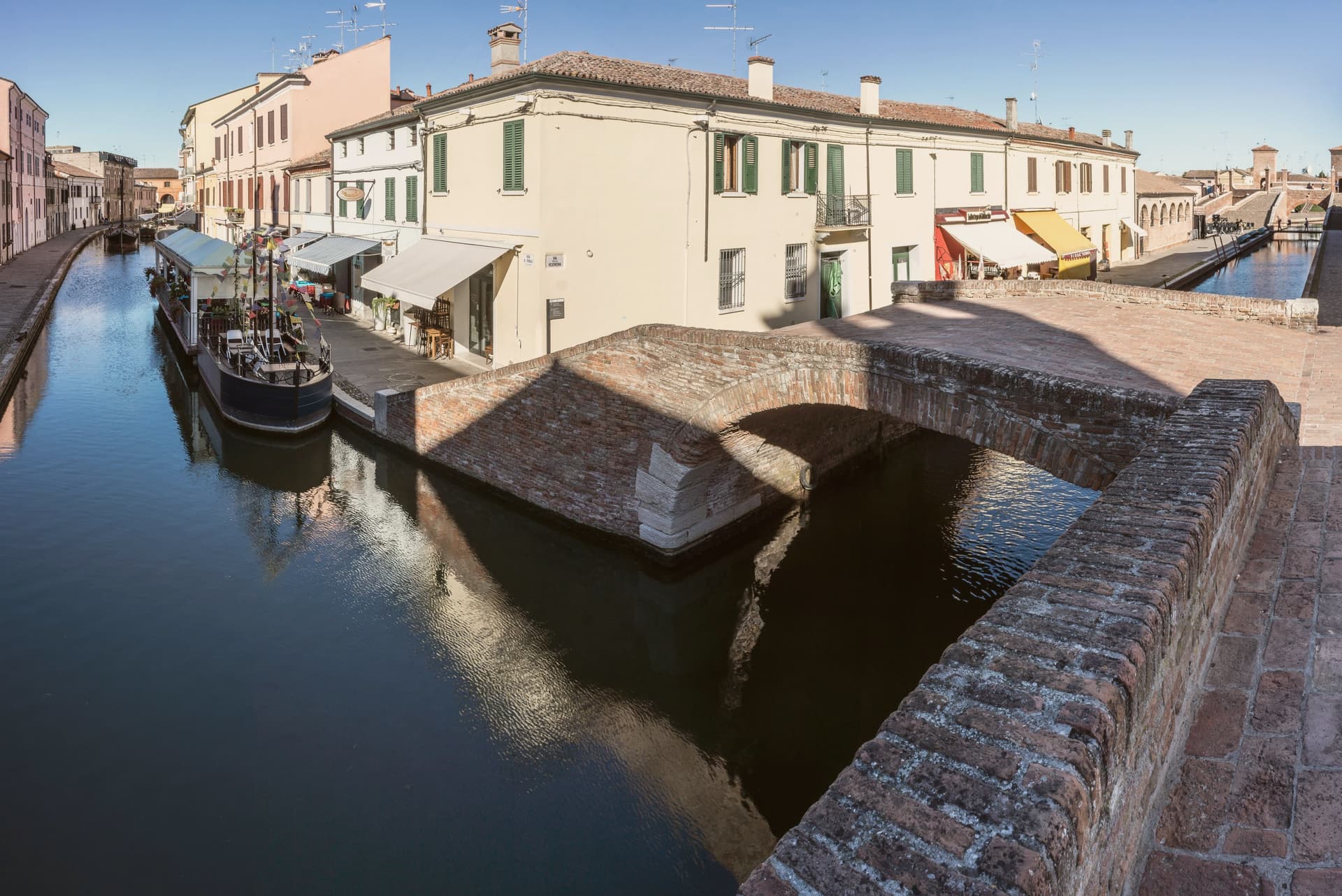
The lagoons that surround it formed from tenth-century subsidence and later silting, and now run as a protected area inside the UNESCO inscription that covers the historic Ferrara plain, linking the town to the wider delta rather than setting it apart. The old town itself is water-built: thirteen islets tied together by bridges, canals threading between the Loggia del Grano and the Loggiato dei Cappuccini, with the bridge acting as the hinge where the inland waterways meet the canal running out toward the sea.
What the layers of rule left behind in stone, the lagoon and the tides have kept in motion around it: a town whose center is inseparable from the water that surrounds it, built up in pieces by whoever governed it at the time.
The beach here holds the national bathing award, which a comune has to win back every year on water quality, beach management and safety.
What to see in Comacchio
- Ponte dei Trepponti. Built around 1638 by Luca Danese of Ravenna, the bridge is the meeting point of three internal canals with the canal Pallotta and the symbol most visible from the water.
- Valli di Comacchio. The lagoon opens flat to the horizon at the edge of the Po Delta, its surface broken by fishing stations and the pink of the resident flamingo colonies.
- Museo Delta Antico. Archaeological museum opened in 2017 inside the eighteenth-century Ospedale degli Infermi, with finds from the Etruscan necropolis of Spina.
How to get to Comacchio
Ravenna is roughly 45 minutes away by road.
Our tip
May through September is the working season for Comacchio. Late May and June are best, when the lagoons hold migrating birds and the heat has not yet pushed visitor numbers into the August peak. The Valli boat tours run from spring to autumn, with flamingos visible all year round on the brackish edges. Festa di San Cassiano falls in August.
Cesenatico
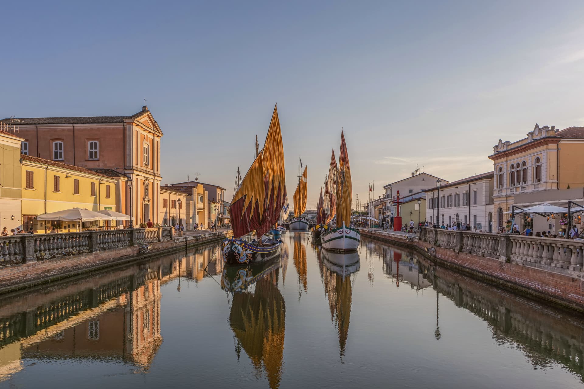
Why visit Cesenatico
Cesenatico sits at three meters on the Adriatic, fifteen kilometers east of Cesena. The town grew around a canal port begun in 1302 by the Malatesta of Cesena to give the inland city its outlet to the sea, and the canal still runs through the centro storico as the town's working spine.
Leonardo da Vinci arrived in 1502 at the request of a Borgia patron to survey and redraw the port; his sketch, preserved in the Codex L, corresponds to the harbor layout today. Garibaldi embarked from this port in August 1849, fleeing the failed Roman Republic on commandeered fishing boats with about two hundred followers.
The canal separates and joins the two halves of the old town, its banks lined with the pastel facades of fishermen's houses, and it is this same stretch of water that carries the floating section of the Museo della Marineria, sails hoisted through the summer. Cesenatico is also the home town of the cyclist Marco Pantani, marked inland by the Nove Colli ride each May.
The beach carries Bandiera Blu. What holds the town together is the canal itself: a fifteenth-century engineering commission that outlasted the port's original purpose and became the frame for everything Cesenatico later added, from Garibaldi's escape to the moored boats of the maritime museum.
The beach here holds the national bathing award, which a comune has to win back every year on water quality, beach management and safety.
What to see in Cesenatico
- Porto Canale Leonardesco. Canal port begun in 1302 by the Malatesta, running through the centro storico and lined with the pastel facades of fishermen's houses. Leonardo da Vinci's redrawn layout from 1502 still corresponds to the harbor as it stands.
- Museo della Marineria. Maritime museum with a floating section of historic Adriatic sailboats moored in the canal, their sails hoisted daily in summer.
- Spazio Pantani. Museum near the railway station dedicated to the cyclist, tracing his career including the 1998 Giro and Tour double.
How to get to Cesenatico
There is a railway station in the town, so you can arrive without a car and never need one while you are here. Rimini is roughly 28 minutes away by road.
Our tip
May through September is the working season on the Cesenatico coast. June and the first half of July hold the best balance of warm sea and lighter crowds. Late July and August are the Italian beach peak, when the seven kilometers of sand fill up and the Porto Canale evening passeggiata runs until midnight.
Cervia
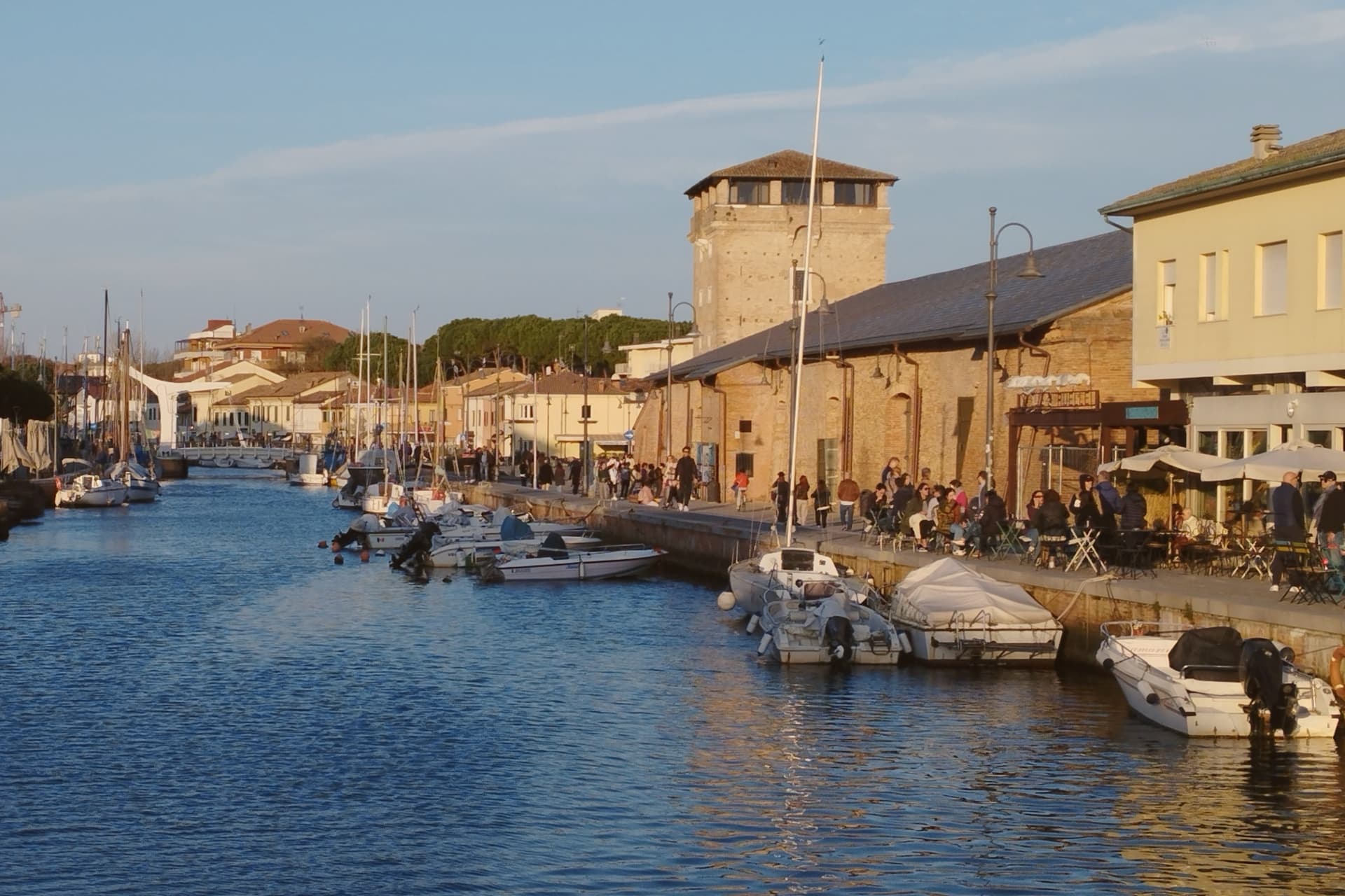
Why visit Cervia
Cervia sits at sea level on the Adriatic, twenty kilometers south of Ravenna, between the pine forest of Milano Marittima and the salt pans that have given the town its identity since Roman times. The original settlement, Ficocle, stood inside the saline itself; the move to the coast in 1697 put the grid of workers' housing where it now stands, closer to the water and to the canal port that the tower on its north side was built to guard.
The two halves of the municipality read as a pairing of extraction and leisure: the saline and the old grid town to the south, worked continuously and still yielding salt by hand at one basin, and the planted pine forest to the north, laid out as a garden-city resort in the following century. The museum inside the old salt warehouse holds two thousand years of the tools and records that connect the two eras.
The beach carries Bandiera Blu recognition along nine kilometers of coast. What holds the town together is that its shape was dictated by salt long before tourism arrived: the grid, the tower, the canal and even the forest to the north all trace back to the working of the saline, with the resort at Milano Marittima grown from land the salt industry had left standing.
The beach here holds the national bathing award, which a comune has to win back every year on water quality, beach management and safety.
What to see in Cervia
- Saline di Cervia. Working salt pans covering 827 hectares, the northernmost in Italy, with the Camillone basin still harvested by hand using nineteenth-century methods.
- Torre San Michele. Defensive tower built in 1691 to protect the salt warehouses and control the canal port, on the north side of the harbor.
- MUSA - Museo del Sale. Salt museum inside the Magazzino del Sale Torre, with tools, documents and photographs gathered from former salt workers.
How to get to Cervia
There is a railway station in the town, so you can arrive without a car and never need one while you are here. Forlì is roughly 29 minutes away by road.
Our tip
May through September is the Cervia season. Late May and June hold the best balance of warm sea and quiet beach, before the Italian holiday peak. July and August bring full beach and full pine forest, with thirty-degree afternoons broken by the evening sea breeze. Festa di San Lorenzo falls in August.
Chioggia
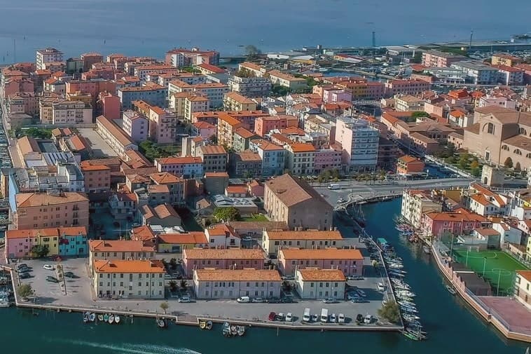
Why visit Chioggia
Chioggia sits at 2 meters on a small island at the southern entrance to the Venetian Lagoon, twenty-five kilometers south of Venice and connected to the mainland and to its frazione Sottomarina by causeways. The Romans knew it as Clodia.
By the eleventh and twelfth centuries it had grown into a salt-producing port and became a free commune in 1110. The naval war that carries the town's name ran through 1378-81 and ended Genoese rivalry with Venice, leaving Chioggia under the Serenissima for the next four centuries.
The defeat reduced the town to fishing, salt and limited Adriatic trade. The fleet never left.
The street plan is a herringbone of calli running off the town's single straight spine, with three canals threading between them and the bridges that gave the town its Little Venice nickname. Inland lies the historic island itself; across the causeway sits Sottomarina, the beach frazione facing the open Adriatic where the lagoon town has none.
What Chioggia lost at sea it kept at the dock: a working port still built around the same trade that outlasted the war which was supposed to end it.
The beach here holds the national bathing award, which a comune has to win back every year on water quality, beach management and safety.
What to see in Chioggia
- Cattedrale di Santa Maria Assunta. Cathedral founded in the eleventh century, raised to episcopal seat in 1110, rebuilt from 1623 to designs by Baldassare Longhena.
- Canale Vena. Main canal of the centro storico, lined with fishing boats and crossed by nine bridges including the seventeenth-century Ponte Vigo.
- Mercato del Pesce. Wholesale fish market on the canal, open before dawn six days a week, the operating center of the Adriatic fleet.
How to get to Chioggia
There is a railway station in the town, so you can arrive without a car and never need one while you are here. Venezia is roughly 46 minutes away by road.
Our tip
May through September is the working season. June and early July bring warm Adriatic water and the long Sottomarina beach to capacity on weekends; mid-August fills it past comfort. The Sagra del Pesce on the third weekend of July puts the whole fleet on display along Canale Vena.
Pesaro
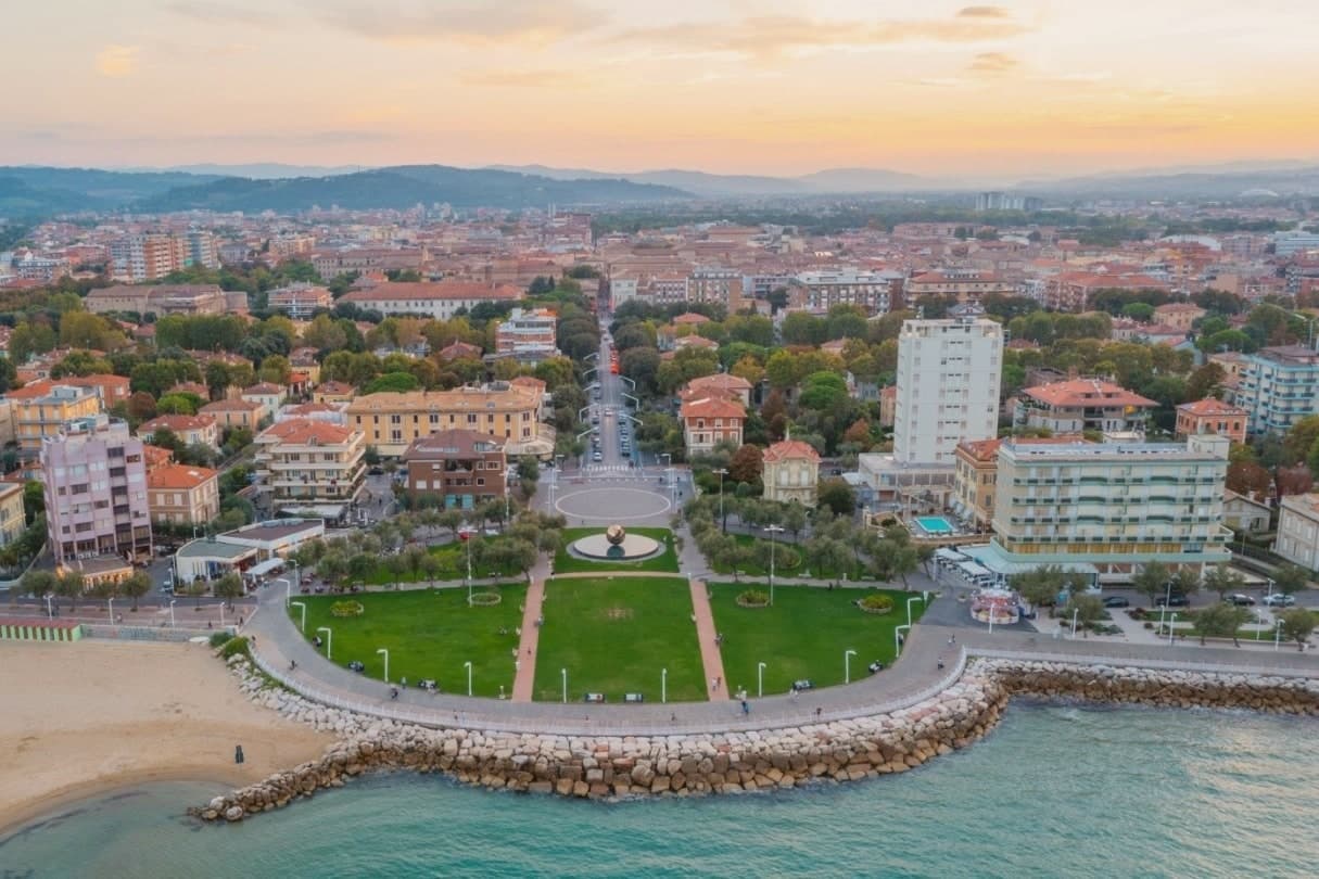
Why visit Pesaro
Pesaro sits at the mouth of the Foglia river on the Adriatic, founded as the Roman colony of Pisaurum in 184 BC on the Via Flaminia and held in turn by Montefeltro, Sforza and Della Rovere lords through the Renaissance. The city was Italian Capital of Culture in 2024.
The centro storico is bookended by two poles: the Rocca Costanza holds one end, a fortress built to defend the town, while the beach runs north from the port along the other, the source of the city's working summer economy rather than its history. Inland and above, on the Monte San Bartolo hills, the Della Rovere and Sforza built their summer villa away from the density of the port town below, a separation of ruling residence from civic center that still marks the geography.
The Palazzo Mosca, in the center, gathers what the town has made and collected: paintings, a modern audio amphitheater, and the maiolica that gave Pesaro its recognition as a city of ceramics. Together the fortress, the villa, the beach and the palazzo describe a town shaped by defense, hillside retreat, coastal work and civic collection, each occupying a different piece of ground rather than competing for the same one.
The beach here holds the national bathing award, which a comune has to win back every year on water quality, beach management and safety.
What to see in Pesaro
- Rocca Costanza. Renaissance fortress commissioned by Costanzo Sforza in the 1470s, four corner bastions and a moat, anchoring the eastern edge of the centro storico.
- Musei Civici di Palazzo Mosca. Civic museum in the former Mosca residence, holding paintings, the Pesaro maiolica collection and the Sonosfera audio amphitheater by David Monacchi.
- Teatro Rossini. Nineteenth-century opera house restored after the 1873 reconstruction, filled for two weeks each August when the Rossini Opera Festival takes over, alongside the Vitrifrigo Arena, for the run of performances.
How to get to Pesaro
There is a railway station in the town, so you can arrive without a car and never need one while you are here. Rimini is roughly 40 minutes away by road.
Our tip
May through September is the Pesaro window: the Velvet Beach opens its bagni from late May, the Rossini Opera Festival fills the second half of August, and the September sea stays warm through the start of school. July and August touch the low thirties with humid Adriatic evenings; the festival nights and the seafront passeggiata draw the largest crowds of the year. April, May and October are cooler, calmer months for the Villa Imperiale guided tours and the museum circuit through Palazzo Mosca. Fiera di San Nicola falls in September.
Ravenna
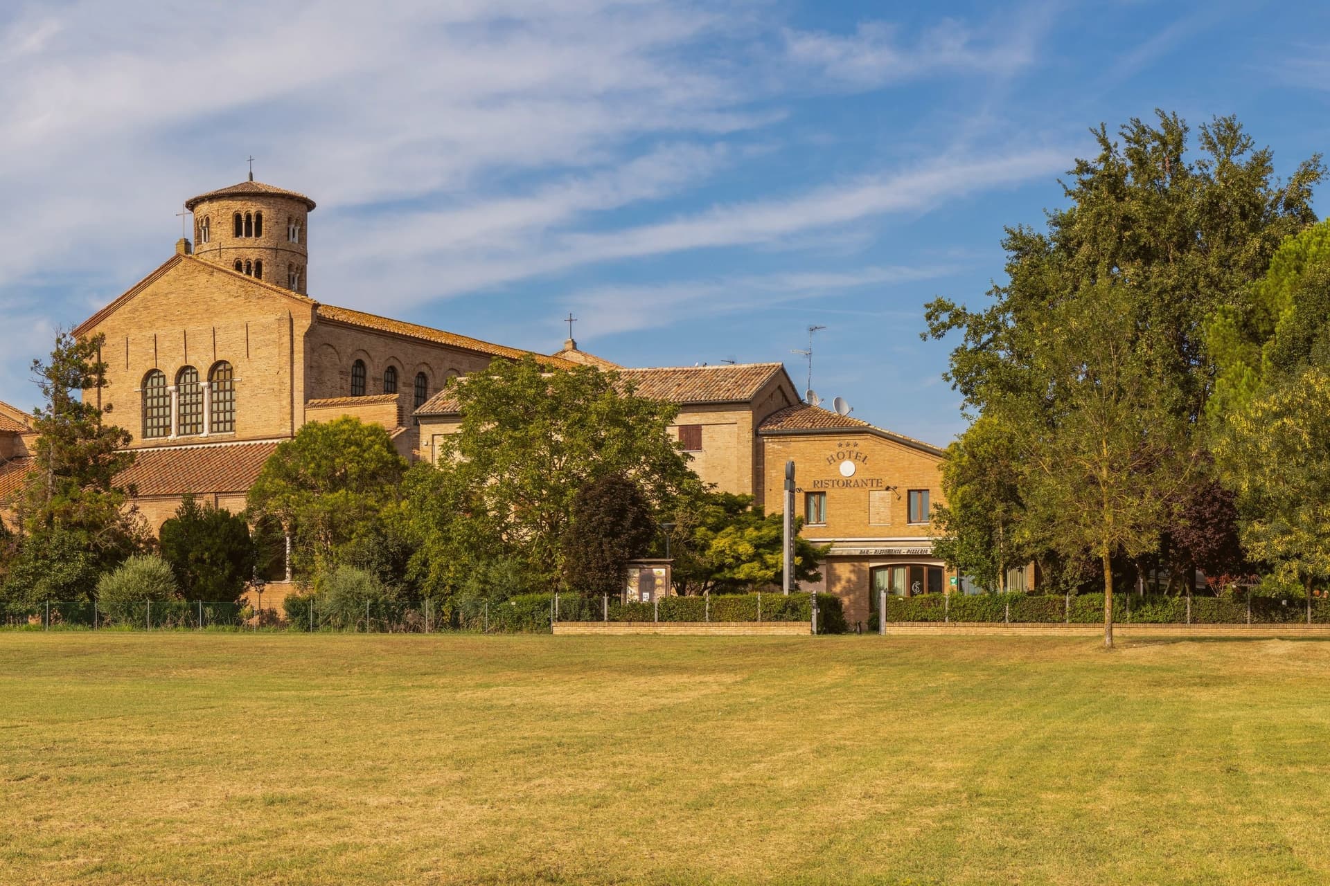
Why visit Ravenna
Ravenna sits four meters above sea level on the Adriatic coastal plain, ten kilometers from the sea and 105 kilometers east of Modena. Its position, low, flat, and close to the coast but not on it, made it defensible in a way landlocked cities were not: the surrounding marsh and lagoon kept armies at a distance while boats could still reach it.
That is why Honorius moved the Western Roman capital here in 402, why Theoderic kept it as his Ostrogothic seat, and why the Byzantine Exarchate held it for Constantinople until 751 as the last piece of imperial territory in northern Italy. Each of the three regimes built churches and paid for mosaic to decorate them, which is why the city's monuments read as a sequence rather than a single style: Roman, Gothic and Byzantine hands working in the same medium across a century and a half.
The municipality itself is split between this historic center and a stretch reaching the Adriatic, where Marina di Ravenna and Punta Marina hold Bandiera Blu beaches, so the same town that holds the fifth-century mausoleums also runs a public coastline. Population is 155,751.
What the churches add up to is less a city of monuments than a record of power changing hands, with each occupant leaving its faith in glass and gold on the walls rather than tearing down what came before.
The beach here holds the national bathing award, which a comune has to win back every year on water quality, beach management and safety.
What to see in Ravenna
- Basilica di San Vitale. Octagonal basilica holding the imperial mosaics of Justinian and Theodora in the presbytery and apse, the throne room of the sequence in gold and purple.
- Mausoleo di Galla Placidia. Small mausoleum next to the basilica, vaulted in a starry blue mosaic sky with gold cross and the symbols of the Evangelists, dim enough that the gold seems to generate its own light.
- Basilica di Sant'Apollinare Nuovo. Built by Theoderic as his palace chapel, the nave walls lined with continuous mosaic processions of saints and martyrs facing each other the full length of the church.
How to get to Ravenna
There is a railway station in the town, so you can arrive without a car and never need one while you are here. Ravenna is roughly 3 minutes away by road.
Our tip
May through September is the working window for Ravenna. The Adriatic warms enough for the beaches at Marina di Ravenna and Punta Marina to fill from late May through August, and the centro storico stays open for the Ravenna Festival in June and July. The mosaics need no weather, but July and August touch thirty-three degrees and the basilica interiors hold their heat. Antica Sagra del Monticino falls in September.
More from Anywhere Italy
- The best towns you can reach by train within 45 minutes of Rimini
- The best coastal towns you can reach by train in Marche
 The best hidden coastal towns in Marche
 The best towns with a serious restaurant that eat well within 90 minutes of Rimini
 The best coastal towns within two hours of Padua
 The best hot-spring towns within 90 minutes of Bologna