
The best towns with a food festival in Basilicata
Basilicata cooks with very few things and takes them seriously. The dried sweet pepper fried in oil until it shatters, the hard durum bread that keeps for a week, lucanica sausage, chickpeas and beans grown on terraces above the river valleys, cardoncelli mushrooms picked after the first proper rain. The festivals that celebrate all this cluster in autumn and late summer, when the heat has gone off the stone and trestle tables get carried out into piazzas paved in sandstone and tufo. Church bells, wood smoke, a brass band, plates handed over for a few coins: the format barely varies from town to town, and that is part of the appeal.
Most visitors to Basilicata go to Matera, and it is right that they do. The Sassi are among the most extraordinary urban landscapes in Europe, and the town has been rebuilt around the fact of being looked at, with cave hotels, tasting menus and a queue at the rupestrian churches through most of the year. What Matera no longer really has is the ordinary version of a Lucanian food festival, the kind organised by a parish committee rather than a tourist board.
The same peppers and the same sausage continue west into the Pollino foothills, north into the volcanic soil around Vulture, and east towards the clay hills above the Ionian. The towns below sit in that country. Each holds a recurring festival built around one local ingredient, and each draws mainly people who live within an hour's drive of it, which is the reason they are worth the detour.
Of the 31 communes we have mapped in Basilicata, 7 qualify as towns with a food festival: each holds a recurring food festival built around one local ingredient. The smallest, Pietrapertosa, has 890 residents.
Elsewhere in the catalogue: The best hidden towns you can reach by train in Basilicata and The best olive oil towns in Basilicata.
Pietrapertosa
Why visit Pietrapertosa
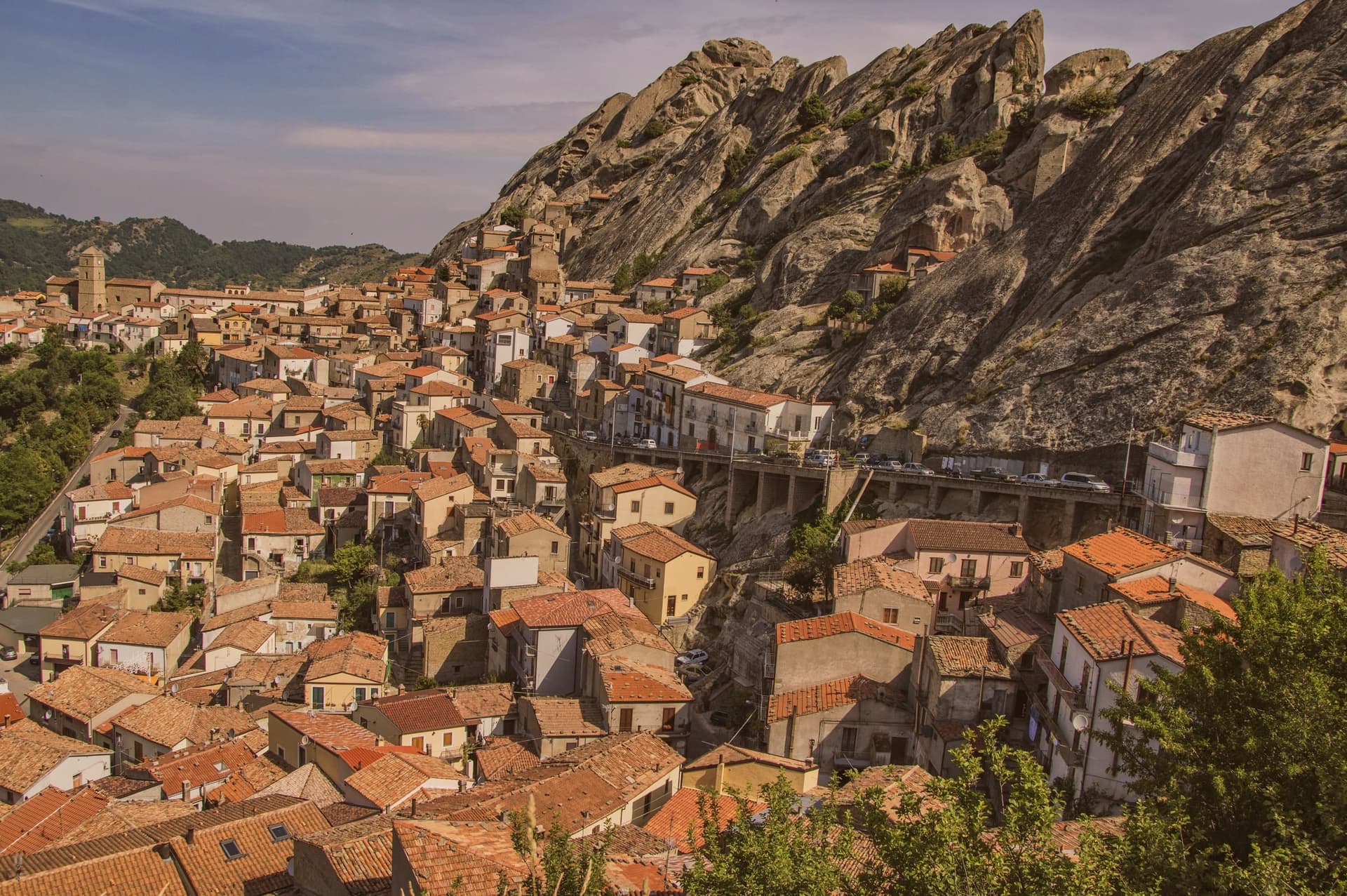
Pietrapertosa sits at 1,088 meters, the highest commune in Basilicata, built directly into the sandstone teeth of the Piccole Dolomiti Lucane inside the Parco Regionale Gallipoli Cognato. The village is so wedded to the rock that several houses share a wall with the cliff.
In the tenth century the fortified settlement was taken by a Saracen band led by a Greek convert to Islam named Luca, who used it as a raiding base across the surrounding valleys until the Catapan of Byzantium pushed him out. The Arabata quarter, the warren of stone houses at the top of the village, still carries his name.
The Castello Saraceno, partly cut into living rock, was later rebuilt by the Normans and Swabians. Pietrapertosa shares its setting with Castelmezzano on the opposite ridge, seven kilometers away, and the two villages are linked by the Volo dell'Angelo, a steel cable that carries passengers between them at speeds touching 120 kilometers per hour.
The Chiesa di San Giacomo Maggiore in the centro preserves its fifteenth-century Romanesque structure.
What to see in Pietrapertosa
- Castello Saraceno. Fortress cut into the sandstone of the Lucanian Dolomites, used by Saracens under Luca in the tenth century, rebuilt by the Normans.
- Rione Arabata. Upper quarter of stone houses tucked into the rock, named for the tenth-century Saracen occupation, the oldest section of the village.
- Chiesa di San Giacomo Maggiore. Fifteenth-century mother church in the centro of Pietrapertosa, the main parish of the village, with a well-preserved Romanesque structure.
How to get to Pietrapertosa
Salerno is roughly 126 minutes away by road.
Our tip
June through September is the high window for Pietrapertosa, with the Volo dell'Angelo open daily, the Gallipoli Cognato trails dry, and the village's 1,088-meter air staying ten degrees below the Lucanian valleys. December through March brings snow on the Dolomiti Lucane ridges, the zipline closes, and the village quiets to its winter population. April, May, October and November are intermediate: cooler hiking days, the zipline running shorter weekends. Sapori D'autunno falls in October.
Miglionico
Why visit Miglionico
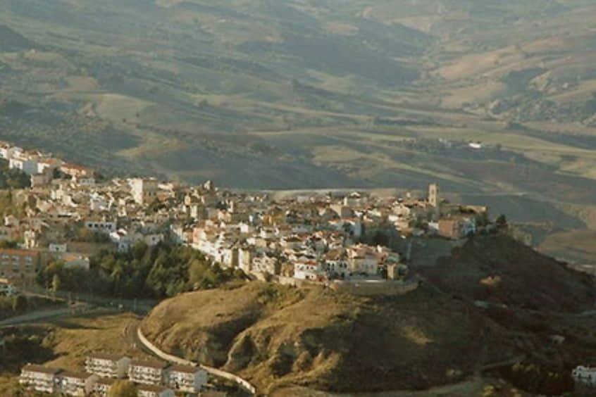
Miglionico sits at 461 meters on a hill between the Bradano and Basento rivers, twelve kilometers from Matera in the central-eastern Matera province. The town is dominated by the Castello del Malconsiglio, the Castle of the Bad Council, built in the eighth or ninth century, enlarged in 1110 and again in the fifteenth century, with seven towers in a parallelogram plan: some square and oldest, two double towers, and circular towers at the corners.
The castle gave its name and its hall to the Conspiracy of the Barons in 1485, when the Sanseverino and Del Balzo families convened here to plot the overthrow of King Ferdinand I of Aragon. The room where they met is still called the Sala del Malconsiglio, the Hall of Bad Counsel; the conspiracy failed and the families were destroyed.
Miglionico is one of the Borghi più belli d'Italia and carries the Città dell'Olio designation for the olive groves on the surrounding slopes.
What to see in Miglionico
- Castello del Malconsiglio. Castle with seven towers in a parallelogram plan, built in the eighth or ninth century, expanded in 1110 and the fifteenth century, site of the 1485 Conspiracy of the Barons.
- Sala del Malconsiglio. The hall inside the castle where the Sanseverino and Del Balzo families plotted against Ferdinand I of Aragon in 1485; the room from which the castle takes its name.
- Chiesa Madre di Santa Maria Maggiore. Mother church on the high point of the village, with a polyptych by Cima da Conegliano dated 1499, one of Basilicata's finest Renaissance works.
How to get to Miglionico
Bari is roughly 92 minutes away by road.
Our tip
April through June and September into October are the months when Miglionico's ridge feels right. The Castello del Malconsiglio against the Bradano and Basento valleys is at its best in slanting light. July and August push past thirty-five degrees; the centro storico empties between two and seven in the afternoon, though the castle stays open with summer hours. XIX Sagra dei Fichi Secchi e dei Sapori d'Autunno di Miglionico falls in September.
Rotondella
Why visit Rotondella
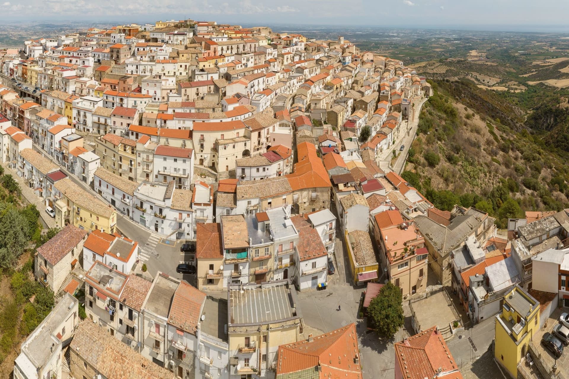
Rotondella occupies a conical hilltop in southeastern Basilicata, its position giving rise to the local name for the view, a balcony over the plain below. The 2,436-resident borgo is a tight ring of streets coiling concentrically around the summit, climbing toward a small Castello, now municipal property, at the very top.
The parish church sits on the central piazza partway along that climb, a fixed point in an otherwise spiraling street plan. The town works as a hinge between two very different landscapes.
To the west, 45 km off, lies the Pollino massif, Italy's largest national park, home to the Loricato pine that serves as its symbol. To the east and north, the Metapontino plain runs down to the coast, where Policoro and Metaponto hold the temple sites and museums of the Greek settlements that once occupied this stretch of the Ionian.
Rotondella sits above both, close enough to serve as a base for either. The economy below the hill is built on the terraced groves that ring it, the source of the town's oil and its designation as a Città dell'Olio.
The food follows the same Lucanian pattern found across the region: peperoni cruschi, pasta with cruschi and breadcrumbs, lagane e ceci, capocollo di Martina Franca and Lucanica sausage, with Aglianico from the Vulture zone 90 km north. Like most small Lucanian borghi, depopulation has thinned the town, from 4,500 residents in 1951 to 2,400 today, a slow contraction that has left the medieval ring largely intact even as it empties.
What to see in Rotondella
- Balconata sullo Jonio (Belvedere). The panoramic terrace looking south across the Metapontino plain to the Ionian Sea 25 km below, the town's nickname comes from this outlook.
- Chiesa di Santa Maria della Neve. Sits on the central piazza with a Renaissance facade, internal frescoes and a small museum of sacred art.
- Centro storico + Castello. Medieval streets coiling concentrically around the conical hill, the small Castello at the summit is municipal property and partially visitable.
How to get to Rotondella
Taranto is roughly 80 minutes away by road.
Our tip
Rotondella is best April–June and September–October — the view is at its best in low-angle spring and autumn light, with the Metapontino plain green in spring and harvest-gold in autumn. November is the Sagra dell'Olio. Summer is hot at the altitude but pleasant compared to the Ionian coast 25 km below. Sagra U'Pastizz Rtunnar falls in August.
Maratea
Why visit Maratea
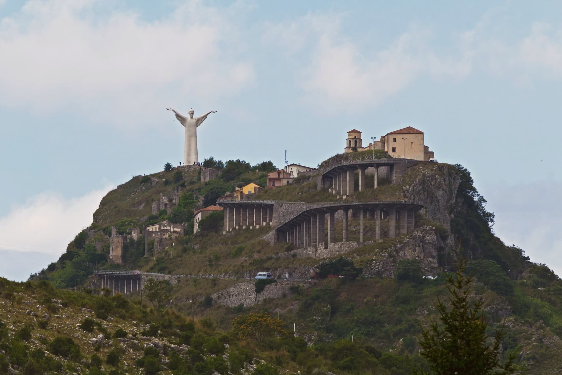
Maratea sits ninety kilometers south of Salerno, on the strip of coast between Campania and Calabria that gives Basilicata its only outlet to the Tyrrhenian. The town is built in layers rather than as a single settlement: the historic centre, Il Borgo, holds the middle ground at three hundred meters on the south slope of the mountain, a few kilometers inland from the water.
Above it, near the summit at 623 meters, the mountain carries both the statue of Christ and, just below it, the sanctuary of the patron saint, the two facing each other rather than out to sea. Higher still, at the very top, are the ruins of Maratea Superiore, the medieval Castello settlement that residents abandoned in favor of the lower borgo.
Below all of this, the comune's thirty-two kilometers of rocky shoreline carry the Bandiera Blu and more than twenty beaches and coves, the only Tyrrhenian coast Basilicata has. The town of forty-four churches is a count that spans not just the borgo but its outlying frazioni, chapels and oratories accumulated over centuries across the whole territory rather than in one place.
What this adds up to is a town stacked vertically from shore to summit, each level, coast, borgo, sanctuary, ruined castello, holding a different age and function of the same settlement rather than a single center with outskirts.
What to see in Maratea
- Cristo Redentore. Arms outstretched at the summit, the statue faces away from the sea, toward the sanctuary and the inland slopes rather than out over the water it overlooks.
- Basilica di San Biagio. Marian sanctuary at the summit of Monte San Biagio, immediately below the Cristo Redentore, holding relics of the patron saint.
- Il Borgo. Historic centre of Maratea on the south slope of the mountain at 300 meters, with narrow stone lanes and small piazzas typical of an inland coastal town.
How to get to Maratea
There is a railway station in the town, so you can arrive without a car and never need one while you are here. Salerno is roughly 110 minutes away by road.
Our tip
May through September is the season for Maratea. The Tyrrhenian water is swimmable from late May to mid-October. June and September are the strongest months: warm water, lighter crowds, and the kind of clear air that pulls the Calabrian coast into view from the Cristo. Borgo diVino tour falls in September.
Lagonegro
Why visit Lagonegro
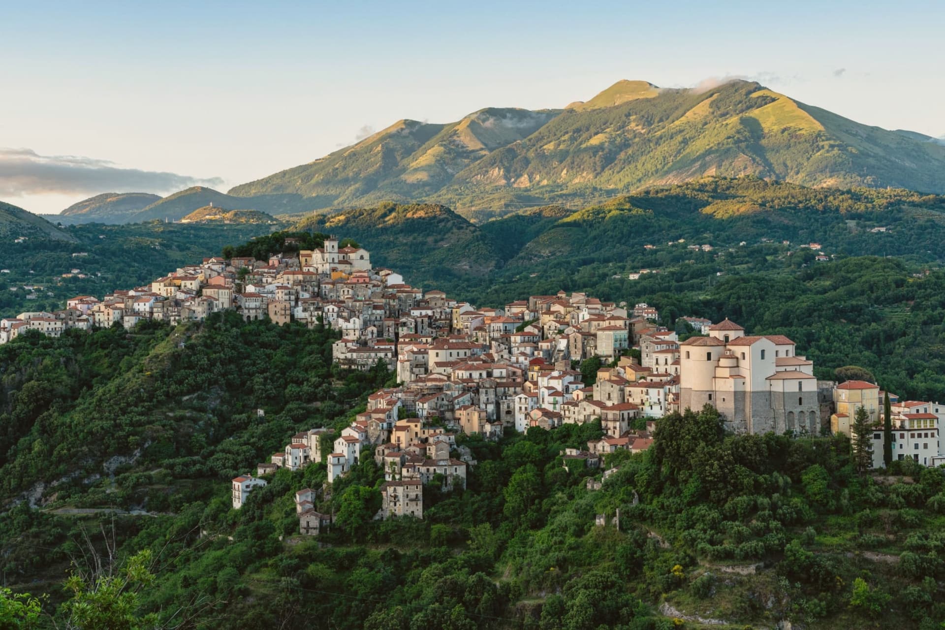
Byzantine monks established the settlement between the ninth and tenth centuries on a defensive promontory between the Noce and Cogliandrino streams, the position that gives the valley its name. The town divides cleanly in two: the old village climbs around the castle ruins and the parish church, while the modern town spreads from the tree-lined Piano square below, the wooded slope between them marking the line where medieval stone gives way to nineteenth-century planning.
The church holds the tomb local tradition assigns to the Florentine model of Leonardo's Mona Lisa, said to have died here in 1506. Lake Sirino at 788 meters and the glacial Lake Laudemio at 1,525 meters both lie within twenty minutes of the town, under the same mountain wall that shelters it.
The town's two halves and the legend it keeps in spite of the evidence against it both point to the same trait: a place defined by what it holds onto, geographically and otherwise.
What to see in Lagonegro
- Chiesa di San Nicola. Tenth-century church in the old village, holds the tomb local tradition assigns to Lisa del Giocondo and two sculptures by Altobello Persio.
- Castello feudale. Ruins of the feudal fortress on the promontory of the old village, the original Byzantine and later Norman defensive anchor of the Valle del Noce.
- Borgo antico. Stone-built medieval core climbing around the castle ruins, separated by the wooded slope from the modern town below.
How to get to Lagonegro
There is a railway station in the town, so you can arrive without a car and never need one while you are here. Salerno is roughly 85 minutes away by road.
Our tip
May through October is the walking and lake season. The Laudemio reserve opens once snow clears from the upper Sirino, usually by late May, and the Cammino di San Nilo passes through Lagonegro for pilgrims working southward. July and August are warm in the lower town but the upper village holds shade; weekends fill with Salerno families on the Sirino trails. Festa lagane e fagioli falls in August.
Venosa
Why visit Venosa
Venosa sits at 415 meters in the Vulture hills, ninety kilometers east of Salerno. The Romans founded Venusia here in 291 BC as a colony on the Appian Way, and it became the birthplace of Quintus Horatius Flaccus, the poet Horace, in 65 BC.
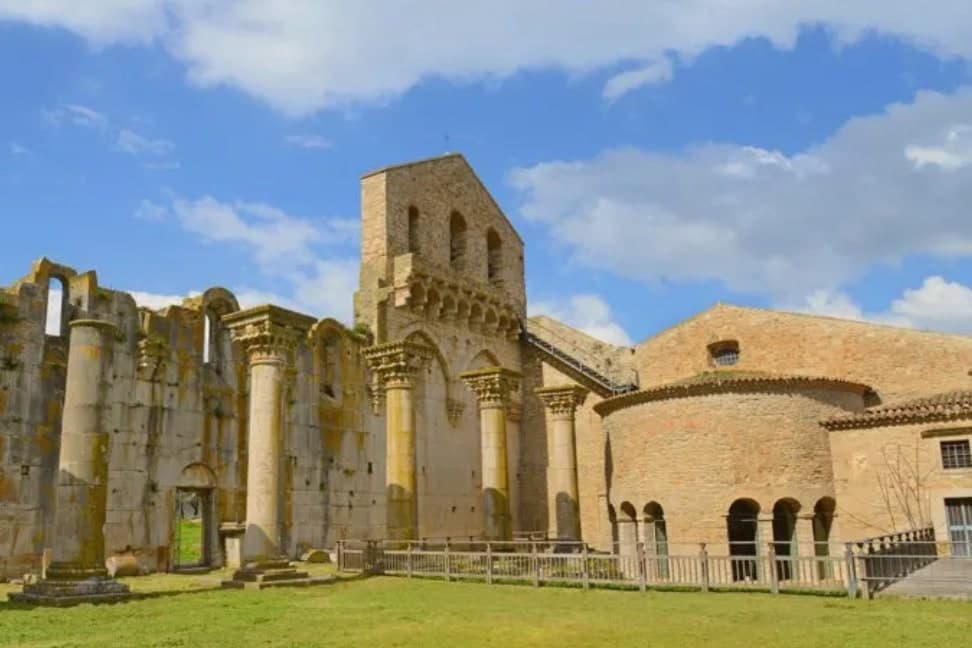
The Parco Archeologico preserves a Roman amphitheater, the baths, and mosaic floors, alongside the so-called Casa di Orazio. Above the ruins stands the Abbazia della Santissima Trinità, an eleventh-century Benedictine complex begun in 1059, with its walls built from blocks salvaged out of the Roman amphitheater next door.
The Incompiuta, the unfinished thirteenth-century cathedral expansion immediately behind the abbey, is roofless and visibly stitched together from Roman fragments. The town centre is dominated by the Castello di Pirro del Balzo, built in 1470 on the foundations of an earlier cathedral and modelled on the Maschio Angioino in Naples.
Venosa is at the heart of the Aglianico del Vulture DOC and DOCG zone, the great red of southern Italy, grown on the volcanic slopes of nearby Monte Vulture.
What to see in Venosa
- Abbazia della Santissima Trinità. Benedictine abbey of 1059 with walls built from blocks of the adjacent Roman amphitheater, the spiritual centre of Norman Venosa.
- Incompiuta. Roofless thirteenth-century cathedral expansion behind the abbey of Santissima Trinità, abandoned mid-build, visibly assembled from Roman spolia.
- Castello di Pirro del Balzo. Quadrangular Aragonese castle of 1470 with corner towers, built on the foundations of the earlier cathedral, modelled on Castel Nuovo in Naples.
How to get to Venosa
There is a railway station in the town, so you can arrive without a car and never need one while you are here. Foggia is roughly 70 minutes away by road.
Our tip
April through June is the green window in the Vulture, with cool evenings and the archaeological park empty in the mornings. September and October are dry and gold, the Aglianico harvest runs into November, and the Cantina di Venosa cellars are open for tastings. July and August reach the mid-thirties; visitors retreat to the abbey shade and the wine cellars. Fiera sapori del Sud falls in May.
Melfi
Why visit Melfi
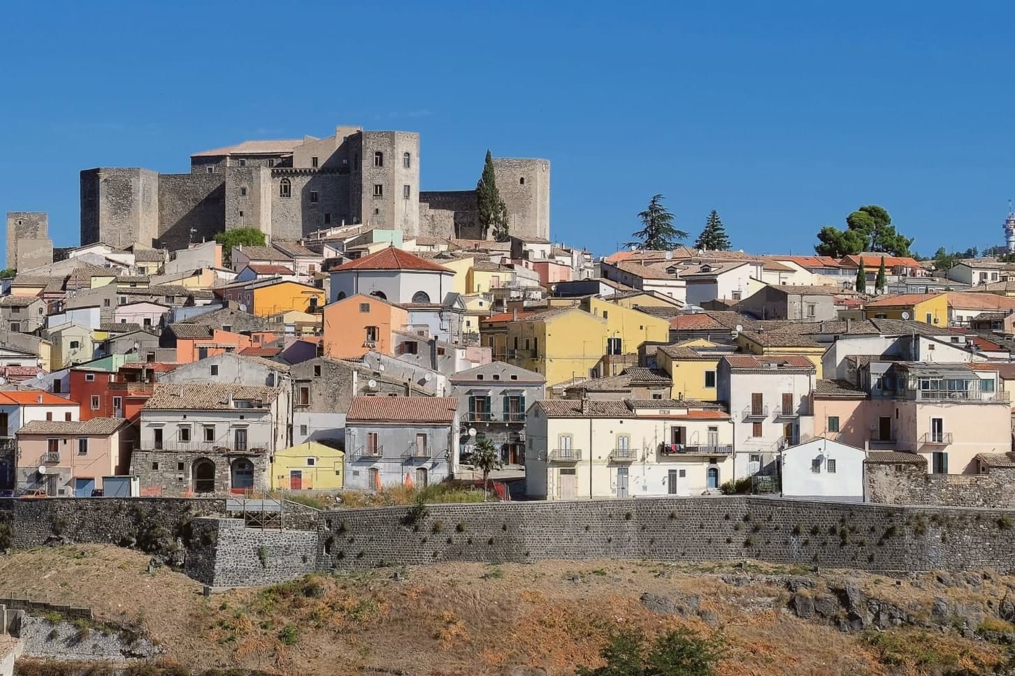
Melfi sits on the slopes of an extinct volcano east of the Apennine spine, the same mass whose crater holds the Laghi di Monticchio and whose soils now define a wine zone. The Hauteville Normans took the town in 1041 and made it the first capital of their southern Italian duchy, a status that explains the density of what followed: a cathedral built within a generation, a castle raised soon after and expanded by an emperor, a legal code drafted within those walls that shaped a kingdom's law.
The walled centro storico spreads below the castle, its gate and noble palazzi still arranged along the lines the Norman-Swabian town laid down. Upper fortress and lower town, volcanic mountain and walled centre: Melfi reads as a place where secular power, church authority and the raw geology of Monte Vulture sat close enough together to shape one small hill town into a seat of empire-level decisions.
What to see in Melfi
- Castello di Melfi. Late-eleventh-century Norman fortress with ten towers, seven rectangular and three pentagonal. Frederick II expanded it after 1194, and the Constitutions of Melfi were promulgated within its walls.
- Cattedrale di Santa Maria Assunta. Dating from 1056, host of five ecumenical councils between 1059 and 1137. Stands at the heart of the walled centre below the castle.
- Museo Archeologico Nazionale del Vulture-Melfese. Inside the castle, with the second-century Roman sarcophagus of Rapolla and finds from the Daunian, Lucanian and Roman periods.
How to get to Melfi
There is a railway station in the town, so you can arrive without a car and never need one while you are here. Foggia is roughly 55 minutes away by road.
Our tip
April through June and September through October are the best windows in Melfi, with cool evenings and the Aglianico vineyards at their most photogenic. July and August reach the mid-thirties; the castle interiors and the cathedral hold the heat at bay. The Aglianico harvest runs into November and the Cantine and museums stay open. Sagra della castagna Varola falls in October.
More from Anywhere Italy
 The best hidden towns you can reach by train in Basilicata
 The best olive oil towns in Basilicata
 The 8 prettiest small villages in Basilicata
- The best towns you can reach by train that eat well in Basilicata
- The 7 prettiest villages in the province of Potenza
 The best towns that eat well in the province of Potenza