The best olive oil towns in Basilicata
Basilicata presses its olives late, often into the cold weeks either side of Christmas, and the new oil comes out of the mills green, cloudy and hot in the throat. The groves here climb, which is the point: Maiatica olives on the clay slopes around the Bradano, Ogliarola and Coratina on the terraces running down towards the Ionian, trees pruned wide and low against the wind. Villages sit above them in tufa and sandstone, the same stone as the ravines, with mills tucked into the ground floors of houses on the edge of town. Autumn smells of crushed leaf and woodsmoke; bread is the vehicle, thick Matera-style loaves rubbed with salt, and lampascioni and dried peppers do the rest.
Most oil tourism in the south happens next door. Puglia has the marketing, the monumental groves, the masserie converted into tasting rooms, the coach parties funnelled through Alberobello and out along the Valle d'Itria, and in high season the queue for a mill visit can be longer than the visit. It is good oil and a pretty landscape, which is why everyone goes. Basilicata's own crowd gathers on the short strip of coast at Maratea, where the restaurants are fine and the groves are somebody else's.
The hills do not stop at the regional border. The same limestone, the same varieties, the same late harvest continue west into the Vulture, south through the badlands above the Agri, and down to the last ridges before the sea, and that is where the towns on this list are. Each belongs to the national association of olive-oil towns, which means a working relationship with its own presses rather than a signposted trail. Fewer people go, the mills are family concerns, and the tasting tends to happen standing up, in a doorway, out of the tank.
Of the 31 communes we have mapped in Basilicata, 7 qualify as olive oil towns: each belongs to the national association of olive-oil towns. The smallest, Aliano, has 880 residents.
Two more lists worth reading alongside this one: The 9 best hill towns in the province of Matera and The 10 best hidden hill towns in Basilicata.
Aliano
Why visit Aliano
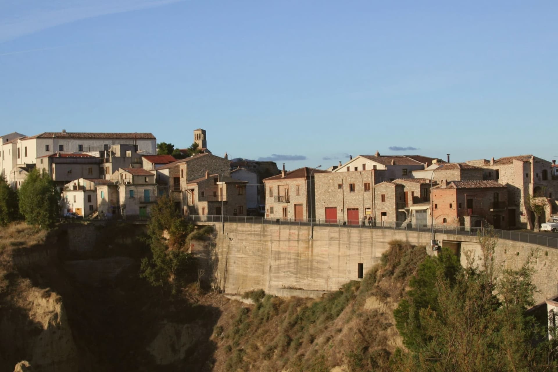
Aliano sits on a clay hill at 555 meters in the southern Matera province, above the Agri river valley and the Sauro stream. The town is surrounded by calanchi, the eroded badlands of bare clay carved by rainwater into ridges and pinnacles, the landscape that became the visual signature of Carlo Levi's exile.
Levi, a Turin doctor, painter and anti-fascist, was confined here from 1935 to 1936 under Mussolini's regime. The book he wrote afterward, Cristo si è fermato a Eboli, published in 1945, gave the village the invented name Gagliano and turned the south's poverty into national literature.
The title comes from a local saying: that Christ stopped short at Eboli, in Campania, and never reached this far. Levi was buried in the village cemetery at his request in 1975.
The house where he was held is now a museum, and the surrounding territory is run as a Parco Letterario. The annual Festival La Luna e i Calanchi, founded by poet Franco Arminio, fills the village every August with readings and music on the bare clay ridges.
What to see in Aliano
- Casa di Carlo Levi. The house where Levi was held in confino from 1935 to 1936, preserved with his paintings, books and personal effects, now the heart of the Parco Letterario.
- Tomba di Carlo Levi. Levi's grave in the village cemetery, where he asked to be buried in 1975 alongside the contadini he wrote about.
- Calanchi di Aliano. Eroded clay badlands surrounding the village, carved by rainwater into bare ridges and pinnacles, a protected geomorphological landscape.
How to get to Aliano
Taranto is roughly 112 minutes away by road.
Our tip
April through June and September into October are the months when the calanchi hold their best light: the bare clay turns silver at dawn and gold at sunset, and the air is clear enough to see down the Agri valley to the Ionian. July and August push past thirty-five degrees and the village empties between two and six in the afternoon, though the Luna e i Calanchi festival in the second half of August packs the streets every night. November through March is quiet and often raw, the calanchi softened by mist.
San Mauro Forte
Why visit San Mauro Forte
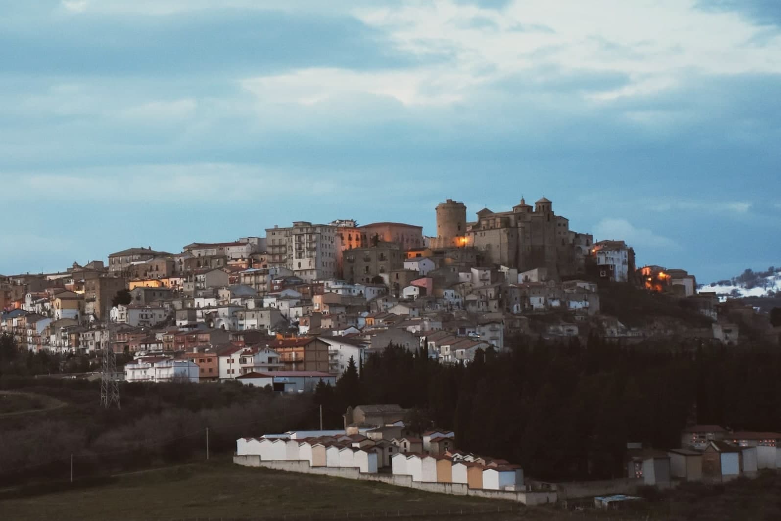
San Mauro Forte sits at 540 meters in the western Matera hills, fifty-five kilometers from the Sassi and forty from Pietrapertosa. The Timponi site, with eighth-century BC remains and fourth-century BC tombs, places the area inside the Lucanian prehistoric network.
The current settlement was founded around 1060 in the Norman period and takes its name from a Benedictine monastery dedicated to Saint Maurus. The Torre Normanna, the cylindrical defensive tower in the main piazza, is the surviving element of the Norman-Swabian castle, later rebuilt by the Angevins.
The Chiesa di Santa Maria Assunta of 1553 preserves a sixteenth-century processional cross. The town's calendar is dominated by the Sagra dei Campanacci on the eve of Sant'Antonio Abate, on 16 January, when men strap belts of cowbells around their waists and walk the streets at dusk in a transhumance rite that predates the church and was kept alive by the shepherding economy.
The town carries Città dell'Olio status: olive groves cover much of the commune.
What to see in San Mauro Forte
- Torre Normanna. Cylindrical Norman tower in the main piazza, the surviving element of the Norman-Swabian castle, rebuilt by the Angevins.
- Chiesa di Santa Maria Assunta. Mother church built in 1553 inside the medieval centre, preserving a sixteenth-century astile cross and an eighteenth-century canvas.
- Chiesa e Convento dell'Annunziata. Franciscan complex begun in the late fifteenth century, with the convent attached to the church of the Annunciation.
How to get to San Mauro Forte
Taranto is roughly 118 minutes away by road.
Our tip
April through June and September through October are the comfortable months in the Matera interior, with green hills and dry evenings. July and August touch thirty-five degrees and the centro storico empties between four and seven. The standout date is 16 January, the eve of Sant'Antonio Abate, when the Sagra dei Campanacci fills the alleys with bell-walkers at dusk and visitors come specifically for the sound.
Acerenza
Why visit Acerenza
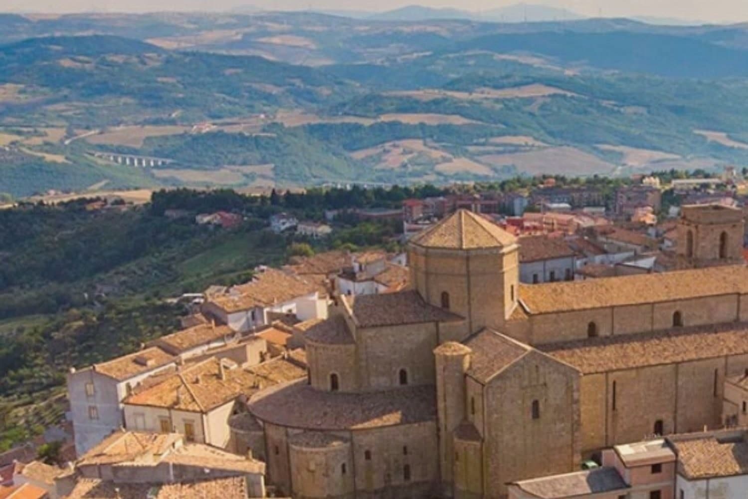
Acerenza stands on a sandstone ridge in the north of the Potenza province, a hundred kilometers inland from Salerno and twenty-two from Venosa. The Romans took it from the Lucanians in 318 BC as Aceruntia; the Ostrogoths and then the Lombards fortified it in turn.
It has been a bishop's seat since at least 499, long before the archbishopric that followed, which places the cathedral at the end of a much longer line of settlement rather than at its start. The town's medieval plan still reads clearly from the square at its summit down to the walls and gates that ring the ridge, the same fortifications raised against the invasions that repeatedly sacked the place.
Vineyards on the slopes below feed the Aglianico produced across the wider area, and the comune holds Città dell'Olio designation alongside its Borghi più belli membership, a working landscape wrapped around a fortified one. The ridge, the walls and the vineyards below them are one continuous piece of geography: a defensible height ringed by the land that has always fed it.
Palazzo Gala have been named by a guide.
What to see in Acerenza
- Cattedrale di Santa Maria Assunta e San Canio. Nave and two aisles under archbishop Arnaldo of Cluny, with sixteenth-century canvases inside and a marble bust identified as Julian the Apostate set among them.
- Centro storico medievale. Concentric plan typical of a fortified borgo, its gates still standing after repeated sackings through the early Middle Ages.
- Cripta del Ferrillo. Frescoes, columns and bas-reliefs beneath the cathedral floor, built as the chapel of the Ferrillo family.
How to get to Acerenza
There is a railway station in the town, so you can arrive without a car and never need one while you are here. Foggia is roughly 101 minutes away by road.
Our tip
May through October is the window when Acerenza's ridge feels right. Spring and autumn bring clear air across the Vulture and long views toward Monte Vulture itself, the extinct volcano whose slopes carry the Aglianico vineyards. July and August push past thirty degrees but the 833-meter elevation keeps the evenings cool; the centro storico empties between two and six. Natale e sapori ad Acerenza falls in December.
Miglionico
Why visit Miglionico
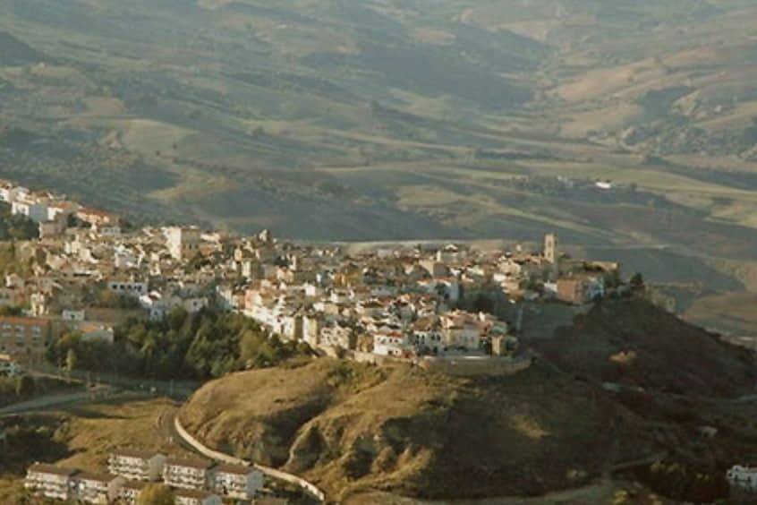
Miglionico sits at 461 meters on a hill between the Bradano and Basento rivers, twelve kilometers from Matera in the central-eastern Matera province. The town is dominated by the Castello del Malconsiglio, the Castle of the Bad Council, built in the eighth or ninth century, enlarged in 1110 and again in the fifteenth century, with seven towers in a parallelogram plan: some square and oldest, two double towers, and circular towers at the corners.
The castle gave its name and its hall to the Conspiracy of the Barons in 1485, when the Sanseverino and Del Balzo families convened here to plot the overthrow of King Ferdinand I of Aragon. The room where they met is still called the Sala del Malconsiglio, the Hall of Bad Counsel; the conspiracy failed and the families were destroyed.
Miglionico is one of the Borghi più belli d'Italia and carries the Città dell'Olio designation for the olive groves on the surrounding slopes.
What to see in Miglionico
- Castello del Malconsiglio. Castle with seven towers in a parallelogram plan, built in the eighth or ninth century, expanded in 1110 and the fifteenth century, site of the 1485 Conspiracy of the Barons.
- Sala del Malconsiglio. The hall inside the castle where the Sanseverino and Del Balzo families plotted against Ferdinand I of Aragon in 1485; the room from which the castle takes its name.
- Chiesa Madre di Santa Maria Maggiore. Mother church on the high point of the village, with a polyptych by Cima da Conegliano dated 1499, one of Basilicata's finest Renaissance works.
How to get to Miglionico
Bari is roughly 92 minutes away by road.
Our tip
April through June and September into October are the months when Miglionico's ridge feels right. The Castello del Malconsiglio against the Bradano and Basento valleys is at its best in slanting light. July and August push past thirty-five degrees; the centro storico empties between two and seven in the afternoon, though the castle stays open with summer hours. XIX Sagra dei Fichi Secchi e dei Sapori d'Autunno di Miglionico falls in September.
Rotondella
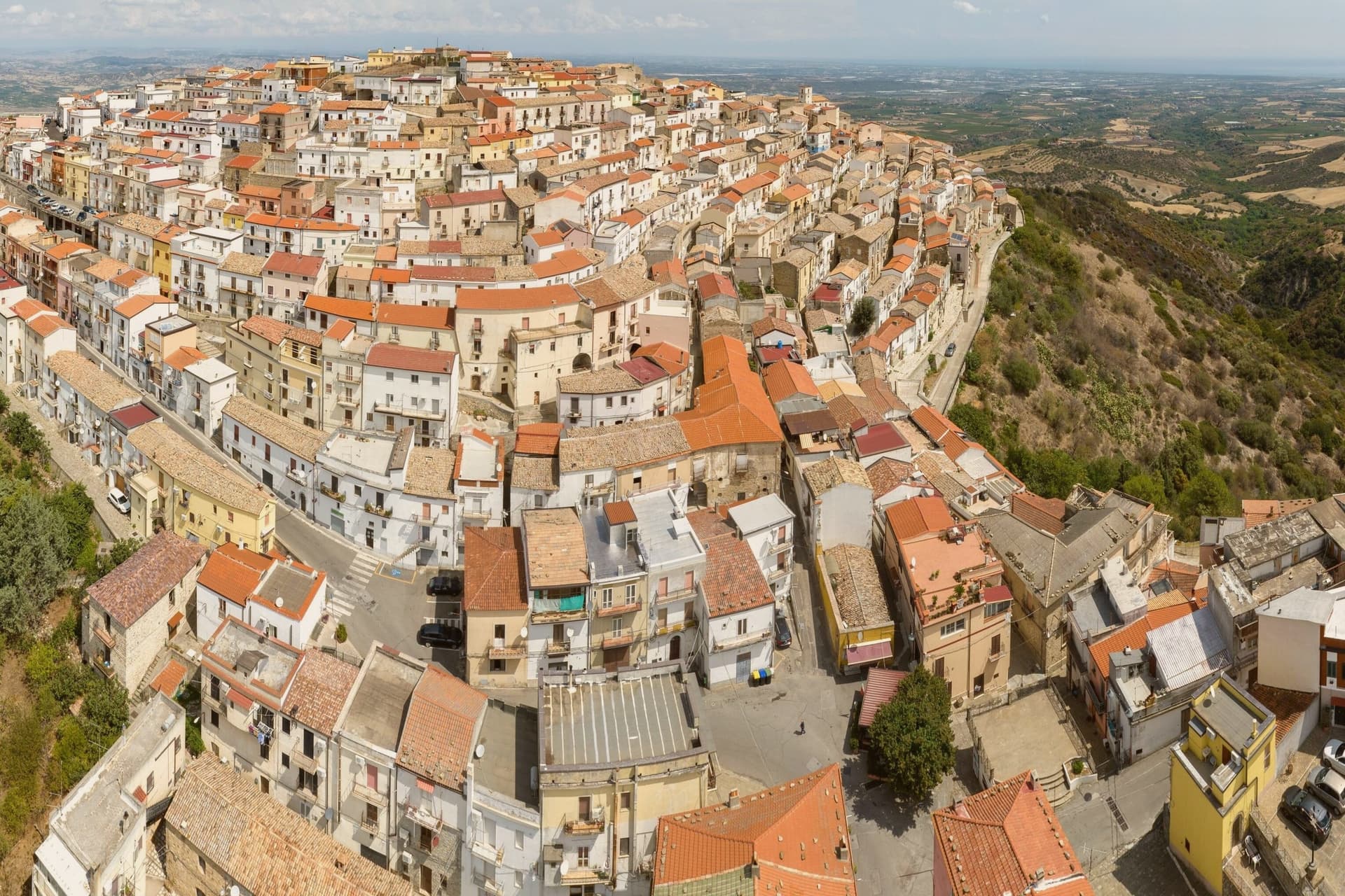
Why visit Rotondella
Rotondella occupies a conical hilltop in southeastern Basilicata, its position giving rise to the local name for the view, a balcony over the plain below. The 2,436-resident borgo is a tight ring of streets coiling concentrically around the summit, climbing toward a small Castello, now municipal property, at the very top.
The parish church sits on the central piazza partway along that climb, a fixed point in an otherwise spiraling street plan. The town works as a hinge between two very different landscapes.
To the west, 45 km off, lies the Pollino massif, Italy's largest national park, home to the Loricato pine that serves as its symbol. To the east and north, the Metapontino plain runs down to the coast, where Policoro and Metaponto hold the temple sites and museums of the Greek settlements that once occupied this stretch of the Ionian.
Rotondella sits above both, close enough to serve as a base for either. The economy below the hill is built on the terraced groves that ring it, the source of the town's oil and its designation as a Città dell'Olio.
The food follows the same Lucanian pattern found across the region: peperoni cruschi, pasta with cruschi and breadcrumbs, lagane e ceci, capocollo di Martina Franca and Lucanica sausage, with Aglianico from the Vulture zone 90 km north. Like most small Lucanian borghi, depopulation has thinned the town, from 4,500 residents in 1951 to 2,400 today, a slow contraction that has left the medieval ring largely intact even as it empties.
What to see in Rotondella
- Balconata sullo Jonio (Belvedere). The panoramic terrace looking south across the Metapontino plain to the Ionian Sea 25 km below, the town's nickname comes from this outlook.
- Chiesa di Santa Maria della Neve. Sits on the central piazza with a Renaissance facade, internal frescoes and a small museum of sacred art.
- Centro storico + Castello. Medieval streets coiling concentrically around the conical hill, the small Castello at the summit is municipal property and partially visitable.
How to get to Rotondella
Taranto is roughly 80 minutes away by road.
Our tip
Rotondella is best April–June and September–October — the view is at its best in low-angle spring and autumn light, with the Metapontino plain green in spring and harvest-gold in autumn. November is the Sagra dell'Olio. Summer is hot at the altitude but pleasant compared to the Ionian coast 25 km below. Sagra U'Pastizz Rtunnar falls in August.
Melfi
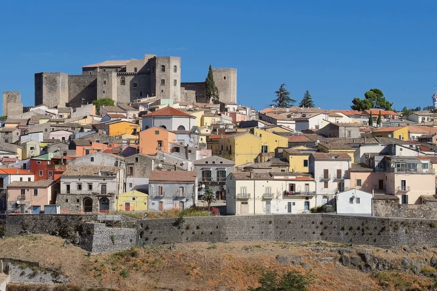
Why visit Melfi
Melfi sits on the slopes of an extinct volcano east of the Apennine spine, the same mass whose crater holds the Laghi di Monticchio and whose soils now define a wine zone. The Hauteville Normans took the town in 1041 and made it the first capital of their southern Italian duchy, a status that explains the density of what followed: a cathedral built within a generation, a castle raised soon after and expanded by an emperor, a legal code drafted within those walls that shaped a kingdom's law.
The walled centro storico spreads below the castle, its gate and noble palazzi still arranged along the lines the Norman-Swabian town laid down. Upper fortress and lower town, volcanic mountain and walled centre: Melfi reads as a place where secular power, church authority and the raw geology of Monte Vulture sat close enough together to shape one small hill town into a seat of empire-level decisions.
La Villa have been named by a guide.
What to see in Melfi
- Castello di Melfi. Late-eleventh-century Norman fortress with ten towers, seven rectangular and three pentagonal. Frederick II expanded it after 1194, and the Constitutions of Melfi were promulgated within its walls.
- Cattedrale di Santa Maria Assunta. Dating from 1056, host of five ecumenical councils between 1059 and 1137. Stands at the heart of the walled centre below the castle.
- Museo Archeologico Nazionale del Vulture-Melfese. Inside the castle, with the second-century Roman sarcophagus of Rapolla and finds from the Daunian, Lucanian and Roman periods.
How to get to Melfi
There is a railway station in the town, so you can arrive without a car and never need one while you are here. Foggia is roughly 55 minutes away by road.
Our tip
April through June and September through October are the best windows in Melfi, with cool evenings and the Aglianico vineyards at their most photogenic. July and August reach the mid-thirties; the castle interiors and the cathedral hold the heat at bay. The Aglianico harvest runs into November and the Cantine and museums stay open. Sagra della castagna Varola falls in October.
Matera
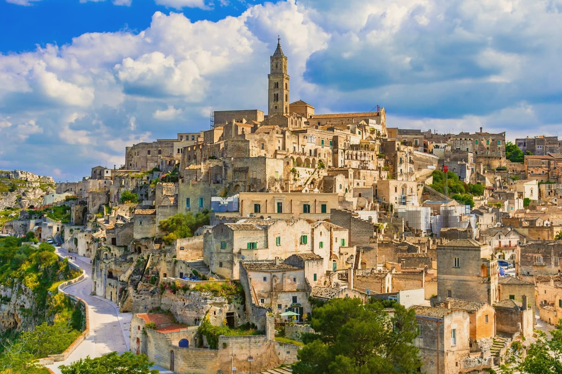
Why visit Matera
Matera sits at 401 meters on the edge of the Gravina ravine in eastern Basilicata, fifty-five kilometers inland from Bari. The Sassi, two districts of houses, churches and cisterns hollowed from tufa limestone, are among the oldest continuously inhabited settlements on earth, with traces of human presence from the Paleolithic.
Sasso Caveoso and Sasso Barisano dropped down the canyon walls; people lived there with their animals into the 1950s. Carlo Levi's 1945 book and the 1948 photographs that followed turned the Sassi into a national scandal, and a 1952 law moved twenty thousand residents to new housing on the plateau above.
The caves stayed empty for thirty years. UNESCO listed them in 1993.
Mel Gibson shot The Passion of the Christ here in 2004 and the city was European Capital of Culture in 2019; No Time to Die filmed in the Sassi in 2019, bringing twelve million euros into the local economy. Bread, ceramics, and rock churches across the Gravina anchor what is now Basilicata's only mass-tourism destination.
Vitantonio Lombardo, Baccanti, Dimora Ulmo and 9 more have been named by a guide.
What to see in Matera
- Sassi di Matera. Two districts of cave dwellings, Sasso Caveoso and Sasso Barisano, carved from tufa limestone and inhabited continuously from the Paleolithic until the 1950s evictions.
- Cattedrale della Madonna della Bruna e di Sant'Eustachio. Thirteenth-century Apulian Romanesque cathedral on the highest point of the Civita, between the two Sassi, with rose window and bell tower.
- Chiese rupestri del Parco della Murgia. More than 150 rock-cut churches scattered across the Gravina canyon, frescoed between the eighth and thirteenth centuries by Italo-Greek monks.
How to get to Matera
There is a railway station in the town, so you can arrive without a car and never need one while you are here. Bari is roughly 60 minutes away by road.
Our tip
April through June and September into October are the months Matera was built for. The light slants across the tufa façades in the late afternoon and turns the Sassi gold. July and August are punishing: temperatures cross thirty-five degrees and the canyon walls hold the heat past midnight, though hotels stay full because the Bond and Gibson tourism waves have not subsided. Festa della Bruna falls in July.