
Basilicata · Matera
Rotondella
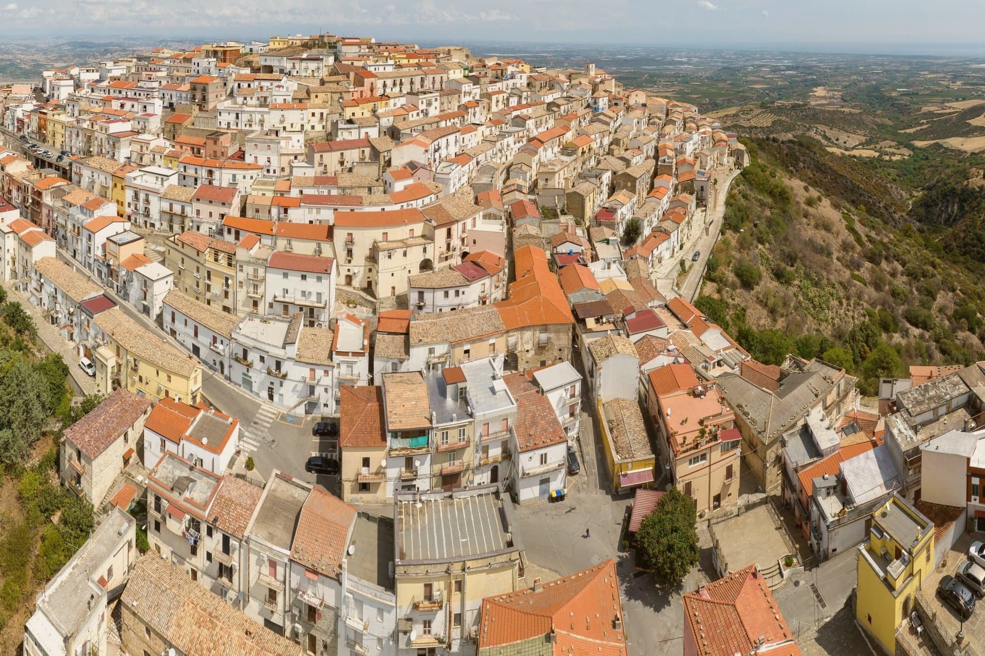
A 2,400-resident Lucanian borgo on a 576m hilltop, its medieval streets ringed concentrically around the summit above the Metapontino plain.
Picked by Peter Benei
Letter to come
Why Rotondella is on our list
It holds Città dell'Olio.
Subscribe and you get Rotondella's letter the day it comes out.
Visiting
- Best time
- Apr–Jun, Sep–Oct
- By car
- 2 h 2 min from Bari
- Population
- 2,352
- J11°
- F12°
- M13°
- A16°
- M22°
- J28°
- J32°
- A31°
- S26°
- O21°
- N16°
- D12°
- Best
- Hot or crowded
- Quiet
- Mostly closed
Daytime air temperature, averages for 2020–2024. Weather data by Open-Meteo.com.
Why come
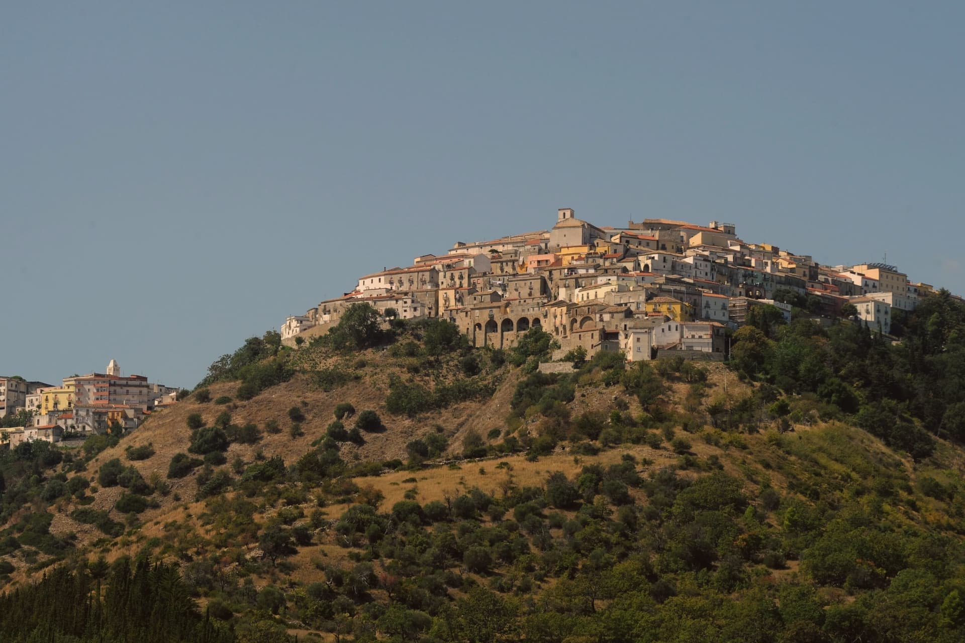
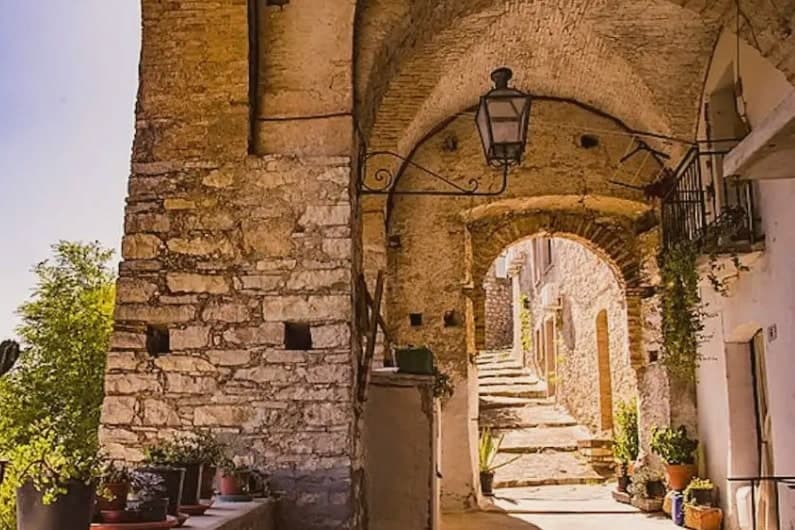
Rotondella occupies a conical hilltop in southeastern Basilicata, its position giving rise to the local name for the view, a balcony over the plain below. The 2,352-resident borgo is a tight ring of streets coiling concentrically around the summit, climbing toward a small Castello, now municipal property, at the very top. The parish church sits on the central piazza partway along that climb, a fixed point in an otherwise spiraling street plan.
The town works as a hinge between two very different landscapes. To the west, 45 km off, lies the Pollino massif, Italy's largest national park, home to the Loricato pine that serves as its symbol. To the east and north, the Metapontino plain runs down to the coast, where Policoro and Metaponto hold the temple sites and museums of the Greek settlements that once occupied this stretch of the Ionian. Rotondella sits above both, close enough to serve as a base for either.
The economy below the hill is built on the terraced groves that ring it, the source of the town's oil and its designation as a Città dell'Olio. The food follows the same Lucanian pattern found across the region: peperoni cruschi, pasta with cruschi and breadcrumbs, lagane e ceci, capocollo di Martina Franca and Lucanica sausage, with Aglianico from the Vulture zone 90 km north. Like most small Lucanian borghi, depopulation has thinned the town, from 4,500 residents in 1951 to 2,400 today, a slow contraction that has left the medieval ring largely intact even as it empties.
How to get there
From Bari (BRI), about 2 h 8 min by car.
Lamezia Terme (SUF) is about 2 h 51 min away.
By car from the center of Bari 2 h 2 min, Lecce 2 h 40 min or Salerno 2 h 44 min.
Coming by train into Taranto? Rotondella is about 1 h 17 min away by road.
First time driving in Italy? Read our complete manual.
What to see
Balconata sullo Jonio (Belvedere)
The panoramic terrace looking south across the Metapontino plain to the Ionian Sea 25 km below, the town's nickname comes from this outlook.
Chiesa di Santa Maria della Neve
Sits on the central piazza with a Renaissance facade, internal frescoes and a small museum of sacred art.
Centro storico + Castello
Medieval streets coiling concentrically around the conical hill, the small Castello at the summit is municipal property and partially visitable.
Olio DOP + frantoi
The surrounding terraced hills produce the DOP olive oil sold in small frantoi within the town.
Pollino + Magna Graecia bases
Eastern gateway to the Pollino national park and western gateway to the Greek coastal sites, Metaponto lies further north.
Living here
Could you live here?
Rotondella is at the end of the road.
- A village of 2,352. The nearest town of 5,000 people, Nova Siri, is 20 min away: past our 15-minute rule, which makes this the end of the road.
- Matera, a city of 59,628, is 1 h 25 min by car. Further than our 30 to 60 minutes, a long way for the hospital visit or the monthly shopping.
The rules come from our series Where to Move in Italy, written from the places we have lived: Part 1, The End of the Road · Part 2, The Small Town · Part 3, The City · Part 4, The Postcard · Part 5, The Other Half. The towns we would pick are in Part 6, The Best Towns.
- Population 2,352, down 11.7% since 2015 (Italy's emptying towns)
- Nearest city Matera, 1 h 25 min drive
- Nearest national health service hospital Policoro, 12 km as the crow flies · how healthcare works in Italy
- Homes in the center: €460 to €690 per m² to buy, €1.30 to €1.90 per m² a month to rent
All the numbers Common questions, designations, lists and sources.
More about living here
- Remote
- Pharmacy in town
- High school within a 30-minute drive
- Full fibre reaches 79% of homes
- Primary school in the comune
- Earthquake zone 3, low hazard
- Bari airport (BRI), 2 h 8 min drive, the nearest with scheduled flights
- Regional capital Potenza, 2 h 6 min drive
If you are moving here
Who lives here
14% of residents are foreign citizens, most often from Albania, Romania and Iraq, against 9% across Italy. There are 252 people over 65 for every 100 children under 15, against 216 across Italy. 44% of homes have no resident, holiday homes and empty ones counted together, against 27% across Italy. Matera province ranks 79th of 107 in Il Sole 24 Ore's quality of life ranking for 2025.
Health and schools
The nearest emergency room is in Policoro, 12 km as the crow flies. The nearest major one is in Taranto, 73 km away. The nearest IB school is Gonzaga International School Palermo, 356 km as the crow flies. The nearest school listed as international is International School of Brindisi, 128 km away.
Information, not medical advice. Confirm with a professional.
Taxes
A home that is not your main one pays 1.06% a year in property tax at the 2025 rate, charged on the cadastral value rather than the price. A main home pays none unless it is in a luxury category. The town adds 0.8% to your income tax. 7% pensioner tax: this town qualifies, for someone with a foreign pension who has lived abroad for five years: 7% on foreign income, for ten years.
Information, not tax advice. Confirm with a professional.
What it costs
The average household in Basilicata spends about €1,890 a month, €580 of it on food, against about €2,170 across Italy. A family of three pays about €459 a year for water, on the Basilicata average.
Climate and risk
It is in climate zone D, on a scale from A, the warmest, to F, the coldest, and heating may run from November 1 to April 15, up to 12 hours a day, unless the mayor changes it. 4% of residents live in a zone the national maps rate high for floods, 5% in a high or medium one. Under 1% live in a zone rated high or very high for landslides.
These shares cover the whole comune, not any one street. Check an address on IdroGEO.
Moving from abroad? Which visa you need. Sources: ISTAT, the Ministry of Health, ISPRA, the Finance Ministry, the Ministry of Enterprise, Poste Italiane, the comuni, the IB, International Schools Database, Il Sole 24 Ore, Cittadinanzattiva.
Known for
BALCONY OF THE IONIAN
576m conical hilltop with a panoramic view across the Metapontino plain to the Ionian Sea, clear winter days reach the Aspromonte 100 km south.
CITTÀ DELL'OLIO
Terraced hill groves produce a DOP olive oil. Sagra dell'Olio in early November is the year's main event.
MAGNA GRAECIA GATEWAY
Policoro/Heraclea is 20 km east, Greek temple sites and the major archaeological museum of the Sibarite + Lucanian world.
POLLINO GATEWAY
Italy's largest national park is 45 km west, Loricato pines, mountain villages, hiking and skiing in the Calabrian-Lucanian Apennines.
Common questions
- What is Rotondella known for?
- Rotondella is a 2,400-resident Lucanian borgo on a 576m hilltop, its medieval streets ringed concentrically around the summit above the Metapontino plain.
- Where is Rotondella?
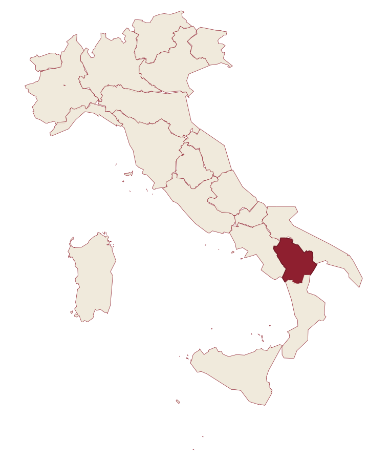
- Rotondella is a comune in the province of Matera, in Basilicata.
- What is the nearest airport to Rotondella?
- The nearest airport with scheduled flights is Bari (BRI), about 2 h 8 min by car.
- How long is the drive from Bari to Rotondella?
- About 2 h 2 min by car.
- When is the best time to visit Rotondella?
- Best in Apr–Jun, Sep–Oct. July is the warmest month, averaging 32 degrees, and November the wettest, with about 10 rain days.
- Which other towns are like Rotondella?
- Valsinni, Miglionico and Grottole.
- How many people live in Rotondella?
- 2,352 residents, by ISTAT's count on 1 January 2025.
- Is Rotondella a good place to live?
- By the rules in our Where to Move in Italy series, Rotondella is at the end of the road: the nearest town of 5,000 people, Nova Siri, is 20 min away. The nearest city, Matera, is 1 h 25 min away by car. The nearest national health service hospital is in Policoro, 12 km as the crow flies. Full fibre reaches 79% of homes.
Tags & data designations · numbers · sources
Recognized as
Landscape
The numbers
- Elevation: 576 m
- Population: 2,352
- Surface area: 76.72 km²
These figures were compiled from public directories: ISTAT, OpenStreetMap and Wikidata, and from the official listings of the guides named on this page. Town details change; verify with official sources before you travel.
The ranked lists
Lists Rotondella appears in
Similar
Towns like Rotondella
What all six share with Rotondella: under 3,000 people · hill towns
The letter
Rotondella is on our list. Its letter is still to come.
We are writing about all 1,000 of these towns, one at a time, in a free letter: the photo, what is worth eating, and when to turn up. That is our mission. Sign up and you will be there when Rotondella comes up. By Peter & Sophia, from Turin.
The nearest town we have written up is Scheggino, 418 km away. Read its letter →
Paid plans, the moving year and the books are on the membership page.