
The best towns that eat well in the province of Potenza
The province of Potenza is high country, sandstone and limestone stacked into ridges, with towns built from the same grey-brown rock they stand on. The food follows the altitude: peperoni cruschi fried until they shatter, cavatelli rolled by hand, lucanica sausage hung to dry in cold rooms, pork cooked slowly with wild fennel, Sarconi beans simmered with pasta into something closer to a meal than a soup. Autumn brings porcini and chestnuts down from the Pollino and the Dolomiti Lucane, and winter brings the pig. Aglianico del Vulture, grown on volcanic soil around Monte Vulture, is one of the great southern reds and it is poured casually here, by the carafe.
Basilicata's reputation now rests almost entirely on Matera, in the other province, where the Sassi have become the region's single image and the restaurants that ring them are booked out months ahead in high summer. It is a extraordinary place and the crowds are the price. The consequence is that most visitors eat their Lucanian food within a short walk of one cave church, and leave with a fairly narrow sense of what the region actually cooks.
The same larder continues west and north, into the Agri valley, the Vulture wine hills, the sandstone spires above the Basento and the beech forests of the Pollino. The towns here are smaller, fewer people go, and in each of them a national or international dining guide has named a table worth sitting down at. That is what this list is: places where the kitchen has been noticed, and the drive up is part of the point.
Of the 16 communes we have mapped in the province of Potenza, 9 qualify as towns that eat well: a national or international dining guide has named a table in each. The smallest, Castelmezzano, has 710 residents.
If you are still choosing, we have also written The best mountain towns that eat well in the province of Potenza and The best towns you can reach by train that eat well in Basilicata.
Castelmezzano
Why visit Castelmezzano
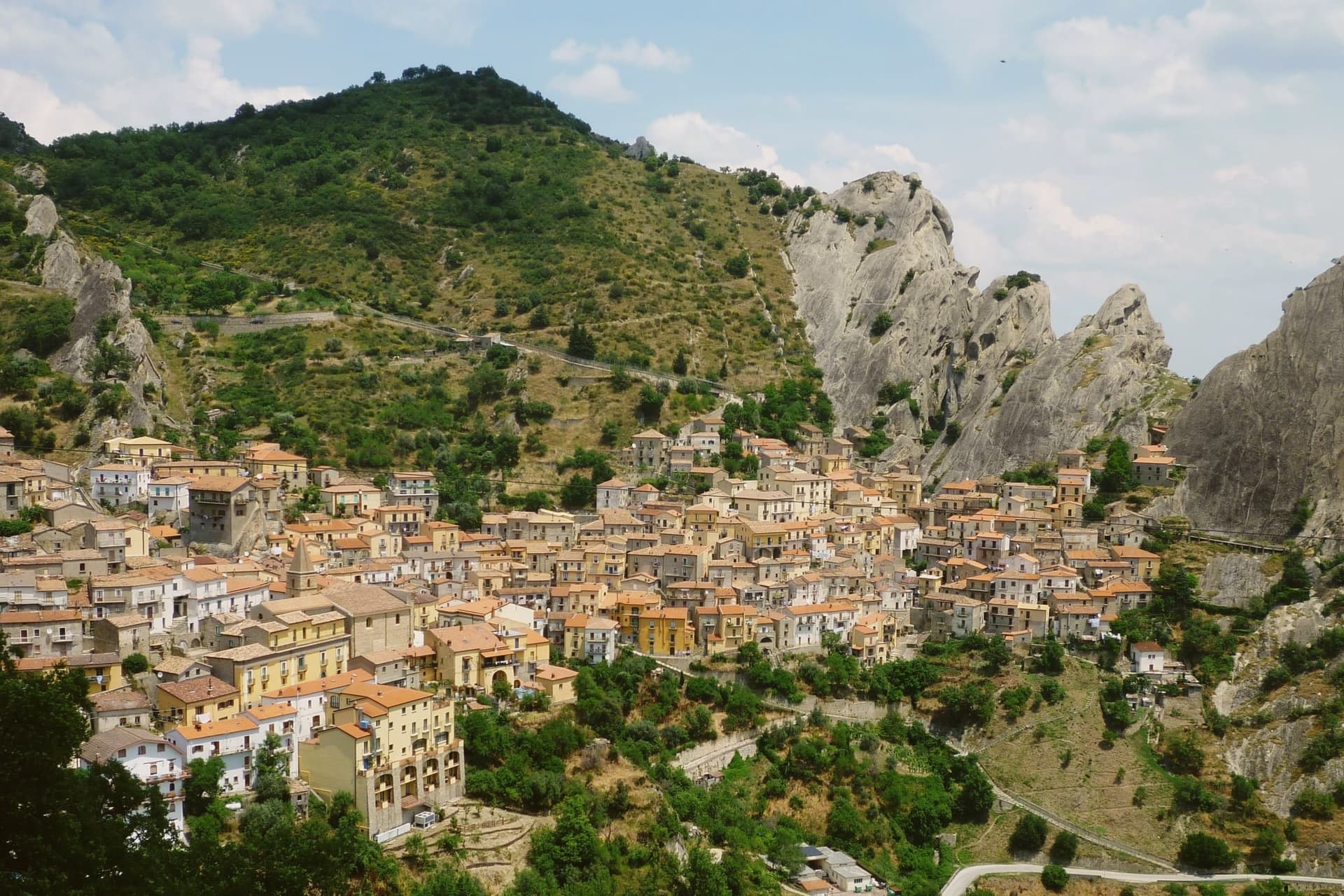
The population is seven hundred and ten, set at 750 meters in a rocky basin that the Dolomiti Lucane close in on every side. The range gives the village its walls before any mason did: houses sit beneath overhangs, lanes climb in stairs cut straight from the sandstone, and the settlement reads as an extension of the rock rather than something built against it.
Castelmezzano and Pietrapertosa face each other across a gorge from opposite ridges within the same Parco Regionale Gallipoli Cognato Piccole Dolomiti Lucane, a shared geology that neither village would present the same way alone. The zipline now formalizes that relationship, its two cables running in either direction between the two ridgelines, the longer at 1,452 meters and speeds reaching one hundred and twenty kilometers per hour.
Castelmezzano carries Borghi più belli and Bandiera Arancione, two of the four highest institutional signals an Italian commune can hold. What holds the place together is the fit between site and settlement: a small population living inside a basin whose sandstone shaped both the old stairs to the watchtower and the new line across the gorge.
Al Becco della Civetta have been named by a guide.
What to see in Castelmezzano
- Dolomiti Lucane. Named formations like the Eagle's Beak and the Lion's Mouth rise around the village, forming the basin it sits in.
- Gradinata Normanna. The steps sit above the village, worn into a single monolith, leading up to the watchtower ruin with a view back over the roofs.
- Volo dell'Angelo. A harness sends visitors face-down across the gorge alone or in pairs, the ridge of Pietrapertosa closing fast on the far cable.
How to get to Castelmezzano
Salerno is roughly 110 minutes away by road.
Our tip
May through October is when Castelmezzano works. The Volo dell'Angelo zipline runs from spring to autumn and not in winter, the Dolomiti Lucane trails open in late spring, and the 750-meter elevation keeps July and August manageable even when the rest of Basilicata bakes. June and September are the strongest combination of weather and lighter crowds; July and August book up months in advance for the flight and accommodation.
Terranova di Pollino
Why visit Terranova di Pollino
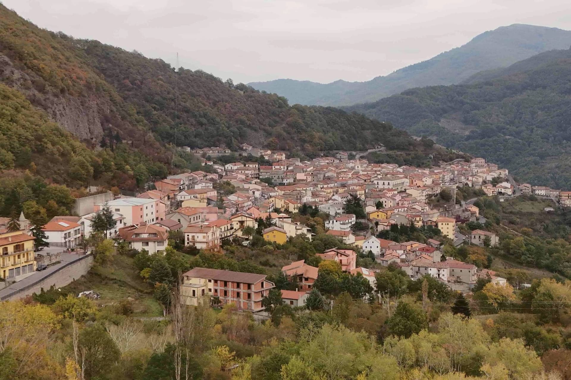
Terranova di Pollino sits at 926 meters on the Lucanian side of the Parco Nazionale del Pollino, Italy's largest national park at 192,000 hectares straddling Basilicata and Calabria. A thousand people live in the stone village above the Sarmento valley, in the territory locals call the gate of the park.
The land around the village rises into the Bosco Magnano and the Bosco di Chiaromonte, beech and Bosnian pine forest that holds the symbolic tree of the park, the loricato pine, on the higher ridges above. Local cuisine is mountain cuisine: hand-rolled pasta, lamb, pecorino, porcini in autumn.
The patata rossa di Terranova, a red-skinned firm-fleshed variety grown at 800 meters, has Slow Food Presidium recognition and is the village's flagship product. Luna Rossa, the Michelin-listed restaurant of Federico Valicenti, has anchored the contemporary Lucanian peasant kitchen here for thirty years.
Luna Rossa have been named by a guide.
What to see in Terranova di Pollino
- Parco Nazionale del Pollino. Italy's largest national park at 192,000 hectares, Terranova is one of the principal Basilicata-side entrance villages with trailheads from the centro.
- Serra di Crispo. Ridge above the village at 2,053 meters known as the Garden of the Gods for its stand of loricato pines, the symbol tree of the park.
- Centro storico. Stone-built mountain village at 926 meters with narrow ascending lanes, organised around the Chiesa Madre and the small piazze of the upper streets.
How to get to Terranova di Pollino
Taranto is roughly 138 minutes away by road.
Our tip
May through October is the trekking window. The Pollino trails open as snow clears the high ridges, usually by mid-May, and the loricato circuits to Serra di Crispo and Serra delle Ciavole run through October. July and August bring weekend visitors from the Ionian coast, but at 926 meters the heat rarely settles.
Acerenza
Why visit Acerenza
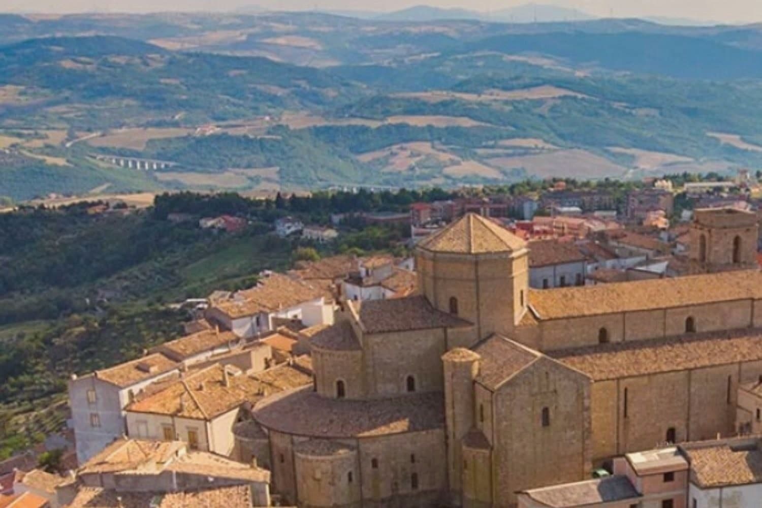
Acerenza stands on a sandstone ridge in the north of the Potenza province, a hundred kilometers inland from Salerno and twenty-two from Venosa. The Romans took it from the Lucanians in 318 BC as Aceruntia; the Ostrogoths and then the Lombards fortified it in turn.
It has been a bishop's seat since at least 499, long before the archbishopric that followed, which places the cathedral at the end of a much longer line of settlement rather than at its start. The town's medieval plan still reads clearly from the square at its summit down to the walls and gates that ring the ridge, the same fortifications raised against the invasions that repeatedly sacked the place.
Vineyards on the slopes below feed the Aglianico produced across the wider area, and the comune holds Città dell'Olio designation alongside its Borghi più belli membership, a working landscape wrapped around a fortified one. The ridge, the walls and the vineyards below them are one continuous piece of geography: a defensible height ringed by the land that has always fed it.
Palazzo Gala have been named by a guide.
What to see in Acerenza
- Cattedrale di Santa Maria Assunta e San Canio. Nave and two aisles under archbishop Arnaldo of Cluny, with sixteenth-century canvases inside and a marble bust identified as Julian the Apostate set among them.
- Centro storico medievale. Concentric plan typical of a fortified borgo, its gates still standing after repeated sackings through the early Middle Ages.
- Cripta del Ferrillo. Frescoes, columns and bas-reliefs beneath the cathedral floor, built as the chapel of the Ferrillo family.
How to get to Acerenza
There is a railway station in the town, so you can arrive without a car and never need one while you are here. Foggia is roughly 101 minutes away by road.
Our tip
May through October is the window when Acerenza's ridge feels right. Spring and autumn bring clear air across the Vulture and long views toward Monte Vulture itself, the extinct volcano whose slopes carry the Aglianico vineyards. July and August push past thirty degrees but the 833-meter elevation keeps the evenings cool; the centro storico empties between two and six. Natale e sapori ad Acerenza falls in December.
Rotonda
Why visit Rotonda
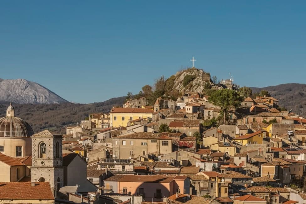
Rotonda sits at 626m in the Mercure river valley, on the Basilicata side of the border that the Parco Nazionale del Pollino, at 1,925 km2 and founded in 1993, draws across two regions. The centro is Lucanian in character: intact stone-paved vicoli, a quiet architectural register, and a hill silhouette closed by the medieval castle ruins above and the 16th-century parish church below, the two marking the old and the sacred ends of the settlement.
Inside the church, later restorations have not displaced the Madonna painted by the Lucanian Mannerist Giovanni de Gregorio, and the castle ruins belonged to the Sangineto family. The park's administrative and visitor apparatus is folded into the town itself rather than kept apart from it: the executive headquarters, the visitor centre, and the main interpretive trail system all sit within walking distance of the church and the castle summit, with the pine-clad slopes rising directly behind the centro.
The pines are Loricato, a high-altitude conifer surviving only here and in the Balkans, some specimens reckoned a thousand years old, and they give the park its symbol. Two Slow Food Presidia are grown on the terraces that step down toward the river, a microclimate specific enough that neither product is found elsewhere: the Fagiolo Bianco Poverello, a white bean with a 14-day cooking-resistance and a buttery texture, and the Melanzana Rossa di Rotonda DOP, a small red eggplant resembling a tomato but closer to a fruit in its cooking properties, used locally in jams and sweet-and-sour preserves.
Both have their own August sagre. Further out, the Loricato pine trails climb toward Monte Pollino at 2,248m and Serra del Prete at 2,181m, the Calabria-side Civita and Bovesìa Grecanic villages lie about 30 km south, and the Tirreno coast at Maratea and Praia a Mare is roughly 50 km west.
The table draws on the same geography: pasta with peperoni cruschi, capocollo and salsiccia lucana, pecorino, the Aglianico del Vulture red from 100 km north, and the Cirò DOC from Calabria 60 km south. Two DOP designations, the Borgo Autentico mark, and the national park's executive seat together make Rotonda one of the most signal-loaded small comuni in Basilicata: a town where the bureaucracy of Italy's largest national park and the agriculture of two Slow Food terraces occupy the same short stretch of streets.
Da Peppe have been named by a guide.
What to see in Rotonda
- Parco Nazionale del Pollino HQ. Executive headquarters, visitor centre, and main interpretive trail system, set at the edge of the centro with the pine-clad slopes rising directly behind it.
- Fagiolo Bianco Poverello (Slow Food Presidium). Delicate white bean grown on Mercure valley terraces. 14-day cooking-resistance and a buttery texture unlike ordinary dried beans. Sagra del Fagiolo in early August.
- Melanzana Rossa di Rotonda DOP. Small red eggplant resembling a tomato, closer to a fruit in its cooking properties. Used in jams and sweet-and-sour preserves, grown only in this microclimate. Sagra della Melanzana Rossa in August.
How to get to Rotonda
Salerno is roughly 118 minutes away by road.
Our tip
Rotonda is best May through September — the Pollino summer is cool (the 626m altitude + the park's higher elevations keep temperatures pleasant). The Sagra del Fagiolo (early August) + Sagra della Melanzana Rossa (mid August) are the year's culinary highlights. October is autumn-foliage season in the Loricato pine forests.
Viggiano
Why visit Viggiano
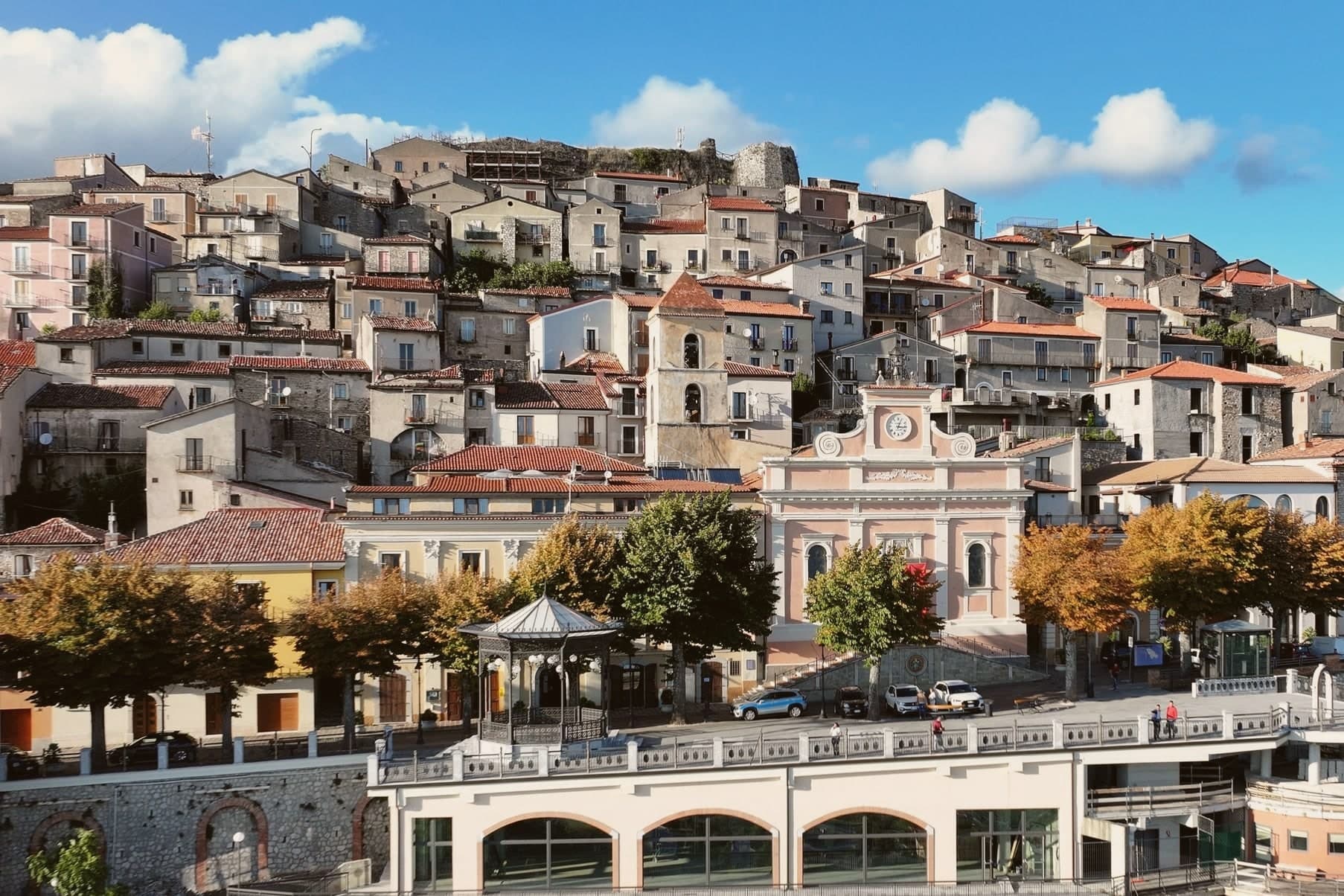
Viggiano sits at 975 meters on a ridge in the Alta Val d'Agri, in the national park. The Santuario della Madonna Nera del Sacro Monte stands at 1,725 meters on the summit above the town: a dark wooden statue of the enthroned Virgin in Byzantine Nikopoia style, the patron saint of Lucania, carried up to the sanctuary on the first Sunday of May and back down to Viggiano on the first Sunday of September.
The procession is the largest religious event in the region. Viggiano is also the historic centre of Italian harp-making and of the arpisti viggianesi, the itinerant harpist musicians who carried Lucanian folk music across Europe and the Americas in the nineteenth century.
The Museo dell'Arpa Vittoria continues the tradition. Beneath the valley floor sits Europe's largest onshore oil field, operated by Eni at the Centro Olio Val d'Agri, producing the majority of Italy's domestic crude.
Bistrot Piano B have been named by a guide.
What to see in Viggiano
- Santuario della Madonna Nera del Sacro Monte. Sanctuary at 1,725 meters on the summit above town, housing the Byzantine-style Black Madonna statue, patron saint of Lucania.
- Museo dell'Arpa Vittoria. Museum dedicated to the Viggiano harp tradition, the Italian folk harp and the itinerant arpisti viggianesi musicians of the nineteenth century.
- Chiesa Madre Santa Maria Assunta. Mother church of the village in the centro storico, the year-round home of the Black Madonna statue between her two annual processions.
How to get to Viggiano
Salerno is roughly 100 minutes away by road.
Our tip
May through October is the festival window. The first Sunday of May opens the year with the Madonna Nera carried from the Chiesa Madre to the Sacro Monte sanctuary; the first Sunday of September brings her back. Both processions fill the ridge with pilgrims from across Lucania. Festa della Madonna Nera falls in September.
Latronico
Why visit Latronico
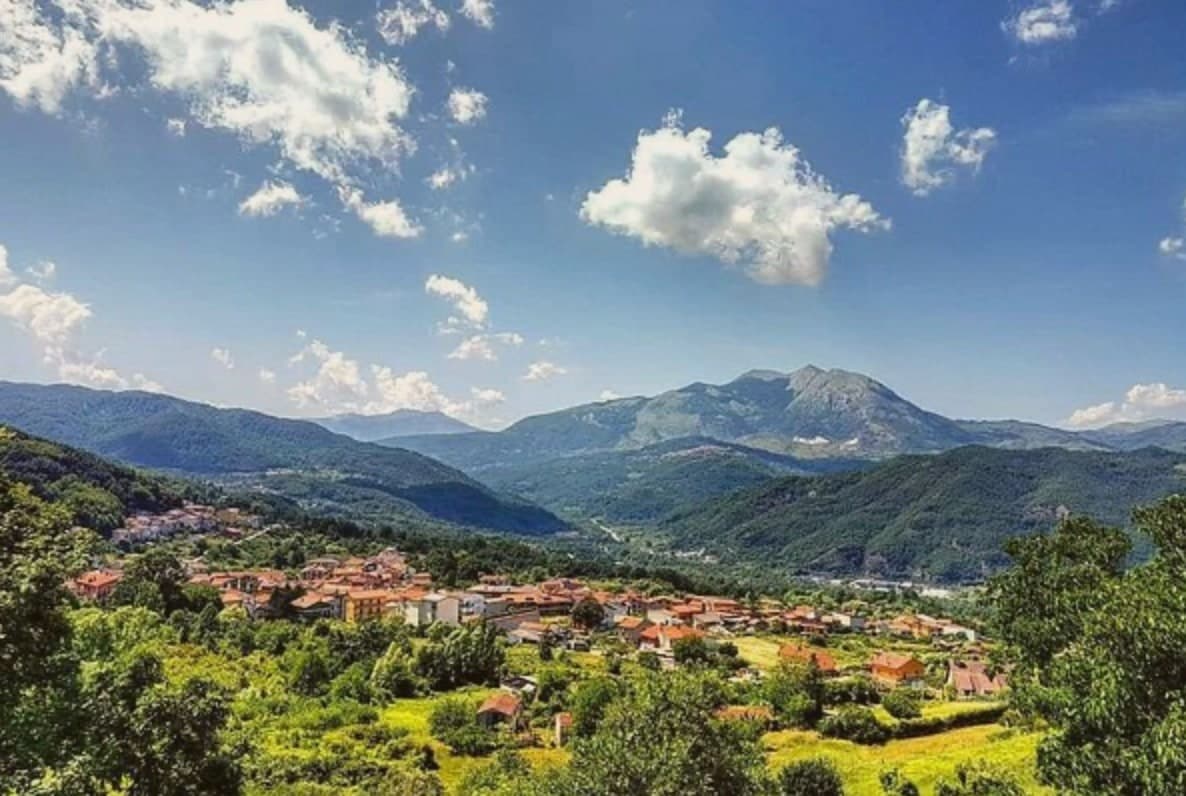
Latronico sits ninety kilometers north of Cosenza, on the northern flank of the park, at an elevation that keeps the town cool in August when the coasts on both seas push past forty. The historic center holds the ridge above the valley, its lanes and stone houses built for that upper ground.
The spa hamlet lies two kilometers below by road, its name meaning hot, a separate settlement tied to the town by that single road and by the water itself. The comune carries three institutional signals at once: national park, thermal town, and a place recognized for how it manages waste, energy and territory inland.
The mountain above, the springs below and the governance in between describe a town that has built its identity on what the ground under it provides, water at a constant temperature and slopes that hold pine forest instead of farmland.
Nonna Vera have been named by a guide.
What to see in Latronico
- Terme Lucane. The Grande Sorgente runs bicarbonate-calcic, the Piccola Sorgente bicarbonate-calcic-sulfurous and slightly radioactive. Archaeological finds around the site attest to prehistoric use of the waters.
- Parco Nazionale del Pollino. Rings the southern half of the comune, old-growth Bosnian pine on the upper slopes and the karst mass of Monte Alpi rising over the trails.
- Monte Alpi. Karst peak at 1,892 meters above the town, reached by trails from the village, a single high massif standing apart from the main Pollino chain.
How to get to Latronico
Salerno is roughly 102 minutes away by road.
Our tip
May through October is the season for Latronico. The Pollino trails open in late spring, the spa runs full hours, and the 888-meter elevation keeps the town cool even in the August heat that crushes the coasts. June, July and September are the strongest months for thermal cures and hiking combined.
Maratea
Why visit Maratea
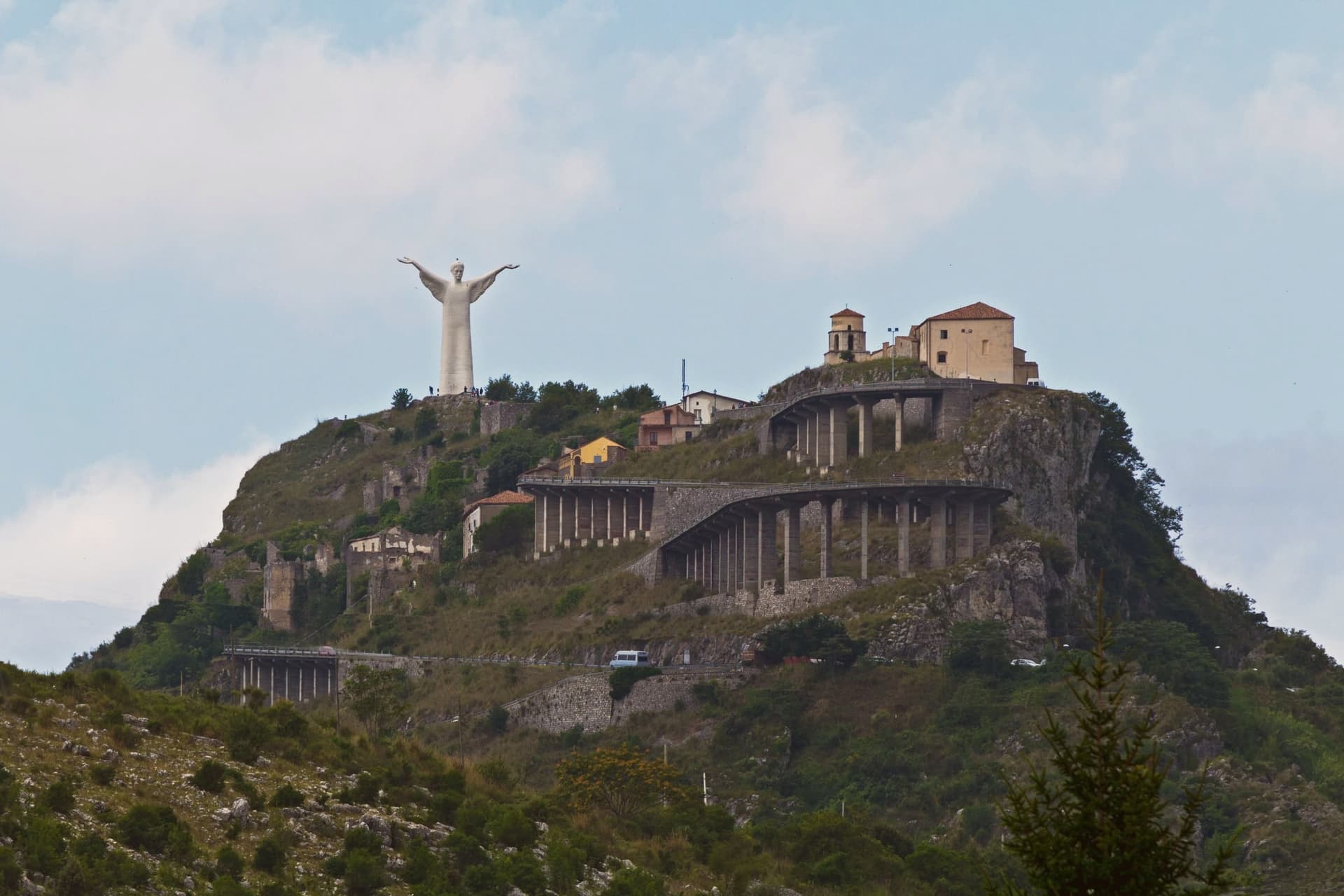
Maratea sits ninety kilometers south of Salerno, on the strip of coast between Campania and Calabria that gives Basilicata its only outlet to the Tyrrhenian. The town is built in layers rather than as a single settlement: the historic centre, Il Borgo, holds the middle ground at three hundred meters on the south slope of the mountain, a few kilometers inland from the water.
Above it, near the summit at 623 meters, the mountain carries both the statue of Christ and, just below it, the sanctuary of the patron saint, the two facing each other rather than out to sea. Higher still, at the very top, are the ruins of Maratea Superiore, the medieval Castello settlement that residents abandoned in favor of the lower borgo.
Below all of this, the comune's thirty-two kilometers of rocky shoreline carry the Bandiera Blu and more than twenty beaches and coves, the only Tyrrhenian coast Basilicata has. The town of forty-four churches is a count that spans not just the borgo but its outlying frazioni, chapels and oratories accumulated over centuries across the whole territory rather than in one place.
What this adds up to is a town stacked vertically from shore to summit, each level, coast, borgo, sanctuary, ruined castello, holding a different age and function of the same settlement rather than a single center with outskirts.
Taverna Rovita, La Cambusa, Cesare and 1 more have been named by a guide.
What to see in Maratea
- Cristo Redentore. Arms outstretched at the summit, the statue faces away from the sea, toward the sanctuary and the inland slopes rather than out over the water it overlooks.
- Basilica di San Biagio. Marian sanctuary at the summit of Monte San Biagio, immediately below the Cristo Redentore, holding relics of the patron saint.
- Il Borgo. Historic centre of Maratea on the south slope of the mountain at 300 meters, with narrow stone lanes and small piazzas typical of an inland coastal town.
How to get to Maratea
There is a railway station in the town, so you can arrive without a car and never need one while you are here. Salerno is roughly 110 minutes away by road.
Our tip
May through September is the season for Maratea. The Tyrrhenian water is swimmable from late May to mid-October. June and September are the strongest months: warm water, lighter crowds, and the kind of clear air that pulls the Calabrian coast into view from the Cristo. Borgo diVino tour falls in September.
Venosa
Why visit Venosa
Venosa sits at 415 meters in the Vulture hills, ninety kilometers east of Salerno. The Romans founded Venusia here in 291 BC as a colony on the Appian Way, and it became the birthplace of Quintus Horatius Flaccus, the poet Horace, in 65 BC.
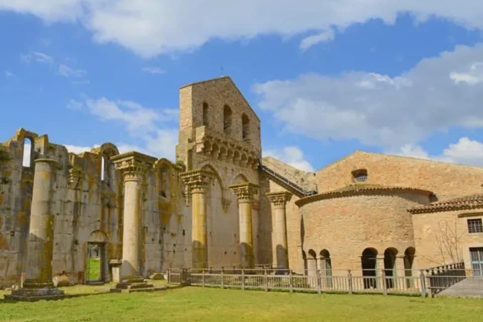
The Parco Archeologico preserves a Roman amphitheater, the baths, and mosaic floors, alongside the so-called Casa di Orazio. Above the ruins stands the Abbazia della Santissima Trinità, an eleventh-century Benedictine complex begun in 1059, with its walls built from blocks salvaged out of the Roman amphitheater next door.
The Incompiuta, the unfinished thirteenth-century cathedral expansion immediately behind the abbey, is roofless and visibly stitched together from Roman fragments. The town centre is dominated by the Castello di Pirro del Balzo, built in 1470 on the foundations of an earlier cathedral and modelled on the Maschio Angioino in Naples.
Venosa is at the heart of the Aglianico del Vulture DOC and DOCG zone, the great red of southern Italy, grown on the volcanic slopes of nearby Monte Vulture.
Al Baliaggio have been named by a guide.
What to see in Venosa
- Abbazia della Santissima Trinità. Benedictine abbey of 1059 with walls built from blocks of the adjacent Roman amphitheater, the spiritual centre of Norman Venosa.
- Incompiuta. Roofless thirteenth-century cathedral expansion behind the abbey of Santissima Trinità, abandoned mid-build, visibly assembled from Roman spolia.
- Castello di Pirro del Balzo. Quadrangular Aragonese castle of 1470 with corner towers, built on the foundations of the earlier cathedral, modelled on Castel Nuovo in Naples.
How to get to Venosa
There is a railway station in the town, so you can arrive without a car and never need one while you are here. Foggia is roughly 70 minutes away by road.
Our tip
April through June is the green window in the Vulture, with cool evenings and the archaeological park empty in the mornings. September and October are dry and gold, the Aglianico harvest runs into November, and the Cantina di Venosa cellars are open for tastings. July and August reach the mid-thirties; visitors retreat to the abbey shade and the wine cellars. Fiera sapori del Sud falls in May.
Melfi
Why visit Melfi
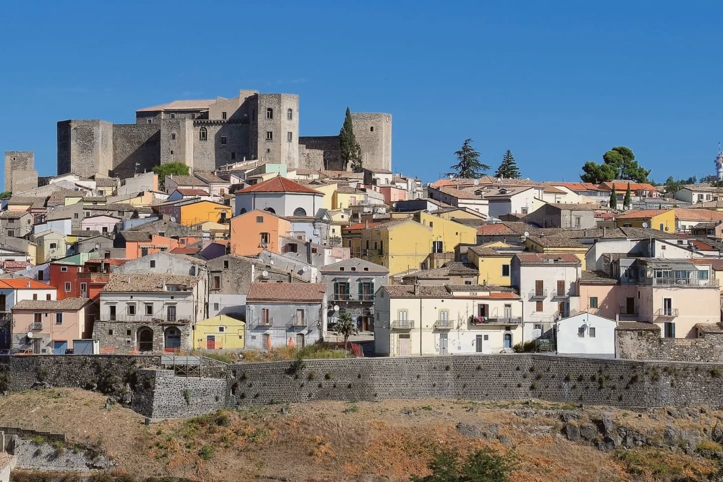
Melfi sits on the slopes of an extinct volcano east of the Apennine spine, the same mass whose crater holds the Laghi di Monticchio and whose soils now define a wine zone. The Hauteville Normans took the town in 1041 and made it the first capital of their southern Italian duchy, a status that explains the density of what followed: a cathedral built within a generation, a castle raised soon after and expanded by an emperor, a legal code drafted within those walls that shaped a kingdom's law.
The walled centro storico spreads below the castle, its gate and noble palazzi still arranged along the lines the Norman-Swabian town laid down. Upper fortress and lower town, volcanic mountain and walled centre: Melfi reads as a place where secular power, church authority and the raw geology of Monte Vulture sat close enough together to shape one small hill town into a seat of empire-level decisions.
La Villa have been named by a guide.
What to see in Melfi
- Castello di Melfi. Late-eleventh-century Norman fortress with ten towers, seven rectangular and three pentagonal. Frederick II expanded it after 1194, and the Constitutions of Melfi were promulgated within its walls.
- Cattedrale di Santa Maria Assunta. Dating from 1056, host of five ecumenical councils between 1059 and 1137. Stands at the heart of the walled centre below the castle.
- Museo Archeologico Nazionale del Vulture-Melfese. Inside the castle, with the second-century Roman sarcophagus of Rapolla and finds from the Daunian, Lucanian and Roman periods.
How to get to Melfi
There is a railway station in the town, so you can arrive without a car and never need one while you are here. Foggia is roughly 55 minutes away by road.
Our tip
April through June and September through October are the best windows in Melfi, with cool evenings and the Aglianico vineyards at their most photogenic. July and August reach the mid-thirties; the castle interiors and the cathedral hold the heat at bay. The Aglianico harvest runs into November and the Cantine and museums stay open. Sagra della castagna Varola falls in October.
More from Anywhere Italy
- The best mountain towns that eat well in the province of Potenza
- The best towns you can reach by train that eat well in Basilicata
- The best towns with a serious restaurant in Basilicata
 The 8 best towns inside a national park in the province of Potenza
- The best high-altitude villages in the province of Potenza
 The 7 prettiest villages in the province of Potenza