
The 8 prettiest small villages in Basilicata
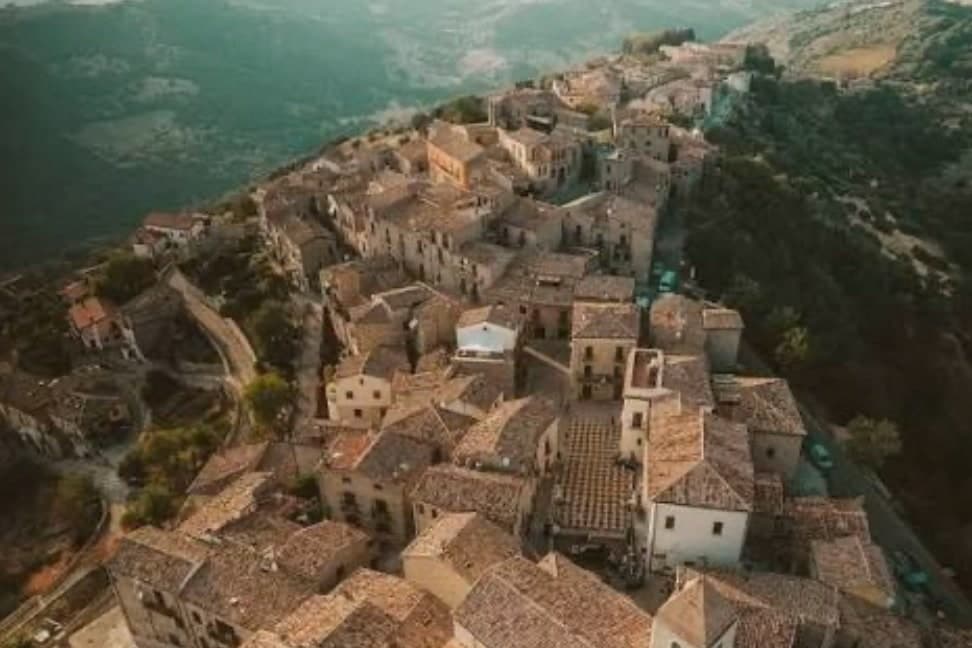
Basilicata is built out of what it stands on: pale tufa, grey limestone, sandstone that goes gold in late afternoon. Villages here hang off ridges above the Basento and the Agri, or look down at olive terraces running towards the Ionian, and the houses stack so tightly that a lane can pass under someone's bedroom. The food follows the altitude, lucanica sausage and peperoni cruschi fried until they shatter, lamb cooked slowly, strong bread from Matera's grain country, and cheeses from flocks that still move between pastures. Spring brings broom and wild orchids to the Lucanian Dolomites; autumn brings chestnuts, mushrooms and the first cold air off the Pollino. Winter is cold up here, and the fires in the older bars are lit for good reason.
Nearly everyone who comes to the region comes for Matera, and the Sassi deserve the attention: rock churches, cave dwellings cut into the ravine, a skyline that photographs like nothing else in Italy. The consequence is that the cruise coaches and the day trips from Puglia arrive on the same schedule, and the belvedere fills by mid-morning between Easter and October. Rooms in the Sassi now cost what rooms in Florence cost. Many visitors see the caves, eat once, and drive back to Bari the same evening, so the rest of Basilicata stays a name on a road sign.
The same stone, the same shepherds' food and the same long views carry on well past Matera, west into the mountains and south towards the sea. Villages on the sandstone pinnacles above the Basento, hill towns on the road to the Pollino, a walled place on the Tyrrhenian coast where the cliffs drop straight into clear water: all of them small, all of them quieter, some reachable only by a road with more bends than straights. Fewer people go, which mostly means the bar knows who you are by the second morning. The towns below have each passed the assessment of the national association of Italy's most beautiful villages, and they are worth the detour off the Matera road.
Of the 31 communes we have mapped in Basilicata, 9 qualify as prettiest villages: each has passed the assessment of the national association of Italy's most beautiful villages. This list is the small ones, 8 in all, ordered smallest first. The smallest, Guardia Perticara, has 517 residents.
If you are still choosing, we have also written The 7 prettiest villages in the province of Potenza and The 10 best hidden hill towns in Basilicata.
Guardia Perticara
Why visit Guardia Perticara
Guardia Perticara sits at 678 meters above the valley of the Sauro stream in the south of the Potenza province, a hundred and twenty kilometers from Cosenza. The Saracens destroyed the earlier settlement in the tenth century; the medieval village that grew up afterward was built almost entirely in the local Gorgoglione sandstone, the warm honey-grey stone that gives the place its name as the paese delle case in pietra, the village of stone houses.
The 1980 Irpinia earthquake damaged most of the settlement. The reconstruction that followed was unusual: rather than concrete, the village was rebuilt block by block in the original stone, with the original portals, stairs, arches and wrought-iron balconies preserved or replaced in kind.
The result became a textbook case of conservation reconstruction, and the village has been used as a film set repeatedly, including for Francesco Rosi's Cristo si è fermato a Eboli and for Basilicata Coast to Coast. Piazza Europa was one of Rosi's main locations.
Guardia Perticara carries Borghi più belli and Bandiera Arancione both.
What to see in Guardia Perticara
- Centro storico in pietra. Medieval village built in Gorgoglione sandstone, rebuilt in kind after the 1980 earthquake, with original portals, stairs, arches and wrought-iron balconies.
- Piazza Europa. Main square at the heart of the village, used as a primary location by Francesco Rosi when filming Cristo si è fermato a Eboli.
- Chiesa Madre di San Nicola. Mother church on the upper village, rebuilt after the 1980 earthquake along with the surrounding stone houses.
How to get to Guardia Perticara
Taranto is roughly 117 minutes away by road.
Our tip
May through October is the window when Guardia Perticara is at its best. The 678-meter elevation keeps the summer heat manageable, and the slanting light on the Gorgoglione stone in late afternoon is the reason photographers come. June and September are the strongest months; July and August are warm but the stone holds the cool of the night well into mid-morning.
Castelmezzano
Why visit Castelmezzano
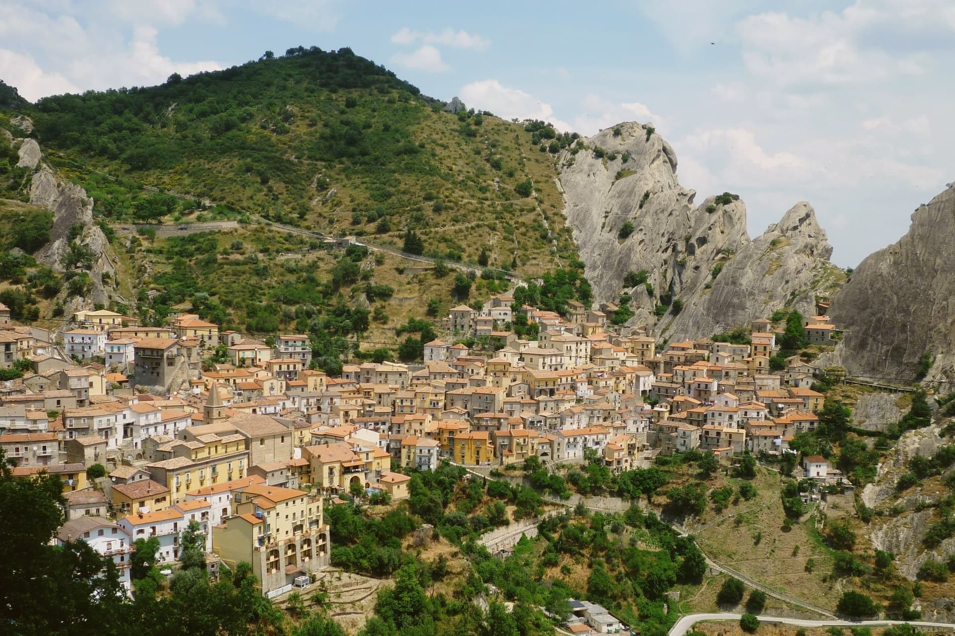
The population is seven hundred and ten, set at 750 meters in a rocky basin that the Dolomiti Lucane close in on every side. The range gives the village its walls before any mason did: houses sit beneath overhangs, lanes climb in stairs cut straight from the sandstone, and the settlement reads as an extension of the rock rather than something built against it.
Castelmezzano and Pietrapertosa face each other across a gorge from opposite ridges within the same Parco Regionale Gallipoli Cognato Piccole Dolomiti Lucane, a shared geology that neither village would present the same way alone. The zipline now formalizes that relationship, its two cables running in either direction between the two ridgelines, the longer at 1,452 meters and speeds reaching one hundred and twenty kilometers per hour.
Castelmezzano carries Borghi più belli and Bandiera Arancione, two of the four highest institutional signals an Italian commune can hold. What holds the place together is the fit between site and settlement: a small population living inside a basin whose sandstone shaped both the old stairs to the watchtower and the new line across the gorge.
What to see in Castelmezzano
- Dolomiti Lucane. Named formations like the Eagle's Beak and the Lion's Mouth rise around the village, forming the basin it sits in.
- Gradinata Normanna. The steps sit above the village, worn into a single monolith, leading up to the watchtower ruin with a view back over the roofs.
- Volo dell'Angelo. A harness sends visitors face-down across the gorge alone or in pairs, the ridge of Pietrapertosa closing fast on the far cable.
How to get to Castelmezzano
Salerno is roughly 110 minutes away by road.
Our tip
May through October is when Castelmezzano works. The Volo dell'Angelo zipline runs from spring to autumn and not in winter, the Dolomiti Lucane trails open in late spring, and the 750-meter elevation keeps July and August manageable even when the rest of Basilicata bakes. June and September are the strongest combination of weather and lighter crowds; July and August book up months in advance for the flight and accommodation.
Pietrapertosa
Why visit Pietrapertosa
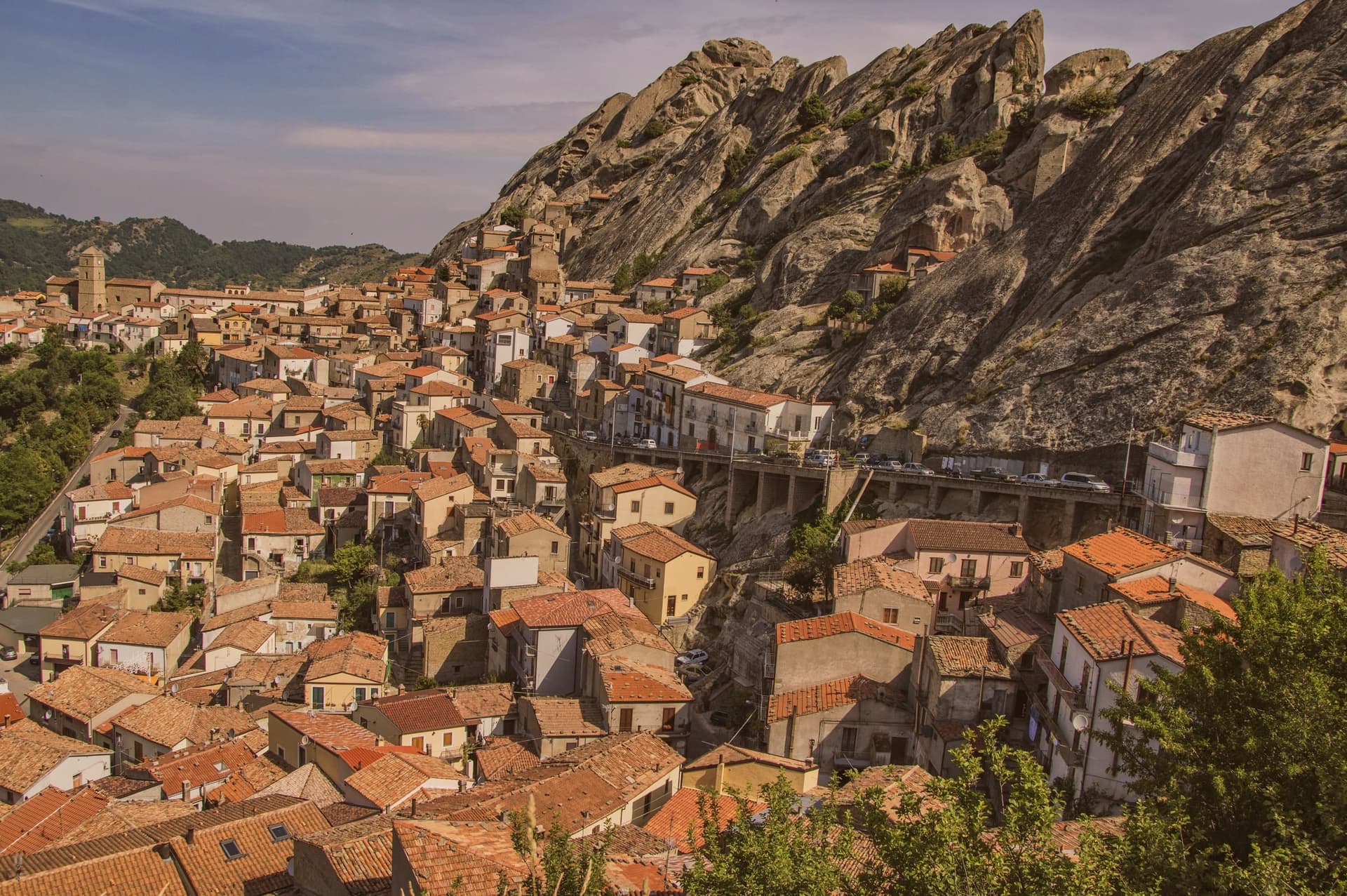
Pietrapertosa sits at 1,088 meters, the highest commune in Basilicata, built directly into the sandstone teeth of the Piccole Dolomiti Lucane inside the Parco Regionale Gallipoli Cognato. The village is so wedded to the rock that several houses share a wall with the cliff.
In the tenth century the fortified settlement was taken by a Saracen band led by a Greek convert to Islam named Luca, who used it as a raiding base across the surrounding valleys until the Catapan of Byzantium pushed him out. The Arabata quarter, the warren of stone houses at the top of the village, still carries his name.
The Castello Saraceno, partly cut into living rock, was later rebuilt by the Normans and Swabians. Pietrapertosa shares its setting with Castelmezzano on the opposite ridge, seven kilometers away, and the two villages are linked by the Volo dell'Angelo, a steel cable that carries passengers between them at speeds touching 120 kilometers per hour.
The Chiesa di San Giacomo Maggiore in the centro preserves its fifteenth-century Romanesque structure.
What to see in Pietrapertosa
- Castello Saraceno. Fortress cut into the sandstone of the Lucanian Dolomites, used by Saracens under Luca in the tenth century, rebuilt by the Normans.
- Rione Arabata. Upper quarter of stone houses tucked into the rock, named for the tenth-century Saracen occupation, the oldest section of the village.
- Chiesa di San Giacomo Maggiore. Fifteenth-century mother church in the centro of Pietrapertosa, the main parish of the village, with a well-preserved Romanesque structure.
How to get to Pietrapertosa
Salerno is roughly 126 minutes away by road.
Our tip
June through September is the high window for Pietrapertosa, with the Volo dell'Angelo open daily, the Gallipoli Cognato trails dry, and the village's 1,088-meter air staying ten degrees below the Lucanian valleys. December through March brings snow on the Dolomiti Lucane ridges, the zipline closes, and the village quiets to its winter population. April, May, October and November are intermediate: cooler hiking days, the zipline running shorter weekends. Sapori D'autunno falls in October.
Acerenza
Why visit Acerenza
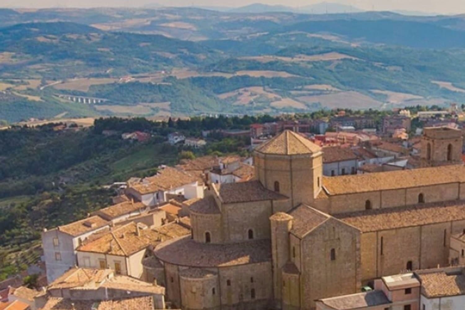
Acerenza stands on a sandstone ridge in the north of the Potenza province, a hundred kilometers inland from Salerno and twenty-two from Venosa. The Romans took it from the Lucanians in 318 BC as Aceruntia; the Ostrogoths and then the Lombards fortified it in turn.
It has been a bishop's seat since at least 499, long before the archbishopric that followed, which places the cathedral at the end of a much longer line of settlement rather than at its start. The town's medieval plan still reads clearly from the square at its summit down to the walls and gates that ring the ridge, the same fortifications raised against the invasions that repeatedly sacked the place.
Vineyards on the slopes below feed the Aglianico produced across the wider area, and the comune holds Città dell'Olio designation alongside its Borghi più belli membership, a working landscape wrapped around a fortified one. The ridge, the walls and the vineyards below them are one continuous piece of geography: a defensible height ringed by the land that has always fed it.
What to see in Acerenza
- Cattedrale di Santa Maria Assunta e San Canio. Nave and two aisles under archbishop Arnaldo of Cluny, with sixteenth-century canvases inside and a marble bust identified as Julian the Apostate set among them.
- Centro storico medievale. Concentric plan typical of a fortified borgo, its gates still standing after repeated sackings through the early Middle Ages.
- Cripta del Ferrillo. Frescoes, columns and bas-reliefs beneath the cathedral floor, built as the chapel of the Ferrillo family.
How to get to Acerenza
There is a railway station in the town, so you can arrive without a car and never need one while you are here. Foggia is roughly 101 minutes away by road.
Our tip
May through October is the window when Acerenza's ridge feels right. Spring and autumn bring clear air across the Vulture and long views toward Monte Vulture itself, the extinct volcano whose slopes carry the Aglianico vineyards. July and August push past thirty degrees but the 833-meter elevation keeps the evenings cool; the centro storico empties between two and six. Natale e sapori ad Acerenza falls in December.
Miglionico
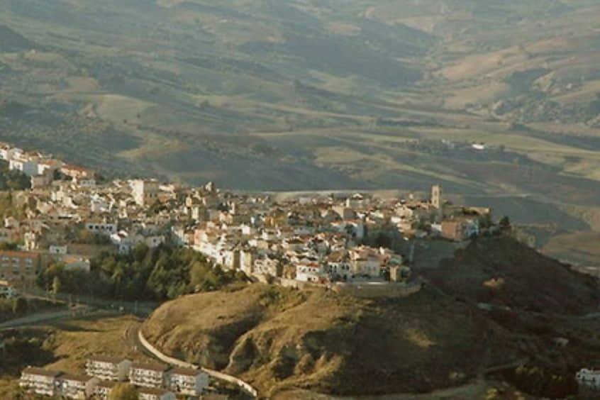
Why visit Miglionico
Miglionico sits at 461 meters on a hill between the Bradano and Basento rivers, twelve kilometers from Matera in the central-eastern Matera province. The town is dominated by the Castello del Malconsiglio, the Castle of the Bad Council, built in the eighth or ninth century, enlarged in 1110 and again in the fifteenth century, with seven towers in a parallelogram plan: some square and oldest, two double towers, and circular towers at the corners.
The castle gave its name and its hall to the Conspiracy of the Barons in 1485, when the Sanseverino and Del Balzo families convened here to plot the overthrow of King Ferdinand I of Aragon. The room where they met is still called the Sala del Malconsiglio, the Hall of Bad Counsel; the conspiracy failed and the families were destroyed.
Miglionico is one of the Borghi più belli d'Italia and carries the Città dell'Olio designation for the olive groves on the surrounding slopes.
What to see in Miglionico
- Castello del Malconsiglio. Castle with seven towers in a parallelogram plan, built in the eighth or ninth century, expanded in 1110 and the fifteenth century, site of the 1485 Conspiracy of the Barons.
- Sala del Malconsiglio. The hall inside the castle where the Sanseverino and Del Balzo families plotted against Ferdinand I of Aragon in 1485; the room from which the castle takes its name.
- Chiesa Madre di Santa Maria Maggiore. Mother church on the high point of the village, with a polyptych by Cima da Conegliano dated 1499, one of Basilicata's finest Renaissance works.
How to get to Miglionico
Bari is roughly 92 minutes away by road.
Our tip
April through June and September into October are the months when Miglionico's ridge feels right. The Castello del Malconsiglio against the Bradano and Basento valleys is at its best in slanting light. July and August push past thirty-five degrees; the centro storico empties between two and seven in the afternoon, though the castle stays open with summer hours. XIX Sagra dei Fichi Secchi e dei Sapori d'Autunno di Miglionico falls in September.
Rivello
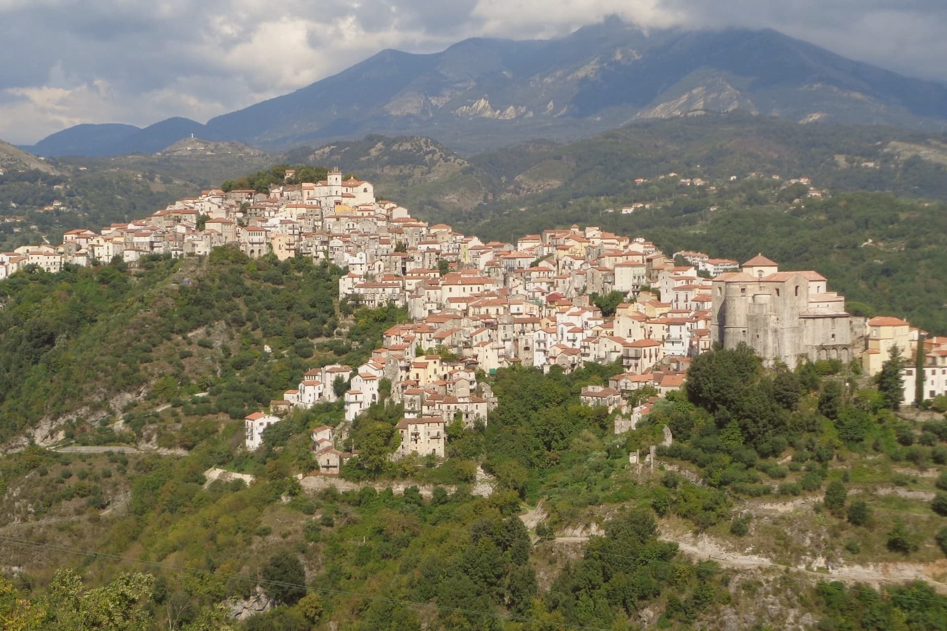
Why visit Rivello
Rivello sits at 479 meters on a ridge above the Noce valley, twenty kilometers inland from Maratea and the Tyrrhenian. The town was disputed between Lombards and Byzantines after the fall of Velia, and its name is read by some as Re-Velia, the place where Velian refugees regrouped.
Both peoples settled here and never fully separated: the ridge organized itself into an upper town and a lower town, and for centuries each pole kept its own church, its own clergy, and its own rite, meeting at the market but not at the altar. The eighteenth century was Rivello's prosperous moment, judging from the parish archives and the stone houses that climb the ridge from that period, including the Baroque work layered onto older Greek-rite foundations in the lower town.
The Pollino park boundary runs nearby, and the belvedere at Passo la Colla looks down on the Gulf of Policastro, a reminder that the ridge, for all its inland feel, sits a short distance from the coast it once helped populate. What the town amounts to is a single street holding two histories that ran side by side for the better part of a millennium before finally merging.
What to see in Rivello
- Convento di Sant'Antonio da Padova. Sixteenth-century Franciscan complex built around a cloister, its frescoes by Giovanni Todisco and Giovanni De Gregorio covering the cloister walls and refectory.
- Chiesa di Santa Maria Maggiore. Upper-town church, plainer in its stonework than its lower-town counterpart, standing at the pole of the ridge that held the Latin congregation.
- Chiesa di San Nicola dei Greci. Lower-town church with Byzantine architectural elements still legible beneath an eighteenth-century reorganisation of the interior.
How to get to Rivello
Salerno is roughly 88 minutes away by road.
Our tip
April through June is the comfortable window, when the Noce valley turns green and the convent frescoes can be viewed without queues. September and October are dry and gold. July and August push toward thirty-five degrees on the ridge, hotter still in the valley, and locals retreat to the Tyrrhenian or the Pollino slopes nearby.
Irsina
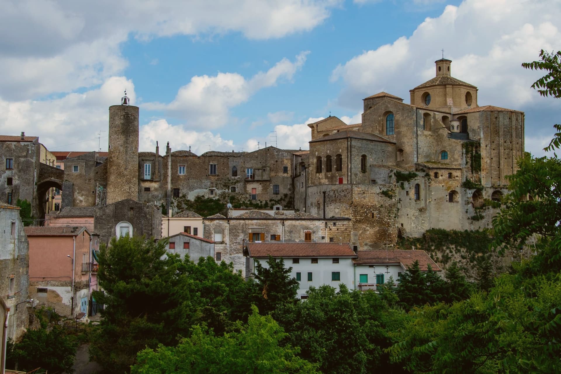
Why visit Irsina
Irsina sits on the border between Basilicata and Puglia, twenty-nine kilometers from Matera, where the Bradano flows below and separates the town from the Murge plateau. The historic centre occupies a tufaceous spur riddled beneath with rupestrian caves and cisterns, a settlement built as much downward as up.
The town's civic and religious history turned on a single commission. Raised to an archbishop's seat in 1452, Montepeloso saw its priest, Roberto de Mabilia, then working as an ecclesiastical notary in Padua, commission a young sculptor from that city to carve a Sant'Eufemia for his home town the following year.
The statue he sent back carries the old town's own coat of arms, the triple mountain and castle, in the saint's hand, binding the imported Renaissance object to the local heraldry it was made to honor. A hill town on a river border ended up holding, by way of a notary's commission to a distant workshop, a devotional statue that ties its Puglia-facing geography to a Veneto hand and its pre-1895 name to the stone the saint holds.
What to see in Irsina
- Cattedrale di Santa Maria Assunta. Thirteenth-century cathedral on the highest point of the borgo. Raised to an archbishop's seat in 1452, it holds the statue as its principal treasure.
- Sant'Eufemia di Mantegna. Carved from Nanto stone of the Veneto, the saint stands with a lion at her side. Identified as Andrea Mantegna's own work in 1996, confirmed by later scholars.
- Ipogei e cantine rupestri. Underground cellars, cisterns and rupestrian rooms cut into the tufaceous spur, reaching beneath the historic centre's alleys and houses.
How to get to Irsina
There is a railway station in the town, so you can arrive without a car and never need one while you are here. Bari is roughly 86 minutes away by road.
Our tip
April through June and September through October are the comfortable months in the Bradano hills, with green wheat fields and dry evenings at 548 meters. July and August touch the mid-thirties on the open spur but stay cool in the rupestrian cellars beneath the centro. November through March is quiet, the cathedral keeps shorter hours and the Mantegna can usually be seen without a queue.
Maratea
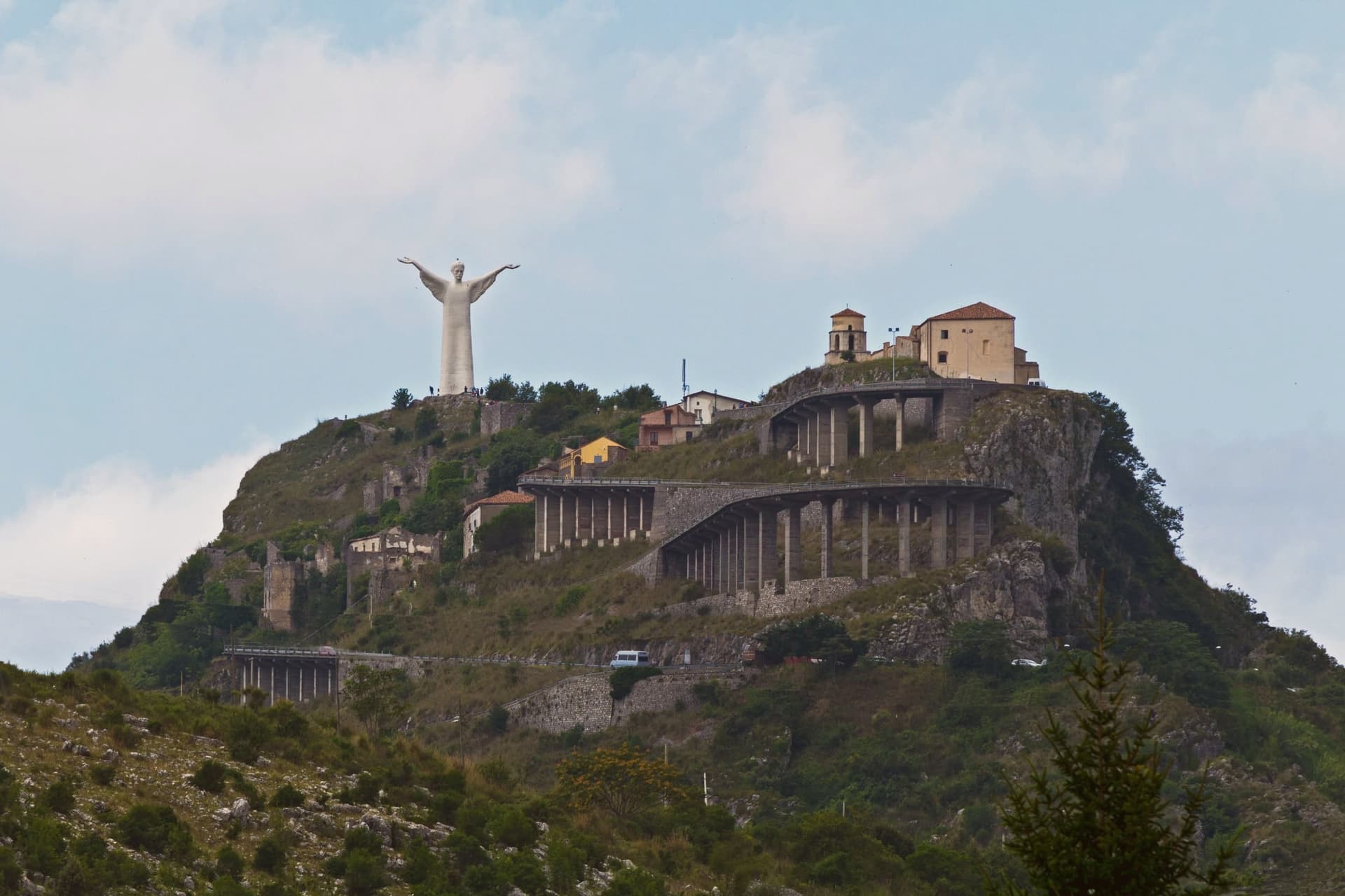
Why visit Maratea
Maratea sits ninety kilometers south of Salerno, on the strip of coast between Campania and Calabria that gives Basilicata its only outlet to the Tyrrhenian. The town is built in layers rather than as a single settlement: the historic centre, Il Borgo, holds the middle ground at three hundred meters on the south slope of the mountain, a few kilometers inland from the water.
Above it, near the summit at 623 meters, the mountain carries both the statue of Christ and, just below it, the sanctuary of the patron saint, the two facing each other rather than out to sea. Higher still, at the very top, are the ruins of Maratea Superiore, the medieval Castello settlement that residents abandoned in favor of the lower borgo.
Below all of this, the comune's thirty-two kilometers of rocky shoreline carry the Bandiera Blu and more than twenty beaches and coves, the only Tyrrhenian coast Basilicata has. The town of forty-four churches is a count that spans not just the borgo but its outlying frazioni, chapels and oratories accumulated over centuries across the whole territory rather than in one place.
What this adds up to is a town stacked vertically from shore to summit, each level, coast, borgo, sanctuary, ruined castello, holding a different age and function of the same settlement rather than a single center with outskirts.
What to see in Maratea
- Cristo Redentore. Arms outstretched at the summit, the statue faces away from the sea, toward the sanctuary and the inland slopes rather than out over the water it overlooks.
- Basilica di San Biagio. Marian sanctuary at the summit of Monte San Biagio, immediately below the Cristo Redentore, holding relics of the patron saint.
- Il Borgo. Historic centre of Maratea on the south slope of the mountain at 300 meters, with narrow stone lanes and small piazzas typical of an inland coastal town.
How to get to Maratea
There is a railway station in the town, so you can arrive without a car and never need one while you are here. Salerno is roughly 110 minutes away by road.
Our tip
May through September is the season for Maratea. The Tyrrhenian water is swimmable from late May to mid-October. June and September are the strongest months: warm water, lighter crowds, and the kind of clear air that pulls the Calabrian coast into view from the Cristo. Borgo diVino tour falls in September.
More from Anywhere Italy
- The 7 prettiest villages in the province of Potenza
 The 10 best hidden hill towns in Basilicata
- The best hidden towns you can reach by train in Basilicata
- The best towns with a food festival in Basilicata
- The best towns you can reach by train that eat well in Basilicata
- The best towns that eat well in the province of Potenza