
The best towns inside a national park in the province of Foggia
The Gargano rises out of the Puglian plain as a hump of white limestone, and almost all of it is national park. Up top there is the Foresta Umbra, ancient beech and holm oak with roads that switchback under closed canopy, and the air noticeably cooler than the coast. Lower down the rock is terraced with olives and citrus, the houses are lime-washed stone with outside stairs, and the fishing platforms called trabucchi stand on stilts over the coves. Late spring and September are the good months: the sea is warm, the orchids are out on the karst, and the almond and lampascioni and podolica cheese turn up on menus that still change with the season.
Most people arrive in Puglia for the trulli and the baroque, so the coach itinerary runs Alberobello, Ostuni, Lecce, and the Gargano gets one afternoon at best. Those places earn their reputation, and in July they are full of it: Alberobello's conical roofs are photographed from a queue, and Ostuni's white ramp of a centre works better in April than in August. The Adriatic beach resorts south of Bari absorb the rest, rows of umbrellas and hotels built for volume.
The limestone does not stop. North of all that, the same coast turns into cliffs, sea stacks and pebble bays inside a protected boundary, with hill towns above them that were here long before anyone came for the swimming. Some of these are known, some are not, and all of them sit within the park, which is why the forest, the falcons and the water are still the point. Fewer people go in the shoulder seasons, when the towns are working rather than performing.
Of the 15 communes we have mapped in the province of Foggia, 8 qualify as towns inside a national park: each sits inside the boundary of a national park. The smallest, Isole Tremiti, has 479 residents.
Elsewhere in the catalogue: The 7 best towns inside a national park that eat well in Puglia and The best towns that eat well in the province of Foggia.
Isole Tremiti
Why visit Isole Tremiti
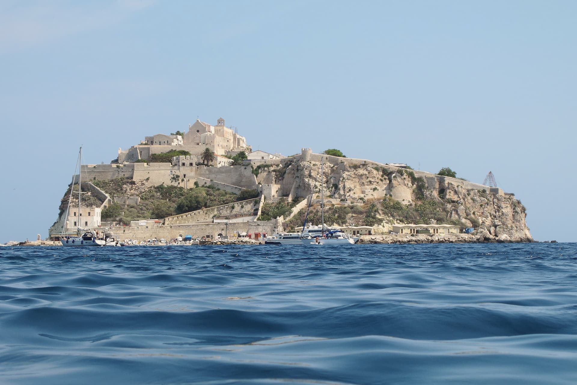
Five islands make up the group: San Domino, the abbey island, Capraia, Cretaccio and Pianosa. Only San Domino and the abbey island are inhabited, with 479 residents between them.
Ancient sources called the group the Insulae Diomedaee, for the Greek hero said to be buried here. The name sits alongside a much later use of the same isolation: for two thousand years the islands have served as a place of confinement, from Libyan resisters in 1911 to Sandro Pertini and the antifascist confinati in the 1920s to six hundred gay men deported here by Mussolini in 1938.
San Domino carries the woods, the one sand beach, and the village above its harbor. The abbey island carries the fortress and the church that once governed the group.
The other three, Capraia, Cretaccio and Pianosa, are uninhabited, with Pianosa the furthest out and the most restricted. The distance that made the archipelago a natural prison for two thousand years is the same distance that now keeps its water among the clearest in the Italian Adriatic.
What to see in Isole Tremiti
- Abbazia di Santa Maria a Mare. The abbey church stands on the high terrace of San Nicola, above the harbor. Inside, a mosaic floor and a polyptych altarpiece survive from the monastery's working centuries.
- Castello dei Badiali. The fortified circuit the Benedictines built around the abbey to hold off pirate raids. Walls and watchtowers remain in place around San Nicola.
- San Domino. Largest and most forested island, with Aleppo pine woods, the only sand beach in the archipelago at Cala delle Arene, and the village above the harbor.
How to get to Isole Tremiti
Our tip
May through September is the only practical window. Ferries from Termoli and Vieste run daily from late May to mid-September, the water warms in June, and the marine reserve handles its peak diving and boat-tour season in July and August. The two inhabited islands are small; San Nicola's abbey village can be walked in an hour, San Domino's pine woods in three. Festa dell'Assunzione e Festa patronale di Santa Assunta falls in August.
Rodi Garganico
Why visit Rodi Garganico
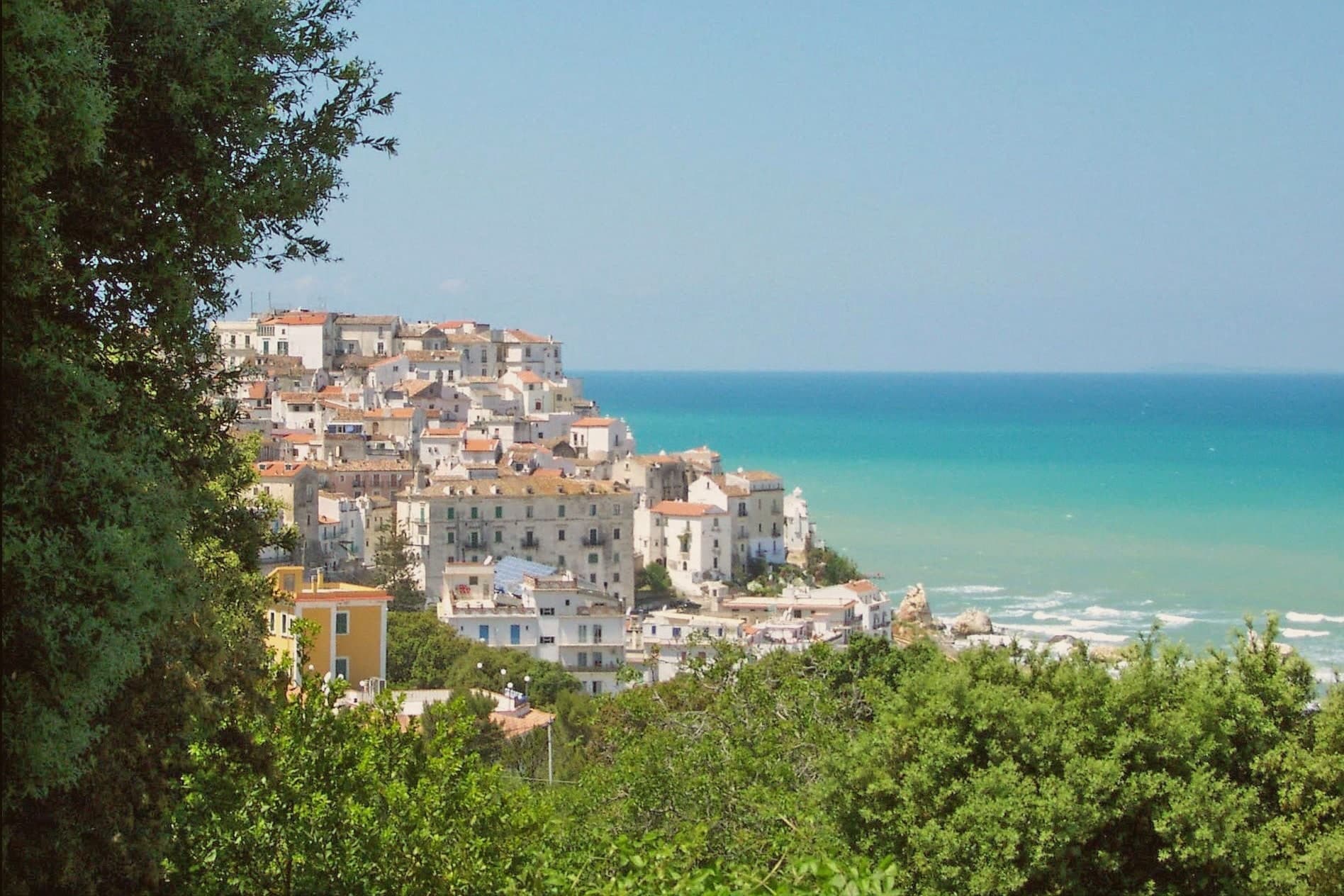
The town sits on a rocky promontory at 42 meters on the northern slope of the Gargano peninsula, inside the national park and east of the Lago di Varano. The early-nineteenth-century historian Michelangelo Manicone connected the founding to the Daunian people; a competing tradition has Greek colonists from Rhodes, the source of the modern name.
Between those two accounts sits a town that reads as both inland hill settlement and coastal outpost, the centro storico climbing the cliff while the terraces drop below it toward the water. The terraced slopes beneath the old town hold the groves that give the place its identity: the Arancia del Gargano and the Limone Femminello del Gargano, both DOP, both grown here since the Middle Ages, the lemon prized for its smooth thin peel and intense aroma.
The Chiesa di San Nicola di Mira keeps a Greek-Byzantine bell tower, a physical remainder of the Gargano's eastern liturgical ties, the same ties that surface in the story of the Madonna della Libera icon, said to have crossed the Adriatic with Venetian refugees after the fall of Constantinople. Long beaches run west and east of the town.
The result is a promontory settlement where citrus terrace, Byzantine trace, and coastline sit within a short walk of one another, each pointing to a different arrival: Daunian or Greek, agricultural, or seaborne and devotional.
What to see in Rodi Garganico
- Santuario della Madonna della Libera. The sanctuary stands above the old town on the promontory edge, the icon inside kept behind the altar the focus of local devotion for centuries.
- Chiesa di San Nicola di Mira. Old parish church with a Greek-Byzantine bell tower, the architectural trace of the Gargano's eastern liturgical past.
- Centro storico. Whitewashed promontory village on the cliff above the Adriatic, narrow stepped lanes dropping toward the harbour and the beaches.
How to get to Rodi Garganico
There is a railway station in the town, so you can arrive without a car and never need one while you are here. Foggia is roughly 94 minutes away by road.
Our tip
May through September is the season the Gargano coast works: warm water, calm Adriatic, the citrus groves green on the terraces above the beaches. June and September are the better months, before and after the August peak when the campsites between Rodi and Peschici fill. July and August push the centre full and the beach parking impossible by ten in the morning. Festeggiamenti di San Rocco falls in August.
Peschici
Why visit Peschici
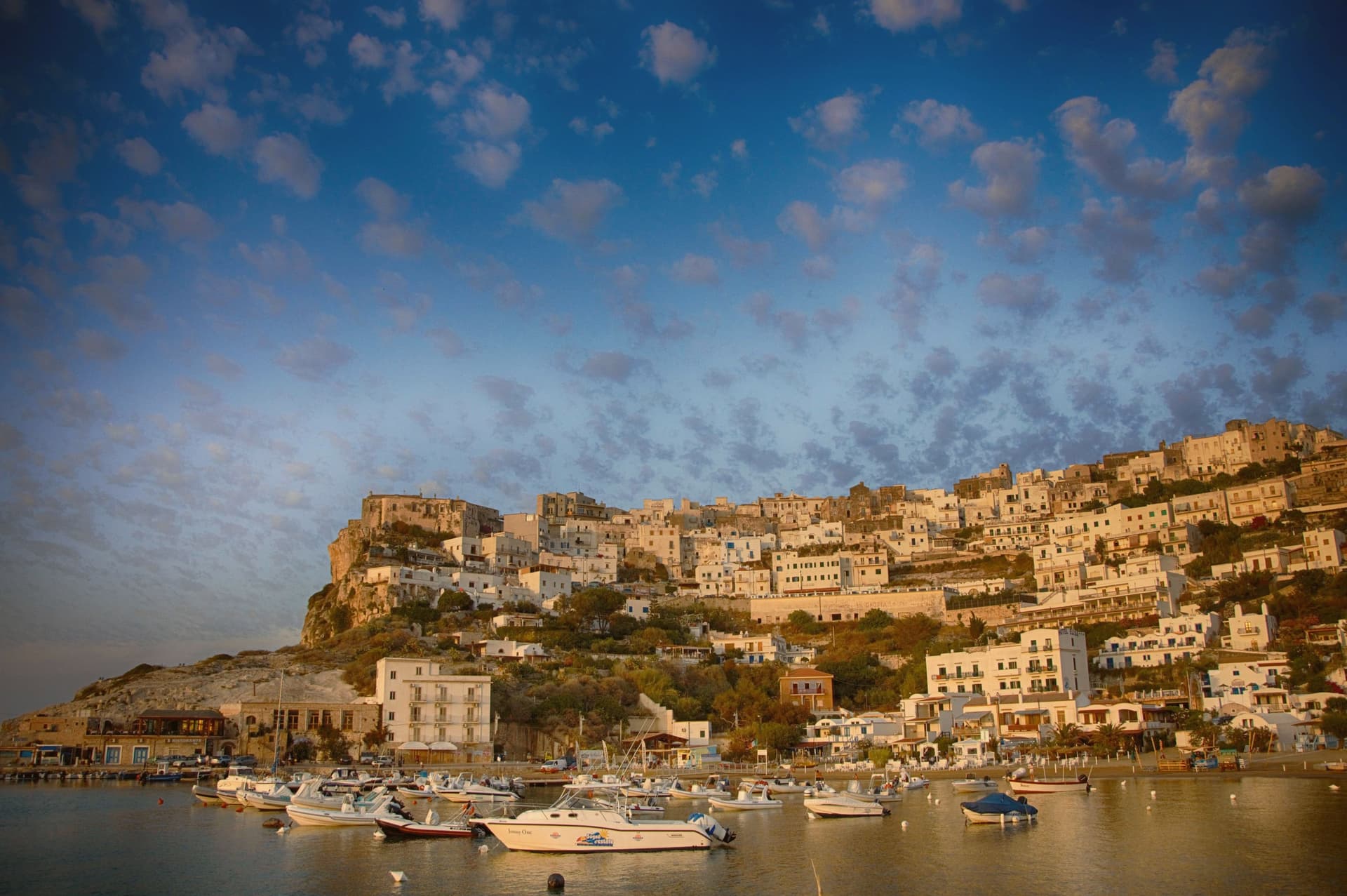
Peschici sits on a karst spur on the northeastern Gargano, 91 meters above the Adriatic, nine kilometers east of San Menaio and nineteen kilometers west of Vieste. The town was founded by the Daunians and later taken by the Romans, and the present village grew up around its cliff-top castle overlooking the small port below.
The municipal territory splits between the built village on its spur and the inland half, which falls within Gargano National Park: karst pine forest and limestone gorges running back from the coast. The coastline itself alternates sandy bays between limestone headlands with cliff sections reachable only from the sea, and the fishing platforms that work this stretch of Adriatic sit on the headlands at both ends of town, timber and rope structures fixed into the rock rather than built up from a harbor.
What holds the place together is the contrast between the white crown of the village, unusual on this coast for its flat and shallow-domed roofs, and the working coast beneath it: a fixed settlement on high ground looking down over a shoreline still worked by hand.
What to see in Peschici
- Castello Normanno-Svevo. Expanded by the Swabians after its Norman origin, the castle stands over the port and is visible from the sea and from inland well before the village itself comes into view.
- Centro storico. White cliff-top village of small whitewashed houses with flat or shallow-domed roofs, unusual on the Gargano, terraced down the karst spur toward the sea.
- Baia di San Nicola. Sandy bay west of the village beneath limestone cliffs, with the small medieval monastery of San Nicola on the headland above the beach.
How to get to Peschici
Foggia is roughly 115 minutes away by road.
Our tip
May through September is the working season, Adriatic water warm enough to swim by late May and the cliff village operational until late. July and August fill the small headland with families from Foggia, Naples and Rome; the town's population multiplies several times and the karst spur runs out of parking by mid-morning. June and September are the sane choices, mild evenings and the same beaches without the crush.
Mattinata
Why visit Mattinata
Mattinata sits at seventy-five meters on the eastern Gargano. The Iapyges, immigrants from Greece and the Balkans, settled the surrounding hills from the fifth century BC; the Roman port of Matinum, on the modern seafront, gave the town its name.
The current settlement is younger than most Garganic centers: it was administered as part of Monte Sant'Angelo until 1955, when it became an independent comune. The town proper sits below the mountain that watches over it, the two bound by the same limestone that runs from the abbey ruins down to the coast.
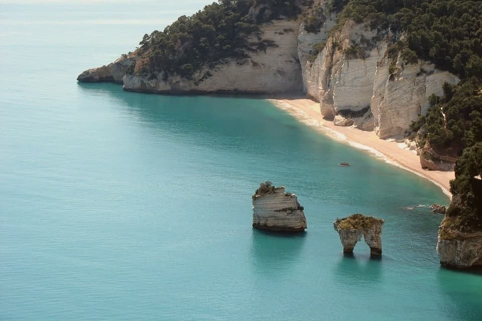
South of town the shoreline drops toward the sea stacks and, ten kilometers further on, the pebble crescent and cliffs of Baia di Vignanotica. The national park covers all of it, mountain, coast and town alike.
A settlement younger than its neighbors, built on ground far older: the Roman port beneath the seafront, the settled hills behind it, the abbey above it, all folded into a comune that has only carried its own name since the middle of the last century.
What to see in Mattinata
- Baia delle Zagare. Bay south of town with two iconic limestone sea stacks, the arch-shaped Arco di Diomede and the scissor-shaped Le Forbici.
- Baia di Vignanotica. Pebble crescent under tall limestone cliffs, reached on foot from the Sentiero dell'Amore from Baia dei Mergoli.
- Monte Sacro and Abbazia della Santissima Trinità. Ruined abbey standing where Benedictine monks raised it to abbey status in 1138, after annexation to the abbey of Siponto brought its abandonment.
How to get to Mattinata
Foggia is roughly 72 minutes away by road.
Our tip
May through September is the season Mattinata runs at full strength. The Adriatic water at Vignanotica and Baia delle Zagare is swimmable from late May, the Monte Sacro trail is at its best when the orchids flower in May and June, and the coastal cliffs catch a long evening light through the summer. July and August push past thirty degrees and fill the beaches; the boat shuttle to the faraglioni is the easier access.
Vico del Gargano
Why visit Vico del Gargano
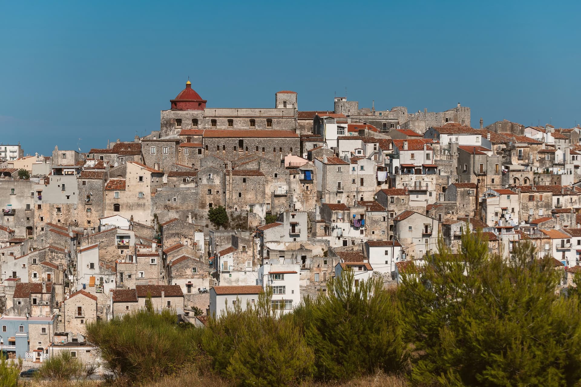
The town sits at 445 meters on a rocky promontory, with the territory falling from the 782-meter heights of the forest above to the beaches of the coastal frazioni below. The first urban core, called Vicus, was founded around 970 by Sueripolo of the Slavonians on land granted by Byzantine authorities, the seed from which the hill town and its later defenses grew.
The upper town, walled and towered, holds the historic center and its churches close around the castle, while the citrus terraces step down from that core toward the sea, and the coastal frazioni mark where the descent ends at the Adriatic. Inland forest, hill town, and coast form one continuous drop in elevation rather than three separate places.
What holds this together is the shape of the ground itself: a settlement founded on a promontory has simply grown downward over the centuries, from Byzantine grant to Norman wall to citrus terrace to shoreline, each layer sitting on the one before it.
What to see in Vico del Gargano
- Castello Normanno-Svevo. Eleventh-century Norman castle enlarged in 1240 by Frederick II and again in 1292, the anchor of the medieval defensive system of twenty towers and walls.
- Centro storico e Vicolo del Bacio. Medieval old town of about thirteen churches and chapels, with the Kiss Alley, a passage so narrow that walking it touching is the local prescription for lasting love. The survival of this core and the density of the olive mills below it earned the town a place among the Borghi più belli d'Italia.
- Foresta Umbra. Beech and oak ancient forest of Gargano National Park, reaching 830 meters within the municipal territory, with trails to centuries-old turkey oaks.
How to get to Vico del Gargano
There is a railway station in the town, so you can arrive without a car and never need one while you are here. Foggia is roughly 99 minutes away by road.
Our tip
April through June and September through October are the months Vico is at its best: the citrus groves in flower or in fruit, the Foresta Umbra in green or autumn rust, and the centro storico mild at 445 meters while the coast below stays swimmable. July and August are hot on the coast and busy at San Menaio; the centro keeps a few degrees cooler than the beach. The Saint Valentine feast on February 14 turns the village into a pilgrimage and a wedding stage.
Monte Sant'Angelo
Why visit Monte Sant'Angelo
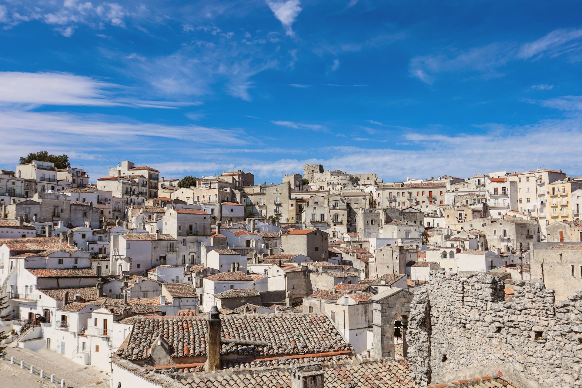
The town sits at 843 meters on the southern slope of the Gargano promontory, the highest inhabited settlement in the massif, with the Adriatic visible to the east on clear days. It is built around a cave where, according to tradition, the Archangel Michael appeared to the bishop of Siponto in 490.
A first sanctuary was raised over the cave in 493, and by the seventh century the Lombards of the Duchy of Benevento had made it the principal Michaeline shrine in the West and a fixed stop on the pilgrimage route to Jerusalem now called the Via Sacra Langobardorum. UNESCO inscribed the site in 2011 as one of seven sites in the serial property 'Longobards in Italy: Places of Power (568-774 A.D.)'.
The town itself steps down from the castle at its highest point through the sanctuary at its center to Rione Junno below, the old pilgrim quarter of stepped alleys and single-pitch roofs that housed the people who served the shrine. Beyond the commune, beech and oak forest of the Gargano National Park closes in on all sides.
What stands today is a settlement shaped entirely around one act of devotion, its layers of castle, cave, and quarter marking who came to guard, worship, and house the pilgrimage rather than any separate reason for a town to exist here at all.
What to see in Monte Sant'Angelo
- Santuario di San Michele Arcangelo. The cave sits at the heart of town, reached by descending stone stairs into rock that has been a shrine since the fifth century. Archangel Michael is said to have appeared here, and the sanctuary that grew around the site remains the town's core.
- Castello di Monte Sant'Angelo. Norman-Swabian-Aragonese castle above the sanctuary, expanded over five centuries on the highest point of the town, with views across the Gargano.
- Tomba di Rotari. Twelfth-century baptistery near the sanctuary, long misidentified as the tomb of the Lombard king Rotari, a fragment of the older religious complex.
How to get to Monte Sant'Angelo
Foggia is roughly 73 minutes away by road.
Our tip
May through October is the working season at 843 meters: cool mornings, dry afternoons, the sanctuary cave naturally cold year-round. June through August stay around twenty-six to twenty-nine degrees in town while Foggia bakes at thirty-eight on the Tavoliere below. The Festa di San Michele on 29 September is the patronal day and the busiest moment in the sanctuary calendar; pilgrims walk the final stretch of the Via Sacra from Siponto.
Vieste
Why visit Vieste
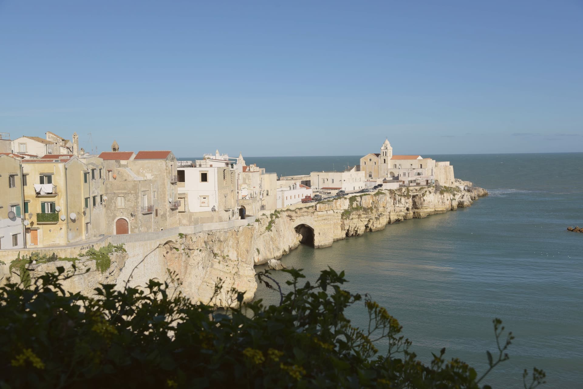
Vieste sits at the eastern tip of the Gargano promontory inside Gargano National Park, a medieval town on a white limestone cliff dropping straight into the Adriatic. The Cathedral was begun in the second half of the eleventh century in Apulian Romanesque, with three naves on two rows of six columns and capitals carved in oriental floral and animal motifs.
The Norman castle of the eleventh century was rebuilt by Frederick II in 1242 as part of a coastal fortification line; the trapezoidal block of 1242 still anchors the headland. On July 18-21, 1554, the Ottoman corsair Dragut sacked the town and executed roughly 5,000 inhabitants on the slab of stone now known as the Chianca Amara, the bitter stone, set into the lane that carries the memory.
Pizzomunno, the 26.6-meter limestone sea stack on Spiaggia del Castello, is the symbol of the Gargano and the centerpiece of a local legend about a fisherman whose lover was taken by sirens. The Bandiera Blu marks the water at Pizzomunno, Scialmarino and Lungomare Mattei.
What to see in Vieste
- Cattedrale di Santa Maria Assunta. Eleventh-century Apulian Romanesque cathedral, three naves on two rows of six columns, with Corinthian and cubic capitals carved in zoomorphic and floral motifs.
- Castello Svevo. Norman fortress rebuilt by Frederick II in 1242 on the headland above the sea, part of the Hohenstaufen Adriatic defensive line, still anchoring the old town.
- Pizzomunno. Limestone sea stack 26.6 meters high on Spiaggia del Castello, the symbol of Vieste and the Gargano, attached to the legend of the fisherman and his stolen lover.
How to get to Vieste
Foggia is roughly 109 minutes away by road.
Our tip
May, June, September and the first half of October are the windows when Vieste works without the heat or the August crowd: warm Adriatic, breezy headland, the centro storico walkable in afternoon as well as evening. July and August are very hot and crowded, with the Bandiera Blu beaches at capacity and rates at peak; the centro storico empties between two and five and refills after sunset for the passeggiata. October still holds for swimming on the south-facing beaches.
San Giovanni Rotondo
Why visit San Giovanni Rotondo
San Giovanni Rotondo sits at 565 meters on the slopes of Monte Calvo, inside the national park that carries the Gargano's name. The town itself is named for an eleventh-century baptistery, round in shape and dedicated to John the Baptist, built over what may have been a Roman temple to Janus: the round form and the double dedication are the origin the name still points to.
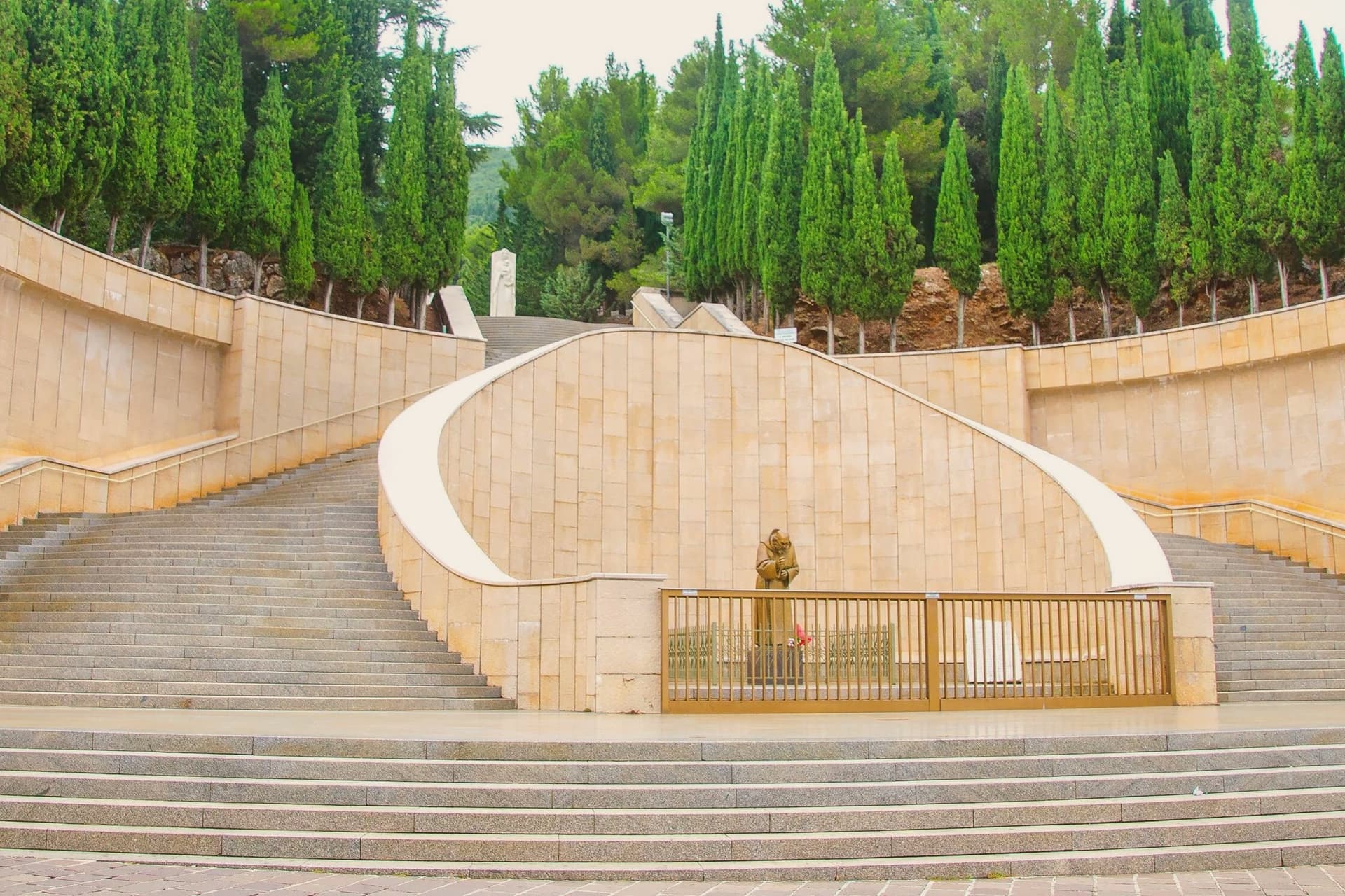
The medieval centro storico gathers around that baptistery, a village of one scale and one era. The contemporary town is built at another scale entirely, around the convent, the sanctuary and the hospital, all raised in the twentieth century and all tied to the same friar.
The two parts of the town sit close together but belong to different centuries: an eleventh-century core that gave the place its name, and a twentieth-century expansion that gave it its purpose. What draws six million visits a year is not the old village but what grew up beside it.
What to see in San Giovanni Rotondo
- Santuario di San Pio da Pietrelcina. Copper roofing over the stone arches is meant to oxidize green over decades, a slow change on a building already built at monumental scale.
- Convento di Santa Maria delle Grazie. The convent where Padre Pio lived from 1916 to 1968; its old and new churches stand side by side, one building added to another rather than replacing it.
- Cripta di San Pio. The lower crypt of the new sanctuary holds the preserved body of Padre Pio, the focus of the pilgrimage and the point most of the six million annual visits are made toward.
How to get to San Giovanni Rotondo
Foggia is roughly 41 minutes away by road.
Our tip
April through June and September through October are the better months on the Gargano interior: cool altitude, dry air, the pilgrim crowds manageable. July and August push above thirty-three degrees and the queues at the crypt of San Pio stretch around the building; midsummer is the peak pilgrimage season. The Feast of San Pio on 23 September draws the largest single-day crowd of the year.
More from Anywhere Italy
- The 7 best towns inside a national park that eat well in Puglia
 The best towns that eat well in the province of Foggia
 The best hill towns inside a national park in Puglia
- The best hidden beach towns in Puglia
- The best hidden coastal towns that eat well in Puglia
 The best hidden olive oil towns in Puglia