
The best olive oil towns inside a national park in Puglia
Puglia produces more olive oil than anywhere else in Italy, and the good stuff comes from trees older than most of the churches around them, gnarled coratina and ogliarola growing straight out of red soil and cracked limestone. In autumn the nets go down under the branches, the mills run late, and the new oil is served on bread with nothing else, bitter at the back of the throat and green enough to stain the plate. The towns here are built from the same pale stone as the walls that divide the fields, tufo and calcare cut into low houses, courtyards, whitewash. Winter brings almond blossom to the Murgia, summer brings heat that empties the piazzas until dusk, and the food follows: fava and chicory, orecchiette, lamb roasted over vine cuttings.
Most people who come to Puglia for the landscape go to the Valle d'Itria and Alberobello, where the trulli fill car parks from Easter until October and the olive groves around Ostuni have been photographed to exhaustion. It is good country, and it is also the part of the region that every tour bus has agreed on. Prices in the Itria towns now match the coast in August, and the mills that take visitors book out weeks ahead.
The olive country does not stop there. It carries north across the Alta Murgia, a national park of stone-strewn grassland and shepherds' tracks, and east into the Gargano, where the groves climb from the sea into the Foresta Umbra and some of the trees are counted among the oldest in Europe. The towns in this list sit inside those parks, all of them recognised nationally for their oil, and fewer people go.
Of the 59 communes we have mapped in Puglia, 6 qualify as olive oil towns inside a national park: each belongs to the national association of olive-oil towns, and each sits inside a national park. The smallest, Mattinata, has 5,976 residents.
Two more lists worth reading alongside this one: The 7 best towns inside a national park that eat well in Puglia and The best hill towns inside a national park in Puglia.
Mattinata
Why visit Mattinata
Mattinata sits at seventy-five meters on the eastern Gargano. The Iapyges, immigrants from Greece and the Balkans, settled the surrounding hills from the fifth century BC; the Roman port of Matinum, on the modern seafront, gave the town its name.
The current settlement is younger than most Garganic centers: it was administered as part of Monte Sant'Angelo until 1955, when it became an independent comune. The town proper sits below the mountain that watches over it, the two bound by the same limestone that runs from the abbey ruins down to the coast.
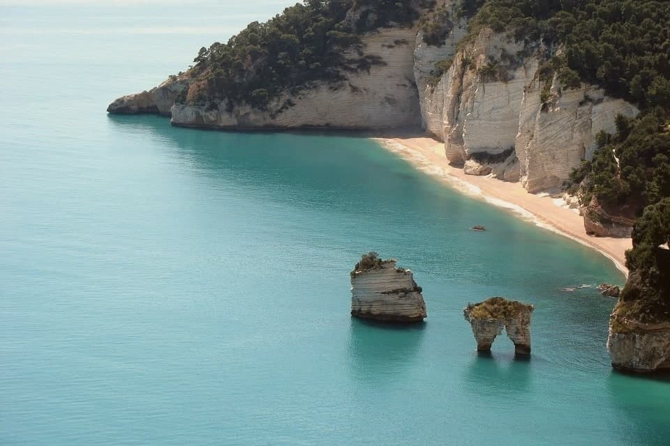
South of town the shoreline drops toward the sea stacks and, ten kilometers further on, the pebble crescent and cliffs of Baia di Vignanotica. The national park covers all of it, mountain, coast and town alike.
A settlement younger than its neighbors, built on ground far older: the Roman port beneath the seafront, the settled hills behind it, the abbey above it, all folded into a comune that has only carried its own name since the middle of the last century.
La Locanda del Maniscalco have been named by a guide.
What to see in Mattinata
- Baia delle Zagare. Bay south of town with two iconic limestone sea stacks, the arch-shaped Arco di Diomede and the scissor-shaped Le Forbici.
- Baia di Vignanotica. Pebble crescent under tall limestone cliffs, reached on foot from the Sentiero dell'Amore from Baia dei Mergoli.
- Monte Sacro and Abbazia della Santissima Trinità. Ruined abbey standing where Benedictine monks raised it to abbey status in 1138, after annexation to the abbey of Siponto brought its abandonment.
How to get to Mattinata
Foggia is roughly 72 minutes away by road.
Our tip
May through September is the season Mattinata runs at full strength. The Adriatic water at Vignanotica and Baia delle Zagare is swimmable from late May, the Monte Sacro trail is at its best when the orchids flower in May and June, and the coastal cliffs catch a long evening light through the summer. July and August push past thirty degrees and fill the beaches; the boat shuttle to the faraglioni is the easier access.
Vico del Gargano
Why visit Vico del Gargano
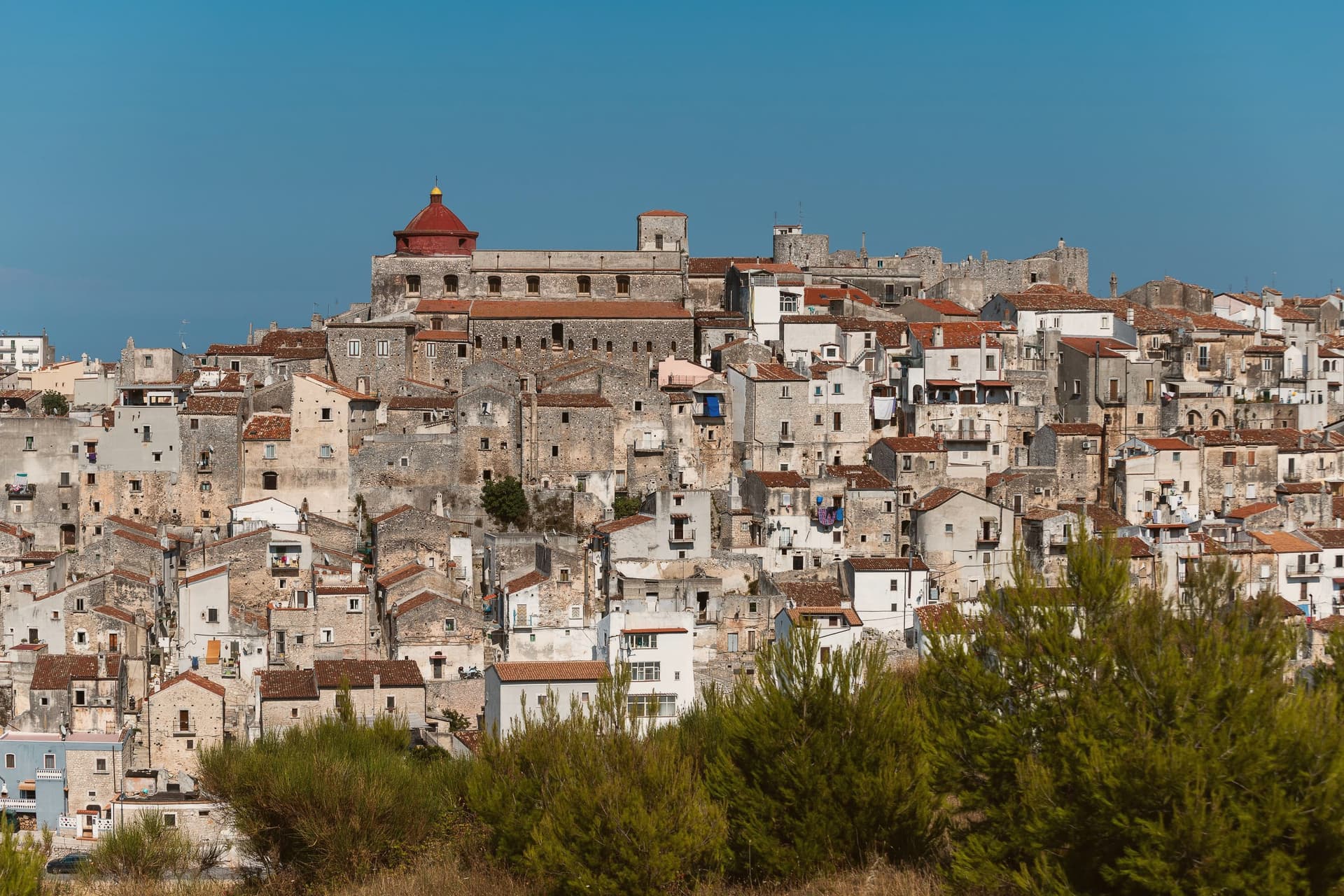
The town sits at 445 meters on a rocky promontory, with the territory falling from the 782-meter heights of the forest above to the beaches of the coastal frazioni below. The first urban core, called Vicus, was founded around 970 by Sueripolo of the Slavonians on land granted by Byzantine authorities, the seed from which the hill town and its later defenses grew.
The upper town, walled and towered, holds the historic center and its churches close around the castle, while the citrus terraces step down from that core toward the sea, and the coastal frazioni mark where the descent ends at the Adriatic. Inland forest, hill town, and coast form one continuous drop in elevation rather than three separate places.
What holds this together is the shape of the ground itself: a settlement founded on a promontory has simply grown downward over the centuries, from Byzantine grant to Norman wall to citrus terrace to shoreline, each layer sitting on the one before it.
Eco del Mare have been named by a guide.
What to see in Vico del Gargano
- Castello Normanno-Svevo. Eleventh-century Norman castle enlarged in 1240 by Frederick II and again in 1292, the anchor of the medieval defensive system of twenty towers and walls.
- Centro storico e Vicolo del Bacio. Medieval old town of about thirteen churches and chapels, with the Kiss Alley, a passage so narrow that walking it touching is the local prescription for lasting love. The survival of this core and the density of the olive mills below it earned the town a place among the Borghi più belli d'Italia.
- Foresta Umbra. Beech and oak ancient forest of Gargano National Park, reaching 830 meters within the municipal territory, with trails to centuries-old turkey oaks.
How to get to Vico del Gargano
There is a railway station in the town, so you can arrive without a car and never need one while you are here. Foggia is roughly 99 minutes away by road.
Our tip
April through June and September through October are the months Vico is at its best: the citrus groves in flower or in fruit, the Foresta Umbra in green or autumn rust, and the centro storico mild at 445 meters while the coast below stays swimmable. July and August are hot on the coast and busy at San Menaio; the centro keeps a few degrees cooler than the beach. The Saint Valentine feast on February 14 turns the village into a pilgrimage and a wedding stage.
Minervino Murge
Why visit Minervino Murge
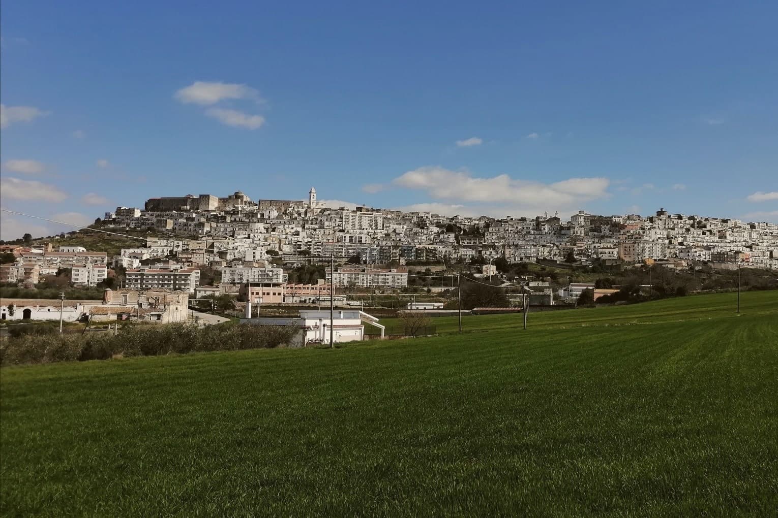
The town is built on two hills at the western edge of the Murgia plateau, where the limestone tableland gives out and the ground drops toward lower country on three sides. That break is what gives the ridge its long view and its nickname: to the east the eye crosses Murgia limestone toward the Gargano and the Adriatic, to the west it crosses cultivated fields into Basilicata, and to the north it runs the length of the Ofanto valley.
The old town sits above this drop, castle and tower on the high ground, cathedral below, the settlement organized around the same ridge that draws the view. Olive oil, almonds and grain define the rural economy beyond the walls, the plateau put to farming where it is not left to steppe grass and karst.
A ridge town, in other words, whose whole character, defensive site, pilgrimage cave, farmed hinterland, follows from the one geological fact of where the plateau ends.
La Tradizione - Cucina Casalinga, Masseria Barbera, A Sud dell'Anima have been named by a guide.
What to see in Minervino Murge
- Castello Normanno-Svevo. Norman fortress remodeled in the baronial period, with surviving towers and bastions on the high ridge above the old town.
- Torre di Pirro del Balzo. Fifteenth-century tower built between 1460 and 1490 when Minervino came to Pirro del Balzo as part of Maria Donata's dowry.
- Grotta di San Michele. Cave formed roughly two million years ago, reached through the karst rather than built, and still kept as a place of pilgrimage rather than display.
How to get to Minervino Murge
There is a railway station in the town, so you can arrive without a car and never need one while you are here. Foggia is roughly 62 minutes away by road.
Our tip
April through June and September through October are the months the Alta Murgia plateau runs best. The wildflower steppe peaks in May, almond blossom comes earlier in February, and the Ofanto valley below stays mild through autumn. July and August push past thirty-five degrees on the limestone with little shade; the centro storico empties between two and five and the panoramic belvedere is best at dawn or dusk.
Vieste
Why visit Vieste
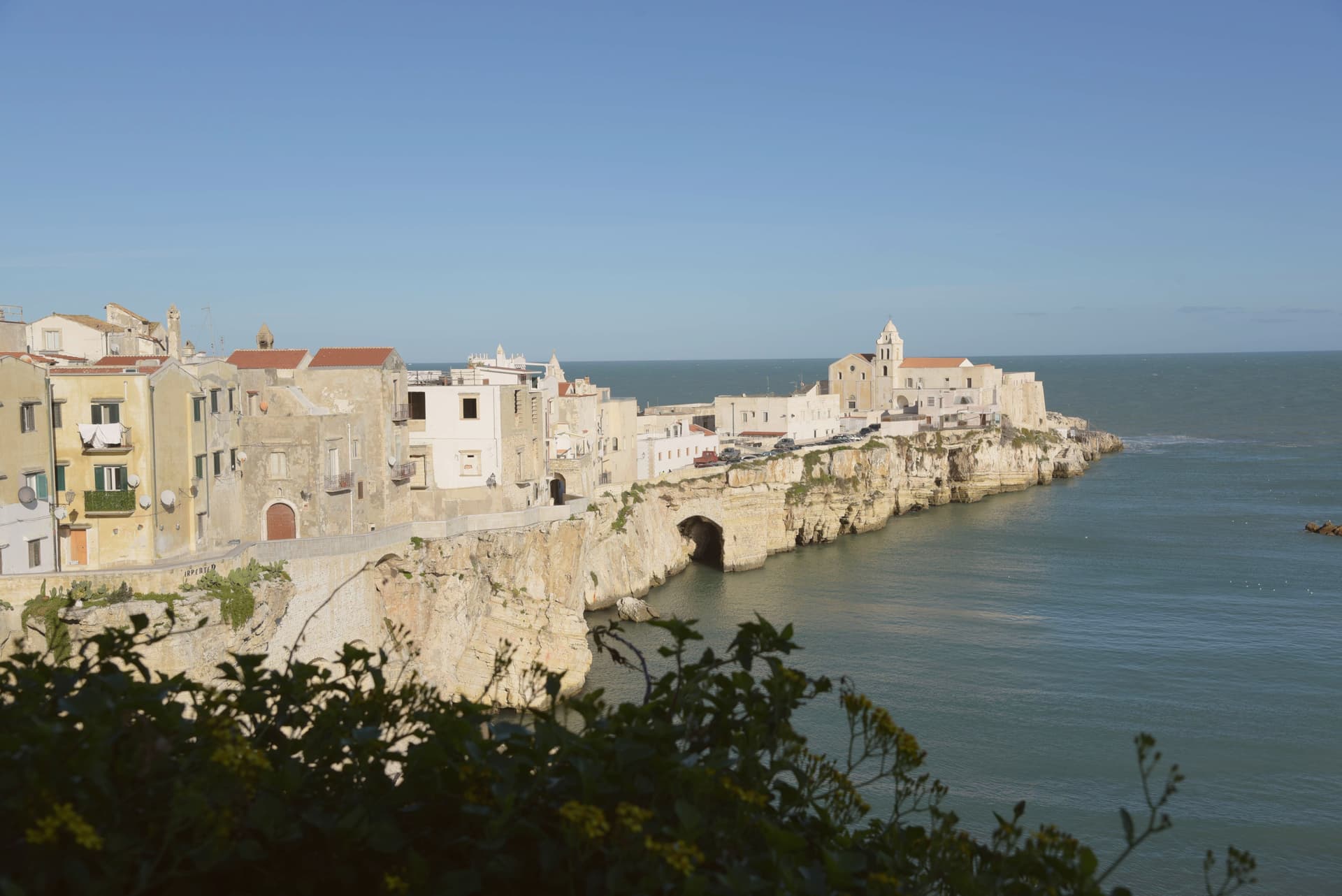
Vieste sits at the eastern tip of the Gargano promontory inside Gargano National Park, a medieval town on a white limestone cliff dropping straight into the Adriatic. The Cathedral was begun in the second half of the eleventh century in Apulian Romanesque, with three naves on two rows of six columns and capitals carved in oriental floral and animal motifs.
The Norman castle of the eleventh century was rebuilt by Frederick II in 1242 as part of a coastal fortification line; the trapezoidal block of 1242 still anchors the headland. On July 18-21, 1554, the Ottoman corsair Dragut sacked the town and executed roughly 5,000 inhabitants on the slab of stone now known as the Chianca Amara, the bitter stone, set into the lane that carries the memory.
Pizzomunno, the 26.6-meter limestone sea stack on Spiaggia del Castello, is the symbol of the Gargano and the centerpiece of a local legend about a fisherman whose lover was taken by sirens. The Bandiera Blu marks the water at Pizzomunno, Scialmarino and Lungomare Mattei.
Al Dragone, Donlù, La Ripa and 1 more have been named by a guide.
What to see in Vieste
- Cattedrale di Santa Maria Assunta. Eleventh-century Apulian Romanesque cathedral, three naves on two rows of six columns, with Corinthian and cubic capitals carved in zoomorphic and floral motifs.
- Castello Svevo. Norman fortress rebuilt by Frederick II in 1242 on the headland above the sea, part of the Hohenstaufen Adriatic defensive line, still anchoring the old town.
- Pizzomunno. Limestone sea stack 26.6 meters high on Spiaggia del Castello, the symbol of Vieste and the Gargano, attached to the legend of the fisherman and his stolen lover.
How to get to Vieste
Foggia is roughly 109 minutes away by road.
Our tip
May, June, September and the first half of October are the windows when Vieste works without the heat or the August crowd: warm Adriatic, breezy headland, the centro storico walkable in afternoon as well as evening. July and August are very hot and crowded, with the Bandiera Blu beaches at capacity and rates at peak; the centro storico empties between two and five and refills after sunset for the passeggiata. October still holds for swimming on the south-facing beaches.
Cassano delle Murge
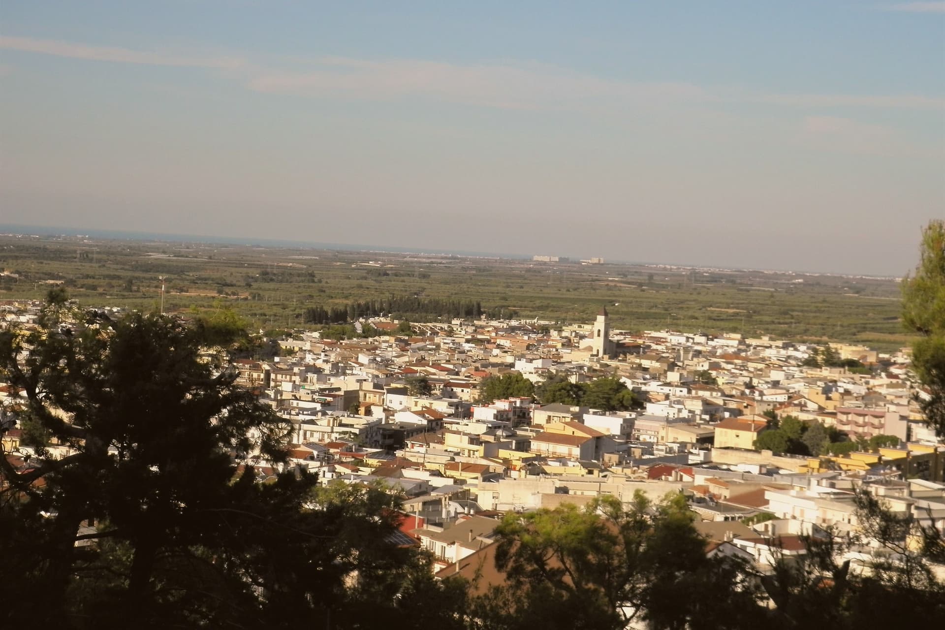
Why visit Cassano delle Murge
Cassano delle Murge sits at 341 meters at the foot of the highest step of the Murgia plateau, thirty kilometers south of Bari, at the eastern gate of the Alta Murgia National Park. The Foresta Mercadante, a 1,300-hectare pine and oak forest planted from 1928 onward to repair nineteenth-century deforestation that had flooded Bari several times, runs across the commune's higher ground, with 872 hectares inside Cassano and the rest in Altamura.
A menhir found in nearby caves dates settlement to 2500-2000 BC, and a fifth-century mosaic floor confirms continuous Roman-era occupation. The name first appears in a fourteenth-century document, derived from the Latin Cassius; the 'delle Murge' was added in 1863.
Roberto il Guiscardo donated the borough to the archbishopric of Bari in the eleventh century. The Santuario di Santa Maria degli Angeli, run by the Augustinian fathers, anchors the country edge of the village above a cave fresco of the Madonna.
What to see in Cassano delle Murge
- Foresta Mercadante. 1,300-hectare pine and oak forest planted from 1928 to repair nineteenth-century Murge deforestation, with 872 hectares inside Cassano, the rest in Altamura.
- Santuario di Santa Maria degli Angeli. Augustinian sanctuary on the country edge of the village, built around a cave fresco of the Madonna and tied to local apparition tradition.
- Chiesa di Santa Maria Assunta. Mother church rebuilt in 1858 on the remains of a fourteenth-century Romanesque church, preserving the original bell tower in the centro storico.
How to get to Cassano delle Murge
Bari is roughly 39 minutes away by road.
Our tip
April through June and September through October are the months the Murge foothills are mild and the Mercadante forest is at its best for walking. July and August reach the mid-thirties on the plateau, but Cassano's reputation as a stazione climatica rests on the cooling effect of the surrounding woods, six or seven degrees below the open Murgia in high summer. October is the olive and almond harvest.
Andria
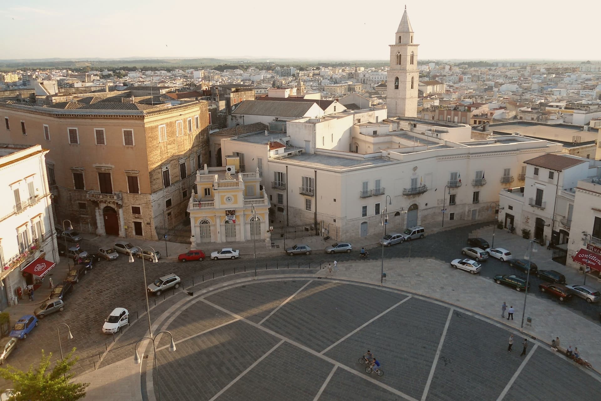
Why visit Andria
Andria sits on the Murge plateau at 151 meters, ten kilometers from the Adriatic, the third-largest city in Puglia after Bari and Taranto. It was made a fortified civitas in 1046 under Peter the Norman, with twelve towers, three gates and a citadel; Frederick II raised it again in the thirteenth century and built his most famous castle on a hilltop eighteen kilometers south of the city walls.
The city and Castel del Monte read as two expressions of the same Frederician ambition, one a working civitas of towers and gates, the other a solitary geometric exercise on an open plateau with no town around it at all. The other claim Andria makes is burrata, invented around the early twentieth century by the Bianchino family as a way to use leftover mozzarella scraps.
A fortified city, an unfinished castle, and a cheese born from kitchen thrift: the Murge produced a walled seat of power and, separately, an object meant to be looked at rather than defended, and a food born of nothing more than not wanting to waste the scraps.
Confetteria Mucci Giovanni con annesso Museo del Confetto, Antichi Sapori, Il Turacciolo have been named by a guide.
What to see in Andria
- Castel del Monte. An octagonal prism with eight octagonal towers, standing alone on a Murge hilltop and visible for fifty kilometers in any direction. Never finished, never used for war.
- Cattedrale di Santa Maria Assunta. Romanesque cathedral founded in the twelfth century, rebuilt over the centuries, holds the crypt and the relics of San Riccardo, the city's patron.
- Chiesa di Sant'Agostino. Gothic-Romanesque church built by the Teutonic Knights in the late thirteenth century, with a sculpted portal that is one of the finest in Puglia.
How to get to Andria
There is a railway station in the town, so you can arrive without a car and never need one while you are here. Bari is roughly 63 minutes away by road.
Our tip
April through June and September through October are the Murge months: clear light, mild evenings, the Castel del Monte plateau walkable without sweat. July and August hit thirty-six in the city and the castle exposed at 540 meters is brutal between noon and four. October is the olive harvest.
More from Anywhere Italy
 The 7 best towns inside a national park that eat well in Puglia
 The best hill towns inside a national park in Puglia
 The best hidden olive oil towns in Puglia
- The best hidden olive oil towns that eat well in Puglia
- The best olive oil towns with a serious restaurant in Puglia
 The best towns inside a national park in the province of Foggia