
The best hidden beach towns in Puglia
Puglia is the only Italian region with two seas of its own. The Adriatic runs down the eastern side, cold and clear over white limestone, and the Ionian curves along the south, warmer and flatter, with sand instead of rock. Between them the heel gets more coastline than anywhere else in the country.
Almost all of the summer goes to the same handful of places. Polignano a Mare for the cliff, Otranto and Gallipoli for the old towns, Monopoli for the harbour, and by August the lidos are booked and the coast road stops moving.
The same water carries on for hundreds of kilometres in both directions, past towns that get a fraction of it. Some are on the Gargano in the north, where the limestone drops into the sea under pine forest. Others are on the Ionian in the far south, where the beaches are long and the towns behind them are Messapian rather than Baroque.
Every town here holds the national bathing award, which a comune has to win again every single year on water quality, beach management and safety. Of the 19 Puglian coastal communes in our catalogue only these hold it and stay under 15,000 residents, and the smallest, Rodi Garganico, has 3,302 people.
Elsewhere in the catalogue: The best hidden coastal towns that eat well in Puglia and The best hidden olive oil towns in Puglia.
Rodi Garganico
Why visit Rodi Garganico
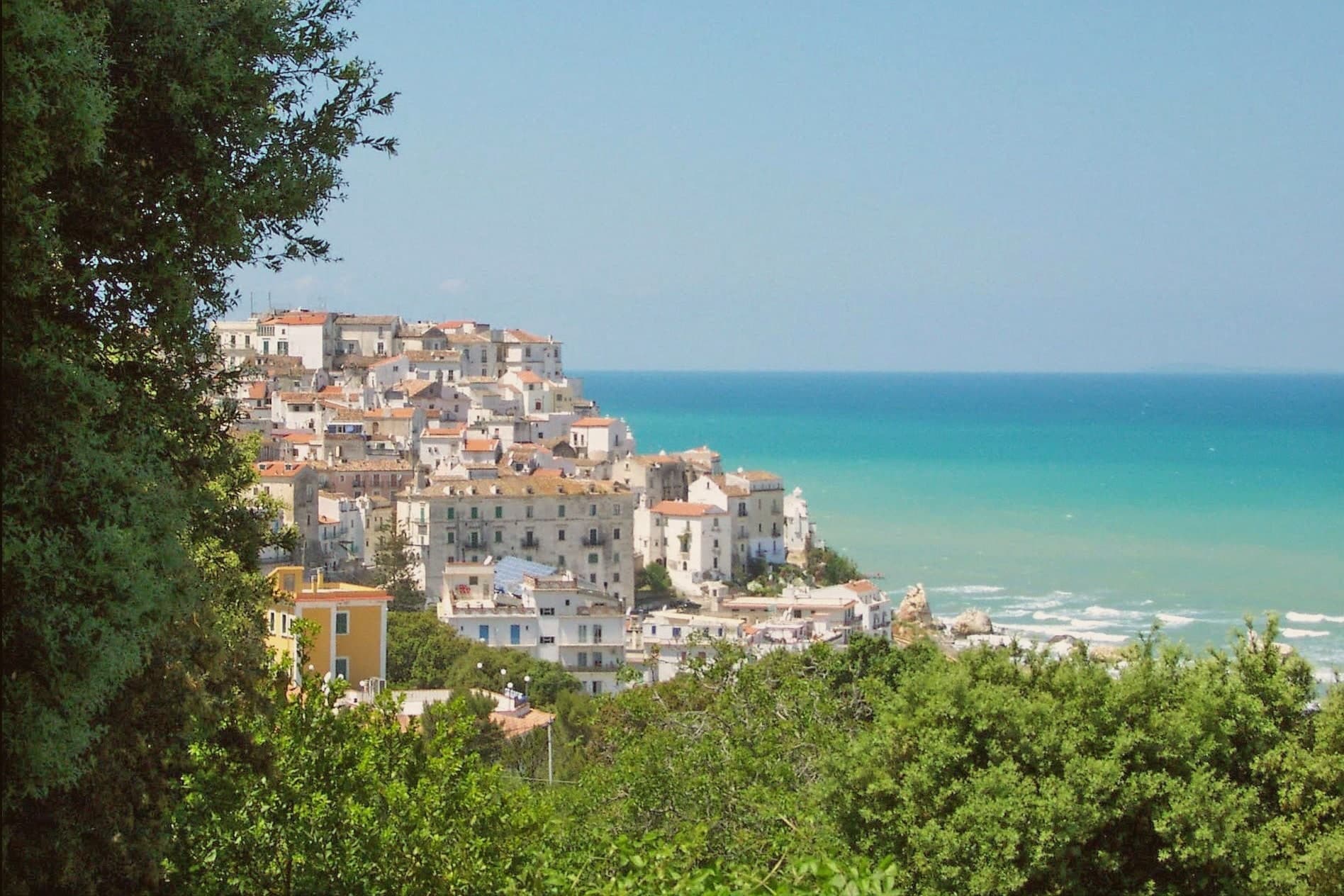
The town sits on a rocky promontory at 42 meters on the northern slope of the Gargano peninsula, inside the national park and east of the Lago di Varano. The early-nineteenth-century historian Michelangelo Manicone connected the founding to the Daunian people; a competing tradition has Greek colonists from Rhodes, the source of the modern name.
Between those two accounts sits a town that reads as both inland hill settlement and coastal outpost, the centro storico climbing the cliff while the terraces drop below it toward the water. The terraced slopes beneath the old town hold the groves that give the place its identity: the Arancia del Gargano and the Limone Femminello del Gargano, both DOP, both grown here since the Middle Ages, the lemon prized for its smooth thin peel and intense aroma.
The Chiesa di San Nicola di Mira keeps a Greek-Byzantine bell tower, a physical remainder of the Gargano's eastern liturgical ties, the same ties that surface in the story of the Madonna della Libera icon, said to have crossed the Adriatic with Venetian refugees after the fall of Constantinople. Long beaches run west and east of the town.
The result is a promontory settlement where citrus terrace, Byzantine trace, and coastline sit within a short walk of one another, each pointing to a different arrival: Daunian or Greek, agricultural, or seaborne and devotional.
The beach here holds the national bathing award, which a comune has to win back every year on water quality, beach management and safety.
What to see in Rodi Garganico
- Santuario della Madonna della Libera. The sanctuary stands above the old town on the promontory edge, the icon inside kept behind the altar the focus of local devotion for centuries.
- Chiesa di San Nicola di Mira. Old parish church with a Greek-Byzantine bell tower, the architectural trace of the Gargano's eastern liturgical past.
- Centro storico. Whitewashed promontory village on the cliff above the Adriatic, narrow stepped lanes dropping toward the harbour and the beaches.
How to get to Rodi Garganico
There is a railway station in the town, so you can arrive without a car and never need one while you are here. Foggia is roughly 94 minutes away by road.
Our tip
May through September is the season the Gargano coast works: warm water, calm Adriatic, the citrus groves green on the terraces above the beaches. June and September are the better months, before and after the August peak when the campsites between Rodi and Peschici fill. July and August push the centre full and the beach parking impossible by ten in the morning. Festeggiamenti di San Rocco falls in August.
Peschici
Why visit Peschici
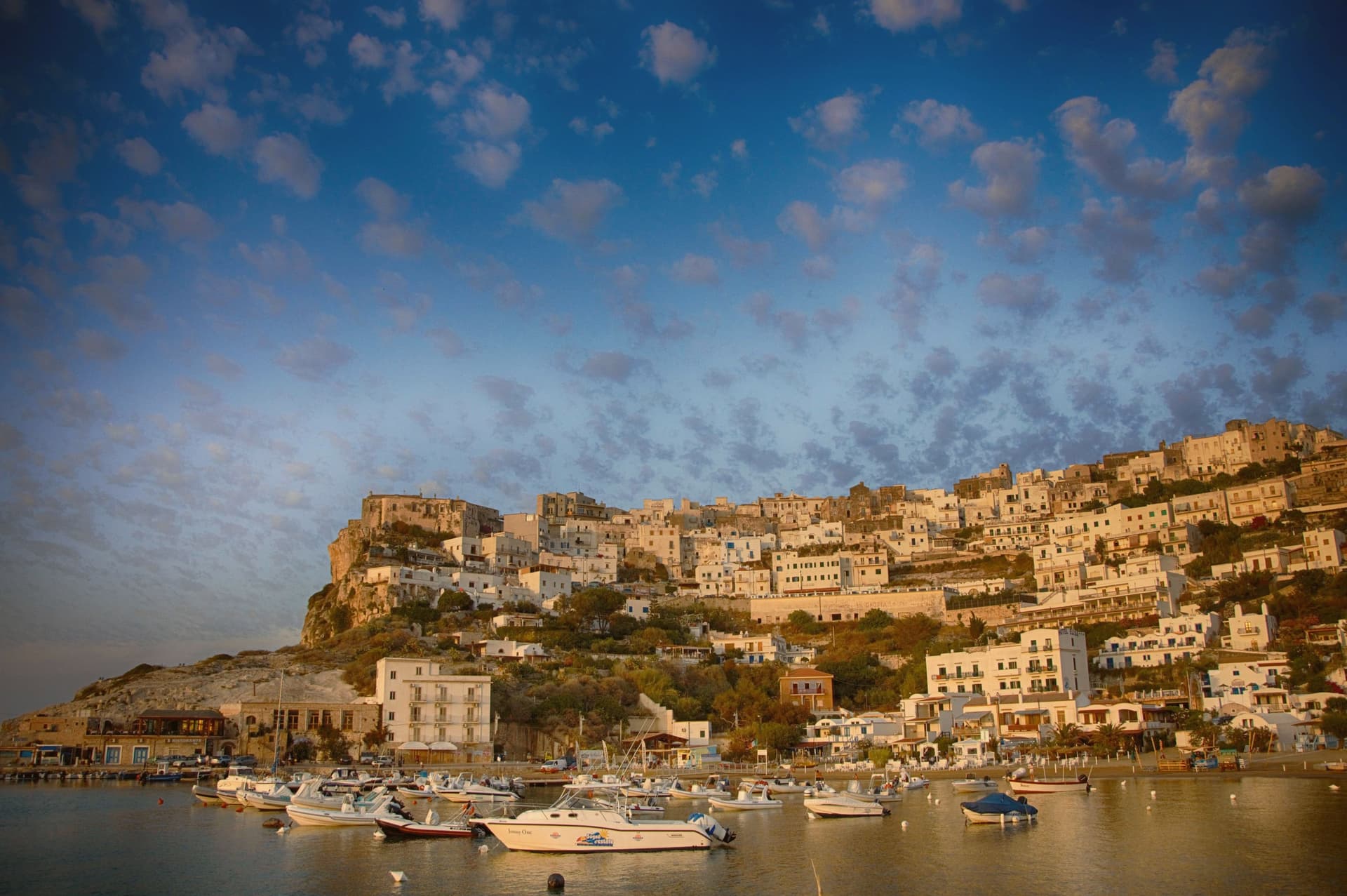
Peschici sits on a karst spur on the northeastern Gargano, 91 meters above the Adriatic, nine kilometers east of San Menaio and nineteen kilometers west of Vieste. The town was founded by the Daunians and later taken by the Romans, and the present village grew up around its cliff-top castle overlooking the small port below.
The municipal territory splits between the built village on its spur and the inland half, which falls within Gargano National Park: karst pine forest and limestone gorges running back from the coast. The coastline itself alternates sandy bays between limestone headlands with cliff sections reachable only from the sea, and the fishing platforms that work this stretch of Adriatic sit on the headlands at both ends of town, timber and rope structures fixed into the rock rather than built up from a harbor.
What holds the place together is the contrast between the white crown of the village, unusual on this coast for its flat and shallow-domed roofs, and the working coast beneath it: a fixed settlement on high ground looking down over a shoreline still worked by hand.
The beach here holds the national bathing award, which a comune has to win back every year on water quality, beach management and safety.
What to see in Peschici
- Castello Normanno-Svevo. Expanded by the Swabians after its Norman origin, the castle stands over the port and is visible from the sea and from inland well before the village itself comes into view.
- Centro storico. White cliff-top village of small whitewashed houses with flat or shallow-domed roofs, unusual on the Gargano, terraced down the karst spur toward the sea.
- Baia di San Nicola. Sandy bay west of the village beneath limestone cliffs, with the small medieval monastery of San Nicola on the headland above the beach.
How to get to Peschici
Foggia is roughly 115 minutes away by road.
Our tip
May through September is the working season, Adriatic water warm enough to swim by late May and the cliff village operational until late. July and August fill the small headland with families from Foggia, Naples and Rome; the town's population multiplies several times and the karst spur runs out of parking by mid-morning. June and September are the sane choices, mild evenings and the same beaches without the crush.
Maruggio
Why visit Maruggio
Maruggio sits inland on the Ionian side of Taranto province, a borgo of 5,250 residents built on a low hill with its coastline several kilometres away at Campomarino di Maruggio. The relationship between the two halves defines the place: a walled historic centre turned inward around its towers and commanderies, and a separate coastal strip of sand and dune that belongs administratively to the same town but reads as a different landscape entirely, brackish lagoon and macchia scrub where the borgo is stone and piazza.
The vineyards close that gap. Primitivo and Negroamaro are pressed on farms that run right up to the edge of the built-up centro, so the Città del Vino designation is not a marketing label attached from a distance but a description of what borders the walls.
The food carries the same compression: bombette of pork, panzerotti, sea urchin in spring, and taralli made with fennel seed, all produced within a town small enough that its vineyards, its coast, and its fortifications are never more than a short distance apart. What the place amounts to is a rare case where a single small municipality holds a complete set of Salento's separate identities, military history, wine country, and protected coast, without any of them being a satellite of a larger town nearby.
The beach here holds the national bathing award, which a comune has to win back every year on water quality, beach management and safety. It is also rated for accessibility, which most of this coast is not.
What to see in Maruggio
- Commenda dei Cavalieri di Malta + Maltese Crosses. The commanderie buildings of San Pietro and Santo Stefano stand side by side, twin structures rather than one. The Chiesa Madre holds the Order's archives, and Maltese cross motifs are carved into doorways throughout the centro.
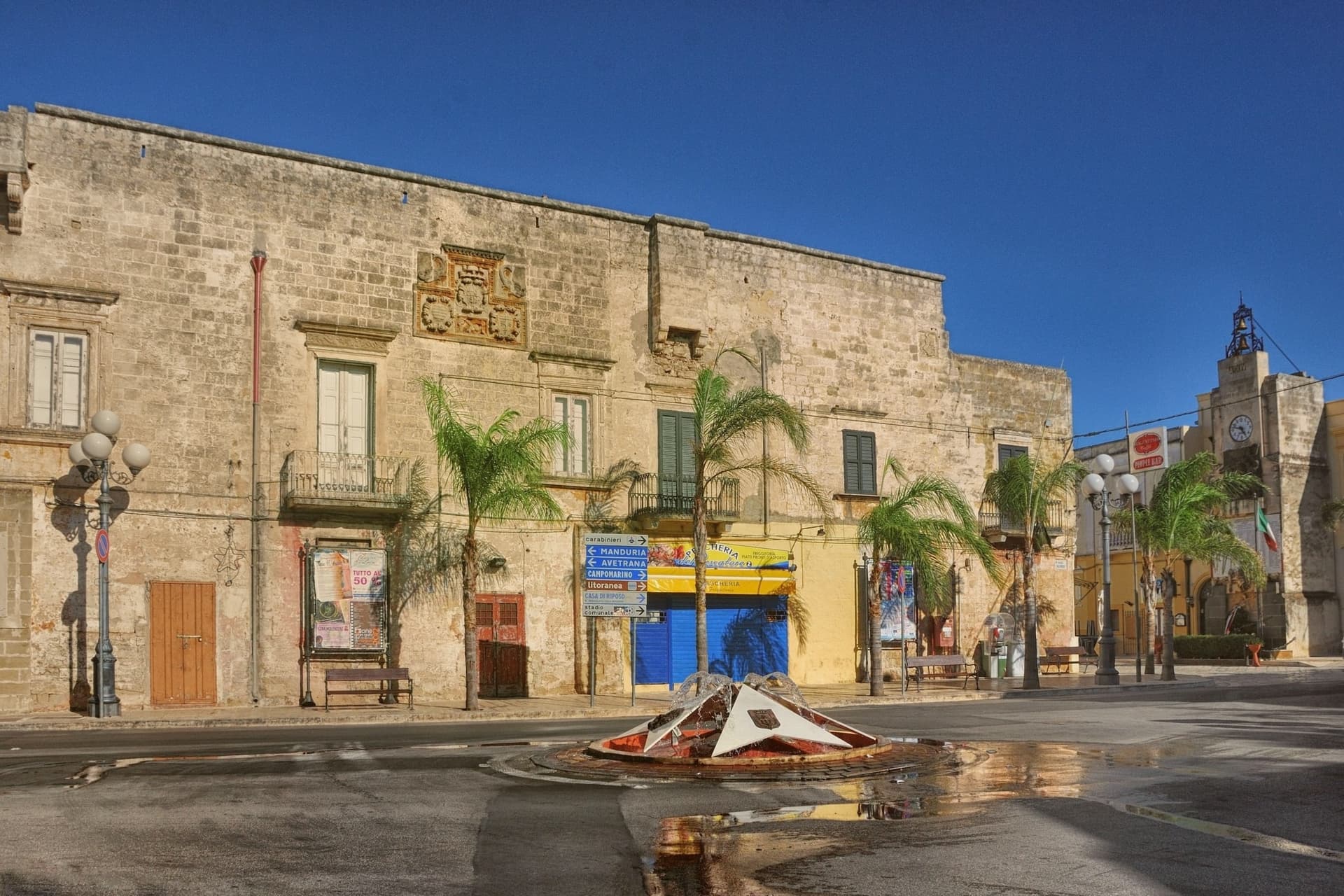
- Centro storico + four surviving towers. The fortified borgo keeps four of its original eight towers and substantial wall sections, raised against Saracen raids from the sea. Inside, a grid of narrow stone-paved vicoli runs between flat-roofed white-and-honey houses with iron balconies, opening onto the 16th-century Palazzo Ducale on the main piazza.
- Campomarino di Maruggio (Bandiera Blu). Sand backed by dunes for the full stretch of coast, held under Bandiera Blu for over a decade. The reserve at its edge protects 1,000 hectares of dune and lagoon.
How to get to Maruggio
Taranto is roughly 46 minutes away by road.
Our tip
Maruggio is at its best in May–June (warm but not yet packed, sea swimmable, the borgo cool in the morning) and September–October (still beach-warm, vendemmia in full swing, Primitivo and Negroamaro in the press). July and August get crowded at Campomarino — the inland borgo stays quieter. Winter is mild Salento — the centro storico is at its most photogenic but most beach amenities close.
Melendugno
Why visit Melendugno
The comune administers 17 km of Adriatic coast east of Lecce, 19 km from the city, with 10,045 residents spread between that shoreline and an inland centre sitting at 36m altitude. The town of Melendugno itself is the administrative seat: the Chiesa di Santa Maria della Vergine (16th century), the Palazzo Marchesale, and a medieval centro that sees none of the coastal traffic.
The coast and the inland town function almost as two separate places under one name, the beaches and the karst pool drawing visitors who may never see the Palazzo Marchesale. Along that coast, three beaches carry Bandiera Blu status, each with its own character: one framed by faraglioni, one a working marina with a still-active fishing port and a castle, one the smallest but with the most dramatic limestone arches.
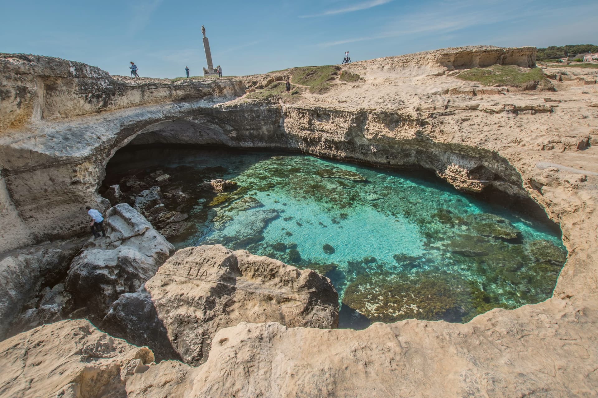
The karst pool at Roca sits beside the archaeological complex of the same stretch: a Messapian settlement built over a Bronze Age fortified predecessor, votive inscriptions cut into the cave walls in proto-Messapian, Greek, and Latin. Two finds from very different eras occupy the same short piece of coastline, one a place to swim, the other a record of who lived there first.
Inland, the comune carries a rare stack of designations beyond the coastal one: Borgo Autentico, Città dell'Olio, tied to the surrounding Salento DOP olive groves and their millennia-old trees toward Acaya, and a honey designation resting on a local beekeeping cooperative that produces thistle, eucalyptus, and millefiori varieties, marked each early autumn by its own sagra. The food follows Salento conventions: pasta con cime di rapa, pittule, bombette of pork, and pasticciotto leccese, whose original source is credited to a 1745 pastry shop in Galatone, 30 km south.
In late August the pizzica festival La Notte della Taranta, the Salento's biggest cultural event, takes place in Melpignano, 25 km south. Between the coast, the archaeology, the olive groves, and the honey cooperative, Melendugno holds more density of designation and documented history per kilometre than its size would suggest.
The beach here holds the national bathing award, which a comune has to win back every year on water quality, beach management and safety.
What to see in Melendugno
- Grotta della Poesia (Roca). A karst-collapsed pool 8m below the rock surface, reached through a single jagged opening above. The water is crystal-clear and connects by underwater tunnels to two adjacent smaller pools.
- Three Bandiera Blu beaches. Torre dell'Orso has 300m of fine sand framed by the Le Due Sorelle faraglioni. San Foca is a working marina with a still-operational fishing port and the Castello Sangiovanni. Sant'Andrea is the smallest of the three, with the most dramatic limestone arches.
- Roca Vecchia archaeological site. A Messapian settlement (5th-3rd c BC) built over an earlier Bronze Age fortified village (16th c BC) on a coastal promontory. Thousands of votive inscriptions in proto-Messapian, Greek, and Latin are scratched into the cave walls.
How to get to Melendugno
Taranto is roughly 117 minutes away by road.
Our tip
Melendugno is best May–June and September–October — the Salento beach summer peaks August (Italian holiday season, ferragosto crush) and the coast is at its hottest 35°C+ in July-August. La Notte della Taranta in nearby Melpignano (late August) is the regional cultural headline. October is harvest in the Salento DOP olive groves. Sagra Ortofrutticola Borgagne falls in July.
Ugento
Why visit Ugento
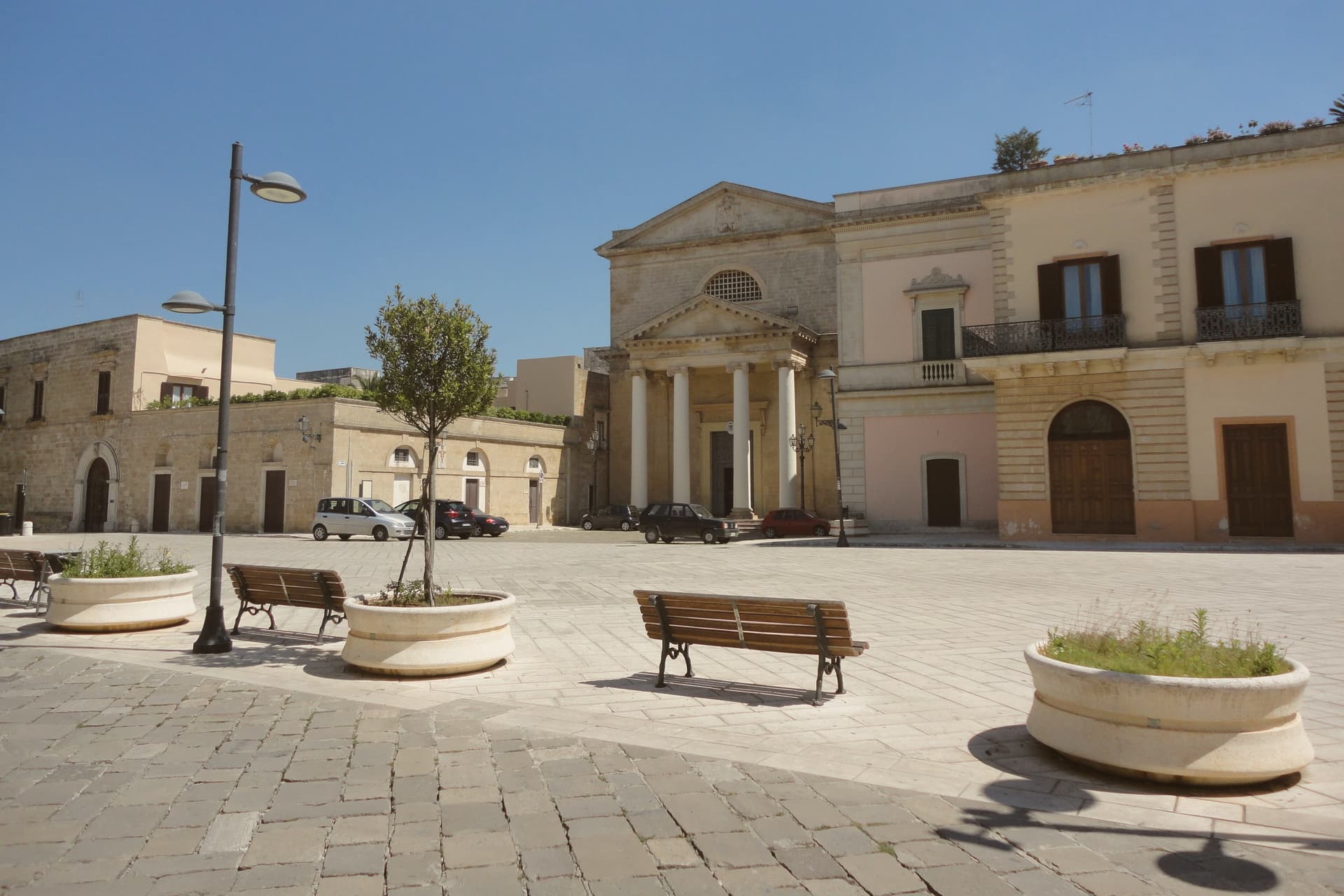
Ugento sits five kilometers inland from the Ionian, its centro built directly over the Messapian city of Ozan, the name recorded on the fourth-century-BC Soleto Map. The walls of that older city and the chamber tombs of its necropolis mark the boundary between the modern town and the ground it grew from, remnants of the civilization that held the lower peninsula between the seventh and third centuries BC.
The castle at the center of town began as a Norman motte-and-bailey raised on those same Messapian foundations, later rebuilt as a Baroque palazzo by a family who frescoed its grand salons to record their own history. A bronze Zeus, cast around 530 BC and found by chance in a cellar in 1961, is now kept in Taranto, with only a copy remaining locally, so the town's oldest and most valuable object is known here mostly by its absence.
Inland, the layered town of walls, tombs, castle and cathedral holds the historical weight; on the coast, the frazioni carry the summer crowds. The two halves of Ugento, one built on the memory of Ozan and one facing the sea, run on entirely different clocks.
The beach here holds the national bathing award, which a comune has to win back every year on water quality, beach management and safety.
What to see in Ugento
- Castello di Ugento. Norman fort rebuilt as a Baroque palazzo by the d'Amore family in the 1690s, with first-floor grand salons frescoed in 1694 to celebrate family history.
- Nuovo Museo Archeologico. Town archaeological museum displaying Messapian finds, the Cozza Petrosa necropolis material and a bronze copy of the Zeus of Ugento.
- Mura Messapiche e Necropoli di Cozza Petrosa. Walls and the trullo-shaped chamber tombs of the necropolis sit at the edge of the centro, the oldest layer of the city built over by the modern town.
How to get to Ugento
There is a railway station in the town, so you can arrive without a car and never need one while you are here. Taranto is roughly 129 minutes away by road.
Our tip
May, June, September and the first half of October are the gentle months on the Ionian Salento: warm sea, cool evenings, the centro and the coast usable in the same day. July and August are dry and very hot, with the Marine packed and the centro storico empty between two and five in the afternoon. The Bandiera Blu beaches at Torre San Giovanni and Lido Marini do most of the August traffic and rates climb accordingly.
Vieste
Why visit Vieste
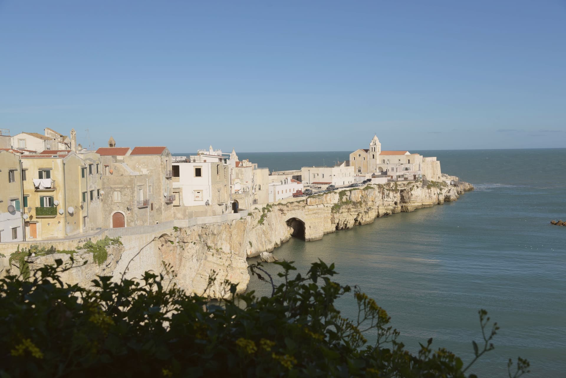
Vieste sits at the eastern tip of the Gargano promontory inside Gargano National Park, a medieval town on a white limestone cliff dropping straight into the Adriatic. The Cathedral was begun in the second half of the eleventh century in Apulian Romanesque, with three naves on two rows of six columns and capitals carved in oriental floral and animal motifs.
The Norman castle of the eleventh century was rebuilt by Frederick II in 1242 as part of a coastal fortification line; the trapezoidal block of 1242 still anchors the headland. On July 18-21, 1554, the Ottoman corsair Dragut sacked the town and executed roughly 5,000 inhabitants on the slab of stone now known as the Chianca Amara, the bitter stone, set into the lane that carries the memory.
Pizzomunno, the 26.6-meter limestone sea stack on Spiaggia del Castello, is the symbol of the Gargano and the centerpiece of a local legend about a fisherman whose lover was taken by sirens. The Bandiera Blu marks the water at Pizzomunno, Scialmarino and Lungomare Mattei.
The beach here holds the national bathing award, which a comune has to win back every year on water quality, beach management and safety.
What to see in Vieste
- Cattedrale di Santa Maria Assunta. Eleventh-century Apulian Romanesque cathedral, three naves on two rows of six columns, with Corinthian and cubic capitals carved in zoomorphic and floral motifs.
- Castello Svevo. Norman fortress rebuilt by Frederick II in 1242 on the headland above the sea, part of the Hohenstaufen Adriatic defensive line, still anchoring the old town.
- Pizzomunno. Limestone sea stack 26.6 meters high on Spiaggia del Castello, the symbol of Vieste and the Gargano, attached to the legend of the fisherman and his stolen lover.
How to get to Vieste
Foggia is roughly 109 minutes away by road.
Our tip
May, June, September and the first half of October are the windows when Vieste works without the heat or the August crowd: warm Adriatic, breezy headland, the centro storico walkable in afternoon as well as evening. July and August are very hot and crowded, with the Bandiera Blu beaches at capacity and rates at peak; the centro storico empties between two and five and refills after sunset for the passeggiata. October still holds for swimming on the south-facing beaches.
More from Anywhere Italy
- The best hidden coastal towns that eat well in Puglia
 The best hidden olive oil towns in Puglia
 The best hidden olive oil towns that eat well in Puglia
- The best hidden towns with a serious restaurant in Puglia
 The best towns inside a national park in the province of Foggia
- The best coastal towns with a serious restaurant in Puglia