
The best hill towns inside a national park in Puglia
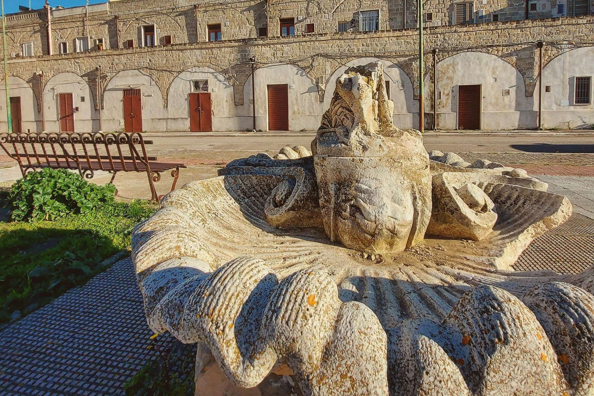
Puglia away from the water is a country of stone. The Alta Murgia is a low limestone plateau scoured by wind, cropped by sheep, planted with hard durum wheat that becomes the region's bread and orecchiette, and split by ravines where rock churches were cut into the cliff face. Further north the Gargano promontory lifts out of the sea into the Foresta Umbra, beech and oak and holly in a part of Italy nobody expects to find shade. Houses here are built of the same pale tufa and limestone that the fields refuse to give up, and the good months are spring, when the pasture flowers, and late autumn, when the olive presses run and lamb, wild greens and sheep's cheese come back onto every menu.
Almost everyone who comes to Puglia goes to the trulli of Alberobello, then down to Polignano a Mare and the whitewashed lanes of Ostuni, and in July and August the coach parks fill by mid-morning. The reasons are real enough, and the photographs are famous for a reason. But the visit tends to run along a narrow strip of the coast and the Valle d'Itria, and the interior is treated as the drive between two stops.
The same limestone, the same bread, the same sheep-country cooking continues inland, and it does so inside protected parkland where the towns are part of the landscape rather than a view of it. These are hill settlements within the boundaries of Puglia's national parks, some looking out over the Murgia's grain plains and gravine, others set among the Gargano's forests and pilgrim roads. Fewer people go, and the walking, the food and the stone are the better for it.
Of the 59 communes we have mapped in Puglia, 7 qualify as hill towns inside a national park: each is an inland hill settlement, and each sits inside a national park. The smallest, Poggiorsini, has 1,273 residents.
Elsewhere in the catalogue: The 7 best towns inside a national park that eat well in Puglia and The best towns known for what they grow within 75 minutes of Bari.
Poggiorsini
Why visit Poggiorsini
The name records the founding family. The Orsini dukes of Gravina bought the rural estate in 1609 and turned it into a working settlement, raising the ducal palazzo and the parish church of Maria Santissima dei Sette Dolori between 1723 and 1727.
Until 1957 the village was a frazione of Gravina, administered from outside its own borders even as the palazzo and church gave it the shape of a town; only in that year did it become an autonomous commune, and with 1,273 residents it remains the smallest in the metropolitan city. The village sits at 461 meters on the Alta Murgia, fifty-five kilometers south of Bari, entirely inside the national park that carries the plateau's name.
Three kilometers north, on the road between Gravina and Spinazzola, a fortress ruin stands on a Murgia outcrop above the old road that once linked the two towns, listed among the emperor's holdings and predating the town itself by centuries. The current parish church replaced the older building after the 1930 Vulture earthquake, so the settlement's oldest structure sits outside it, on the plateau, while the village center is largely a rebuilt one.
What the estate's late founding and its small size add up to is a place whose civic history is short and legible: bought, built, and only recently let govern itself, set inside a landscape far older than any of its buildings.
What to see in Poggiorsini
- Castello del Garagnone. Norman fortress on a Murgia ridge three kilometers north, rebuilt by Frederick II in 1220 to control the Appian Way; now ruins in the national park.
- Chiesa di Maria Santissima Addolorata. Three-nave parish church built shortly after the 1930 Vulture earthquake, the centerpiece of the modern village.
- Palazzo Orsini. Ducal palace raised by the Orsini family between 1723 and 1727 when they reorganized the rural estate into a town.
How to get to Poggiorsini
Bari is roughly 77 minutes away by road.
Our tip
April through June and September through October are the months the Murgia stays workable: green grass, dry air, the karst plateau at its clearest. July and August push past thirty-five degrees on the open uplands; shade is scarce and the wind off the plain is dry rather than cooling. November through March is cold and quiet at 461 meters, with frost on the plateau and frequent fog at dawn.
Vico del Gargano
Why visit Vico del Gargano
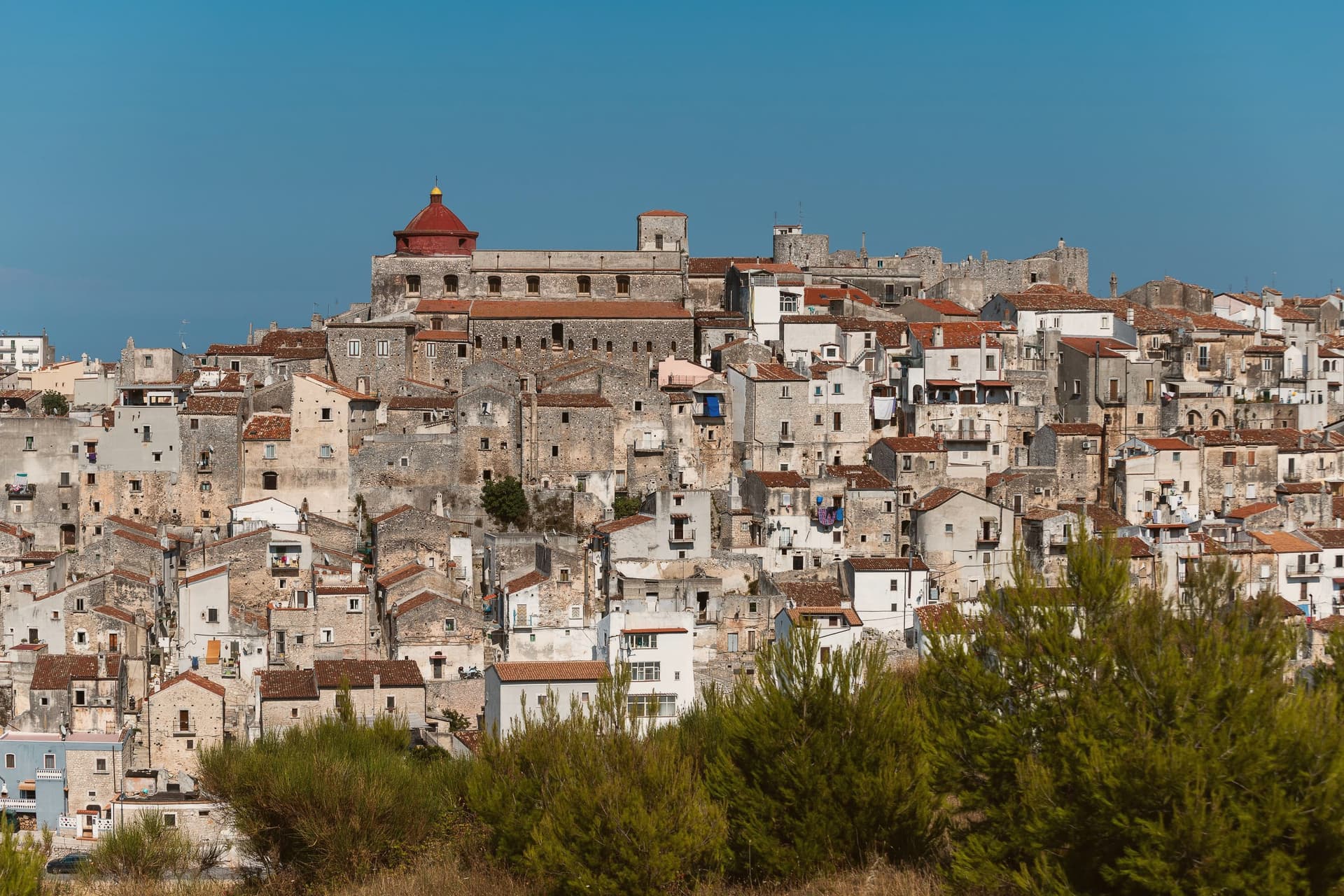
The town sits at 445 meters on a rocky promontory, with the territory falling from the 782-meter heights of the forest above to the beaches of the coastal frazioni below. The first urban core, called Vicus, was founded around 970 by Sueripolo of the Slavonians on land granted by Byzantine authorities, the seed from which the hill town and its later defenses grew.
The upper town, walled and towered, holds the historic center and its churches close around the castle, while the citrus terraces step down from that core toward the sea, and the coastal frazioni mark where the descent ends at the Adriatic. Inland forest, hill town, and coast form one continuous drop in elevation rather than three separate places.
What holds this together is the shape of the ground itself: a settlement founded on a promontory has simply grown downward over the centuries, from Byzantine grant to Norman wall to citrus terrace to shoreline, each layer sitting on the one before it.
What to see in Vico del Gargano
- Castello Normanno-Svevo. Eleventh-century Norman castle enlarged in 1240 by Frederick II and again in 1292, the anchor of the medieval defensive system of twenty towers and walls.
- Centro storico e Vicolo del Bacio. Medieval old town of about thirteen churches and chapels, with the Kiss Alley, a passage so narrow that walking it touching is the local prescription for lasting love. The survival of this core and the density of the olive mills below it earned the town a place among the Borghi più belli d'Italia.
- Foresta Umbra. Beech and oak ancient forest of Gargano National Park, reaching 830 meters within the municipal territory, with trails to centuries-old turkey oaks.
How to get to Vico del Gargano
There is a railway station in the town, so you can arrive without a car and never need one while you are here. Foggia is roughly 99 minutes away by road.
Our tip
April through June and September through October are the months Vico is at its best: the citrus groves in flower or in fruit, the Foresta Umbra in green or autumn rust, and the centro storico mild at 445 meters while the coast below stays swimmable. July and August are hot on the coast and busy at San Menaio; the centro keeps a few degrees cooler than the beach. The Saint Valentine feast on February 14 turns the village into a pilgrimage and a wedding stage.
Minervino Murge
Why visit Minervino Murge
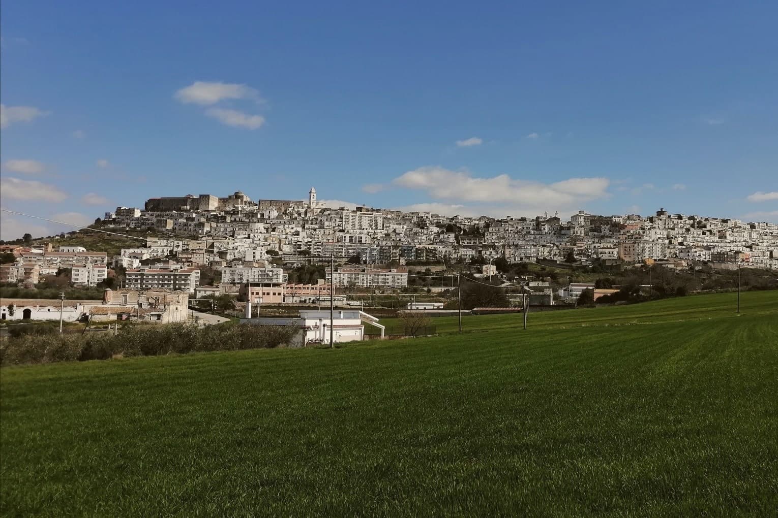
The town is built on two hills at the western edge of the Murgia plateau, where the limestone tableland gives out and the ground drops toward lower country on three sides. That break is what gives the ridge its long view and its nickname: to the east the eye crosses Murgia limestone toward the Gargano and the Adriatic, to the west it crosses cultivated fields into Basilicata, and to the north it runs the length of the Ofanto valley.
The old town sits above this drop, castle and tower on the high ground, cathedral below, the settlement organized around the same ridge that draws the view. Olive oil, almonds and grain define the rural economy beyond the walls, the plateau put to farming where it is not left to steppe grass and karst.
A ridge town, in other words, whose whole character, defensive site, pilgrimage cave, farmed hinterland, follows from the one geological fact of where the plateau ends.
What to see in Minervino Murge
- Castello Normanno-Svevo. Norman fortress remodeled in the baronial period, with surviving towers and bastions on the high ridge above the old town.
- Torre di Pirro del Balzo. Fifteenth-century tower built between 1460 and 1490 when Minervino came to Pirro del Balzo as part of Maria Donata's dowry.
- Grotta di San Michele. Cave formed roughly two million years ago, reached through the karst rather than built, and still kept as a place of pilgrimage rather than display.
How to get to Minervino Murge
There is a railway station in the town, so you can arrive without a car and never need one while you are here. Foggia is roughly 62 minutes away by road.
Our tip
April through June and September through October are the months the Alta Murgia plateau runs best. The wildflower steppe peaks in May, almond blossom comes earlier in February, and the Ofanto valley below stays mild through autumn. July and August push past thirty-five degrees on the limestone with little shade; the centro storico empties between two and five and the panoramic belvedere is best at dawn or dusk.
Cassano delle Murge
Why visit Cassano delle Murge
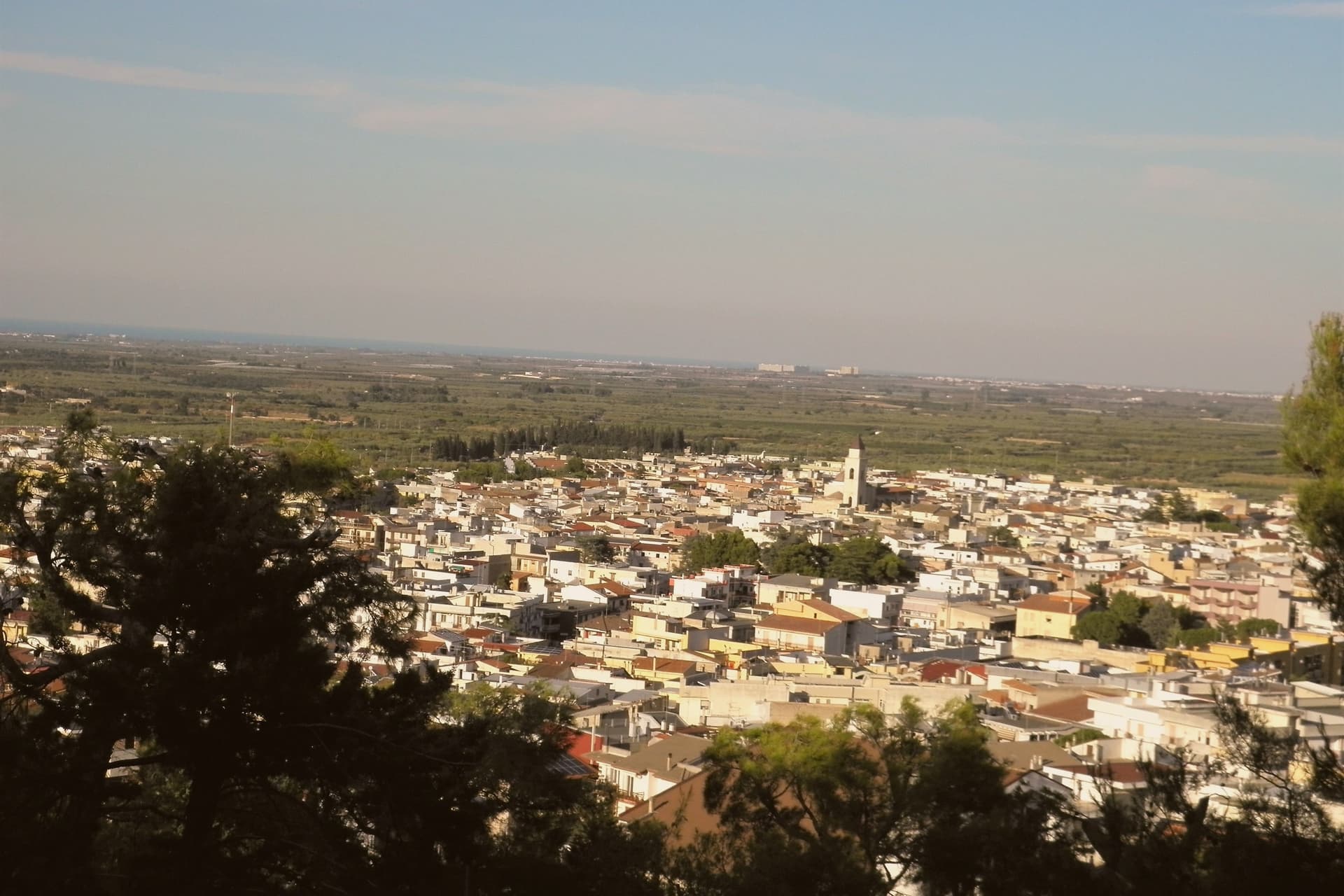
Cassano delle Murge sits at 341 meters at the foot of the highest step of the Murgia plateau, thirty kilometers south of Bari, at the eastern gate of the Alta Murgia National Park. The Foresta Mercadante, a 1,300-hectare pine and oak forest planted from 1928 onward to repair nineteenth-century deforestation that had flooded Bari several times, runs across the commune's higher ground, with 872 hectares inside Cassano and the rest in Altamura.
A menhir found in nearby caves dates settlement to 2500-2000 BC, and a fifth-century mosaic floor confirms continuous Roman-era occupation. The name first appears in a fourteenth-century document, derived from the Latin Cassius; the 'delle Murge' was added in 1863.
Roberto il Guiscardo donated the borough to the archbishopric of Bari in the eleventh century. The Santuario di Santa Maria degli Angeli, run by the Augustinian fathers, anchors the country edge of the village above a cave fresco of the Madonna.
What to see in Cassano delle Murge
- Foresta Mercadante. 1,300-hectare pine and oak forest planted from 1928 to repair nineteenth-century Murge deforestation, with 872 hectares inside Cassano, the rest in Altamura.
- Santuario di Santa Maria degli Angeli. Augustinian sanctuary on the country edge of the village, built around a cave fresco of the Madonna and tied to local apparition tradition.
- Chiesa di Santa Maria Assunta. Mother church rebuilt in 1858 on the remains of a fourteenth-century Romanesque church, preserving the original bell tower in the centro storico.
How to get to Cassano delle Murge
Bari is roughly 39 minutes away by road.
Our tip
April through June and September through October are the months the Murge foothills are mild and the Mercadante forest is at its best for walking. July and August reach the mid-thirties on the plateau, but Cassano's reputation as a stazione climatica rests on the cooling effect of the surrounding woods, six or seven degrees below the open Murgia in high summer. October is the olive and almond harvest.
San Giovanni Rotondo
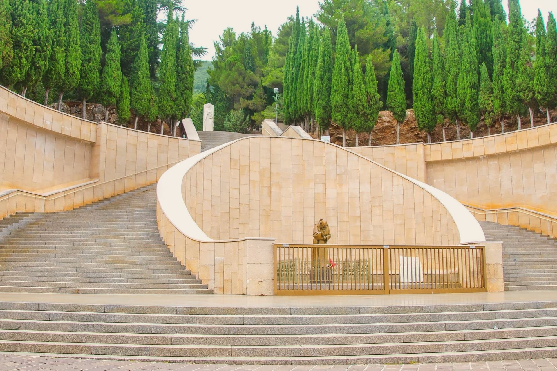
Why visit San Giovanni Rotondo
San Giovanni Rotondo sits at 565 meters on the slopes of Monte Calvo, inside the national park that carries the Gargano's name. The town itself is named for an eleventh-century baptistery, round in shape and dedicated to John the Baptist, built over what may have been a Roman temple to Janus: the round form and the double dedication are the origin the name still points to.
The medieval centro storico gathers around that baptistery, a village of one scale and one era. The contemporary town is built at another scale entirely, around the convent, the sanctuary and the hospital, all raised in the twentieth century and all tied to the same friar.
The two parts of the town sit close together but belong to different centuries: an eleventh-century core that gave the place its name, and a twentieth-century expansion that gave it its purpose. What draws six million visits a year is not the old village but what grew up beside it.
What to see in San Giovanni Rotondo
- Santuario di San Pio da Pietrelcina. Copper roofing over the stone arches is meant to oxidize green over decades, a slow change on a building already built at monumental scale.
- Convento di Santa Maria delle Grazie. The convent where Padre Pio lived from 1916 to 1968; its old and new churches stand side by side, one building added to another rather than replacing it.
- Cripta di San Pio. The lower crypt of the new sanctuary holds the preserved body of Padre Pio, the focus of the pilgrimage and the point most of the six million annual visits are made toward.
How to get to San Giovanni Rotondo
Foggia is roughly 41 minutes away by road.
Our tip
April through June and September through October are the better months on the Gargano interior: cool altitude, dry air, the pilgrim crowds manageable. July and August push above thirty-three degrees and the queues at the crypt of San Pio stretch around the building; midsummer is the peak pilgrimage season. The Feast of San Pio on 23 September draws the largest single-day crowd of the year.
Gravina in Puglia
Why visit Gravina in Puglia
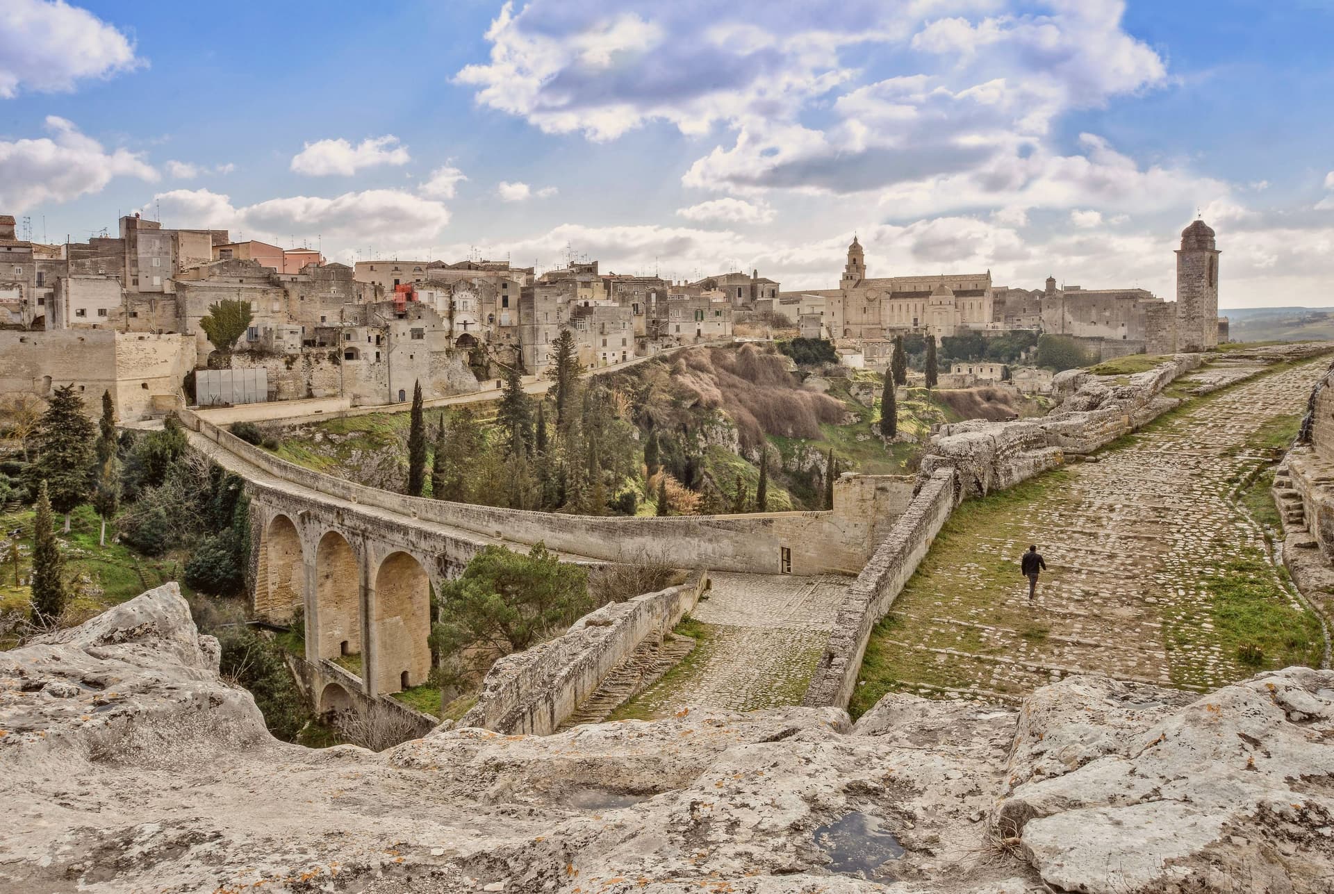
Gravina sits within the gravine, the network of limestone canyons cut across the Bari-Matera-Taranto karst plateau, the same geological system that produced Matera's Sassi 30 km west. This canyon is the deepest of them: 100m down, 350m wide at its narrowest, running straight through the centre of the modern town.
The plateau above holds the current population of 42,703; the old town clings to the cliff edge, its houses stacked against the same rock that the canyon walls below carry as a run of rupestrian churches and sanctuaries hollowed straight from the stone. The defining crossing of the two halves is the aqueduct bridge, built in the 18th century to bring water from the Murgia springs into the city and still walkable as a pedestrian route at 37m above the gorge floor.
On the canyon walls below it: a sanctuary carved into the rock, a church reached by a vertical stair and cut entirely into the cliff face, and a crypt complex holding frescoes from the 10th to 12th centuries, Byzantine work surviving in the dark of the rupestrian chambers. Above, on the plateau, the medieval centro takes over: the Cattedrale di Santa Maria Assunta, Romanesque and founded in 1092, holding its own Byzantine icon of the Madonna delle Grazie; the Castello Svevo rebuilt by Federico II; the Fondazione Ettore Pomarici Santomasi with its archaeological and Renaissance collections.
Gravina holds the Borghi più belli d'Italia designation together with Cittaslow, and lies on the Via Francigena, the branch tracing the old Via Appia route south, as well as bordering the Parco Nazionale dell'Alta Murgia, the karst plateau protected as national park immediately to the north. The food follows the same Murgia-Puglian line as the landscape: focaccia barese, orecchiette with cime di rapa, capocollo di Martina Franca, Primitivo di Manduria and the local Murgia DOC reds, built around the Festa di San Michele Arcangelo each September and the Carnevale Gravinese in late winter.
What Gravina adds up to is a town whose deepest cut in the earth doubles as its main street: canyon below carrying the sacred and the ancient, plateau above carrying the civic and the everyday, the two halves joined by a bridge built for water and now crossed for its own sake.
What to see in Gravina in Puglia
- Ponte Acquedotto (Bond's bridge). Crosses the gorge at 37m height on 18th-c stonework, a walkable pedestrian route today. This is the crossing James Bond takes by motorbike in the Matera chase sequence of No Time to Die.
- Chiesa di San Michele delle Grotte. A church carved entirely into the rock cliff of the gravina, reached by a vertical stair. The most striking of the canyon's rupestrian churches.
- Castello Svevo + Cattedrale. The castle sits on the plateau beside the Romanesque cathedral, founded 1092, which holds the Byzantine Madonna delle Grazie icon.
How to get to Gravina in Puglia
There is a railway station in the town, so you can arrive without a car and never need one while you are here. Bari is roughly 68 minutes away by road.
Our tip
Gravina in Puglia is best March–June and September–October — the Murgia summer is brutally hot (38°C+ inland) and the gorge becomes an oven. The Festa di San Michele Arcangelo 28-29 September is the year's headline. February-March brings the Carnevale Gravinese. Historia falls in September.
Andria
Why visit Andria
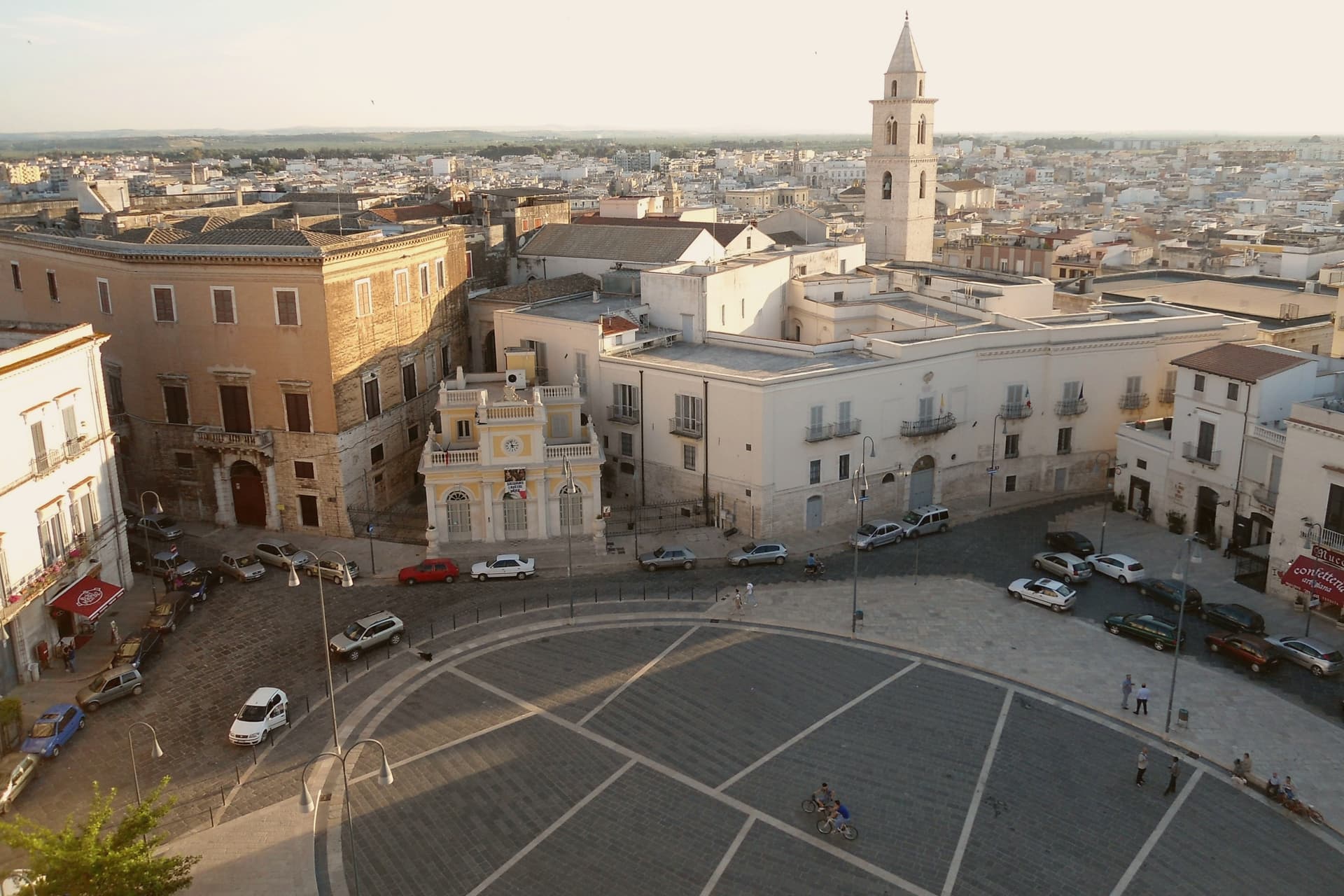
Andria sits on the Murge plateau at 151 meters, ten kilometers from the Adriatic, the third-largest city in Puglia after Bari and Taranto. It was made a fortified civitas in 1046 under Peter the Norman, with twelve towers, three gates and a citadel; Frederick II raised it again in the thirteenth century and built his most famous castle on a hilltop eighteen kilometers south of the city walls.
The city and Castel del Monte read as two expressions of the same Frederician ambition, one a working civitas of towers and gates, the other a solitary geometric exercise on an open plateau with no town around it at all. The other claim Andria makes is burrata, invented around the early twentieth century by the Bianchino family as a way to use leftover mozzarella scraps.
A fortified city, an unfinished castle, and a cheese born from kitchen thrift: the Murge produced a walled seat of power and, separately, an object meant to be looked at rather than defended, and a food born of nothing more than not wanting to waste the scraps.
What to see in Andria
- Castel del Monte. An octagonal prism with eight octagonal towers, standing alone on a Murge hilltop and visible for fifty kilometers in any direction. Never finished, never used for war.
- Cattedrale di Santa Maria Assunta. Romanesque cathedral founded in the twelfth century, rebuilt over the centuries, holds the crypt and the relics of San Riccardo, the city's patron.
- Chiesa di Sant'Agostino. Gothic-Romanesque church built by the Teutonic Knights in the late thirteenth century, with a sculpted portal that is one of the finest in Puglia.
How to get to Andria
There is a railway station in the town, so you can arrive without a car and never need one while you are here. Bari is roughly 63 minutes away by road.
Our tip
April through June and September through October are the Murge months: clear light, mild evenings, the Castel del Monte plateau walkable without sweat. July and August hit thirty-six in the city and the castle exposed at 540 meters is brutal between noon and four. October is the olive harvest.
More from Anywhere Italy
 The 7 best towns inside a national park that eat well in Puglia
- The best towns known for what they grow within 75 minutes of Bari
 The best towns inside a national park in the province of Foggia
- The best hill towns inside a nature park in Puglia
 The best hidden hill towns that eat well in Puglia
- The 10 best hill towns with a serious restaurant in Puglia