
The best hidden coastal towns that eat well in Puglia
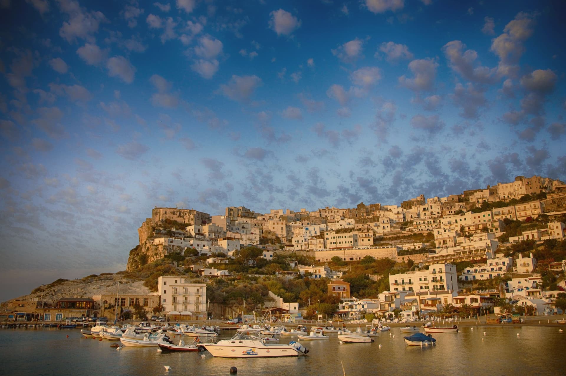
The Puglian coast is built out of what it sits on, tufo and limestone cut into blocks and lime-washed until the towns glow in the late afternoon. The food follows the same logic of proximity: fish landed that morning and served raw with nothing but lemon, wild chicory boiled and dressed with fava purée, burrata that was made before breakfast, taralli broken over a glass of Negroamaro. Summer is loud and hot and the water is the colour people come for, but the eating peaks in late spring and again in October, when the sea urchins and the new oil arrive. Houses are flat-roofed and whitewashed, with terraces angled at the water and vines run over pergolas for shade.
The obvious route runs through Polignano a Mare, where the town hangs over a cove that has been photographed to exhaustion, and on to Alberobello, where the trulli district takes coach parties in shifts. Both deserve their reputations and both are hard work between June and September, with parking on the edge of town and queues down the lanes. The restaurants nearest the viewpoints have learned to charge accordingly.
The same coast keeps going, north into the Gargano headland and south past Otranto towards the Ionian, and the cooking does not thin out as the crowds do. The towns here sit directly on the sea, with harbours that still work and kitchens a dining guide has taken the trouble to name. Fewer people go, which mostly means you can get a table in August.
Of the 59 communes we have mapped in Puglia, 12 qualify as coastal towns that eat well: each sits directly on the sea, and a dining guide has named a table in each. This list is the hidden ones, 6 in all, ordered smallest first. The smallest, Peschici, has 4,283 residents.
If you are still choosing, we have also written The 7 best towns inside a national park that eat well in Puglia and The best hidden olive oil towns that eat well in Puglia.
Peschici
Why visit Peschici
Peschici sits on a karst spur on the northeastern Gargano, 91 meters above the Adriatic, nine kilometers east of San Menaio and nineteen kilometers west of Vieste. The town was founded by the Daunians and later taken by the Romans, and the present village grew up around its cliff-top castle overlooking the small port below.
The municipal territory splits between the built village on its spur and the inland half, which falls within Gargano National Park: karst pine forest and limestone gorges running back from the coast. The coastline itself alternates sandy bays between limestone headlands with cliff sections reachable only from the sea, and the fishing platforms that work this stretch of Adriatic sit on the headlands at both ends of town, timber and rope structures fixed into the rock rather than built up from a harbor.
What holds the place together is the contrast between the white crown of the village, unusual on this coast for its flat and shallow-domed roofs, and the working coast beneath it: a fixed settlement on high ground looking down over a shoreline still worked by hand.
Porta di Basso, Eden, Al Trabucco da Mimì have been named by a guide.
What to see in Peschici
- Castello Normanno-Svevo. Expanded by the Swabians after its Norman origin, the castle stands over the port and is visible from the sea and from inland well before the village itself comes into view.
- Centro storico. White cliff-top village of small whitewashed houses with flat or shallow-domed roofs, unusual on the Gargano, terraced down the karst spur toward the sea.
- Baia di San Nicola. Sandy bay west of the village beneath limestone cliffs, with the small medieval monastery of San Nicola on the headland above the beach.
How to get to Peschici
Foggia is roughly 115 minutes away by road.
Our tip
May through September is the working season, Adriatic water warm enough to swim by late May and the cliff village operational until late. July and August fill the small headland with families from Foggia, Naples and Rome; the town's population multiplies several times and the karst spur runs out of parking by mid-morning. June and September are the sane choices, mild evenings and the same beaches without the crush.
Otranto
Why visit Otranto
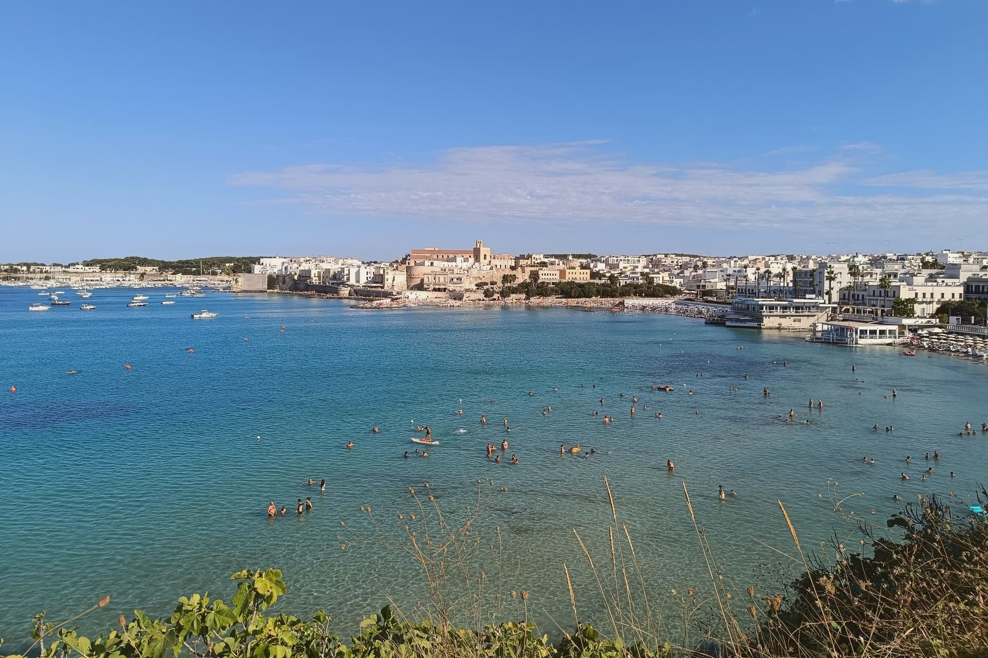
Otranto sits at sea level on a small promontory thirty kilometers southeast of Lecce, the easternmost city of Italy and the closest mainland point to Albania across the eighty-kilometer Strait of Otranto. The Cattedrale di Santa Maria Annunziata, consecrated in 1088, holds a mosaic floor laid between 1163 and 1165 by the monk Pantaleone for Archbishop Gionata.
About 800,000 tesserae across the three naves depict Adam and Eve, Noah, the Tower of Babel and a Tree of Life with biblical, classical and chivalric figures: Alexander the Great, Arthur, the months of the year. On 14 August 1480 an Ottoman force under Gedik Ahmed Pasha took the city; 813 inhabitants who refused to convert were beheaded on the Colle della Minerva and their bones are now in the cathedral, in seven glass-fronted recesses.
Pope Francis canonized them in 2013. The Castello Aragonese, raised by Ferdinand I of Aragon between 1485 and 1498, is the response: a five-sided fortress with a moat, built specifically to prevent a second sack.
Retrogusto, L' Altro Baffo, Umberto 1972 have been named by a guide.
What to see in Otranto
- Cattedrale di Santa Maria Annunziata. Norman cathedral consecrated in 1088, with Pantaleone's mosaic floor of 1163-1165 and the relics of the 813 martyrs of 1480 in seven glass recesses.
- Castello Aragonese. Five-sided Aragonese fortress raised 1485-1498 by Ferdinand I after the Ottoman sack, irregular plan with moat running the full perimeter.
- Chiesa di San Pietro. Byzantine cross-plan church in the centro storico, ninth-tenth century, with three apses and frescoes from the tenth through fifteenth centuries.
How to get to Otranto
There is a railway station in the town, so you can arrive without a car and never need one while you are here. Taranto is roughly 137 minutes away by road.
Our tip
May through September is the working coastal season, Adriatic water warm enough to swim by mid-May and the centro storico operational into the evening. July and August fill the small headland with day-trippers from across Salento and beyond; weekends in August are shoulder to shoulder along the Lungomare and the cathedral fills with queues. June and September are the sane choices, mild evenings and the same water without the crush.
Mattinata
Why visit Mattinata
Mattinata sits at seventy-five meters on the eastern Gargano. The Iapyges, immigrants from Greece and the Balkans, settled the surrounding hills from the fifth century BC; the Roman port of Matinum, on the modern seafront, gave the town its name.
The current settlement is younger than most Garganic centers: it was administered as part of Monte Sant'Angelo until 1955, when it became an independent comune. The town proper sits below the mountain that watches over it, the two bound by the same limestone that runs from the abbey ruins down to the coast.
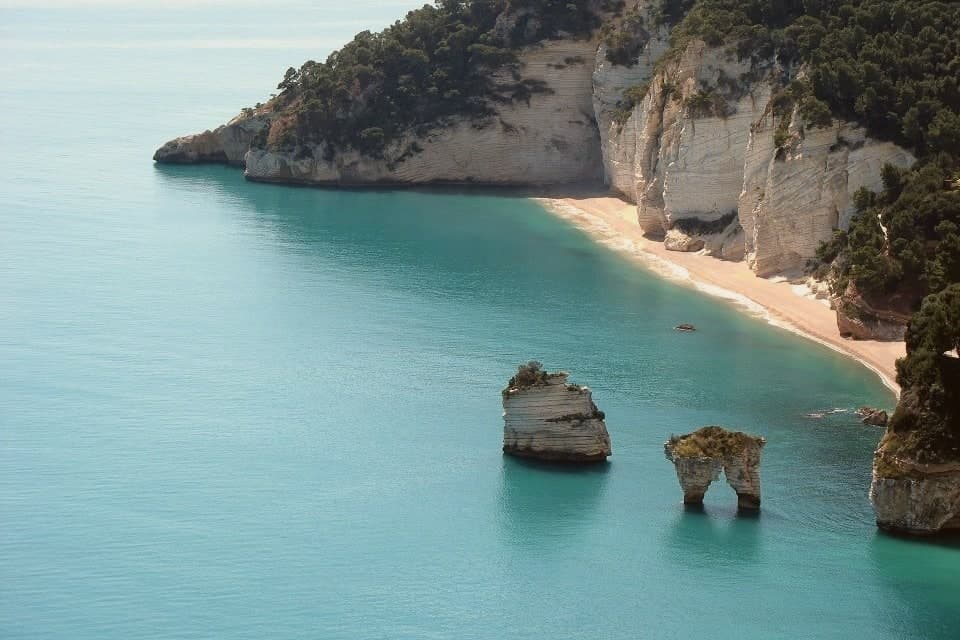
South of town the shoreline drops toward the sea stacks and, ten kilometers further on, the pebble crescent and cliffs of Baia di Vignanotica. The national park covers all of it, mountain, coast and town alike.
A settlement younger than its neighbors, built on ground far older: the Roman port beneath the seafront, the settled hills behind it, the abbey above it, all folded into a comune that has only carried its own name since the middle of the last century.
La Locanda del Maniscalco have been named by a guide.
What to see in Mattinata
- Baia delle Zagare. Bay south of town with two iconic limestone sea stacks, the arch-shaped Arco di Diomede and the scissor-shaped Le Forbici.
- Baia di Vignanotica. Pebble crescent under tall limestone cliffs, reached on foot from the Sentiero dell'Amore from Baia dei Mergoli.
- Monte Sacro and Abbazia della Santissima Trinità. Ruined abbey standing where Benedictine monks raised it to abbey status in 1138, after annexation to the abbey of Siponto brought its abandonment.
How to get to Mattinata
Foggia is roughly 72 minutes away by road.
Our tip
May through September is the season Mattinata runs at full strength. The Adriatic water at Vignanotica and Baia delle Zagare is swimmable from late May, the Monte Sacro trail is at its best when the orchids flower in May and June, and the coastal cliffs catch a long evening light through the summer. July and August push past thirty degrees and fill the beaches; the boat shuttle to the faraglioni is the easier access.
Vernole
Why visit Vernole
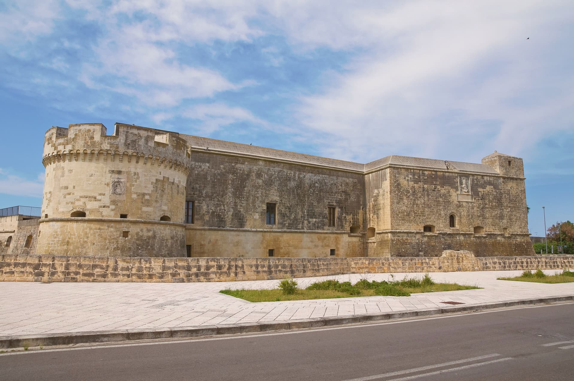
Vernole sits ten kilometers southeast of Lecce, on the line between the city and the Adriatic, with a small stretch of coast of its own and a string of frazioni that includes Strudà, Pisignano, Vanze and Acaya. The village at Acaya was originally called Segine and was granted as a fief in 1294 by Charles II of Anjou to Gervasio dell'Acaya, well before its Renaissance rebuilding.
That earlier history is easy to miss standing in the citadel today, where the grid of streets and the walled perimeter read as a single sixteenth-century act rather than a place with a medieval name underneath it. The commune itself is split between this inland fortified core and the coast, where the Cesine reserve holds the dune system ten kilometers east of the citadel.
Vernole's own centro, with its rebuilt mother church, sits apart from both, the administrative middle point between a Renaissance curiosity and a wetland on the Adriatic. The three parts, town, citadel and coast, rarely overlap in a visitor's day: whichever draws people to the commune, the other two are reached separately, not passed through.
Lilith have been named by a guide.
What to see in Vernole
- Castello di Acaya. Renaissance fortress of 1535-1536 by Gian Giacomo dell'Acaya, trapezoidal with a wet moat, one of the best examples of sixteenth-century defensive architecture in Terra d'Otranto.
- Borgo fortificato di Acaya. Walls, gates and a grid of stone streets laid out between 1521 and 1536, still readable underfoot as the plan the engineer drew.
- Riserva Naturale Le Cesine. Dune systems and pine groves along the longest stretch of protected lower-Salento coast, on the Adriatic edge of the commune.
How to get to Vernole
Taranto is roughly 107 minutes away by road.
Our tip
May, June, September and early October are the easiest months: the Acaya walls workable from morning into the evening, Le Cesine in spring migration or autumn passage, and the Adriatic still swimmable. July and August are dry and very hot on the coastal plain, with the citadel best visited at opening or in the last hour of daylight. The classical music programs in the courtyard of the Castello di Acaya run on summer evenings.
Ugento
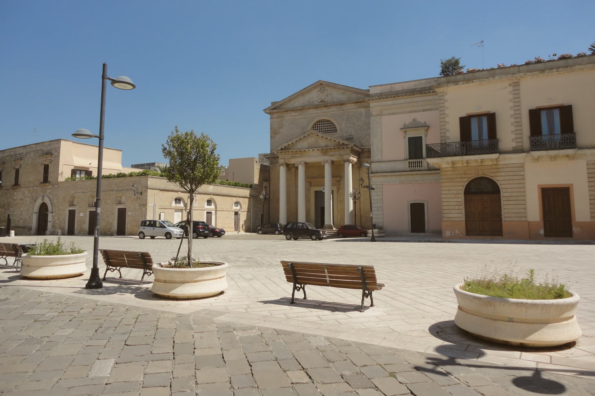
Why visit Ugento
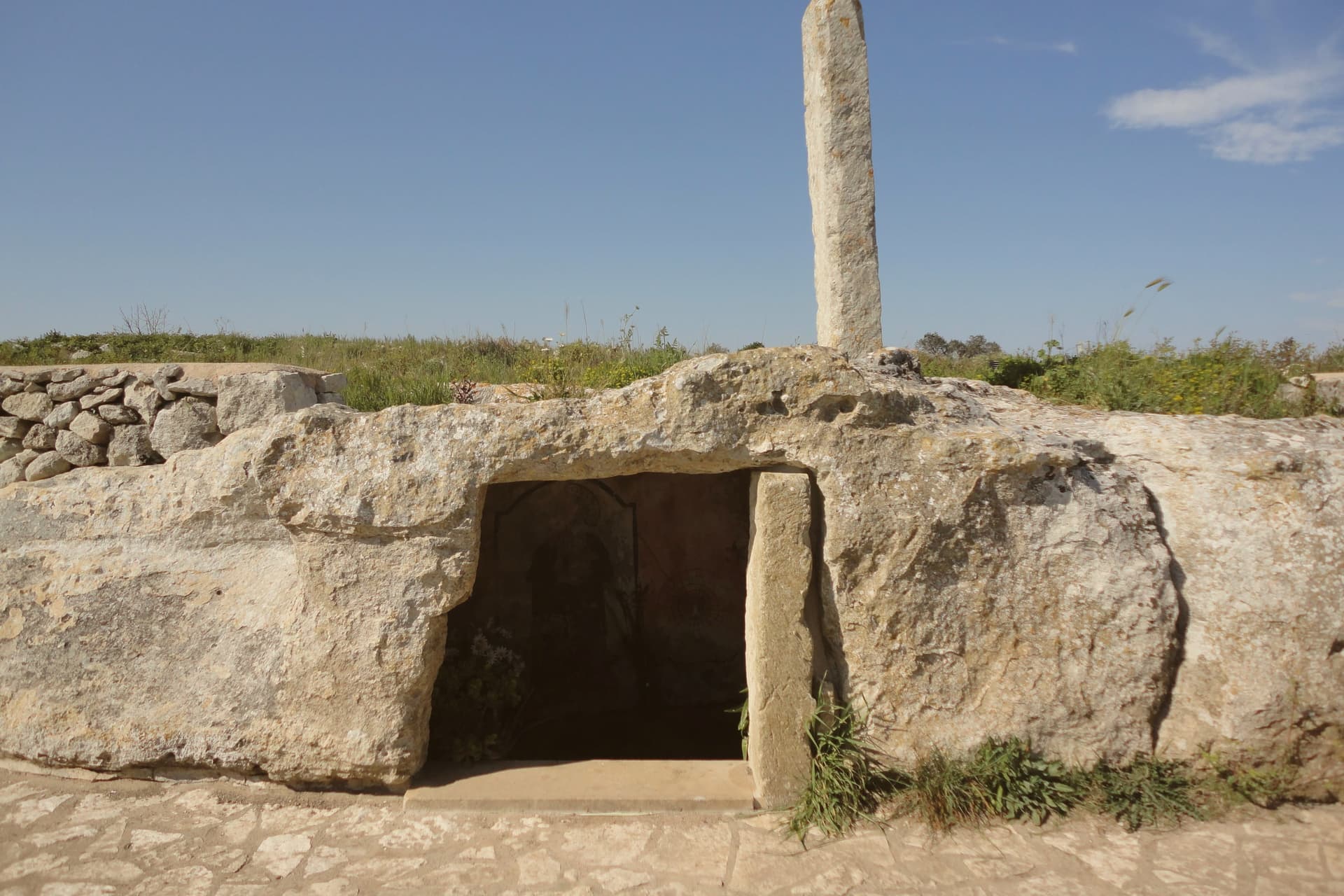
Ugento sits five kilometers inland from the Ionian, its centro built directly over the Messapian city of Ozan, the name recorded on the fourth-century-BC Soleto Map. The walls of that older city and the chamber tombs of its necropolis mark the boundary between the modern town and the ground it grew from, remnants of the civilization that held the lower peninsula between the seventh and third centuries BC.
The castle at the center of town began as a Norman motte-and-bailey raised on those same Messapian foundations, later rebuilt as a Baroque palazzo by a family who frescoed its grand salons to record their own history. A bronze Zeus, cast around 530 BC and found by chance in a cellar in 1961, is now kept in Taranto, with only a copy remaining locally, so the town's oldest and most valuable object is known here mostly by its absence.
Inland, the layered town of walls, tombs, castle and cathedral holds the historical weight; on the coast, the frazioni carry the summer crowds. The two halves of Ugento, one built on the memory of Ozan and one facing the sea, run on entirely different clocks.
La Bottega dei Sapori, Farnari Unconventional Locanda have been named by a guide.
What to see in Ugento
- Castello di Ugento. Norman fort rebuilt as a Baroque palazzo by the d'Amore family in the 1690s, with first-floor grand salons frescoed in 1694 to celebrate family history.
- Nuovo Museo Archeologico. Town archaeological museum displaying Messapian finds, the Cozza Petrosa necropolis material and a bronze copy of the Zeus of Ugento.
- Mura Messapiche e Necropoli di Cozza Petrosa. Walls and the trullo-shaped chamber tombs of the necropolis sit at the edge of the centro, the oldest layer of the city built over by the modern town.
How to get to Ugento
There is a railway station in the town, so you can arrive without a car and never need one while you are here. Taranto is roughly 129 minutes away by road.
Our tip
May, June, September and the first half of October are the gentle months on the Ionian Salento: warm sea, cool evenings, the centro and the coast usable in the same day. July and August are dry and very hot, with the Marine packed and the centro storico empty between two and five in the afternoon. The Bandiera Blu beaches at Torre San Giovanni and Lido Marini do most of the August traffic and rates climb accordingly.
Vieste
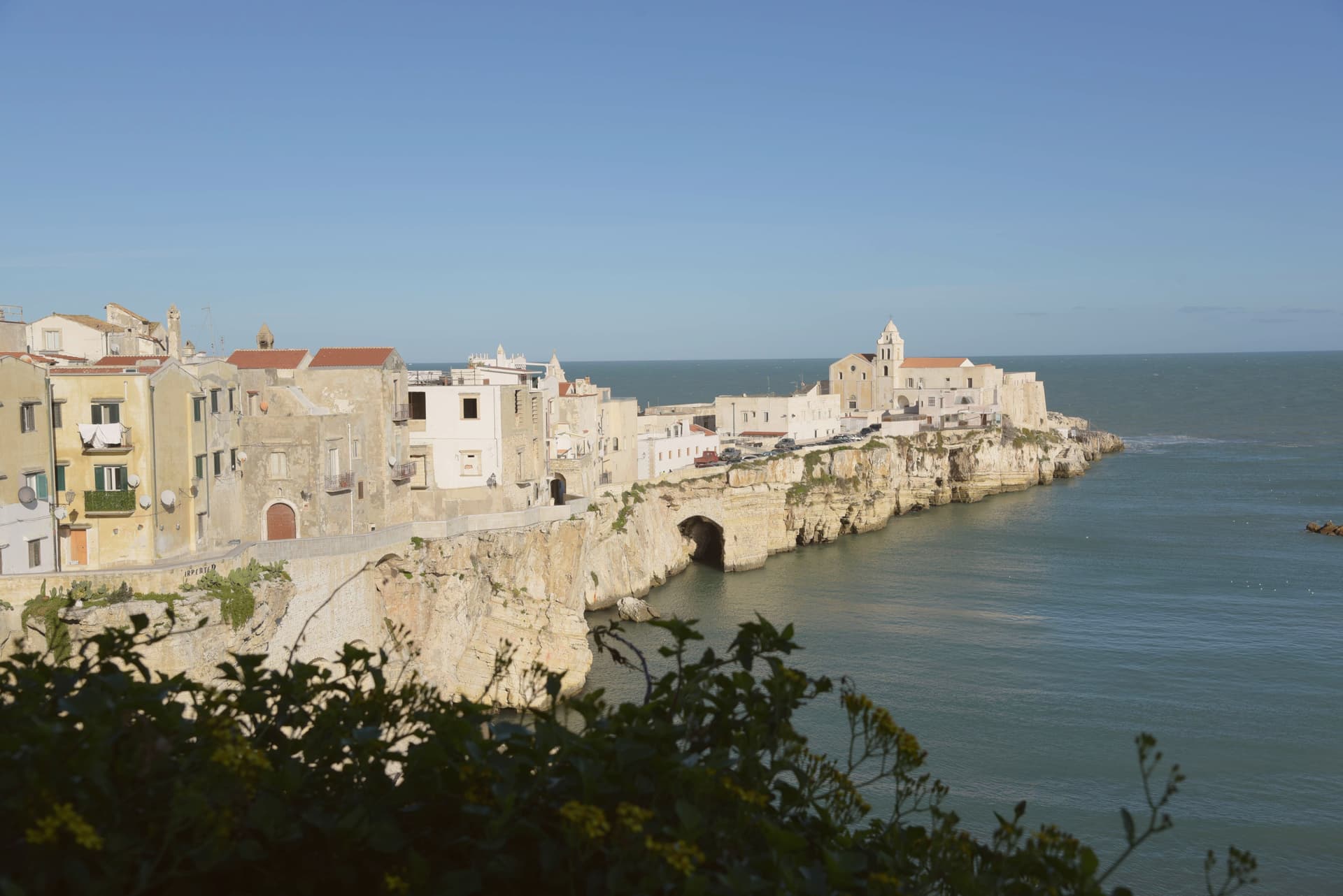
Why visit Vieste
Vieste sits at the eastern tip of the Gargano promontory inside Gargano National Park, a medieval town on a white limestone cliff dropping straight into the Adriatic. The Cathedral was begun in the second half of the eleventh century in Apulian Romanesque, with three naves on two rows of six columns and capitals carved in oriental floral and animal motifs.
The Norman castle of the eleventh century was rebuilt by Frederick II in 1242 as part of a coastal fortification line; the trapezoidal block of 1242 still anchors the headland. On July 18-21, 1554, the Ottoman corsair Dragut sacked the town and executed roughly 5,000 inhabitants on the slab of stone now known as the Chianca Amara, the bitter stone, set into the lane that carries the memory.
Pizzomunno, the 26.6-meter limestone sea stack on Spiaggia del Castello, is the symbol of the Gargano and the centerpiece of a local legend about a fisherman whose lover was taken by sirens. The Bandiera Blu marks the water at Pizzomunno, Scialmarino and Lungomare Mattei.
Al Dragone, Donlù, La Ripa and 1 more have been named by a guide.
What to see in Vieste
- Cattedrale di Santa Maria Assunta. Eleventh-century Apulian Romanesque cathedral, three naves on two rows of six columns, with Corinthian and cubic capitals carved in zoomorphic and floral motifs.
- Castello Svevo. Norman fortress rebuilt by Frederick II in 1242 on the headland above the sea, part of the Hohenstaufen Adriatic defensive line, still anchoring the old town.
- Pizzomunno. Limestone sea stack 26.6 meters high on Spiaggia del Castello, the symbol of Vieste and the Gargano, attached to the legend of the fisherman and his stolen lover.
How to get to Vieste
Foggia is roughly 109 minutes away by road.
Our tip
May, June, September and the first half of October are the windows when Vieste works without the heat or the August crowd: warm Adriatic, breezy headland, the centro storico walkable in afternoon as well as evening. July and August are very hot and crowded, with the Bandiera Blu beaches at capacity and rates at peak; the centro storico empties between two and five and refills after sunset for the passeggiata. October still holds for swimming on the south-facing beaches.
More from Anywhere Italy
- The 7 best towns inside a national park that eat well in Puglia
- The best hidden olive oil towns that eat well in Puglia
 The 9 best hidden towns you can reach by train that eat well in Puglia
- The best coastal towns with a serious restaurant in Puglia
 The best hidden beach towns in Puglia
- The best coastal towns within an hour of Lecce