
The best towns inside a national park in Lazio
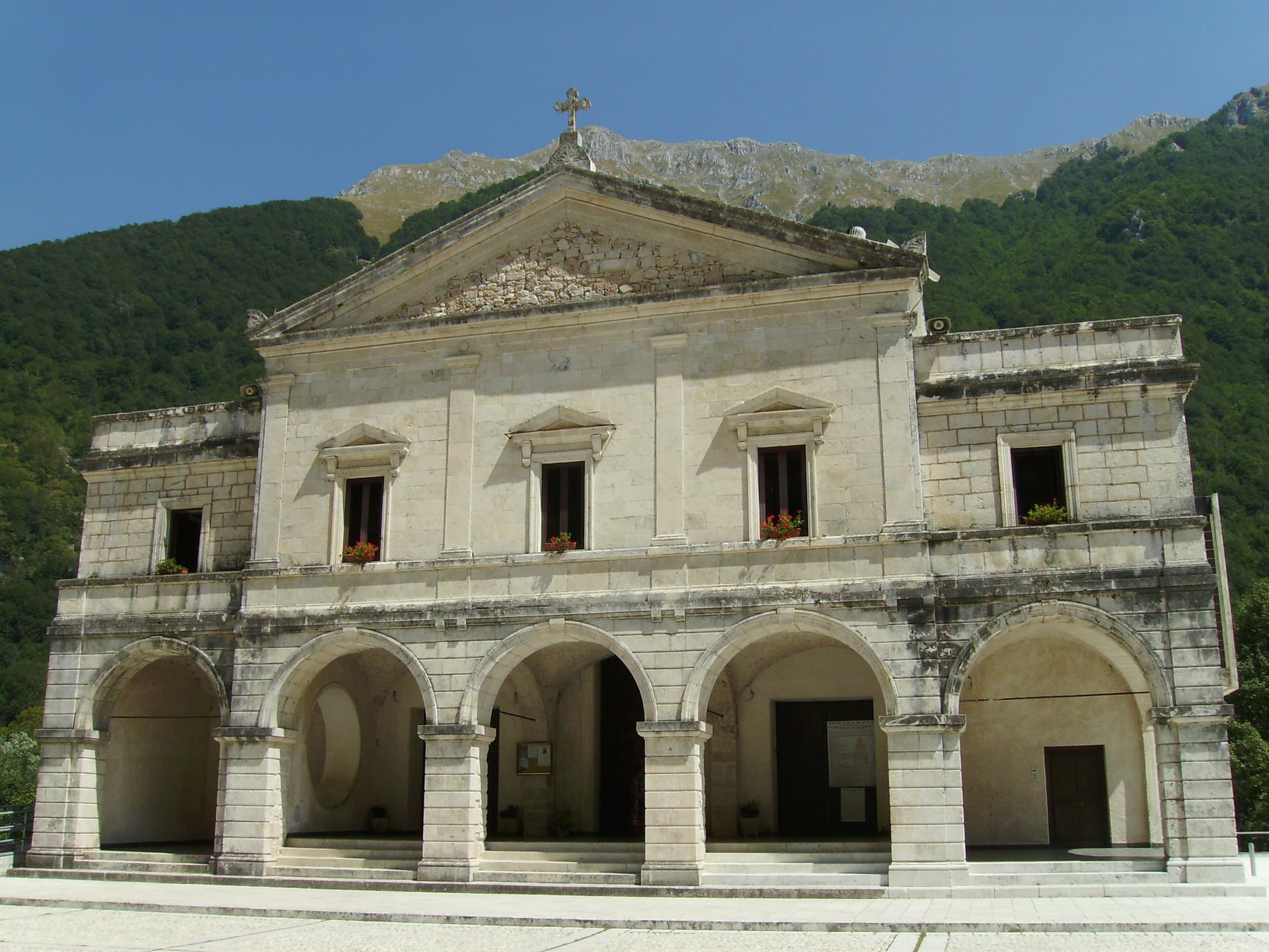
Lazio hides its wild edges behind Rome. East and south of the city the land climbs into limestone and beech, where wolves and Marsican bears still move through the Apennine national parks, and shepherds' tracks run between stone villages built from the grey rock underfoot. On the coast the ground goes flat and sandy, pine forest behind the dunes, brackish lakes full of migrating birds in autumn, and a single promontory of white rock rising out of the plain. The kitchens follow the geology: mountain pecorino, cured pork and lentils, hand-cut pasta in tomato and guanciale up in the hills, and sea urchin, mullet and eels down on the lagoons. Spring for the wildflower meadows and Easter processions, late September for the sea without the queue for a parasol.
Most visitors treat all of this as a day trip. They stay in Rome, take the train to Tivoli for the fountains, or drive down the Via Appia to Sperlonga and sit on a beach that is fully booked by the middle of July. It is a reasonable plan and the reason the coastal road south of the capital jams solid on August weekends, with car parks charging by the hour and every fritto misto served at a rush. The famous names are famous for good cause. They are also seen at the same time as everyone else.
The parks do not stop where the coach tours turn round. The same protected forest that holds the bears continues into the Comino valley on the Lazio side of the Abruzzo border, and the same dunes and pine woods run the length of the Pontine coast into a park of lakes and sea cliffs. The towns here sit inside the park boundary rather than beside it, which means trailheads at the edge of the historic centre and rangers who know which flowers are out. Fewer people go, and the ones who do tend to be walking.
Of the 60 communes we have mapped in Lazio, 6 qualify as towns inside a national park: each sits inside the boundary of a national park. The smallest, Picinisco, has 1,098 residents.
If you are still choosing, we have also written The best mountain towns in Lazio and The best towns that eat well in the province of Latina.
Picinisco
Why visit Picinisco
Picinisco occupies a fortified spur inside the Parco Nazionale d'Abruzzo, Lazio e Molise, looking down on the Val di Comino below. The village itself divides along the slope: a lower piazza gives onto the narrow streets of the centro storico, which climb toward the castle ruins at the top, the point originally built to hold the eastern approach to the valley.
The parish church sits higher up, its baroque interior resting on medieval foundations, a layering repeated in the castle and the streets around it. The food still defines the place.
Pecorino di Picinisco DOP comes from raw sheep milk produced on the pastures above the village, and the valley also holds Maturano, a white grape almost extinct before the I Ciacca winery, founded by returning Scots-Italians, restarted it. That last detail closes a loop that runs through the whole town: the same families who left for Glasgow and Edinburgh through the last century are the ones who came back to put the valley's own wine back into production.
What to see in Picinisco
- Castello medievale. Ruined medieval castle on the highest point of the village, built to control the eastern access to the Val di Comino.
- Centro storico. Fortified medieval village, narrow stone streets climbing from the lower piazza toward the castle.
- Chiesa di San Lorenzo. Parish church in the upper village, baroque interior on medieval foundations.
How to get to Picinisco
There is no station we could confirm here, so this one means driving. Napoli is roughly 124 minutes away by road.
Our tip
May through October is the open season at 725 meters: trails into the national park clear of snow, pastures in production, and the village restaurants serving pecorino with Maturano. June through August stays cool here even when the Lazio coast hits the mid-thirties, the altitude keeping nights in the teens. September and October are the most rewarding months for hikers: the beech woods of Forca d'Acero turn through every shade of red.
San Donato Val di Comino
Why visit San Donato Val di Comino
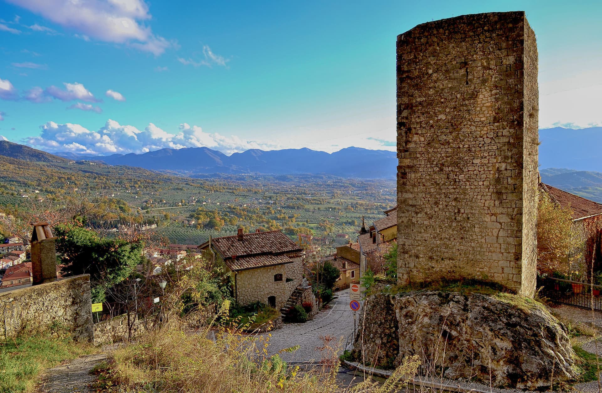
San Donato Val di Comino sits at 728 meters on the eastern wall of the Val di Comino, the last Lazio village before the Forca d'Acero pass crosses into Abruzzo at 1,538 meters. The Samnite town of Cominium stood near here until the Romans destroyed it in 293 BC.
The current village formed around the Church of San Donato in the 12th century. The Jewish community here is among the better-documented in southern Italy: forced to wear the badge in the 13th century, expelled and readmitted through the medieval period, and in 1940 the village became one of the internment locations chosen by the Fascist regime for foreign Jews, a story documented in the Casa della Memoria.
The position at the foot of the Forca d'Acero pass makes the village the standard starting point for climbing into the beech forests and the Pescasseroli plateau on the Abruzzo side.
What to see in San Donato Val di Comino
- Centro storico. Medieval village at 728 meters, built around the Church of San Donato from the 12th century, encircled by Bourbon-era walls.
- Chiesa di San Donato. Parish church on the site of the 12th-century original, the nucleus around which the village formed.
- Casa della Memoria. Documentation center on the 1940 internment camp for foreign Jews and on the village's medieval Jewish community.
How to get to San Donato Val di Comino
There is no station we could confirm here, so this one means driving. Latina is roughly 108 minutes away by road.
Our tip
May through October is the active season. June and July bring the high pastures into production and the trails dry. September and October are the visual peak: the beech forests of Forca d'Acero turn red and gold, drawing day-trippers from Rome and Naples.
Amatrice
Why visit Amatrice
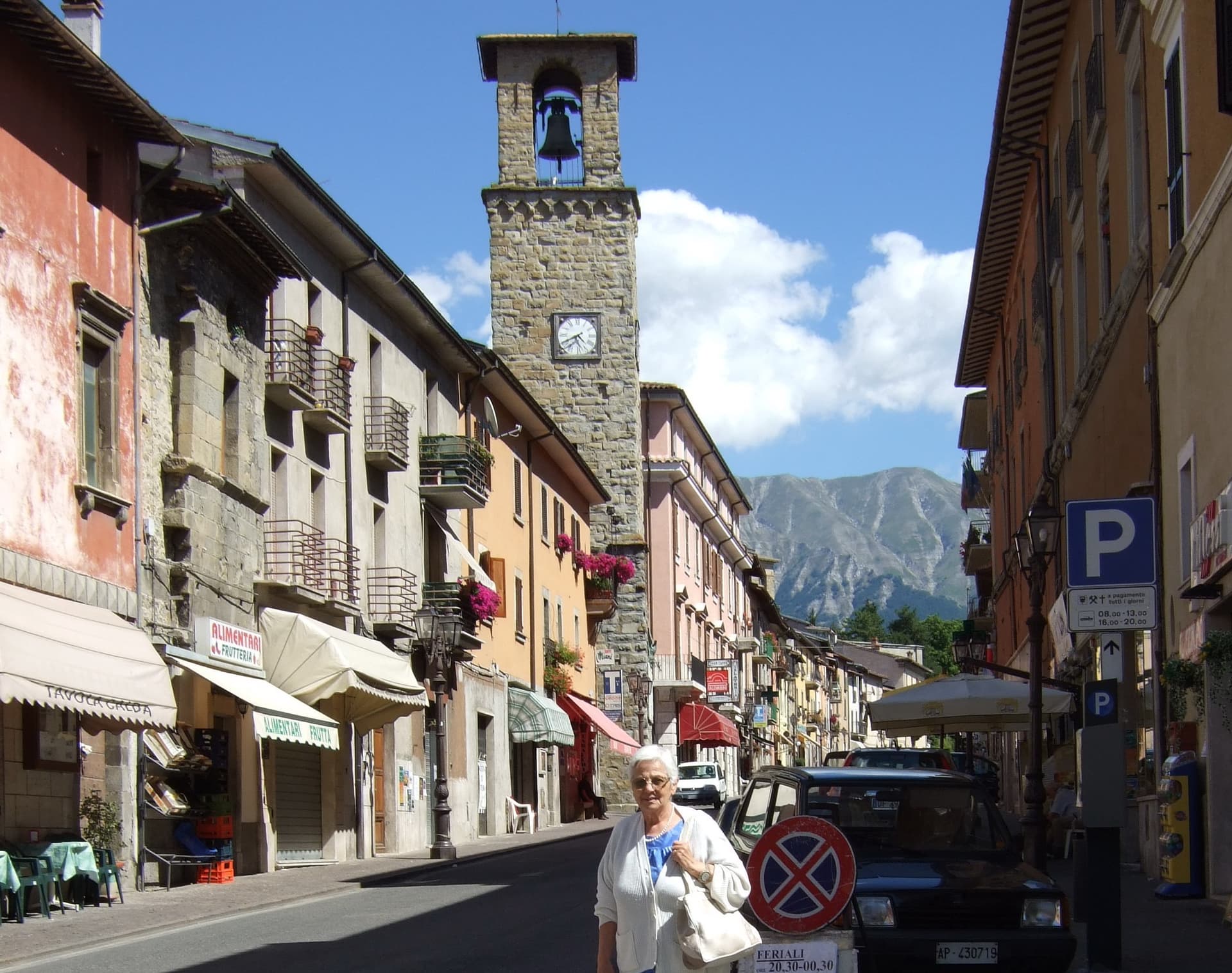
Amatrice sits on a saddle where Lazio runs into Abruzzo and the Marche, the range rising directly above the roofs. The Corso Umberto I and the Piazza Sagnotti formed the spine of the centro storico, the two anchored by the tower at their crossing and by the church nearby; both collapsed almost completely on 24 August 2016.
Two hundred and ninety-five people died in the cratere, most of them here. The town that survived gave its name to sugo all'amatriciana, guanciale, pecorino, pepper, and, since the nineteenth century, tomato.
The Sagra degli Spaghetti all'Amatriciana, run since 1967, returned in 2018 in the temporary food court Area Food, held among the ruins while reconstruction went on around it. Reconstruction continues below; the peaks above are unchanged.
The dish carried the name outward long before the earthquake made the name known for a different reason, and the two facts now sit side by side in anyone's memory of the place.
What to see in Amatrice
- Torre Civica. Fourteenth-century civic tower at the crossing of Via Roma and Corso Umberto. Severed at the bell chamber in 2016, it stood under scaffolding for six years; consolidation began in August 2022 and the bell stage was finished in 2023.
- Chiesa di Sant'Agostino. Fourteenth-century church with a rose window heightened in the twentieth century. It was the first building to fall in 2016 and is the primary reconstruction priority in the centro storico.
- Monti della Laga. Sandstone Apennine range above town, sheltering rare relict beech and silver fir forest, inside the Gran Sasso e Monti della Laga National Park.
How to get to Amatrice
There is no station we could confirm here, so this one means driving. Terni is roughly 88 minutes away by road.
Our tip
May through October is the season for Amatrice. The Laga snow clears by late May; June and September are dry and clear, with the Pizzo di Sevo visible from the temporary square. July and August are the festival months: the Sagra degli Spaghetti all'Amatriciana, run since 1967 and resumed in 2018, brings the town back to its food and its name. Sagra degli Spaghetti all'Amatriciana falls in August.
Ponza
Why visit Ponza
Ponza is a 7.3 square kilometre volcanic crescent in the Tyrrhenian Sea, 40 km off the Lazio coast at Formia and 90 km off Naples. It is the main island of the Pontine archipelago.
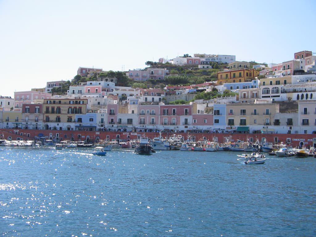
The shape is the story: the island is half of a collapsed Pliocene volcano, a curved ridge of pumice and white tuff cliffs rising 280m above the sea, with sheltered bays carved into the eastern, leeward side and vertical cliffs facing west into open water. The settlement sits at the southeast end, where the only natural harbour is, because that is the sheltered side.
Ferdinand IV of Naples brought settlers from the Bay of Naples in the 1770s to displace pirate use of the island, and the port and houses above it date from that colonisation. The north of the island, Le Forna, is a different register entirely: greener, quieter, given over to rock pools and abandoned mineral workings rather than the working harbour and its piazza at sea level.
The Roman fishpond caves, at the southeastern tip, show that this pattern of use goes back further still: aristocrats carving private breeding tanks into the same cliffs that would later be settled and painted at the harbour. The food is Tyrrhenian-island: zuppa di pesce, spaghetti alle vongole, fresh tuna, pesce azzurro, lentils from neighbouring Ventotene, and the local Biancolella and Forastera white wines grown on terraced volcanic slopes.
Ferries from Formia and Anzio run year-round but service drops sharply October to April. The island is seasonal in a literal sense: summer roughly doubles its population with Romans and Neapolitans, while winter empties the restaurants and leaves the place quiet.
What the island amounts to, in the end, is a single volcanic ridge worked in layers: Roman engineering at one tip, an 18th-century harbour settlement at the other, and an untouched, quieter half left to the north.
What to see in Ponza
- Chiaia di Luna. The Roman tunnel that once cut through the cliff to reach the beach is currently closed, so the crescent of pale sand is reachable only by boat from the harbour, seen from the water below the cliff face.
- Grotte di Pilato. The cave complex sits at the southeastern tip of the island, cut directly into the cliff face, with separate chambers for different species kept apart in the breeding tanks.
- Bourbon-pastel harbour. The horseshoe port is lined with houses cascading up the hillside behind it. The town's main piazza, Pisacane, sits at sea level at the water's edge.
How to get to Ponza
There is no station we could confirm here, so this one means driving.
Our tip
Ponza is genuinely seasonal — May–June and September are the sweet spot, with warm water and uncrowded coves. July–August doubles the island's population and the harbour fills with day-trippers from Formia and Anzio; ferragosto is the absolute peak. Ferries run year-round from Formia (and Anzio in summer) but service drops sharply October–April and most restaurants close.
San Felice Circeo
Why visit San Felice Circeo
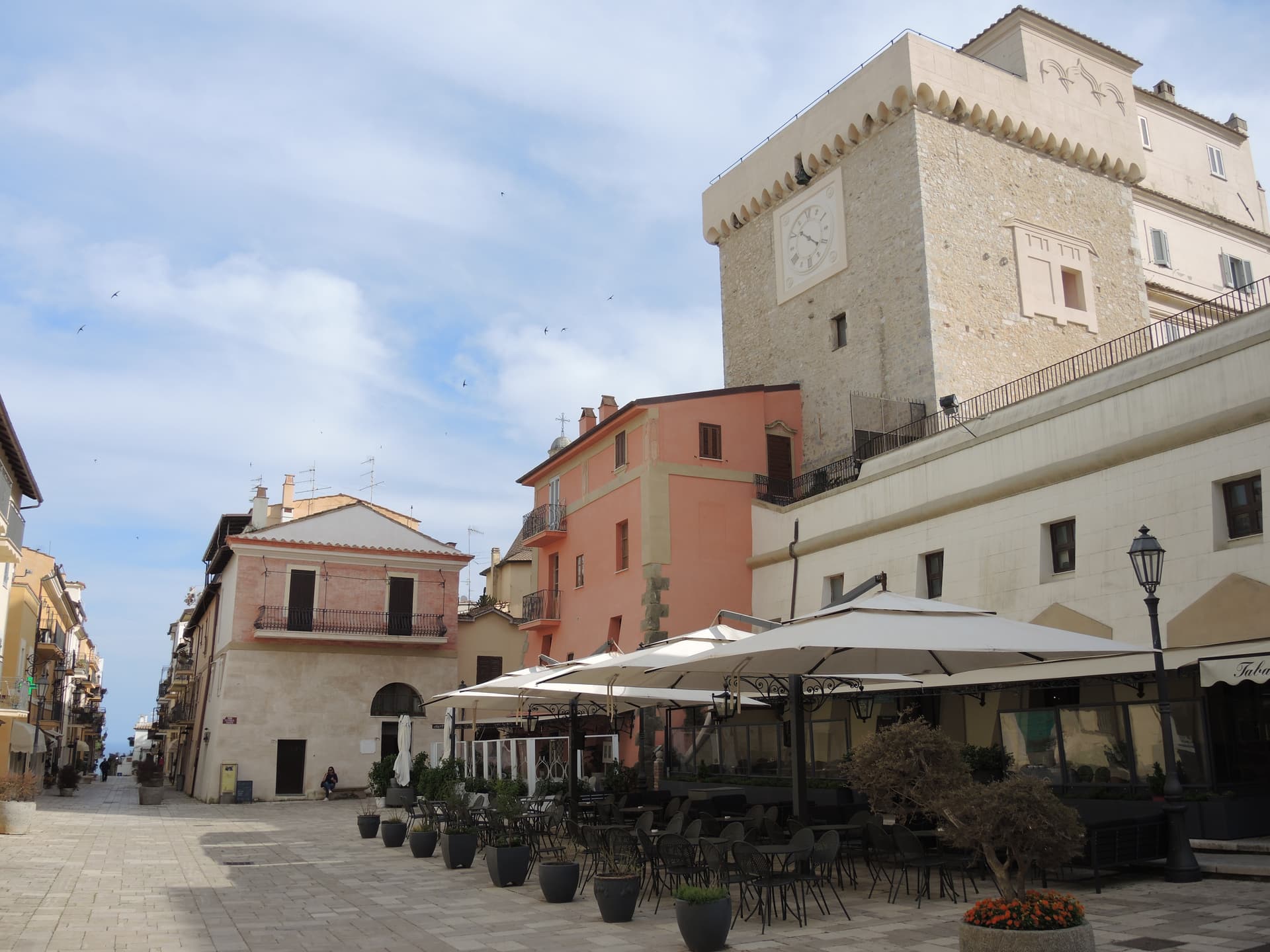
San Felice Circeo sits at about 100 meters on the inland flank of the promontory, the limestone mass that closes the south end of the old Pontine Marshes. The Romans called the ancient city here Circeii; the treaty between Carthage and Rome in 509 BC mentions it by name.
The cape is still called Promontorio del Circeo, after the sorceress who turned Odysseus's men into pigs. The centro storico is small, built inland and above the water rather than on it, with the coast reached by a road that drops from the borgo to the beaches below.
The baronial palace adjoins the tower on the town's small piazza, the medieval heart of the fortified center, while the cave on the promontory's south face sits apart from both, closer to the sea than to the old town. Below the borgo, the coast runs into the beaches of the Parco Nazionale del Circeo, with views across the Gulf of Gaeta to the Pontine Islands.
What holds the town together is the promontory itself: a single limestone landmark that has given the place its name, its ancient treaty mention, its myth, and its oldest human trace, while the borgo that grew on its flank stayed small enough to be walked in an afternoon.
What to see in San Felice Circeo
- Torre dei Templari. Thirteenth-century tower with Guelph crenellations on Piazza Lanzuisi, built between 1239 and 1259 on a Roman-era foundation.
- Palazzo Baronale. Baronial palace adjoining the Templar tower, the medieval heart of the small fortified centro storico.
- Monte Circeo. Limestone promontory rising to 541 meters, with Path 750 to the summit and views across the Pontine Islands and the Gulf of Gaeta.
How to get to San Felice Circeo
There is no station we could confirm here, so this one means driving. Latina is roughly 41 minutes away by road.
Our tip
May through September is the season for the beaches and the Monte Circeo trails. June and September are the calmest months on the water and the easiest for the climb to the summit, with cooler air and no afternoon haze. July and August push the rock into the high thirties and the trails go quiet between noon and four. San Felice Circeo falls in August.
Sabaudia
Why visit Sabaudia
Sabaudia stands on what was malarial swamp until the 1930s. Work began on 5 August 1933, the town was inaugurated on 15 April 1934, and the whole construction took 253 days.
It was the fifth of the new Pontine towns built on land drained under Mussolini and was named for the Savoy dynasty then on the throne. Four architects, Gino Cancellotti, Eugenio Montuori, Luigi Piccinato and Alfredo Scalpelli, won the competition with a plan that placed the civic center on an axis between the dunes and Lago di Paola, the coastal lagoon also called Lago di Sabaudia.
The Torre Civica, the post office and the Chiesa della SS. Annunziata stand around Piazza del Comune as one of the cleanest examples of Italian rationalism still in use.
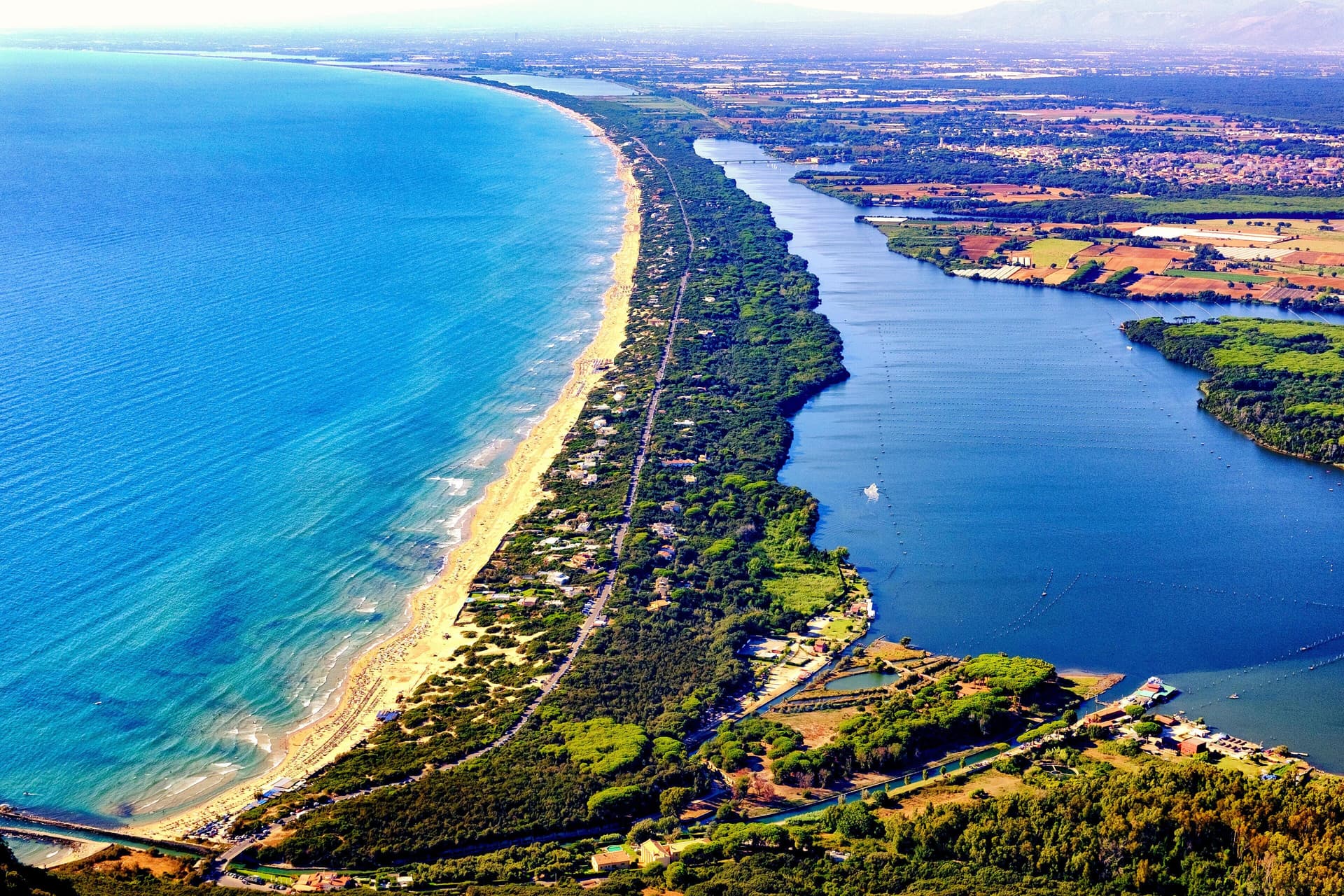
The Parco Nazionale del Circeo, which surrounds the town, protects the dune system, the lagoon, and the coastal forest behind Monte Circeo. Fifteen kilometers of open beach run south to San Felice, with a boardwalk along the dunes.
What to see in Sabaudia
- Torre Civica. Civic tower at the center of Piazza del Comune, the rationalist landmark visible from across the lagoon and the dunes.
- Piazza del Comune. Central square of the 1934 plan, lined by the Palazzo del Comune, the post office and the Chiesa della SS. Annunziata.
- Lago di Paola. Coastal lagoon of about 3.9 square kilometers, separated from the sea by the Sabaudia dunes and protected within the national park.
How to get to Sabaudia
There is no station we could confirm here, so this one means driving. Latina is roughly 41 minutes away by road.
Our tip
May through September is the season on the dunes. June and September are the best swimming months, with warm sea and emptier beaches than the peak. July and August fill with Roman weekenders and the town doubles in population; the boardwalk above the dunes stays the cleanest stretch.
More from Anywhere Italy
 The best mountain towns in Lazio
 The best towns that eat well in the province of Latina
 The best beach towns in the province of Latina
 The best hill towns inside a nature park in Lazio
- The best small towns inside a nature park in Lazio
 The best towns inside a nature park that have a serious restaurant in Lazio