
The best beach towns in the province of Latina
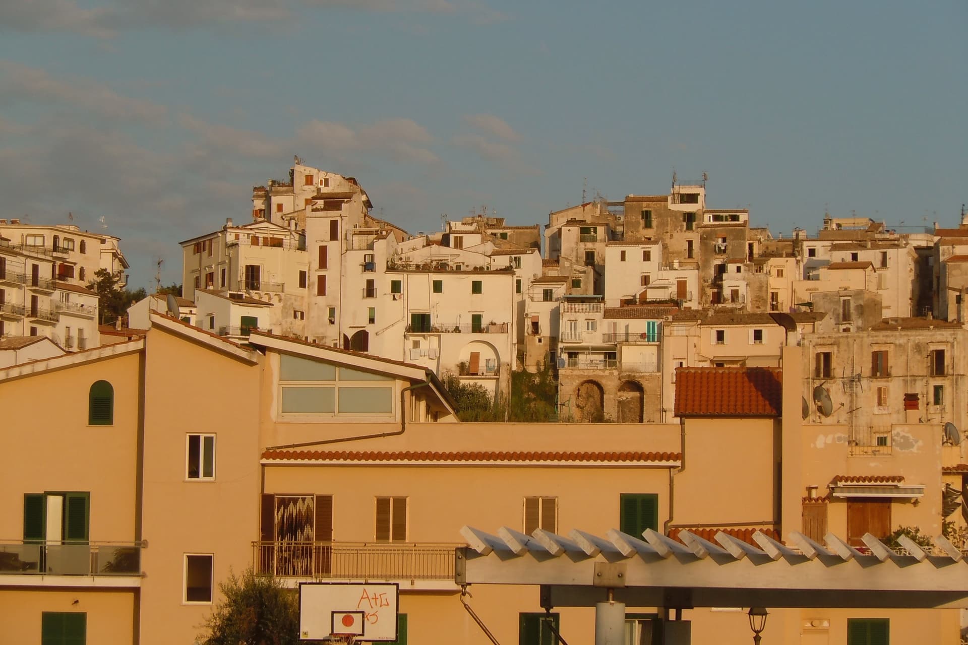
The coast of southern Lazio is built out of two materials, pale limestone and sand. Monte Circeo drops into the sea at one end and the promontory of Gaeta closes the other, and between them lie long shallow beaches backed by dunes, umbrella pines and brackish lagoons where eels and mullet are still fished. The towns above the water are white and stacked, lime-washed houses along stepped alleys, with Roman villas and Bourbon-era fortifications wedged in wherever the rock allowed. Eat the local buffalo mozzarella, the Sperlonga celery, the tiella of Gaeta stuffed with octopus or escarole, and the anchovies fried whole in early summer, before the August traffic arrives. Bathing season runs long here, well into September, when the water is warmest and the beaches quieten.
People heading south from Rome for a coastline mostly keep going, past Naples, to the Amalfi Coast. Positano and Amalfi collect the coaches, the terrace tables booked months ahead and the one road that jams in both directions from June onwards. It earns the attention, but the price is queueing for a lift down to a beach the size of a courtyard, and paying resort rates for a sunbed on grey shingle. The same crowds fill the ferries to Capri, and the return boats leave before dinner.
The Tyrrhenian does not begin at Sorrento. It runs continuously up through the Gulf of Gaeta and along the Pontine coast, with cleaner water, wider sand and towns that have not organised themselves entirely around visitors. These are the beach towns of the province of Latina, each of them holding the national award for clean bathing water and beaches that are properly looked after. Fewer people go, and the ones who do are mostly Roman.
Of the 11 communes we have mapped in the province of Latina, 7 qualify as beach towns: each holds the national award for clean bathing water and well-run beaches. The smallest, Sperlonga, has 3,050 residents.
If you are still choosing, we have also written The best towns that eat well in the province of Latina and The best towns inside a nature park that have a serious restaurant in Lazio.
Sperlonga
Why visit Sperlonga
Sperlonga sits on a rocky spur on the Tyrrhenian coast, halfway between Rome and Naples. A Republican-era villa at the base of the town was inherited by Tiberius, who reigned from 14 to 37 AD and made the place his retreat.
Road crews building the coastal route between Terracina and Gaeta broke into its sea grotto in 1957, exposing the fragments now reassembled in the villa's museum: Odysseus blinding Polyphemus, the rape of the Palladium, Scylla devouring sailors. The town proper stands above, pedestrianized, a maze of stone houses, arches and stair-streets that drop down to the shore on either side of a cliff promontory.
The whitewash covering those walls is not decorative but a centuries-old defense against malaria and sun. Buffalo mozzarella country starts an hour south, and Sperlonga is the last Lazio commune before the Campania border, a town built literally on top of the emperor's private theater, with the modern coast road tracing the same line that cut it open.
The beach here holds the national bathing award, which a comune has to win back every year on water quality, beach management and safety.
What to see in Sperlonga
- Villa di Tiberio e Grotta. Imperial seaside villa with a natural grotto staged as a banqueting hall, where the marble Odyssey groups were unearthed in 1957.
- Museo Archeologico Nazionale. On-site museum displaying the reconstructed Sperlonga sculptures, including Odysseus blinding Polyphemus and the Scylla group.
- Centro storico. Pedestrian-only whitewashed old town on Monte San Magno, a maze of arches, stair-streets and lime-washed stone houses.
How to get to Sperlonga
Latina is roughly 65 minutes away by road.
Our tip
May through September is the season Sperlonga is built for: the beaches open, the boats run to the grotto, and the centro storico fills with day-trippers from Rome and Naples. June and September are the calmer bookends, mid-twenties, water warm enough to swim. July and August touch thirty-five and the two beaches fill by ten in the morning.
San Felice Circeo
Why visit San Felice Circeo
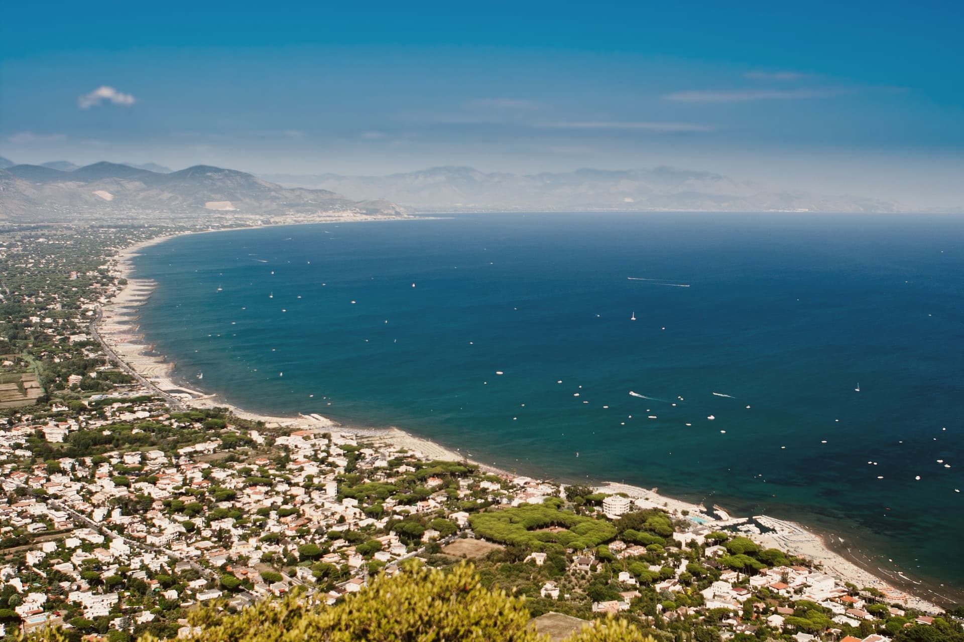
San Felice Circeo sits at about 100 meters on the inland flank of the promontory, the limestone mass that closes the south end of the old Pontine Marshes. The Romans called the ancient city here Circeii; the treaty between Carthage and Rome in 509 BC mentions it by name.
The cape is still called Promontorio del Circeo, after the sorceress who turned Odysseus's men into pigs. The centro storico is small, built inland and above the water rather than on it, with the coast reached by a road that drops from the borgo to the beaches below.
The baronial palace adjoins the tower on the town's small piazza, the medieval heart of the fortified center, while the cave on the promontory's south face sits apart from both, closer to the sea than to the old town. Below the borgo, the coast runs into the beaches of the Parco Nazionale del Circeo, with views across the Gulf of Gaeta to the Pontine Islands.
What holds the town together is the promontory itself: a single limestone landmark that has given the place its name, its ancient treaty mention, its myth, and its oldest human trace, while the borgo that grew on its flank stayed small enough to be walked in an afternoon.
The beach here holds the national bathing award, which a comune has to win back every year on water quality, beach management and safety.
What to see in San Felice Circeo
- Torre dei Templari. Thirteenth-century tower with Guelph crenellations on Piazza Lanzuisi, built between 1239 and 1259 on a Roman-era foundation.
- Palazzo Baronale. Baronial palace adjoining the Templar tower, the medieval heart of the small fortified centro storico.
- Monte Circeo. Limestone promontory rising to 541 meters, with Path 750 to the summit and views across the Pontine Islands and the Gulf of Gaeta.
How to get to San Felice Circeo
Latina is roughly 41 minutes away by road.
Our tip
May through September is the season for the beaches and the Monte Circeo trails. June and September are the calmest months on the water and the easiest for the climb to the summit, with cooler air and no afternoon haze. July and August push the rock into the high thirties and the trails go quiet between noon and four. Circeo di Gusto - San Felice Circeo falls in July.
Gaeta
Why visit Gaeta
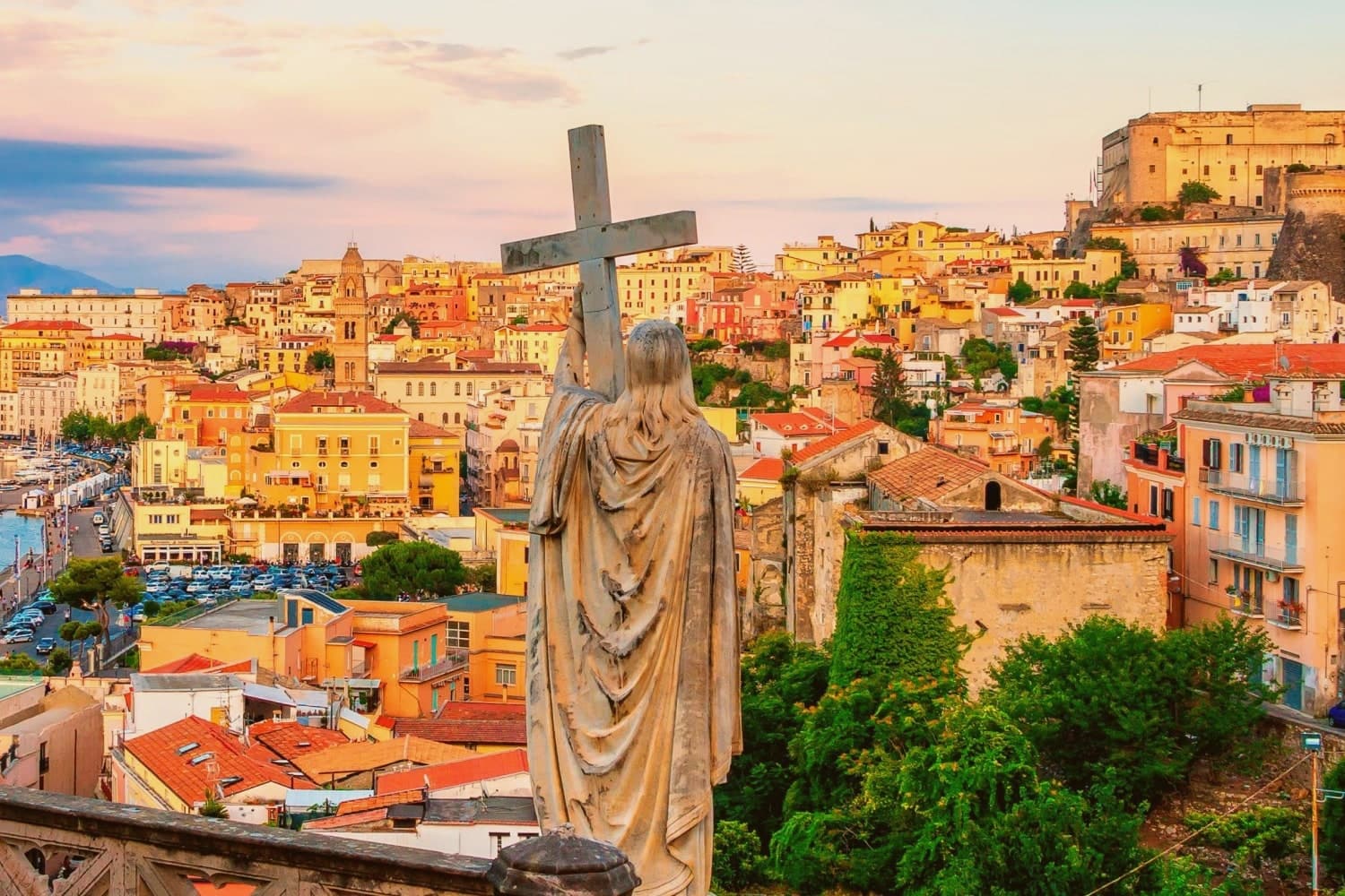
Gaeta sits on a promontory on the Tyrrhenian coast halfway between Rome and Naples, a shape that made it a port and a fortress before it was anything else. The wooded headland above the harbor is the hinge: it rises straight from the water, carries a Roman consul's tomb on its summit and a cliffside sanctuary on its flank, with the medieval quarter of Sant'Erasmo occupying the flatter ground at its base where the cathedral and the old churches stand behind the Bourbon-era walls.
The last chapter belongs to the Two Sicilies. Francis II and Maria Sofia held the town from November 1860 against the Sardinian army of Cialdini, and when the siege ended in February 1861 it ended the Bourbon kingdom in the south.
The tiella, the stuffed double-crust pie the town still makes, is what the defenders ate while it lasted. A fortified headland guarding a harbor, worn down by a Roman tomb, a medieval pilgrimage site, and a modern siege in turn: Gaeta's layers read less as separate monuments than as one defensible piece of coastline put to the same use again and again.
The beach here holds the national bathing award, which a comune has to win back every year on water quality, beach management and safety.
What to see in Gaeta
- Santuario della Montagna Spaccata. The sanctuary of the Santissima Trinità is wedged into the fissure itself, the rock walls closing overhead on the walk up to it. Pope Pius IX retreated here in 1848.
- Cattedrale di Santa Maria Assunta. Cathedral in Sant'Erasmo with a 57-meter Norman-Gothic campanile, decorated with marble fragments from earlier Roman buildings.
- Mausoleo di Lucio Munazio Planco. Roman circular tomb of the consul who founded Lyon, on the summit of Monte Orlando, dating to the late 1st century BC. The climb through the headland's woods to reach it is part of the point.
How to get to Gaeta
There is a railway station in the town, so you can arrive without a car and never need one while you are here. Latina is roughly 82 minutes away by road.
Our tip
May through September is the Tyrrhenian beach season, with Serapo and the other coves running at full capacity in July and August. June and September are the strong months: warm sea, manageable crowds, the headland walks on Monte Orlando still pleasant in the middle of the day. October and April are good for the old town and the sanctuary, when day temperatures stay in the low twenties and the cliffs hold the light.
Sabaudia
Why visit Sabaudia
Sabaudia stands on what was malarial swamp until the 1930s. Work began on 5 August 1933, the town was inaugurated on 15 April 1934, and the whole construction took 253 days.
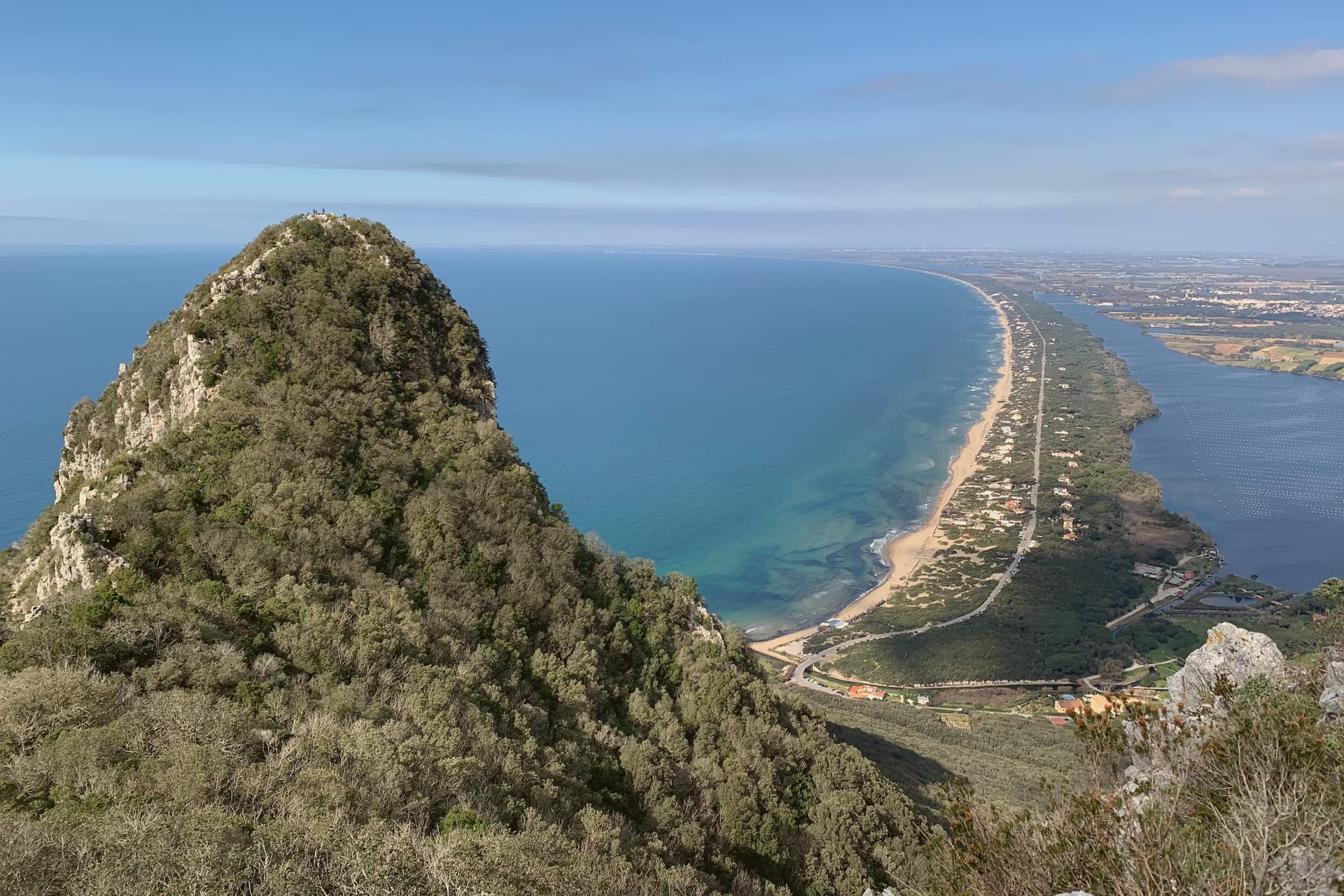
It was the fifth of the new Pontine towns built on land drained under Mussolini and was named for the Savoy dynasty then on the throne. Four architects, Gino Cancellotti, Eugenio Montuori, Luigi Piccinato and Alfredo Scalpelli, won the competition with a plan that placed the civic center on an axis between the dunes and Lago di Paola, the coastal lagoon also called Lago di Sabaudia.
The Torre Civica, the post office and the Chiesa della SS. Annunziata stand around Piazza del Comune as one of the cleanest examples of Italian rationalism still in use.
The Parco Nazionale del Circeo, which surrounds the town, protects the dune system, the lagoon, and the coastal forest behind Monte Circeo. Fifteen kilometers of open beach run south to San Felice, with a boardwalk along the dunes.
The beach here holds the national bathing award, which a comune has to win back every year on water quality, beach management and safety.
What to see in Sabaudia
- Torre Civica. Civic tower at the center of Piazza del Comune, the rationalist landmark visible from across the lagoon and the dunes.
- Piazza del Comune. Central square of the 1934 plan, lined by the Palazzo del Comune, the post office and the Chiesa della SS. Annunziata.
- Lago di Paola. Coastal lagoon of about 3.9 square kilometers, separated from the sea by the Sabaudia dunes and protected within the national park.
How to get to Sabaudia
Latina is roughly 41 minutes away by road.
Our tip
May through September is the season on the dunes. June and September are the best swimming months, with warm sea and emptier beaches than the peak. July and August fill with Roman weekenders and the town doubles in population; the boardwalk above the dunes stays the cleanest stretch.
Minturno
Why visit Minturno
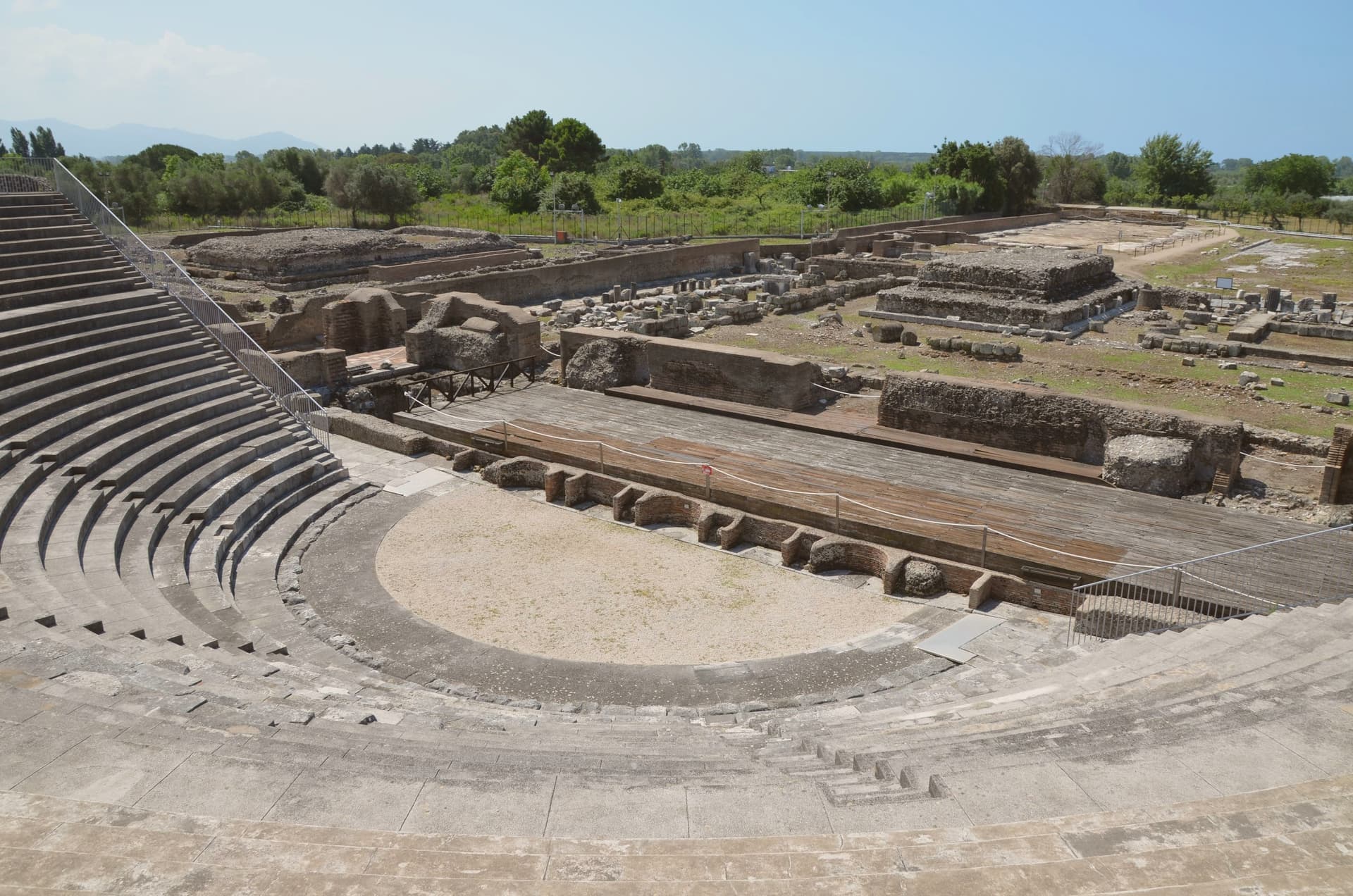
Minturno sits on a hill at 140 meters above the right bank of the Garigliano, with the Scauri and Marina coast running down from it to the Tyrrhenian. The two halves of the comune answer different needs and different centuries: the river mouth held the Roman colony and its flat, engineered plain, while the hill above took over as the medieval settlement once malaria and Saracen raids made the lowland unsafe to live on.
The castle at the center of the upper town carries that shift in its own fabric, with a ninth-century core built up over time by later lords. The coast has its own separate history again, flattened in 1943-44 as a battlefield on the German defensive line and rebuilt afterward around the bathing village of Scauri.
Olive country runs inland behind all of this, and the comune belongs to the Città dell'Olio network. What the town amounts to, then, is three settlements stacked in time rather than one: a Roman river port, a medieval hill town built in retreat from it, and a rebuilt postwar coast, each still legible in its own part of the comune.
The beach here holds the national bathing award, which a comune has to win back every year on water quality, beach management and safety.
What to see in Minturno
- Parco Archeologico di Minturnae. Theater, forum, aqueduct and amphitheater standing together at the river mouth, on the stretch of the Via Appia that once ran through the colony.
- Castello Baronale. Hilltop castle in the centro storico, its core built in the ninth century and expanded in stages by the Caetani and the Carafa through the medieval period.
- Basilica di San Pietro Apostolo. Basilica in the upper town holding a cosmatesque pulpit and Easter candlestick, both worked in the twelfth and thirteenth centuries.
How to get to Minturno
There is a railway station in the town, so you can arrive without a car and never need one while you are here. Napoli is roughly 79 minutes away by road.
Our tip
May through September is the season on the Garigliano coast. June and September give the best balance of warm sea and emptier beaches; July and August fill with Roman and Neapolitan weekenders and the seaside road slows. October is still warm enough to swim on calm days, and the inland olive harvest in late October and November is the busiest moment in the upper town.
Fondi
Why visit Fondi
Fondi sits in the middle of its own plain, the Piana di Fondi, a fertile basin between the Ausoni and Aurunci mountains halfway between Rome and Naples, with the Tyrrhenian only a few kilometers south. The Via Appia ran straight through it, and the town has been here since 338 BC, when its inhabitants gained limited Roman citizenship after the Latin War.
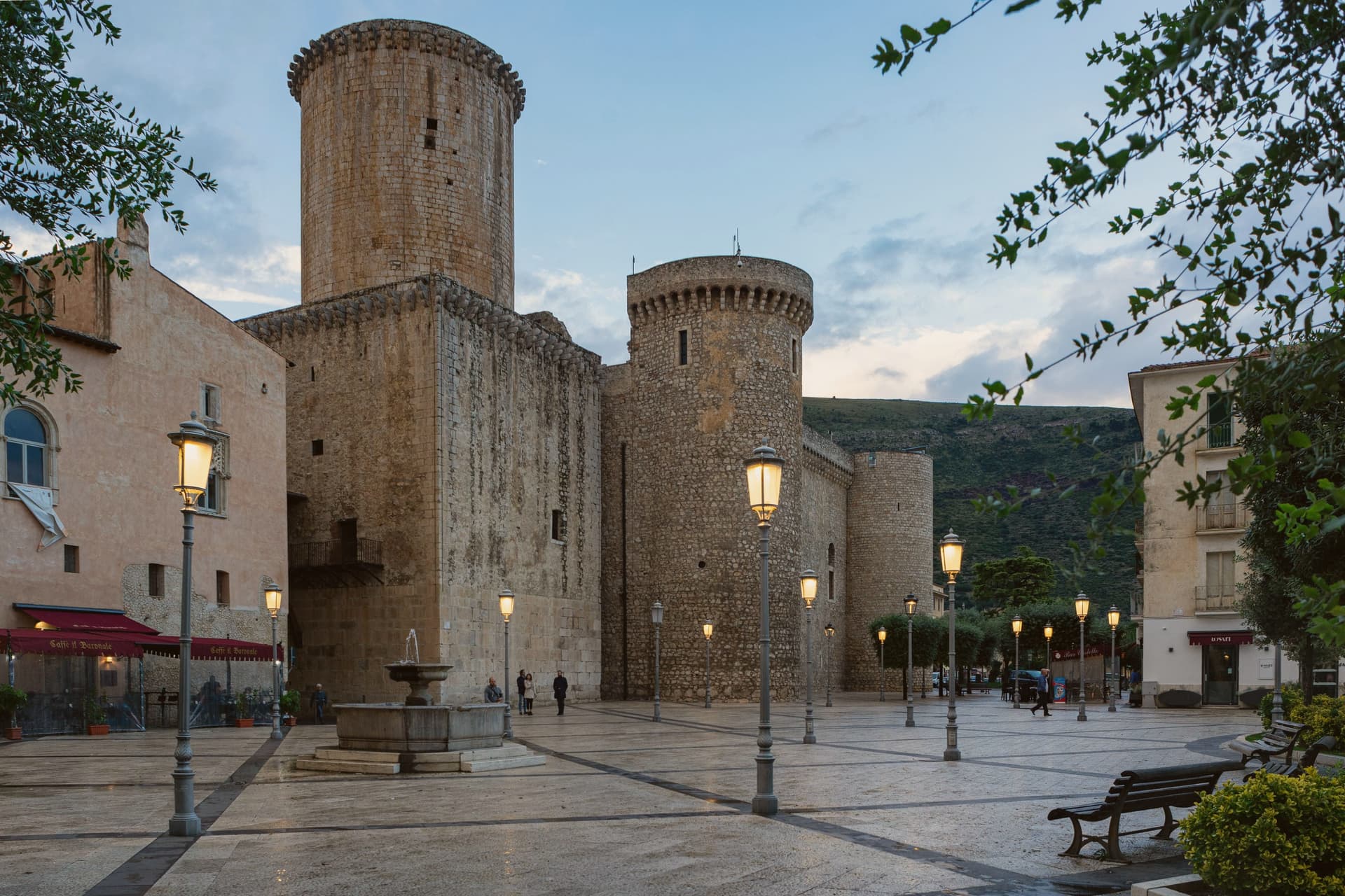
The old walls that once ringed the settlement still show at the base of the castle in the center, and inside those same walls sits the Giudea, the former Jewish quarter, so the medieval town and the Roman one occupy the same footprint rather than sitting apart. South of the built-up center the plain gives way to the Lago di Fondi, a brackish lake cut off from the sea by a sand bar and worked for fishing rather than farming.
The fields that surround all of this now feed the Mercato Ortofrutticolo, moving millions of tons of produce a year out of a basin whose flatness once made it easy to defend and now makes it easy to farm.
The beach here holds the national bathing award, which a comune has to win back every year on water quality, beach management and safety.
What to see in Fondi
- Castello Baronale Caetani. Round towers over 30 meters high in the centro storico, raised on Roman walls that still form part of the base.
- Palazzo Caetani-Colonna. Adjoining noble residence built into the castle complex, the seat of Giulia Gonzaga's court between 1526 and 1534.
- Cattedrale di San Pietro Apostolo. Romanesque-Gothic cathedral with a 13th-century pulpit and the throne where the antipope Clement VII was elected.
How to get to Fondi
There is a railway station in the town, so you can arrive without a car and never need one while you are here. Latina is roughly 68 minutes away by road.
Our tip
May through September is when the plain works best for visitors: the lake, the sea, and the centro storico all reachable in a single day, evenings warm enough for late dinners on the piazzas. July and August push past thirty-two degrees and the plain has no relief from heat until the sea breeze comes in. April, October and early November are dry and quiet, the citrus groves heavy, the wholesale market running at full pace. Mercato Settimanale Di Fondi falls in October.
Terracina
Why visit Terracina
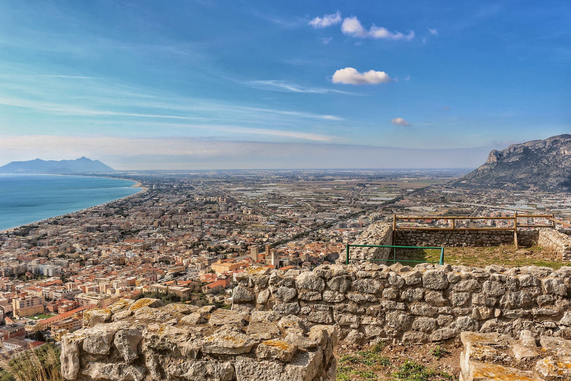
Terracina sits where the Lepini mountains meet the Tyrrhenian Sea, a hundred kilometers south of Rome. The Volsci called it Anxur, the name of the youthful Jupiter who was its tutelary god, and the temple crowning the summit above the port carries that name still.
Below it the Roman town spread out along the coast road, its forum paved by a magistrate whose inscription remains underfoot, its capitolium later built over by the co-cathedral. Where the road met a headland it could not go around, the rock itself was cut away to let it pass, a shelf sliced through stone rather than a path found around it.
The upper town, on the mountain, and the lower town, on the plain and shore, read as two different solutions to the same site: one held the god and looked down, the other held the forum, the road, and eventually the harbor. What survives today, the beach, the working fishing port, the olive groves signed for their oil, is the plain continuing to do what it always did, at sea level, while the temple keeps its distance above.
The beach here holds the national bathing award, which a comune has to win back every year on water quality, beach management and safety.
What to see in Terracina
- Tempio di Giove Anxur. The temple on Monte Sant'Angelo stands on a vaulted substructure, thirty-five by twenty meters, the arcading still visible from below and, on clear days, the view running out past the port to the sea.
- Foro Emiliano. Original limestone-paved Roman forum, bronze-letter inscription of Aulus Aemilius still legible, eleventh forum along the Via Appia from Rome.
- Cattedrale di San Cesareo. Co-cathedral consecrated 1074 on the ancient capitolium, Cosmatesque pulpit and pavement, twelfth-century bell tower and portico.
How to get to Terracina
Latina is roughly 41 minutes away by road.
Our tip
May through September brings the beach and the port to full life: Bandiera Blu water, ferries to Ponza and Ventotene, fishermen unloading at the eastern mole. June and September are the calmer months. July and August fill with Roman day-trippers and touch thirty-five degrees on the seaward slopes.
More from Anywhere Italy
 The best towns that eat well in the province of Latina
 The best towns inside a nature park that have a serious restaurant in Lazio
 The best olive oil towns in Lazio
 The best towns with a serious restaurant that sit on a walking route in Lazio
 The best towns you can reach by train that have a serious restaurant in Lazio
 The 6 best wine towns in Lazio