
The best mountain towns in Lazio
Lazio's mountains are built out of the same pale limestone as their walls, so the villages read as outcrops until you are close enough to see shutters. The high country runs from the Sabine hills north of the Tiber through the Simbruini and the Ernici to the Val di Comino, where beech forest turns copper in late October and the passes hold snow into spring. Kitchens up here work with what the slopes give: pecorino aged in caves, guanciale, mutton stewed slowly, chestnuts, wild greens, and pasta cut by hand and dressed simply. Summer evenings are cool enough for a jacket even when Rome is unbearable, which is the oldest reason Romans have climbed these roads.
Most visitors who leave Rome for higher ground go to the Castelli Romani, or to Tivoli for the gardens and the waterfalls of Villa Gregoriana, and both are worth the trip. They are also close, well signposted, and on every coach itinerary, so the car parks fill by mid-morning and the trattorie run two sittings. Abruzzo's Gran Sasso and the Parco Nazionale d'Abruzzo pull the serious walkers straight past Lazio's own peaks. The result is a region with real mountains and a reputation built almost entirely on its capital and its beaches.
The ridges do not stop where the day trips do. The same limestone, the same beech woods, the same pecorino and the same cool August nights continue north into the Sabina, east towards the Abruzzo border and south into the Comino valley, and that is where the towns on this list sit. Some hold a lake below them, some a Franciscan sanctuary, some a castle on the rock above the roofs. They take longer to reach, which is most of the point.
Of the 60 communes we have mapped in Lazio, 9 qualify as mountain towns: each sits in the mountains. The smallest, Castel di Tora, has 266 residents.
Two more lists worth reading alongside this one: The best mountain towns within 75 minutes of Rome and The best hidden mountain towns within 90 minutes of Roma.
Castel di Tora
Why visit Castel di Tora
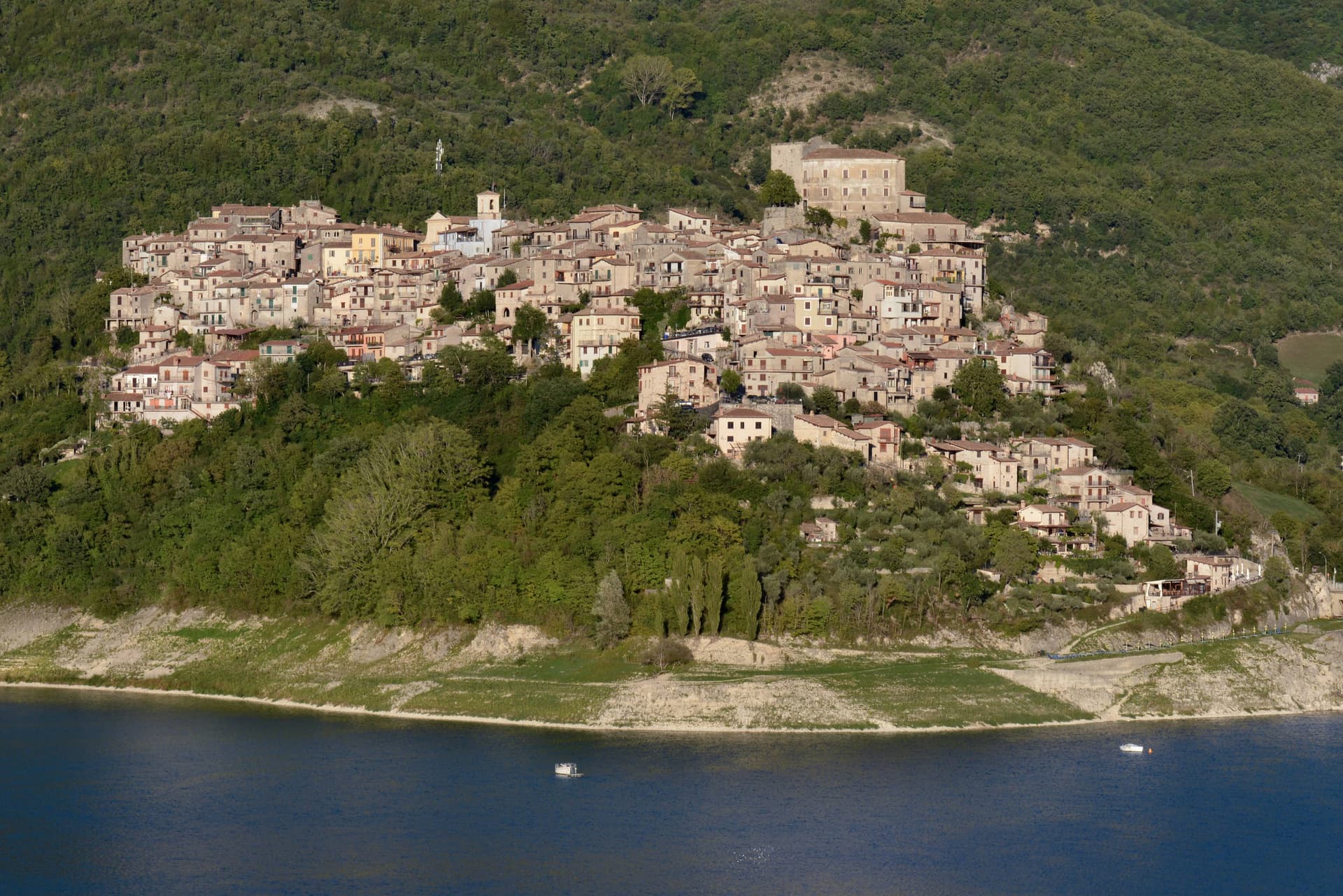
Castel di Tora sits at 607 meters on the northeast shore of Lago del Turano, in the upper Sabina, fifty kilometers northeast of Rome. The lake itself is artificial, dammed in 1936 for hydroelectric regulation of the Turano river; before then, two villages stood on the valley floor.
One of them, Antuni, gave up its houses and emptied. Today a small isthmus runs out to the Antuni promontory, where the fifteenth-century Palazzo del Drago, built with 365 windows for the days of the year, has been restored along with its garden labyrinth.
The medieval centro storico climbs the slope above the lake to a polygonal fortress tower of the eleventh century. The Monti Sabini close the western shore; the Carseolani close the eastern, rising to Monte Navegna at 1,508 meters.
Two hundred and sixty-six people live here year-round. The Cammino di San Benedetto passes through on its way from Subiaco to Rieti.
The village sits at 607 metres.
What to see in Castel di Tora
- Rocca medievale. Eleventh-century polygonal fortress tower on the cliff above the village, anchor of the original Castrum Vetus that gave the town its name.
- Antuni e Palazzo del Drago. Restored fifteenth-century palace with 365 windows for the days of the year, on the Antuni promontory across an isthmus, with a garden labyrinth.
- Lago del Turano. Artificial reservoir dammed in 1936 at 536 meters elevation, ten kilometers long, 60 meters deep, surrounded by the Sabini and Carseolani ranges.
How to get to Castel di Tora
Terni is roughly 72 minutes away by road.
Our tip
May through October is the season for Castel di Tora. The lake warms to swimming by late June, the Sabini stay green into August, and the chestnut woods on the slopes turn gold in October. July and August fill the lakeshore with day-trippers from Rome and Rieti, especially weekends.
Capranica Prenestina
Why visit Capranica Prenestina
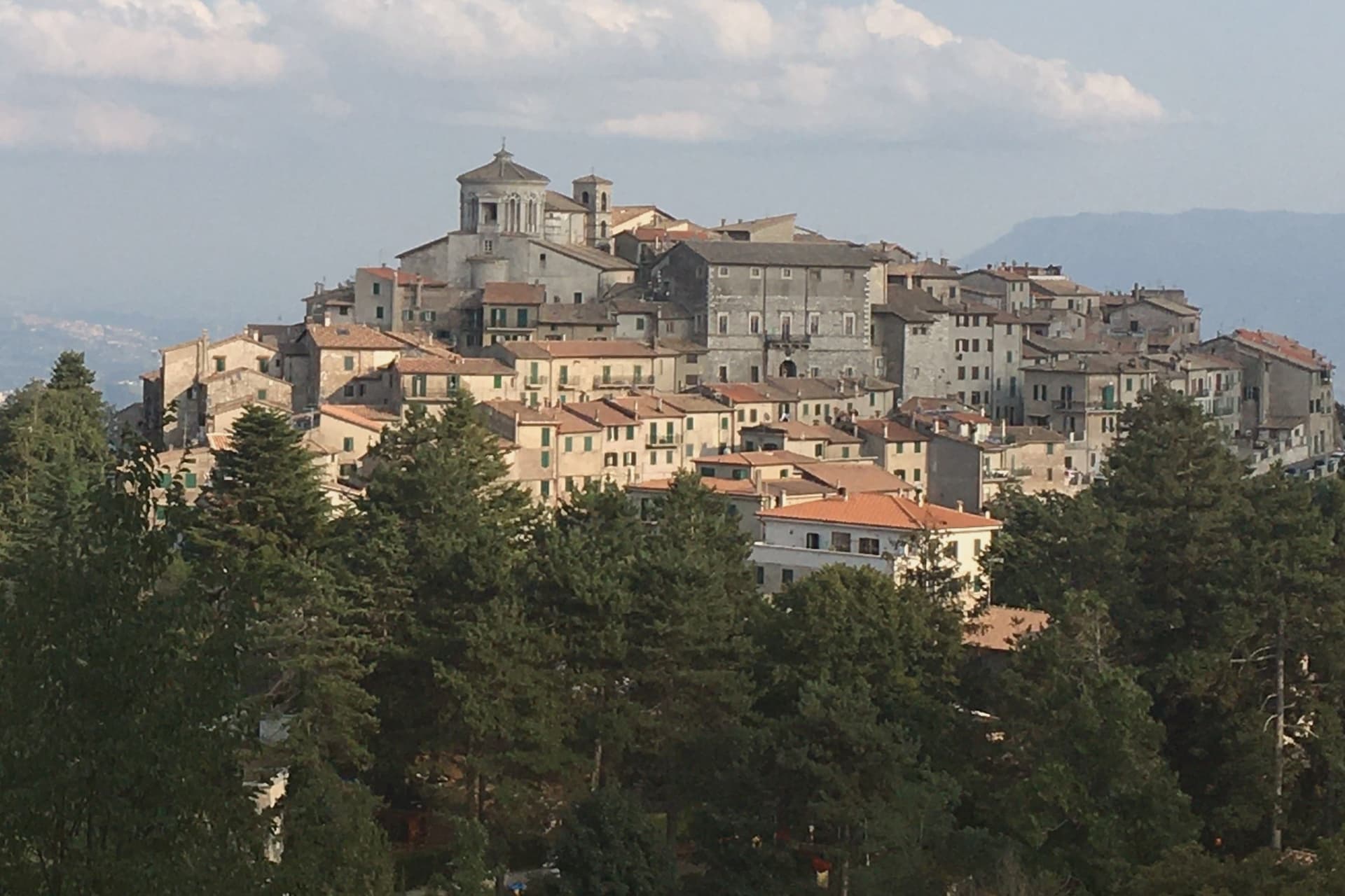
The Monti Prenestini are a small sub-Apennine range east of Rome, with Castel San Pietro Romano and Palestrina anchoring the southern flank and Capranica Prenestina set higher on the ridge above them. The village has three hundred residents and one institutional signal, the Borghi più belli d'Italia membership it received in 2024.
Beech forest covers the slopes above the houses, and the ground beneath is karst, the subject the civic museum in the old Barberini residence was built to explain. Above it all, in the frazione of Guadagnolo, the Mentorella sanctuary sits at 1,018 meters below Monte Guadagnolo itself, and tradition ties its founding to Constantine in the fourth century; Pope John Paul II went there as cardinal and as pope.
The village is half an hour by car from Tivoli, the via Empolitana threading through the woods between them. A small ridge settlement, then, with its natural history collected in a converted palace at its center and its oldest sacred site set apart on the mountain above it, the two poles, civic and devotional, that the range holds together.
The village sits at 915 metres.
What to see in Capranica Prenestina
- Santuario della Madre di Dio alla Mentorella. The sanctuary stands on a cliff, managed today by the Polish Resurrectionist order.
- Palazzo Barberini. The residence's rooms now hold the civic natural history collection, the grandest building the centro storico has.
- Museo Civico Naturalistico dei Monti Prenestini. Civic natural history museum dedicated to the karst geology, beech forests and fauna of the surrounding range.
How to get to Capranica Prenestina
Roma is roughly 70 minutes away by road.
Our tip
May through September is the working window. At 915 meters the village stays ten degrees cooler than Rome and the beech forests on the slopes above are walkable through August. October still holds for the autumn light on the Aniene valley and for the pilgrim traffic up to Mentorella.
Labro
Why visit Labro
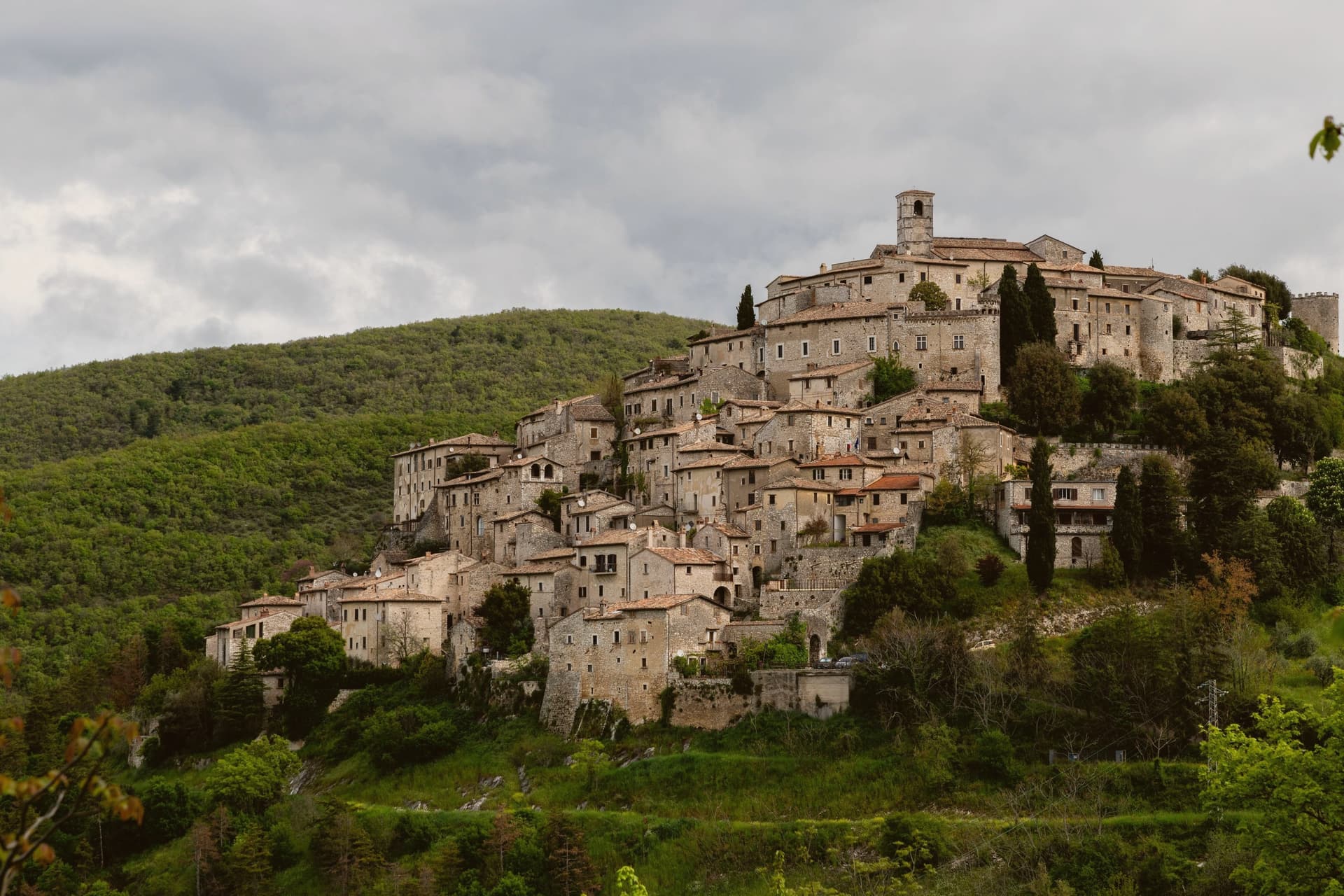
The village sits on the Lazio side of the Umbrian border, its stone houses climbing a slope that faces east over Lake Piediluco and the Reatini mountains. The name descends from the family that has held the central castle for more than a thousand years, an unbroken tenure from a royal grant to the present owners' later dynastic name.
That family shaped the top of the village around the castle and the church below it; the rest of the centro storico, some twelve hectares of stone houses, fell empty by the 1960s. The Belgian architect who began buying and restoring those houses did so with his wife, and the project passed to his children, who still own and run much of the centro.
Two families, one holding the summit since the tenth century and one rebuilding the slope since the twentieth, account for nearly all of the village that stands today. Labro survived depopulation not by chance but by becoming, in effect, two long private restorations laid one above the other.
The village sits at 628 metres.
What to see in Labro
- Castello Nobili-Vitelleschi. The castle sits at the top of the village, reached by narrow stone alleys climbing from the lower gate. Still privately owned.
- Chiesa di Santa Maria Maggiore. Parish church on the main square of the centro storico, with works of devotional art collected by the family that has long held the castle above it.
- Belvedere su Lago di Piediluco. Eastern viewpoint at 628 meters dropping to Lake Piediluco at 375 meters, with the Reatini and Sabini ranges in the background.
How to get to Labro
Terni is roughly 26 minutes away by road.
Our tip
May through October is the working window. Spring brings green slopes and clear views down to Piediluco; autumn turns the surrounding woods. July and August push warm but the 628-meter elevation keeps nights cool, unlike the valley below.
Collalto Sabino
Why visit Collalto Sabino
The name preserves Collis Altus and the family who first held the hill. Lombards established the village in the tenth century; the Savelli, Strozzi and Soderini families held it in turn before the fief passed to Cardinal Francesco Barberini in 1641.
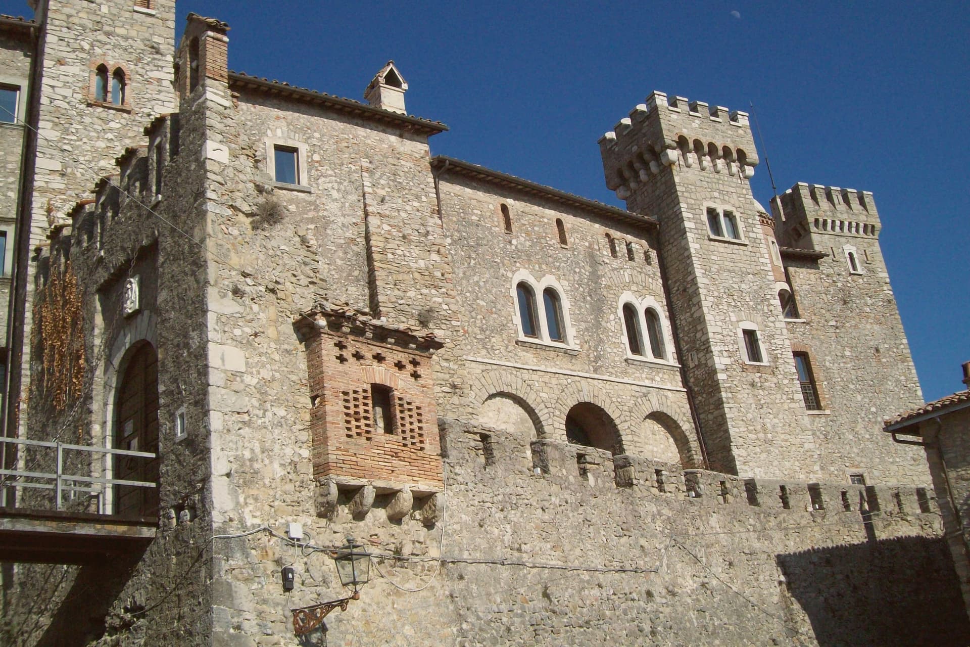
The castle on the summit is the result of his work and that of his nephew Francesco Barberini junior, who enlarged the keep, fortified the walls and built dungeons inside the rock. It has a central square tower, two round corner towers and a curtain of watchtowers and sentry posts.
The village sits at 980 meters northeast of Rome, walled since the fifteenth century, with the fortress set above the stone houses and the older settlement gathered under it on the slope, narrow stairs and panoramic alleys threading between them. Ownership of the fief changed hands for centuries, from Lombards through three baronial families, before the Barberini building campaign gave the place the fortified shape that has lasted: walls below, keep above, the two still reading as one structure from the approach, the panorama at the summit the reward for climbing through all of it.
The village sits at 980 metres.
What to see in Collalto Sabino
- Castello Baronale. Dungeons cut into the rock beneath the keep, watchtowers and sentry posts along the curtain wall, the work of Cardinal Francesco Barberini and his nephew after 1641.
- Centro storico. Stone houses reached by narrow stairs, alleys that open onto the panorama below the castle walls.
- Panorama from the keep. The terrace view takes in Gran Sasso, Terminillo and Maiella at once, the three highest ranges of the central Apennines standing in a single arc from the same point.
How to get to Collalto Sabino
Roma is roughly 65 minutes away by road.
Our tip
May through September is the window the castle and the village were built around. At 980 meters the air stays clean in midsummer when Rome fifty-five kilometers downhill is hitting thirty-five, and the three-range panorama opens longest after spring rain clears the haze. October still holds for the woods of the Monte Navegna reserve turning copper and for short walks toward Lago del Turano below.
Orvinio
Why visit Orvinio
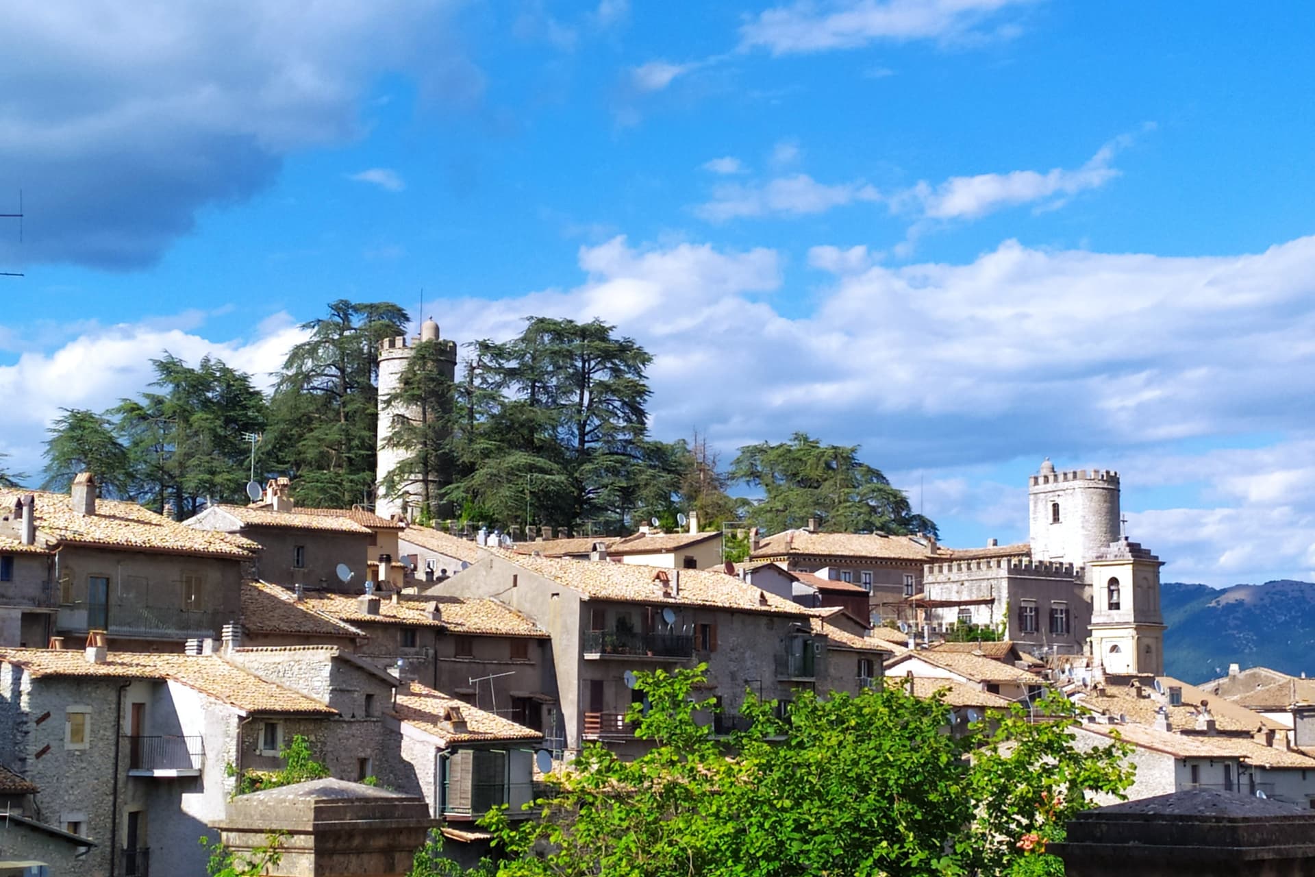
Orvinio sits on a saddle in the Monti Lucretili park, the last village before the slopes drop toward the Turano lake. The ancient settlement called Orvinium was destroyed before the year 1000, and the medieval town that grew up afterward took the name Canemorto, said to commemorate a Saracen defeat by Charlemagne's troops in 817.
The Orsini built the Granarone palace in the fifteenth century, before the Borghese took the fief in 1632. The village they governed still reads in two layers: stone houses running in tight loops below the ridge, and the Castello Malvezzi-Campeggi above them, the physical record of who held the place longest.
The Cammino di San Benedetto crosses this lower town on its way between Subiaco and Norcia, a reminder that the village has always been a point of passage as much as a seat of lordship. What remains is a settlement whose name changed twice and whose skyline did not: the castle above, the loops of houses below, unchanged in relation even as the village below it was renamed.
The village sits at 840 metres.
What to see in Orvinio
- Castello Malvezzi-Campeggi. Rebuilt by the Borghese in the nineteenth century, it dominates the village from the upper ridge, still visibly the seat of the family that held the fief the longest.
- Abbazia di Santa Maria del Piano. Benedictine abbey founded in the early Middle Ages, the original landlords of the territory before the Orsini took it.
- Centro storico. Stone houses in tight medieval loops below the castle, with vaulted passages and the original village gates preserved.
How to get to Orvinio
Roma is roughly 60 minutes away by road.
Our tip
May through September is the working window at 840 meters. The Lucretili woods open, the trails dry out and the village evenings stay cool when Rome forty-five kilometers downhill is hitting thirty-five. October still holds for the woods turning copper and for the Cammino di San Benedetto walkers passing through on the route between Subiaco and Norcia. Sagra della Polenta falls in August.
Castel San Pietro Romano
Why visit Castel San Pietro Romano
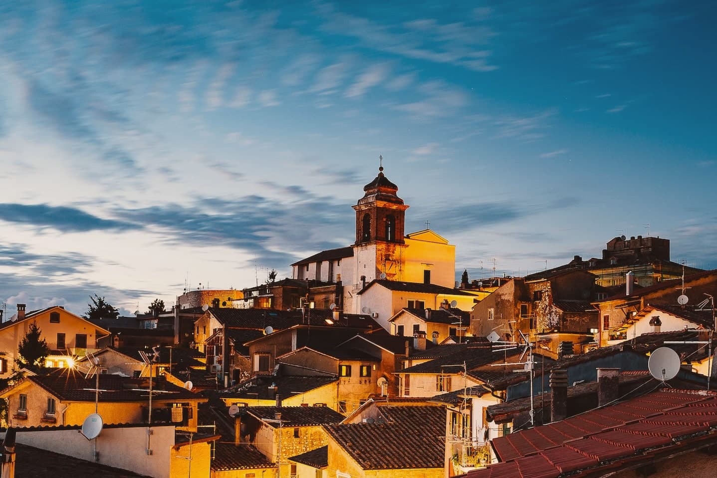
The hilltop sits three kilometers above Palestrina and forty east of Rome, and has been inhabited since the late Bronze Age. The acropolis of ancient Praeneste, the Latin city known for the sanctuary of Fortuna Primigenia, occupied this same ground before the medieval village grew inside it, which is why cyclopean walls from that earlier phase still ring the upper settlement built centuries later.
In the twelfth century the Colonna raised a castrum here for defensive control over Palestrina below. It was destroyed in 1298 and rebuilt twice over the following two centuries, then restored again in 1482, after which it lost its military role entirely and served the community as a grain store.
The village also saw the 1848 Battle of Palestrina, when Garibaldi's Roman Republic troops fought soldiers of the Kingdom of the Two Sicilies on these slopes, and later lent its streets and terraces to Wyler's cameras before the Borghi più belli d'Italia membership followed. What stands today is a single hill occupied twice over, once for a Latin acropolis and once for a Colonna stronghold, with the second built directly on the bones of the first.
The village sits at 763 metres.
What to see in Castel San Pietro Romano
- Rocca Colonna. The fortress on the summit of Monte Ginestro stands over the grain store it became after Stefano Colonna's 1482 rebuilding; the walls that face Palestrina still carry the bulk of a structure built for defense, not storage.
- Cyclopean walls of Praeneste. Pre-Roman polygonal masonry from the Latin acropolis, sections still visible inside the medieval village.
- Chiesa di San Pietro Apostolo. Parish church enlarged in 1732 under Clement XII on a project by Nicola Michetti, replacing an earlier thirteenth-century structure.
How to get to Castel San Pietro Romano
Roma is roughly 57 minutes away by road.
Our tip
May through September is the strongest window. The 763-meter altitude takes the edge off Roman summer heat and the view from the castle terrace opens cleanest in late spring and early autumn. October holds for the autumn light over the Sacco valley and the Lepini ridges. Festeggiamenti Patronali San Rocco falls in July.
Picinisco
Why visit Picinisco
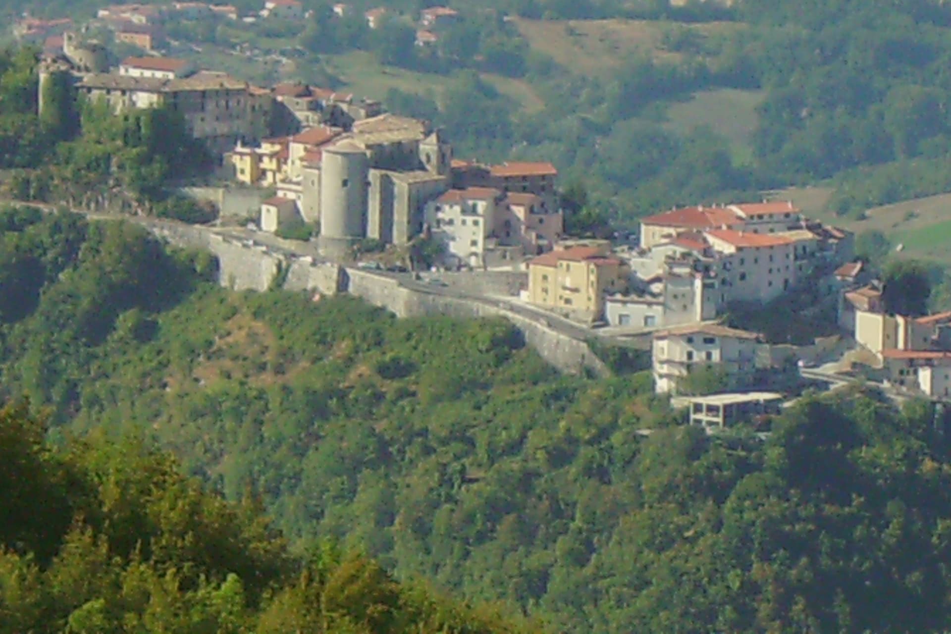
Picinisco occupies a fortified spur inside the Parco Nazionale d'Abruzzo, Lazio e Molise, looking down on the Val di Comino below. The village itself divides along the slope: a lower piazza gives onto the narrow streets of the centro storico, which climb toward the castle ruins at the top, the point originally built to hold the eastern approach to the valley.
The parish church sits higher up, its baroque interior resting on medieval foundations, a layering repeated in the castle and the streets around it. The food still defines the place.
Pecorino di Picinisco DOP comes from raw sheep milk produced on the pastures above the village, and the valley also holds Maturano, a white grape almost extinct before the I Ciacca winery, founded by returning Scots-Italians, restarted it. That last detail closes a loop that runs through the whole town: the same families who left for Glasgow and Edinburgh through the last century are the ones who came back to put the valley's own wine back into production.
The village sits at 725 metres.
What to see in Picinisco
- Castello medievale. Ruined medieval castle on the highest point of the village, built to control the eastern access to the Val di Comino.
- Centro storico. Fortified medieval village, narrow stone streets climbing from the lower piazza toward the castle.
- Chiesa di San Lorenzo. Parish church in the upper village, baroque interior on medieval foundations.
How to get to Picinisco
Napoli is roughly 124 minutes away by road.
Our tip
May through October is the open season at 725 meters: trails into the national park clear of snow, pastures in production, and the village restaurants serving pecorino with Maturano. June through August stays cool here even when the Lazio coast hits the mid-thirties, the altitude keeping nights in the teens. September and October are the most rewarding months for hikers: the beech woods of Forca d'Acero turn through every shade of red.
Greccio
Why visit Greccio
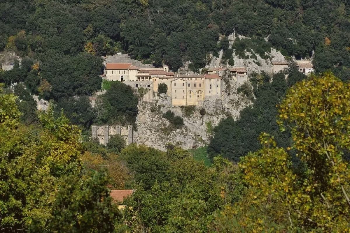
Greccio sits at 705 meters on a forested ridge above the Rieti valley, fifteen kilometers from Rieti in the Sabina. Francis of Assisi came here in December 1223, recalling his pilgrimage to Bethlehem fifteen years earlier, and asked the local lord Giovanni Velita for a cave where he could stage a representation of the Nativity.
On Christmas Eve the friars and villagers gathered in the rock chamber with a manger, an ox and a donkey; one of the friars said Mass and Francis preached. Greccio has been making versions of that scene every Christmas for eight centuries, and the Cappella del Presepio was built into the cave itself in 1228, the year of Francis's canonisation.
The medieval village runs along the ridge above the sanctuary, separated from it by the wooded slopes of the Monte Salto del Cieco reserve, so the walled center and the cave church remain two distinct places linked by a single climb through beech and oak woodland. Greccio is one of four shrines forming the Sacred Valley of Rieti, and the arrangement of a hilltop village standing apart from its own founding cave is what gives the place its shape: a settlement that grew beside a site it did not begin as, built to keep watch over a single night eight centuries old.
The village sits at 705 metres.
What to see in Greccio
- Santuario Francescano. Sanctuary built around the rock chamber where the manger, ox and donkey were assembled, its Cappella del Presepio carved directly into the cave wall.
- Museo Internazionale del Presepio. Crèches and presepi from cultures across the world, gathered inside the sanctuary complex.
- Centro storico medievale. Walled medieval village on the ridge above the sanctuary, with stone houses, vaulted passages and the original village gates.
How to get to Greccio
There is a railway station in the town, so you can arrive without a car and never need one while you are here. Terni is roughly 28 minutes away by road.
Our tip
May through September is the main outdoor window at 705 meters. The Rieti valley is green into June and the cool ridge stays workable through midsummer. October draws walkers for the autumn colour in the Salto del Cieco reserve.
San Donato Val di Comino
Why visit San Donato Val di Comino
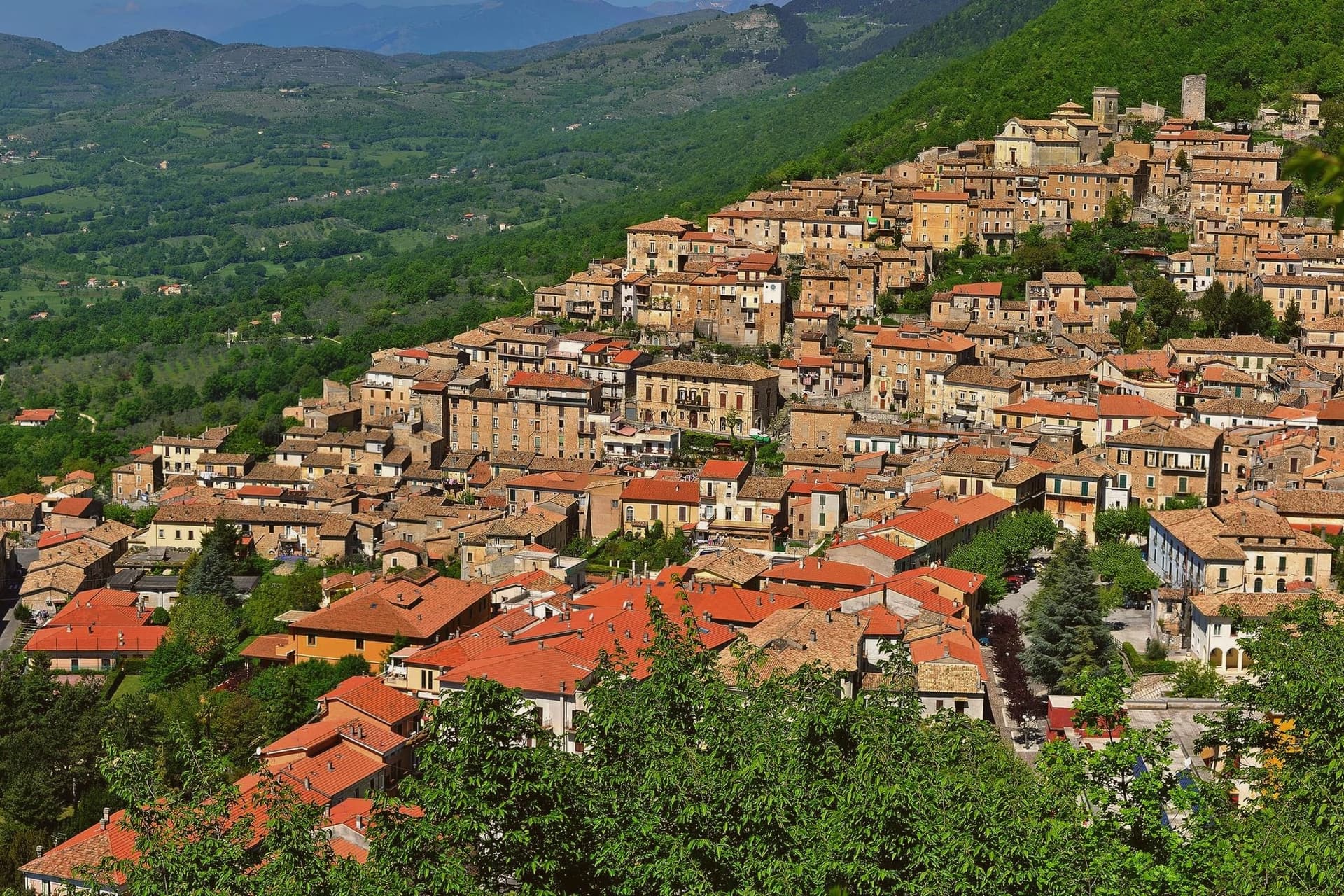
San Donato Val di Comino sits at 728 meters on the eastern wall of the Val di Comino, the last Lazio village before the Forca d'Acero pass crosses into Abruzzo at 1,538 meters. The Samnite town of Cominium stood near here until the Romans destroyed it in 293 BC.
The current village formed around the Church of San Donato in the 12th century. The Jewish community here is among the better-documented in southern Italy: forced to wear the badge in the 13th century, expelled and readmitted through the medieval period, and in 1940 the village became one of the internment locations chosen by the Fascist regime for foreign Jews, a story documented in the Casa della Memoria.
The position at the foot of the Forca d'Acero pass makes the village the standard starting point for climbing into the beech forests and the Pescasseroli plateau on the Abruzzo side.
The village sits at 728 metres.
What to see in San Donato Val di Comino
- Centro storico. Medieval village at 728 meters, built around the Church of San Donato from the 12th century, encircled by Bourbon-era walls.
- Chiesa di San Donato. Parish church on the site of the 12th-century original, the nucleus around which the village formed.
- Casa della Memoria. Documentation center on the 1940 internment camp for foreign Jews and on the village's medieval Jewish community.
How to get to San Donato Val di Comino
Latina is roughly 108 minutes away by road.
Our tip
May through October is the active season. June and July bring the high pastures into production and the trails dry. September and October are the visual peak: the beech forests of Forca d'Acero turn red and gold, drawing day-trippers from Rome and Naples.
More from Anywhere Italy
- The best mountain towns within 75 minutes of Rome
- The best hidden mountain towns within 90 minutes of Roma
 The prettiest small villages within 90 minutes of Roma
- The 6 best mountain towns within 90 minutes of Terni
- The best mountain towns within 90 minutes of Perugia
- The prettiest villages on a walking route in Lazio