
Lazio · Latina
Ponza
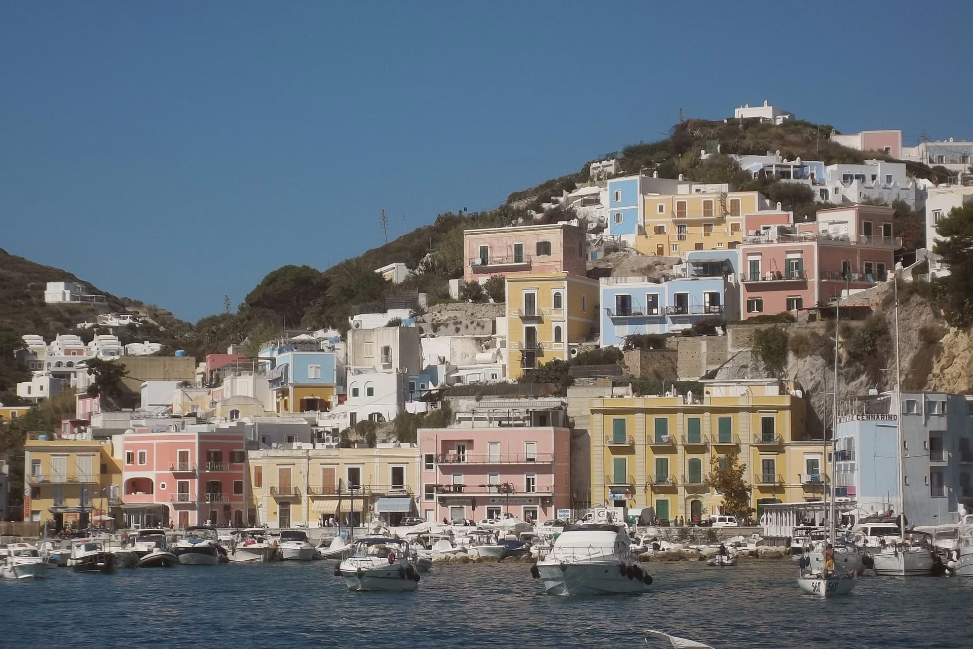
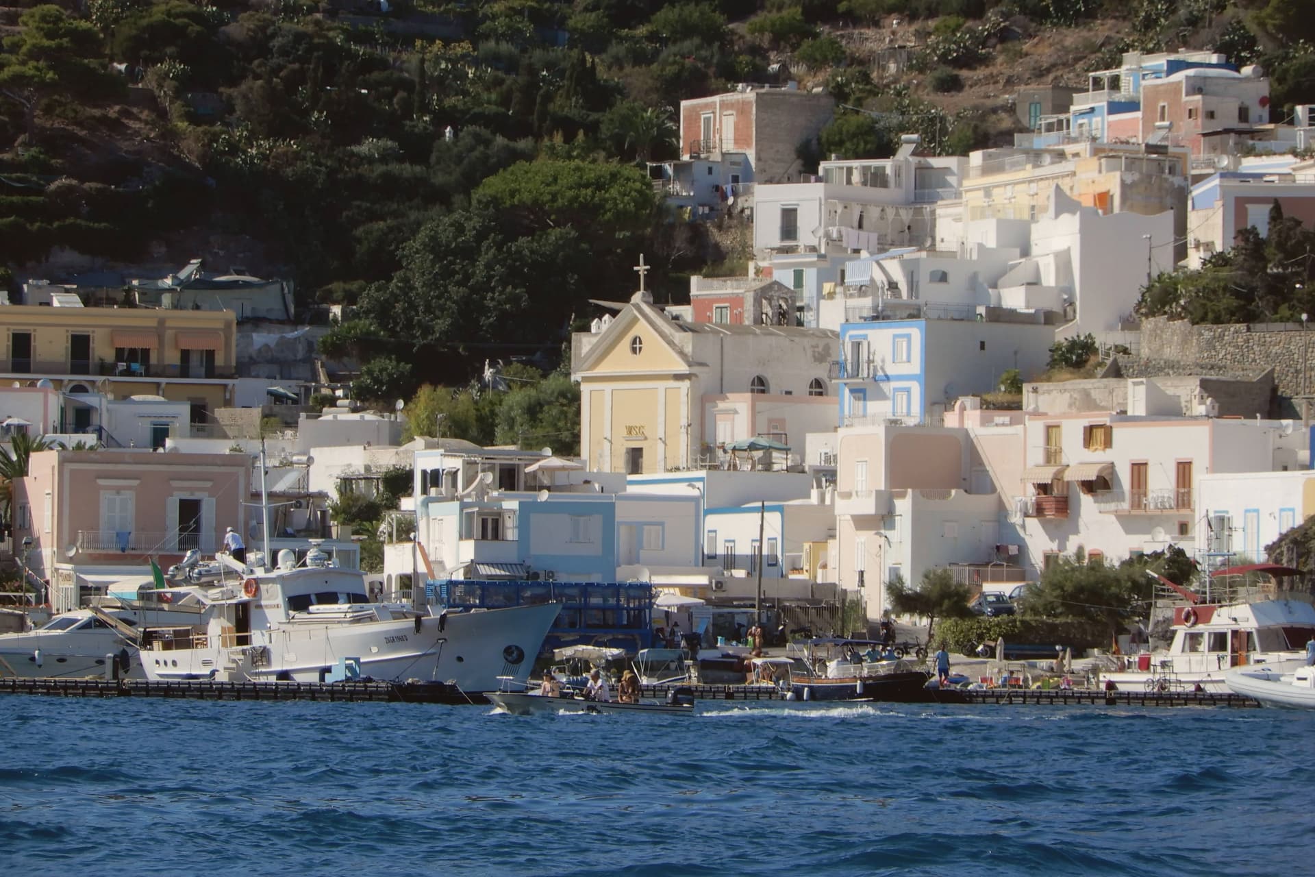
The main island of the Pontine archipelago, a volcanic crescent 40 km off Formia with white tuff cliffs, Roman fishpond tunnels at Pilato, Cala Feola's natural pools, and a 3,200-resident borgo curving around a horseshoe harbour painted in 18th-century Bourbon-pastel.
- Best time
- May–Jun, Sep
- Getting there
- By ferry
- Population
- 3,289
Known for
BOURBON-PASTEL HARBOUR
Ferdinand IV of Naples colonised Ponza in the 1770s. The painted horseshoe port and the cascading pastel houses date from then.
CHIAIA DI LUNA
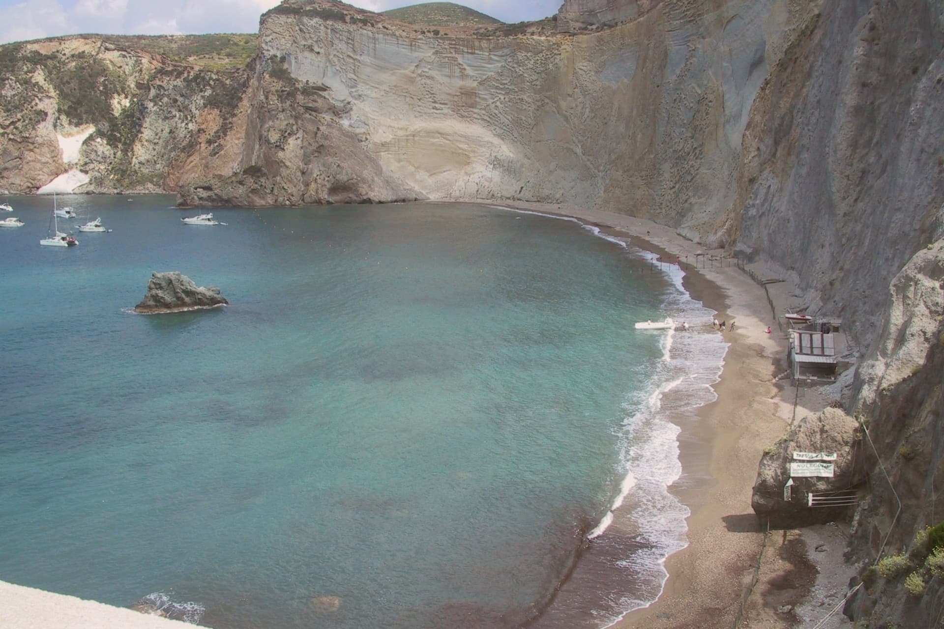
The defining image of the island: a crescent of tuff sand against a 100m sheer white cliff at the north of the village.
ROMAN FISHPONDS
Grotte di Pilato, 1st-century AD artificial sea caves carved as private breeding tanks for sea bream and moray. One of the best-preserved Roman maritime engineering sites.
RISERVA MARINA ISOLE PONZIANE
All the archipelago's waters are a marine protected area, with clear visibility, healthy fish populations, and prized diving sites at Palmarola and Zannone.
When to visit
Best · May–Jun, Sep
- J14°
- F14°
- M14°
- A16°
- M19°
- J23°
- J26°
- A27°
- S25°
- O22°
- N19°
- D16°
- Best
- Hot or crowded
- Quiet
- Mostly closed
Daytime averages, 2020–2024. The sea is warmest in August at 28° and coldest in February at 15°. Weather data by Open-Meteo.com.
The festa: papa Silverio, 20 June
Why come
Ponza is a 7. 3 square kilometre volcanic crescent in the Tyrrhenian Sea, 40 km off the Lazio coast at Formia and 90 km off Naples. It is the main island of the Pontine archipelago.
The shape is the story: the island is half of a collapsed Pliocene volcano, a curved ridge of pumice and white tuff cliffs rising 280m above the sea, with sheltered bays carved into the eastern, leeward side and vertical cliffs facing west into open water. The settlement sits at the southeast end, where the only natural harbour is, because that is the sheltered side. Ferdinand IV of Naples brought settlers from the Bay of Naples in the 1770s to displace pirate use of the island, and the port and houses above it date from that colonisation.
The north of the island, Le Forna, is a different register entirely: greener, quieter, given over to rock pools and abandoned mineral workings rather than the working harbour and its piazza at sea level. The Roman fishpond caves, at the southeastern tip, show that this pattern of use goes back further still: aristocrats carving private breeding tanks into the same cliffs that would later be settled and painted at the harbour. The food is Tyrrhenian-island: zuppa di pesce, spaghetti alle vongole, fresh tuna, pesce azzurro, lentils from neighbouring Ventotene, and the local Biancolella and Forastera white wines grown on terraced volcanic slopes.
Ferries from Formia and Anzio run year-round but service drops sharply October to April. The island is seasonal in a literal sense: summer roughly doubles its population with Romans and Neapolitans, while winter empties the restaurants and leaves the place quiet. What the island amounts to, in the end, is a single volcanic ridge worked in layers: Roman engineering at one tip, an 18th-century harbour settlement at the other, and an untouched, quieter half left to the north.
The Sunday letter
Ponza is on our list. Its letter is still to come.
We are writing about all 1,000 of these towns, one at a time, in a free letter every Sunday: the photo, the food, the festa. That is our mission. Sign up and you will be there when Ponza comes up. By Peter & Sophia, from Pietrasanta.
Read on
Ponza in our articles
How to get there
Ponza is on an island and is reached by ferry.
What to see
Chiaia di Luna
The Roman tunnel that once cut through the cliff to reach the beach is currently closed, so the crescent of pale sand is reachable only by boat from the harbour, seen from the water below the cliff face.
Grotte di Pilato
The cave complex sits at the southeastern tip of the island, cut directly into the cliff face, with separate chambers for different species kept apart in the breeding tanks.
Bourbon-pastel harbour
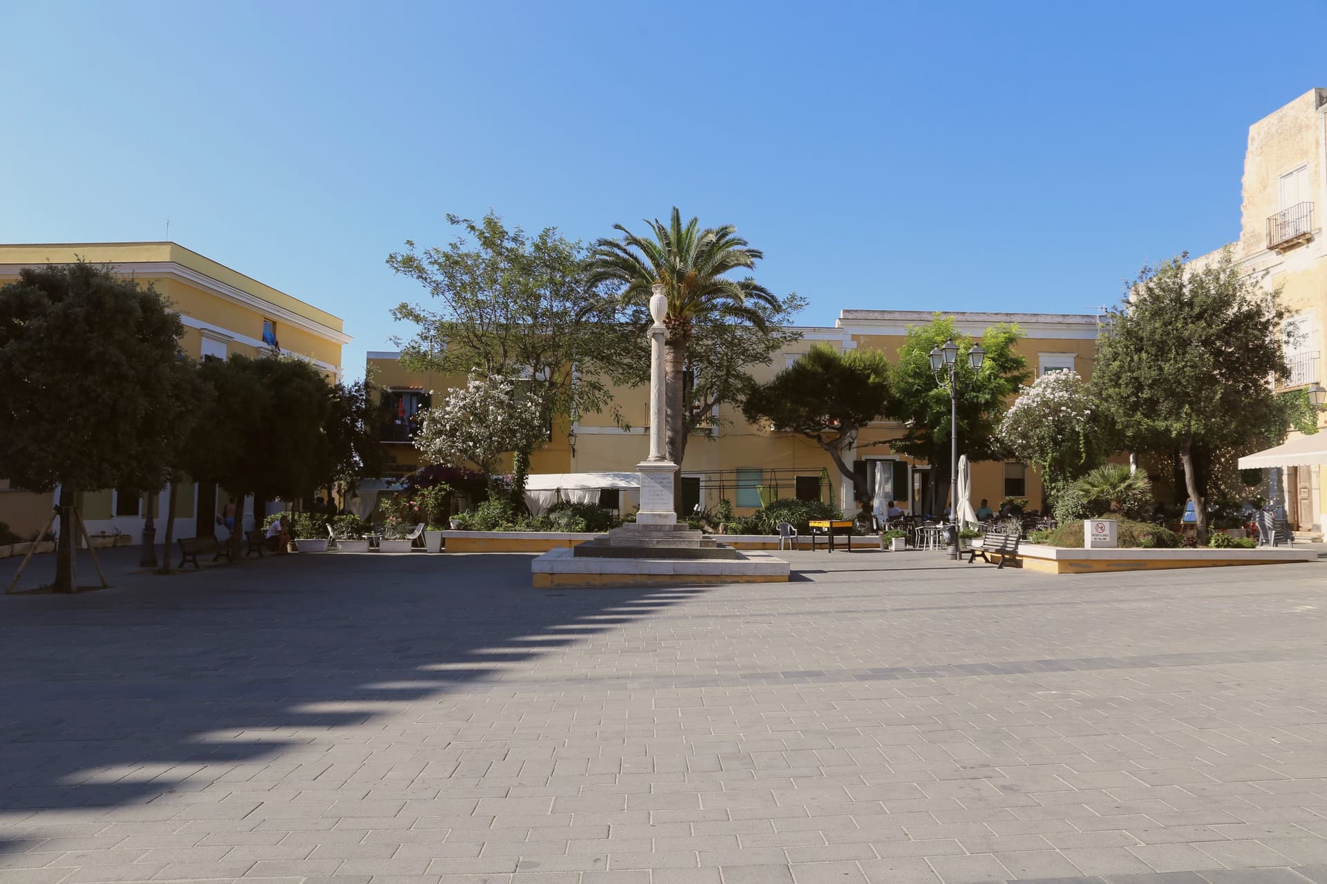
The horseshoe port is lined with houses cascading up the hillside behind it. The town's main piazza, Pisacane, sits at sea level at the water's edge.
Cala Feola natural pools
At Le Forna on the northern half of the island: natural rock pools fed by waves, plus the abandoned bentonite mines at Cala dell'Acqua nearby. Quieter than the southern beaches.
Boat circumnavigation
The standard day plan is a rented gozzo around the island, with swims at Chiaia di Luna, Cala dell'Acqua, the Faraglioni della Madonna sea stacks, and the smaller islets Palmarola and Zannone within the marine reserve.
The slow-trip planner
Building a trip? Find where Ponza fits in a slow Italy circuit.
Answer five questions. We will shape a geographically coherent slow trip from the 1,000 Italian towns most travelers skip. Yours to save and share.
We recommend
Where to eat
Not our picks, but places the guides put their name to: a Michelin star, a Gambero Rosso fork, a Slow Food snail, a Michelin Key for the hotels. Worth a table, a counter, or a night when you pass through.
Acqua PazzaRistorante
Acqua Pazza has one Michelin star and two Gambero Rosso forks (85/100).
EeaRistorante
Eea carries one Gambero Rosso fork (79/100), plus a spot in the Michelin Guide.
Living here
- Population 3,289
- Very remotei
- Pharmacy in town
- High school within a 30-minute drive
- Regional capital Roma, 12 h 15 min drive
Common questions
- What is Ponza known for?
- Ponza is the main island of the Pontine archipelago, a volcanic crescent 40 km off Formia with white tuff cliffs, Roman fishpond tunnels at Pilato, Cala Feola's natural pools, and a 3,200-resident borgo curving around a horseshoe harbour painted in 18th-century Bourbon-pastel.
- Where is Ponza?
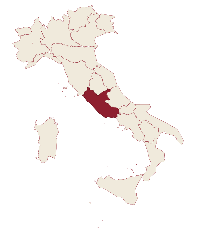
- Ponza is a comune in the province of Latina, in Lazio, at 5 meters above sea level.
- How do you get to Ponza?
- Ponza is on an island and is reached by ferry.
- When is the best time to visit Ponza?
- Best in May–Jun, Sep. August is the warmest month, averaging 27 degrees, and November the wettest, with about 14 rain days.
- Is there a sagra or a festival in Ponza?
- The town keeps its patron saint's day: papa Silverio, 20 June.
- Which other towns are like Ponza?
- Lampedusa e Linosa, Pantelleria and Favignana.
- How many people live in Ponza?
- 3,289 at the 2023 count.
Tags & datadesignations · numbers · sources
Recognised as
The numbers
- Elevation: 5 m
- Population: 3,289
- Surface area: 10.16 km²
On the map
These figures were compiled from public directories: ISTAT, OpenStreetMap and Wikidata, and from the official listings of the guides named on this page. Town details change; verify with official sources before you travel.
Similar
Towns like Ponza
Lampedusa e Linosa
Province: Agrigento
both between 3,000 and 10,000 people · both near sea level
Pantelleria
Province: Trapani
both between 3,000 and 10,000 people · both near sea level
Favignana
Province: Trapani
both between 3,000 and 10,000 people · both near sea level
Carloforte
Province: Sud Sardegna
both between 3,000 and 10,000 people · both near sea level
Casamicciola Terme
Province: Napoli
both between 3,000 and 10,000 people · both near sea level
Capri
Province: Napoli
both between 3,000 and 10,000 people · both near sea level
🌲 Parco Nazionale
More Parco Nazionale towns in Lazio
Picinisco
Province: Frosinone
A medieval village at 725 meters on the eastern edge of Lazio, the source of much of Italo-Scottish emigration.
Sabaudia
Province: Latina
A rationalist city built in 253 days on drained Pontine marshland, founded 15 April 1934 between Lago di Paola and the Tyrrhenian dunes.
San Donato Val di Comino
Province: Frosinone
A medieval village at 728 meters at the gateway to Forca d'Acero, the pass into the Abruzzo National Park.
San Felice Circeo
Province: Latina
A medieval borgo on the flank of a promontory that Homer made the home of Circe in the Odyssey.