
The best hill towns inside a nature park in Lazio

Lazio away from the sea is built on volcanic rock and worked woodland. Towns sit on tufa outcrops the colour of wet sand, their houses cut from the same stone they stand on, with beech and chestnut forest closing in behind the last row of gardens. Autumn is the season that makes sense here: chestnuts roasting outside bars, porcini in the trattorie, mushroom hunters parked along the forest roads before light. Spring brings the other side of it, when the Apennine foothills fill with orchids and the lake water is still cold enough to keep the crowds off.
Most visitors to the region give inland Lazio a single day at most, and usually spend it at Tivoli, where Villa d'Este and Hadrian's Villa absorb coach parties from Rome all year. It is a reasonable thing to do, and the gardens deserve their reputation. It also means car parks, timed tickets and a fast train back to Termini before dinner. The countryside beyond the gate goes largely unlooked at.
The same hills and the same forests keep going, and much of what they cover is protected: regional parks that take in whole ridgelines, river gorges, volcanic craters and the towns living inside them. Fewer people go, so the walking is quieter and the tables at lunch are mostly local. These are the hill towns that sit within those park boundaries, each within reach of Rome and each with the woods beginning where the streets end.
Of the 60 communes we have mapped in Lazio, 10 qualify as hill towns inside a nature park: each is an inland hill settlement, and each sits inside a regional nature park. The smallest, Percile, has 219 residents.
Elsewhere in the catalogue: The best hill towns inside a nature park within 90 minutes of Roma and The best small towns inside a nature park in Lazio.
Percile
Why visit Percile
Percile sits sixty kilometers from Rome, on the border between the Roma and Rieti provinces. The name derives from gens Porcia, a Roman family of the area, and the earliest documented evidence of habitation dates between 314 and 335, in the biography of Pope Sylvester I.
The village occupies the rocky spur itself, walled stone houses and vaulted passages built to the shape of the ground; above it the slopes rise into oak and beech woods that belong to the wider park, climbing toward Monte Pellecchia. The relation between the two levels is the whole of the place: the settlement below, compact and defensible on its spur, and the water held above it in limestone basins fed by underground springs.
What the borgo protected on the ground, the park has protected in the hills. The population today is 219, spread across a comune territory of 24 square kilometers, which makes Percile a small fixed point inside a much larger stretch of protected woodland.
What to see in Percile
- Lagustelli di Percile. The walk up from the village runs through oak forest and ends at clear water held in two limestone basins between 674 and 704 meters, filled by underground springs.
- Centro storico. Medieval stone village on a rocky spur, with vaulted passages, surviving gates and the panorama from the upper terrace.
- Parco Naturale dei Monti Lucretili. Regional park covering oak and beech woods on the karst slopes around the village, with marked trails to the lakes and toward Monte Pellecchia.
How to get to Percile
Roma is roughly 54 minutes away by road.
Our tip
April through June and September through October are the best months at 575 meters. The Lucretili woods are green into June and the walks up to the Lagustelli are at their best when the karst basins are full from spring rain. July and August are workable; the village stays cooler than Rome forty kilometers downhill, but the open trails go silent in midday heat.
Calcata
Why visit Calcata
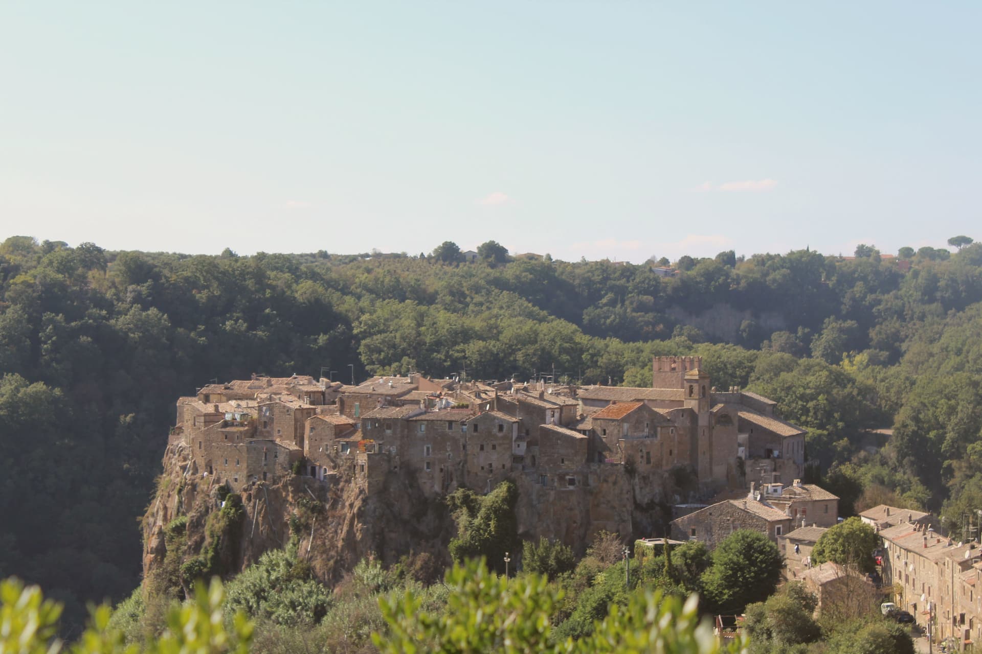
Calcata sits on a tufa cliff above the Treja valley, forty kilometers north of Rome. The Anguillara family walled and castled it in the 13th century.
In 1935 the Italian government condemned the village as structurally unsafe and ordered residents to move down to the new town in the valley below. Most did.
The empty houses on the cliff were re-occupied by artists, hippies and a small bohemian community from the late 1960s onward; they cleared the alleys, opened studios and bars, and turned an officially uninhabitable village into one of Lazio's strangest functioning settlements. The Holy Foreskin relic of Jesus was kept in the parish church here from 1527, taken from the Sancta Sanctorum during the Sack of Rome, and was an active object of pilgrimage until the relic was stolen in 1983 and the Vatican suppressed its cult.
Calcata Vecchia is now a single street of workshops on a cliff edge above the Parco della Valle del Treja.
What to see in Calcata
- Calcata Vecchia. Medieval village on a tufa cliff, condemned in 1935 and re-occupied from the 1960s by artists and craftspeople.
- Castello Anguillara. 13th-century baronial castle of the Anguillara family, partially restored, now owned by the Treja Valley park.
- Chiesa del Santissimo Nome di Gesù. Parish church that held the Holy Foreskin relic from 1527 until its theft in 1983.
How to get to Calcata
Terni is roughly 66 minutes away by road.
Our tip
April through June and September through October are when Calcata works. The Treja valley below is in leaf, the cliff in sun, the workshops and bars in the old village all open. July and August push past thirty degrees and the artist community thins out.
Pico
Why visit Pico
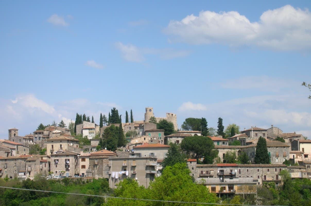
The town sits on a limestone spur at 220m, between Rome (115 km north) and Naples (140 km south), in the Ciociaria mountain landscape that runs into the national parks to the south and the Liri valley route toward Fondi. The Monastero di Montecassino lies 40 km east.
The castle at the high point of the town, built in the 16th century on 11th-century Norman foundations, belonged to the Boncompagni family, into which the writer Tommaso Landolfi was born; his fantastic-realism stories (Mar delle blatte, La pietra lunare, Il dialogo dei massimi sistemi) place him alongside Borges or Kafka in Italian letters, and the museum now inside the castle also covers the broader school he belonged to, including Buzzati, Calvino, and Bontempelli. Below the castle, the streets of the old town descend to the central piazza, and the Palazzo Boncompagni, the baronial family's residence, sits at that lower point between the two.
The mountains that border the town on the south side are the same range the medieval centro was built to look out over, and they carry the karst hiking, the wild boar territory, and the historic route through the Liri valley that give the area its hunting economy. The food follows that same pattern found across the surrounding villages: pasta alla ciociara, abbacchio, Pecorino, salame ciociaro, and boar from those forests, with the Cesanese del Piglio DOCG red, from the Piglio hills 30 km north, as the local wine.
Population has fallen from 5,200 in 1951 to 2,634 today, the same depopulation that has thinned most Ciociaria mountain villages. What the town amounts to is a single hill settlement where a family castle, a writer's inheritance, and a mountain economy of hunting and wine all occupy the same small footprint, with little distance between the literary museum at the top and the working village below it.
What to see in Pico
- Casa Museo Tommaso Landolfi (Castello Baronale). The 16th-c Boncompagni baronial castle holds the writer's library, manuscripts, and the rooms where he wrote, preserved as he left them, alongside exhibits on the wider Italian fantastic-realism school.
- BPB medieval centro. Narrow stone-paved vicoli climb from the central piazza to the castle, past the Chiesa di Sant'Antonino (15th-c), the Chiesa di San Rocco, and the Palazzo Boncompagni.
- Monti Ausoni + Aurunci parks. The Monti Ausoni and Monti Aurunci National Parks sit immediately south, with karst hiking, wild boar territory, and the Liri valley historic route.
How to get to Pico
Latina is roughly 91 minutes away by road.
Our tip
Pico is best April–June and September–October. The Festa di Sant'Antonino (10 May) and the Sagra del Cinghiale (mid-October) frame the season. Summer is hot in the Ciociaria — the Castello + Casa Museo are the cool indoor refuges.
Oriolo Romano
Why visit Oriolo Romano
Oriolo Romano sits at 420 meters in the Sabatini hills, between Lake Bracciano and the volcanic Cimini, not far from the old Via Clodia. The village is unusually new for the Tuscia: in 1560 the Orsini family ceded a wooded fief to the nobleman Giorgio Santacroce, who began clearing the forest and founded a planned agricultural settlement.
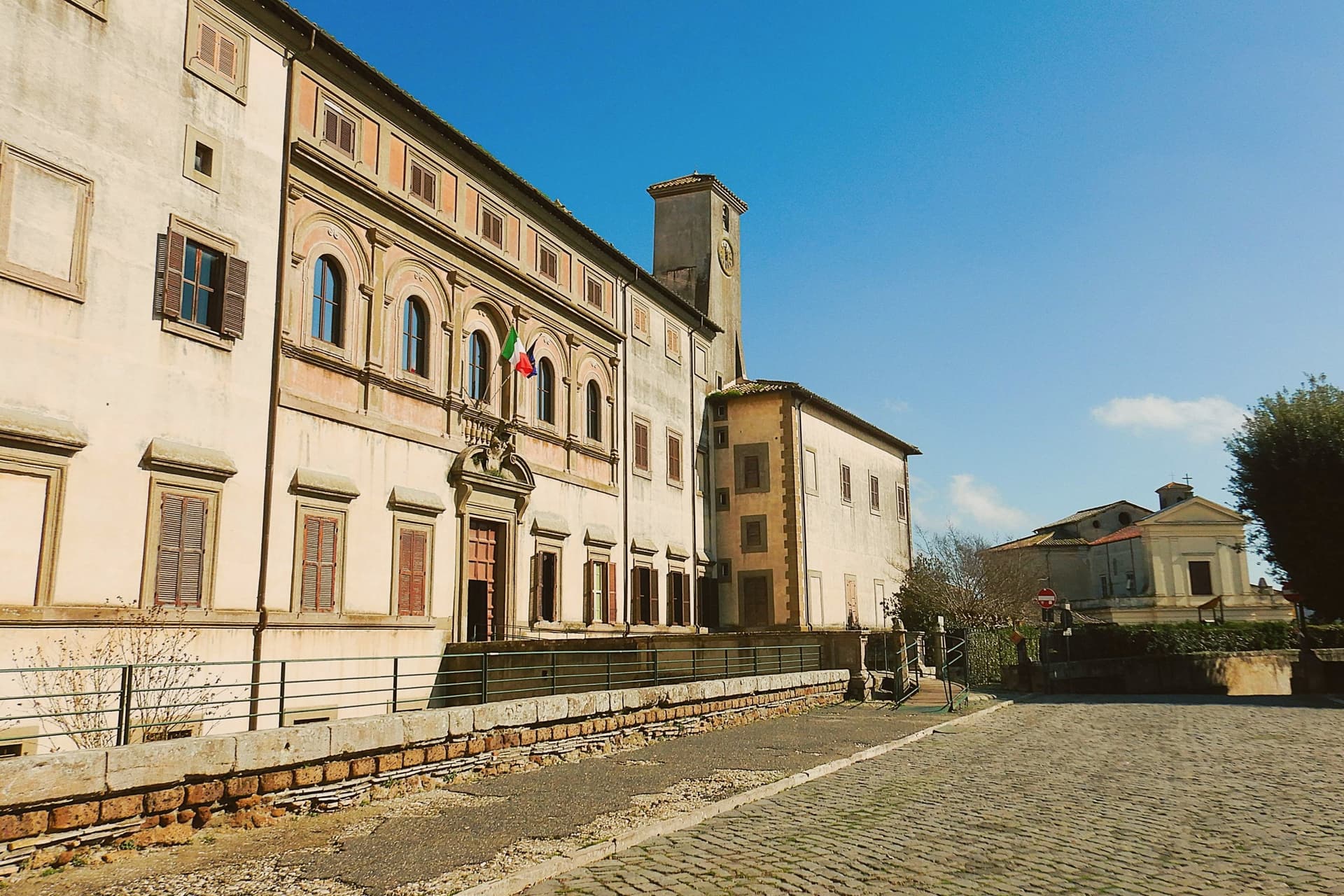
The first inhabitants were farmers, shepherds and woodcutters drawn from Tuscany and Umbria, so the local accent kept Umbrian inflections for generations. The palace at the center of the village gave the settlement its shape, with the parish church and the main square arranged around it as the plan intended.
The forest that once covered the whole fief survives now at the margins, an exceptionally low-altitude stand for an Apennine beech wood, while hazelnut groves have taken over the lower slopes that were cleared for farming. The village, in effect, is the cleared half of a wooded fief, its cultivated ring still framed by the wood the Santacroce family left standing.
What to see in Oriolo Romano
- Palazzo Altieri. Sixteenth-century palace enlarged in 1674 under Pope Clement X, with Old Testament frescoes and painted views of the Altieri fiefs.
- Faggeta di Monte Raschio. Primeval beech forest of about eighty hectares between 400 and 550 meters, UNESCO World Heritage since 2017.
- Piazza Umberto I. Central square of the 1560 plan, anchored by the palace and the parish Chiesa di Sant'Anna at the head of the village.
How to get to Oriolo Romano
There is a railway station in the town, so you can arrive without a car and never need one while you are here. Roma is roughly 75 minutes away by road.
Our tip
April through June and September into October are the months for the beech forest, when the canopy is full and the trails on Monte Raschio are at their cleanest. The exceptionally low altitude of the faggeta means autumn color arrives earlier and lasts longer than in higher Apennine beech woods. July and August push the lower hills into the low thirties; the forest holds shade and stays five or six degrees cooler than the surrounding farmland. Oriolo Romano Porcini Mushroom Festival falls in September.
Castro dei Volsci
Why visit Castro dei Volsci
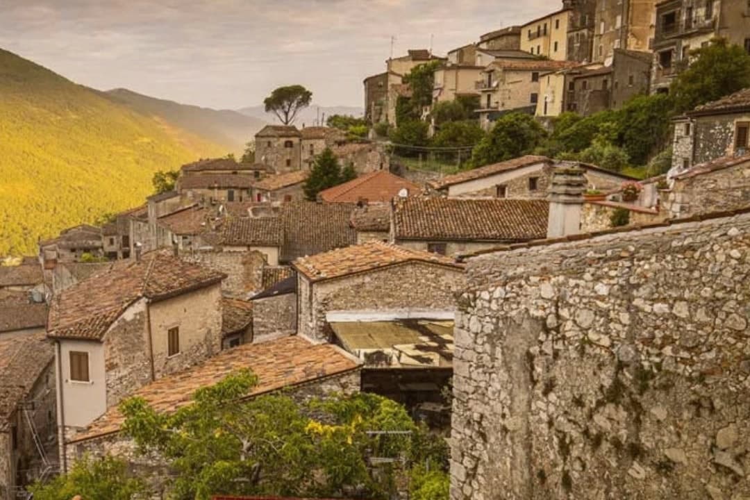
Castro dei Volsci sits at 385 meters on a ridge above the Sacco river valley, ninety kilometers southeast of Rome and fourteen from Frosinone. The Volsci, an Italic tribe Rome spent two centuries subduing, held this hill before the Latins took it; the name preserves both occupants, Castrum and Volsci, castle and people.
After the year 1000 the village fell to the Papal States and stayed inside that orbit until unification. The valley floor below the ridge holds Roman-era foundations and mosaics, remains of a settlement separate from the hill village above it.
The slopes between the two carry the olive groves that still supply the town's oil. The upper village, where the clock tower and castle ruins stand, is where Nino Manfredi was born in 1921 before the family's path led him to Rome and to postwar cinema; the town he left behind kept its stacked houses, its gates and its position over the valley, and it is that unbroken layout, hill above, groves on the slope, valley floor beneath, that the Borghi più belli d'Italia listing recognizes.
What to see in Castro dei Volsci
- Torre dell'Orologio. Medieval clock tower in the upper village. Inside, a permanent exhibition holds Nino Manfredi's films, scripts and personal effects.
- Castello. Ruins of the medieval fortress at the top of the borgo, with a panorama over the Sacco valley and the Monti Ausoni.
- Centro storico. Stacked stone houses, vaulted passages and medieval gates that earned the borgo its Borghi più belli d'Italia membership.
How to get to Castro dei Volsci
There is a railway station in the town, so you can arrive without a car and never need one while you are here. Latina is roughly 71 minutes away by road.
Our tip
April through June and September through October are the best windows. The Sacco valley is green in spring and the panoramas from the castle ruins open clean once the haze burns off. July and August push past thirty-five degrees; the centro storico empties between two and five in the afternoon, and the olive groves on the slopes go silent until evening.
Sutri
Why visit Sutri
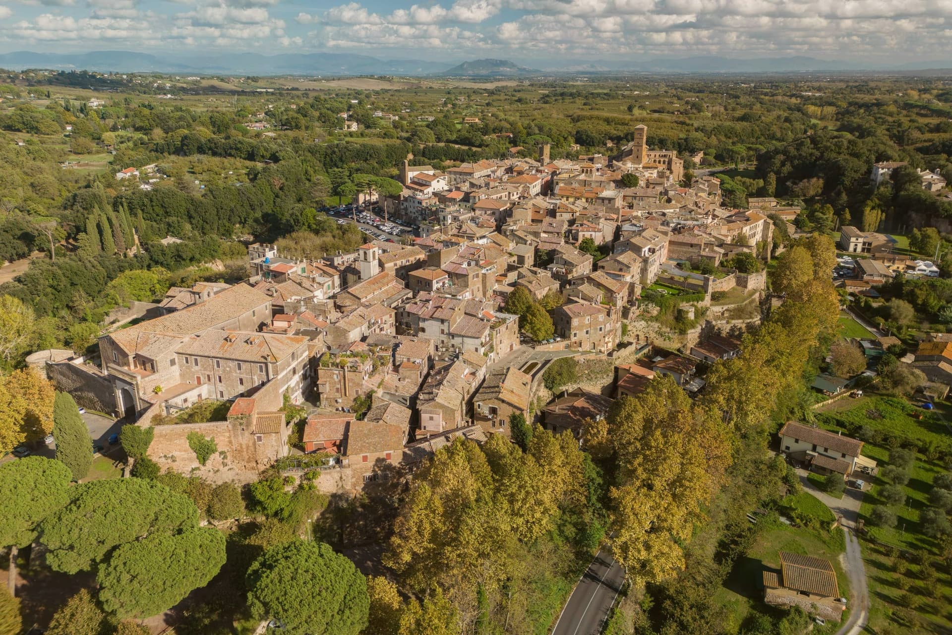
Sutri sits at 291 meters on a narrow tuff spur, fifty kilometers north of Rome on the old road linking the two. The Etruscans held it before the Romans took it in the fourth century BC, and it was among the colonies that refused further military contributions to Rome during the Second Punic War in 209 BC.
The rock-cut monuments that define the town, the arena, the temple turned sanctuary, the chamber tombs, all come from the same tuff spur the town is built on, so the stone that gives Sutri its ground is also what its Etruscan and Roman residents carved into. The high ground above, where the eighteenth-century villa and its gardens sit, looks down over that older excavated town rather than sitting apart from it.
Local tradition ties the town's beans to Charlemagne, who passed through and was supposedly relieved of an attack of gout by Sutri's variety. What the place adds up to is a settlement where the town and its excavation are the same rock: nothing was built so much as removed.
What to see in Sutri
- Anfiteatro Romano. Elliptical amphitheater about forty-nine by forty meters, carved directly out of the tuff rock rather than built on it.
- Mithraeum / Madonna del Parto. Roman temple to Mithras hewn into the tuff and reused as a Marian sanctuary, accessed through the medieval rock-cut church.
- Necropoli rupestre. Etruscan necropolis with dozens of rock-cut chamber tombs in the cliff face along the Via Cassia.
How to get to Sutri
Roma is roughly 57 minutes away by road.
Our tip
April through June and September into October are the best months in the tuff country, when the amphitheater grass is green and the gardens of Villa Savorelli are open. July and August push afternoons into the mid-thirties; the rock-cut Mithraeum and tomb chambers stay cool and become the part of the visit that doesn't need to be timed. November through March is quiet. Sagra del Fagiolo falls in August.
Subiaco
Why visit Subiaco
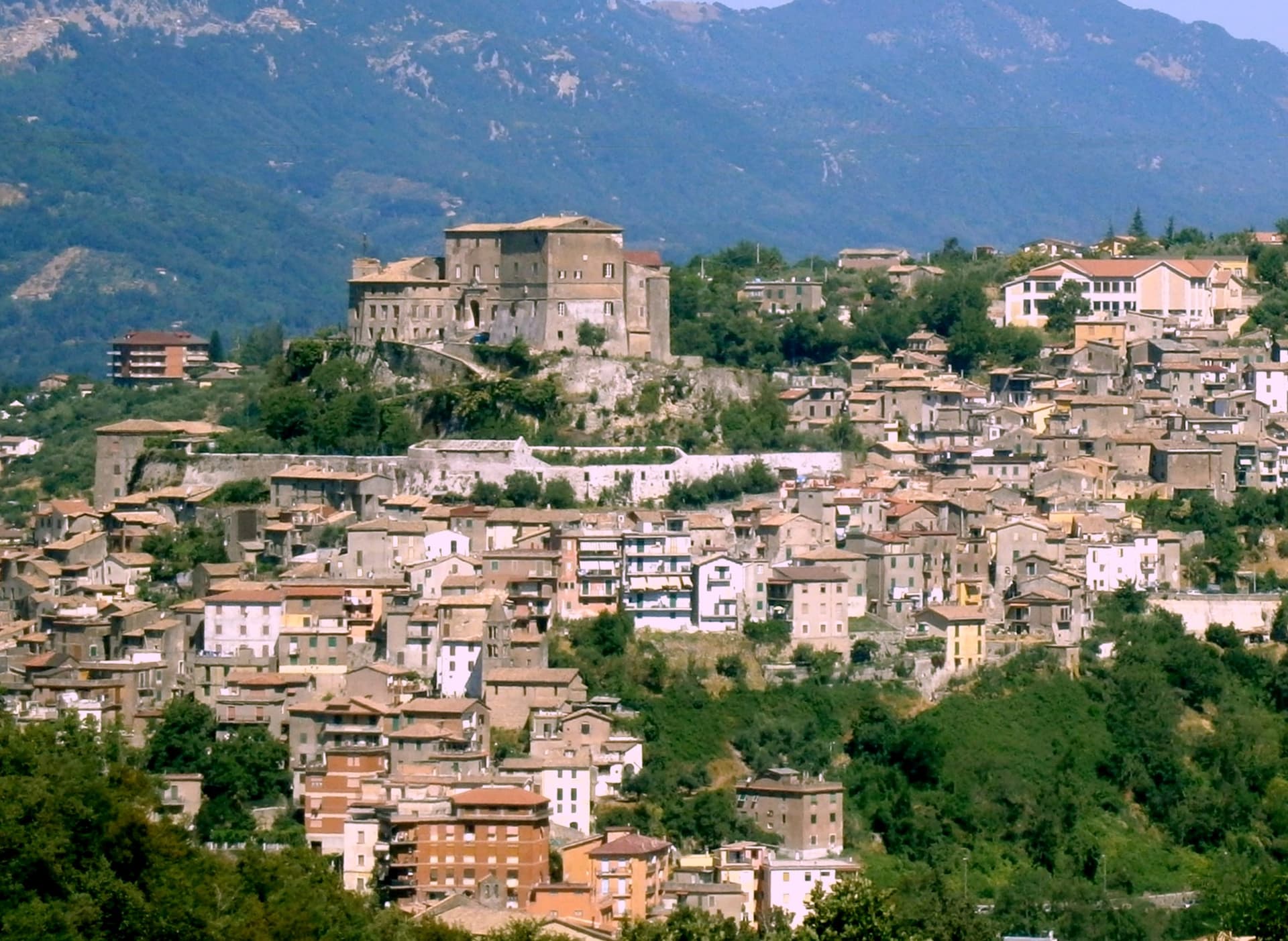
Subiaco sits at 408 meters along the upper Aniene, seventy-three kilometers east of Rome and forty from Tivoli. Nero built a villa here in the first century, damming the river into artificial lakes known as Sublaqueum, below the lake, and the name outlasted the villa and the emperor both.
The town that grew up here reads in layers going up the valley side: the river and the bridge at the bottom, the abbey partway up the hill, the fortress at the summit, and the cliff sanctuary further out along the cliff face that gave the hermit's cave its shelter, each one built at a different remove from the water and from the town center. What holds these layers together is a single life.
A man who came here as a young man to live alone in a cave gave his name to a monastery down the hill, and centuries later that same monastery's press put the first printed book on Italian soil into circulation. The fortress above answers to a different history, the abbots who ruled here as feudal lords, one of whom fathered a child who became one of the most written-about women of her age.
A river valley that supplied an emperor's pleasure lakes became, without much overlap, the ground where monastic life took its early shape.
What to see in Subiaco
- Monastero del Sacro Speco. Built into the cliff face of Monte Taleo, the sanctuary rises in tiers over the cave itself, and the frescoes by Conxolus and the school of Cimabue cover walls that follow the rock rather than a flat plan.
- Abbazia di Santa Scolastica. The only one of Benedict's twelve original monasteries still standing, sixth century in origin; its library holds three hundred manuscripts, including a copy of the Lactantius run off the abbey's own press.
- Rocca Abbaziale (Rocca dei Borgia). Set on the highest ground of the borgo, the fortress was raised by abbot Giovanni V in the twelfth century and later gave Lucrezia Borgia, daughter of the abbot Rodrigo Borgia, a birthplace in 1480.
How to get to Subiaco
There is a railway station in the town, so you can arrive without a car and never need one while you are here. Roma is roughly 70 minutes away by road.
Our tip
April through June and September through October are the months for Subiaco: the Aniene runs full, the cliff sanctuaries are open from morning, and the pilgrim road south fills with walkers on the Cammino di San Benedetto. July and August are warm in town and cool in the monasteries; the cave at the Sacro Speco holds twelve degrees year-round. November through March is the quiet pilgrim season, mist on the river and few coaches in the lots. Festa Madonna di Pompei Rione Colle falls in August.
Castelnuovo di Porto
Why visit Castelnuovo di Porto
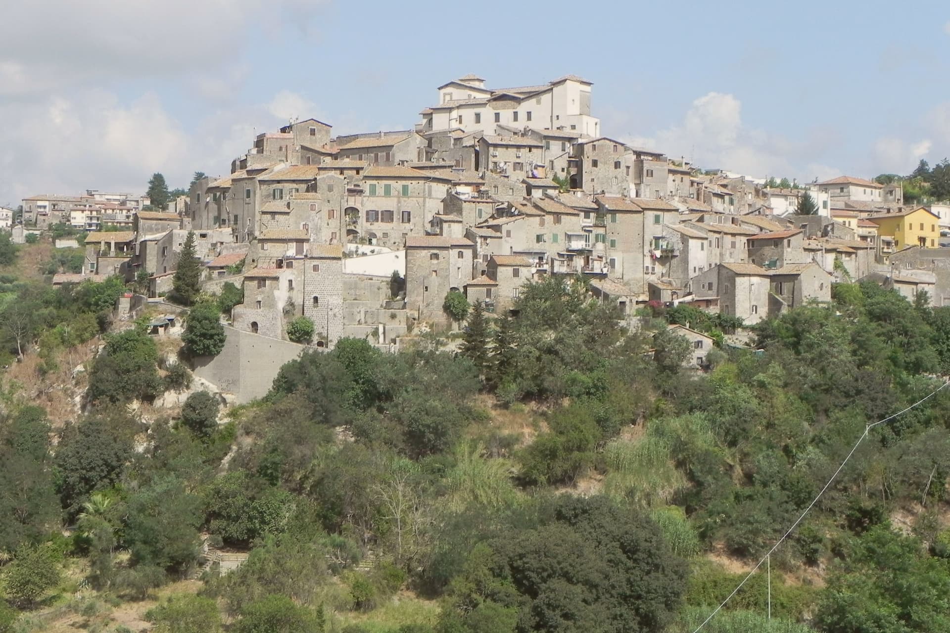
Castelnuovo di Porto sits at 250 meters on a tufa spur between the Chiarano and Mola valleys. The first fortification went up before the year 1000 under the senator Alberico, and the medieval village grew around it in concentric loops that still shape the centro storico today.
The Colonna family took the fief in the late Middle Ages and built the fortress that occupies the highest point of the ridge, the keep from which the whole settlement takes its layout, houses and passages stepping down the slope in rings. The town's name preserves its administrative link to the river: this was the Castrum Novum of the bishop of Porto, the old diocesan seat at the Tiber mouth, a naming that ties a tufa hilltop village to an ecclesiastical authority seated on the coast.
The Borghi più belli d'Italia membership covers the centro storico and the fortress together, while Etruscan and Roman archaeology runs through the Veio park that surrounds both. The result is a village whose name records a bishop's jurisdiction, whose form records a medieval defense, and whose surroundings record two much older civilizations, all still legible on the same ridge.
What to see in Castelnuovo di Porto
- Rocca Colonna. Ducal palace inside the keep at the highest point of the ridge, used by Marcantonio Colonna after Lepanto and later by Christina of Sweden passing through to Rome.
- Centro storico. Tufa houses and vaulted passages along the concentric loops, with the surviving village gates still marking the old perimeter.
- Chiesa di Santa Lucia. Parish church inside the walls, with Renaissance frescoes and a baptismal font dating to the period of the fortress above it.
How to get to Castelnuovo di Porto
There is a railway station in the town, so you can arrive without a car and never need one while you are here. Roma is roughly 37 minutes away by road.
Our tip
April through June and September through October are the strongest months. The Tiber valley is green in spring and the rocca terraces open cleanest at low sun. July and August touch the upper thirties; the centro storico stays cooler than Rome twenty-five kilometers downhill but the Veio park trails go silent in midday heat. Sagra Degli Gnocchi A Castelnuovo Di Porto falls in September.
Ariccia
Why visit Ariccia
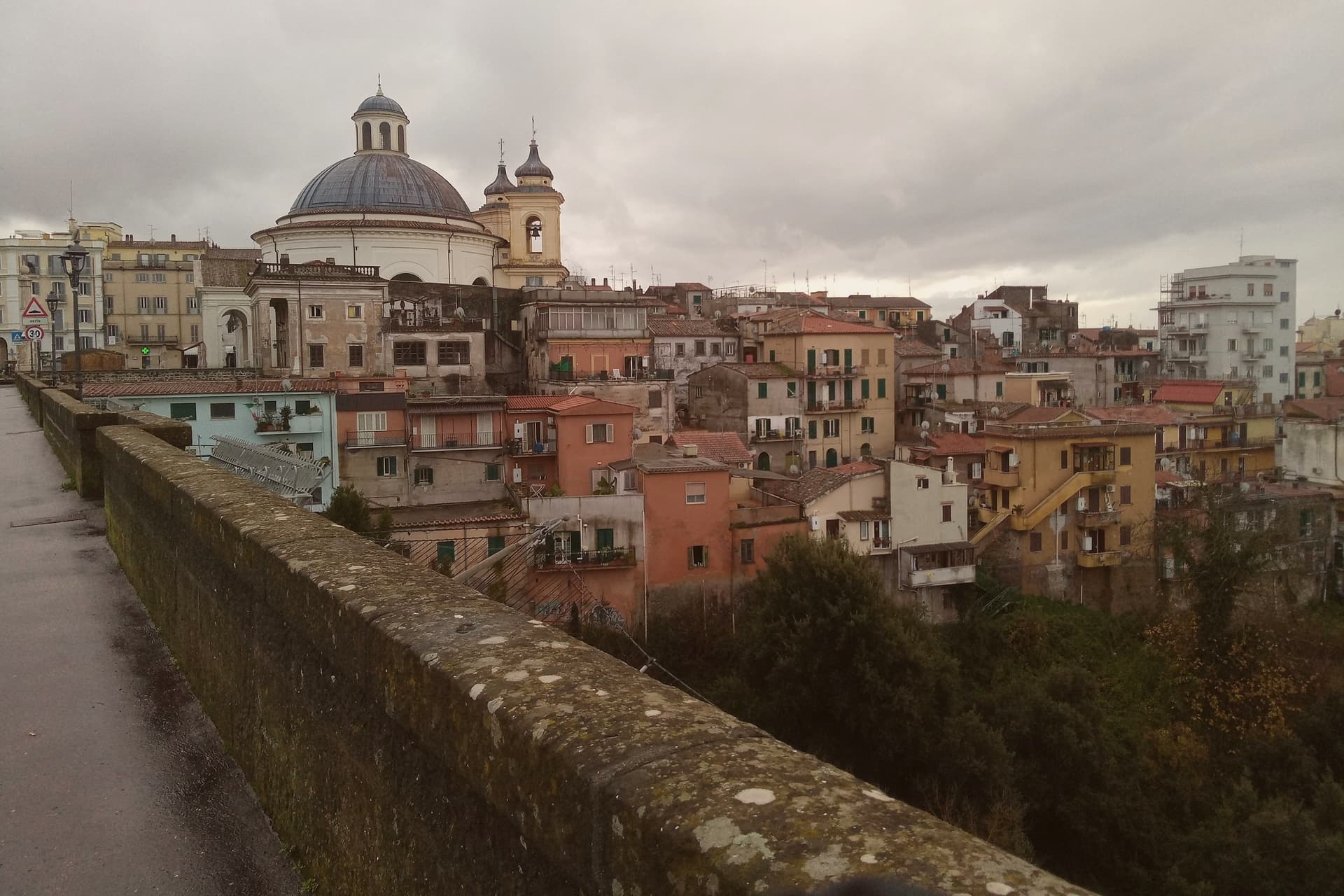
Ariccia sits on the rim of the Alban Hills volcanic complex, and the crater geography organizes everything about the place. The town centre occupies the ridge; below it on the eastern side the ground drops into the deep crater valley of Vallericcia, crossed by the viaduct linking the town to the next ridge.
The gorge itself became notorious after a series of suicides in the 1990s, now blocked with high railings. Further east and below, the volcanic lakes and the papal estate sit in a cluster within a few kilometres of the town centre, part of the same crater system that shaped Ariccia's position in the first place.
The Roman past predates the Baroque town by centuries: Aricia was the southern terminus of the original Via Appia, laid out in 312 BC, and the neighbouring lake was the site of the Latin League's federal sanctuary of Diana Aricina. The porchetta tradition is separate again: whole pork loin, deboned and seasoned with rosemary, garlic, pepper and wild fennel, slow-roasted on rotating spits in wood-fired ovens and served at room temperature in panini or by the etto.
The fraschette that serve it were originally outdoor wine vendors, marked with frasche, branches, as signs, and the town's status as a Città del Vino within the Frascati zone explains why the wine on the table is local rather than incidental. What makes Ariccia distinct among the Castelli towns is that these layers, Roman road terminus, crater rim settlement, unified Baroque set piece, and porchetta town, sit on top of each other in one small place rather than being scattered across the region.
What to see in Ariccia
- Palazzo Chigi + Piazza di Corte (Bernini). The Chigi family's Baroque summer residence. The palazzo, the piazza and the church facing it were designed as one ensemble. The palazzo is preserved as a 17th-c interior museum.
- Santa Maria dell'Assunzione (Bernini). Bernini's circular church, domed and modelled on the Pantheon: small, perfect, often empty.
- Ponte Monumentale. 1854 triple-tier brick viaduct spanning the 312m-deep Vallericcia crater. Walk across for the panoramic view; the gorge below is wooded and undeveloped.
How to get to Ariccia
There is a railway station in the town, so you can arrive without a car and never need one while you are here. Roma is roughly 41 minutes away by road.
Our tip
Ariccia is year-round — the Castelli Romani are Rome's cooler escape in summer (400m altitude buys 5-7 degrees off the city heat) and the porchetta is cold-served so it works in any weather. October–November is the Sagra dell'Uva and the Sagra della Porchetta (first weekend in September) — fraschette spill into the streets. Saturday lunch in any season is the locals' main event.
Velletri
Why visit Velletri
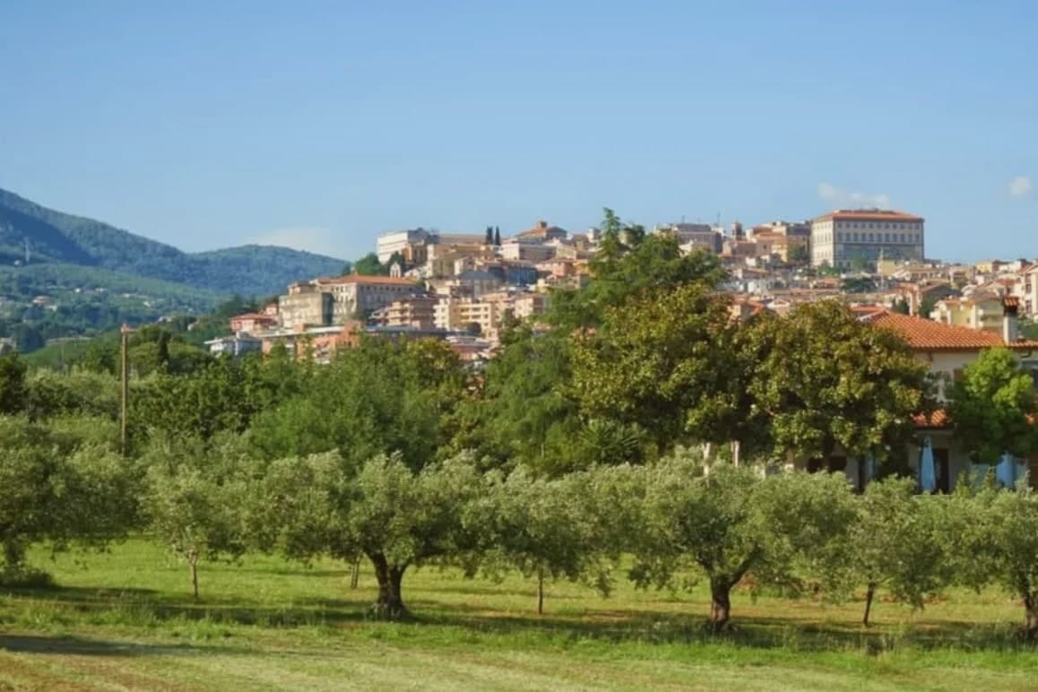
The town sits at 332 meters, thirty-five kilometers from Rome, on the southeastern rim of a volcanic ring of craters and lakes. Before it was a papal possession and a diocesan seat, it was a Volscian stronghold, and before that the home ground of the Octavii, the paternal family of the man who became Augustus: Suetonius records a street here called Octavian and an altar consecrated by an Octavius, and the future emperor passed his childhood in the town under its old name, Velitrae.
That layering, Volscian settlement, imperial family seat, papal diocese, is what the center still shows once the war is accounted for: an army broke through a German defensive line here in May 1944, and much of the town was destroyed in the process. What stands now above the old piazza and around the rebuilt town hall is largely reconstruction fitted around what survived, with a wine trade going back to the volcanic soil that predates all of it.
A town whose name changed twice, whose family produced an emperor, and whose center was rebuilt from a battle line, but whose vineyards on the same slopes never stopped being the constant.
What to see in Velletri
- Torre del Trivio. 50-meter Romanesque bell tower from the 14th century, the only structure to come through the 1944 bombing intact, still the shape by which the town is recognized from a distance.
- Palazzo Comunale. Renaissance town hall designed by Giacomo Della Porta, rebuilt after wartime damage, facing the piazza named for the emperor born to the town.
- Cattedrale di San Clemente. Cathedral seat of the suburbicarian Diocese of Velletri-Segni, a title held today by the Dean of the College of Cardinals.
How to get to Velletri
There is a railway station in the town, so you can arrive without a car and never need one while you are here. Latina is roughly 35 minutes away by road.
Our tip
April through June brings the Alban Hills at their greenest, vineyards in leaf, and mild evenings on the piazzas. September and October are the wine months: the Festa dell'Uva, one of the oldest grape festivals in Italy, runs in the first week of September. July and August are hot in the lower town and at their best after sunset, when the volcanic slopes hold the breeze. Calici sotto le stelle falls in August.
More from Anywhere Italy
- The best hill towns inside a nature park within 90 minutes of Roma
- The best small towns inside a nature park in Lazio
- The best towns inside a nature park in the province of Roma
- The prettiest villages inside a nature park within 90 minutes of Roma
 The 6 best hill towns within 90 minutes of Latina
 The prettiest villages you can reach by train in Lazio