
The best small towns inside a nature park in Lazio

Lazio protects a surprising amount of itself. Regional parks cover volcanic crater lakes, gorges cut through tufa, beech and chestnut forest on the Apennine flank, and stretches of limestone coast where the maquis runs down to the sand. The villages inside them are built from what the ground offered: tufa blocks the colour of wet biscuit, grey limestone, brick where the clay was good. Autumn is the season the parks earn their keep, with porcini and chestnuts in the mountain towns, olive pressing on the lower slopes, and wild boar on the menu in places where the local cooking still means beans, sheep's cheese and a dish of handmade pasta with a name nobody uses in the next valley.
Almost everyone who comes to Lazio for landscape rather than churches ends up in Rome first and then, if there is time, on a coach to Tivoli for the fountains and the villa gardens. It is a reasonable decision. The gardens are extraordinary and the train from Roma Tiburtina is short. It also means the queue outside Villa d'Este on a Saturday in May is longer than the main street of most mountain communes an hour further on, and the coaches park nose to tail.
The parks continue past that. The same hills that hold Tivoli rise into the Monti Lucretili, the same volcanic ring that made the Alban Hills holds Lake Nemi, the tufa canyons north of Rome run on towards Viterbo, and the limestone of the Ciociaria carries south to the coast at Sperlonga. The towns on this list all sit inside a regional nature park, which is why the footpaths start at the edge of the houses. Fewer people go, and the ones who do tend to be walking.
Of the 60 communes we have mapped in Lazio, 21 qualify as towns inside a nature park: each sits inside a regional nature park. This list is the small ones, 8 in all, ordered smallest first. The smallest, Percile, has 219 residents.
Elsewhere in the catalogue: The best hill towns inside a nature park in Lazio and The prettiest villages inside a nature park within 90 minutes of Roma.
Percile
Why visit Percile
Percile sits sixty kilometers from Rome, on the border between the Roma and Rieti provinces. The name derives from gens Porcia, a Roman family of the area, and the earliest documented evidence of habitation dates between 314 and 335, in the biography of Pope Sylvester I.
The village occupies the rocky spur itself, walled stone houses and vaulted passages built to the shape of the ground; above it the slopes rise into oak and beech woods that belong to the wider park, climbing toward Monte Pellecchia. The relation between the two levels is the whole of the place: the settlement below, compact and defensible on its spur, and the water held above it in limestone basins fed by underground springs.
What the borgo protected on the ground, the park has protected in the hills. The population today is 219, spread across a comune territory of 24 square kilometers, which makes Percile a small fixed point inside a much larger stretch of protected woodland.
What to see in Percile
- Lagustelli di Percile. The walk up from the village runs through oak forest and ends at clear water held in two limestone basins between 674 and 704 meters, filled by underground springs.
- Centro storico. Medieval stone village on a rocky spur, with vaulted passages, surviving gates and the panorama from the upper terrace.
- Parco Naturale dei Monti Lucretili. Regional park covering oak and beech woods on the karst slopes around the village, with marked trails to the lakes and toward Monte Pellecchia.
How to get to Percile
Roma is roughly 54 minutes away by road.
Our tip
April through June and September through October are the best months at 575 meters. The Lucretili woods are green into June and the walks up to the Lagustelli are at their best when the karst basins are full from spring rain. July and August are workable; the village stays cooler than Rome forty kilometers downhill, but the open trails go silent in midday heat.
Orvinio
Why visit Orvinio
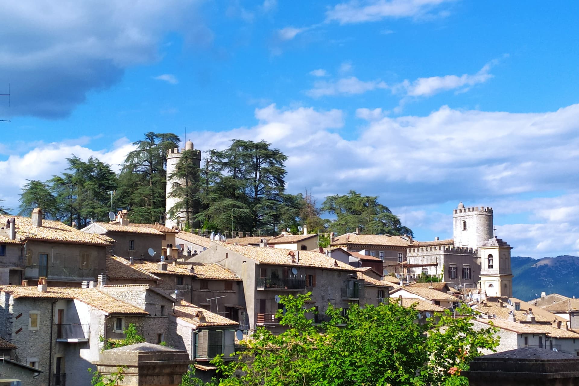
Orvinio sits on a saddle in the Monti Lucretili park, the last village before the slopes drop toward the Turano lake. The ancient settlement called Orvinium was destroyed before the year 1000, and the medieval town that grew up afterward took the name Canemorto, said to commemorate a Saracen defeat by Charlemagne's troops in 817.
The Orsini built the Granarone palace in the fifteenth century, before the Borghese took the fief in 1632. The village they governed still reads in two layers: stone houses running in tight loops below the ridge, and the Castello Malvezzi-Campeggi above them, the physical record of who held the place longest.
The Cammino di San Benedetto crosses this lower town on its way between Subiaco and Norcia, a reminder that the village has always been a point of passage as much as a seat of lordship. What remains is a settlement whose name changed twice and whose skyline did not: the castle above, the loops of houses below, unchanged in relation even as the village below it was renamed.
What to see in Orvinio
- Castello Malvezzi-Campeggi. Rebuilt by the Borghese in the nineteenth century, it dominates the village from the upper ridge, still visibly the seat of the family that held the fief the longest.
- Abbazia di Santa Maria del Piano. Benedictine abbey founded in the early Middle Ages, the original landlords of the territory before the Orsini took it.
- Centro storico. Stone houses in tight medieval loops below the castle, with vaulted passages and the original village gates preserved.
How to get to Orvinio
Roma is roughly 60 minutes away by road.
Our tip
May through September is the working window at 840 meters. The Lucretili woods open, the trails dry out and the village evenings stay cool when Rome forty-five kilometers downhill is hitting thirty-five. October still holds for the woods turning copper and for the Cammino di San Benedetto walkers passing through on the route between Subiaco and Norcia. Sagra della Polenta falls in August.
Calcata
Why visit Calcata
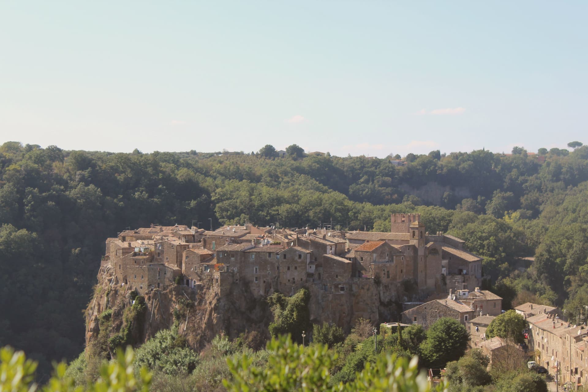
Calcata sits on a tufa cliff above the Treja valley, forty kilometers north of Rome. The Anguillara family walled and castled it in the 13th century.
In 1935 the Italian government condemned the village as structurally unsafe and ordered residents to move down to the new town in the valley below. Most did.
The empty houses on the cliff were re-occupied by artists, hippies and a small bohemian community from the late 1960s onward; they cleared the alleys, opened studios and bars, and turned an officially uninhabitable village into one of Lazio's strangest functioning settlements. The Holy Foreskin relic of Jesus was kept in the parish church here from 1527, taken from the Sancta Sanctorum during the Sack of Rome, and was an active object of pilgrimage until the relic was stolen in 1983 and the Vatican suppressed its cult.
Calcata Vecchia is now a single street of workshops on a cliff edge above the Parco della Valle del Treja.
What to see in Calcata
- Calcata Vecchia. Medieval village on a tufa cliff, condemned in 1935 and re-occupied from the 1960s by artists and craftspeople.
- Castello Anguillara. 13th-century baronial castle of the Anguillara family, partially restored, now owned by the Treja Valley park.
- Chiesa del Santissimo Nome di Gesù. Parish church that held the Holy Foreskin relic from 1527 until its theft in 1983.
How to get to Calcata
Terni is roughly 66 minutes away by road.
Our tip
April through June and September through October are when Calcata works. The Treja valley below is in leaf, the cliff in sun, the workshops and bars in the old village all open. July and August push past thirty degrees and the artist community thins out.
Nemi
Why visit Nemi
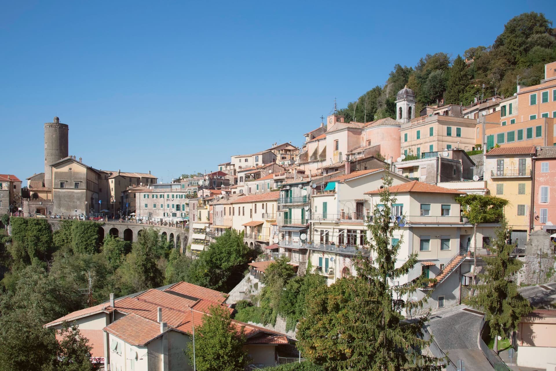
Nemi sits at 521 meters on the rim of a volcanic crater, the smallest of the Castelli Romani and thirty kilometers southeast of Rome. The lake below was the Speculum Dianae, the mirror of Diana, with a sanctuary on its northern shore that covered around 45,000 square meters and drew pilgrims from across Latium.
Emperor Caligula built two ceremonial ships on the lake, ninety meters of timber and bronze that sat on the water until they sank. Mussolini drained part of the lake between 1929 and 1932 to recover them.
They were destroyed by fire in 1944, almost certainly by retreating German troops. The Museo delle Navi Romane, built in 1940 to hold them, now shows scaled reconstructions and salvaged fragments.
Palazzo Ruspoli, a ninth-century castle restored by Valadier, anchors the centro storico. The wild strawberries grown on the inner slopes of the crater are sold from stalls along Via Roma and celebrated each June at the Sagra delle Fragole.
What to see in Nemi
- Palazzo Ruspoli. Ninth-century castle of the Counts of Tuscolo, restored by Valadier, with cylindrical tower and hanging garden over the lake.
- Museo delle Navi Romane. Lakeshore museum built in 1940 for Caligula's two recovered ships, destroyed by fire in 1944, now housing scaled models and fragments.
- Santuario di Diana Nemorense. Remains of the federal sanctuary on the lake's northern shore, once 45,000 square meters of temple, porticoes and theater.
How to get to Nemi
Roma is roughly 52 minutes away by road.
Our tip
April through June and September into October are the dry months on the crater rim, when the wild strawberries ripen and the lake holds its color. The Sagra delle Fragole runs the first Sunday of June and draws thousands. July and August push the basin into the low thirties; the centro storico stays cooler at 521 meters than the coast or the city, but weekends fill with day-trippers from Rome. Borgo diVino in tour falls in September.
Pico
Why visit Pico
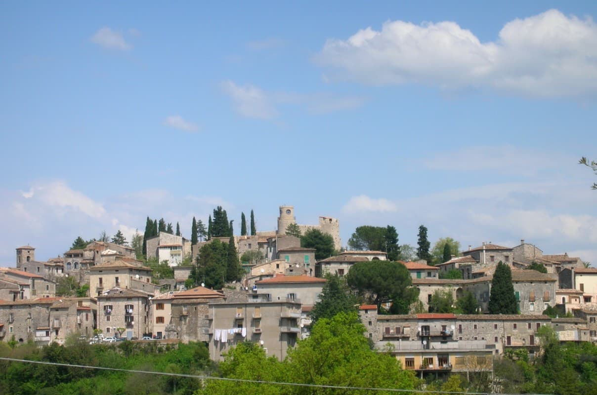
The town sits on a limestone spur at 220m, between Rome (115 km north) and Naples (140 km south), in the Ciociaria mountain landscape that runs into the national parks to the south and the Liri valley route toward Fondi. The Monastero di Montecassino lies 40 km east.
The castle at the high point of the town, built in the 16th century on 11th-century Norman foundations, belonged to the Boncompagni family, into which the writer Tommaso Landolfi was born; his fantastic-realism stories (Mar delle blatte, La pietra lunare, Il dialogo dei massimi sistemi) place him alongside Borges or Kafka in Italian letters, and the museum now inside the castle also covers the broader school he belonged to, including Buzzati, Calvino, and Bontempelli. Below the castle, the streets of the old town descend to the central piazza, and the Palazzo Boncompagni, the baronial family's residence, sits at that lower point between the two.
The mountains that border the town on the south side are the same range the medieval centro was built to look out over, and they carry the karst hiking, the wild boar territory, and the historic route through the Liri valley that give the area its hunting economy. The food follows that same pattern found across the surrounding villages: pasta alla ciociara, abbacchio, Pecorino, salame ciociaro, and boar from those forests, with the Cesanese del Piglio DOCG red, from the Piglio hills 30 km north, as the local wine.
Population has fallen from 5,200 in 1951 to 2,634 today, the same depopulation that has thinned most Ciociaria mountain villages. What the town amounts to is a single hill settlement where a family castle, a writer's inheritance, and a mountain economy of hunting and wine all occupy the same small footprint, with little distance between the literary museum at the top and the working village below it.
What to see in Pico
- Casa Museo Tommaso Landolfi (Castello Baronale). The 16th-c Boncompagni baronial castle holds the writer's library, manuscripts, and the rooms where he wrote, preserved as he left them, alongside exhibits on the wider Italian fantastic-realism school.
- BPB medieval centro. Narrow stone-paved vicoli climb from the central piazza to the castle, past the Chiesa di Sant'Antonino (15th-c), the Chiesa di San Rocco, and the Palazzo Boncompagni.
- Monti Ausoni + Aurunci parks. The Monti Ausoni and Monti Aurunci National Parks sit immediately south, with karst hiking, wild boar territory, and the Liri valley historic route.
How to get to Pico
Latina is roughly 91 minutes away by road.
Our tip
Pico is best April–June and September–October. The Festa di Sant'Antonino (10 May) and the Sagra del Cinghiale (mid-October) frame the season. Summer is hot in the Ciociaria — the Castello + Casa Museo are the cool indoor refuges.
Sperlonga
Why visit Sperlonga
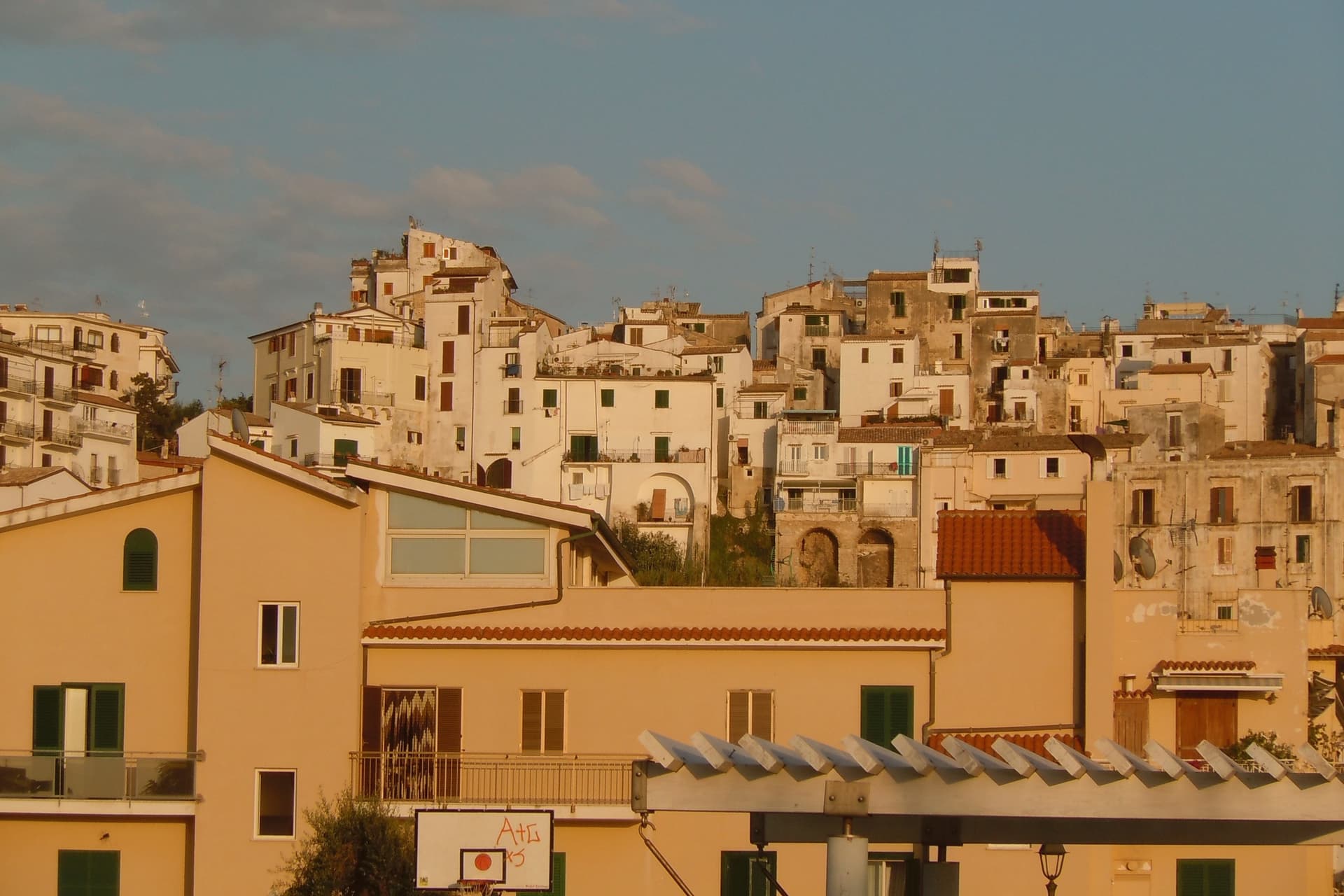
Sperlonga sits on a rocky spur on the Tyrrhenian coast, halfway between Rome and Naples. A Republican-era villa at the base of the town was inherited by Tiberius, who reigned from 14 to 37 AD and made the place his retreat.
Road crews building the coastal route between Terracina and Gaeta broke into its sea grotto in 1957, exposing the fragments now reassembled in the villa's museum: Odysseus blinding Polyphemus, the rape of the Palladium, Scylla devouring sailors. The town proper stands above, pedestrianized, a maze of stone houses, arches and stair-streets that drop down to the shore on either side of a cliff promontory.
The whitewash covering those walls is not decorative but a centuries-old defense against malaria and sun. Buffalo mozzarella country starts an hour south, and Sperlonga is the last Lazio commune before the Campania border, a town built literally on top of the emperor's private theater, with the modern coast road tracing the same line that cut it open.
What to see in Sperlonga
- Villa di Tiberio e Grotta. Imperial seaside villa with a natural grotto staged as a banqueting hall, where the marble Odyssey groups were unearthed in 1957.
- Museo Archeologico Nazionale. On-site museum displaying the reconstructed Sperlonga sculptures, including Odysseus blinding Polyphemus and the Scylla group.
- Centro storico. Pedestrian-only whitewashed old town on Monte San Magno, a maze of arches, stair-streets and lime-washed stone houses.
How to get to Sperlonga
Latina is roughly 65 minutes away by road.
Our tip
May through September is the season Sperlonga is built for: the beaches open, the boats run to the grotto, and the centro storico fills with day-trippers from Rome and Naples. June and September are the calmer bookends, mid-twenties, water warm enough to swim. July and August touch thirty-five and the two beaches fill by ten in the morning.
Oriolo Romano
Why visit Oriolo Romano
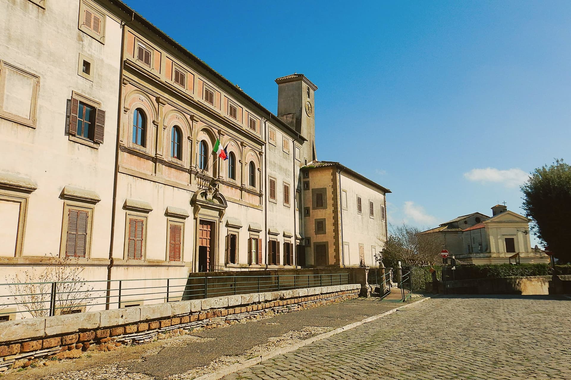
Oriolo Romano sits at 420 meters in the Sabatini hills, between Lake Bracciano and the volcanic Cimini, not far from the old Via Clodia. The village is unusually new for the Tuscia: in 1560 the Orsini family ceded a wooded fief to the nobleman Giorgio Santacroce, who began clearing the forest and founded a planned agricultural settlement.
The first inhabitants were farmers, shepherds and woodcutters drawn from Tuscany and Umbria, so the local accent kept Umbrian inflections for generations. The palace at the center of the village gave the settlement its shape, with the parish church and the main square arranged around it as the plan intended.
The forest that once covered the whole fief survives now at the margins, an exceptionally low-altitude stand for an Apennine beech wood, while hazelnut groves have taken over the lower slopes that were cleared for farming. The village, in effect, is the cleared half of a wooded fief, its cultivated ring still framed by the wood the Santacroce family left standing.
What to see in Oriolo Romano
- Palazzo Altieri. Sixteenth-century palace enlarged in 1674 under Pope Clement X, with Old Testament frescoes and painted views of the Altieri fiefs.
- Faggeta di Monte Raschio. Primeval beech forest of about eighty hectares between 400 and 550 meters, UNESCO World Heritage since 2017.
- Piazza Umberto I. Central square of the 1560 plan, anchored by the palace and the parish Chiesa di Sant'Anna at the head of the village.
How to get to Oriolo Romano
There is a railway station in the town, so you can arrive without a car and never need one while you are here. Roma is roughly 75 minutes away by road.
Our tip
April through June and September into October are the months for the beech forest, when the canopy is full and the trails on Monte Raschio are at their cleanest. The exceptionally low altitude of the faggeta means autumn color arrives earlier and lasts longer than in higher Apennine beech woods. July and August push the lower hills into the low thirties; the forest holds shade and stays five or six degrees cooler than the surrounding farmland. Oriolo Romano Porcini Mushroom Festival falls in September.
Castro dei Volsci
Why visit Castro dei Volsci
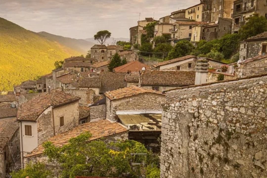
Castro dei Volsci sits at 385 meters on a ridge above the Sacco river valley, ninety kilometers southeast of Rome and fourteen from Frosinone. The Volsci, an Italic tribe Rome spent two centuries subduing, held this hill before the Latins took it; the name preserves both occupants, Castrum and Volsci, castle and people.
After the year 1000 the village fell to the Papal States and stayed inside that orbit until unification. The valley floor below the ridge holds Roman-era foundations and mosaics, remains of a settlement separate from the hill village above it.
The slopes between the two carry the olive groves that still supply the town's oil. The upper village, where the clock tower and castle ruins stand, is where Nino Manfredi was born in 1921 before the family's path led him to Rome and to postwar cinema; the town he left behind kept its stacked houses, its gates and its position over the valley, and it is that unbroken layout, hill above, groves on the slope, valley floor beneath, that the Borghi più belli d'Italia listing recognizes.
What to see in Castro dei Volsci
- Torre dell'Orologio. Medieval clock tower in the upper village. Inside, a permanent exhibition holds Nino Manfredi's films, scripts and personal effects.
- Castello. Ruins of the medieval fortress at the top of the borgo, with a panorama over the Sacco valley and the Monti Ausoni.
- Centro storico. Stacked stone houses, vaulted passages and medieval gates that earned the borgo its Borghi più belli d'Italia membership.
How to get to Castro dei Volsci
There is a railway station in the town, so you can arrive without a car and never need one while you are here. Latina is roughly 71 minutes away by road.
Our tip
April through June and September through October are the best windows. The Sacco valley is green in spring and the panoramas from the castle ruins open clean once the haze burns off. July and August push past thirty-five degrees; the centro storico empties between two and five in the afternoon, and the olive groves on the slopes go silent until evening.
More from Anywhere Italy
- The best hill towns inside a nature park in Lazio
- The prettiest villages inside a nature park within 90 minutes of Roma
- The 6 best small towns with a food festival in Lazio
- The best hidden towns inside a nature park in the province of Roma
- The best hill towns inside a nature park within 90 minutes of Roma
- The best towns inside a nature park in the province of Roma