
The prettiest villages that live slowly in Toscana
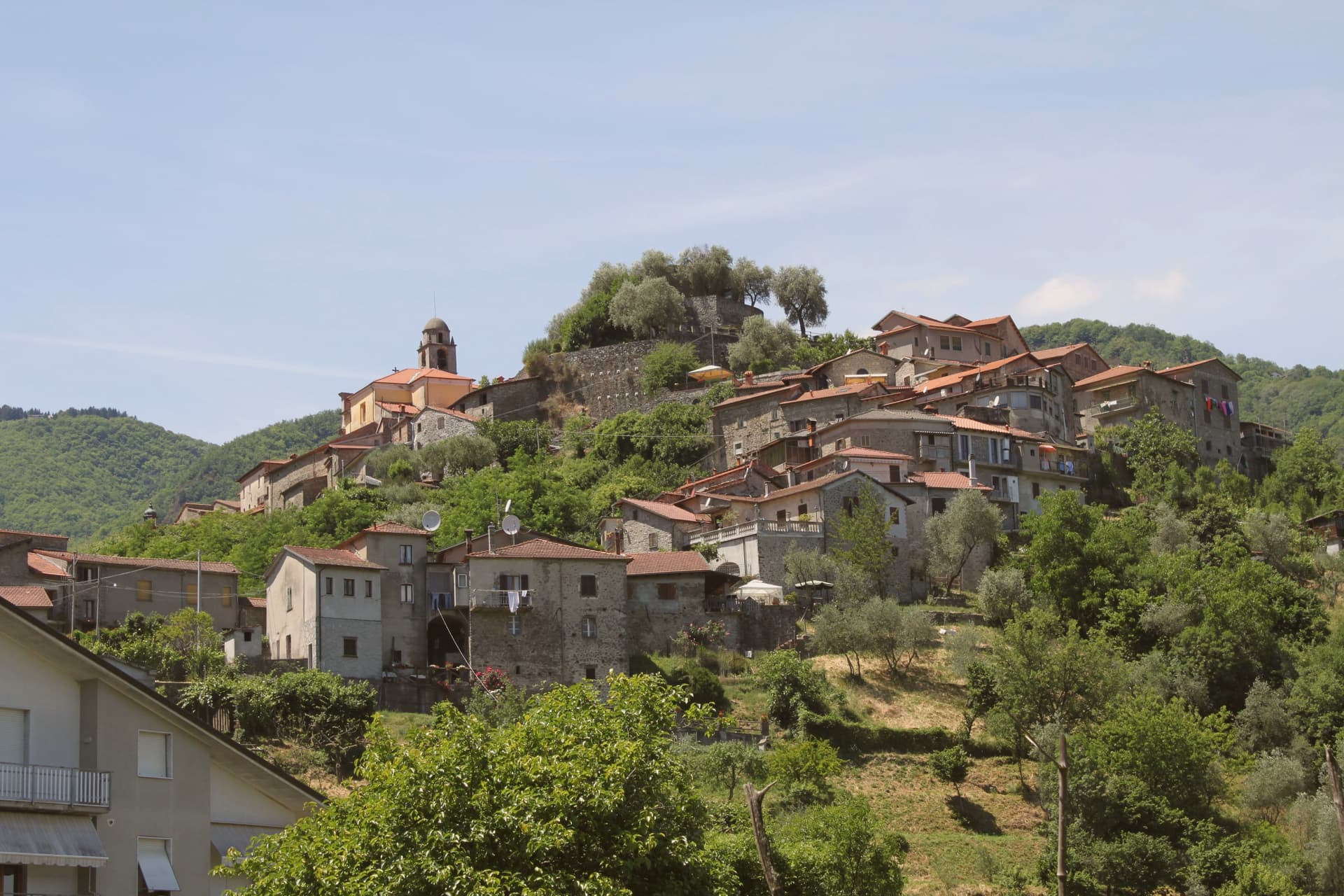
Tuscany's older villages are built from what was underfoot: grey pietra serena in the Apennine foothills, warm sandstone in the Valtiberina, tufo and lime render nearer the Maremma coast. The rhythm follows the crop rather than the calendar, olives pressed in late autumn, chestnut flour ground and stored, wild boar on the menu once the weather turns. Kitchens run on soup, ribollita and farro and bean broths thickened with yesterday's bread, and the wine is often made a short walk from where it is poured. Spring and October are the good months, when the light is long and the hill roads are clear.
Most visitors to Tuscany work a familiar loop: Florence, then Siena, then San Gimignano for the towers and a gelato, with a coach park at the bottom of the hill. It is a fine loop, and the art in it is among the best in Europe, which is why the queues outside the Uffizi start before it opens. By midday in high summer the smaller of those towns are given over almost entirely to day trippers, and the shops sell the same things to them.
The same hills carry on, though, north into the Serchio valley and east towards the Arno headwaters, south to the Maremma and its cork oaks. The villages there hold the same stone, the same oil and the same October light, and fewer people go. They tend to be places where the shops close for lunch because the people who run them go home to eat, which is broadly the point.
Of the 84 communes we have mapped in Toscana, 6 qualify as prettiest villages that live slowly: each has passed the national assessment of Italy's most beautiful villages, and each has signed the international slow-living charter. The smallest, Mulazzo, has 2,284 residents.
Two more lists worth reading alongside this one: The 9 best hill towns that live slowly in Toscana and The best olive oil towns that live slowly in Toscana.
Why visit Mulazzo
Mulazzo sits at 351 meters in the Lunigiana, the corner of Toscana that bends north toward Liguria and Emilia. The centro storico holds the tower and the parish church at the top of its stepped streets, the marquisate's old seat of power made physical in stone.
Three kilometers up the ridge, reached by climbing further into the hills, sits the frazione where the booksellers once lived, a separate settlement bound to the centro by the same ridge line but carrying its own, later history: villagers who left in the nineteenth century with panniers of books on their backs to sell across central and northern Italy. Ten kilometers off in the other direction, in Castevoli, a ruined castle marks where a separate branch of the family held its own patch of the same fiefdom.
The town's two settlements, the medieval seat and the book-trading frazione, describe a place shaped less by one center than by a hierarchy of them spread along a ridge, each with a distinct trade in memory: rule from above, books carried out on foot, stone left standing here and reduced to rubble there.
What to see in Mulazzo
- Torre di Dante. Medieval tower at the head of the borgo, once six stories and thirty meters. Demolished down to a sixth of its original height around 1750, what stands now is the stump of a much larger structure.
- Montereggio. Frazione three kilometers up the ridge, the only Italian member of the International Organisation of Book Towns, in honor of the village's bookselling diaspora.
- Centro Studi Alessandro Malaspina. Inside the tower, a study centre of documents and materials tracing the navigator's charting of the Pacific coast for the Spanish crown.
How to get to Mulazzo
Parma is roughly 95 minutes away by road.
Our tip
April through June and September into October are the months when the Lunigiana ridge is at its best, with green hills, low cloud, and the chestnut and oak forests turning. July and August stay cooler than the coast thirty kilometers south, but the centro empties around midday. The Montereggio book festival, in late August, is when the bookselling frazione fills again for a weekend with publishers and readers.
Why visit Anghiari
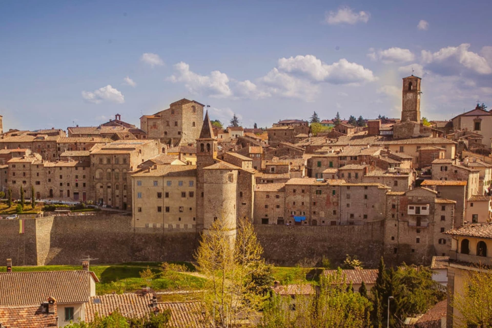
Anghiari sits at 430 meters on a spur above the upper Tiber valley, the Valtiberina, between Arezzo and the Umbrian border. The walled centro storico is intact, the streets running steeply from the Porta Sant'Angelo up to the Castello.
On 29 June 1440 the Florentine army defeated a Milanese force under Niccolò Piccinino in the plain below town, a battle that secured Florence's hold over central Italy and gave Leonardo da Vinci the commission for the Palazzo Vecchio fresco he started in 1505 and never finished. The painting, the Lost Leonardo, is presumed still to be hidden behind a Vasari wall in Florence.
Palazzo Taglieschi in the centro storico holds a polychrome wooden Madonna by Jacopo della Quercia and a working sixteenth-century table organ. The Mostra Mercato dell'Artigianato della Valtiberina has filled the streets with craft producers every spring since 1976, a working continuation of the textile and woodwork traditions that supported the town through the twentieth century.
What to see in Anghiari
- Palazzo Taglieschi. Sixteenth-century palace in the centro storico, now the Museo Statale di Palazzo Taglieschi, with a wooden Madonna by Jacopo della Quercia and a working table organ.
- Castello di Anghiari. Medieval fortified core at the top of the town, walls and gates still intact, the visual anchor of the silhouette from the valley below.
- Campo della Battaglia. The plain at the foot of the walls where Florence defeated Milan on 29 June 1440, the battle that inspired Leonardo's lost Palazzo Vecchio fresco.
How to get to Anghiari
Perugia is roughly 82 minutes away by road.
Our tip
April through June and September into October are the working months in the Valtiberina: dry days, low cloud over the upper Tiber, the surrounding farmland green or gold by season. The Mostra Mercato dell'Artigianato runs the last week of April and the first week of May, filling the streets with artisans from across the valley. Late June marks the anniversary of the 1440 battle, with reenactments below the walls. Palio della Vittoria di Anghiari falls in June.
Why visit Suvereto
Suvereto sits at 127 meters on the inland edge of the Val di Cornia, twelve kilometers from the Tyrrhenian coast. The name comes from the Latin suberetum, a wood of cork oaks, and the surrounding forests still hold them.
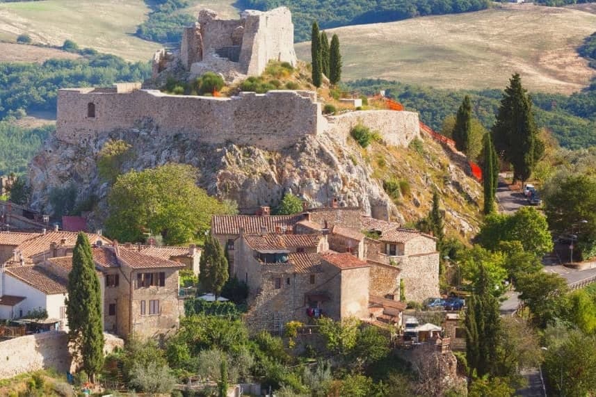
The Rocca Aldobrandesca, first documented in 973, occupies the highest point of the borgo; the Aldobrandeschi family who controlled it also ruled large sections of southern Toscana and the Maremma. The town reached its golden age in the thirteenth century, when Frederick II granted it a charter of freedoms in 1216 and the Palazzo Comunale was built.
The centro storico is a tight grid of stone vicoli that runs uphill from the Romanesque Pieve di San Giusto to the fortress. Suvereto carries five institutional signals at once, a rare combination in the province of Livorno, and the surrounding wine country falls under the Val di Cornia DOC and Suvereto DOCG appellations.
What to see in Suvereto
- Rocca Aldobrandesca. Fortress at the highest point of the borgo, documented from 973, expanded in the twelfth century and partly restored as an open archaeological site.
- Pieve di San Giusto. Eleventh-century Romanesque parish church at the foot of the borgo, with a sandstone façade and a single nave divided by stone columns.
- Palazzo Comunale. Thirteenth-century town hall with a double external staircase and Ghibelline merlons, one of the earliest surviving civic palaces of the Maremma.
How to get to Suvereto
Livorno is roughly 84 minutes away by road.
Our tip
April through June and September into October are the dry months in the Val di Cornia, when the cork forests behind the town hold their light and the wine harvest runs in September. The Sagra del Cinghiale, celebrating the wild boar of the surrounding hills, runs across two weekends in December and draws a different crowd. July and August are hot at 127 meters and most visitors descend to the Tyrrhenian coast in the afternoon. Palio dell'Imperatore falls in August.
Why visit Capalbio
Capalbio stands twelve kilometers from the Tyrrhenian coast, the last hill town before the border with Lazio. Charlemagne gave the land to the Abbey of Tre Fontane in 805; the Aldobrandeschi held it through the medieval period, the Orsini built the castle, and Cosimo I de' Medici took it in 1555.
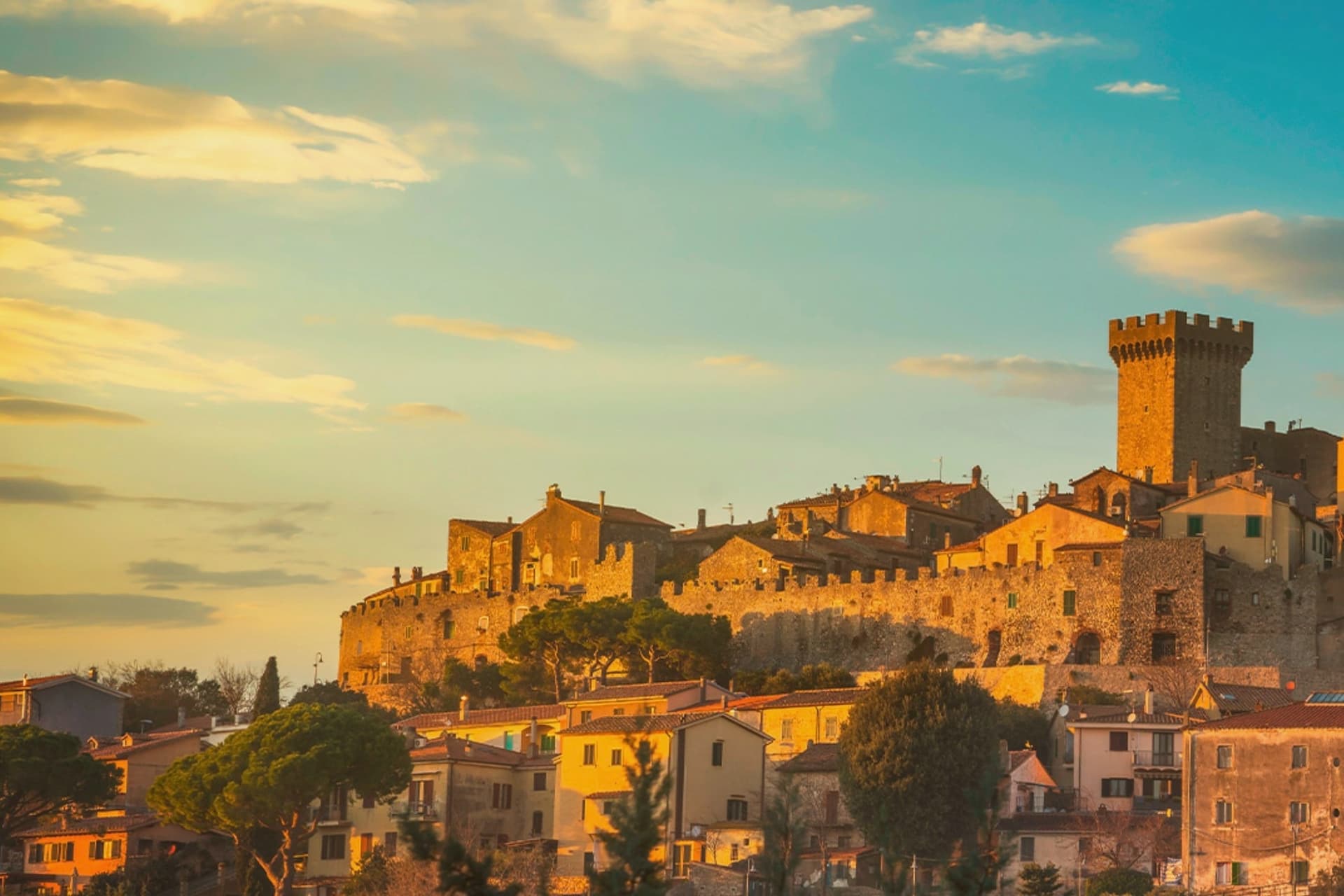
It became an independent commune in 1960. The medieval walls and the fortress define the centro storico at the top of the hill; the surrounding territory drops from the wooded uplands of Monte Calmata down to the coastal reserve at Lago di Burano.
The sculpture park sits four kilometers south of the walls, apart from the old town rather than within it. A borgo that governed itself late, held by abbey, feudal lords and Medici in turn before its own commune, and a territory that runs in one line from hilltop stone to coastal wetland.
What to see in Capalbio
- Rocca Aldobrandesca. Medieval fortress at the top of the borgo, later expanded by the Orsini, with a square tower and battlements that overlook the Maremma.
- Mura medievali. Two concentric circles of walls enclosing the centro storico, with a walkable parapet that opens onto views toward the Argentario.
- Giardino dei Tarocchi. Sculpture park four kilometers south of the borgo, its ceramic and mirrored figures set among holm oaks.
How to get to Capalbio
There is a railway station in the town, so you can arrive without a car and never need one while you are here. Roma is roughly 108 minutes away by road.
✷ We have written about Capalbio
“Everyone driving from Florence down to Rome crosses the Maremma without noticing, because there is nothing on that stretch to make them slow down. The hills give out. The cypresses stop. What opens up instead is flat open country, wheat and grass running off to a few low rises, the least Tuscan-looking part of Tuscany, a landscape you would call dull if you were being honest and which most guidebooks solve by leaving out.”
Read our piece on Capalbio →Maremma | The Last Cowboys of Tuscany
Our tip
May through September is the season the borgo and its territory work together: the centro storico stays cool at 217 meters while the Tyrrhenian coast at Chiarone-Capalbio fills with swimmers. The Giardino dei Tarocchi runs April through October. July and August are hot inland; afternoon hours in the borgo thin out and the coast takes over. Sagra del Cinghiale falls in September.
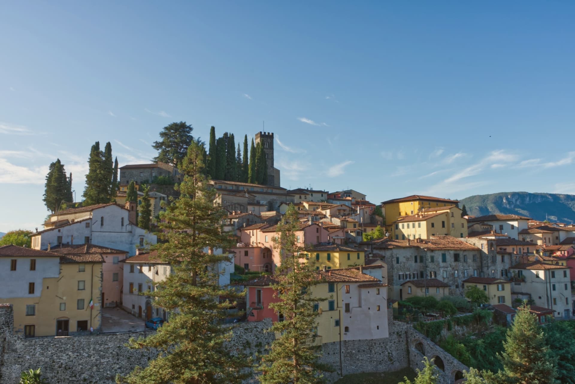
Why visit Barga
The town sits on the Colle Remeggio above the Serchio river, the Apennine ridge rising to the east as a counterpart to the Apuan Alps on the western side of the valley. The walled centro storico climbs the hill from Porta Reale, its stone houses narrowing as the streets rise toward the highest terrace, where the collegiate church stands.
The Colle di Caprona, a separate rise from the walled town itself, holds the house where Pascoli lived out his last years and the chapel where he is buried. The town also carries a Scottish thread: a wave of late nineteenth-century emigration sent generations of Barga families into the chip shop trade in Glasgow, and their descendants' festival now fills the streets every August with fish and chips rather than any dish more expected of the Tuscan hills.
A hill town built in stone around a Romanesque church, with a poet's house on one rise and a Glasgow-born sagra filling its streets each summer, holds more than its size would suggest.
What to see in Barga
- Duomo di San Cristoforo. The church climbs from the eleventh century into the sixteenth, four red marble columns of the pulpit resting on stone lions. It occupies the highest terrace of the town, above the streets that lead up to it.
- Casa Museo Giovanni Pascoli. The house is preserved with its original furnishings and library, the chapel next door holding the poet's tomb.
- Centro storico. Walled medieval town climbing the hill, narrow streets of stone houses leading from Porta Reale up to the church on the highest terrace.
How to get to Barga
There is a railway station in the town, so you can arrive without a car and never need one while you are here. Pisa is roughly 74 minutes away by road.
✷ We have written about Barga
“We were trying to get to Garfagnana. It was July, the coast was unlivable, we pointed the car at the Serchio Valley with a vague idea of chestnut forests and cool air, and somewhere on the road up we took a turn we should not have taken and ended up at the gate of a town I had never heard of. Barga was today's accident.”
Read our piece on Barga →Barga | The Scottish Accent
Our tip
April through June and September into October are the working months in the middle Serchio valley: green pasture, mild days at 410 meters, walking weather to the Apuan ridges. The Opera Barga festival fills the Teatro dei Differenti in July with chamber concerts. The Sagra del Pesce e Patate runs for two weeks in August and brings Glasgow-Barga families home.
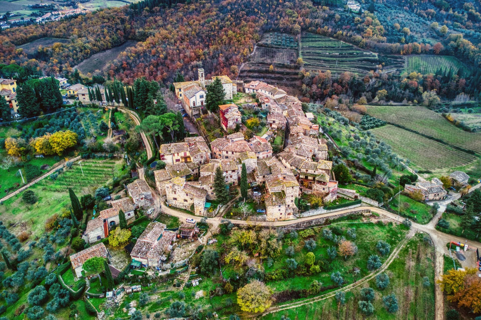
Why visit Greve in Chianti
Greve sits at 236 meters in the Val di Greve, thirty-one kilometers south of Firenze and forty-two north of Siena, on the small fast river that gave the town its name. The valley narrows here enough that the road to Firenze runs past the castle estates on the slopes to the north before dropping into the town itself, and the walled hamlet above Greve looks down on the piazza from its kilometer of higher ground, a settlement some centuries older than the square below it, its tenth-century walls predating the piazza's sixteenth-century arcades.
The piazza is the point around which the rest of the town organizes itself: shops and a market under the arcades, a rebuilt church closing its south end, and the roads out toward the castles and the hamlet all beginning at its edges. The Saturday market fills the piazza.
The wine festival in early September empties the surrounding cellars into glasses for three days. What holds the place together is the geography more than any single monument: a market town at a river crossing, ringed by the vineyard slopes and the older hill settlement that all feed into the same triangular square.
What to see in Greve in Chianti
- Piazza Matteotti. The arcades shelter wine shops, butchers and pasticcerie, wrapped around the irregular triangle of paving with the navigator's bronze figure watching the center.
- Chiesa di Santa Croce. Neoclassical parish church on the south point of the piazza, rebuilt in the nineteenth century after earthquake damage.
- Castello di Verrazzano. Vineyard estate on the hills north of town, producing Chianti Classico on slopes tied to the family name that reached New York Bay.
How to get to Greve in Chianti
Firenze is roughly 44 minutes away by road.
✷ We have written about Greve in Chianti
“The wine is the whole economy of these hills, every village with its own, the region’s name stamped on the most famous red in Italy. Tuscan food runs to cured and roasted meat, so the wine ran red to meet it, lighter than you expect, almost fruity, easy, made to sit beside a steak and not to be lectured about. Here is the only wine knowledge you need on this road: it is all good.”
Read our piece on Greve in Chianti →Road to Siena | The Long Way Is the Better Way
Our tip
April through June and September into October are the months when the Chianti hills are at their best, green or gold depending on the harvest. July and August push past thirty degrees and the piazza empties between two and five. The wine harvest runs late September and the cellars open in turns. Expo Chianti Classico falls in September.
More from Anywhere Italy
- The 9 best hill towns that live slowly in Toscana
 The best olive oil towns that live slowly in Toscana
- The best towns with a serious restaurant that live slowly in Toscana
 The 10 prettiest villages with a food festival in Toscana
 The prettiest hidden villages with a serious restaurant in Toscana
- The prettiest small villages that eat well in Toscana