
The best olive oil towns that live slowly in Toscana
Olive terraces hold the Tuscan hills together, silver-grey lines running across slopes of clay and limestone below the stone farmhouses. The oil year peaks when the weather turns, nets under the trees, crates going down to the frantoio, and the first pressing served on bread rubbed with garlic and nothing else. Good Tuscan oil tastes of cut grass and green almond and catches at the back of the throat, which is the polyphenol and the point. Autumn and early winter are when these towns are most themselves, wood smoke in the lanes, wild boar on the menu, the vineyards stripped back to wire and stump.
Most people arrive in Tuscany through Florence, and Florence in high season is a queue: the Uffizi booked out, the Duomo steps full, the day trips leaving at dawn for the same photographed cypress avenues in the Val d'Orcia. It is famous for good reason and it absorbs an enormous share of the region's visitors. What it cannot give you is an unhurried morning in a town where the bar knows everyone who comes in.
The same hills, the same mills and the same oil continue well past the coach routes, south towards the Maremma, east towards the Valdichiana, west towards the coastal ridges above the sea. The towns here have committed on paper to running at a slower pace, and they press oil that carries a national association's name behind it. Fewer people go, the olive harvest is still a working season rather than a spectacle, and lunch takes as long as it takes.
Of the 84 communes we have mapped in Toscana, 6 qualify as olive oil towns that live slowly: each belongs to the national association of olive-oil towns, and each has signed the international slow-living charter. The smallest, Suvereto, has 2,955 residents.
Elsewhere in the catalogue: The 9 best hill towns that live slowly in Toscana and The best towns with a serious restaurant that live slowly in Toscana.
Why visit Massa Marittima
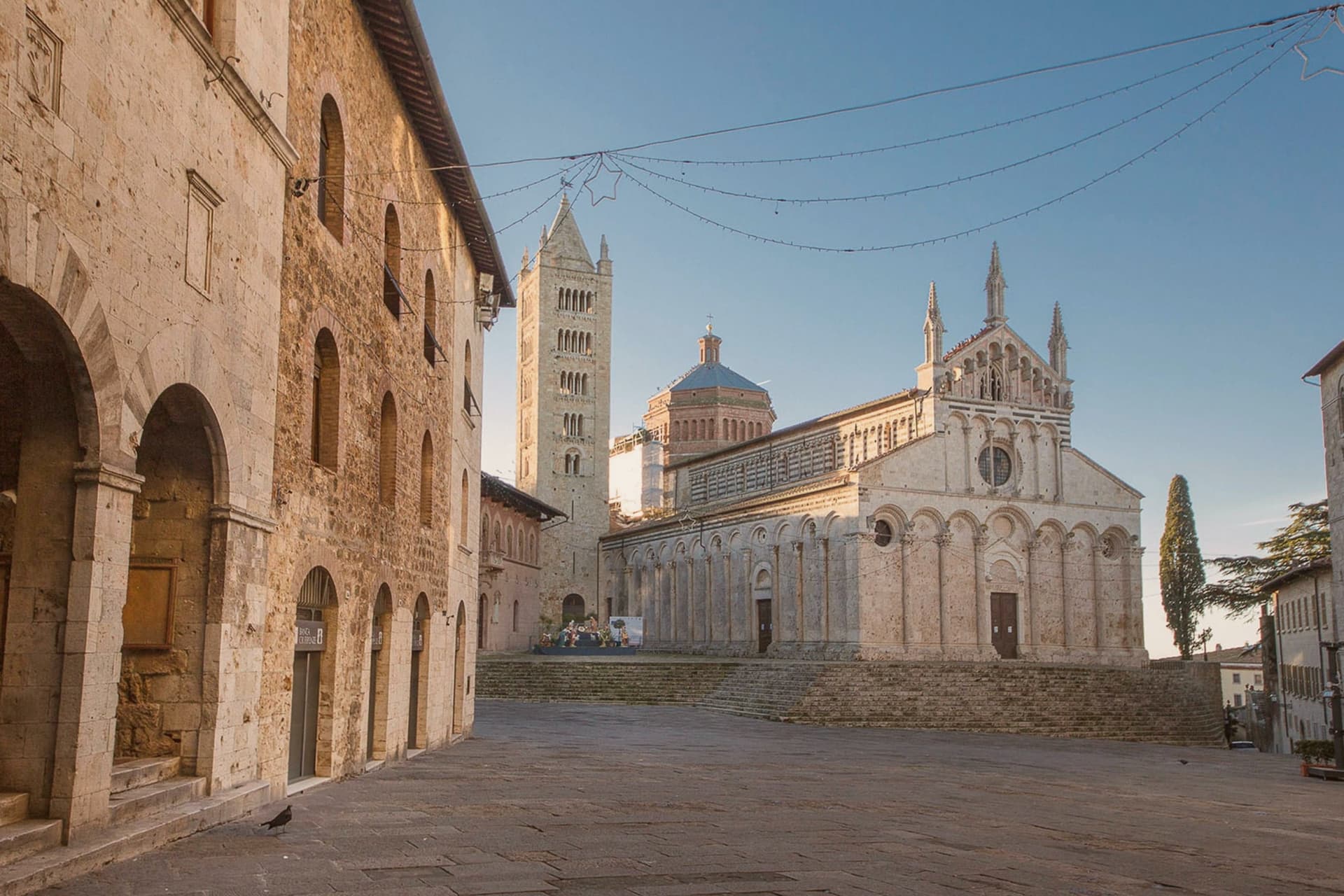
Massa Marittima sits on an isolated hill in the Colline Metallifere, the Tuscan hills that supplied copper and silver from Etruscan times. Despite the name, the sea is roughly twenty kilometers away.
The town's wealth as a free commune was built on that ore, and the buildings on Piazza Garibaldi still date from the century of its independence: the cathedral, the communal palace, the Palazzo Comunale, all raised while the mines were active. The old center keeps a medieval grid, with the Città Nuova rising above it and the watchtower marking the join between the two.
Mining gave way to tourism after the seams ran out, but the layout never had to be redrawn for cars or commerce: what stands today is largely what stood when the terzieri divided the town for its crossbow contest. The hill, the ore beneath it and the thirteenth-century square form one continuous fact: the town's shape was set by what it dug out of the ground, and its history stopped adding new layers once the ground stopped paying.
Bracali have been named by a guide.
What to see in Massa Marittima
- Duomo di San Cerbone. Pisan Romanesque cathedral on Piazza Garibaldi, its facade rising in tiers above the square. The Arca inside holds the saint's remains beneath carved marble figures.
- Fonti dell'Abbondanza. The vaulted fountain building where the fresco survives on the interior wall, plaster and pigment exposed after centuries hidden under whitewash.
- Palazzo del Podestà. Communal palace on Piazza Garibaldi, now housing the Museo Archeologico, with the Maestà by Ambrogio Lorenzetti among its rooms.
How to get to Massa Marittima
There is a railway station in the town, so you can arrive without a car and never need one while you are here. Livorno is roughly 95 minutes away by road.
Our tip
April through June and September into October are the months Massa Marittima opens up. The Balestro del Girifalco runs on the fourth Sunday of May and again on the second Sunday of August, and the town fills with archers in costume from the three terzieri. July and August are hot inland and the centro storico thins in the afternoon; the Tyrrhenian beaches at Follonica are half an hour away by car. Balestro del Girifalco di Agosto a Massa Marittima falls in August.
Why visit Cortona
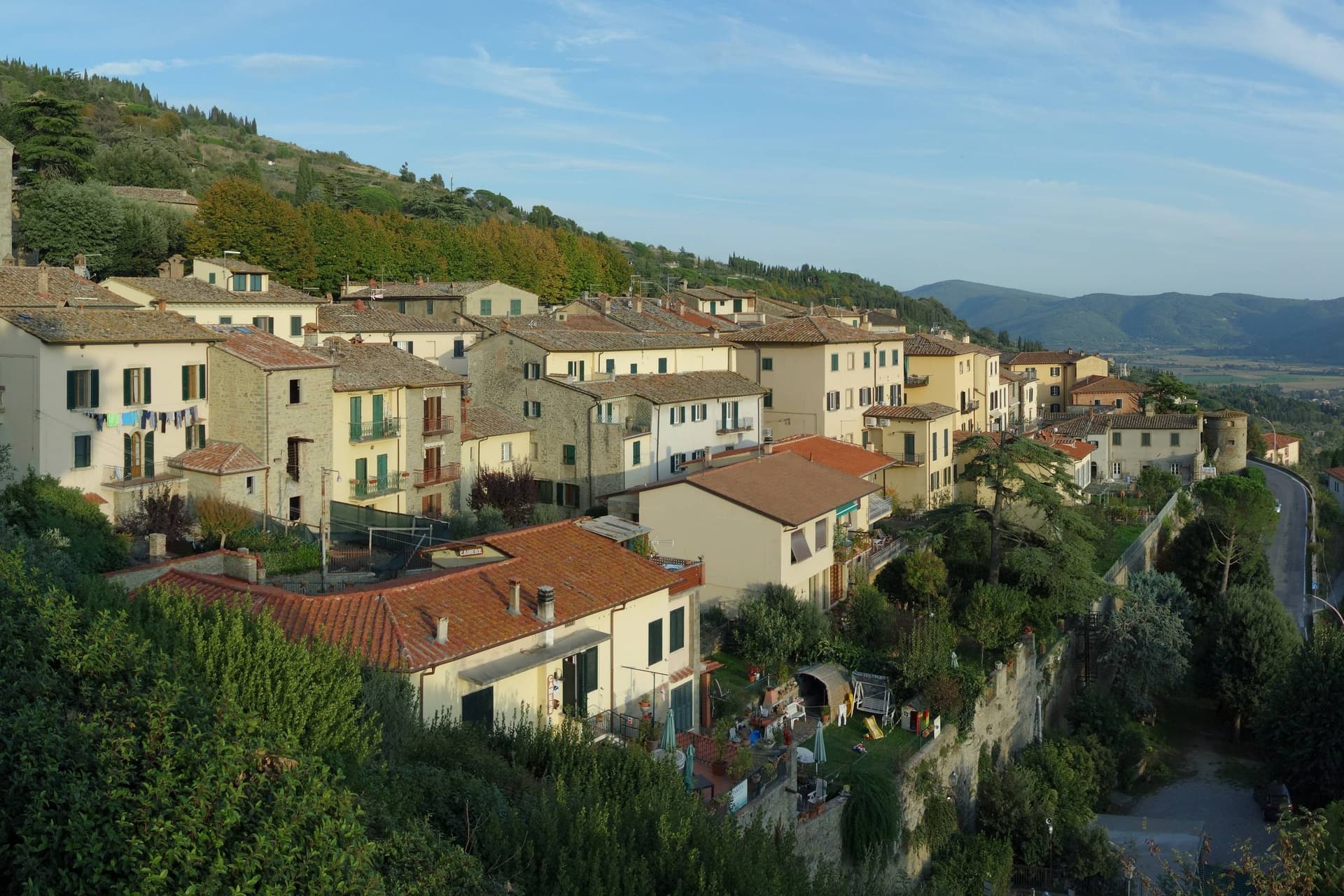
Cortona stands on the southern flank of the Val di Chiana, looking across to Lake Trasimeno: a position that put it in sight of both the plain it governed and the water beyond it. The Etruscan name Curtun survives fixed in stone, and the city that carried it was built in tiers up the hillside, walls and fortress at the crown, church and convent lower down at the edges of the slope, houses and squares filling the ground between.
The bishop granted Francis of Assisi a place for retreat in 1211, and what resulted was built into a narrow valley below the town rather than within its walls, a retreat kept apart from the civic center even as it stayed within reach. Santa Margherita, the city's patron, is held on the ridge above the streets she once walked.
The painters Luca Signorelli and Pietro da Cortona were born inside the walls that still define the town's shape. Frances Mayes published her memoir in 1996, and the town has not been quiet since.
What emerges is a hill town whose Etruscan skeleton, medieval faith, and modern fame sit stacked on the same slope, each layer visible without erasing the one beneath it.
Il Falconiere, La Bucaccia, Osteria del Teatro and 4 more have been named by a guide.
What to see in Cortona
- Mura etrusche. The walls still ring the city entire, the foundation under every later layer of building, Roman and medieval alike.
- MAEC. Museum of the Etruscan Academy in Palazzo Casali, holding the bronze plaque and the lampadario di Cortona.
- Museo Diocesano. Collection in the former Chiesa del Gesù with Beato Angelico's Annunciation of 1430 and works by Luca Signorelli.
How to get to Cortona
There is a railway station in the town, so you can arrive without a car and never need one while you are here. Perugia is roughly 45 minutes away by road.
Our tip
April through June brings green hills, cool evenings and the longest hours in the Diocesano without a queue. September and October are the dry, gold months, light coming in low across Lake Trasimeno and the olive harvest running until November. July and August are the difficult months. ChocoMoments Cortona falls in the season.
Why visit Suvereto
Suvereto sits at 127 meters on the inland edge of the Val di Cornia, twelve kilometers from the Tyrrhenian coast. The name comes from the Latin suberetum, a wood of cork oaks, and the surrounding forests still hold them.
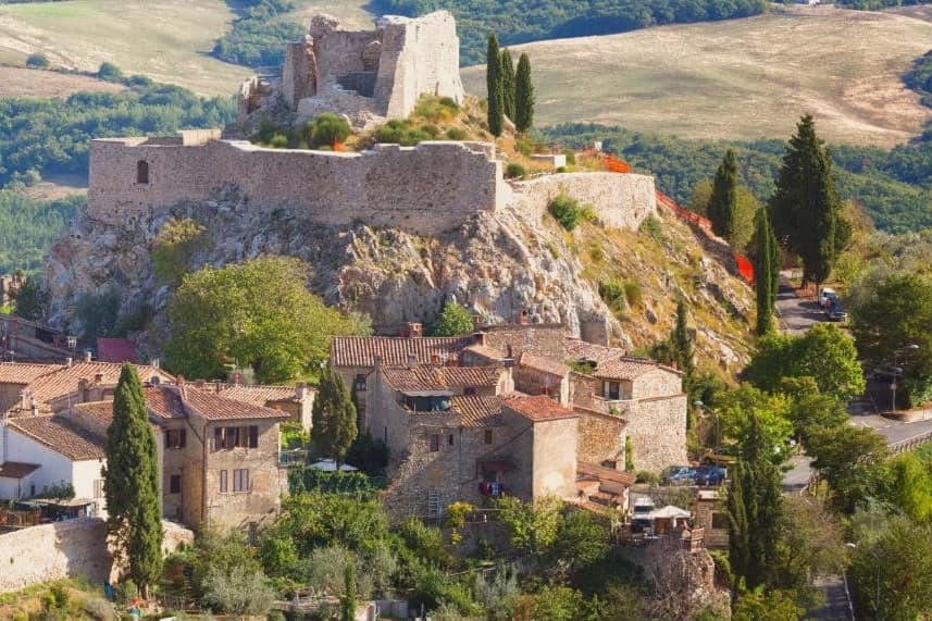
The Rocca Aldobrandesca, first documented in 973, occupies the highest point of the borgo; the Aldobrandeschi family who controlled it also ruled large sections of southern Toscana and the Maremma. The town reached its golden age in the thirteenth century, when Frederick II granted it a charter of freedoms in 1216 and the Palazzo Comunale was built.
The centro storico is a tight grid of stone vicoli that runs uphill from the Romanesque Pieve di San Giusto to the fortress. Suvereto carries five institutional signals at once, a rare combination in the province of Livorno, and the surrounding wine country falls under the Val di Cornia DOC and Suvereto DOCG appellations.
I’ Ciocio have been named by a guide.
What to see in Suvereto
- Rocca Aldobrandesca. Fortress at the highest point of the borgo, documented from 973, expanded in the twelfth century and partly restored as an open archaeological site.
- Pieve di San Giusto. Eleventh-century Romanesque parish church at the foot of the borgo, with a sandstone façade and a single nave divided by stone columns.
- Palazzo Comunale. Thirteenth-century town hall with a double external staircase and Ghibelline merlons, one of the earliest surviving civic palaces of the Maremma.
How to get to Suvereto
Livorno is roughly 84 minutes away by road.
Our tip
April through June and September into October are the dry months in the Val di Cornia, when the cork forests behind the town hold their light and the wine harvest runs in September. The Sagra del Cinghiale, celebrating the wild boar of the surrounding hills, runs across two weekends in December and draws a different crowd. July and August are hot at 127 meters and most visitors descend to the Tyrrhenian coast in the afternoon. Palio dell'Imperatore falls in August.
Why visit Capalbio
Capalbio stands twelve kilometers from the Tyrrhenian coast, the last hill town before the border with Lazio. Charlemagne gave the land to the Abbey of Tre Fontane in 805; the Aldobrandeschi held it through the medieval period, the Orsini built the castle, and Cosimo I de' Medici took it in 1555.
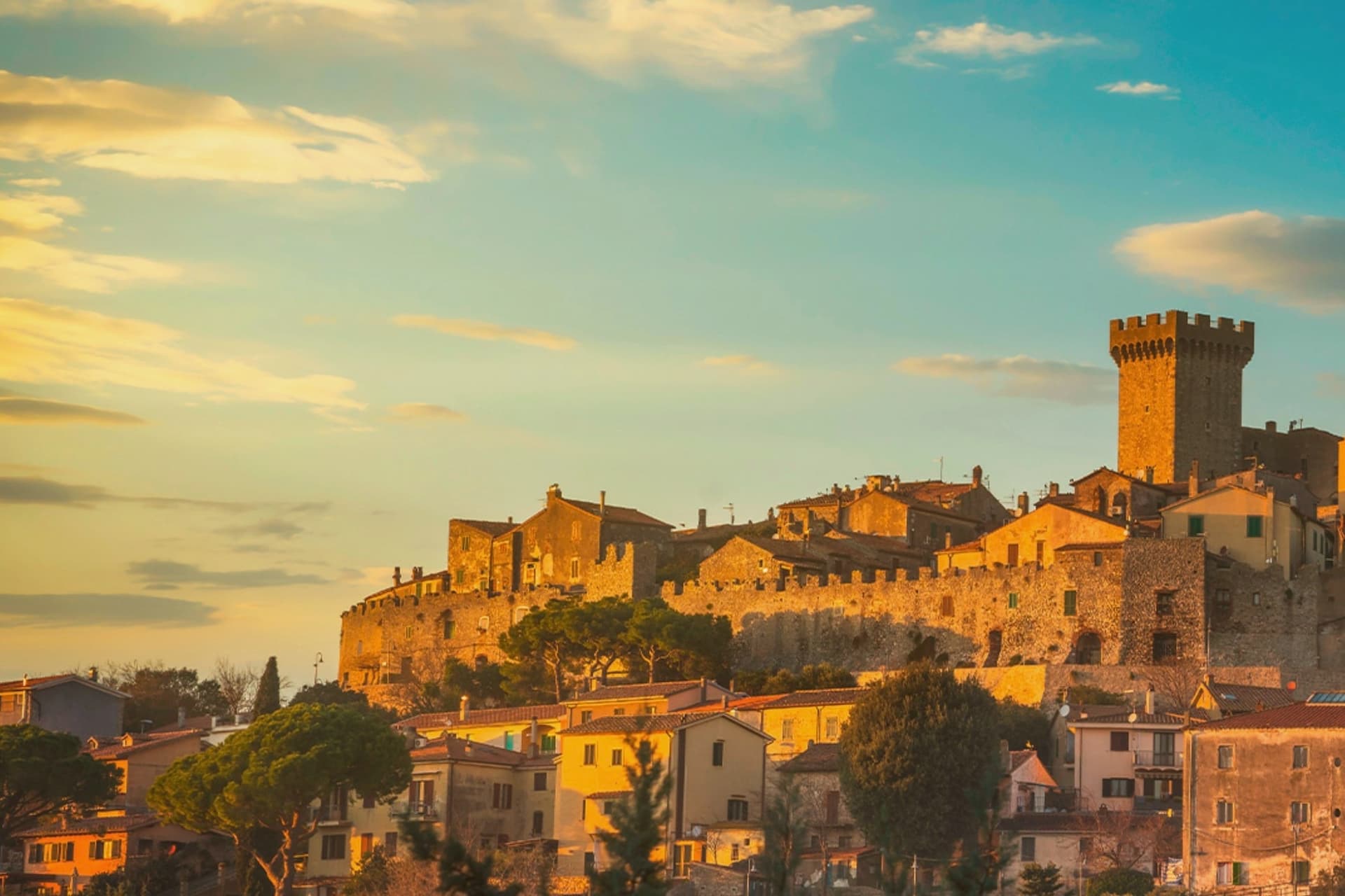
It became an independent commune in 1960. The medieval walls and the fortress define the centro storico at the top of the hill; the surrounding territory drops from the wooded uplands of Monte Calmata down to the coastal reserve at Lago di Burano.
The sculpture park sits four kilometers south of the walls, apart from the old town rather than within it. A borgo that governed itself late, held by abbey, feudal lords and Medici in turn before its own commune, and a territory that runs in one line from hilltop stone to coastal wetland.
Agriturismo Antica Pinciana, Il Frantoio, La Dogana by Enoteca la Torre and 1 more have been named by a guide.
What to see in Capalbio
- Rocca Aldobrandesca. Medieval fortress at the top of the borgo, later expanded by the Orsini, with a square tower and battlements that overlook the Maremma.
- Mura medievali. Two concentric circles of walls enclosing the centro storico, with a walkable parapet that opens onto views toward the Argentario.
- Giardino dei Tarocchi. Sculpture park four kilometers south of the borgo, its ceramic and mirrored figures set among holm oaks.
How to get to Capalbio
There is a railway station in the town, so you can arrive without a car and never need one while you are here. Roma is roughly 108 minutes away by road.
✷ We have written about Capalbio
“Everyone driving from Florence down to Rome crosses the Maremma without noticing, because there is nothing on that stretch to make them slow down. The hills give out. The cypresses stop. What opens up instead is flat open country, wheat and grass running off to a few low rises, the least Tuscan-looking part of Tuscany, a landscape you would call dull if you were being honest and which most guidebooks solve by leaving out.”
Read our piece on Capalbio →Maremma | The Last Cowboys of Tuscany
Our tip
May through September is the season the borgo and its territory work together: the centro storico stays cool at 217 meters while the Tyrrhenian coast at Chiarone-Capalbio fills with swimmers. The Giardino dei Tarocchi runs April through October. July and August are hot inland; afternoon hours in the borgo thin out and the coast takes over. Sagra del Cinghiale falls in September.
Why visit Castelnuovo Berardenga
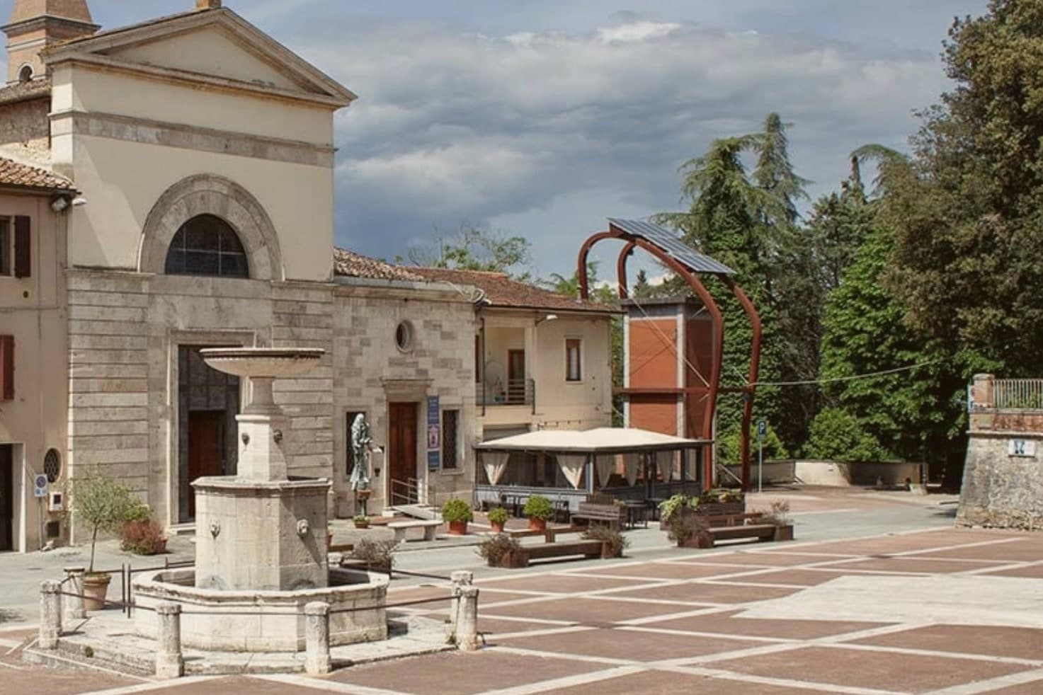
The commune sits east of Siena, where the hills give way to the clay swells of the Crete Senesi. The name comes from the Terra Berardinga, the area controlled in the tenth century by a Frankish nobleman named Berardo, and the borgo grew up around the castle walls the Sienese Republic raised against Florence.
The centro storico, the villa and gardens at its heart, and the surrounding zone of vineyards form one continuous pattern rather than separate parts: fortress town above, wine country falling away below it toward the clay hills. Across the wider territory, 13 castles, 70 churches and 200 farms record the medieval pattern of the Sienese contado, a scatter of small fortified points and parish churches administering land rather than one dominant center.
The place reads as a border post that outlived its military purpose and settled into agriculture and the arts, its castle now a clock tower, its noble villa now a music foundation, its walls now overlooking rows of Sangiovese.
Il Visibilio, Poggio Rosso, L'Asinello and 4 more have been named by a guide.
What to see in Castelnuovo Berardenga
- Villa Chigi Saracini. Eighteenth-century villa and Italian garden inside the centro storico, its park designed by the Sienese composer Guido Chigi Saracini, whose family foundation still runs the Accademia Musicale Chigiana in Siena.
- Torre dell'Orologio. Surviving tower of the fortress, now bearing the civic clock, the highest visible point of the centro storico.
- Chiesa dei Santi Giusto e Clemente. Eighteenth-century parish church with a neoclassical façade, built on the site of an earlier Romanesque pieve.
How to get to Castelnuovo Berardenga
There is a railway station in the town, so you can arrive without a car and never need one while you are here. Firenze is roughly 77 minutes away by road.
✷ We have written about Castelnuovo Berardenga
“The wine is the whole economy of these hills, every village with its own, the region’s name stamped on the most famous red in Italy. Tuscan food runs to cured and roasted meat, so the wine ran red to meet it, lighter than you expect, almost fruity, easy, made to sit beside a steak and not to be lectured about. Here is the only wine knowledge you need on this road: it is all good.”
Read our piece on Castelnuovo Berardenga →Road to Siena | The Long Way Is the Better Way
Our tip
April through June and September into October are the months Chianti Classico shows best, the green hills moving toward the gold of harvest. The Sagra del Vino runs the second weekend of September. July and August push past thirty and the centro storico empties between two and six; the cellars on the surrounding hills offer cool tastings and longer rentals. Dit'unto – Festival del Mangiar con le Mani falls in the season.
Why visit Greve in Chianti
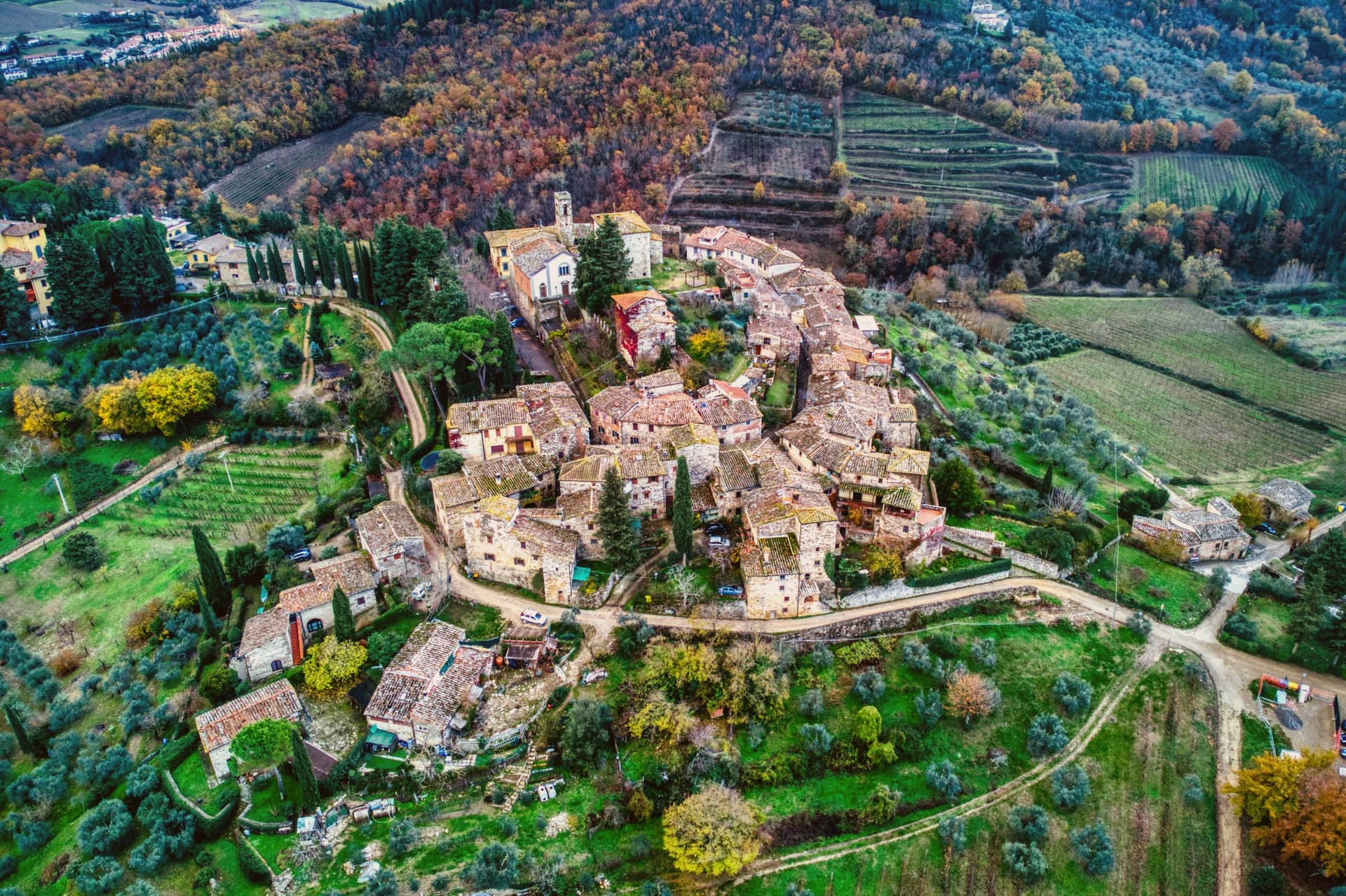
Greve sits at 236 meters in the Val di Greve, thirty-one kilometers south of Firenze and forty-two north of Siena, on the small fast river that gave the town its name. The valley narrows here enough that the road to Firenze runs past the castle estates on the slopes to the north before dropping into the town itself, and the walled hamlet above Greve looks down on the piazza from its kilometer of higher ground, a settlement some centuries older than the square below it, its tenth-century walls predating the piazza's sixteenth-century arcades.
The piazza is the point around which the rest of the town organizes itself: shops and a market under the arcades, a rebuilt church closing its south end, and the roads out toward the castles and the hamlet all beginning at its edges. The Saturday market fills the piazza.
The wine festival in early September empties the surrounding cellars into glasses for three days. What holds the place together is the geography more than any single monument: a market town at a river crossing, ringed by the vineyard slopes and the older hill settlement that all feed into the same triangular square.
Enoteca Baldi, Castello Vicchiomaggio, Officina della Bistecca and 2 more have been named by a guide.
What to see in Greve in Chianti
- Piazza Matteotti. The arcades shelter wine shops, butchers and pasticcerie, wrapped around the irregular triangle of paving with the navigator's bronze figure watching the center.
- Chiesa di Santa Croce. Neoclassical parish church on the south point of the piazza, rebuilt in the nineteenth century after earthquake damage.
- Castello di Verrazzano. Vineyard estate on the hills north of town, producing Chianti Classico on slopes tied to the family name that reached New York Bay.
How to get to Greve in Chianti
Firenze is roughly 44 minutes away by road.
Our tip
April through June and September into October are the months when the Chianti hills are at their best, green or gold depending on the harvest. July and August push past thirty degrees and the piazza empties between two and five. The wine harvest runs late September and the cellars open in turns. Expo Chianti Classico falls in September.
More from Anywhere Italy
 The 9 best hill towns that live slowly in Toscana
 The best towns with a serious restaurant that live slowly in Toscana
 The best olive oil towns within 90 minutes of Firenze
 The best small olive oil towns with a serious restaurant in Toscana
 The 6 best hidden towns inside a nature park in Toscana
 The best hidden wine towns with a medieval festival in Toscana