
The prettiest hidden villages with a serious restaurant in Toscana
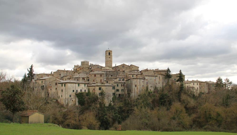
Tuscany builds its villages out of whatever the hill gives it: grey pietra serena in the Casentino, warm sandstone along the Val d'Arno, soft yellow tufa where the Maremma drops into its ravines. The good ones are compact, walled, and arranged around a single piazza with a church on one side and a kitchen on the other. Autumn is when the food catches up with the setting, with porcini from the chestnut woods, new oil pressed in November, wild boar stewed slowly with juniper and red wine. Spring brings artichokes and the first broad beans eaten raw with pecorino, and the tables move outside by Easter.
Most people eat their Tuscan dinner in Florence or Siena, or in the row of hill towns strung along the Val d'Orcia between them, and the reasons are obvious enough. Those places have the frescoes, the wine names everyone recognises, the terraces looking out over cypress avenues that have been photographed a million times. In high summer the booking window for a decent table in San Gimignano runs to weeks, and the menus have been tuned for people passing through once. Prices follow the coach parks.
The same hills, the same oil and the same pecorino carry on past all of that, north into the Casentino and Valdarno, south into the tufa country above Lake Bolsena, west towards the iron hills behind the coast. These are villages that have cleared the national assessment of Italy's most beautiful borghi, so the fabric is intact, and each one holds a restaurant the toughest guides have thought worth listing. Fewer people go, which mostly means you can still book on the day.
Of the 84 communes we have mapped in Toscana, 11 qualify as prettiest villages with a serious restaurant: each has passed the national assessment of Italy's most beautiful villages, and each holds a restaurant listed by the most demanding of the guides. This list is the hidden ones, 10 in all, ordered smallest first. The smallest, San Casciano dei Bagni, has 1,500 residents.
Two more lists worth reading alongside this one: The best small olive oil towns with a serious restaurant in Toscana and The best hidden towns with a food festival that have a serious restaurant in Toscana.
San Casciano dei Bagni
Why visit San Casciano dei Bagni
San Casciano dei Bagni sits at 582 meters at the southern edge of the province of Siena, above 42 hot springs that average 42 degrees Celsius. The baths were used continuously from Etruscan through Roman times and again from the Renaissance, when visitors came from across Europe.
In 2022, an excavation that began in 2019 at the ancient sanctuary turned up 24 bronze votive statues protected by mud, with around 6,000 coins in gold, silver and bronze. The find was the largest of its kind in fifty years; most surviving Etruscan votive material is terracotta.
The 1,500 residents live on a basalt outcrop above the Roman thermal complex, in a centro storico of stone houses and three small churches. The borgo joined the Borghi più belli network in 2014 and remains one of the smallest communes in Toscana to carry both that label and Bandiera Arancione.
Daniela, Castello di Fighine have been named by a guide.
What to see in San Casciano dei Bagni
- Santuario Ritrovato. Etruscan-Roman thermal sanctuary excavated since 2019, where 24 bronze votives and around 6,000 coins were recovered in 2022.
- Bagno Grande. The principal natural pool of the 42 hot springs, used from the second century BC through the Renaissance and reopened to the public.
- Collegiata di San Leonardo. Romanesque parish church in the centro storico, restored in the seventeenth century, with a baptismal font carved from local travertine.
How to get to San Casciano dei Bagni
Perugia is roughly 68 minutes away by road.
Our tip
The thermal pools make the calendar different here. Winter is the season many visitors prefer, when the 42-degree water steams against cold air and snow occasionally dusts the basalt outcrop. April through June and September into October are the most balanced months: warm hill light, the dry-stone walls of the borgo at their best, the sanctuary excavations open to guided tours. Sagra del Ciaffagnone di San Casciano dei Bagni falls in June.
Montescudaio
Why visit Montescudaio
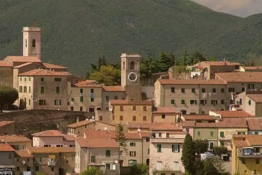
Montescudaio sits fifteen kilometers inland from the Tyrrhenian coast, on a hill above the valley the Cecina river cuts toward the sea. Fewer than 2,200 people live in the commune, and most of them are outside the centro storico, which is left as a tight knot of stone houses ringed by its old walls: a single church, the clock tower, and the terrace where the vines drop downhill toward the Val di Cecina and the water beyond.
The town carries four institutional signals at once, an unusual density for its size: a registered wine appellation, a bread-network membership rare in this part of Tuscany, a name that predates the medieval walls, and the walls themselves built around an eleventh-century abbey. Wine and bread are both grown and baked around the same hilltop that once needed fortifying.
The fortress, the loaf, and the vineyard are not three separate stories here but three uses of the same ground, worked over centuries after the shields it was named for stopped being necessary.
SaQua - Ristorante in Collina have been named by a guide.
What to see in Montescudaio
- Centro storico. Walled medieval village, a tight ring of stone houses on the hilltop, built around the abbey that gave the settlement its first walls and structure.
- Torre Civica. Clock tower at the entrance to the borgo, the tallest visible structure and former civic landmark of the fortified village.
- Chiesa di Santa Maria Assunta. Eleventh-century parish church on the site of the medieval abbey, the anchor around which the walled village took shape.
How to get to Montescudaio
Livorno is roughly 44 minutes away by road.
Our tip
May through September is the season on the Cecina hills: dry days, vine work, harvest from late August through September. The coast lies fifteen kilometers west and the sea breeze keeps evening temperatures lower than the inland Maremma. July and August bring crowds to the beaches at Cecina and Marina di Bibbona, but the borgo on the hill stays quieter. Festa del Vino di Montescudaio falls in October.
Cetona
Why visit Cetona
The town sits on the western flank of a ridge at the meeting point of Toscana, Umbria and Lazio, where the mountain divides the Val d'Orcia from the Val di Chiana. The medieval comune passed between Siena, Orvieto and Perugia before falling to Siena in the late fourteenth century, and it was Cosimo I who later sold it whole to a marchese.
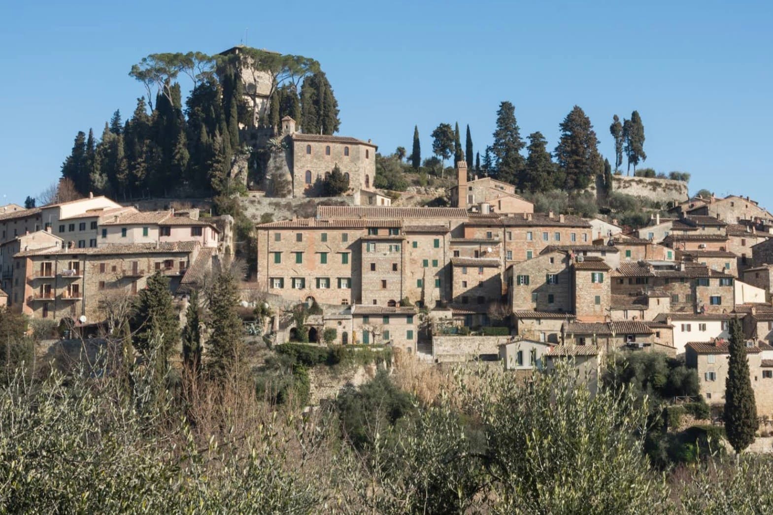
The fortress at the top of the grid and the square laid out below it are two halves of the same Renaissance move: a private residence replacing a garrison at the summit, a flat civic stage opened up at the base. Above the town, in the woods, the hermitage and the caves belong to a much older layer, human use of the mountain reaching back to the Mesolithic, long before any comune or marchese laid claim to it.
What the town adds up to is a settlement built in tiers: a prehistoric mountain, a contested medieval center, and a Renaissance overlay that reorganized the base of the hill without touching what stood above it.
Da Nilo, Il Tiglio di Piazza da Nilo have been named by a guide.
What to see in Cetona
- Piazza Garibaldi. Elliptical square at the foot of the medieval grid, flat and open where the streets above it climb steeply. The civic stage of the borgo, still the first thing that orients a visitor.
- Rocca di Cetona. Fortress at the top of the centro storico, its walls and keep still standing though the interior became a private residence rather than a garrison.
- Convento di San Francesco. Franciscan convent below the borgo, founded in 1212, with a single-nave church and a small cloister still in religious use.
How to get to Cetona
Perugia is roughly 78 minutes away by road.
Our tip
April through June and September into October are the months Cetona keeps its calmest pace, the wooded slopes of Monte Cetona green or rust depending on the half. July and August are hot in the centro storico but the mountain trails above 800 meters stay cool. The Mostra del Tartufo, dedicated to the local white truffles, runs the second weekend of November in Piazza Garibaldi. Sagra del Bico di Cetona falls in June.
Suvereto
Why visit Suvereto
Suvereto sits at 127 meters on the inland edge of the Val di Cornia, twelve kilometers from the Tyrrhenian coast. The name comes from the Latin suberetum, a wood of cork oaks, and the surrounding forests still hold them.
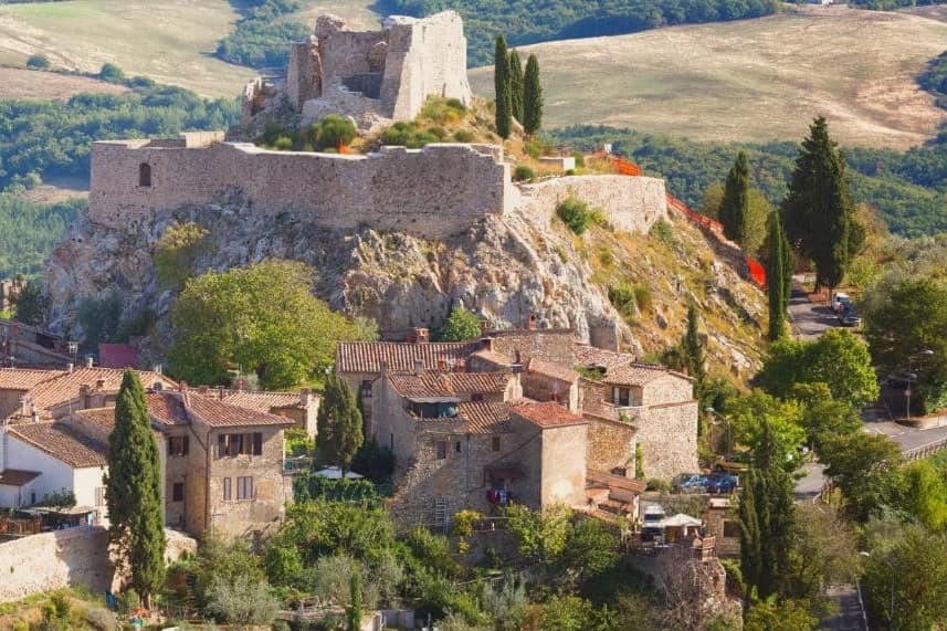
The Rocca Aldobrandesca, first documented in 973, occupies the highest point of the borgo; the Aldobrandeschi family who controlled it also ruled large sections of southern Toscana and the Maremma. The town reached its golden age in the thirteenth century, when Frederick II granted it a charter of freedoms in 1216 and the Palazzo Comunale was built.
The centro storico is a tight grid of stone vicoli that runs uphill from the Romanesque Pieve di San Giusto to the fortress. Suvereto carries five institutional signals at once, a rare combination in the province of Livorno, and the surrounding wine country falls under the Val di Cornia DOC and Suvereto DOCG appellations.
I’ Ciocio have been named by a guide.
What to see in Suvereto
- Rocca Aldobrandesca. Fortress at the highest point of the borgo, documented from 973, expanded in the twelfth century and partly restored as an open archaeological site.
- Pieve di San Giusto. Eleventh-century Romanesque parish church at the foot of the borgo, with a sandstone façade and a single nave divided by stone columns.
- Palazzo Comunale. Thirteenth-century town hall with a double external staircase and Ghibelline merlons, one of the earliest surviving civic palaces of the Maremma.
How to get to Suvereto
Livorno is roughly 84 minutes away by road.
✷ We have written about Suvereto
“That is the thing the young man on the beach did not see, and the man who lives here cannot stop seeing. This is an industrial coast wearing a beach towel. Run it back far enough and the whole of it, the swamp and the steel and the slag and the white water, is one long story about iron, and the holiday is the costume the story put on after the work ran out.”
Read our piece on Suvereto →The Iron Coast | The Wrong Sea
Our tip
April through June and September into October are the dry months in the Val di Cornia, when the cork forests behind the town hold their light and the wine harvest runs in September. The Sagra del Cinghiale, celebrating the wild boar of the surrounding hills, runs across two weekends in December and draws a different crowd. July and August are hot at 127 meters and most visitors descend to the Tyrrhenian coast in the afternoon. Palio dell'Imperatore falls in August.
Manciano
Why visit Manciano
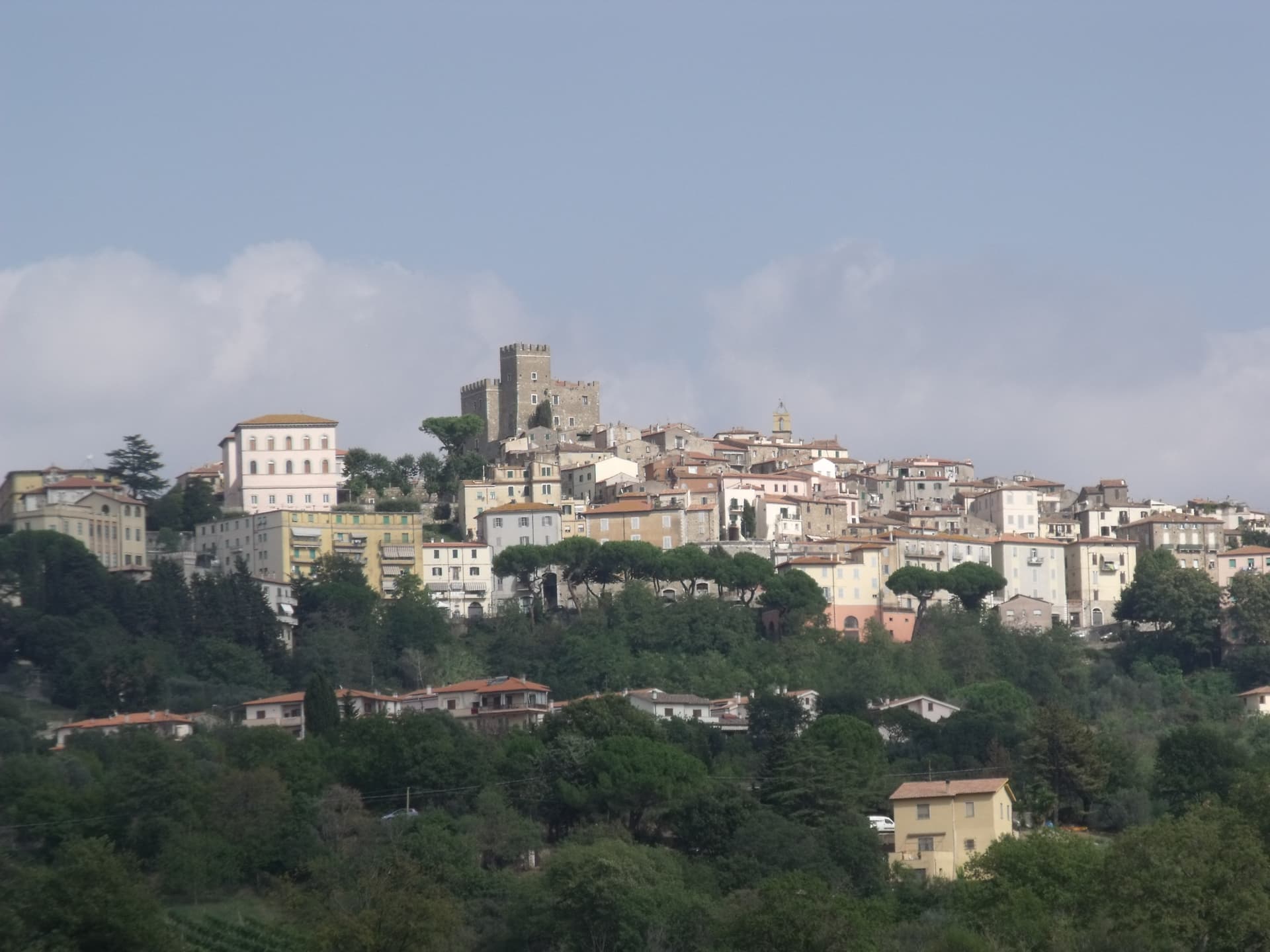
Manciano sits at 444 meters on a hill in the southern Maremma grossetana, with a 360-degree view that runs from Monte Amiata north to the Tyrrhenian coast. The Aldobrandeschi held the original stronghold from the twelfth century.
Siena occupied the town between 1419 and 1455 and built the Rocca that still dominates the centro storico, a square keep with battlements on a shoe-base. After 1455 it returned to local rule and passed eventually to the Medici Grand Duchy.
The comune is large by Toscana standards and includes some of the best-known places of the southern Maremma: Saturnia, the Etruscan town built around its sulphurous hot springs, and Montemerano, a small walled borgo on the road to the Lago di Bolsena. The Albegna and Fiora valleys, which the town once served as a regional market, still meet at its foot.
Wine, olive oil and wild boar work the territory in roughly the order they sit on a Maremmano menu.
Caino, I Due Cippi dal 1976, La Filanda and 1 more have been named by a guide.
What to see in Manciano
- Rocca Aldobrandesca. Sienese fortress of 1424 on Aldobrandeschi foundations, square keep, walls with battlements and a solid shoe-base, dominating the centro storico.
- Saturnia. Etruscan town and frazione south of Manciano, with medieval walls, remains of a Roman road and the sulphurous hot springs used since antiquity.
- Montemerano. Small walled borgo east of Manciano, three concentric circles of streets and a fifteenth-century Madonna della Gattaiola in the parish church.
How to get to Manciano
Terni is roughly 132 minutes away by road.
✷ We have written about Manciano
“Everyone driving from Florence down to Rome crosses the Maremma without noticing, because there is nothing on that stretch to make them slow down. The hills give out. The cypresses stop. What opens up instead is flat open country, wheat and grass running off to a few low rises, the least Tuscan-looking part of Tuscany, a landscape you would call dull if you were being honest and which most guidebooks solve by leaving out.”
Read our piece on Manciano →Maremma | The Last Cowboys of Tuscany
Our tip
April through June and September into October are the months Manciano shows the southern Maremma at its best, the territory dry but green, the Saturnia pools warm against cool mornings. The Sagra dell'Anatra runs in mid-August. July and August are hot at 444 meters but easier than the coast; afternoons in the centro storico empty between two and six. Palio delle Botti di Manciano falls in August.
Monte Argentario
Why visit Monte Argentario
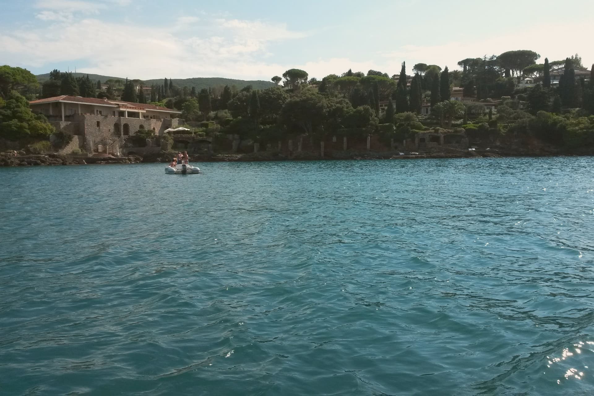
Monte Argentario is a peninsula on the southern Tuscan coast, 35 kilometers south of Grosseto, connected to the mainland by three sand spits that enclose the lagoons of Orbetello. The mountain at its center rises to 635 meters, and the two seats of the comune sit at sea level on opposite sides of it, the northern harbor facing toward Grosseto, the southern one turned toward the open coast below.
The history of the peninsula splits from the rest of Tuscany after 1557, when the territory was carved out of Sienese land and handed to the Spanish crown, which spent the next century and a half fortifying the coastline against corsair raids rather than building the kind of inland towns found elsewhere in the region. The result is a place organized around its edges rather than a center: two ports facing different waters, a mountain of forts between them, and a coastal road that ties the whole shape together for anyone crossing from one harbor to the other.
What the peninsula adds up to is a piece of Tuscany that spent its formative centuries as a Spanish military frontier, and still wears that history in its two-harbor shape and the ring of stone above them.
Il Pellicano, Alicina sul porto, Ristorante Dama Dama and 1 more have been named by a guide.
What to see in Monte Argentario
- Forte Stella. Six-pointed star fort above Porto Ercole, designed for the Spanish by Buontalenti and Camerini and completed in the mid-1600s as part of the Presidi defense system.
- Forte Filippo. Spanish bastioned fortress above Porto Ercole, named for Philip II and built in the late 16th century to protect the Stato dei Presidi from corsair raids.
- Rocca Aldobrandesca, Porto Ercole. Earlier Aldobrandeschi fortress incorporated into the Spanish defense system, dominating the harbor and the old town of Porto Ercole.
How to get to Monte Argentario
There is a railway station in the town, so you can arrive without a car and never need one while you are here. Roma is roughly 137 minutes away by road.
Our tip
May through September is the season on the peninsula. Porto Santo Stefano and Porto Ercole fill in July and August; the Palio Marinaro on August 15 doubles the population of Porto Santo Stefano for a single afternoon. June and September are the easiest months, with warm water and fewer day-trippers. Palio Marinaro dell'Argentario falls in August.
Pitigliano
Why visit Pitigliano
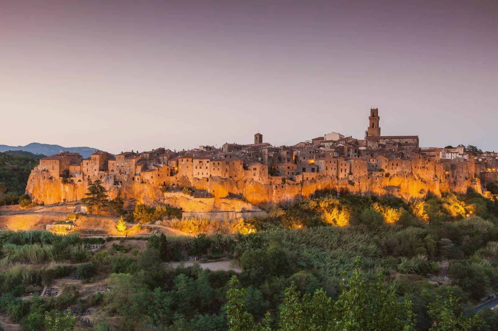
Pitigliano sits at 313 meters on a tuff spur in the southern Maremma, eighty kilometers southeast of Grosseto and close to the Lazio border. The town is built into the rock it stands on: cellars, stables and synagogue all carved into the same volcanic tuff that the houses rise from above.
The county passed to the Orsini family in 1293 and stayed Orsini for 150 years of wars with Siena. In 1556 Niccolò IV Orsini gave land for a Jewish cemetery to his physician David de Pomis; the synagogue followed in 1598.
When Pitigliano was absorbed into the Grand Duchy of Tuscany in 1608, the Medici imposed a ghetto in 1622 around the synagogue, on the cliff edge. The nickname Little Jerusalem comes from there.
The Etruscan tagliate, channels cut into the tuff at depths from one to over ten meters, were carved long before any of that, and remain in use as paths and roads. The DOC Bianco di Pitigliano, a Trebbiano blend, is grown on the surrounding slopes.
Il Tufo Allegro, Angiolina, Il Caveau and 1 more have been named by a guide.
What to see in Pitigliano
- Palazzo Orsini. Twelfth-century fortress remodeled by Antonio da Sangallo the Younger in the sixteenth century, now housing the Museo Civico Archeologico and the Diocesan Museum.
- Sinagoga di Pitigliano. Synagogue built in 1598, restored after partial collapse, the heart of the Jewish quarter that gave the town its Little Jerusalem nickname.
- Quartiere Ebraico. The ghetto established in 1622 around the synagogue, with the kosher bakery, mikveh, oven and wine cellar carved into the tuff.
How to get to Pitigliano
Terni is roughly 107 minutes away by road.
Our tip
April through June and September into October are the dry months in the southern Maremma: vine work, mild days, evening light that hits the tuff cliff at low angle. July and August push into the mid-thirties and the rock holds the heat; the centro storico empties between four and seven. The Sagra dello Sfratto, celebrating the Jewish honey-and-walnut pastry, runs in September.
Anghiari
Why visit Anghiari
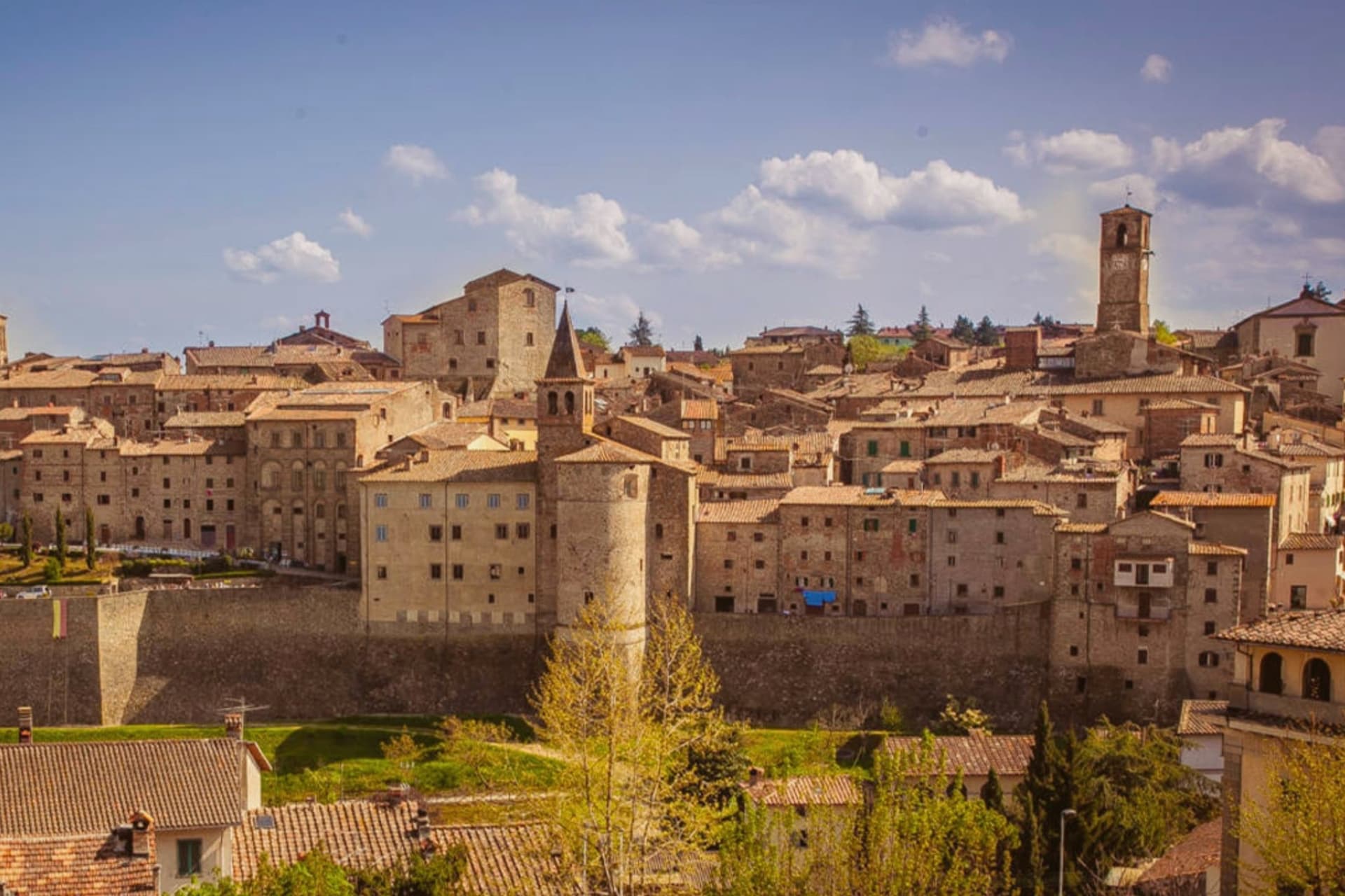
Anghiari sits at 430 meters on a spur above the upper Tiber valley, the Valtiberina, between Arezzo and the Umbrian border. The walled centro storico is intact, the streets running steeply from the Porta Sant'Angelo up to the Castello.
On 29 June 1440 the Florentine army defeated a Milanese force under Niccolò Piccinino in the plain below town, a battle that secured Florence's hold over central Italy and gave Leonardo da Vinci the commission for the Palazzo Vecchio fresco he started in 1505 and never finished. The painting, the Lost Leonardo, is presumed still to be hidden behind a Vasari wall in Florence.
Palazzo Taglieschi in the centro storico holds a polychrome wooden Madonna by Jacopo della Quercia and a working sixteenth-century table organ. The Mostra Mercato dell'Artigianato della Valtiberina has filled the streets with craft producers every spring since 1976, a working continuation of the textile and woodwork traditions that supported the town through the twentieth century.
Da Alighiero, Il Cappello di Paglia have been named by a guide.
What to see in Anghiari
- Palazzo Taglieschi. Sixteenth-century palace in the centro storico, now the Museo Statale di Palazzo Taglieschi, with a wooden Madonna by Jacopo della Quercia and a working table organ.
- Castello di Anghiari. Medieval fortified core at the top of the town, walls and gates still intact, the visual anchor of the silhouette from the valley below.
- Campo della Battaglia. The plain at the foot of the walls where Florence defeated Milan on 29 June 1440, the battle that inspired Leonardo's lost Palazzo Vecchio fresco.
How to get to Anghiari
Perugia is roughly 82 minutes away by road.
Our tip
April through June and September into October are the working months in the Valtiberina: dry days, low cloud over the upper Tiber, the surrounding farmland green or gold by season. The Mostra Mercato dell'Artigianato runs the last week of April and the first week of May, filling the streets with artisans from across the valley. Late June marks the anniversary of the 1440 battle, with reenactments below the walls. Palio della Vittoria di Anghiari falls in June.
Poppi
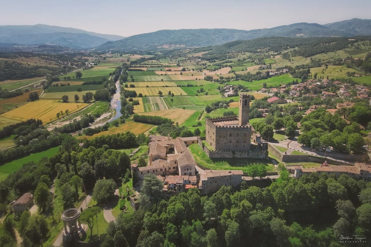
Why visit Poppi
Poppi rises above the upper Arno in the Casentino, the wooded valley set between Pratovecchio and Bibbiena. The Counts Guidi held this hill from at least 1169, and the castle they raised across the late twelfth and thirteenth centuries is attributed in its older part to Lapo di Cambio and in the later upper section to Arnolfo di Cambio.
Dante Alighieri, who fought below the hill as a young man, returned to it later as a guest of the Guidi during his exile, so the borgo held him twice, once as a soldier and once as a household guest. The town itself sits above the battle plain, the abbey church inside the walls, the castle over both.
A further Romanesque pieve stands a short distance off, and the forested ridges of the Apennine watershed rise to the east, the same terrain the Guidi once ruled from their hill. What the place adds up to is a single family's hold on a valley, visible still in the line from castle to plain to church, with the forest marking where their lordship ran out.
Il Cedro, Mater have been named by a guide.
What to see in Poppi
- Castello dei Conti Guidi. The castle keeps a working library and a fourteenth-century chapel frescoed by the school of Giotto, along with a hand-painted model of the battle below, more than four thousand tin soldiers set out on the table.
- Piano di Campaldino. The plain sits directly beneath the castle walls, open ground still readable as a battlefield, with nothing built across it since.
- Abbazia di San Fedele. Romanesque abbey church inside the borgo, with single nave and stone façade, dating from the early twelfth century.
How to get to Poppi
There is a railway station in the town, so you can arrive without a car and never need one while you are here. Firenze is roughly 64 minutes away by road.
Our tip
April through June brings the Casentino into clear sun, the beech forests in their first leaf and the upper Arno full from spring rain. July and August are pleasant at 437 meters, never coastal-hot, with the castle and library full of weekend visitors from Florence. September and October are the harvest and chestnut months: the Foreste Casentinesi turn orange in the high cuts above Pratovecchio. Il Casentino nel piatto falls in June.
Loro Ciuffenna
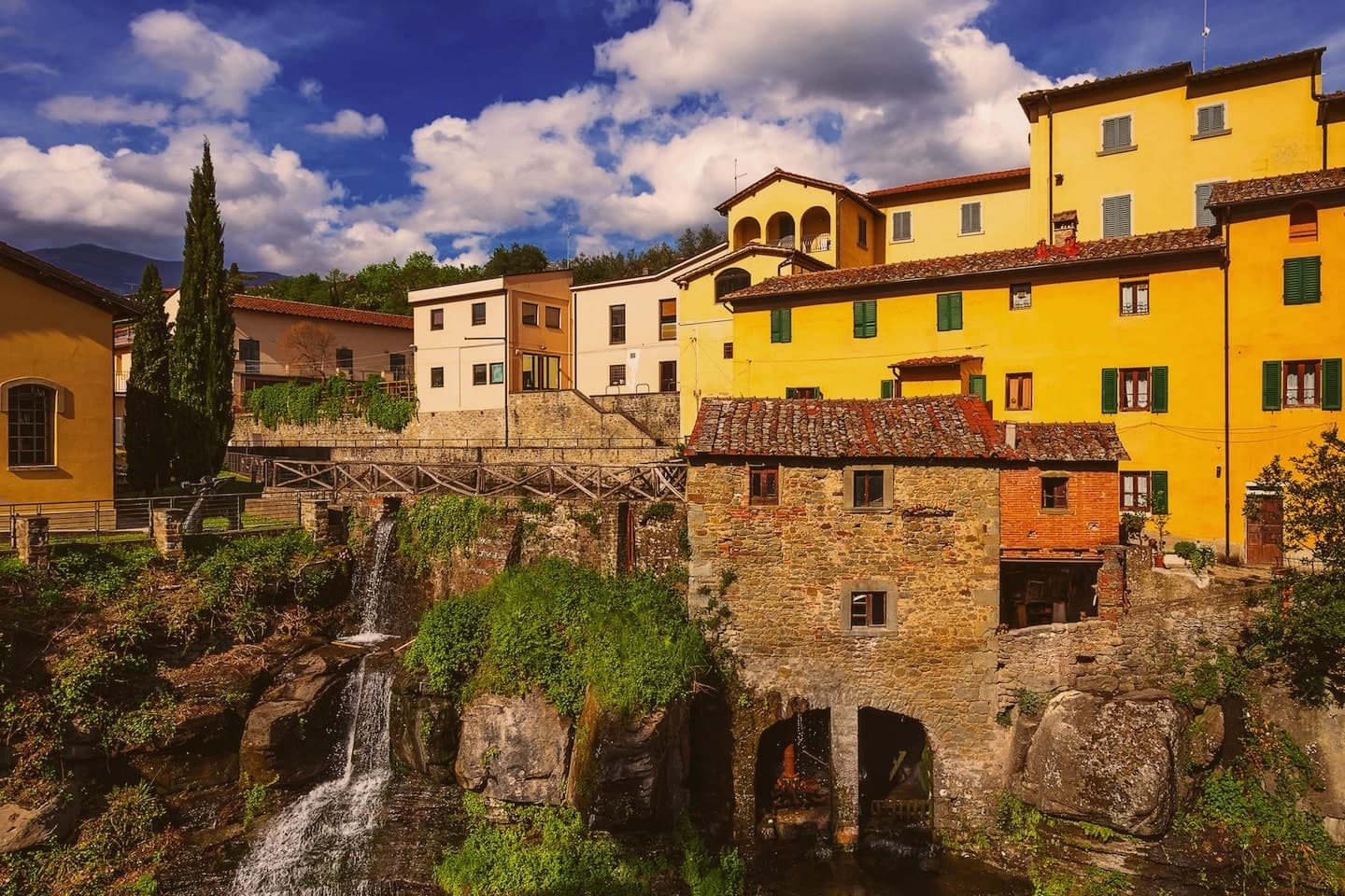
Why visit Loro Ciuffenna
Loro Ciuffenna sits at 330 meters on the western slopes of the Pratomagno, between the Arno valley and the Casentino. The torrent it is named for cuts through the centro storico under a hump-backed stone bridge of Roman origin, remodeled in the Middle Ages.
A water mill on the bank is still in operation, the oldest active mill in Tuscany, dating to the 12th century and used until recently to grind chestnuts into flour. The inhabitants of the castle of Loro were the first to submit to the Florentine Republic in 1306, and the village formed its own statutes as an autonomous comune in 1462.
Two kilometers up the Setteponti road stands the Pieve di San Pietro a Gropina, one of the great Romanesque parish churches of Tuscany, built around the year 1000 over two earlier churches; its circular pulpit, supported by two knotted Lombard columns, is 8th century.
Il Cipresso - Da Cioni, Osteria del Borro, Casa e Ciliegie have been named by a guide.
What to see in Loro Ciuffenna
- Pieve di San Pietro a Gropina. Romanesque parish church 2 km south of the village, built around 1000 over a 5th-century church and an 8th-century Lombard one with a knotted-column pulpit.
- Ponte sul Ciuffenna. Hump-backed stone bridge of Roman origin crossing the torrent in the centro storico, heavily remodeled in the medieval period.
- Mulino di Loro Ciuffenna. 12th-century water mill on the Ciuffenna, the oldest active mill in Tuscany, traditionally used to grind chestnut flour.
How to get to Loro Ciuffenna
Firenze is roughly 62 minutes away by road.
Our tip
April through June brings green slopes, mild evenings and water in the Ciuffenna torrent. September and October are the dry months, when the Pratomagno chestnuts ripen and the Setteponti road sees the best light of the year. July and August can push the Valdarno floor into the mid-thirties; the village stays cooler at 330 meters than the plain below, but the centro storico empties in the afternoon hours.
More from Anywhere Italy
 The best small olive oil towns with a serious restaurant in Toscana
- The best hidden towns with a food festival that have a serious restaurant in Toscana
 The 10 prettiest villages with a food festival in Toscana
- The prettiest small villages that eat well in Toscana
- The best towns with a serious restaurant that live slowly in Toscana
 The best hill towns in the province of Arezzo