
The 10 prettiest villages with a food festival in Toscana
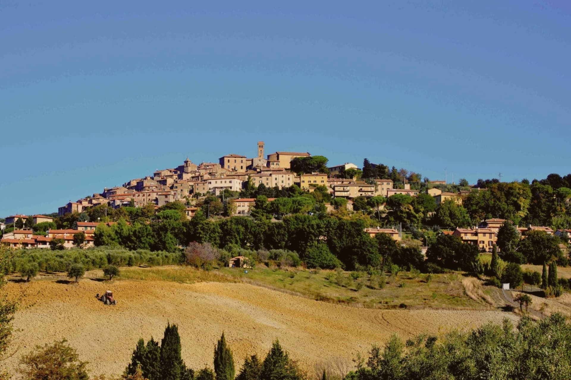
Autumn is when Tuscany stops performing and starts cooking. Chestnuts are roasted in perforated pans over vine cuttings, the year's oil comes out of the mill green and peppery and gets poured over toasted bread in the street, and village squares of sandstone and travertine fill with trestle tables. The villages themselves are built from what the hillside gave up: pietra serena around the doorways, roofs of curved terracotta gone grey with lichen, plaster the colour of dried clay. Spring and early summer bring their own festivals, artichokes, cherries, wild asparagus, snails, but the calendar tilts heavily towards the months after harvest.
Most people arrive for Florence and Siena, and in high season the queue for the Uffizi bends around the building while Piazza del Campo takes the full weight of the coach parks. The food follows the crowd. Restaurants near the great monuments print menus in five languages and serve bistecca to people who have walked a very long way to eat it. None of that is fraudulent, but it is the version of Tuscan eating designed to be encountered once, by strangers, at speed.
The same hills, the same oil, the same butchers keep going well past the city walls. In the Val d'Orcia, the Casentino, the Chianti ridges and down on the Maremma coast, there are villages that hold a festival for one thing they grow or hunt, cook it for their neighbours, and put out extra tables for whoever else turns up. Fewer people go, and the ones who do tend to eat sitting down.
Of the 84 communes we have mapped in Toscana, 12 qualify as prettiest villages with a food festival: each has passed the national assessment of Italy's most beautiful villages, and each holds a recurring food festival built around one local ingredient. This list is 10 of them. The smallest, Casale Marittimo, has 1,051 residents.
Elsewhere in the catalogue: The best small towns with a food festival in Toscana and The best wine towns with a food festival in Toscana.
Casale Marittimo
Why visit Casale Marittimo
Casale Marittimo rises on a hill at 214 meters above the Val di Cecina, fifty kilometers southeast of Pisa, the Tyrrhenian coast visible from the upper streets. The settlement here was an outpost of Etruscan Volterra in the seventh century BC; the necropolis of Casa Nocera turned up two stone statues of warrior princes, now in the Archaeological Museum of Florence, among the oldest figurative sculptures in European art.
The medieval centro is recorded as a castle of the Counts of Gherardesca by 1004, the streets arranged in concentric rings inside the old walls, stone houses pressed against the slope. Casale Marittimo carries both the Borghi più belli d'Italia and Bandiera Arancione marks, unusual for a commune of just over a thousand inhabitants.
The Chiesa di Sant'Andrea sits on the foundations of an older parish church; Palazzo Rocca and the eighteenth-century Santa Maria delle Grazie close the small loop of the centro storico.
What to see in Casale Marittimo
- Centro storico. Concentric ring of stone streets inside the medieval walls, with houses pressed against the slope and Palazzo Rocca at the top.
- Chiesa di Sant'Andrea. Parish church rebuilt on the ruins of an older pieve, the principal religious building of the borgo.
- Santa Maria delle Grazie. Eighteenth-century church on the lower edge of the centro storico, simple Tuscan late-Baroque façade.
How to get to Casale Marittimo
Livorno is roughly 50 minutes away by road.
Our tip
April through June brings the warm coastal hills into their best season, evenings still cool on the ridge. September and October are dry and clear, the harvest in the surrounding vineyards followed by the olive pick. July and August are hot in the Val di Cecina, but the sea breeze reaches the upper streets and tempers the worst of it. Sagra della Tagliata Mare e Terra falls in July.
Isola del Giglio
Why visit Isola del Giglio
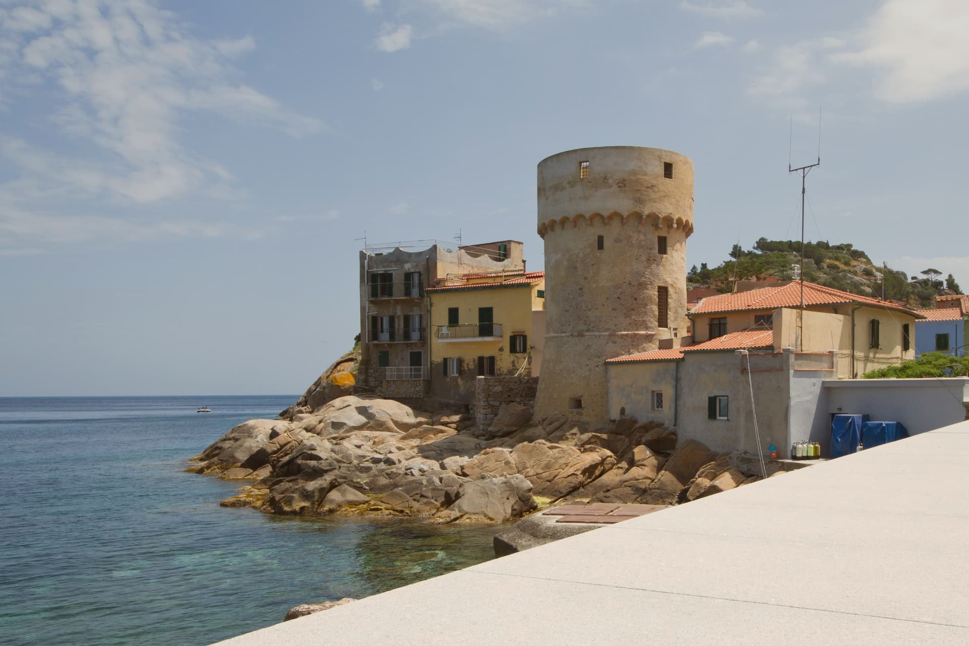
Isola del Giglio is the second-largest island in the Tuscan Archipelago, almost entirely granite, the highest point at Poggio della Pagana 496 meters above the sea. The commune has three inhabited frazioni: Giglio Porto on the eastern coast, where the ferries from Porto Santo Stefano dock; Giglio Castello on the central ridge at around 405 meters, the walled medieval village and administrative center; and Giglio Campese on the western bay, a 1960s seaside resort built on an old pyrite mine closed in 1964.
Charlemagne gave the island to the abbey of Tre Fontane in 805. It was Pisan from 1264, ceded to Antonio Piccolomini in the fifteenth century, then passed to the Medici in 1558.
Saracen raids continued until 1799. The wreck of the Costa Concordia on the night of 13 January 2012 killed thirty-two people and held the world's attention until the ship was righted, refloated and towed to Genoa in July 2014.
What to see in Isola del Giglio
- Giglio Castello. Walled medieval village on the ridge at around 405 meters, with intact mura and the Rocca Aldobrandesca, the administrative center of the island.
- Giglio Porto. Main harbor of the island on the east coast, with the colored houses around the small ferry dock and the lighthouse of Capel Rosso to the south.
- Giglio Campese. Largest bay and sandy beach of the island on the west coast, with the medieval Torre del Campese and the disused pyrite mine on the headland.
How to get to Isola del Giglio
Our tip
May through September is the only practical season for Giglio. The ferries from Porto Santo Stefano run on a full schedule, the beaches at Campese and the smaller coves work, and the temperature in Castello on the ridge stays manageable through August. July and August are crowded with mainland day-trippers; the island roughly doubles in population. Festa dell'Uva e delle Cantine falls in September.
San Casciano dei Bagni
Why visit San Casciano dei Bagni
San Casciano dei Bagni sits at 582 meters at the southern edge of the province of Siena, above 42 hot springs that average 42 degrees Celsius. The baths were used continuously from Etruscan through Roman times and again from the Renaissance, when visitors came from across Europe.
In 2022, an excavation that began in 2019 at the ancient sanctuary turned up 24 bronze votive statues protected by mud, with around 6,000 coins in gold, silver and bronze. The find was the largest of its kind in fifty years; most surviving Etruscan votive material is terracotta.
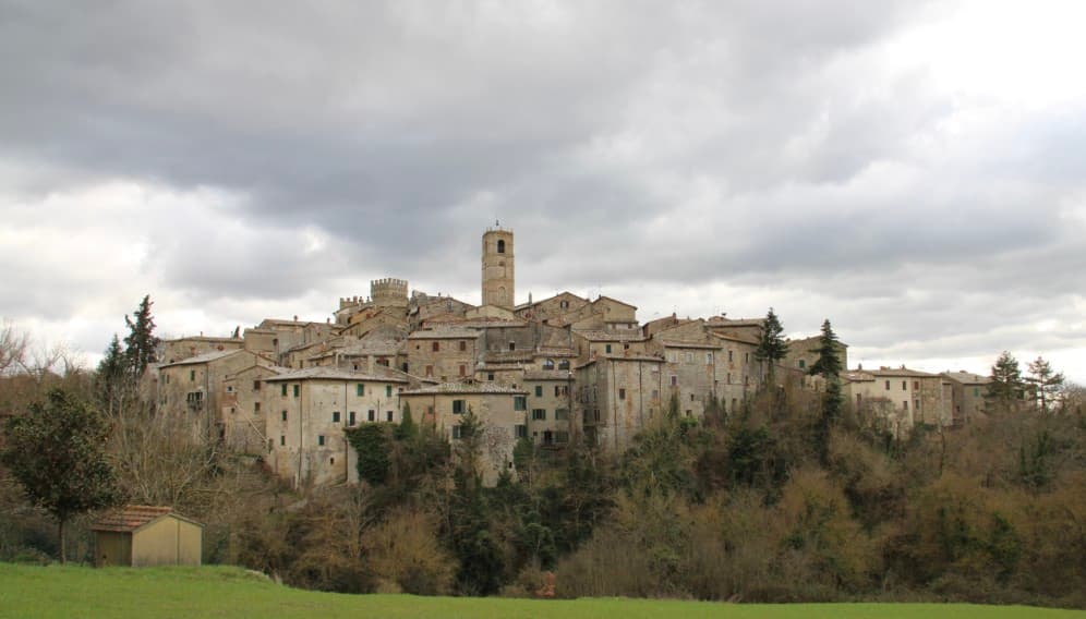
The 1,500 residents live on a basalt outcrop above the Roman thermal complex, in a centro storico of stone houses and three small churches. The borgo joined the Borghi più belli network in 2014 and remains one of the smallest communes in Toscana to carry both that label and Bandiera Arancione.
The re-enactment here is Palio di San Cassiano di San Casciano dei Bagni, usually held in August.
What to see in San Casciano dei Bagni
- Santuario Ritrovato. Etruscan-Roman thermal sanctuary excavated since 2019, where 24 bronze votives and around 6,000 coins were recovered in 2022.
- Bagno Grande. The principal natural pool of the 42 hot springs, used from the second century BC through the Renaissance and reopened to the public.
- Collegiata di San Leonardo. Romanesque parish church in the centro storico, restored in the seventeenth century, with a baptismal font carved from local travertine.
How to get to San Casciano dei Bagni
Perugia is roughly 68 minutes away by road.
Our tip
The thermal pools make the calendar different here. Winter is the season many visitors prefer, when the 42-degree water steams against cold air and snow occasionally dusts the basalt outcrop. April through June and September into October are the most balanced months: warm hill light, the dry-stone walls of the borgo at their best, the sanctuary excavations open to guided tours. Sagra del Ciaffagnone di San Casciano dei Bagni falls in June.
Capalbio
Why visit Capalbio
Capalbio stands twelve kilometers from the Tyrrhenian coast, the last hill town before the border with Lazio. Charlemagne gave the land to the Abbey of Tre Fontane in 805; the Aldobrandeschi held it through the medieval period, the Orsini built the castle, and Cosimo I de' Medici took it in 1555.
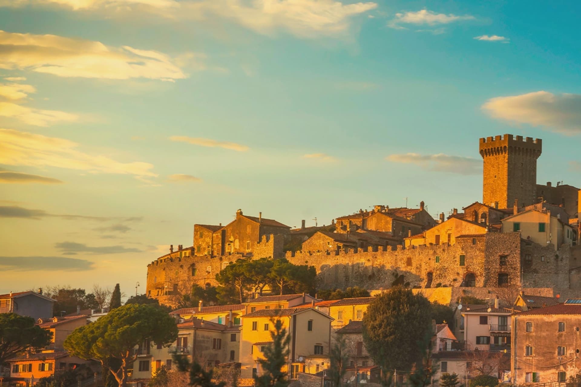
It became an independent commune in 1960. The medieval walls and the fortress define the centro storico at the top of the hill; the surrounding territory drops from the wooded uplands of Monte Calmata down to the coastal reserve at Lago di Burano.
The sculpture park sits four kilometers south of the walls, apart from the old town rather than within it. A borgo that governed itself late, held by abbey, feudal lords and Medici in turn before its own commune, and a territory that runs in one line from hilltop stone to coastal wetland.
What to see in Capalbio
- Rocca Aldobrandesca. Medieval fortress at the top of the borgo, later expanded by the Orsini, with a square tower and battlements that overlook the Maremma.
- Mura medievali. Two concentric circles of walls enclosing the centro storico, with a walkable parapet that opens onto views toward the Argentario.
- Giardino dei Tarocchi. Sculpture park four kilometers south of the borgo, its ceramic and mirrored figures set among holm oaks.
How to get to Capalbio
There is a railway station in the town, so you can arrive without a car and never need one while you are here. Roma is roughly 108 minutes away by road.
✷ We have written about Capalbio
“Everyone driving from Florence down to Rome crosses the Maremma without noticing, because there is nothing on that stretch to make them slow down. The hills give out. The cypresses stop. What opens up instead is flat open country, wheat and grass running off to a few low rises, the least Tuscan-looking part of Tuscany, a landscape you would call dull if you were being honest and which most guidebooks solve by leaving out.”
Read our piece on Capalbio →Maremma | The Last Cowboys of Tuscany
Our tip
May through September is the season the borgo and its territory work together: the centro storico stays cool at 217 meters while the Tyrrhenian coast at Chiarone-Capalbio fills with swimmers. The Giardino dei Tarocchi runs April through October. July and August are hot inland; afternoon hours in the borgo thin out and the coast takes over. Sagra del Cinghiale falls in September.
Manciano
Why visit Manciano
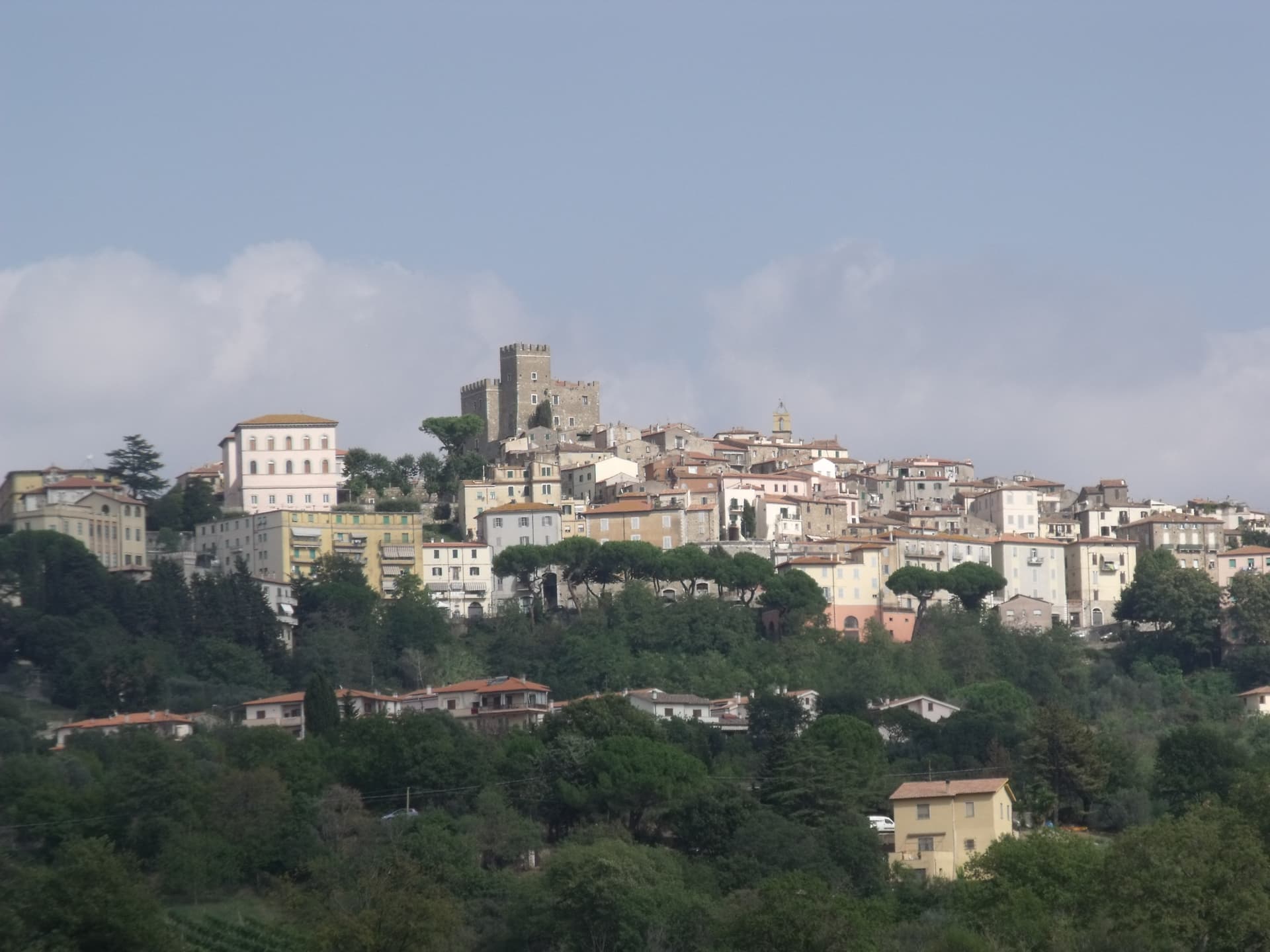
Manciano sits at 444 meters on a hill in the southern Maremma grossetana, with a 360-degree view that runs from Monte Amiata north to the Tyrrhenian coast. The Aldobrandeschi held the original stronghold from the twelfth century.
Siena occupied the town between 1419 and 1455 and built the Rocca that still dominates the centro storico, a square keep with battlements on a shoe-base. After 1455 it returned to local rule and passed eventually to the Medici Grand Duchy.
The comune is large by Toscana standards and includes some of the best-known places of the southern Maremma: Saturnia, the Etruscan town built around its sulphurous hot springs, and Montemerano, a small walled borgo on the road to the Lago di Bolsena. The Albegna and Fiora valleys, which the town once served as a regional market, still meet at its foot.
Wine, olive oil and wild boar work the territory in roughly the order they sit on a Maremmano menu.
The re-enactment here is Palio delle Botti di Manciano, usually held in August.
What to see in Manciano
- Rocca Aldobrandesca. Sienese fortress of 1424 on Aldobrandeschi foundations, square keep, walls with battlements and a solid shoe-base, dominating the centro storico.
- Saturnia. Etruscan town and frazione south of Manciano, with medieval walls, remains of a Roman road and the sulphurous hot springs used since antiquity.
- Montemerano. Small walled borgo east of Manciano, three concentric circles of streets and a fifteenth-century Madonna della Gattaiola in the parish church.
How to get to Manciano
Terni is roughly 132 minutes away by road.
Our tip
April through June and September into October are the months Manciano shows the southern Maremma at its best, the territory dry but green, the Saturnia pools warm against cool mornings. The Sagra dell'Anatra runs in mid-August. July and August are hot at 444 meters but easier than the coast; afternoons in the centro storico empty between two and six. Palio delle Botti di Manciano falls in August.
Greve in Chianti
Why visit Greve in Chianti
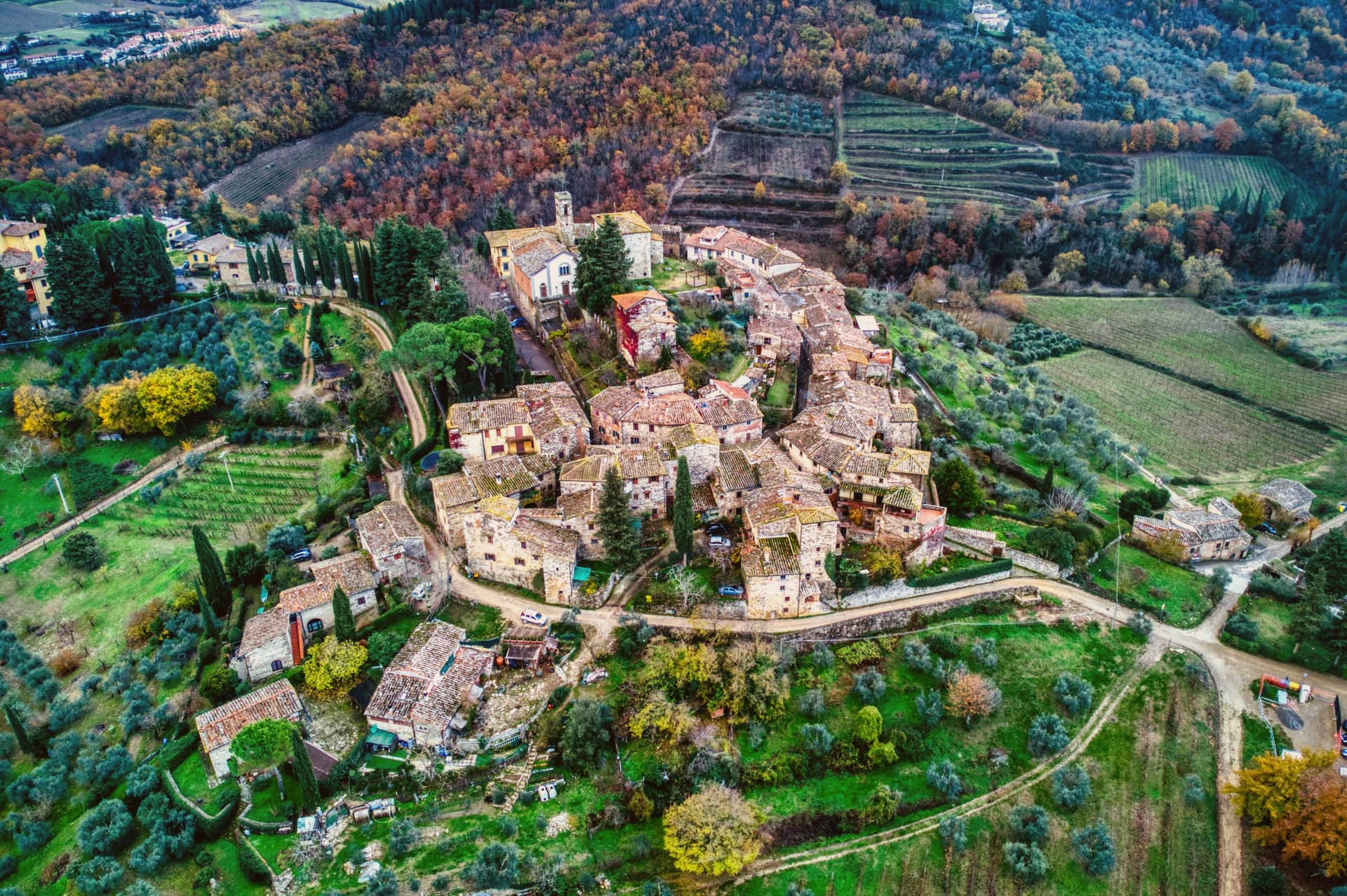
Greve sits at 236 meters in the Val di Greve, thirty-one kilometers south of Firenze and forty-two north of Siena, on the small fast river that gave the town its name. The valley narrows here enough that the road to Firenze runs past the castle estates on the slopes to the north before dropping into the town itself, and the walled hamlet above Greve looks down on the piazza from its kilometer of higher ground, a settlement some centuries older than the square below it, its tenth-century walls predating the piazza's sixteenth-century arcades.
The piazza is the point around which the rest of the town organizes itself: shops and a market under the arcades, a rebuilt church closing its south end, and the roads out toward the castles and the hamlet all beginning at its edges. The Saturday market fills the piazza.
The wine festival in early September empties the surrounding cellars into glasses for three days. What holds the place together is the geography more than any single monument: a market town at a river crossing, ringed by the vineyard slopes and the older hill settlement that all feed into the same triangular square.
What to see in Greve in Chianti
- Piazza Matteotti. The arcades shelter wine shops, butchers and pasticcerie, wrapped around the irregular triangle of paving with the navigator's bronze figure watching the center.
- Chiesa di Santa Croce. Neoclassical parish church on the south point of the piazza, rebuilt in the nineteenth century after earthquake damage.
- Castello di Verrazzano. Vineyard estate on the hills north of town, producing Chianti Classico on slopes tied to the family name that reached New York Bay.
How to get to Greve in Chianti
Firenze is roughly 44 minutes away by road.
✷ We have written about Greve in Chianti
“The wine is the whole economy of these hills, every village with its own, the region’s name stamped on the most famous red in Italy. Tuscan food runs to cured and roasted meat, so the wine ran red to meet it, lighter than you expect, almost fruity, easy, made to sit beside a steak and not to be lectured about. Here is the only wine knowledge you need on this road: it is all good.”
Read our piece on Greve in Chianti →Road to Siena | The Long Way Is the Better Way
Our tip
April through June and September into October are the months when the Chianti hills are at their best, green or gold depending on the harvest. July and August push past thirty degrees and the piazza empties between two and five. The wine harvest runs late September and the cellars open in turns. Expo Chianti Classico falls in September.
Piombino
Why visit Piombino
Piombino sits on a triangular promontory pointing southeast into the Tyrrhenian, at the northern edge of the Maremma. The town was founded in the ninth century by refugees from the Etruscan port after Greek pirates attacked the city; they called the new settlement Populino, small Populonia, and the name shortened over time to what it is now.
The old city, now a frazione north on the coast, became the source of the newer town's name rather than the other way round. In the medieval period Piombino became an independent signoria under the Appiani, who ruled from here over a small state that reached out to the islands across the water.
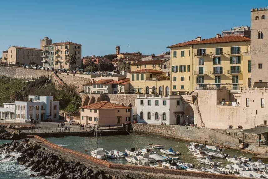
The castle at the seafront, the piazza cantilevered out over the cliff toward Elba, and the working ferry port make up the contemporary town, each looking the same direction the refugees once looked back from: toward the older settlement to the north and the channel to the islands beyond it. The Bandiera Blu coast covers the four kilometers between the port and the old acropolis, so that the walk from new town to old runs along the same shoreline that separates them by name only.
What to see in Piombino
- Castello di Piombino. Principal defensive fortress of the city on a headland pointing southeast into the sea, with the Torrione, the Rivellino and the Cittadella complex, now a museum.
- Piazza Bovio. Long rocky breakwater extending into the sea as La Rocchetta, terraced as a piazza, with a balcony view across the channel to Elba.
- Parco Archeologico di Baratti e Populonia. Chamber tombs from the seventh to second centuries BC cut into the ground of the Gulf of Baratti, laid out for walking among the excavated structures rather than viewed from a distance.
How to get to Piombino
There is a railway station in the town, so you can arrive without a car and never need one while you are here. Livorno is roughly 77 minutes away by road.
✷ We have written about Piombino
“That is the thing the young man on the beach did not see, and the man who lives here cannot stop seeing. This is an industrial coast wearing a beach towel. Run it back far enough and the whole of it, the swamp and the steel and the slag and the white water, is one long story about iron, and the holiday is the costume the story put on after the work ran out.”
Read our piece on Piombino →The Iron Coast | The Wrong Sea
Our tip
May, June, September and October are the months when the Piombino promontory is at its best, sea warm enough to swim and the ferry to Elba running every hour without the August crush. July and August are full season, with the centro storico filling by late morning and the Baratti beach turning over twice a day. November through March is cold and windy on the promontory, with limited ferry crossings and many seaside trattorie closed. Sagra del Pesce - Piombino falls in July.
Montescudaio
Why visit Montescudaio
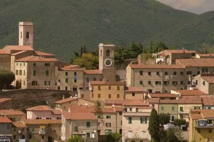
Montescudaio sits fifteen kilometers inland from the Tyrrhenian coast, on a hill above the valley the Cecina river cuts toward the sea. Fewer than 2,200 people live in the commune, and most of them are outside the centro storico, which is left as a tight knot of stone houses ringed by its old walls: a single church, the clock tower, and the terrace where the vines drop downhill toward the Val di Cecina and the water beyond.
The town carries four institutional signals at once, an unusual density for its size: a registered wine appellation, a bread-network membership rare in this part of Tuscany, a name that predates the medieval walls, and the walls themselves built around an eleventh-century abbey. Wine and bread are both grown and baked around the same hilltop that once needed fortifying.
The fortress, the loaf, and the vineyard are not three separate stories here but three uses of the same ground, worked over centuries after the shields it was named for stopped being necessary.
What to see in Montescudaio
- Centro storico. Walled medieval village, a tight ring of stone houses on the hilltop, built around the abbey that gave the settlement its first walls and structure.
- Torre Civica. Clock tower at the entrance to the borgo, the tallest visible structure and former civic landmark of the fortified village.
- Chiesa di Santa Maria Assunta. Eleventh-century parish church on the site of the medieval abbey, the anchor around which the walled village took shape.
How to get to Montescudaio
Livorno is roughly 44 minutes away by road.
Our tip
May through September is the season on the Cecina hills: dry days, vine work, harvest from late August through September. The coast lies fifteen kilometers west and the sea breeze keeps evening temperatures lower than the inland Maremma. July and August bring crowds to the beaches at Cecina and Marina di Bibbona, but the borgo on the hill stays quieter. Festa del Vino di Montescudaio falls in October.
Cetona
Why visit Cetona
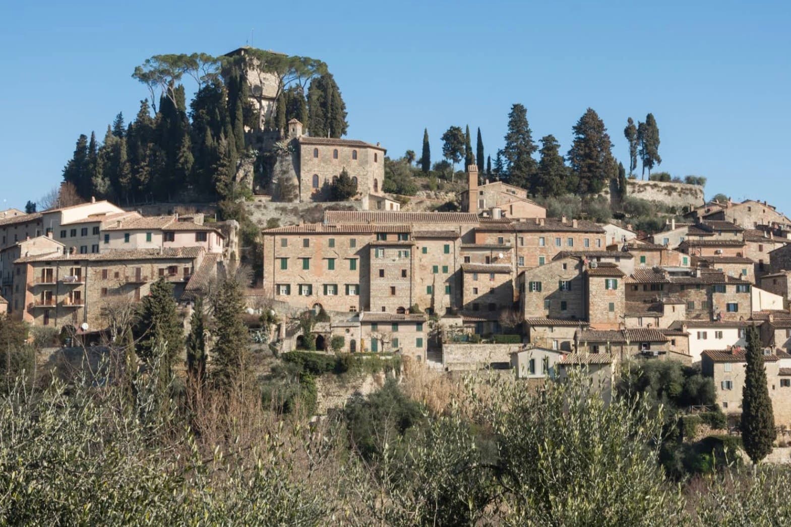
The town sits on the western flank of a ridge at the meeting point of Toscana, Umbria and Lazio, where the mountain divides the Val d'Orcia from the Val di Chiana. The medieval comune passed between Siena, Orvieto and Perugia before falling to Siena in the late fourteenth century, and it was Cosimo I who later sold it whole to a marchese.
The fortress at the top of the grid and the square laid out below it are two halves of the same Renaissance move: a private residence replacing a garrison at the summit, a flat civic stage opened up at the base. Above the town, in the woods, the hermitage and the caves belong to a much older layer, human use of the mountain reaching back to the Mesolithic, long before any comune or marchese laid claim to it.
What the town adds up to is a settlement built in tiers: a prehistoric mountain, a contested medieval center, and a Renaissance overlay that reorganized the base of the hill without touching what stood above it.
The re-enactment here is Corsa delle brocche a Cetona, usually held in July.
What to see in Cetona
- Piazza Garibaldi. Elliptical square at the foot of the medieval grid, flat and open where the streets above it climb steeply. The civic stage of the borgo, still the first thing that orients a visitor.
- Rocca di Cetona. Fortress at the top of the centro storico, its walls and keep still standing though the interior became a private residence rather than a garrison.
- Convento di San Francesco. Franciscan convent below the borgo, founded in 1212, with a single-nave church and a small cloister still in religious use.
How to get to Cetona
Perugia is roughly 78 minutes away by road.
Our tip
April through June and September into October are the months Cetona keeps its calmest pace, the wooded slopes of Monte Cetona green or rust depending on the half. July and August are hot in the centro storico but the mountain trails above 800 meters stay cool. The Mostra del Tartufo, dedicated to the local white truffles, runs the second weekend of November in Piazza Garibaldi. Sagra del Bico di Cetona falls in June.
Anghiari
Why visit Anghiari
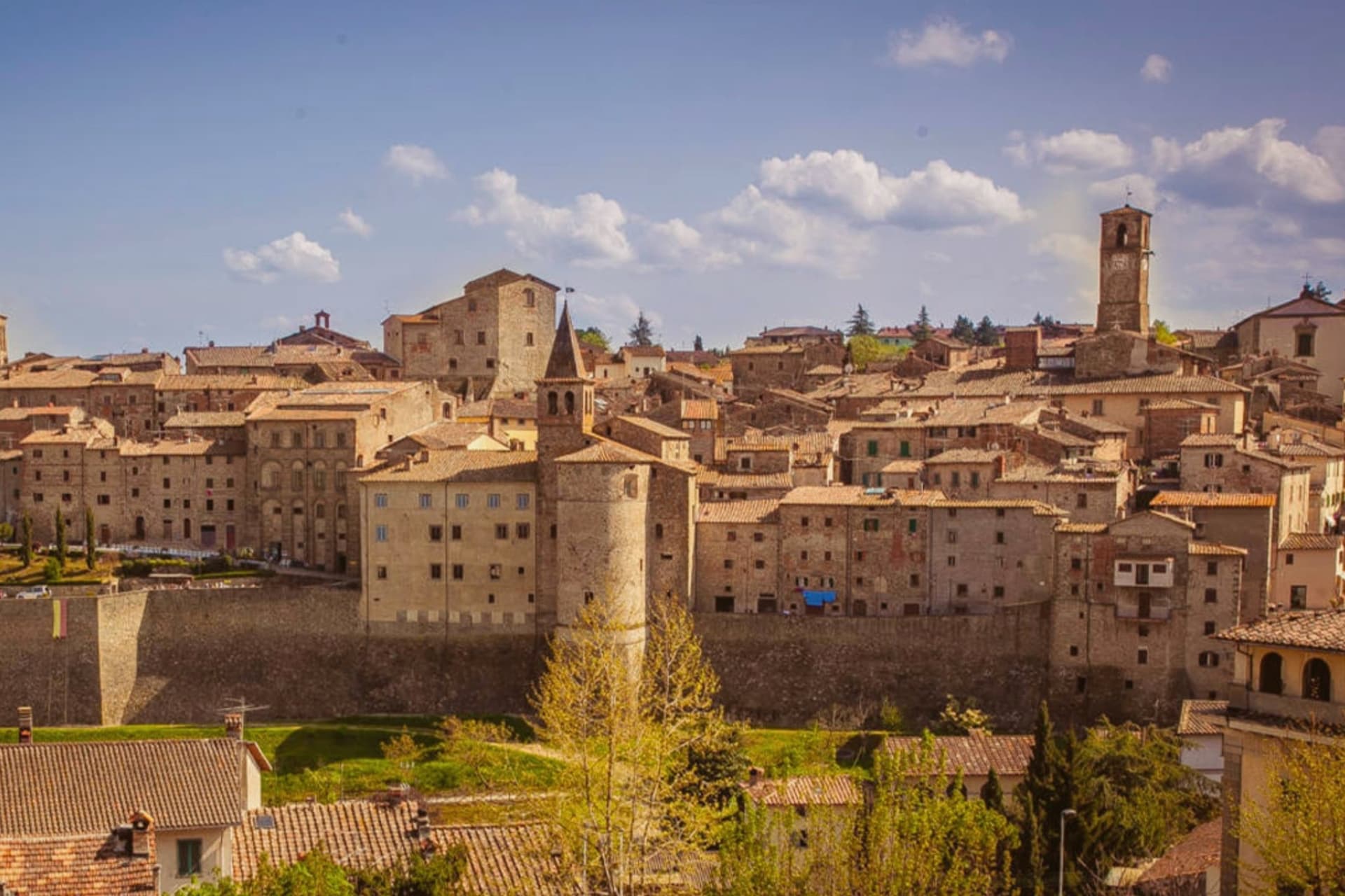
Anghiari sits at 430 meters on a spur above the upper Tiber valley, the Valtiberina, between Arezzo and the Umbrian border. The walled centro storico is intact, the streets running steeply from the Porta Sant'Angelo up to the Castello.
On 29 June 1440 the Florentine army defeated a Milanese force under Niccolò Piccinino in the plain below town, a battle that secured Florence's hold over central Italy and gave Leonardo da Vinci the commission for the Palazzo Vecchio fresco he started in 1505 and never finished. The painting, the Lost Leonardo, is presumed still to be hidden behind a Vasari wall in Florence.
Palazzo Taglieschi in the centro storico holds a polychrome wooden Madonna by Jacopo della Quercia and a working sixteenth-century table organ. The Mostra Mercato dell'Artigianato della Valtiberina has filled the streets with craft producers every spring since 1976, a working continuation of the textile and woodwork traditions that supported the town through the twentieth century.
The re-enactment here is Palio della Vittoria di Anghiari, usually held in June.
What to see in Anghiari
- Palazzo Taglieschi. Sixteenth-century palace in the centro storico, now the Museo Statale di Palazzo Taglieschi, with a wooden Madonna by Jacopo della Quercia and a working table organ.
- Castello di Anghiari. Medieval fortified core at the top of the town, walls and gates still intact, the visual anchor of the silhouette from the valley below.
- Campo della Battaglia. The plain at the foot of the walls where Florence defeated Milan on 29 June 1440, the battle that inspired Leonardo's lost Palazzo Vecchio fresco.
How to get to Anghiari
Perugia is roughly 82 minutes away by road.
Our tip
April through June and September into October are the working months in the Valtiberina: dry days, low cloud over the upper Tiber, the surrounding farmland green or gold by season. The Mostra Mercato dell'Artigianato runs the last week of April and the first week of May, filling the streets with artisans from across the valley. Late June marks the anniversary of the 1440 battle, with reenactments below the walls. Palio della Vittoria di Anghiari falls in June.
More from Anywhere Italy
 The best small towns with a food festival in Toscana
- The best wine towns with a food festival in Toscana
- The prettiest hidden villages with a serious restaurant in Toscana
- The best hidden towns with a food festival that have a serious restaurant in Toscana
- The prettiest small villages that eat well in Toscana
- The prettiest villages in the province of Grosseto